| Main | Births etc |
|---|
| Yate | |
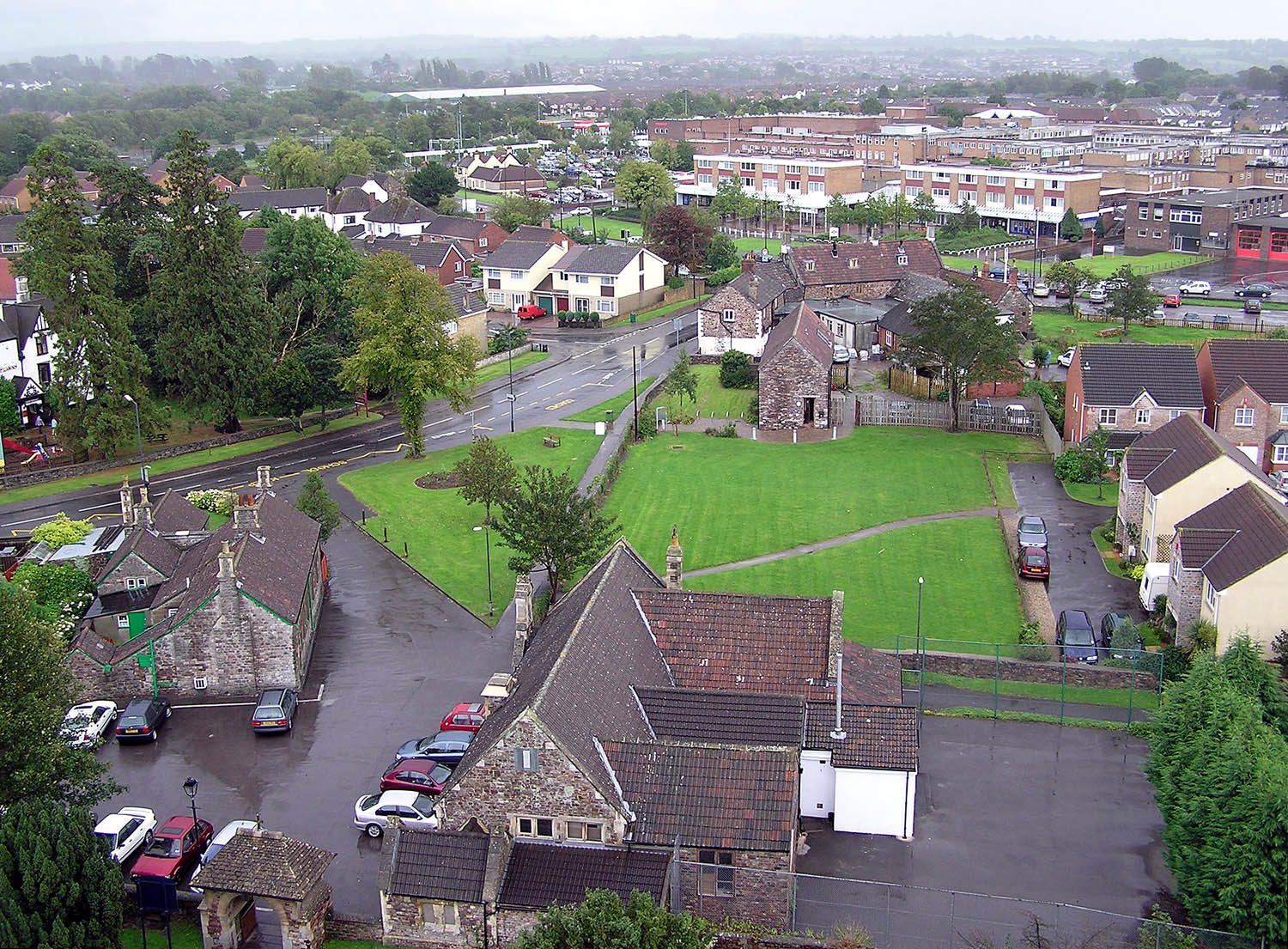 Yate from the tower of St Marys Church |
|
Yate | |
| Population | 21,603 |
|---|---|
| OS grid reference | |
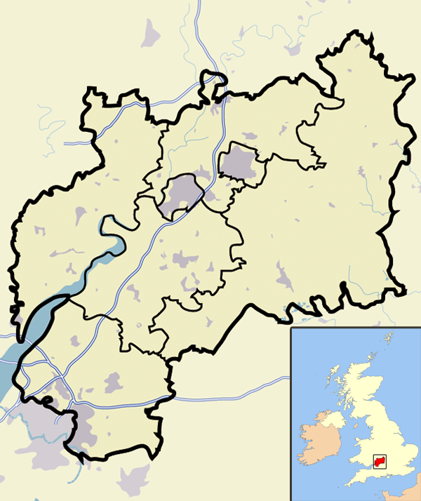
| Parish | Yate |
| Unitary authority | South Gloucestershire |
| Ceremonial county | Gloucestershire |
| Region | South West |
| Country | England |
| Sovereign state | United Kingdom |
| Post town | BRISTOL |
| Postcode district | BS37 |
| Dialling code | 01454 |
| Police | Avon and Somerset |
| Fire | Avon |
| Ambulance | Great Western |
| EU Parliament | South West England |
| UK Parliament | Thornbury and Yate |
| List of places: UK • England • Gloucestershire | |
Yate is a town and civil parish in South Gloucestershire, England, at the southwest extremity of the Cotswold Hills, 11 miles (17.7 km) northeast of Bristol city centre. Yate developed from a village into a sizable town from the 1960s onwards, partly as an overspill or commuter town for the city of Bristol. Although not a New Town in the official sense, Yate took on many of the characteristics of one. At the 2011 census the population was 21,603. The town of Chipping Sodbury (population 5,045) is contiguous with Yate to the east. In addition, a large southern section of the built-up area spills over into the parish of Dodington (population 8,206), and so the total population of Yate's urban area is now approaching 35,000.
Location[]
Yate is located in South Gloucestershire, which itself is in the South West of England. The town is to the north-east of Bristol city centre, which is about 11 miles away by road. A couple of miles to the south of Yate is the M4, which serves Yate from junctions 18 and 19 (the latter via the M32). The South Wales Main Line, a branch of the Great Western Mainline runs along the south of Yate. This line does not have a station in Yate. The Cross Country route from Bristol to Birmingham and the North runs through the west of Yate. Yate railway station is situated on this line. Apart from Chipping Sodbury to the east, Yate is surrounded by countryside and is situated to the south-west of the Cotswolds. The A432 is the main road to serve Yate and runs through the centre of the town.
Administration[]
National[]
Yate is represented in the UK Parliament by the constituency of Thornbury and Yate.
County[]
Yate was in Gloucestershire until 1974 when it became part of district of Northavon within the newly formed county of Avon. In 1996, Avon was abolished, and the area became part of the unitary authority of South Gloucestershire and rejoined the ceremonial county of Gloucestershire.
Local[]
Yate Town Council provides local services.[1]
History[]
The coat of arms of Yate
The first mention of Yate is the existence of a religious house in about AD 770; Yate is also mentioned in the Domesday Book of 1086. The name is derived from the Old English word giete or gete, meaning ‘a gateway into a forest area’.[2]
During the Anglo-Saxon period and well into medieval times, most of this part of south Gloucestershire was covered with forest. Through the centuries the land was cleared for farming.
The town's parish church, St Mary's,[3] dates from Norman times. It was altered during the fifteenth century and was extensively restored in 1970. St Mary's Primary School,[4] situated outside the churchyard walls, was built on the site of a former poor house.
It was the opening of the railway station in 1844, as part of Bristol and Gloucester Railway, that established Yate, with Station Road becoming the central thoroughfare. The cattle and produce markets were held around this road, and businesses were established there. Yate railway station was closed by the Beeching Axe in January 1965, but was reopened in May 1989; the Brunel-built engine shed is preserved nearby.
In the 1960s Yate was designated as a development area and the building boom began. The creation of a new town included a large retail shopping area, sports and leisure development together with public buildings.
When a secondary school was built in the late 1970s, it was supposed to be called Brinsham Green School, after Brinsham Lane at nearby Yate Rocks. Owing to a spelling error, however, it was in fact called Brimsham Green School.
The town further expanded in the 1990s and 2000s with the construction of housing at North Yate. This housing estate continued to use the corrupted name of Brimsham. To locals the area is known as Brimsham Park.
Yate rail yard[]
During World War II, a rail transfer yard was constructed for the United States Army, probably as part of Operation Bolero to assist the buildup of troops and stores before D-Day. Two large storage sheds survived on the site until 2008.
At the end of World War II, the site was taken over by the Royal Navy and became known as the Sea Transport Stores Depot. It was occupied by the Highways Agency until the sheds were demolished for development.
Oxford Archaeology[5] has been commissioned to undertake an investigation as to the military significance of this site. The opinion of Bristol Industrial Archaeological Society has also been sought.[6]
Transport[]
Railway[]
Yate railway station serves the town. The station is located on the main Bristol to Birmingham line between Bristol Parkway and Cam and Dursley, and is operated by First Great Western.
Buses[]
Bus services within the Yate area are mainly provided by First Group and Wessex Connect. Other operators who provide bus services to/from Yate include Andybus, Severnside Transport and South Gloucestershire Bus and Coach Company.
Regular bus services link Yate with Bristol City Centre. There are also buses from Yate running to Bath, Cribbs Causeway, Malmesbury, Tetbury and Westonbirt Arboretum. Additionally, buses link Yate to a number of other towns/villages within South Gloucestershire including Badminton, Charfield, Chipping Sodbury, Downend, Emersons Green, Filton, Fishponds, Frenchay, Hanham, Kingswood, Pucklechurch, Mangotsfield, Old Sodbury, Staple Hill, Thornbury, Tormarton, Westerleigh, Wick, Winterbourne and Wotton under Edge.
Buses in Yate pick up and set down at Yate Bus Station which is at Yate Shopping Centre. A number of bus services also pass Yate railway station.
Design[]
Major growth in Yate started in the early 1920s with the construction of the Moorlands Road estates behind Station Road, close to the Parnall aeroplane factory. In the 1950s the Ridge housing estate was developed. The area between these estates was still being mined for celestine and therefore could not be built on until the mineral had been extracted.
In the 1960s the area around Stanshawes was exhausted of celestine and the housing boom started with the major construction taking place in the south. Much of this development was planned using the Radburn model, a design that created a vehicle-free environment by the use of green spaces and linking paths at the front of the houses. This model was used until the late 1980s and early 1990s, when the planners reverted to traditional street design methods for the development of the remainder of North Yate, Brinsham Park, and the Newmans factory site.
Twin town[]
Yate is twinned with Bad Salzdetfurth in Germany, and Genieri in Gambia.
Industry[]
Before World War II, Yate had an aircraft manufacturing industry (Parnall) with a grass aerodrome.[7] During World War II, Parnall specialized in making gun turrets. A number of people were killed in raids by the Luftwaffe on the factory in February and March 1941.[8]
Following WWII, the Parnall factory turned to the manufacture of domestic goods and was famous for its washing machines. In 1958 Parnall merged with Radiation Ltd to become known as Jackson, producing the Jackson range of cookers. Through mergers and acquisitions, Jacksons is now part of Indesit and the Jackson name is no longer used.
Newmans of Bristol had a large factory on Station road, from 1932 until the 1980s, in its heyday in the 1960s, employing over 1500 people.
Yate has had three natural products associated with it: limestone to the east, celestine or spar near the centre of the town, and coal to the west.
The need for limestone increased with the growth of roads, while the demand for coal grew with the diminishing supply of timber. Celestine, the major strontium mineral, was first dug in the late 1880s and was initially used for the refining of sugar beet. At one time Yate’s celestine accounted for 95 per cent of the world's production.[9] It colours flames red, and so was important for pyrotechnics such as fireworks, military and signal flares, and tracer bullets. The last commercial excavation of celestine from the Yate area was during the Vietnam War. The mining company, Bristol Mineral and Land Co, closed in 1994.
Shopping[]
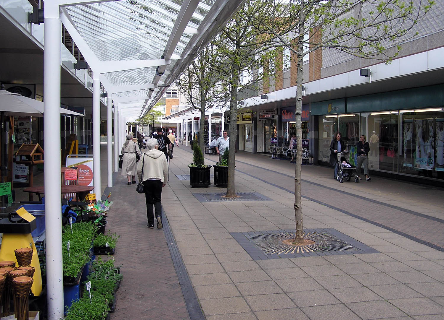
Yate shopping centre has over 100 shops
Construction of a pedestrianised shopping centre of around a hundred shops began in the early-to-mid-1960s.[10] The shopping centre was opened by Patricia Phoenix, (who played Elsie Tanner in ITV's Coronation Street), Mary Rand (Athlete) and Ted Ray (Comedian). As with the most British net towns, modern art was included in the design: in the case of Yate, this was in the form of the Four Seasons sculpture, and a graceful and dramatic spire-shaped sculpture, which could be seen for miles, mounted high above the centre on the roof of one of the shops. This sculpture existed until the early 1990s when it was removed during the revamping of the centre, which included the erection of glass roofs over the walkways. An extension to East Walk was constructed at the start of the 1980s, and this included the construction of a new Tesco store, with the old store in South Walk turned into a Tesco Home and Wear store. An extension to West Walk was constructed in the early 1990s.
Yate shopping centre housed a single screen cinema until the early 1980s. It was closed and replaced with Spirals nightclub. The club closed in the 2000s and was replaced with Rileys pool club and then by Waves, another club. Waves closed in 2012. A youth centre called Armadillo opened in 2011.
Shops in the centre include Tesco, Boots (chemist), Halfords Metro, Iceland (supermarket), Argos, Superdrug and The Entertainer. Eating places in the Centre include McDonald's, Boswells and Wetherspoons.
During the 1980s and into the mid-1990s, the shopping centre hosted Yate’s annual festival. On opening day a celebrity launched the festival by releasing balloons and stayed to sign autographs. Celebrities have included Carole Lee Scott, in character as Grotbags (from Rod Hull and Emu's enemy), Timmy Mallett, Keith Chegwin, Ross Kemp (EastEnders' Grant Mitchell), Ken Morley (Coronation Street's Reg Holdsworth), David Neilson (Coronation Street's Roy Cropper), Beverley Callard (Coronation Street's Liz McDonald), Bob Carolgees and Spit the Dog, and the Milky Bar Kid. The festival also brought along a number of news presenters from HTV West including Bruce Hockin, Richard Wyatt and Peter Rowell.
On 19 November 2009, a large crowd packed into the shopping centre to see Peter Andre switch on the town's Christmas lights and sing his single "Unconditional".
On 15 November 2012, Steps (group) plus a finalist (still to be announced) from the 2012 series of The X Factor (UK) are due to switch on the town centre's Christmas lights.
In December 2006, the owners of the shopping centre (Dominion Corporate Trustees) announced plans to enlarge and modernise it. In Phase 1 one of the main changes has been the replacement of the existing small Tesco with a large Tesco Extra. To replace lost shopping centre parking following the enlargement, the store is on stilts, with parking beneath. It opened on 24 October 2011.
Located near the shopping centre are Lidl, Morrisons and B&Q. There are two Tesco Express stores in Yate: one on Station Road and one in Brinsham Park. The B&Q was built in the mid-to-late 1980s, along with two small housing estates, on the site of the Newmans electric motor factory which had been demolished in the mid-1980s.
The shopping centre also has a Jobcentre Plus, Citizens Advice Bureau, library, leisure centre, over-50s café, and health centre.
In 2008, construction of a new health centre began on the site of the old one, costing around £12 million. The new West Gate Health Centre (formerly the West Walk Health Centre) was officially opened on 8 March 2010.
In August 2009, plans were agreed for Tesco to pull down their store and replace it with a more modern store three times the size, known as a Tesco Extra. The plans include four more shop units, relocation of the bus station, and a revamped entrance to East Walk. The revamp of the town's bus station was officially opened in January 2010. A temporary Tesco store was opened on 28 February 2011 while the new Tesco Extra was under construction. The old Tesco closed its doors on 27 February 2011 and the Tesco Extra store opened on 24 October 2011.
It was revealed in September 2011 that Marks and Spencer have asked for planning permission for a new store in two of the four new units, on which building work will commence in October 2012. The other two units will be occupied by Costa Coffee and Sports Direct. This second phase of the centre's expansion plans is being built next to Superdrug, in East Walk (opposite the Tesco Extra store). The public toilets next to the Superdrug store will be demolished and re-built on West Walk.
JD Wetherspoons public house and restaurant opened in the summer of 2012, on the corner of South Walk/South Parade, occupying several units, including the former Motorworld Store.
In September 2014, it was finally announced that Yate would get a new cinema. The cinema would be operated by Cineworld and would be part of a further expansion to the Yate Shopping Centre, which is also to include seven restaurants. The exstension will be built on and behind the current overflow carpark on Link Road, on the other side from the Tesco Extra store, and will be called 'Yate Riverside'. Construction is expected to begin early 2015, with an expected completion date set for Spring 2016.
Amenities[]

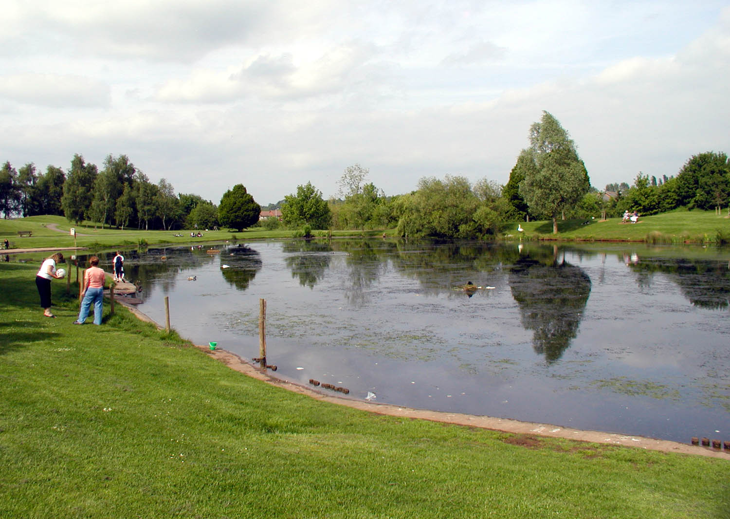
Kingsgate Park
The town has a skatepark at Peghill. Yate Common on Westerleigh Road is used for dog walking, nature watching, kite flying, circuses and fairs.
The common has a stretch of unused dual carriageway (), known as the "road to nowhere", which has been used for filming in TV programmes such as Casualty.[11] This was part a scheme to create a bypass from Rodford Way in South Yate to Nibley. The scheme was only partially completed in 1974, the year when Yate became a part of Avon. Completion of the road would have entailed building a bridge over the railway, but finance for this was never made available.
The town has several parks and areas of open space. The largest of these is Kingsgate Park, which has an adventure playground for children.
The town is served by a community radio station, GLOSS FM which broadcasts 365 days a year on its webcasts and twice a year on 87.7 MHz FM.
Plans[]
Yate and Chipping Sodbury have been earmarked for 5000 new homes to be built by 2026. While the location of the housing has yet to be decided, the expected areas are to the north of Yate, and towards Chipping Sodbury.
In early 2013 it was announced by the owners of Yate Shopping Centre that a £12 million development would take place on the Overflow car park which would bring a long awaited multi-screen cinema (since announced to be a Cineworld) and retail units. Planning permission was granted in early 2014 with construction tipped to begin in early 2015. The name of the new development will be; Yate Riverside.
Local sport[]
Athletics[]
Yate and District Athletic Club[12] is a track-and-field club based at Yate Outdoor Sports Centre.
Cricket[]
Chipping Sodbury Cricket Club[13] is Yate's nearest cricket club, providing cricket for men, women, boys and girls. They play their home matches on their two grounds at The Ridings playing fields in Chipping Sodbury.
Football[]
Yate Town F.C.[14] plays in the Southern League South and West Division. There is also a ladies' football team, Yate Town Girls/Ladies FC,[15] that plays in local leagues. A junior team, Yate United F.C.,[16] provides competitive youth football.
The second largest youth club in Yate is Yate United Youth Football Club. They play their home matches at Yate Outdoor Sports Complex, Sunnyside Playing Fields and Kelston Close playing fields.
The largest football club in Yate and Chipping Sodbury is St. Nicholas FC. Otherwise known as St. Nicks, this clubs has a total of 21 teams, including two ladies and one men's team. They play at the Chipping Sodbury Rigby Football Club grounds near Chipping Sodbury.
Other local clubs include Shire Way Rangers who also play in Yate and St Nicholas Youth Football Club who play in nearby Chipping Sodbury.
Hockey[]
Yate Hockey Club runs teams from adult to junior.[17]
Estates in Yate[]
Abbotswood[]
Abbotswood has a small shopping centre, privately owned blocks of flats, a youth club and church.
North Yate[]
Construction began in the late 1970s and early 1980s.
Brimsham Park[]
Construction of the estate began in the early 1990s.
The Ridge[]
The Ridge is a large housing estate with two local schools, Broadway Infants School and The Ridge Junior School. There are shops in the centre of the estate including a convenience store and dentists.
Notable residents[]
J.K. Rowling, author of the Harry Potter fantasy series, was born in 1965 at the Chipping Sodbury Maternity Hospital (later the Chipping Sodbury Memorial Day Centre), on Station Road, Yate. Until the age of four, she lived with her parents in Sundridge Park, Yate.[18][19][20]
Literary references to Yate[]
Yate was awarded the tongue-in-cheek honour of being the 45th worst place to live in the UK, according to the Idler book of Crap Towns,[21] while Half Man Half Biscuit's song ‘The Referee's Alphabet’ on their Cammell Laird Social Club album informs the listener that ‘Y is for Yate, the kind of town that referees come from’.
Location grid[]

|
Iron Acton | Rangeworthy | Wickwar |
|
| Coalpit Heath | Chipping Sodbury | |||
 Yate | ||||
| Ram Hill | Westerleigh | Codrington |
References[]
- ^ Yate Town Council official website
- ^ English Towns Website
- ^ St Mary, Yate Diocese of Bristol
- ^ St.Marys School, Yate official website
- ^ Oxford Archaeology Official Website
- ^ Bristol Industrial Archaeological Society (BIAS) official website
- ^ History of Parnall Aircraft.
- ^ The Bombing of Parnalls Aircraft Factory of Yate BBC WW2 People's War
- ^ Ian S. Bishop, Around Yate and the Sodburys (Nottingham: Adlard Print and Reprographics Ltd, 2010), 1.
- ^ Yate Shopping centre
- ^ South Gloucestershire council hires out many venues for filming / training purposes
- ^ Yate and District Athletic Club official website
- ^ Chipping Sodbury Cricket Club official website
- ^ Yate Town F.C official website of Yate F.C.
- ^ Yate Town Girls/Ladies FC
- ^ Official website of Yate United F.C.,
- ^ Yate Hockey Club official website
- ^ Connie Ann Kirk, J.K. Rowling: A Biography, Greenwood Publishing Group, 2003, pp.11-12
- ^ C. D. Miller, Harry Potter Places: Snitch-Seeking in Southern England and Wales, Book 3, First Edition Design Pub., 2012, pp.110-113
- ^ Lynne Hutchinson, Concerns raised about future of former Chipping Sodbury cottage hospital site, Gazette Series, 6 September 2012. Retrieved 6 April 2013
- ^ Idler book of Crap Towns, eds Sam Jordison and Dan Kieran (Box Tree 2003)
External links[]
- Yate at the Open Directory Project
| |||||
| This page uses content from the English language Wikipedia. The original content was at Yate. The list of authors can be seen in the page history. As with this Familypedia wiki, the content of Wikipedia is available under the Creative Commons License. |