m (AWB cleanup- template:wp) |
m (update from Wikipedia) Tag: apiedit |
||
| Line 4: | Line 4: | ||
| county = Worth County |
| county = Worth County |
||
| state = Iowa |
| state = Iowa |
||
| + | | ex image = Worth County Courthouse, Northwood.jpg |
||
| + | | ex image size =240px |
||
| + | | ex image cap = The [[Worth County Courthouse (Northwood, Iowa)|courthouse]] in Northwood is on the [[National Register of Historic Places|NRHP]]. |
||
| seal = |
| seal = |
||
| − | | |
+ | | founded = 1851 |
| + | | seat wl= Northwood |
||
| ⚫ | |||
| − | | |
+ | | largest city wl= Northwood |
| + | | named for = [[William Jenkins Worth]] |
||
| − | | founded = |
||
| ⚫ | |||
| − | | largest city = |
||
| area_total_sq_mi = 402 |
| area_total_sq_mi = 402 |
||
| − | | area_total_km2 = 1040 |
||
| area_land_sq_mi = 400 |
| area_land_sq_mi = 400 |
||
| ⚫ | |||
| − | | area_land_km2 = 1036 |
||
| ⚫ | |||
| ⚫ | |||
| − | | |
+ | | census yr = 2010 |
| ⚫ | |||
| ⚫ | |||
| − | | |
+ | | density_sq_mi = 19 |
| ⚫ | |||
| − | | density_sq_mi = 20 |
||
| − | | density_km2 = 8 |
||
| time zone = Central |
| time zone = Central |
||
| − | | |
+ | | footnotes = |
| − | | DST offset= -5 |
||
| − | | footnotes = |
||
| web = www.worthcounty.org |
| web = www.worthcounty.org |
||
| + | | district = 1st |
||
| − | + | }} |
|
| − | '''Worth County''' is a [[county|county]] located in the [[U.S. state|U.S. state]] of [[Iowa|Iowa]]. It was named for Major General William Jenkins Worth(1749-1849), an officer in both the [[Wikipedia:Black Hawk War|Black Hawk War]] and the [[Wikipedia:Mexican-American War|Mexican-American War]]. As of [[2000]], the population is 7,909. Its [[county seat|county seat]] is [[Wikipedia:Northwood, Iowa|Northwood]].[[Wikipedia:Geographic references|<sup>6</sup>]] |
||
| + | |||
| + | '''Worth County''' is a [[County (US)|county]] located in the [[U.S. state]] of [[Iowa]]. As of the [[2010 United States Census|2010 census]], the population was 7,598.<ref name="QF">{{cite web|title=State & County QuickFacts|url=http://quickfacts.census.gov/qfd/states/19/19195.html|publisher=United States Census Bureau|accessdate=July 20, 2014}}</ref> The [[county seat]] is in [[Northwood, Iowa|Northwood]].<ref name="GR6">{{cite web|url=http://www.naco.org/Counties/Pages/FindACounty.aspx |accessdate=2011-06-07 |title=Find a County |publisher=National Association of Counties |deadurl=yes |archiveurl=https://web.archive.org/20110531210815/http://www.naco.org/Counties/Pages/FindACounty.aspx |archivedate=May 31, 2011 }}</ref> The county was founded in 1851 and named for Major General [[William Jenkins Worth]] (1794–1849), an officer in both the [[Seminole War]] and the [[Mexican-American War]]. |
||
| + | |||
| + | Worth County is part of the [[Mason City, Iowa|Mason City]], IA [[Mason City micropolitan area|Micropolitan Statistical Area]]. |
||
==Geography== |
==Geography== |
||
| − | According to the [[ |
+ | According to the [[U.S. Census Bureau]], the county has a total area of {{convert|402|sqmi}}, of which {{convert|400|sqmi}} is land and {{convert|1.8|sqmi}} (0.5%) is water.<ref name="GR1">{{cite web|url=http://www.census.gov/geo/www/gazetteer/gazette.html|publisher=[[United States Census Bureau]]|accessdate=2011-04-23|date=2011-02-12|title=US Gazetteer files: 2010, 2000, and 1990}}</ref> It is the fourth-smallest county in Iowa by land area and third-smallest by total area. |
| + | |||
| − | ===Major |
+ | ===Major highways=== |
| − | *[[Image:I-35.svg|20px]][[Image:Iowa 27.svg|20px]] [[Wikipedia:Interstate 35|Interstate 35]]/[[Wikipedia:Iowa Highway 27|Iowa Highway 27]] |
||
| − | *[[Image: |
+ | *[[Image:I-35.svg|20px]][[Image:Iowa 27.svg|20px]] [[Interstate 35]]/[[Iowa Highway 27]] |
| − | *[[Image:US |
+ | *[[Image:US 65.svg|20px]] [[U.S. Highway 65]] |
| − | *[[Image: |
+ | *[[Image:US 69.svg|20px]] [[U.S. Highway 69]] |
| + | *[[Image:Iowa 9.svg|20px]] [[Iowa Highway 9]] |
||
| − | === |
+ | ===Adjacent counties=== |
| − | *[[Freeborn County, Minnesota |
+ | *[[Freeborn County, Minnesota]] (north) |
| − | *[[Mower County, Minnesota |
+ | *[[Mower County, Minnesota]] (northeast) |
*[[Mitchell County, Iowa|Mitchell County]] (east) |
*[[Mitchell County, Iowa|Mitchell County]] (east) |
||
*[[Cerro Gordo County, Iowa|Cerro Gordo County]] (south) |
*[[Cerro Gordo County, Iowa|Cerro Gordo County]] (south) |
||
| Line 46: | Line 46: | ||
==Demographics== |
==Demographics== |
||
| + | {{US Census population |
||
| ⚫ | |||
| + | |1860= 756 |
||
| − | {{USCensusPop |
||
| + | |1870= 2892 |
||
| ⚫ | |||
| + | |1880= 7953 |
||
| ⚫ | |||
| + | |1890= 9247 |
||
| ⚫ | |||
| ⚫ | |||
| ⚫ | |||
| ⚫ | |||
| ⚫ | |||
| ⚫ | |||
| ⚫ | |||
| ⚫ | |||
| ⚫ | |||
| ⚫ | |||
| ⚫ | |||
| ⚫ | |||
| ⚫ | |||
| ⚫ | |||
| ⚫ | |||
| ⚫ | |||
| ⚫ | |||
| ⚫ | |||
| − | | footnote=[http://www.census.gov/population/cencounts/ia190090.txt IA Counties 1900-1990] |
||
| ⚫ | |||
| ⚫ | |||
| ⚫ | |||
| ⚫ | As of the [[ |
||
| + | |2010= 7598 |
||
| + | |estyear=2015 |
||
| + | |estimate=7569 |
||
| + | |estref=<ref name="USCensusEst2015">{{cite web|url=http://www.census.gov/popest/data/counties/totals/2015/CO-EST2015-alldata.html|title=County Totals Dataset: Population, Population Change and Estimated Components of Population Change: April 1, 2010 to July 1, 2015|accessdate=July 2, 2016}}</ref> |
||
| + | |align-fn=center |
||
| + | |footnote=U.S. Decennial Census<ref>{{cite web|url=http://www.census.gov/prod/www/decennial.html|title=U.S. Decennial Census|publisher=United States Census Bureau|accessdate=July 20, 2014|deadurl=yes|archiveurl=http://www.webcitation.org/6YSasqtfX|archivedate=May 11, 2015 }}</ref><br />1790-1960<ref>{{cite web|url=http://mapserver.lib.virginia.edu|title=Historical Census Browser|publisher=University of Virginia Library|accessdate=July 20, 2014}}</ref> 1900-1990<ref>{{cite web|url=http://www.census.gov/population/cencounts/ia190090.txt|title=Population of Counties by Decennial Census: 1900 to 1990|publisher=United States Census Bureau|accessdate=July 20, 2014}}</ref><br />1990-2000<ref>{{cite web|url=http://www.census.gov/population/www/cen2000/briefs/phc-t4/tables/tab02.pdf|title=Census 2000 PHC-T-4. Ranking Tables for Counties: 1990 and 2000|publisher=United States Census Bureau|accessdate=July 20, 2014}}</ref> 2010-2013<ref name="QF"/> |
||
| ⚫ | |||
| + | |||
| + | ===2010 census=== |
||
| + | The 2010 census recorded a population of 7,598 in the county, with a population density of {{Pop density|7598|400.00|sqmi|km2}}. There were 3,548 housing units, of which 3,172 were occupied.<ref name="USCB">{{cite web|url=http://factfinder2.census.gov/faces/tableservices/jsf/pages/productview.xhtml?pid=DEC_10_PL_GCTPL2.ST05&prodType=table|title=Population & Housing Occupancy Status 2010|publisher=[[United States Census Bureau]] American FactFinder|accessdate= 2011-06-19}}</ref> |
||
| + | |||
| + | ===2000 census=== |
||
| ⚫ | |||
| ⚫ | As of the [[census]]<ref name="GR2">{{cite web|url=http://factfinder2.census.gov|publisher=[[United States Census Bureau]]|accessdate=2008-01-31|title=American FactFinder}}</ref> of 2000, there were 7,909 people, 3,278 households, and 2,265 families residing in the county. The [[population density]] was 20 people per square mile (8/km²). There were 3,534 housing units at an average density of 9 per square mile (3/km²). The racial makeup of the county was 98.37% [[Race (United States Census)|White]], 0.28% [[Race (United States Census)|Black]] or [[Race (United States Census)|African American]], 0.09% [[Race (United States Census)|Native American]], 0.14% [[Race (United States Census)|Asian]], 0.01% [[Race (United States Census)|Pacific Islander]], 0.42% from [[Race (United States Census)|other races]], and 0.70% from two or more races. 1.57% of the population were [[Race (United States Census)|Hispanic]] or [[Race (United States Census)|Latino]] of any race. |
||
There were 3,278 households out of which 30.40% had children under the age of 18 living with them, 58.10% were [[Marriage|married couples]] living together, 7.30% had a female householder with no husband present, and 30.90% were non-families. 27.60% of all households were made up of individuals and 14.30% had someone living alone who was 65 years of age or older. The average household size was 2.38 and the average family size was 2.88. |
There were 3,278 households out of which 30.40% had children under the age of 18 living with them, 58.10% were [[Marriage|married couples]] living together, 7.30% had a female householder with no husband present, and 30.90% were non-families. 27.60% of all households were made up of individuals and 14.30% had someone living alone who was 65 years of age or older. The average household size was 2.38 and the average family size was 2.88. |
||
| Line 67: | Line 81: | ||
In the county the population was spread out with 24.30% under the age of 18, 6.50% from 18 to 24, 26.30% from 25 to 44, 23.50% from 45 to 64, and 19.40% who were 65 years of age or older. The median age was 41 years. For every 100 females there were 98.50 males. For every 100 females age 18 and over, there were 95.20 males. |
In the county the population was spread out with 24.30% under the age of 18, 6.50% from 18 to 24, 26.30% from 25 to 44, 23.50% from 45 to 64, and 19.40% who were 65 years of age or older. The median age was 41 years. For every 100 females there were 98.50 males. For every 100 females age 18 and over, there were 95.20 males. |
||
| − | The median income for a household in the county was $36,444, and the median income for a family was $41,763. Males had a median income of $27,927 versus $20,897 for females. The [[ |
+ | The median income for a household in the county was $36,444, and the median income for a family was $41,763. Males had a median income of $27,927 versus $20,897 for females. The [[per capita income]] for the county was $16,952. About 6.30% of families and 8.30% of the population were below the [[poverty line]], including 9.60% of those under age 18 and 7.80% of those age 65 or over. |
| + | ==Communities== |
||
| − | == Cities and towns == |
||
| − | <table><tr valign="top"><td> |
||
| ⚫ | |||
| ⚫ | |||
| − | </td><td> |
||
| ⚫ | |||
| ⚫ | |||
| − | </td><td> |
||
| ⚫ | |||
| ⚫ | |||
| − | </td><td> |
||
| ⚫ | |||
| − | </td></tr></table> |
||
| − | == |
+ | ===Cities=== |
| ⚫ | |||
| ⚫ | |||
| ⚫ | |||
| ⚫ | |||
| ⚫ | |||
| ⚫ | |||
| ⚫ | |||
| + | |||
| + | ===Unincorporated community=== |
||
| + | *[[Bolan, Iowa|Bolan]] |
||
| + | |||
| + | ===Townships=== |
||
| + | {{div col|3}} |
||
| + | *[[Barton Township, Worth County, Iowa|Barton]] |
||
| + | *[[Bristol Township, Worth County, Iowa|Bristol]] |
||
| + | *[[Brookfield Township, Worth County, Iowa|Brookfield]] |
||
| + | *[[Danville Township, Worth County, Iowa|Danville]] |
||
| + | *[[Deer Creek Township, Worth County, Iowa|Deer Creek]] |
||
| + | *[[Fertile Township, Worth County, Iowa|Fertile]] |
||
| + | *[[Grove Township, Worth County, Iowa|Grove]] |
||
| + | *[[Hartland Township, Worth County, Iowa|Hartland]] |
||
| + | *[[Kensett Township, Worth County, Iowa|Kensett]] |
||
| + | *[[Lincoln Township, Worth County, Iowa|Lincoln]] |
||
| + | *[[Silver Lake Township, Worth County, Iowa|Silver Lake]] |
||
| + | *[[Union Township, Worth County, Iowa|Union]] |
||
| + | {{div col end}} |
||
| + | |||
| + | ===Population ranking=== |
||
| + | |||
| + | The population ranking of the following table is based on the [[2010 United States census|2010 census]] of Worth County.<ref>http://www.census.gov/2010census/</ref> |
||
| + | |||
| + | '''†''' ''county seat'' |
||
| + | |||
| + | {| class="wikitable sortable" |
||
| + | |- |
||
| + | !Rank |
||
| + | !City/Town/etc. |
||
| + | !Municipal type |
||
| + | !Population (2010 Census) |
||
| + | ''' |
||
| + | |- style="background-color:#FFFACD;" |
||
| + | | 1 |
||
| ⚫ | |||
| + | | City |
||
| + | | 1,989 |
||
| + | |- style="background-color:#FFFACD;" |
||
| + | | 2 |
||
| + | |'''[[Manly, Iowa|Manly]]''' |
||
| + | | City |
||
| + | | 1,323 |
||
| + | |- style="background-color:#FFFACD;" |
||
| + | | 3 |
||
| + | |'''[[Fertile, Iowa|Fertile]]''' |
||
| + | | City |
||
| + | | 370 |
||
| + | |- style="background-color:#FFFACD;" |
||
| + | | 4 |
||
| + | |'''[[Kensett, Iowa|Kensett]]''' |
||
| + | | City |
||
| + | | 266 |
||
| + | |- style="background-color:#FFFACD;" |
||
| + | | 5 |
||
| + | |'''[[Grafton, Iowa|Grafton]]''' |
||
| + | | City |
||
| + | | 252 |
||
| + | |- style="background-color:#FFFACD;" |
||
| + | | 6 |
||
| + | |'''[[Hanlontown, Iowa|Hanlontown]]''' |
||
| + | | City |
||
| + | | 226 |
||
| + | |- style="background-color:#FFFACD;" |
||
| + | | 7 |
||
| + | |'''[[Joice, Iowa|Joice]]''' |
||
| + | | City |
||
| + | | 222 |
||
| + | |- style="background-color:#F0FFF0;" |
||
| + | | 8 |
||
| + | |'''[[Bolan, Iowa|Bolan]]''' |
||
| + | | CDP |
||
| + | | 33 |
||
| + | |} |
||
| + | |||
| + | ==See also== |
||
| + | {{Portal|Iowa}} |
||
| + | *[[Worth County Courthouse (Northwood, Iowa)|Worth County Courthouse]] |
||
| + | *[[National Register of Historic Places listings in Iowa#Worth County|National Register of Historic Places listings in Worth County, Iowa]] |
||
| + | |||
| + | ==References== |
||
| + | {{reflist|30em}} |
||
| + | |||
| + | ==External links== |
||
| + | {{Commons}}<!--for current and future use if material is uploaded--> |
||
*[http://www.worthcounty.org/ County Government website] |
*[http://www.worthcounty.org/ County Government website] |
||
| + | |||
| + | {{Geographic Location |
||
| ⚫ | |||
| + | |North = [[Freeborn County, Minnesota]] |
||
| + | |Northeast = [[Mower County, Minnesota]] |
||
| + | |East = [[Mitchell County, Iowa|Mitchell County]] |
||
| + | |Southeast = |
||
| + | |South = [[Cerro Gordo County, Iowa|Cerro Gordo County]] |
||
| + | |Southwest = |
||
| + | |West = [[Winnebago County, Iowa|Winnebago County]] |
||
| + | |Northwest = |
||
| + | }} |
||
{{Worth County, Iowa}} |
{{Worth County, Iowa}} |
||
{{Iowa}} |
{{Iowa}} |
||
| − | {{ |
+ | {{coord|43|22|44|N|93|15|26|W|region:US-IA_type:adm2nd_source:dewiki|display=title}} |
[[Category:Worth County, Iowa| ]] |
[[Category:Worth County, Iowa| ]] |
||
| + | [[Category:1851 establishments in Iowa]] |
||
| + | [[Category:Mason City, Iowa micropolitan area]] |
||
| + | [[Category:Settlements established in 1851]] |
||
| ⚫ | |||
| − | |||
| ⚫ | |||
Revision as of 03:49, 11 August 2016
| ||||||||||||||
| Worth County, Iowa | |
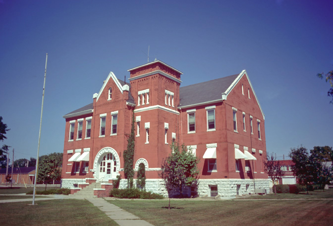 The courthouse in Northwood is on the NRHP.
| |
 Location in the state of Iowa | |
 Iowa's location in the U.S. | |
| Founded | 1851 |
|---|---|
| Named for | William Jenkins Worth |
| Seat | Northwood |
| Largest city | Northwood |
| Area - Total - Land - Water |
402 sq mi (1,041 km²) 400 sq mi (1,036 km²) 1.8 sq mi (5 km²), 0.5% |
| Population - (2010) - Density |
7,598 19/sq mi (7/km²) |
| Congressional district | 1st |
| Time zone | Central: UTC-6/-5 |
| Website | www.worthcounty.org |
Worth County is a county located in the U.S. state of Iowa. As of the 2010 census, the population was 7,598.[1] The county seat is in Northwood.[2] The county was founded in 1851 and named for Major General William Jenkins Worth (1794–1849), an officer in both the Seminole War and the Mexican-American War.
Worth County is part of the Mason City, IA Micropolitan Statistical Area.
Geography
According to the U.S. Census Bureau, the county has a total area of 402 square miles (1,040 km2), of which 400 square miles (1,000 km2) is land and 1.8 square miles (4.7 km2) (0.5%) is water.[3] It is the fourth-smallest county in Iowa by land area and third-smallest by total area.
Major highways
 Interstate 35/Iowa Highway 27
- U.S. Highway 65
- U.S. Highway 69
- Iowa Highway 9
Adjacent counties
- Freeborn County, Minnesota (north)
- Mower County, Minnesota (northeast)
- Mitchell County (east)
- Cerro Gordo County (south)
- Winnebago County (west)
Demographics
| Historical populations | |||
|---|---|---|---|
| Census | Pop. | %± | |
| 1860 | 756 | ||
| 1870 | 2,892 | 282.5% | |
| 1880 | 7,953 | 175.0% | |
| 1890 | 9,247 | 16.3% | |
| 1900 | 10,887 | 17.7% | |
| 1910 | 9,950 | −8.6% | |
| 1920 | 11,630 | 16.9% | |
| 1930 | 11,164 | −4.0% | |
| 1940 | 11,449 | 2.6% | |
| 1950 | 11,068 | −3.3% | |
| 1960 | 10,259 | −7.3% | |
| 1970 | 8,968 | −12.6% | |
| 1980 | 9,075 | 1.2% | |
| 1990 | 7,991 | −11.9% | |
| 2000 | 7,909 | −1.0% | |
| 2010 | 7,598 | −3.9% | |
| Est. 2015 | 7,569 | [4] | −4.3% |
| U.S. Decennial Census[5] 1790-1960[6] 1900-1990[7] 1990-2000[8] 2010-2013[1] | |||
2010 census
The 2010 census recorded a population of 7,598 in the county, with a population density of 18.9950/sq mi (7.3340/km2). There were 3,548 housing units, of which 3,172 were occupied.[9]
2000 census


2000 Census Age Pyramid for Worth County
As of the census[10] of 2000, there were 7,909 people, 3,278 households, and 2,265 families residing in the county. The population density was 20 people per square mile (8/km²). There were 3,534 housing units at an average density of 9 per square mile (3/km²). The racial makeup of the county was 98.37% White, 0.28% Black or African American, 0.09% Native American, 0.14% Asian, 0.01% Pacific Islander, 0.42% from other races, and 0.70% from two or more races. 1.57% of the population were Hispanic or Latino of any race.
There were 3,278 households out of which 30.40% had children under the age of 18 living with them, 58.10% were married couples living together, 7.30% had a female householder with no husband present, and 30.90% were non-families. 27.60% of all households were made up of individuals and 14.30% had someone living alone who was 65 years of age or older. The average household size was 2.38 and the average family size was 2.88.
In the county the population was spread out with 24.30% under the age of 18, 6.50% from 18 to 24, 26.30% from 25 to 44, 23.50% from 45 to 64, and 19.40% who were 65 years of age or older. The median age was 41 years. For every 100 females there were 98.50 males. For every 100 females age 18 and over, there were 95.20 males.
The median income for a household in the county was $36,444, and the median income for a family was $41,763. Males had a median income of $27,927 versus $20,897 for females. The per capita income for the county was $16,952. About 6.30% of families and 8.30% of the population were below the poverty line, including 9.60% of those under age 18 and 7.80% of those age 65 or over.
Communities
Cities
- Fertile
- Grafton
- Hanlontown
- Joice
- Kensett
- Manly
- Northwood
Unincorporated community
- Bolan
Townships
- Barton
- Bristol
- Brookfield
- Danville
- Deer Creek
- Fertile
- Grove
- Hartland
- Kensett
- Lincoln
- Silver Lake
- Union
Population ranking
The population ranking of the following table is based on the 2010 census of Worth County.[11]
† county seat
| Rank | City/Town/etc. | Municipal type | Population (2010 Census)
|
|---|---|---|---|
| 1 | † Northwood | City | 1,989 |
| 2 | Manly | City | 1,323 |
| 3 | Fertile | City | 370 |
| 4 | Kensett | City | 266 |
| 5 | Grafton | City | 252 |
| 6 | Hanlontown | City | 226 |
| 7 | Joice | City | 222 |
| 8 | Bolan | CDP | 33 |
See also
- Worth County Courthouse
- National Register of Historic Places listings in Worth County, Iowa
References
- ^ a b "State & County QuickFacts". United States Census Bureau. http://quickfacts.census.gov/qfd/states/19/19195.html. Retrieved July 20, 2014.
- ^ "Find a County". National Association of Counties. Archived from the original on May 31, 2011. https://web.archive.org/20110531210815/http://www.naco.org/Counties/Pages/FindACounty.aspx. Retrieved 2011-06-07.
- ^ "US Gazetteer files: 2010, 2000, and 1990". United States Census Bureau. 2011-02-12. http://www.census.gov/geo/www/gazetteer/gazette.html. Retrieved 2011-04-23.
- ^ "County Totals Dataset: Population, Population Change and Estimated Components of Population Change: April 1, 2010 to July 1, 2015". http://www.census.gov/popest/data/counties/totals/2015/CO-EST2015-alldata.html. Retrieved July 2, 2016.
- ^ "U.S. Decennial Census". United States Census Bureau. Archived from the original on May 11, 2015. http://www.webcitation.org/6YSasqtfX. Retrieved July 20, 2014.
- ^ "Historical Census Browser". University of Virginia Library. http://mapserver.lib.virginia.edu. Retrieved July 20, 2014.
- ^ "Population of Counties by Decennial Census: 1900 to 1990". United States Census Bureau. http://www.census.gov/population/cencounts/ia190090.txt. Retrieved July 20, 2014.
- ^ "Census 2000 PHC-T-4. Ranking Tables for Counties: 1990 and 2000". United States Census Bureau. http://www.census.gov/population/www/cen2000/briefs/phc-t4/tables/tab02.pdf. Retrieved July 20, 2014.
- ^ "Population & Housing Occupancy Status 2010". United States Census Bureau American FactFinder. http://factfinder2.census.gov/faces/tableservices/jsf/pages/productview.xhtml?pid=DEC_10_PL_GCTPL2.ST05&prodType=table. Retrieved 2011-06-19.
- ^ "American FactFinder". United States Census Bureau. http://factfinder2.census.gov. Retrieved 2008-01-31.
- ^ http://www.census.gov/2010census/
External links

|
Freeborn County, Minnesota | Mower County, Minnesota |
| |
| Winnebago County | Mitchell County | |||
 Worth County, Iowa | ||||
| Cerro Gordo County |
| |||||||||||
| This page uses content from the English language Wikipedia. The original content was at Worth County, Iowa. The list of authors can be seen in the page history. As with this Familypedia wiki, the content of Wikipedia is available under the Creative Commons License. |