| Main | Births etc |
|---|
| Whittier, California | |
|---|---|
| — City — | |
| City of Whittier | |
 |
|
 |
|
| Coordinates: Coordinates: | |
| Country | United States |
| State | California |
| County | Los Angeles |
| Incorporated | February 25, 1898[1] |
| Government | |
| • Mayor | Cathy Warner[2] |
| Area[3] | |
| • Total | 14.7 sq mi (37 km2) |
| • Land | 14.7 sq mi (37 km2) |
| • Water | 0.016 sq mi (0.041 km2) 0.11% |
| Elevation[4] | 367 ft (112 m) |
| Population (2010) | |
| • Total | 85,331 |
| • Density | 5,800/sq mi (2,300/km2) |
| Demonym | Whittierite |
| Time zone | PST (UTC-8) |
| • Summer (DST) | PDT (UTC-7) |
| ZIP codes[5] | 90601–90610 |
| Area code(s) | 562 |
| FIPS code | 06-85292 |
| GNIS feature IDs | 1652813, 2412260 |
| Website | cityofwhittier.org |
Whittier, California, late 19th century

Cover of a Whittier Chamber of Commerce brochure, around 1920.
Whittier is a city in Los Angeles County, California about 12 miles (19 km) southeast of Los Angeles. The city had a population of 85,331 at the 2010 census, up from 83,680 as of the 2000 census, and encompasses 14.7 square miles (38.0 km2). Like nearby Montebello, the city constitutes part of the Gateway Cities. Whittier was incorporated in February 1898 and became a charter city in 1955.[6] The city is named for the poet John Greenleaf Whittier and is home to Whittier College.
History[]
Whittier's roots can be traced to Spanish soldier Manuel Nieto.[7] In 1784, Nieto received a Spanish land grant of 300,000 acres (1,200 km2), Rancho Los Nietos, as a reward for his military service and to encourage settlement in California.[6] The area of Nieto's land grant was reduced in 1790 as the result of a dispute with Mission San Gabriel. Nonetheless, Nieto still had claim to 167,000 acres (680 km2) stretching from the hills north of Whittier, Fullerton and Brea, south to the Pacific ocean, and from what is known today as the Los Angeles River east to the Santa Ana River. Nieto built a rancho for his family near Whittier, and purchased cattle and horses for his ranch and also planted cornfields. When Nieto died in 1804, his children inherited their father's property.
At the time of the Mexican-American War, much of Whittier was owned by Pio Pico, a rancher and the last Mexican governor of California.[6] Pio Pico built a hacienda in Whittier on the San Gabriel River, which today is known as Pio Pico State Historic Park[6] Following the Mexican-American war, German immigrant Jacob F. Gerkens paid $234 to the U.S. government to acquire 160 acres (0.6 km2) of land under the Homestead Act and built a cabin known today as the Jonathan Bailey House. Gerkens would later become the first chief of police of the Los Angeles Police Department. Gerkens' land was owned by several others before a group of Quakers purchased it and expanded it to 1,259 acres (5 km2), with the intent of founding a Quaker community. The area soon became known as a thriving citrus ranching region, with "Quaker Brand" fruit being shipped all over the United States. Later, walnut trees were also planted, and Whittier became the largest walnut grower in the United States.[6] In addition to walnuts and citrus, Whittier was also a major producer of pampas grass.
Southern Pacific Railroad built the first railroad spur to Whittier in 1887.[7] The railroad spur helped promote the boom of the 1880s. By 1906, 650 carloads of oranges and 250 carloads of lemons were shipped annually by rail. In 1904, the Pacific Electric opened the trolley line known as "Big Red Cars" from Los Angeles to Whittier. In the first two decades over a million passengers a year rode to and from Los Angeles on the Whittier line.[6] Groves of walnuts were planted in 1887 and eventually Whittier was known as the primary walnut growing town in the United States.[7] After World War II Whittier grew rapidly and the sub-dividing of orange groves began, driven by housing shortages in southern California. In 1955 the new Civic Center complex was completed and the City Council met in new chambers for the first time on March 8, 1955. The City continued to grow as the City annexed portions of Whittier Boulevard and East Whittier. The 1961 annexation added over 28,000 people to the population, bringing the total to about 67,000.[6]
Origin of name[]
In the founding days of Whittier, when it was a small isolated town, Jonathan Bailey and his wife, Rebecca, were among the first residents. They followed the Quaker religious faith and practice, and held religious meetings on their porch. Other early settlers, such as Aquila Pickering, espoused the Quaker faith. As the city grew, the citizens named it after John Greenleaf Whittier, a respected Quaker poet, and deeded a lot to him. Whittier wrote a dedication poem, and is honored today with statues and a small exhibit at the Whittier museum; a statue of him sits in Whittier's Central Park, and another representing his poem The Barefoot Boy used to reside by the City Hall. Whittier never set foot there, but the city still bears his name and is rooted in the Quaker tradition.[6]
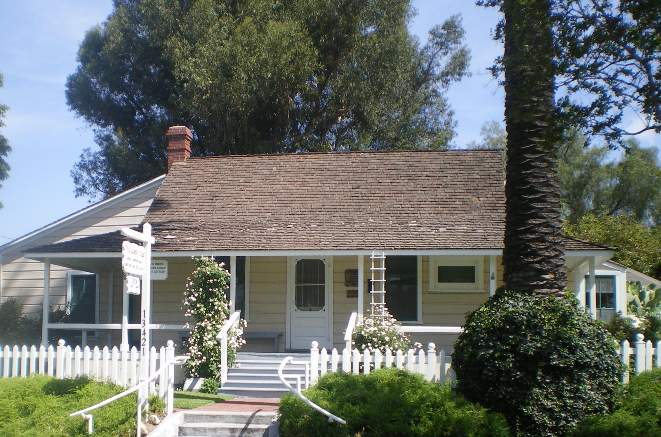

Jonathan Bailey House
Quaker history in Whittier[]
The first Quaker meeting house was built on the corner of Comstock Avenue and Wardman Street in 1887. The meeting soon outgrew this 100 seat meeting house and new, larger building was erected on the corner of Philadelphia Street and Washington Avenue in 1902. By 1912, membership had grown to 1,200 and a third building was dedicated on the same site in 1917. With a capacity of 1,700, the 1917 meeting house featured a balcony and was constructed of brick with mahogany paneling and pews. The present meeting house, dedicated in 1975, features many architectural elements and materials from the 1917 building including the stained glass windows and mahogany interior.[8] The Quakers also founded Whittier Academy (later Whittier College), and additional meetings met in East Whittier and at Whittier College's Mendenhall. Both the Mendenhall meeting and the East Whittier meeting kept the silent meeting longer than the main church.
College history[]
In 1887 the Pickering Land and Water Company set aside a 20-acre (81,000 m2) parcel of land for the development of a college, but a collapse in the land boom stalled construction. Progress on developing a college was sporadic, but on July 30, 1896 the Whittier Academy, operating since 1891, officially changed its name to Whittier College with 100 students enrolled. The school mascot is "The Poet." By 1906, Whittier College was an educational institution with laboratories, boarding halls, a large gymnasium and athletic fields. Due to an economic depression in the 1890s, the first bachelors degrees were not awarded at the college for 17 years.[6]
The Mendenhall Building at Whittier College was donated by Leona May Mendenhall in honor of her husband Oscar. The Mendenhalls were among the founding families of Whittier. Oscar's brother, Samuel Mendenhall, helped bring in the water system and post office. The Mendenhalls were large growers for Sunkist oranges and Blue Diamond walnuts.
Whittier was the first home to Azusa Pacific University, established on March 3, 1899, by the Quaker community and a Methodist evangelist under the name Training School for Christian Workers.[9]
Whittier Narrows earthquake[]
On October 1, 1987, at 7:42 a.m., the Whittier Narrows earthquake struck, the epicenter six miles (10 km) north by northwest of Whittier. The seismic event, which registered 5.9 on the Richter scale, resulted in eight casualties and massive damage to uptown Whittier's historic buildings. Three days later, on October 4, 1987, at 3:59 a.m., a major aftershock measuring 5.2 occurred, causing further damage. Buildings and residential structures which were already borderline unsafe were now deemed unsafe or uninhabitable. In the years following the earthquake, the city's deteriorating uptown business district, which suffered substantial damage in the earthquake, became the focus of renewed development, which met with opposition from many Whittier citizens. Out of the rubble of the earthquake the Whittier Conservancy was formed in 1987 in an effort to stop the demolition of many historic buildings and residences after the disaster. The city also created a Historic Resources Commission to oversee the approval of historic designations, historic districts and Mills Act proposals.
Whittier Narrows Earthquake also destroyed The Quad at Whittier, a shopping mall which had to be rebuilt after earthquake damage.
Geography and climate[]
Whittier is located at (33.5756, -118.128).[10]
According to the United States Census Bureau, the city has a total area of 14.7 square miles (38 km2), virtually all land.
Whittier is bordered by the community of Hacienda Heights to the northeast, City of Industry to the north, and several other unincorporated communities in the San Gabriel Valley mostly along its northern sections. Pico Rivera lies at the west, La Habra Heights to the east, La Habra to the southeast and Santa Fe Springs to the south.
Whittier is situated approximately 18 miles (29 kilometres) inland of the Pacific Ocean, resulting in higher daytime temperatures and since it lies at a higher elevations than the cities further west, cold air drains into lower elevation of the Los Angeles Basin which results in warmer night-time lows, producing an example of thermal inversion. Winter daytime highs typically range from 68 °F to 80 °F (20 °C to 27 °C) with overnight lows dropping to about 43 °F to 54 °F (6° to 12 °C). In the summer highs range from 78 °F to 95 °F (26 °C to 35 °C) and corresponding overnight lows in the 58 °F to 72 °F (14 °C to 22 °C). Rainfall follows a Mediterranean pattern with the majority of the rain falling during the winter months, while summer tend to be rather dry. The mean annual rainfall is approximately 14 inches.
| Climate data for Whitter CA (Wx-Station located 4.5mi NNW at Montebello, CA 1971–2000 Normals) | |||||||||||||
|---|---|---|---|---|---|---|---|---|---|---|---|---|---|
| Month | Jan | Feb | Mar | Apr | May | Jun | Jul | Aug | Sep | Oct | Nov | Dec | Year |
| Record high °F (°C) | 91 (33) |
95 (35) |
100 (38) |
104 (40) |
105 (41) |
108 (42) |
108 (42) |
106 (41) |
113 (45) |
106 (41) |
100 (38) |
88 (31) |
113 (45) |
| Average high °F (°C) | 69.7 (20.9) |
71.3 (21.8) |
72.6 (22.6) |
77.4 (25.2) |
79.2 (26.2) |
84.2 (29.0) |
88.9 (31.6) |
89.4 (31.9) |
87.5 (30.8) |
82.2 (27.9) |
75.2 (24.0) |
70.7 (21.5) |
79.0 (26.1) |
| Daily mean °F (°C) | 58.8 (14.9) |
60.0 (15.6) |
61.6 (16.4) |
65.3 (18.5) |
68.1 (20.1) |
72.6 (22.6) |
76.6 (24.8) |
77.4 (25.2) |
75.7 (24.3) |
70.3 (21.3) |
63.6 (17.6) |
59.0 (15.0) |
67.4 (19.7) |
| Average low °F (°C) | 47.9 (8.8) |
48.7 (9.3) |
50.5 (10.3) |
53.1 (11.7) |
56.9 (13.8) |
60.9 (16.1) |
64.3 (17.9) |
65.4 (18.6) |
63.8 (17.7) |
58.4 (14.7) |
52.0 (11.1) |
47.3 (8.5) |
55.8 (13.2) |
| Record low °F (°C) | 30 (−1) |
29 (−2) |
33 (1) |
39 (4) |
30 (−1) |
30 (−1) |
38 (3) |
44 (7) |
50 (10) |
44 (7) |
37 (3) |
30 (−1) |
29 (−2) |
| Precipitation inches (mm) | 3.53 (89.7) |
3.60 (91.4) |
2.94 (74.7) |
0.90 (22.9) |
0.23 (5.8) |
0.06 (1.5) |
0.01 (0.3) |
0.02 (0.5) |
0.17 (4.3) |
0.31 (7.9) |
1.00 (25.4) |
1.67 (42.4) |
14.44 (366.8) |
| Source: http://www.wrcc.dri.edu/cgi-bin/cliMAIN.pl?ca5790 [11] | |||||||||||||
Neighborhoods[]
There are several neighborhoods in Whittier. The area centered around Philadelphia Street and Greenleaf Avenue is known as Uptown Whittier and contains the traditional central business core. Just north of Uptown Whittier are the neighborhoods known as Central Park and Hadley-Greenleaf. They have been designated historic districts by the city Historic Resources Commission, and together comprise most of the area of the Whittier Historic Neighborhood Association. These districts contain many Craftsman and Spanish Colonial Revival homes. In and abutting the hills north of the historic districts is Starlite Estates, an upscale neighborhood. The area surrounding Whittier College is known as College Hills and was also recently designated a historic district, as has a small cluster of homes along Earlham Drive. The area east of College Avenue is referred to as East Whittier. East Whittier was a separate agricultural community until the postwar era. The eastern parts of East Whittier, developed in the 1950s and 60s, are Friendly Hills, Murphy Ranch and Leffingwell Ranch.
Demographics[]


C.W.Harvey Home
2010[]
The 2010 United States Census[12] reported that Whittier had a population of 85,331. The population density was 5,818.6 people per square mile (2,246.6/km²). The racial makeup of Whittier was 55,117 (64.6%) White (28.3% Non-Hispanic White),[13] 1,092 (1.3%) African American, 1,093 (1.3%) Native American, 3,262 (3.8%) Asian, 123 (0.1%) Pacific Islander, 20,848 (24.4%) from other races, and 3,796 (4.4%) from two or more races. Hispanic or Latino of any race were 56,081 persons (65.7%).
The Census reported that 83,696 people (98.1% of the population) lived in households, 1,083 (1.3%) lived in non-institutionalized group quarters, and 552 (0.6%) were institutionalized.
There were 28,273 households, out of which 11,289 (39.9%) had children under the age of 18 living in them, 14,152 (50.1%) were opposite-sex married couples living together, 4,566 (16.1%) had a female householder with no husband present, 1,896 (6.7%) had a male householder with no wife present. There were 1,770 (6.3%) unmarried opposite-sex partnerships, and 247 (0.9%) same-sex married couples or partnerships. 6,096 households (21.6%) were made up of individuals and 2,495 (8.8%) had someone living alone who was 65 years of age or older. The average household size was 2.96. There were 20,614 families (72.9% of all households); the average family size was 3.46.
The population was spread out with 21,686 people (25.4%) under the age of 18, 9,198 people (10.8%) aged 18 to 24, 23,627 people (27.7%) aged 25 to 44, 20,819 people (24.4%) aged 45 to 64, and 10,001 people (11.7%) who were 65 years of age or older. The median age was 35.4 years. For every 100 females there were 94.0 males. For every 100 females age 18 and over, there were 90.5 males.
There were 29,591 housing units at an average density of 2,017.8 per square mile (779.1/km²), of which 16,207 (57.3%) were owner-occupied, and 12,066 (42.7%) were occupied by renters. The homeowner vacancy rate was 1.3%; the rental vacancy rate was 5.1%. 49,393 people (57.9% of the population) lived in owner-occupied housing units and 34,303 people (40.2%) lived in rental housing units.
According to the 2010 United States Census, Whittier had a median household income of $67,417, with 11.2% of the population living below the federal poverty line.[13]
2000[]
As of the census[14] of 2000, there were 83,680 people, 28,271 households, and 20,468 families residing in the city. The population density was 5,719.4 inhabitants per square mile (2,208.4/km²). There were 28,977 housing units at an average density of 1,980.5 per square mile (764.7/km²). The racial makeup of the city was 43.2% White, 1.2% African American, 1.3% Native American, 3.3% Asian, 0.2% Pacific Islander, 25.8% from other races, and 5.0% from two or more races. Hispanic or Latino of any race were 65.9% of the population.[15]
There were 28,271 households out of which 37.8% had children under the age of 18 living with them, 52.5% were married couples living together, 14.3% had a female householder with no husband present, and 27.6% were non-families. 22.4% of all households were made up of individuals and 9.4% had someone living alone who was 65 years of age or older. The average household size was 2.88 and the average family size was 3.38.
In the city the population was spread out with 28.3% under the age of 18, 10.0% from 18 to 24, 30.6% from 25 to 44, 18.6% from 45 to 64, and 12.5% who were 65 years of age or older. The median age was 33 years. For every 100 females there were 94.6 males. For every 100 females age 18 and over, there were 90.1 males.
The median income for a household in the city was $49,256, and the median income for a family was $55,726. Males had a median income of $40,394 versus $34,223 for females. The per capita income for the city was $21,409. About 7.8% of families and 10.5% of the population were below the poverty line, including 13.7% of those under age 18 and 8.0% of those age 65 or over.
Government[]
In the California State Legislature, Whittier is in the 32nd Senate District, represented by Democrat Tony Mendoza, and in the 57th Assembly District, represented by Democrat Ian Calderon.[16]
In the United States House of Representatives, Whittier is in California's 38th congressional district, represented by Democrat Linda Sánchez.[17]
Infrastructure[]
The Los Angeles County Department of Health Services operates the Whittier Health Center in Whittier.[18]
At one time the California Youth Authority operated the Fred C. Nelles Youth Correctional Facility.[19] The center, which started operations in 1890, closed.[20]
Business[]
Whittier's Redevelopment Agency has numerous projects underway to revitalize the community. This includes a $7 million project near historic Hoover Hotel.
The Whittwood Town Center (formerly the Whittwood Mall) anchored by JC Penney, Target, Sears, Vons, and Kohl's has made way for Red Robin and Carino's Italian. The city still waits to attract more well known businesses and open new residential town homes with the revival of its Uptown district.
In addition, the agency is working on developing a 480-acre (1.9 km2) project area near Whittier Blvd. The master plan was adopted in June 2005 by the City Council.
Media[]
The local newspaper is the Whittier Daily News. Other area papers include the San Gabriel Valley Tribune, the parent paper of the Whittier Daily News, Los Angeles Times and the Orange County Register.
Top employers[]
According to the City's 2013 Comprehensive Annual Financial Report,[21] the top employers in the city are:
| # | Employer | # of Employees |
|---|---|---|
| 1 | Presbyterian Intercommunity Hospital | 2,600 |
| 2 | Whittier Union High School District | 950 |
| 3 | Whittier Hospital Medical Center | 850 |
| 4 | Whittier City School District | 720 |
| 5 | City of Whittier | 621 |
| 6 | United States Postal Service | 360 |
| 7 | Bright Health Physicians | 300 |
| 8 | Ralph's | 270 |
| 9 | East Whittier City School District | 270 |
| 10 | Johnson Controls | 250 |
Transportation[]


Southern Pacific Railroad Depot
There are a variety of bus routes operating within the city with Metro, Foothill Transit, Montebello Bus Lines and the Norwalk Transit being the leading bus lines used within the city. Foothill Transit line 274 originates at Beverly & Norwalk, then proceeds north to Baldwin Park via Workman Mill Road and Puente Avenue. Foothill Transit line 285 travels through Whittier on Whittier Boulevard and Colima Road between La Habra and Hacienda Heights. Montebello Transit Line 10 originates at Whittwood Mall, then proceeds west to Montebello and the Atlantic Gold Line station via Whittier Boulevard. Montebello 40 originates at Beverly and Norwalk, then proceeds west to Montebello and Downtown Los Angeles via Beverly Boulevard and 4th Street. Montebello 50 travels through Whittier between La Mirada and Downtown Los Angeles. Metro Bus line 121 originates at Whittwood Mall and travels west to the Norwalk Green Line station, then to the Aviation Green line station via Imperial Hwy. Metro Bus line 270 runs through North, Uptown and West Whittier on its way between Monrovia and the Norwalk Green Line station. The Sunshine Shuttle is a circular serving Whittier and the unincorporated communities of South and West Whittier
The city also has a variety of freeways with the San Gabriel River Freeway (I-605) running right along the northern end of the city. State Route 72 runs via Whittier Boulevard and forms part of El Camino Real. Other major streets in Whittier include Beverly Boulevard, Colima Road, Greenleaf Avenue, Lambert Road, Mar Vista Street, Mills Avenue, Norwalk Boulevard, Painter Avenue, Philadelphia Street and Washington Boulevard.
Police and fire departments[]
Police[]
The Whittier Police Department provides patrol service to the communities of Whittier and Santa Fe Springs. Currently, over 100[22] officers are assigned to patrol the city streets. The Patrol Division includes the Traffic Bureau, Special Enforcement Team, Code Enforcement, and School Resource Officers.[23] The Police Services Division consists of the Records Bureau, 9-1-1 Communications Center, Property and Evidence, and the Jail. The Services Division operates 24 hours a day, 365 days a year, staffing communications and records functions around the clock. This permits continuous support to patrol and investigational activities.[24]
In October 2010, the dedication of the new, spacious police station was held. It is a 53,000-square-foot (4,900 m2) facility, built at a cost of $35 million. Police Chief David Singer said he has been working towards a new station since 2002, but the project has been in the works for three decades, because the old station, built in 1955, at only 20,000 square feet (1,900 m2) was so small. Voters had previously rejected a raise in their utility tax, so the delay in building was a matter of finding funding. Included in the new station is a more modern jail, air conditioning, upgraded radio and 9-1-1 communications systems and more space for the department offices and private interview rooms. Chief Singer celebrated his efforts by retiring that day, and leaving behind the attractive new building for his officers and community.[22]
Fire[]
Los Angeles County Fire Department Station 28 (Engine, Quint, Paramedic Squad, Mobile Aid, and the Battalion Chief), Station 17 (Engine), Station 59 (Engine and EST) serve the community of Whittier. The Los Angeles County Fire Department, Battalion 8 services the unincorporated area of Whittier.[25]
Library[]
On April 17, 1900, the Whittier Public Library Board of Trustees held its first meeting in Landrum Smith's drugstore. With an initial collection of 60 books and 200 magazines, the library facilities began in the Woody Building as a reading room, maintained by Mr. Hester in exchange for space for his telegraph office. In 1907, a Carnegie grant funded the construction of the building at Bailey and Greenleaf that many Whittierites fondly remember. As the city expanded, a larger library was needed, and the Friends of the Library organized in 1956 to raise money for a new building. Through their efforts, and those of the board members, librarians, and citizen fund raising groups, the new library was completed at the Washington Avenue site in May 1959. In 1968, service was further expanded with the construction of the Whittwood Branch Library on Santa Gertrudes.[26]
Education[]


Lou Henry Hoover School
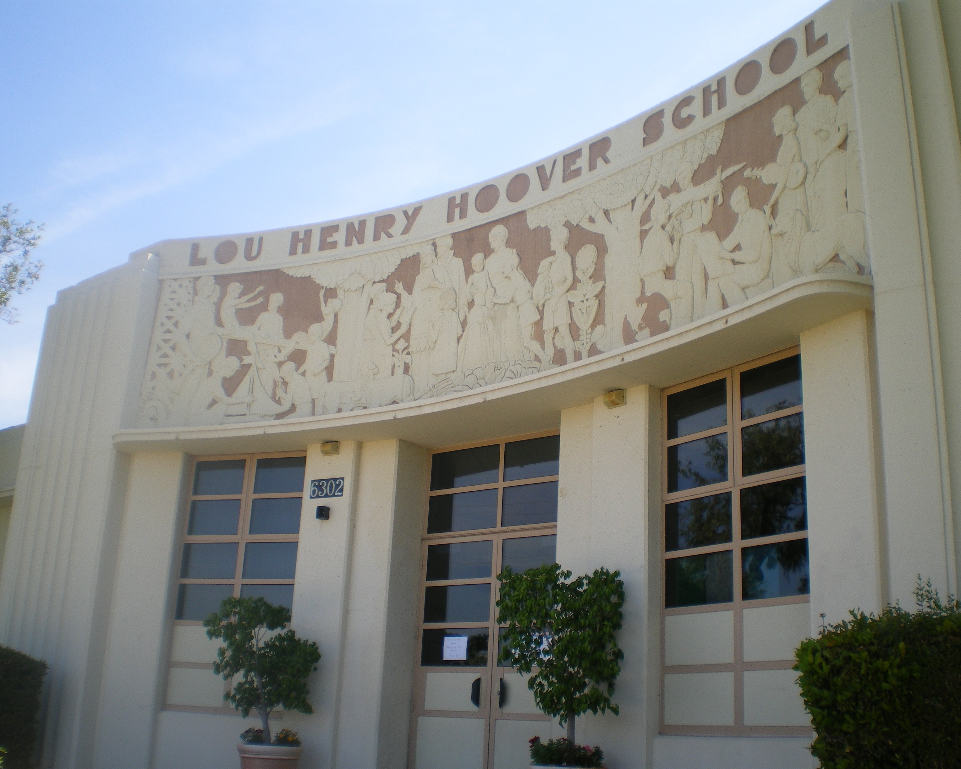

Frieze at Hoover School, designed by Bartholomew Mako
The city of Whittier is served by the Whittier Union High School District, East Whittier City School District, Whittier City School District, Lowell Joint School District and the Fullerton Joint Union High School District.
Five high schools, California High School, La Serna High School, Pioneer High School, Santa Fe High School, and Whittier High School comprise the Whittier Union High School District. There is one alternative continuation high school Frontier High School and a homeschooling hq, Sierra Vista High School. Although they still have Whittier postal addresses, both California High School and Pioneer High School lie outside the city limits in unincorporated Los Angeles County. Santa Fe High School is located within the City of Santa Fe Springs. Adults may attend the Whittier Adult School, which belongs to the Whittier Union High School District. The city also has three private Catholic elementary schools, K-8
- St. Bruno's Parish School[27]
- St Gregory The Great Parish School[28]
- St. Mary of the Assumption School[29]
The schools are operated by the Roman Catholic Archdiocese of Los Angeles with one (St. Mary of the Assumption School) being one of the largest Catholic elementary schools in Los Angeles County. St Gregory The Great School has been Number One in their deanery for the Academic Decathlon two years in a row.
Trinity Lutheran School,[30] a ministry of Trinity Lutheran Church, serves Pre-K through eighth grade and is accredited by Western Association of Schools and Colleges. Whittier Christian School,[31] a ministry of Calvary Baptist Church, Association of Christian Schools International serves grades K–8 in the Whittier community.
Plymouth Christian School,[32] a ministry of Plymouth Church, serves preschool through sixth grade.
Higher education institutions in the area include Rio Hondo College, which lies just outside the city, Southern California University of Health Sciences, and historic Whittier College.
Fred C. Nelles Youth Correctional Facility[]
The Fred C. Nelles Youth Correctional Facility served as a state reform school for boys and girls until 1916, when the girls were moved elsewhere. Opened in 1891 before Whittier was incorporated, Nelles was the longest-running state school for juvenile offenders in California and has been declared a California State Historical Landmark. In 2014, Brookfield Residential Properties announced plans for a large retail, commercial and residential project on the site. Much of Whittier is built out so the 74 acres (29.9 ha) site brings a unique chance for growth in the city. Although over 50 buildings will be demolished, discussions have focused on how many of the eight historic buildings should be preserved.[33] The administration building that was constructed in 1928-29, has its own historical designation.
Historical landmarks and entertainment locations[]
Places[]
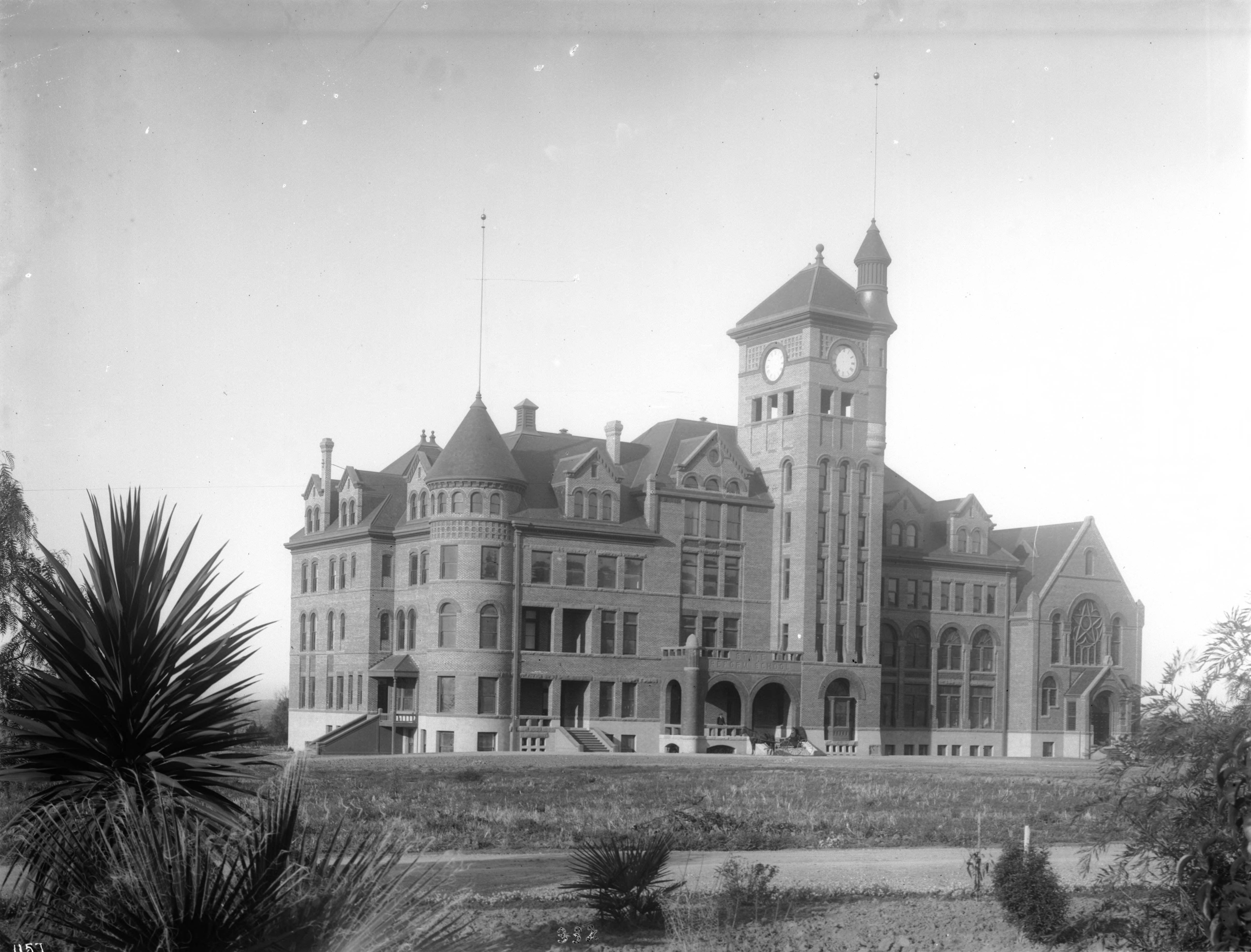

California State Reform School at Whittier, ca.1901 (CHS-1157)


Hoover Hotel
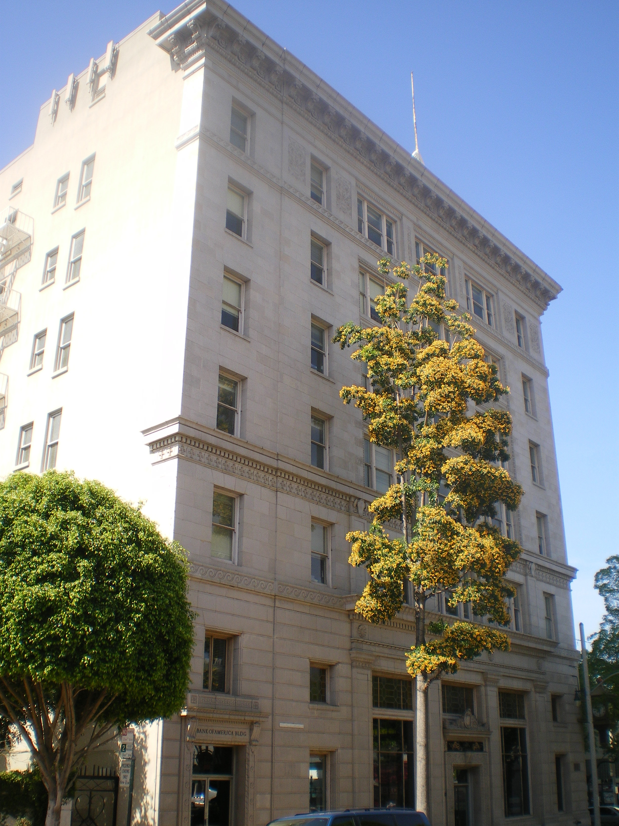

National Bank of Whittier Building
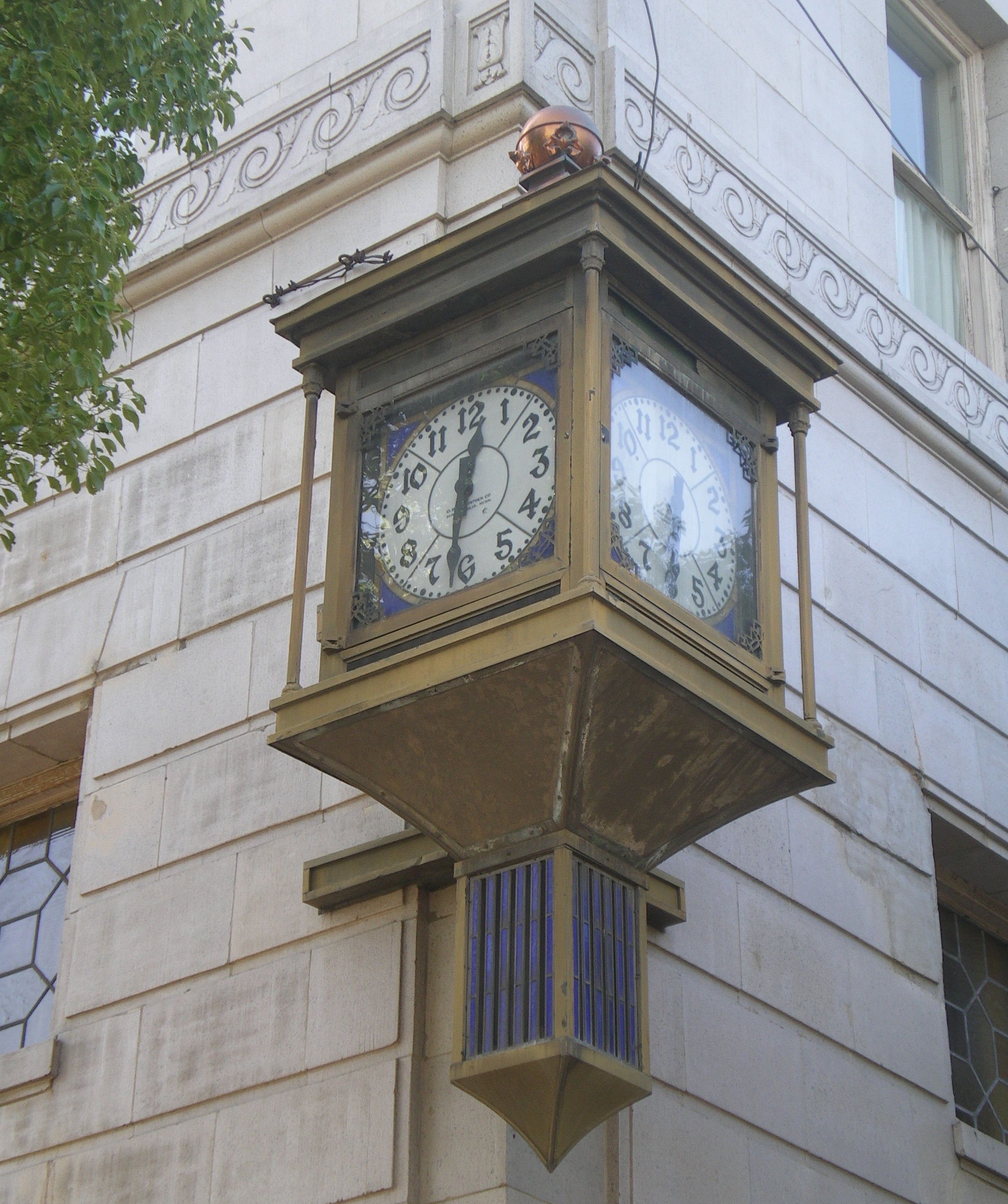

Whittier Village Clock


Standard Oil Building

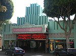
Whittier Village Cinemas
- Rose Hills Memorial Park, the largest single-location cemetery in the world, is located at the western edge of the city limits.[34]
- The Principia Discordia was revealed to its authors in the city's local bowling alley.
- Whittier is home to the following California Historical Landmarks[35]
- Pio Pico State Historic Park, California Historical Landmark No. 127: The Casa de Governor Pío Pico/Home of Governor Pío Pico, home of the last Mexican Governor of California.
- California Historical Landmark No. 646: Grave of George Caralambo, (Greek George):
- California Historical Landmark No. 681: Paradox Hybrid Walnut Tree:
- California Historical Landmark No. 947: Reform School for Juvenile Offenders (Fred C. Nelles School — Closed May 27, 2004 and currently being redeveloped for business and residential use)
- Whittier Museum - 6755 Newlin Ave, Whittier 90601. Open to the public Saturdays and Sundays from 1 to 4 p.m. and is free of charge[36]
- Whittier is the home to the following places listed in the National Register of Historic Places:
- Pio Pico House, 6003 Pioneer Blvd.
- Hoover Hotel, 7035 Greenleaf Ave.
- Southern Pacific Railroad Depot, 7333 Greenleaf Ave.
- Standard Oil Building, 7257 Bright Ave.
- Jonathan Bailey House, 13421 E. Camilla St.
- National Bank of Whittier Building, 13002 E. Philadelphia
- Orin Jordan House, 8310 S. Comstock Ave.
Film and television locations[]
- Various movies and television shows have been filmed in the city including:
- Amish Grace (2010) - Television film. The carriage procession was filmed on Greenleaf St. in Uptown Whittier and funeral home scene was filmed at The Good Shepherd Family Bible Church, across the street from the post office on Bailey St.
- Back to the Future/Back to the Future Part II - Films starring Michael J. Fox. Whittier High School was used as the setting for Hill Valley High School.
- Hocus Pocus - Film starring Bette Midler, Sarah Jessica Parker, Thora Birch and Vinessa Shaw. Parts were filmed in Uptown Whittier and East Whittier Middle School.
- Father of the Bride Part II - Film starring Steve Martin. Parts were filmed in uptown Whittier.
- The Wonder Years - Television series starring Fred Savage. The parade scene in the last episode was filmed in uptown Whittier.
- The Next Best Thing - Film starring Madonna and Rupert Everett was filmed in the Whittier Hills.
- Bringing Down the House - Film starring Queen Latifah and Steve Martin was filmed at the Friendly Hills Country Club, in East Whittier.
- Terminator 3: Rise of the Machines (2003) - Film starring Arnold Schwarzenegger. Various parts were shot in Whittier including in Rose Hills Memorial Park.
- Blow - Film starring Johnny Depp and Penélope Cruz. Scenes were filmed at the Fred C. Nelles Youth Correctional Facility, which closed in January 2004, and in a residential neighborhood.
- Ali - directed by Michael Mann, portions of which were filmed at a residence in the historic neighborhood near the uptown village.
- Disturbia (2007) - Film starring Shia LaBeouf, Carrie-Anne Moss, and Amanda Walsh. Was shot on Painter Ave, the deli scenes were filmed at "Our Cleaners" on Comstock Ave. in uptown Whittier.
- Moonlight - Television series starring Alex O'Loughlin and Sophia Myles. Exteriors of a state execution facility were filmed at the Fred C. Nelles Youth Correctional Facility, the facility name being clearly shown in multiple shots.
- What Just Happened? (2008) - Film starring Robert De Niro, Bruce Willis, Sean Penn and Robin Wright Penn. Scenes were filmed in Rose Hills Memorial Park.
- Red State (2011) - Film directed by Kevin Smith and starring Michael Parks. Scenes were filmed at the Fred C. Nelles Youth Correctional Facility.
- True Blood (HBO Series) - several scenes of involving The Fellowship of the Sun church were filmed at the chapel at Rose Hills Memorial Park. On the DVD commentary of Season 3, Stephen Moyer says several local girls came to the filming with shirts saying, "The girls are prettier in Whittier".
- Roadracers (1994) - Film starring David Arquette, John Hawkes (actor), and Salma Hayek; directed by Robert Rodriguez. Much of the filming took place in Uptown, the nearby residential neighborhoods, and Turnbull Canyon Road. John Hawkes describes in an interview, "We shot anywhere we could find something that looked like the 1950s. It was difficult near L.A. It was hard to find things that looked authentic to the period and a small Texas town. I think they did a good job finding [the locations]."[37]
- "The Muppets" (2011) - film starring Amy Adams and Jason Segel . Scenes at the beginning, of Walter and Gary's hometown, were shot in residential area of historic Uptown Whittier.
John Greenleaf Whittier's dedication poem[]
Although John Greenleaf Whittier never visited the city, he did write a poem in honor of it:
"My Name I Give To Thee"
Dear Town, for whom the flowers are born,
Stars shine, and happy songbirds sing,
What can my evening give to thy morn,
My Winter to Thy Spring?
A life not void of pure intent
With small desert of praise or blame;
The Love I felt, the Good I meant,
I leave Thee with My Name.
Notable people[]
- George Allen, former Virginia governor and U.S. Senator
- Raymond F. Chandler III, SMA, US Army. current Sergeant Major of the US Army
- Jeff B. Davis, comedian and actor
- Justin De Fratus, pitcher for Philadelphia Phillies
- M.F.K. Fisher, food writer, grew up in Whittier[38]
- Nomar Garciaparra, professional baseball player[39]
- Greg Hancock, American Speedway Rider
- Lou Henry Hoover, wife of U.S. president Herbert Hoover, grew up in Whittier[40]
- Gabriel Iglesias, comedian
- Tinker Juarez, professional cyclist, two-time Olympian, MTB Hall of Fame, BMX Hall of Fame, national champion, World Master MTB Champion,[40]
- Mark Kostabi, artist and composer
- John Lasseter, co-founder of Pixar Animation Studios and film director
- Carey Lovelace, art writer and curator
- Pat Nixon, First Lady of the United States, wife of Richard Nixon, whom she met while teaching English at Whittier High School
- Richard Nixon, 37th President of the United States, attended and played football at Whittier High School and Whittier College;[41] Whittier was his childhood home, and he is buried in Yorba Linda, California in nearby Orange County, where he was born[42]
- Ron Shelton, film director and screenwriter
- Stu Thomsen, professional BMX racer
- Douglas Robinson, professor of English, dean
- Jessamyn West, author of The Friendly Persuasion[40]
- Del Worsham, NHRA funny car and top fuel driver, 2011 Top Fuel World Champion
- Tina Yothers, actress and singer
Sister cities[]
 Changshu, P.R. China [43]
- Whittier, Alaska
See also[]
- South Whittier, California (an unincorporated area south of the city limits)
- West Whittier-Los Nietos, California
- Los Angeles
- 1987 Whittier Narrows earthquake
- List of people from Whittier, California
References[]
- ^ "California Cities by Incorporation Date" (Word). California Association of Local Agency Formation Commissions. http://www.calafco.org/docs/Cities_by_incorp_date.doc. Retrieved August 25, 2014.
- ^ "City Council Profiles". City of Whittier. http://www.cityofwhittier.org/council/profiles/default.asp. Retrieved October 1, 2014.
- ^ "2010 Census Gazetteer File - Places - California". United States Census Bureau. http://www.census.gov/geo/maps-data/data/docs/gazetteer/2010_place_list_06.txt. Retrieved September 19, 2014.
- ^ "Whittier". Geographic Names Information System, U.S. Geological Survey. http://geonames.usgs.gov/pls/gnispublic/f?p=gnispq:3:::NO::P3_FID:1652813. Retrieved October 12, 2014.
- ^ "ZIP Code(tm) Lookup". United States Postal Service. https://tools.usps.com/go/ZipLookupAction!input.action. Retrieved December 3, 2014.
- ^ a b c d e f g h i "Whitter Web - Homepage". Cityofwhittier.org. http://www.cityofwhittier.org/. Retrieved 2011-03-16.
- ^ a b c [1]
- ^ Nelson, Carl (1975). Whittier Friends Church: Eighty-Eight Years of Service. Library of William Wright: First Friends Church. pp. 2–9.
- ^ http://www.apu.edu/about/history/timeline
- ^ "US Gazetteer files: 2010, 2000, and 1990". United States Census Bureau. 2011-02-12. http://www.census.gov/geo/www/gazetteer/gazette.html. Retrieved 2011-04-23.
- ^ WRCC. "Western U.S. Climate Historical Summaries Weather". Desert Research Institute. http://www.wrcc.dri.edu/cgi-bin/cliMAIN.pl?ca5790. Retrieved February 12, 2011.
- ^ "2010 Census Interactive Population Search: CA - Whittier city". U.S. Census Bureau. http://www.census.gov/2010census/popmap/ipmtext.php?fl=06:0685292. Retrieved July 12, 2014.
- ^ a b "Error: no
|title=specified when using {{Cite web}}". http://quickfacts.census.gov/qfd/states/06/0685292.html. - ^ "American FactFinder". United States Census Bureau. http://factfinder2.census.gov. Retrieved 2008-01-31.
- ^ http://factfinder.census.gov/servlet/QTTable?_bm=y&-geo_id=16000US0685292&-qr_name=DEC_2000_SF1_U_QTP3&-ds_name=D&-_lang=en&-redoLog=false factfinder.census.gov
- ^ "Statewide Database". UC Regents. http://statewidedatabase.org/gis/gis2011/index_2011.html. Retrieved November 21, 2014.
- ^ "California's 38th Congressional District - Representatives & District Map". Civic Impulse, LLC. http://www.govtrack.us/congress/members/CA/38.
- ^ "Whittier Health Center." Los Angeles County Department of Health Services. Retrieved on March 18, 2010.
- ^ "Institutions & Camps." California Youth Authority. January 25, 1998. Retrieved on August 10, 2010.
- ^ "States Closing Youth Prisons as Arrests Plunge." Associated Press. June 7, 2010. Retrieved on August 10, 2010.
- ^ City of Whittier CAFR
- ^ a b "New era for Police Department". Whittier Daily News. http://www.whittierdailynews.com/ci_16442382. Retrieved 2011-03-16.
- ^ [2]
- ^ [3]
- ^ "Unincorporated Area of Whittier". Whittier.lacounty.info. http://whittier.lacounty.info/Fire.htm. Retrieved 2011-03-16.
- ^ [4]
- ^ "Home". Saintbrunoschool.com. http://saintbrunoschool.com/default.aspx. Retrieved 2011-03-16.
- ^ "Squarespace - Account Not Available". Stgregorywhittier.org. http://www.stgregorywhittier.org/. Retrieved January 1, 2013.
- ^ [5]
- ^ Trinity Lutheran School
- ^ Whittier Christian School
- ^ Plymouth Christian School
- ^ Mejia, Brittny (November 2, 2014) "Whittier sees hope in plan to transform historic Nelles property" Los Angeles Times
- ^ "Home". Rose Hills. http://www.rosehills.com/locationsContent/Default.aspx. Retrieved 2011-03-16.
- ^ "Los Angeles". Ohp.parks.ca.gov. http://ohp.parks.ca.gov/default.asp?page_id=21427. Retrieved January 1, 2013.
- ^ "Home". Whittier Historical Society & Museum. http://www.whittiermuseum.org. Retrieved 2013-08-19.
- ^ [6]
- ^ Reardon, Joan (2004). Poet of the Appetites: The Lives and Loves of M.F.K. Fisher [Hardcover]. North Point Press. pp. 5. ISBN 0-86547-562-8.
- ^ "Anthony Nomar Garciaparra". Baseball Reference. http://www.baseball-reference.com/players/g/garcino01.shtml. Retrieved January 2014.
- ^ a b c "Whittier California Profile and Resource Guide, City or community of Whittier, California Facts, Information, Relocation, Real Estate, Advertising". Usacitiesonline.com. 2011-02-28. http://www.usacitiesonline.com/cacountywhittier.htm. Retrieved 2011-03-16. Cite error: Invalid
<ref>tag; name "home" defined multiple times with different content - ^ "Richard M. Nixon | The White House". Whitehouse.gov. 2011-03-11. http://www.whitehouse.gov/about/presidents/richardnixon. Retrieved 2011-03-16.
- ^ By R. W. Apple Jr. (1994-04-23). <0A15757C0A962958260 "THE 37th PRESIDENT - RICHARD NIXON, 81, DIES - A MASTER OF POLITICS UNDONE BY WATERGATE - Obituary; Biography - NYTimes.com". New York Times. http://query.nytimes.com/gst/fullpage.html?res=9A06E0D71031F93<0A15757C0A962958260. Retrieved 2011-03-16.
- ^ "Directory". SOCAL Sister Cities. http://www.socalsistercities.org/Directory.html. Retrieved 2010-08-17.
External links[]

|
Pico Rivera | Industry Unincorporated Los Angeles County |
Hacienda Heights Unincorporated Los Angeles County |
|
| Pico Rivera | La Habra Heights | |||
 Whittier | ||||
| West Whittier-Los Nietos Santa Fe Springs |
Santa Fe Springs South Whittier East Whittier |
La Habra |
| ||||||||||||||||||||

.jpg)
| |||||||||||||||||||||||||||
| This page uses content from the English language Wikipedia. The original content was at Whittier, California. The list of authors can be seen in the page history. As with this Familypedia wiki, the content of Wikipedia is available under the Creative Commons License. |