| White New South Wales | |||||||||||||
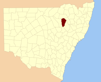 Location in New South Wales | |||||||||||||
| |||||||||||||
White County is one of the 141 Cadastral divisions of New South Wales. It is located to the south of the Namoi River along both sides of Bohena Creek, with Narrabri at the northern end. It includes most of the Pilliga Nature Reserve.
White County was named in honour of the surveyor and diarist George Boyle White (1802-1876).[1]
Parishes within this county[]
A full list of parishes found within this county; their current LGA and mapping coordinates to the approximate centre of each location is as follows:
| Parish | LGA | Coordinates |
|---|---|---|
| Arrarownie | Narrabri Shire Council | |
| Belmore | Narrabri Shire Council | |
| Blake | Narrabri Shire Council | |
| Bohena | Narrabri Shire Council | |
| Borah | Warrumbungle Shire Council | |
| Boral | Narrabri Shire Council | |
| Brigalow | Narrabri Shire Council | |
| Bulgarra | Narrabri Shire Council | |
| Capp | Narrabri Shire Council | |
| Cocaboy | Narrabri Shire Council | |
| Coghill | Narrabri Shire Council | |
| Cook | Narrabri Shire Council | |
| Cooma | Narrabri Shire Council | |
| Coormore | Warrumbungle Shire Council | |
| Cowallah | Narrabri Shire Council | |
| Cox | Warrumbungle Shire Council | |
| Crowie | Narrabri Shire Council | |
| Dampier | Narrabri Shire Council | |
| Dangar | Narrabri Shire Council | |
| Denobollie | Narrabri Shire Council | |
| Dewhurst | Narrabri Shire Council | |
| Galloway | Narrabri Shire Council | |
| Goona | Narrabri Shire Council | |
| Gorman | Narrabri Shire Council | |
| Gurleigh | Narrabri Shire Council | |
| Humphrey | Warrumbungle Shire Council | |
| Iredale | Warrumbungle Shire Council | |
| Lloyd | Narrabri Shire Council | |
| Loder | Narrabri Shire Council | |
| Loftus | Warrumbungle Shire Council | |
| Mallallee | Narrabri Shire Council | |
| Mallee | Unincorporated | |
| Manum | Warrumbungle Shire Council | |
| Milner | Narrabri Shire Council | |
| Mollee | Narrabri Shire Council | |
| Mollieroi | Narrabri Shire Council | |
| Nuable | Narrabri Shire Council | |
| Orr | Warrumbungle Shire Council | |
| Parkes | Narrabri Shire Council | |
| Quinn | Narrabri Shire Council | |
| Robertson | Narrabri Shire Council | |
| Tannawanda | Warrumbungle Shire Council | |
| Turrawan | Narrabri Shire Council | |
| Wee Waa | Narrabri Shire Council | |
| White | Narrabri Shire Council | |
| Yaminba | Warrumbungle Shire Council | |
| Yaraman | Narrabri Shire Council |
References[]
| This page uses content from the English language Wikipedia. The original content was at White County, New South Wales. The list of authors can be seen in the page history. As with this Familypedia wiki, the content of Wikipedia is available under the Creative Commons License. |