| ||||||||||||||
| Webster County, Mississippi | |
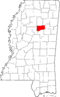
 Location in the state of Mississippi | |
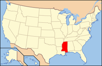
 Mississippi's location in the U.S. | |
| Founded | 1874 |
|---|---|
| Seat | Walthall |
| Largest city | Eupora |
| Area - Total - Land - Water |
423 sq mi (1,096 km²) 422 sq mi (1,093 km²) 1 sq mi (3 km²), 0.20% |
| Population - (2000) - Density |
10,294 23/sq mi (9/km²) |
| Website | www.webstercountyms.com/county/ |
Webster County is a county located in the U.S. state of Mississippi. As of 2000, the population is 10,294. Its county seat is Walthall6. Webster County is named for statesman Daniel Webster.
Geography[]
According to the U.S. Census Bureau, the county has a total area of 1,096 km² (423 sq mi). 1,094 km² (422 sq mi) of it is land and 2 km² (1 sq mi) of it (0.20%) is water.
Major Highways[]
 U.S. Highway 82
Mississippi Highway 9
Mississippi Highway 15
Mississippi Highway 46
Mississippi Highway 50
- Natchez Trace Parkway
Adjacent Counties[]
- Calhoun County (north)
- Chickasaw County (northeast)
- Clay County (east)
- Oktibbeha County (southeast)
- Choctaw County (south)
- Montgomery County (west)
- Grenada County (northwest)
Demographics[]
As of the census2 of 2000, there were 10,294 people, 3,905 households, and 2,877 families residing in the county. The population density was 9/km² (24/sq mi). There were 4,344 housing units at an average density of 4/km² (10/sq mi). The racial makeup of the county was 77.55% White, 20.93% Black or African American, 0.11% Native American, 0.17% Asian, 0.01% Pacific Islander, 0.84% from other races, and 0.39% from two or more races. 1.69% of the population were Hispanic or Latino of any race.
| Historical populations | |||
|---|---|---|---|
| Census | Pop. | %± | |
| 1880 | 9,534 | ||
| 1890 | 12,060 | 26.5% | |
| 1900 | 13,619 | 12.9% | |
| 1910 | 14,853 | 9.1% | |
| 1920 | 12,644 | −14.9% | |
| 1930 | 12,128 | −4.1% | |
| 1940 | 14,160 | 16.8% | |
| 1950 | 11,607 | −18.0% | |
| 1960 | 10,580 | −8.8% | |
| 1970 | 10,047 | −5.0% | |
| 1980 | 10,300 | 2.5% | |
| 1990 | 10,222 | −0.8% | |
| 2000 | 10,294 | 0.7% | |
| Est. 2006 | 10,041 | −2.5% | |
There were 3,905 households out of which 33.90% had children under the age of 18 living with them, 56.20% were married couples living together, 13.10% had a female householder with no husband present, and 26.30% were non-families. 24.00% of all households were made up of individuals and 12.20% had someone living alone who was 65 years of age or older. The average household size was 2.59 and the average family size was 3.07.
In the county the population was spread out with 26.10% under the age of 18, 9.00% from 18 to 24, 26.60% from 25 to 44, 21.80% from 45 to 64, and 16.40% who were 65 years of age or older. The median age was 37 years. For every 100 females there were 93.50 males. For every 100 females age 18 and over, there were 89.40 males.
The median income for a household in the county was $28,834, and the median income for a family was $34,969. Males had a median income of $27,297 versus $19,627 for females. The per capita income for the county was $14,109. About 14.80% of families and 18.70% of the population were below the poverty line, including 24.60% of those under age 18 and 18.30% of those age 65 or over.
Communities[]
- Cities
- Unincorporated places
See also[]
| ||||||||||||||||||||
| This page uses content from the English language Wikipedia. The original content was at Webster County, Mississippi. The list of authors can be seen in the page history. As with this Familypedia wiki, the content of Wikipedia is available under the Creative Commons License. |
