Familypedia
Advertisement
Wartburg District
—  District  —
Wappen Wartburgkreis
Coat of arms
Thuringia wak
Country Flag of Germany Germany
State Thuringia
Capital Bad Salzungen
Area
 • Total 1,305 km2 (504 sq mi)
Population (31 December 2010)[1]
 • Total 130,560
 • Density 100/km2 (260/sq mi)
Time zone CET (UTC+1)
 • Summer (DST) CEST (UTC+2)
Vehicle registration WAK
Website wartburgkreis.de

Wartburg District (German: Wartburgkreis) is a Kreis (district) in the west of Thuringia, Germany. Neighboring districts are (from the north clockwise) the districts Unstrut-Hainich, Gotha, Schmalkalden-Meiningen, and the districts Fulda, Hersfeld-Rotenburg and Werra-Meißner in Hesse. The district-free city Eisenach is nearly completely surrounded by the district.

History[]

The district was created in 1994 by merging the previous districts Eisenach and Bad Salzungen, and a few municipalities from the district Bad Langensalza. The city Eisenach left the district in 1998 and became a district-free city.

The district is named after the Wartburg, a castle near Eisenach most famous as the place of residence of Ludwig, Landgrave of Thuringia and his wife, Saint Elizabeth of Hungary; and, as Martin Luther's refuge in 1521.
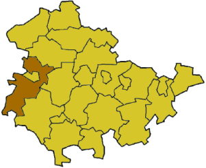
Geography[]

The district is located in the Thuringian Forest, including the Hainich national park. The main river in the district is the Werra.

Coat of arms[]

Coat of arms The coat of arms combines the symbols of the historic states which existed on the territory. In the topleft and the bottomright is the lion of the dukes of Thuringia, the chicken in the topright refers to the county Henneberg, and the black cross in the bottomleft is the symbol of the imperial abbey and state of Fulda.

Towns and municipalities[]

Verwaltungsgemeinschaft-free towns and municipalities
  1. Bad Salzungen
  2. Bad Liebenstein
  3. Geisa
  4. Ruhla
  5. Stadtlengsfeld
  6. Treffurt
  1. Barchfeld-Immelborn
  2. Buttlar
  3. Dorndorf
  4. Ettenhausen an der Suhl
  5. Frauensee
  6. Gerstengrund
  7. Gerstungen
  8. Hörselberg-Hainich
  9. Leimbach
  1. Marksuhl
  2. Merkers-Kieselbach
  3. Moorgrund
  4. Schleid
  5. Seebach
  6. Tiefenort
  7. Unterbreizbach
  8. Wolfsburg-Unkeroda
  9. Wutha-Farnroda
Verwaltungsgemeinschaften
  • 1. Berka/Werra
  1. Berka/Werra1, 2
  2. Dankmarshausen
  3. Dippach
  4. Großensee
  • 2. Creuzburg
  1. Creuzburg1, 2
  2. Ifta
  3. Krauthausen
  • 3. Dermbach
  1. Brunnhartshausen
  2. Dermbach1
  3. Neidhartshausen
  4. Oechsen
  5. Urnshausen
  6. Weilar
  7. Wiesenthal
  8. Zella/Rhön
  • 4. Mihla
  1. Berka vor dem Hainich1
  2. Bischofroda
  3. Ebenshausen
  4. Frankenroda
  5. Hallungen
  6. Lauterbach
  7. Mihla
  8. Nazza
  • 5. Oberes Feldatal
  1. Andenhausen
  2. Diedorf
  3. Empfertshausen
  4. Fischbach/Rhön
  5. Kaltenlengsfeld
  6. Kaltennordheim1
  7. Klings
  • 6. Vacha
  1. Martinroda
  2. Vacha1, 2
  3. Völkershausen
  4. Wölferbütt
1seat of the Verwaltungsgemeinschaft; 2town

References[]

External links[]

Coordinates: 50°55′N 10°15′E / 50.92, 10.25

Advertisement