| ||||||||||||||

Araku valley
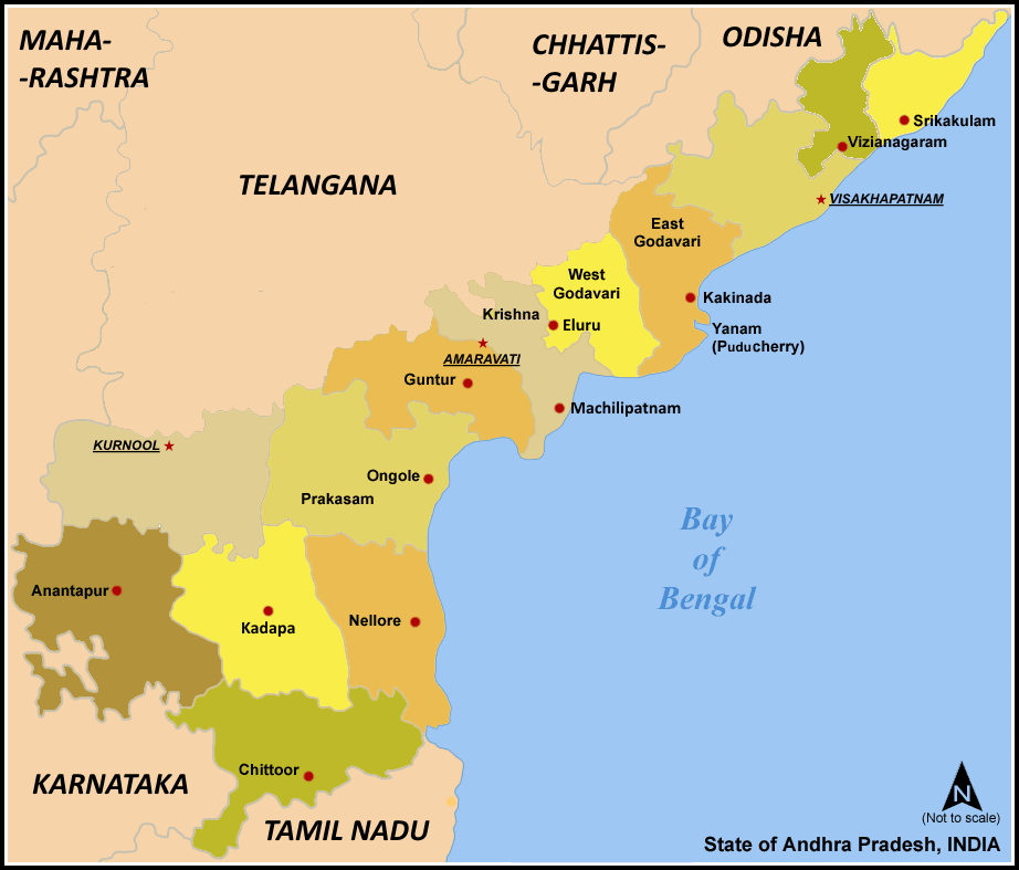
Visakhapatnam district (Telugu: విశాఖపట్నం జిల్లా), also known as Visakha Zilla, is an administrative division of Andhra Pradesh, India. The administrative headquarters of the Visakhapatnam District is Visakhapatnam.
History[]
Post-Independence[]
In 1979, part of the district was split to help form Vizianagaram district.[1] Visakhapatnam District is currently a part of the Red Corridor.[2]
Geography[]
Visakhapatnam district occupies an area of approximately 11,200 square kilometres (4,300 sq mi),[3] comparatively equivalent to Canada's Cape Breton Island.[4]
Climate[]
| Climate data for Visakhapatnam | |||||||||||||
|---|---|---|---|---|---|---|---|---|---|---|---|---|---|
| Month | Jan | Feb | Mar | Apr | May | Jun | Jul | Aug | Sep | Oct | Nov | Dec | Year |
| Average high °C (°F) | 28.9 (84.0) |
31.3 (88.3) |
33.8 (92.8) |
35.3 (95.5) |
36.2 (97.2) |
35.3 (95.5) |
32.9 (91.2) |
32.7 (90.9) |
32.5 (90.5) |
31.7 (89.1) |
30.4 (86.7) |
28.9 (84.0) |
32.5 (90.5) |
| Average low °C (°F) | 18.0 (64.4) |
19.9 (67.8) |
23.0 (73.4) |
26.1 (79.0) |
27.7 (81.9) |
27.3 (81.1) |
26.1 (79.0) |
26.0 (78.8) |
25.6 (78.1) |
24.3 (75.7) |
21.6 (70.9) |
18.6 (65.5) |
23.7 (74.7) |
| Precipitation mm (inches) | 11.4 (0.449) |
7.7 (0.303) |
7.5 (0.295) |
27.6 (1.087) |
57.8 (2.276) |
105.6 (4.157) |
134.6 (5.299) |
141.2 (5.559) |
174.8 (6.882) |
204.3 (8.043) |
65.3 (2.571) |
7.9 (0.311) |
945.7 (37.232) |
| Source: [5] | |||||||||||||
Economy[]
Visakhapatnam district is the central hub for industry and education in the state of Andhra Pradesh.
Visakhapatnam district hosts the "Vizag Steel plant". To acquire this plant a huge mass movement arose, using the slogan "visakha ukku andhrula Hakku", (meaning - Steel for Vizag is the right of Andhraites; ukku - steel and hakku - right), which finally got the steel plant to the city.
Household indicators[]
In 2007–2008 the International Institute for Population Sciences interviewed 1233 households in 30 villages across the district.[6] They found that 82.1% had access to electricity, 73.9% had drinking water, 42.6% toilet facilities, and 43.8% lived in a pucca (permanent) home.[6] 22.6% of girls wed before the legal age of 18[7] and 73.8% of interviewees carried a BPL card.[6]
Divisions[]
Political Constituencies[]
There are 3 parliamentary and 15 assembly constituencies in Visakhapatnam district.
The Parliamentary Constituencies are Anakapalli, Visakhapatnam and Araku Valley.
The Assembly Constituencies [8] are Anakapalli, Bheemunipatnam, Chodavaram, Elamanchili, Madugula, Narsipatnam, Paderu, Pendurthi, Payakaraopeta, Araku Valley, Visakhapatnam East, Visakhapatnam West, Visakhapatnam North, Visakhapatnam South and Gajuwaka.
Mandals[]

Evening scenic view in peddipalem village of Visakhapatnam District
There are 43 Mandals or subdistricts in Visakhapatnam district.[9]
- Anakapalle
- Anandapuram
- Ananthagiri
- Araku Valley
- Achutapuram
- Bheemunipatnam
- Butchayyapeta
- Cheedikada
- Chintapalle
- Chodavaram
- Devarapalle
- Dumbriguda
- Gangaraju Madugula
- Gajuwaka
- Golugonda
- Gudem Kotha Veedhi
- Hukumpeta
- K.Kotapadu
- Kasimkota
- Kotauratla
- Koyyuru
- Madugula
- Makavarapalem
- Munagapaka
- Munchingi Puttu
- Nakkapalle
- Narsipatnam
- Nathavaram
- Paderu
- Padmanabham
- Paravada
- Payakaraopeta
- Peda Bayalu
- Pedagantyada
- Pendurthi
- Rambilli
- Ravikamatham
- Rolugunta
- S.Rayavaram
- Sabbavaram
- Visakhapatnam (rural)
- Visakhapatnam (urban)
- Yalamanchili
Transport[]
The Andhra Pradesh government is seriously considering building a new International Airport because of the region's growing importance. Also, a second major port called Gangavaram on the southern side of Dolphin's Nose is stepping up to cater the needs of imports and exports.
Demographics[]
According to the 2011 census Visakhapatnam district has a population of 4,288,113 ,[10] roughly equal to the nation of New Zealand[11] or the US state of Kentucky.[12] This gives it a ranking of 44th in India (out of a total of 640) and 5th in its state.[10] The district has a population density of 384 inhabitants per square kilometre (990 /sq mi) .[10] Its population growth rate over the decade 2001-2011 was 11.89 %.[10] Visakhapatnam has a sex ratio of 1003 females for every 1000 males,[10] and a literacy rate of 67.7 %.[10]
Visakhapatnam district has a population of 4,288,113 people of which 57.95% is urban as of 2011 census.[1]
| Population | 4,288,113 |
| Males | 2,140,872 |
| Females | 2,147,241 |
| Growth(1991–2001) | 15.36% |
| Rural | 1,301,437 |
| Urban | 3,530,899 |
| Scheduled Caste Population | 291,219 (7.6%) |
| Scheduled Tribe Population | 557,572 (14.55%) |
Culture[]


Stone carved Lord Ganapati at Dharalingeshwara temple near Atchutapuram of Visakhapatnam Dist in Andhra Pradesh
"Vijay Diwas" is a holiday celebrated by the Indian Navy in Visakhapatnam as a victory over Pakistan in 1971, when a submarine marauded the entire coast and entered the waters of the port of Vizag with the intention of destroying the port. The submarine was sunk by the Indian navy.
Every December, from the third Friday to Sunday, an exclusive three day festival brings to life the arts, crafts, culture and cuisine of Visakhapatnam.
Places of tourist interest Visakhapatnam is famous for its natural harbour, Ship building unit, Steel plant, Oil refinaries, light on Dalphins"nose hills, and Ramakrishna beach. It is industrial city in Andhra pradesh. 2. Bhimuni patnam. It is 40 KM from Visakhapatnam and famous for its natural sea port6. simhacalam. It is outskrits of main city. It is famous for its famous varahanarasimha svami temple. araku valley. It is 112 KM away from Visakhapatnam. The Way from visakhapatnam both Rail and Road very interesting. The hill is about 1000 feet height sea level. There are so many tourist interest places at Araku. It is famous for Tribal culture and their dance. There are so many eye catching scenarists here.
References[]
- ^ Law, Gwillim (2011-09-25). "Districts of India". Statoids. http://www.statoids.com/yin.html. Retrieved 2011-10-11.
- ^ "83 districts under the Security Related Expenditure Scheme". IntelliBriefs. 2009-12-11. http://intellibriefs.blogspot.com/2009/12/naxal-menace-83-districts-under.html. Retrieved 2011-09-17.
- ^ Srivastava, Dayawanti et al. (ed.) (2010). "States and Union Territories: Andhra Pradesh: Government". India 2010: A Reference Annual (54th ed.). New Delhi, India: Additional Director General, Publications Division, Ministry of Information and Broadcasting (India), Government of India. pp. 1111–1112. ISBN 978-81-230-1617-7.
- ^ "Island Directory Tables: Islands by Land Area". United Nations Environment Program. 1998-02-18. http://islands.unep.ch/Tiarea.htm. Retrieved 2011-10-11. "Cape Breton Island 10,311km2"
- ^ "Visakhapatnam". India Meteorological Department. May 2011. http://www.imd.gov.in/section/climate/visakhapatnam2.htm. Retrieved 2010-03-26.
- ^ a b c "District Level Household and Facility Survey (DLHS-3), 2007-08: India. Andhra Prades" (PDF). International Institute for Population Sciences and Ministry of Health and Family Welfare. 2010. http://www.rchiips.org/pdf/rch3/report/AP.pdf. Retrieved 2011-10-03.
- ^ "How Do I? : Obtain Marriage Certificate". National Portal Content Management Team, National Informatics Centre. 2005. http://india.gov.in/howdo/howdoi.php?service=3. Retrieved 2011-10-03. "To be eligible for marriage, the minimum age limit is 21 for males and 18 for females."
- ^ District-wise Assembly Constituencies in Andhra Pradesh
- ^ APonline Visakhapatnam factfile
- ^ a b c d e f "District Census 2011". Census2011.co.in. 2011. http://www.census2011.co.in/district.php. Retrieved 2011-09-30.
- ^ US Directorate of Intelligence. "Country Comparison:Population". https://www.cia.gov/library/publications/the-world-factbook/rankorder/2119rank.html. Retrieved 2011-10-01. "New Zealand 4,290,347 July 2011 est."
- ^ "2010 Resident Population Data". U. S. Census Bureau. http://2010.census.gov/2010census/data/apportionment-pop-text.php. Retrieved 2011-09-30. "Kentucky 4,339,367"
External links[]

|
Malkangiri district, Orissa | Koraput district, Orissa | Vizianagaram district |
|
 Visakhapatnam district | ||||
| East Godavari district | Bay of Bengal |
| |||||||||||||||||
| This page uses content from the English language Wikipedia. The original content was at Visakhapatnam district. The list of authors can be seen in the page history. As with this Familypedia wiki, the content of Wikipedia is available under the Creative Commons License. |