| Main | Births etc |
|---|
| ||||||||||||||
| Vinton County, Ohio | ||
| ||
 Location in the state of Ohio | ||
 Ohio's location in the U.S. | ||
| Founded | March 23, 1850[1] | |
|---|---|---|
| Named for | Samuel Finley Vinton | |
| Seat | McArthur | |
| Largest village | McArthur | |
| Area - Total - Land - Water |
415 sq mi (1,075 km²) 412 sq mi (1,067 km²) 2.6 sq mi (7 km²), 0.6% | |
| Population - (2010) - Density |
13,435 33/sq mi (13/km²) | |
| Congressional district | 15th | |
| Time zone | Eastern: UTC-5/-4 | |

Vinton County is a county located in the U.S. state of Ohio. As of the 2010 census, the population was 13,435,[2] making it the least populous county in the state. Its county seat is McArthur.[3] The county is named for Samuel Finley Vinton, a 19th-century United States Congressman from Ohio.[4]
Geography
According to the U.S. Census Bureau, the county has a total area of 415 square miles (1,070 km2), of which 412 square miles (1,070 km2) is land and 2.6 square miles (6.7 km2) (0.6%) is water.[5]
Waterways
Most of Vinton County is in the Raccoon Creek watershed. Most of the rest of the county, to the west, is in the Salt Creek watershed.[6]
Adjacent counties
- Hocking County (north)
- Athens County (northeast)
- Meigs County (east)
- Gallia County (southeast)
- Jackson County (south)
- Ross County (west)
Demographics
| Historical populations | |||
|---|---|---|---|
| Census | Pop. | %± | |
| 1850 | 9,353 | ||
| 1860 | 13,631 | 45.7% | |
| 1870 | 15,027 | 10.2% | |
| 1880 | 17,223 | 14.6% | |
| 1890 | 16,045 | −6.8% | |
| 1900 | 15,330 | −4.5% | |
| 1910 | 13,096 | −14.6% | |
| 1920 | 12,075 | −7.8% | |
| 1930 | 10,287 | −14.8% | |
| 1940 | 11,573 | 12.5% | |
| 1950 | 10,759 | −7.0% | |
| 1960 | 10,274 | −4.5% | |
| 1970 | 9,420 | −8.3% | |
| 1980 | 11,584 | 23.0% | |
| 1990 | 11,098 | −4.2% | |
| 2000 | 12,806 | 15.4% | |
| 2010 | 13,435 | 4.9% | |
| Est. 2015 | 13,048 | [7] | 1.9% |
| U.S. Decennial Census[8] 1790-1960[9] 1900-1990[10] 1990-2000[11] 2010-2013[2] | |||
2000 census
As of the census[12] of 2000, there were 12,806 people, 4,892 households, and 3,551 families residing in the county. The population density was 31 people per square mile (12/km²). There were 5,653 housing units at an average density of 14 per square mile (5/km²). The racial makeup of the county was 98.08% White, 0.35% Black or African American, 0.45% Native American, 0.09% Asian, 0.08% from other races, and 0.95% from two or more races. 0.47% of the population were Hispanic or Latino of any race.
There were 4,892 households out of which 34.00% had children under the age of 18 living with them, 57.20% were married couples living together, 10.20% had a female householder with no husband present, and 27.40% were non-families. 23.60% of all households were made up of individuals and 9.40% had someone living alone who was 65 years of age or older. The average household size was 2.59 and the average family size was 3.04.
In the county, the population was spread out with 26.90% under the age of 18, 8.80% from 18 to 24, 29.00% from 25 to 44, 23.10% from 45 to 64, and 12.10% who were 65 years of age or older. The median age was 36 years. For every 100 females there were 99.10 males. For every 100 females age 18 and over, there were 95.50 males.
The median income for a household in the county was $29,465, and the median income for a family was $34,371. Males had a median income of $30,936 versus $21,257 for females. The per capita income for the county was $13,731. About 15.10% of families and 20.00% of the population were below the poverty line, including 27.60% of those under age 18 and 13.50% of those age 65 or over.
2010 census
As of the 2010 United States Census, there were 13,435 people, 5,260 households, and 3,640 families residing in the county.[13] The population density was 32.6 inhabitants per square mile (12.6 /km2). There were 6,291 housing units at an average density of 15.3 per square mile (5.9 /km2).[14] The racial makeup of the county was 97.9% white, 0.4% American Indian, 0.3% black or African American, 0.2% Asian, 0.1% from other races, and 1.1% from two or more races. Those of Hispanic or Latino origin made up 0.5% of the population.[13] In terms of ancestry, 17.0% were German, 16.2% were American, 14.2% were Irish, and 7.5% were English.[15]
Of the 5,260 households, 32.9% had children under the age of 18 living with them, 51.0% were married couples living together, 12.1% had a female householder with no husband present, 30.8% were non-families, and 26.1% of all households were made up of individuals. The average household size was 2.54 and the average family size was 3.03. The median age was 39.6 years.[13]
The median income for a household in the county was $34,242 and the median income for a family was $37,409. Males had a median income of $36,598 versus $28,226 for females. The per capita income for the county was $16,736. About 17.3% of families and 19.5% of the population were below the poverty line, including 25.8% of those under age 18 and 13.3% of those age 65 or over.[16]
Politics
| Year | Republican | Democrat |
|---|---|---|
| 2012 | 52.02% 2,856 | 44.37% 2,436 |
| 2008 | 53.51% 3,021 | 43.62% 2,463 |
| 2004 | 54.81% 3,249 | 44.72% 2,651 |
| 2000 | 54.99% 2,720 | 41.18% 2,037 |
Government and infrastructure
Vinton County has a three-member Board of County Commissioners that administers and oversees the various county departments, similar to all but two of the 88 Ohio counties. The elected commissioners serve four-year terms. The elected commissioners are Michael Bledsoe, Tim Eberts, and Jerry Zinn.[18]
Emergency services
The following emergency services, with their locations, serve the county:[19]
- Ohio State Highway Patrol
- Vinton County Sheriff's Department
- 106 South Market Street, McArthur
- McArthur Police Department
- 124 West Main Street, McArthur
- Vinton County Emergency Medical Services
- 31931 State Route 93, McArthur
- Vinton County Emergency Management Agency
- 106 South Market Street, McArthur
- MedFlight 3
- 110 West Second Street, Wellston, Ohio 45692
- LifeAir
- 1843 River Road, Chillicothe, Ohio
- McArthur Fire Department
- 303 West High Street, McArthur
- Hamden Fire Department
- 100 Wilkesville Street, Hamden
- Wilkesville Fire Department
- 161 Main Street, Wilkesville
- Zaleski Fire Department
- State Route 278, Zaleski
- Harrison Township Fire Department
- 51560 Old Route 50, Londonderry
Post Offices
There are post offices in the following Vinton County communities:[20]
- Hamden
- McArthur
- New Plymouth
- Ray
- Wilkesville
- Zaleski
- Wellston
- Jackson
Utilities
The following utilities serve Vinton County:[21]
Phone, Internet and cable
- Horizon Telephone
- Ohio Hills
- Frognet
- Verizon
- First Communications
- Time Warner Cable
Gas and electricity
- Columbia Gas of Ohio
- South Central Power Company
- American Electric Power
- Buckeye Rural Electric Co-Op
Water and garbage disposal
- Ross County Water Company
- Jackson County Water Company
- Leax Water Company
- McArthur Water Department
- Rumpke
- Waste Management
- Dutcher Sanitation
Education
The entire county is served by the Vinton County Local School District which operates the following schools:[22]
- West Elementary
- 57750 US Highway 50, Allensville, Ohio 45651
- South Elementary
- 38234 State Route 93, Hamden, Ohio 45634
- Central Elementary
- 507 Jefferson Avenue, McArthur, Ohio 45651
- Vinton County Middle School
- 63780 Locker Plant Road, McArthur, Ohio 45651
- Vinton County High School
- 63910 US Highway 50, McArthur, Ohio 45651
Transportation
Highways
 U.S. Route 50
- State Route 32
- State Route 56
- State Route 93
- State Route 124
- State Route 160
- State Route 278
- State Route 324
- State Route 327
- State Route 328
- State Route 356
- State Route 671
- State Route 677
- State Route 683
- State Route 689
Airports
Vinton County has one public airport, the Vinton County Airport (K22I/22I). The runway is a 3725' x 75' asphalt, east-west (09/27) runway with a single intersecting taxiway. Navigation and radio equipment includes a two-light PAPI for runway 27, Pilot Controlled Lighting and UNICOM.[23]
The airport is leased to the Vinton County Pilots & Booster Association by the County, who raise funds to maintain and update the airport. As of 2015, the boosters are raising funds to finance a 2000-foot runway extension and resurfacing project. The airport is equipped to provide basic service to piston-engined general aviation aircraft. Flight instruction services are also available.[24]
Media
Vinton County is served by one local newspaper outlet, the Vinton County Courier, a print newspaper and website.[25]
Tourism
Covered bridges


Mt. Olive Covered Bridge


Ponn Covered Bridge prior to arson
There are four covered bridges located around Vinton County. The most famous bridge was the Ponn Bridge, also known as the Humpback Bridge. It was built in 1874 and was the longest one in the county. The bridge's name came from the shape of the bridge and there are only a few 'humpback' bridges left around the world. This bridge was burned down in June, 2013 by arsonists.[26] In 1875, the Mt. Olive Bridge was built by a Civil War veteran named George Washington Pilcher. This bridge is open to foot traffic and goes over the Middle Fork Salt Creek. The Bay Bridge is located on the Vinton County Fairgrounds. It was moved to the fairgrounds in 1967 and is still open to pedestrians. The Cox Bridge was built in 1884. The bridge is open to foot traffic and has a picnic area near it. The Arbaugh Bridge was built in 1871, making it the oldest covered bridge in the county. The bridge is the only one open to vehicles thanks to a grant that allowed for renovations.
State Parks and Recreation Areas


Lake Hope State Park
There are eight recreation areas in Vinton County. The state parks consist of Lake Alma State Park located in Wellston, Ohio and Lake Hope State Park located in McArthur, Ohio. There are also three state forests consisting of Richland Furnace State Forest, Tar Hollow State Forest, and Zaleski State Forest. Along with these, there is the Wayne National Forest, which covers many other counties in Ohio besides Vinton County, Raccoon Ecological Management Area located on State Route 160, and the Wellston Wildlife Area and Lake Rupert located on State Route 683. There are also many more public areas within a short distance of Vinton County.[27]
Lake Hope Bike Trails
Lake Hope State Park is located in Vinton and Athens Counties. There are five loop trails in the park ranging from 4.5 miles to 16 miles. The Hope Furnace Trail loop is the shortest of the trails at 4.5 miles. The Sidewinder Loop is 5.5 miles, the Copperhead Loop is 10 miles, and the New Big Loop is 15 miles. The longest of the trails in the Old Big Loop at 16 miles.[28]
Zaleski Backpack Trails
There are two trails in Zaleski State Forest, a trail of 23.5 miles and a day trail of 10 miles.[29]
Quilt barns
Throughout Vinton County, 27 quilt barns are scattered by the roadways. They are located on Vinton County's Quilt Trail.[30]
|
|
|
|
Events
Wild Turkey Festival
The Wild Turkey Festival is a music festival held in McArthur, Ohio, on the first weekend of May, beginning on the Thursday evening and concluding on the Sunday afternoon. A parade runs through the town on the Saturday night.[31]
Ridgetop Music Festival
Every August, the Ridgetop Music Festival is held at the Vinton County Airport which offers music and airplane rides throughout the festival.[32]
Vinton County Air Show
The air show is held on the third Sunday in September. The show is the biggest free air show in Ohio and includes food and aerial acts.[33]
Communities
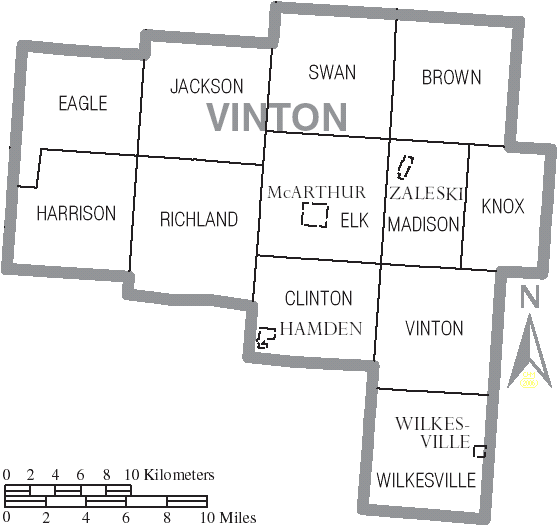

Map of Vinton County, Ohio with municipal and township labels
Villages
- Hamden
- McArthur (county seat)
- Wilkesville
- Zaleski
Townships
- Brown
- Clinton
- Eagle
- Elk
- Harrison
- Jackson
- Knox
- Madison
- Richland
- Swan
- Vinton
- Wilkesville
Unincorporated communities
- Allensville
- Creola
- Dundas
- Eagle Mills
- Hope
- Hue
- Jimtown
- Knox
- Minerton
- New Plymouth
- Orland
- Puritan
- Radcliff
- Ratcliffburg
- Ray
- Richland
- Siverly
- Stella
- Vales Mills
Ghost towns
- Ingham
- Moonville
- Oreton
See also
- Covered bridges of southeast Ohio
- National Register of Historic Places listings in Vinton County, Ohio
References
- ^ "Ohio County Profiles: Vinton County" (PDF). Ohio Department of Development. http://www.odod.state.oh.us/research/FILES/S0/Vinton.pdf. Retrieved April 28, 2007.
- ^ a b "State & County QuickFacts". United States Census Bureau. http://quickfacts.census.gov/qfd/states/39/39163.html. Retrieved February 11, 2015.
- ^ "Find a County". National Association of Counties. Archived from the original on May 31, 2011. https://web.archive.org/web/20110531210815/http://www.naco.org/Counties/Pages/FindACounty.aspx. Retrieved June 7, 2011.
- ^ "Vinton County data". Ohio State University Extension Data Center. http://www.osuedc.org/profiles/profile_entrance.php?fips=39163&sid=0. Retrieved April 28, 2007.
- ^ "2010 Census Gazetteer Files". United States Census Bureau. August 22, 2012. http://www.census.gov/geo/maps-data/data/docs/gazetteer/counties_list_39.txt. Retrieved February 11, 2015.
- ^ "State of Ohio GIS Databases". http://metadataexplorer.gis.state.oh.us/metadataexplorer/. Retrieved March 6, 2011.
- ^ "County Totals Dataset: Population, Population Change and Estimated Components of Population Change: April 1, 2010 to July 1, 2015". http://www.census.gov/popest/data/counties/totals/2015/CO-EST2015-alldata.html. Retrieved July 2, 2016.
- ^ "U.S. Decennial Census". United States Census Bureau. Archived from the original on May 11, 2015. http://www.webcitation.org/6YSasqtfX?url=http%3A%2F%2Fwww.census.gov%2Fprod%2Fwww%2Fdecennial.html. Retrieved February 11, 2015.
- ^ "Historical Census Browser". University of Virginia Library. http://mapserver.lib.virginia.edu. Retrieved February 11, 2015.
- ^ Forstall, Richard L., ed (March 27, 1995). "Population of Counties by Decennial Census: 1900 to 1990". United States Census Bureau. http://www.census.gov/population/cencounts/oh190090.txt. Retrieved February 11, 2015.
- ^ "Census 2000 PHC-T-4. Ranking Tables for Counties: 1990 and 2000". United States Census Bureau. April 2, 2001. http://www.census.gov/population/www/cen2000/briefs/phc-t4/tables/tab02.pdf. Retrieved February 11, 2015.
- ^ "American FactFinder". United States Census Bureau. Archived from the original on 2013-09-11. https://web.archive.org/web/20130911234518/http://factfinder2.census.gov. Retrieved 2008-01-31.
- ^ a b c "DP-1 Profile of General Population and Housing Characteristics: 2010 Demographic Profile Data". United States Census Bureau. http://factfinder.census.gov/bkmk/table/1.0/en/DEC/10_DP/DPDP1/0500000US39163. Retrieved 2015-12-27.
- ^ "Population, Housing Units, Area, and Density: 2010 - County". United States Census Bureau. http://factfinder.census.gov/bkmk/table/1.0/en/DEC/10_SF1/GCTPH1.CY07/0500000US39163. Retrieved 2015-12-27.
- ^ "DP02 SELECTED SOCIAL CHARACTERISTICS IN THE UNITED STATES – 2006-2010 American Community Survey 5-Year Estimates". United States Census Bureau. http://factfinder.census.gov/bkmk/table/1.0/en/ACS/10_5YR/DP02/0500000US39163. Retrieved 2015-12-27.
- ^ "DP03 SELECTED ECONOMIC CHARACTERISTICS – 2006-2010 American Community Survey 5-Year Estimates". United States Census Bureau. http://factfinder.census.gov/bkmk/table/1.0/en/ACS/10_5YR/DP03/0500000US39163. Retrieved 2015-12-27.
- ^ "Dave Leip's Atlas of U.S. Presidential Elections". http://uselectionatlas.org/RESULTS/. Retrieved 2016-03-30.
- ^ "County Commissioners". Vinton County Ohio Homepage. http://www.vintoncounty.com/government-a-to-z.html. Retrieved May 4, 2014.
- ^ "Vinton County: Emergency Services". http://www.vintoncounty.com/vinton-county-emergency-services.html. Retrieved July 23, 2014.
- ^ "Vinton County: Postal Offices- Zip Codes". http://www.vintoncounty.com/vinton-county-postoffices-zipcodes.html. Retrieved July 23, 2014.
- ^ "Vinton County: Utilities". http://www.vintoncounty.com/vinton-county-utilities.html. Retrieved July 23, 2014.
- ^ "Vinton County: Local Schools and Higher Education". http://www.vintoncounty.com/vinton-county-education.html. Retrieved July 23, 2014.
- ^ "About Us: Vinton County Airport". Vintoncountyairport.com. http://www.vintoncountyairport.com/index.php?q=node/2. Retrieved May 12, 2015.
- ^ http://www.vintondaily.com
- ^ "Covered Bridges". http://www.vintoncountytravel.com/covered_bridges.htm. Retrieved July 28, 2014.
- ^ "Ohio State Parks and Public Recreation Areas in Vinton County, Ohio". http://www.vintoncountytravel.com/the_outdoors.htm. Retrieved July 30, 2014.
- ^ "Lake Hope Mountain Bike Trail". http://www.vintoncountytravel.com/lake_hope_bike_trail.htm. Retrieved July 28, 2014.
- ^ "Zaleski Backpack Trail". http://www.vintoncountytravel.com/zaleski_backpack_trail.htm. Retrieved July 30, 2014.
- ^ "Quilt Barns". http://www.vintoncountytravel.com/quilt_barns.htm. Retrieved July 30, 2014.
- ^ "Vinton County Wild Turkey Festival". http://www.vintoncountytravel.com/turkeyfestival.htm. Retrieved July 30, 2014.
- ^ "Ridgetop Music Festival". http://www.vintoncountytravel.com/ridge_top_festival.htm. Retrieved July 30, 2014.
- ^ "Vinton County Air Show". http://www.vintoncountytravel.com/vinton_county_air_show.htm. Retrieved July 30, 2014.
External links
- Vinton County Government Website
- Vinton County Convention and Visitors Bureau
- Herbert Wescoat Memorial Library serving Vinton County
- Public Lands Map of Vinton County

|
Hocking County | Athens County |
| |
| Ross County | Meigs County | |||
 Vinton County, Ohio | ||||
| Jackson County | Gallia County |
| |||||||||||||||||

| This page uses content from the English language Wikipedia. The original content was at Vinton County, Ohio. The list of authors can be seen in the page history. As with this Familypedia wiki, the content of Wikipedia is available under the Creative Commons License. |