| Main | Births etc |
|---|
| City of Victoria | |||
|---|---|---|---|
| — City — | |||
 |
|||
|
|||
 |
|||
| Coordinates: Coordinates: | |||
| Country | |||
| State | |||
| County | Victoria | ||
| Government | |||
| • Type | Council-manager | ||
| • City Council | Mayor Paul Polasek Tom Halepaska Emett Alvarez David Hagan Josephine Soliz Dr. Andrew Young Jeff Bauknight |
||
| • City Manager | Charmelle Garrett | ||
| Area | |||
| • City | 33.1 sq mi (85.8 km2) | ||
| • Land | 33.0 sq mi (85.9 km2) | ||
| • Water | 0.2 sq mi (0.2 km2) | ||
| Elevation | 95 ft (29 m) | ||
| Population (2000) | |||
| • City | 60,603 | ||
| • Urban | 84,088 | ||
| • Metro | 111,163 | ||
| Time zone | CST (UTC-6) | ||
| • Summer (DST) | CDT (UTC-5) | ||
| ZIP code | 77901, 77902, 77903, 77904, 77905 | ||
| Area code(s) | 361 | ||
| FIPS code | 48-75428[1] | ||
| GNIS feature ID | 1370631[2] | ||
| Website | victoriatx.org | ||
Victoria is a city in the state of Texas, United States. It is the county seat of Victoria County. The population was 62,592 as of the 2010 census. The three counties of the Victoria Metropolitan Statistical Area had a population of 111,163 as of the 2000 census.[3]
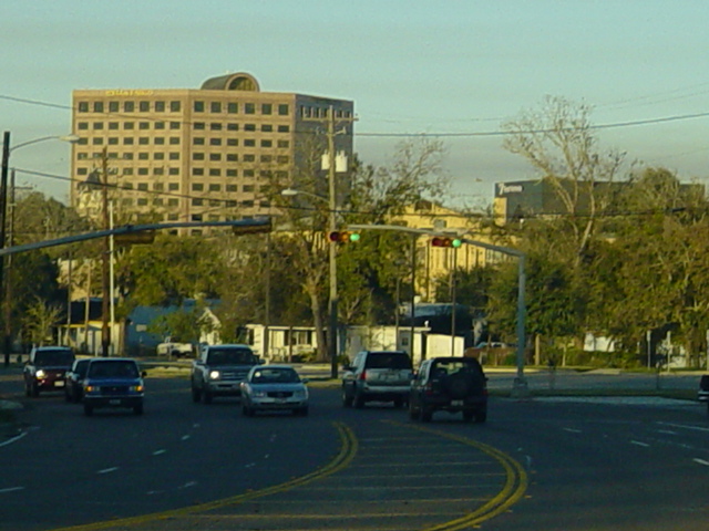
Victoria is located 30 miles inland from the Gulf of Mexico. The city is a regional hub for a seven-county area known as the "Golden Crescent", and serves a retail trade area of over 250,000 people. Victoria is known as "The Crossroads" because of its location within a two-hour drive of Corpus Christi, Houston, San Antonio, and Austin.
Victoria is named for General Guadalupe Victoria, who became the first president of independent Mexico.[4] The city is home to the University of Houston–Victoria and Victoria College. Victoria is the cathedral city of the Roman Catholic Diocese of Victoria in Texas.
History[]
René Robert Cavelier, Sieur de La Salle, established Fort Saint Louis as a French colony, from 1685 until 1689. It was built on Matagorda Bay near Garcitas Creek, in Victoria, Texas.
Mission Nuestra Señora del Espíritu Santo de Zúñiga was then established by Spain in Victoria County, in 1722. Also built on Matagorda Bay near La Salle's Fort Saint Louis, the mission and complementing Presidio La Bahia (fort) was intended to secure the Texas coastline from the French and to gather the local Indians. Being unable to attract the Indians to stay at the mission and due to tensions between the Indians and Spanish soldiers, the mission was relocated only four years later, to a more favorable location on the Guadalupe River. Artifacts from this settlement are currently on display at the Museum of the Coastal Bend in Victoria.
Moved in 1726 near Victoria, it was established among the Tamique and Aranama Indians in Mission Valley. Dams and stone acequias were built to carry water from the river to the mission. A ranching outpost was also built of mortar and stone at Tonkawa Bank, on the river about 12 miles distant. The presidio also followed and was built at what was later to become Fernando De Leon's Ranch. The establishment prospered for 26 years, producing enough grain and hay to trade with other Spanish settlements. At this time, the foundation for cattle and horse ranching started.
A later colony was established by Martín De León in 1824, and was the only predominantly Mexican colony in Texas. Victoria was the center of the colony, which was part of an effort by the Mexican government to settle Texas. From March through November 1840, the government of the Republic of the Rio Grande operated in Victoria until the collapse of the Republic.
Geography[]
Victoria is located on the coastal plains of Texas about 50 miles from the Gulf of Mexico and 20 miles from the nearest bay waters. It lies along and just to the east of the Guadalupe River. The topography is mostly flat to slightly rolling with an average elevation of 95 feet. Most of the city is underlain by smectite-rich clay which is locally capped by silt or fine sand; the high shrink-swell potential associated with smectite creates major challenges to urban infrastructure.[5] Vegetation in better-drained areas consists primarily of short grasses with post oaks and other small timber and brush. Moist sites can grow tall forests dominated by elm and pecan.[6]
Climate[]
Victoria is classified as humid subtropical. June through August is very hot and humid with high temperatures regularly exceeding 90°F. The record high temperature of 111°F. was recorded in September 2000. Spring and autumn months are generally mild to warm with lower humidity. Winters are mild with occasional cold spells. The record low temperature was recorded in December 1989, when the temperature dropped to 9°F. Snow is very infrequent, usually occurring on average once every 11 years. On December 24–25, 2004, Victoria recorded its first White Christmas ever when 12.5 inches of snow fell.[7]
Victoria has occasional severe weather, mostly from flooding. Hurricanes have the potential to bring severe damage to the area. Hurricane Claudette in July 2003 was the last hurricane to score a direct hit on the city. During this event, winds gusted to 83 mph at the Victoria Regional Airport and 90% of the city lost power. The most intense hurricane to affect Victoria remains Hurricane Carla in September 1961.
| Climate data for Victoria, Texas | |||||||||||||
|---|---|---|---|---|---|---|---|---|---|---|---|---|---|
| Month | Jan | Feb | Mar | Apr | May | Jun | Jul | Aug | Sep | Oct | Nov | Dec | Year |
| Record high °F (°C) | 88 (31) |
96 (36) |
99 (37) |
100 (38) |
102 (39) |
107 (42) |
110 (43) |
109 (43) |
111 (44) |
109 (43) |
93 (34) |
88 (31) |
111 (44) |
| Average high °F (°C) | 62.8 (17.1) |
66.6 (19.2) |
73.4 (23.0) |
79.2 (26.2) |
85.1 (29.5) |
90.3 (32.4) |
93.4 (34.1) |
93.7 (34.3) |
89.9 (32.2) |
83.0 (28.3) |
73.0 (22.8) |
65.2 (18.4) |
79.63 (26.46) |
| Average low °F (°C) | 43.6 (6.4) |
46.7 (8.2) |
53.9 (12.2) |
60.1 (15.6) |
68.1 (20.1) |
73.3 (22.9) |
75.0 (23.9) |
74.6 (23.7) |
70.3 (21.3) |
61.6 (16.4) |
52.3 (11.3) |
45.2 (7.3) |
60.39 (15.77) |
| Record low °F (°C) | 9 (−13) |
15 (−9) |
21 (−6) |
33 (1) |
40 (4) |
54 (12) |
61 (16) |
61 (16) |
45 (7) |
31 (−1) |
18 (−8) |
9 (−13) |
9 (−13) |
| Precipitation inches (mm) | 2.44 (62) |
2.04 (51.8) |
2.25 (57.2) |
2.97 (75.4) |
5.12 (130) |
4.96 (126) |
2.90 (73.7) |
3.05 (77.5) |
5.00 (127) |
4.26 (108.2) |
2.64 (67.1) |
2.47 (62.7) |
40.1 (1,018.5) |
| Source: National Weather Service[8] | |||||||||||||
Demographics[]
| Historical populations | |||
|---|---|---|---|
| Census | Pop. | %± | |
| 1850 | 806 | ||
| 1860 | 1,986 | 146.4% | |
| 1870 | 2,534 | 27.6% | |
| 1890 | 3,046 | ||
| 1900 | 4,010 | 31.6% | |
| 1910 | 3,673 | −8.4% | |
| 1920 | 5,957 | 62.2% | |
| 1930 | 7,421 | 24.6% | |
| 1940 | 11,566 | 55.9% | |
| 1950 | 16,126 | 39.4% | |
| 1960 | 33,047 | 104.9% | |
| 1970 | 41,349 | 25.1% | |
| 1980 | 50,695 | 22.6% | |
| 1990 | 55,076 | 8.6% | |
| 2000 | 60,603 | 10.0% | |
| 2010 | 62,592 | 3.3% | |
As of census[1] of 2000, 60,603 people, 22,129 households, and 15,755 families resided in the city. The population density was 1,838.3 people per square mile (709.7/km²). There were 24,192 housing units at an average density of 733.8 per square mile (283.3/km²). The racial makeup of the city was 71.18% White, Hispanic or Latino of any race were 42.92% of the population, 7.59% African American, 0.51% Native American, 1.01% Asian, 0.04% Pacific Islander, 17.31% from other races, and 2.35% from two or more races.
Of the 22,129 households, 36.1% had children under the age of 18 living with them, 52.4% were married couples living together, 14.3% had a female householder with no husband present, and 28.8% were not families. About 24.5% of all households were made up of an individual, and 10.0% had someone living alone who was 65 years of age or older. The average household size was 2.68 and the average family size was 3.21.
In the city, the population was distributed as 28.8% under the age of 18, 9.7% from 18 to 24, 28.0% from 25 to 44, 21.0% from 45 to 64, and 12.6% who were 65 years of age or older. The median age was 34 years. For every 100 females, there were 92.6 males. For every 100 females age 18 and over, there were 88.8 males.
The median income for a household in the city was $36,829, and for a family was $42,866. Males had a median income of $34,184 versus $21,161 for females. The per capita income for the city was $19,009. About 12.2% of families and 14.7% of the population were below the poverty line, including 20.4% of those under the age of 18 and 12.2% ages 65 or older.
Government and infrastructure[]
Victoria is administered by a city council of seven members. The council is composed of six council members and an elected mayor, accompanied by a hired city manager under the manager-council system of municipal governance. Victoria also serves as the county seat of Victoria County.
Economy[]
Victoria's economy is a mix of education, health, retail, agriculture, and industry. Its access to major highways, the Victoria Regional Airport, railway terminals, the shallow draft Port of Victoria, and the deep water Port of Port Lavaca-Point Comfort help to sustain a healthy environment for business. Major industrial employers in the region include Formosa Plastic, Inteplast Group, Dow, Invista, and Alcoa. In 2012, Caterpillar Industries invested $200 million to build a 1.1-million-square-foot hydraulic excavator manufacturing facility in Victoria that will employ around 500 people.
Arts and culture[]
Victoria has many performing arts and theatre events and venues. Theatre Victoria offers six productions in a season that runs from July to May. Performances are held in the newly renovated Leo J. Welder Center, a fully equipped, modern performing space located downtown. The Victoria Symphony Orchestra and Victoria Ballet provide several performances each year.
Several museums are located in Victoria. They include the McNamara House (a social history museum), the Nave (art), the Children's Discovery Museum, and the Museum of the Coastal Bend (MCB). The MCB showcases the rich multicultural heritage of the region, and includes prominent displays of artifacts found from La Salle's colony in the late 17th century.
Presidio La Bahia and Mission Espiritu Santo is located a short 30-minute drive from Victoria. La Bahia is the best-preserved Spanish presidio in the United States, and Espiritu Santo is an excellent example of an early Spanish colonial church and mission.
Recreation[]
Victoria's 562-acre (2.27-km2) Riverside Park is home to the Texas Zoo, which houses more than 200 species of animals and plants indigenous to Texas, exhibiting them in their natural habitats. The park is also home to more than 15 baseball fields which are occupied during the spring and summer by teams from the Victoria Metro region. Also in Riverside Park on the Guadalupe River is the Victoria Paddling trail. This 4.2-mile stretch of the Guadalupe River is bordered by scenic soft banks rather than the limestone bluffs of the Hill Country.
Boating and freshwater fishing are available at two area reservoirs, Lake Texana and Coleto Lake. Many residents also take advantage of the nearby Gulf of Mexico. Port O'Connor, 50 miles to the southeast, is renowned for bay, off-shore and wade fishing.
Three golf courses are located in Victoria: the Victoria Country Club, Riverside Golf Course, and Colony Creek Country Club.
The major shopping center is Victoria Mall.
Athletics[]
The University of Houston–Victoria Jaguars – NAIA compete in baseball, softball, soccer, and golf. The Jaguars compete in the NAIA's independent conference the Association of Independent Institutions (AII). The baseball Jaguars are two-time defending conference champions. The softball team captured the conference title in 2009.
The Victoria Generals compete in the Texas Collegiate League, a summer baseball league experience for the best professional prospects from colleges across the country. The Generals captured the 2010 conference championship.
In 2010, the Victoria East Titans made it to the regional round of the 2010 playoffs, losing to the state champions Lake Travis 59-28, finishing the season 11-2 overall and unbeaten in the district. They were also featured on the "DQ Big Game Of the Week" on Fox Sports Houston.
Notable people[]
- Stone Cold Steve Austin, WWE Hall of Fame
- Cowboy Troy (Troy Lee Coleman III), singer
- Doug Drabek, MLB player [9]
- Kyle Drabek, MLB pitcher[10]
- Ron Gant, MLB player [11]
- Kevin Kolb, NFL quarterback [12]
- Jerheme Urban, NFL wide-receiver[13]
- Frankie Miller (country musician)
- Edward F. Knipling, entomologist
Points of interest[]
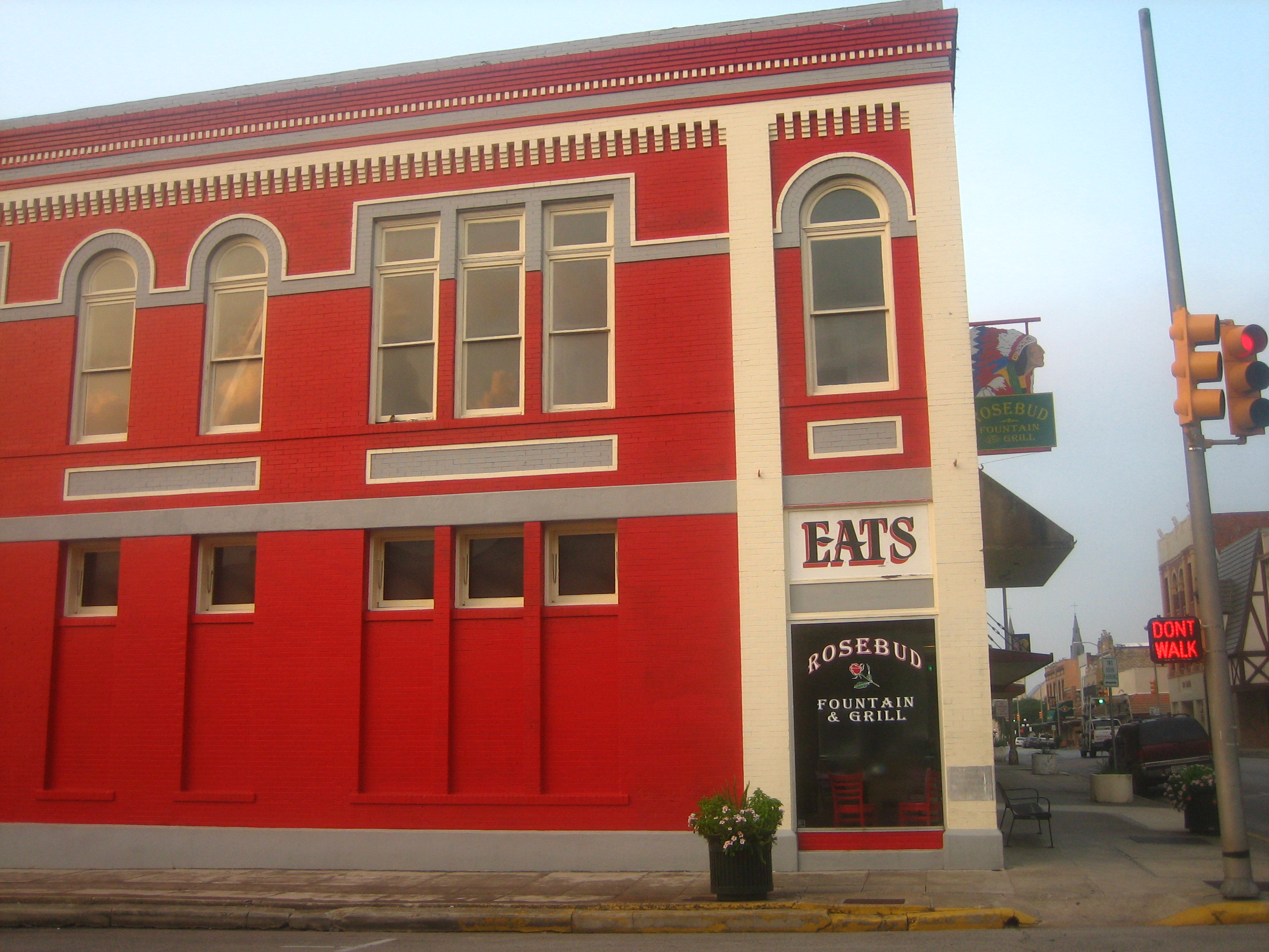
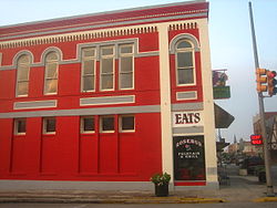
Rosebud Fountain and Grill has been highlighted on Bob Phillips' Texas Country Reporter.
DeLeon Plaza and Bandstand, originally known as ‘Plaza de la Constitucion’, was one of four public squares set aside by colony founder Martin de Leon. The plaza is filled with local monuments and memorials, shade trees, a band stand built in 1890, and information about the six flags over Texas.
The Victoria County Courthouse, located at Bridge and Constitution Streets, was built in 1892 in Romanesque architecture by James R. Gordan in the style of Henry Richardson. The structure is made of Texas granite and Indiana limestone.
Fossati's Delicatessen is located in downtown Victoria, it was opened in 1882 by Italian immigrant Fraschio ("Frank") Napoleon Fossati. After 125 years, Fossati's is still owned and operated by the same family.
The Rosebud Fountain and Grill downtown is a restoration of the diner atmosphere popular in the 1950s. The restaurant, located in a bright-red corner building at North Main and West Constitution Streets, has been featured in Bob Phillips' Texas Country Reporter syndicated television series.
Downtown Victoria has the second-oldest Roman Catholic Church in Texas and first to be canonically established in the Republic of Texas, St. Mary's Church.[14]
Transportation[]
Known as the South Texas Crossroads, Victoria is located at the intersection of three major U.S. highways:
- US Highway 59 is a four-lane divided, interstate-quality highway extending southwest to Laredo and northeast to Houston, where it meets Interstate 10 and Interstate 45. It is also known as the Lloyd M. Bentsen Highway. US 59 is planned to be included within the future Interstate 69.
- US Highway 77 travels north from Victoria to the Dallas-Fort Worth metroplex, intersecting Interstate 10, Interstate 35 and Interstate 37. US 77 travels south via a four-lane divided highway to the Rio Grande Valley.
- US Highway 87 travels northwest connecting Victoria to San Antonio, providing access to Interstate 35. US 87 also connects with Port Lavaca to the southeast.
Victoria is a regional transportation hub for the surrounding counties, with local access to major large and small freight carriers, Victoria Regional Airport, railway terminals, the shallow draft Port of Victoria and the deep water Port of Port Lavaca – Point Comfort.
In 2002, Victoria Transit began operation of a city-wide transportation system. It currently offers bus service on four fixed routes consisting of 70 stops.
Education[]
Higher education[]
Victoria is home to Victoria College and the University of Houston–Victoria. The two institutions share some facilities, and are located in the central part of the city.
Public, primary and secondary education[]
Victoria Independent School District is a TEA Recognized School District servicing about 13,400 students. In May 2007, voters approved a $159-million bond proposal to fund major construction initiatives and facility upgrades. In August 2010, the district was reorganized into two smaller learning communities anchored by two new high schools, Victoria East and Victoria West. The former Memorial High School was converted into a District Events Center, with a new state of the art fine arts auditorium and natatorium. A new middle school and two new elementary schools helped complete the transition to smaller learning environments.
Private and alternative education[]
Victoria has several private education options including Trinity Episcopal School, Faith Academy, Northside Baptist School, Our Lady of Victory School, Nazareth Academy and St. Joseph High School.
Victoria gallery[]
")
")
")
")
")
")
")
")
")
References[]
- ^ a b "American FactFinder". United States Census Bureau. http://factfinder.census.gov. Retrieved 2008-01-31.
- ^ "US Board on Geographic Names". United States Geological Survey. 2007-10-25. http://geonames.usgs.gov. Retrieved 2008-01-31.
- ^ "Annual Estimates of the Population of Metropolitan and Micropolitan Statistical Areas: April 1, 2000 to July 1, 2007 (CBSA-EST2007-01)" (CSV). 2007 Population Estimates. United States Census Bureau, Population Division. 2008-03-27. http://www.census.gov/popest/metro/tables/2007/CBSA-EST2007-01.csv. Retrieved 2008-03-30.
- ^ Texas Transportation Commission, Texas State Travel Guide, 2008, p. 72.
- ^ http://websoilsurvey.nrcs.usda.gov/app/HomePage.htm Web Soil Survey
- ^ The Vegetation Types of Texas. Texas Parks and Wildlife, 1984.
- ^ "White Christmas in South Texas - 2004". National Weather Service Forecast Office. http://www.srh.noaa.gov/crp/?n=whitechristmas2004. Retrieved 23 April 2012.
- ^ "National Weather Service Corpus Christi". Archived from the original on 2008-01-02. http://web.archive.org/web/20080102092527/http://www.srh.noaa.gov/crp/climate/normals.html. Retrieved 2008-06-29.
- ^ "Doug Drabek Stats". Baseball Almanac. http://www.baseball-almanac.com/players/player.php?p=drabedo01. Retrieved December 10, 2012.
- ^ "Kyle Drabek". Basebal-Reference.com. http://www.baseball-reference.com/bullpen/Kyle_Drabek. Retrieved December 10, 2012.
- ^ "Ron Grant Stats". Baseball Almanac. http://www.baseball-almanac.com/players/player.php?p=gantro01. Retrieved December 10, 2012.
- ^ "Kevin Kolb". databaseFootball.com. http://www.databasefootball.com/players/playerpage.htm?ilkid=KolbKev01. Retrieved December 10, 2012.
- ^ "Jerheme Urban". databaseFootball.com. http://www.databasefootball.com/players/playerpage.htm?ilkid=URBANJER01. Retrieved December 10, 2012.
- ^ Handbook of Texas Online - ST. MARY'S CHURCH
External links[]
- City of Victoria, Texas
- 'VTSM (Victoria Texas Social Media) - Adding coordination into communication
- Aloe Army Air Field from the Handbook of Texas Online
- City-Data.com
- ePodunk: Profile for Victoria, Texas, TX
| |||||||||||||||||


| ||||||||||||||||||||||||||||||||||||||||||||||||||||||||||||||
| This page uses content from the English language Wikipedia. The original content was at Victoria, Texas. The list of authors can be seen in the page history. As with this Familypedia wiki, the content of Wikipedia is available under the Creative Commons License. |