m (AWB cleanup- template:wp) |
m (Fix category) |
||
| Line 776: | Line 776: | ||
[[Category:Utah|*]] |
[[Category:Utah|*]] |
||
[[Category:States of the United States]] |
[[Category:States of the United States]] |
||
| − | [[Category: |
+ | [[Category:Established in 1896]] |
[[Category:Former Spanish colonies]] |
[[Category:Former Spanish colonies]] |
||
Revision as of 02:14, 16 May 2010
| State of Utah | |||||
| |||||
| Nickname(s): Beehive State | |||||
| Motto(s): "Industry" | |||||
 | |||||
| Official language(s) | English | ||||
| Capital | Salt Lake City | ||||
| Largest city | Salt Lake City | ||||
| Largest metro area | Salt Lake City | ||||
| Area | Ranked 13th in the U.S. | ||||
| - Total | 84,889 sq mi (219,887 km2) | ||||
| - Width | 270 miles (435 km) | ||||
| - Length | 350 miles (565 km) | ||||
| - % water | 3.25 | ||||
| - Latitude | 37° N to 42° N | ||||
| - Longitude | 109° 3′ W to 114° 3′ W | ||||
| Population | Ranked 34th in the U.S. | ||||
| - Total | 2,233,169 | ||||
| - Density | 27.2/sq mi (10.50/km2) Ranked 41st in the U.S. | ||||
| - Median household income | $50,614 (11th) | ||||
| Elevation | |||||
| - Highest point | Kings Peak[1] 13,528 ft (4,126 m) | ||||
| - Mean | 6,100 ft (1,860 m) | ||||
| - Lowest point | Beaver Dam Wash[2] 2,178 ft (664 m) | ||||
| Admission to Union | January 4, 1896 (45th) | ||||
| Governor | Jon Huntsman (R) | ||||
| Lieutenant Governor | {{{Lieutenant Governor}}} | ||||
| Legislature | {{{Legislature}}} | ||||
| - Upper house | {{{Upperhouse}}} | ||||
| - Lower house | {{{Lowerhouse}}} | ||||
| U.S. Senators | Orrin Hatch (R) Bob Bennett (R) | ||||
| U.S. House delegation | List | ||||
| Time zone | Mountain: UTC-7/-6 | ||||
| Abbreviations | UT US-UT | ||||
| Website | utah.gov | ||||


Utah (English pronunciation: /ˈjutɑː/) is a U.S. state located in the western United States. It was the 45th state admitted to the union, on January 4 1896. Approximately 88 percent of Utah's 2,500,000 people, known as "Utahns," live in an urban concentration with Salt Lake City as the center, known as the Wasatch Front. In contrast, vast expanses of the state are nearly uninhabited, making the population the sixth most urbanized in the U.S.[3] The name "Utah" is derived from the Ute Indian language, meaning "people of the mountains".[4] Utah is known for its geological diversity ranging from snowcapped mountains to well-watered river valleys to rugged, stony deserts. It is also known for being one of the most religiously homogeneous states in the Union, with approximately 62 percent[5] of its inhabitants claiming membership in The Church of Jesus Christ of Latter-day Saints, which greatly influences Utah culture and daily life.
The state is a center of transportation, information technology and research, government services and mining as well as a major tourist destination for outdoor recreation. St. George was the fastest growing metropolitan area in the United States from 2000-2005[6] with Utah being the sixth fastest growing state overall in 2006.[7]
Geography
| [[Image:Flag of Utah|center|250px]] | |
| The Flag of Utah. | |
| [[Image:Seal of Utah|center|250px]] | |
| The Seal of Utah. | |
| Animate insignia | |
| Bird(s) | California Gull |
| Fish | Bonneville Cutthroat Trout |
| Flower(s) | Sego Lily |
| Grass | Indian ricegrass |
| Insect | European Honey Bee |
| Tree | Blue Spruce |
| Inanimate insignia | |
| Dance | Square Dance |
| Fossil | Allosaurus |
| Gemstone | Topaz |
| Mineral | Copper |
| Rock | Coal |
| Ship(s) | USS Utah |
| Slogan(s) | "Life Elevated" |
| Soil | Mivida |
| Song(s) | Utah |
| Tartan | Utah State Tartan |
| Route marker(s) | |
| State Quarter | |
| Released in | |
| Lists of United States state insignia | |


Map of Utah


Delicate Arch, Arches National Park, Utah


Double Arch, a close-set pair of arches located in Arches National Park in Utah


Utah from space. The state is known for its diversity in geology, climate, and ecosystems.
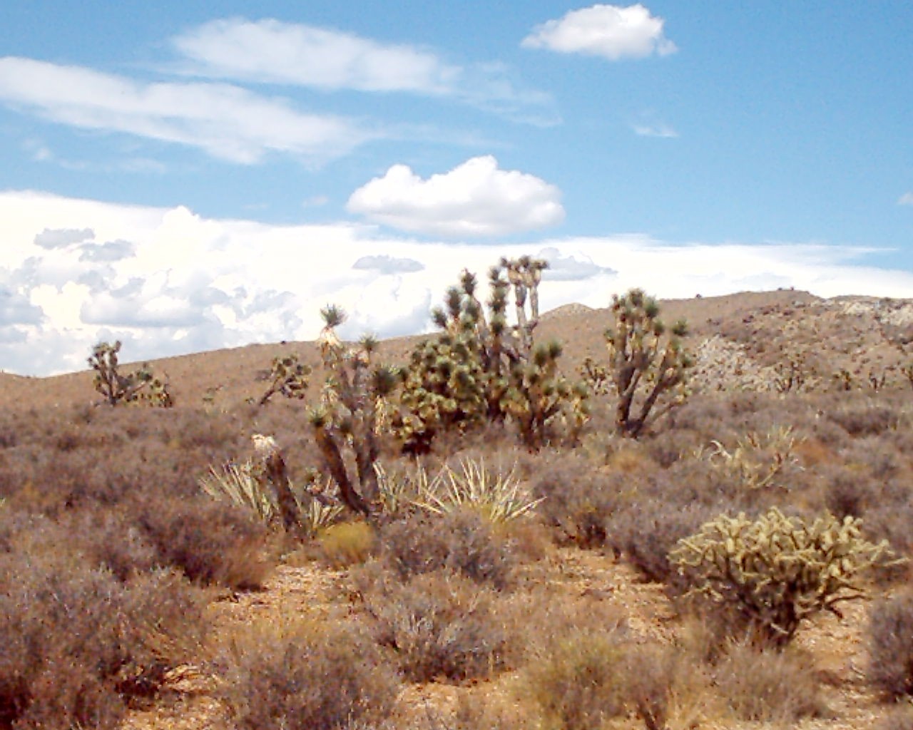
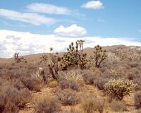
Joshua Trees, yucca plants, and Jumping Cholla cactus occupy the far southwest corner of the state in the Mojave Desert.

Logan Canyon in northern Utah.


Mount Timpanogos in the Wasatch Range of the Rocky Mountains.
Utah is generally rocky with three distinct geological regions: the Rocky Mountains, the Great Basin, and the Colorado Plateau. Utah is known for its natural diversity and is home to features ranging from arid deserts with sand dunes to thriving pine forests in mountain valleys.
Utah is one of the Four Corners states, and is bordered by Idaho and Wyoming in the north; by Colorado in the east; at a single point by New Mexico to the southeast (at the Four Corners Monument); by Arizona in the south; and by Nevada in the west. It covers an area of 84,899 square miles (219,887 km²).
One of Utah's defining characteristics is the variety of its terrain. Running down the center of the state is the Wasatch Range, which rises to heights of about 12,000 feet (3,650 m) above sea level. Portions of these mountains receive more than 500 inches (12.7 m) of snow each year and are home to world-renowned ski resorts, made popular by the light, fluffy snow, which is considered good for skiing. In the northeastern section of the state, running east to west, are the Uinta Mountains, which rise to heights of 13,000 feet (3,950 m) or more. The highest point in the state, Kings Peak, at 13,528 feet (4,123 m),[1] lies within the Uinta Mountains.
At the western base of the Wasatch Range is the Wasatch Front, a series of valleys and basins that are home to the most populous parts of the state. The major cities of Ogden, Salt Lake City, Layton, West Valley City, Sandy, West Jordan, Orem, and Provo are located within this region, which stretches approximately from Brigham City at the north end to Nephi at the south end. Approximately 75 percent of the population of the state lies in this corridor, and urban sprawl continues to expand along the edges of these valleys.
Western Utah is mostly arid desert with a basin and range topography. Small mountain ranges and rugged terrain punctuate the landscape. The Bonneville Salt Flats are an exception, being comparatively flat as a result of once forming the bed of Lake Bonneville. Great Salt Lake, Utah Lake, Sevier Lake, Rush Lake and Little Salt Lake are all remnants of this ancient freshwater lake,[8] which once covered most of the eastern Great Basin. West of the Great Salt Lake, stretching to the Nevada border, lies the arid Great Salt Lake Desert.
Much of the scenic southern landscape is sandstone, specifically Kayenta sandstone and Navajo sandstone. The Colorado River and its tributaries wind their way through the sandstone, creating some of the world's most striking and wild terrain. Wind and rain have also sculpted the soft sandstone over millions of years. Canyons, gullies, arches, pinnacles, buttes, bluffs, and mesas are the common sight throughout south-central and southeast Utah. This terrain is the central feature of protected parks such as Arches, Bryce Canyon, Canyonlands, Capitol Reef, and Zion national parks, Cedar Breaks, Grand Staircase-Escalante, Hovenweep, and Natural Bridges national monuments, Glen Canyon National Recreation Area (site of the popular tourist destination, Lake Powell), Dead Horse Point and Goblin Valley state parks, and Monument Valley (a popular photographic and filming site).
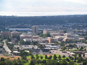
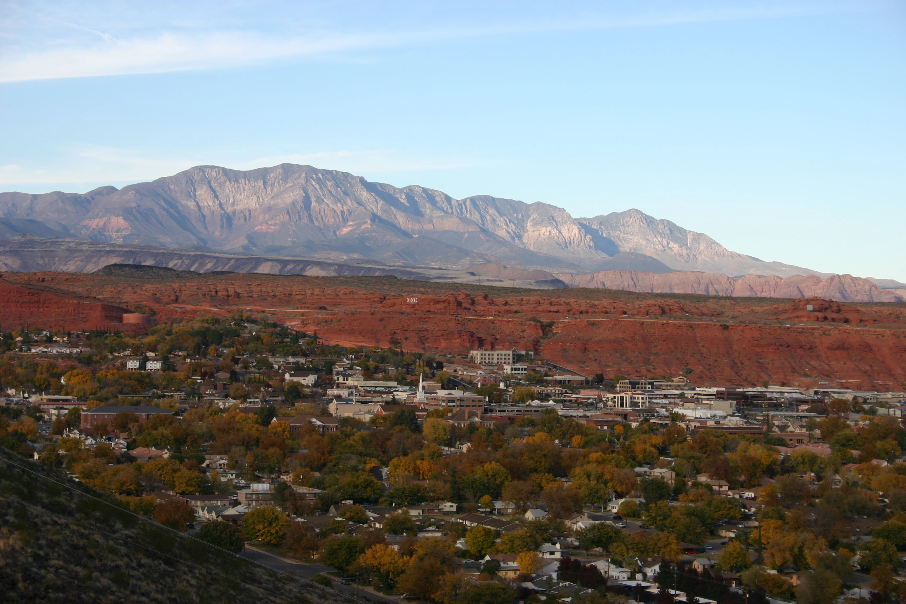
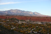
Southwestern Utah is the lowest and hottest spot in Utah. It is known as Utah's Dixie because early settlers were able to grow limited amounts of cotton there. Beaverdam Wash in far southwestern Utah is the lowest point in the state, at 2,000 feet (610 m).[1] The northernmost portion of the Mojave Desert is also located in this area. Dixie is quickly becoming a popular recreational and retirement destination, and the population is growing rapidly. Just north of Dixie is the state's highest ski resort, Brian Head.
Eastern Utah is a high-elevation area covered mostly by plateaus and basins. Economies are dominated by mining, oil and natural gas-drilling, ranching, and recreation. Much of eastern Utah is part of the Uintah and Ouray Indian Reservation. The Navajo Nation also extends into southeastern Utah. The most popular destination within eastern Utah is Dinosaur National Monument near Vernal.
Like most of the Western and Southwestern states, the federal government owns much of the land in Utah. Over 70 percent of the land is either BLM land, Utah State Trustland, or U.S. National Forest, U.S. National Park, U.S. National Monument, National Recreation Area or U.S. Wilderness Area.
Climate
Most of Utah is arid and high in elevation. Much of eastern and southern Utah receives 12 inches (300 mm) or less of precipitation per year, while many mountain areas receive more than 40 inches (1 m) per year, with some areas receiving up to 60 in (1.5 m). Much of western Utah receives less than 10 inches (25 cm), while the Wasatch Front receives approximately 15 inches (38 cm). The Great Salt Lake Desert is especially dry, receiving less than 5 inches (13 cm) annually. Snowfall is common in winter everywhere except the southern border and the Great Salt Lake Desert. St. George averages about 3 inches (7.5 cm) of snow per year, while Salt Lake City receives almost 60 inches (1.5 m) annually (amplified by the lake effect from the Great Salt Lake). Many mountain areas receive in excess of 350 inches (9 m) of snow in a year, while portions of the Wasatch Range receive up to 500 inches (12.7 m). Snowfall is common from November through mid-April in the lower elevations and from October through May in the mountains. The mountains often remain snow-covered into July. Fog and haze caused by temperature inversions are common in the valleys and basins during winter, especially the Uinta Basin, just south of the Uinta Mountains.


The Great Salt Lake
During summer and fall, most of the precipitation is received from the storms coming from the south and consists of short, sporadic, and intense thunderstorms that can cause wildfires and flash floods. Most precipitation during the rest of the year is received from the Pacific Ocean. Spring is the wettest season across the north, while late summer and early fall are the wettest times in the south, and winter is the wettest season in most of the mountain areas.
Temperatures during the winter across most of Utah are below freezing. High temperatures average between 25 °F (-4 °C) and 50 °F (10 °C) across the state. Days below 0 °F (-18 °C) can be expected in many areas at least once a year, but in most of the populated areas, periods of subzero temperature are usually short in duration and not severe. Some mountain valleys are very cold in winter. The town of Randolph sees an average of about 50 days a year where temperatures drop below 0 °F (-18 °C).
Mountains to the north and east of the state sometimes serve as barriers to Arctic air. In the summer, high temperatures average between 85 °F (29 °C) and 100 °F (38 °C). Days over 100 °F (38 °C) can be expected in most areas below 5,000 feet (1,500 m) at least once per year and are the norm in the southern valleys. The record high temperature in Utah was 118 °F (47 °C), recorded south of St. George on July 4, 2007,[9] and the record low was -69 °F (-56 °C), recorded at Peter's Sink in the Bear River Mountains of northern Utah on February 1, 1985.[10]
Utah, like most of the western United States, has few days of thunderstorms. On average there are fewer than 40 days of thunderstorm activity during the year, although these storms can be briefly intense when they do occur. Tornadoes are uncommon in Utah, with an average of two striking the state yearly, rarely higher than F1 intensity.[11]
History
Mormon settlement
Following the assassination of Joseph Smith, in Carthage, Illinois, in 1844, the more than 11,000[12] Latter-Day Saints remaining in Nauvoo struggled in conflict with neighbors until Brigham Young, the President of the Council of the Twelve Apostles of The Church of Jesus Christ of Latter-Day Saints, emerged as their new leader. Brigham Young and the first band of Mormon pioneers came to the Salt Lake Valley on July 24, 1847. Over the next 22 years, more than 70,000 pioneers crossed the plains and settled in Utah.[13]
For the first few years, Brigham Young and the thousands of early settlers of Salt Lake City struggled to survive. The barren desert land was deemed by the Mormons as desirable only because no one else would want it and they could practice their religion in peace - something they had not been afforded while the church migrated from one state to another, followed by persecution, during the first 20 years since the founding of the church in 1830.
It is not widely known that Utah was the source of many pioneer settlements located elsewhere in the West. From the beginning, Salt Lake City was seen as only the hub of a "far-flung commonwealth"[14] of Mormon settlements. Fed by a constant supply of church converts coming from the East and around the world, Church leaders often assigned groups of church members to establish settlements throughout the West. Beginning with settlements along Utah's Wasatch front (Salt Lake City, then Bountiful and Weber Valley, then Provo and Utah Valley), irrigation enabled the establishment of fairly large pioneer populations in an area that Jim Bridger had advised Young would be inhospitable for the cultivation of crops because of frost.[15] Throughout the remainder of the 1800s, Mormon pioneers called by Brigham Young would leave Salt Lake City and establish hundreds of other settlements in Utah, Idaho, Nevada, Arizona, Wyoming, California, Canada, and Mexico - including such notable places as Las Vegas, Nevada, Franklin, Idaho (the first white settlement in Idaho), San Bernardino, California, Star Valley, Wyoming, and Carson Valley, Nevada. Prominent settlements in Utah included St. George, Logan, and Manti (where settlers raised the three first temples in Utah, each built many years before the larger and better known temple built in Salt Lake City was completed in 1892), as well as Parowan, Cedar City, Bluff, Moab, Vernal, Fillmore (which served as the territorial capital between 1850 and 1856), Nephi, Levan, Spanish Fork, Springville, Provo Bench (now Orem), Pleasant Grove, American Fork, Lehi, Sandy, Murray, Jordan, Centerville, Farmington, Huntsville, Kaysville, Grantsville, Tooele, Roy, Brigham City, and many other smaller towns and settlements. At the time, Young had an expansionist's view of the territory he and the Mormon pioneers were settling, calling it Deseret - which church founder Smith had taught meant "honeybee" - hence the beehive which can still be found on the Utah flag, and the state's motto, "Industry."[16]
In 1847 when the first pioneers arrived, Utah was still Mexican territory. As a consequence of the Mexican-American War, the land became the territory of the United States upon the signing of the Treaty of Guadalupe Hidalgo, February 2, 1848. The treaty was ratified by the United States Senate on March 10. In 1850, the Utah Territory was created with the Compromise of 1850, and Fillmore was designated the capital. In 1856, Salt Lake City replaced Fillmore as the territorial capital.
Disputes between the Mormon inhabitants and the US Government intensified due to The Church of Jesus Christ of Latter-day Saints' practice of plural marriage among its members. The Mormons were pushing for the establishment of the State of Deseret. The U.S. Government, which was reluctant to admit a state the size of the proposed Deseret into the union, opposed the polygamous practices of the Mormons.
After news of their polygamous practices spread, the members of the LDS Church were quickly viewed as un-American and rebellious. In 1857, after news of a false rebellion spread, the government sent troops on the "Utah expedition" to quell the supposed rebellion and to replace Brigham Young as territorial governor with Alfred Cumming. The resulting conflict is known as the Utah War.
As troops approached Salt Lake in northern Utah, nervous Mormon settlers and Paiutes attacked and killed 120 immigrants from Arkansas in southern Utah. The attack became known as the Mountain Meadows Massacre. The massacre became a point of contention between LDS leaders and the federal government for decades. Only one person, John D. Lee, was ever convicted of the murders, and he was executed at the massacre site.
Before troops led by Albert Sidney Johnston entered the territory, Brigham Young ordered all residents of Salt Lake City to evacuate southward to Utah Valley and sent out a force, known as the Nauvoo Legion, to delay the government's advance. Although wagons and supplies were burned, eventually the troops arrived, and Young surrendered official control to Cumming, although most subsequent commentators claim that Young retained true power in the territory. A steady stream of governors appointed by the president quit the position, often citing the unresponsiveness of their supposed territorial government. By agreement with Young, Johnston established Fort Floyd 40 miles (60 km) away from Salt Lake City, to the southwest.
Salt Lake City was the last link of the First Transcontinental Telegraph, completed in October of 1861. Brigham Young was among the first to send a message, along with Abraham Lincoln and other officials.

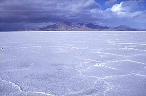
Bonneville Salt Flats
Because of the American Civil War, federal troops were pulled out of Utah Territory, leaving the territory in LDS hands until Patrick E. Connor arrived with a regiment of California volunteers in 1862. Connor established Fort Douglas just three miles (5 km) east of Salt Lake City and encouraged his people to discover mineral deposits to bring more non-Mormons into the state. Minerals were discovered in Tooele County, and miners began to flock to the territory.
Beginning in 1865, Utah's Black Hawk War developed into the deadliest conflict in the territory's history. Chief Antonga Black Hawk died in 1870, but fights continued to break out until additional federal troops were sent in to suppress the Ghost Dance of 1872. The war is unique among Indian Wars because it was a three-way conflict, with mounted Timpanogos Utes led by Antonga Black Hawk exploited by federal and LDS authorities.
On May 10, 1869, the First Transcontinental Railroad was completed at Promontory Summit, north of the Great Salt Lake. The railroad brought increasing numbers of people into the state, and several influential businesspeople made fortunes in the territory.
During the 1870s and 1880s, laws were passed to punish polygamists, and in the 1890 Manifesto, the LDS Church banned polygamy. When Utah applied for statehood again, it was accepted. One of the conditions for granting Utah statehood was that a ban on polygamy be written into the state constitution. This was a condition required of other western states that were admitted into the Union later. Statehood was officially granted on January 4, 1896. Utah was the last state admitted in the Nineteenth century.


Alpine Loop near Sundance in the fall.
1900s to present
Beginning in the early 1900s, with the establishment of such national parks as Bryce Canyon National Park and Zion National Park, Utah began to become known for its natural beauty. Southern Utah became a popular filming spot for arid, rugged scenes, and such natural landmarks as Delicate Arch and "the Mittens" of Monument Valley are instantly recognizable to most national residents. During the 1950s, '60s, and '70s, with the construction of the Interstate highway system, accessibility to the southern scenic areas was made easier.
Beginning in 1939, with the establishment of Alta Ski Area, Utah has become world-renowned for its skiing. The dry, powdery snow of the Wasatch Range is considered some of the best skiing in the world. Salt Lake City won the bid for the 2002 Winter Olympics in 1995, and this has served as a great boost to the economy. The ski resorts have increased in popularity, and many of the Olympic venues scattered across the Wasatch Front continue to be used for sporting events. This also spurred the development of the light-rail system in the Salt Lake Valley, known as TRAX, and the re-construction of the freeway system around the city.
During the late 20th century, the state grew quickly. In the 1970s, growth was phenomenal in the suburbs. Sandy was one of the fastest-growing cities in the country at that time. Today, many areas of Utah are seeing phenomenal growth. Northern Davis, southern and western Salt Lake, Summit, eastern Tooele, Utah, Wasatch, and Washington counties are all growing very quickly. Transportation and urbanization are major issues in politics as development consumes agricultural land and wilderness areas.
Demographics
| Historical populations | |||
|---|---|---|---|
| Census | Pop. | %± | |
| 1850 | 11,380 | ||
| 1860 | 40,273 | 253.9% | |
| 1870 | 86,336 | 114.4% | |
| 1880 | 143,963 | 66.7% | |
| 1890 | 210,779 | 46.4% | |
| 1900 | 276,749 | 31.3% | |
| 1910 | 373,351 | 34.9% | |
| 1920 | 449,396 | 20.4% | |
| 1930 | 507,847 | 13.0% | |
| 1940 | 550,310 | 8.4% | |
| 1950 | 688,862 | 25.2% | |
| 1960 | 890,627 | 29.3% | |
| 1970 | 1,059,273 | 18.9% | |
| 1980 | 1,461,037 | 37.9% | |
| 1990 | 1,722,850 | 17.9% | |
| 2000 | 2,233,169 | 29.6% | |

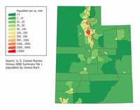
Utah Population Density Map
The center of population of Utah is located in Utah County in the city of Lehi.[17] As of 2005, Utah has an estimated population of 2,469,585, which is an increase of 48,877, or 2.0 percent, from the prior year and an increase of 236,387, or 10.6 percent, since the year 2000. This includes a natural increase since the last census of 186,411 people (that is 254,433 births minus 68,022 deaths) and an increase due to net migration of 16,173 people into the state. Immigration from outside the United States resulted in a net increase of 49,995 people, and migration within the country produced a net loss of 33,822 people.
Much of the population lives in cities and towns along the Wasatch Front, a metropolitan region that runs north-south with the Wasatch Mountains rising on the eastern side. The rest of the state is mostly rural or wilderness. Utah has a higher percentage of people sharing a single religious denomination than any other state.
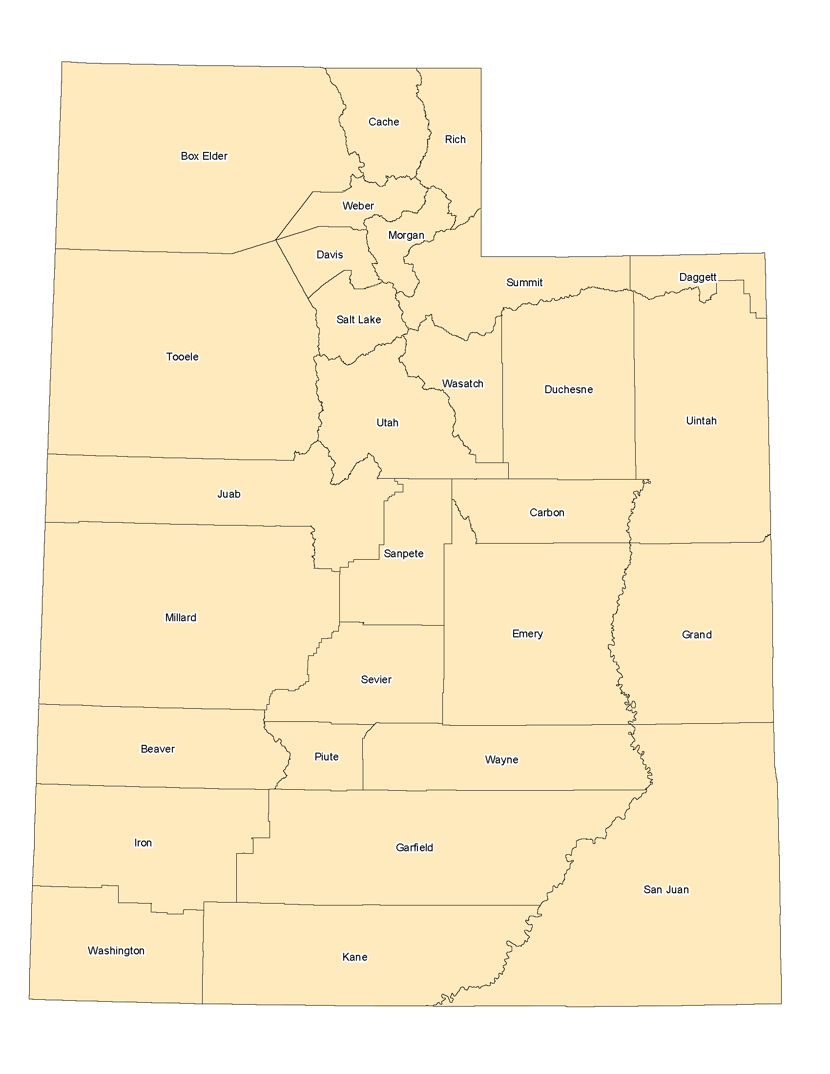
Utah county boundaries
Utah contains 5 metropolitan areas (Logan, Ogden-Clearfield, Salt Lake City, Provo-Orem, and St. George), and 5 micropolitan areas (Brigham City, Heber, Vernal, Price, and Cedar City).
The St. George metropolitan area is currently the second-fastest growing in the country after the Las Vegas metropolitan area, while the Heber micropolitan area is also the second-fastest growing in the country (behind Palm Coast).[18] Rural agricultural areas of Juab and Millard counties have seen rapid-growth in population as well.
Race and ancestry
| Demographics of Utah (csv) | |||||
|---|---|---|---|---|---|
| By race | White | Black | AIAN | Asian | NHPI |
| AIAN is American Indian or Alaskan Native - NHPI is Native Hawaiian or Pacific Islander | |||||
| 2000 (total population) | 95.20% | 1.14% | 1.84% | 2.20% | 0.97% |
| 2000 (Hispanic only) | 8.62% | 0.16% | 0.26% | 0.08% | 0.05% |
| 2005 (total population) | 95.01% | 1.32% | 1.69% | 2.40% | 0.95% |
| 2005 (Hispanic only) | 10.39% | 0.23% | 0.26% | 0.10% | 0.05% |
| Growth 2000-2005 (total population) | 10.37% | 28.78% | 2.04% | 21.00% | 8.53% |
| Growth 2000-2005 (non-Hispanic only) | 8.09% | 23.37% | 0.78% | 20.69% | 8.43% |
| Growth 2000-2005 (Hispanic only) | 33.30% | 61.74% | 9.53% | 28.88% | 10.45% |
The largest ancestry groups in the state are:
- 29.0% English
- 11.5% German
- 6.8% American (Mostly British Descent)
- 6.5% Danish
- 5.9% Irish
- 4.4% Scottish
- 4.3% Swedish
Most Utahns are of Northern European descent.[19] The state has the largest percentage of residents who claim British ancestry and the largest percentage of residents of Danish ancestry in the nation. Anglo-Utahns are the largest group in every county except for San Juan County, which has a large Navajo Indian population. Chinese form the largest Asian group followed by other Asian groups (i.e. Japanese-Americans, Koreans, Indians and Pakistanis), and Tongans form the largest Pacific Islander group, the majority are Mormons converted in the south Pacific under LDS missionary work programs. Hispanics are rapidly growing in the state, especially in Salt Lake City, Ogden, and Orem/Provo area from recent immigration from Latin America, mostly from Mexico but some Central American and South American groups. Despite its relatively scarce black population, Utah does have African-Americans and a sizable proportion of new Utah residents are blacks, usually made up of middle-class professionals from California, while there's a small black community in southern Salt Lake City and Ogden near Hill Air Force Base.
Religion
A majority of the state's residents are members of The Church of Jesus Christ of Latter-day Saints, sometimes called the Mormons or the LDS Church. As of 2004, the percentage of Utahns that are counted as members of The Church of Jesus Christ of Latter-day Saints is 62.4 percent of the state's population,[5] which represent less than 50 percent of the population in urban areas and over 90 percent in rural areas. The only other state in the nation in which a majority of the population belongs to a single religious body is Rhode Island. There is a large and increasing number of Catholics in Utah as a result of immigration from Mexico, along with previous waves of Catholics from Italy, Austria, Germany and Ireland. Other Christian faiths in the state are mostly made up of Protestants, including Baptists, Lutherans and Methodists, which comprise about one-quarter of Utah's population. The Salt Lake Tribune has projected that Latter-day Saints may no longer be a majority in the state, not just the case in Salt Lake City, as early as 2030.[5]
Cathedral of the Madeline, Salt Lake City.
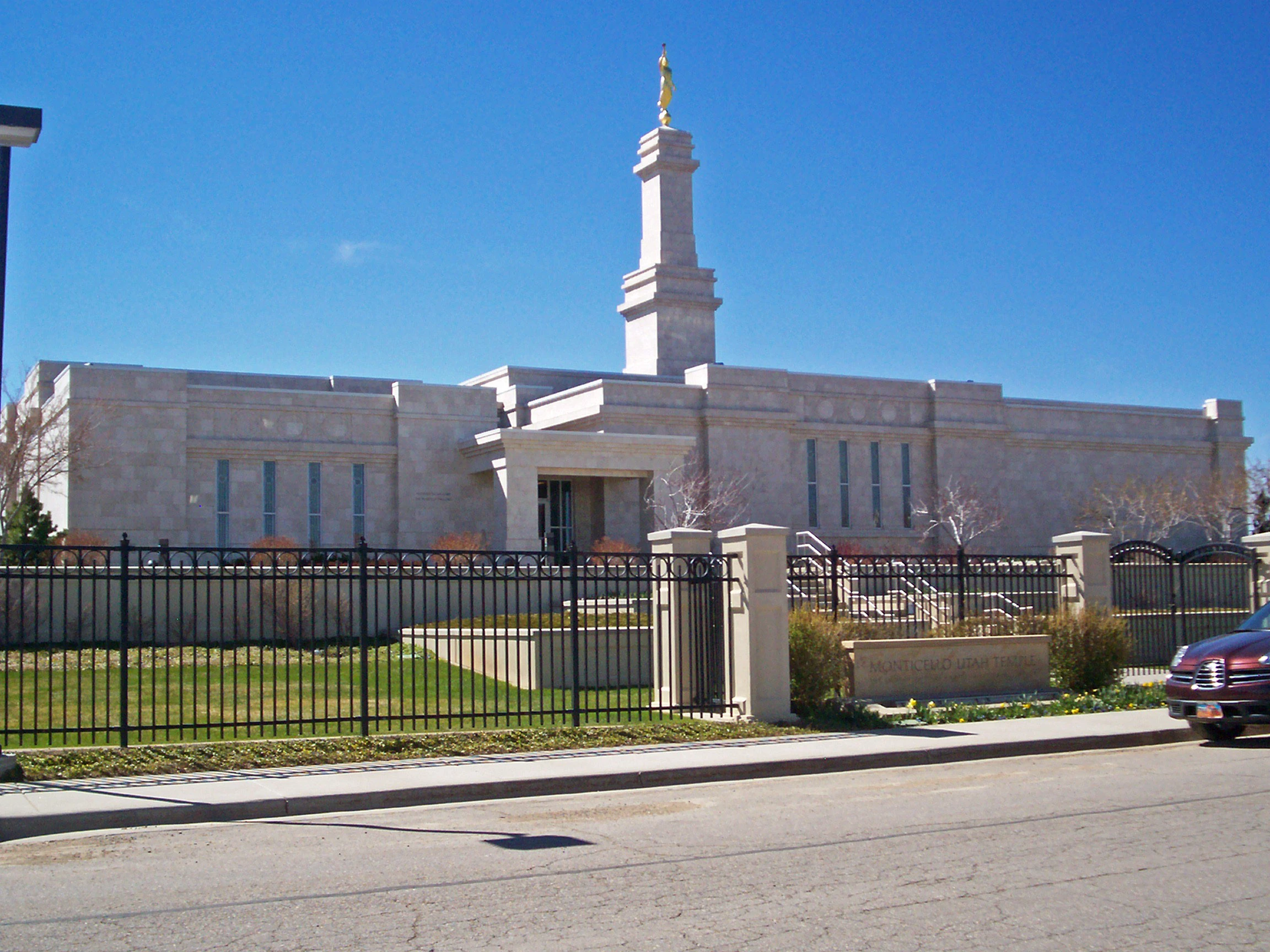

LDS Temple in Monticello.
The LDS Church has historically had a strong regional influence and has contributed to the state's restrictive attitude towards alcohol and gambling, while also contributing to its high birth rate (25 percent higher than the national average; the highest for a state in the U.S.).[20] Before the 1890 Manifesto, the Church's teachings of plural marriage had led to confrontation with the U.S. federal government in the Utah War.[21] The Mormons in Utah tend to have conservative views when it comes to most political issues and the majority of Utahns are registered Republicans.
The self identified religious affiliations of adults (note that numbers below do not include children, thus the disparity with the percentage identified above) living in Utah are:
- Latter-day Saints - 62 percent
- Roman Catholics - 6 percent
- Episcopalians - 3 percent
- Baptists - 2 percent
- Other Christians - 3 percent
- Evangelicals - 1 percent
- Presbyterians - 1 percent
- Lutherans - 1 percent
- Methodists - 1 percent
- Non-religious - 17 percent
- Refused to identify - 4 percent
- Other - 3 percent
- Muslim - 1 percent
Totals are rounded. Pentecostal, Judaism, Church of Christ, Non-denominational, United Church of Christ, Jehovah's Witness, Assemblies of God, Buddhist, Church of God, and the Seventh-day Adventist Church each represent less than .5 percent of the population.
Age and sex
Due to its high total birth rate (highest of any state in the U.S.), Utah has the youngest population of any state.
The age distribution in Utah is:
- 9.4 percent under age 5
- 32.2 percent under age 18
- 59.3 percent ages 18 through 64
- 8.5 percent 65 or older
The gender makeup of Utah is:
- 49.9 percent female
- 50.1 percent male
Economy


Bryce Canyon National Park is a major tourist attraction
According to the U.S. Bureau of Economic Analysis, the gross state product of Utah in 2004 was $82.6 billion. The per capita personal income was $26,606 in 2004. Major industries of Utah include: mining, cattle ranching, salt production, and government services.
According to the 2007 State New Economy Index, Utah is ranked the top state in the nation for Economic Dynamism, determined by
"The degree to which state economies are knowledge-based, globalized, entrepreneurial, information technology-driven and innovation-based."
In eastern Utah petroleum production is a major industry.[22] Near Salt Lake City, petroleum refining is done by a number of oil companies. In central Utah, coal production accounts for much of the mining activity.
Tourism is a major industry in Southern Utah, with Utah's five national parks (Arches, Bryce Canyon, Canyonlands, Capitol Reef, and Zion) and many other attractions. In Moab mountain biking is a popular sport. Research, information technology development, and service based industries are important economic activities along the Salt Lake City-Ogden-Provo corridor. Utah is also noted for its ski resorts, near Salt Lake City, Park City, Ogden, Provo, and Cedar City (Brian Head).


Utah collects personal income tax within 6 income brackets. The state sales tax has a base rate of 5.75 percent, with cities and counties levying additional local sales taxes that vary among the municipalities. Property taxes are assessed and collected locally. Utah does not charge intangible property taxes and does not impose an inheritance tax.
Tourism
Utah has a large tourism business and was host to the 2002 Winter Olympics. The ski resorts in the northern Wasatch Range, the Bonneville Salt Flats, the Great Salt Lake, the five national parks in the south, such as Arches, Zion and Bryce Canyon, and cultural attractions such as Temple Square, Sundance Film Festival, and the Utah Shakespearean Festival are among the most visited. For more information on Utah parks, outdoor recreation, lodging, and much more, please visit the official site of tourism for the state of Utah at Utah.com.


Bridal Veil Falls in Provo Canyon between Orem and Heber City.
Mining
Beginning in the late 19th century with the state's mining boom (including the Bingham Canyon Mine, among the world's largest open pit mines), companies attracted large numbers of immigrants (of diverse faiths) with job opportunities. Since the days of the Utah Territory mining has played a major role in Utah's economy. Historical mining towns include Mercur in Tooele County, Silver Reef in Washington County, Eureka in Juab County, and Park City in Summit County were characteristic of the boom and bust cycle that dominated mining towns of the American West. During the early part of the Cold War era, uranium was mined in eastern Utah. Today mining activity still plays a major role in the state's economy. Minerals mined in Utah include copper, gold, silver, molybdenum, zinc, lead, and beryllium. Fossil fuels include coal, petroleum, and natural gas.[23]

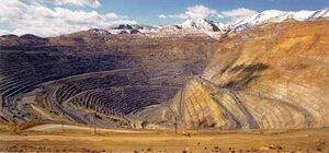
Bingham Canyon Mine southwest of Salt Lake City.


Coal mine near Price, Utah.
Transportation
Interstate 15 is the main interstate highway in the state, entering from Arizona and spanning the state north-south, entering Idaho near Portage. It serves the primary population centers of the state, running past St. George and its suburbs (collectively known as Dixie) and Cedar City, and then spans the length of the Wasatch Front north-south, past such major cities as Provo, Orem, Sandy, West Jordan, Salt Lake City, Layton, and Ogden.
Interstate 80 spans the northern portion of the state west-east. It enters from Nevada at Wendover, traverses Salt Lake City (briefly merging with I-15 west of Downtown), then crosses the Wasatch Range, entering Wyoming just before reaching Evanston. Interstate 84 splits from I-80 at Echo, heading west through the Wasatch Range and joining I-15 southwest of Ogden. The two interstates stay merged until Tremonton, where I-84 heads northwest, entering Idaho near Snowville.
Interstate 70 splits from I-15 at Cove Fort, heading east through the mountains, past Richfield, and then east into Colorado west of Grand Junction, traversing desolate desert terrain and serving the various national parks and national monuments of southern Utah. The stretch of I-70 between Salina and Green River is the longest stretch of interstate in the country without any services.


U.S. Highway 6 in Emery County.
A light rail system in the Salt Lake Valley, known as TRAX, consists of two lines, one providing access from Downtown Salt Lake City south to Sandy, and the other heading east to the University of Utah. The Utah Transit Authority (UTA), which operates TRAX, also operates a bus system that stretches across the Wasatch Front and into Tooele, and also provides winter service to the ski resorts east of Salt Lake City. Several bus companies provide access to the ski resorts in winter, and local bus companies also serve Logan, St. George and Cedar City. The Legacy Highway is a freeway that is currently under construction in southern Davis County to relieve congestion on I-15 through the area. A commuter rail line, named FrontRunner, is under construction between Salt Lake City and Pleasant View, north of Ogden. Both of these projects are expected to be completed in spring 2008. FrontRunner is expected to eventually span the Wasatch Front from Brigham City in the north to Payson in the south.
Salt Lake City International Airport is the only international airport in the state and serves as a hub of Delta Airlines. In 2005 it was ranked 1st in on-time departures and 2nd in on-time arrivals in the country, and consistently ranks in the top 10 for customer service. Canyonlands Field (near Moab), Cedar City Regional Airport, St. George Municipal Airport, and Vernal-Uintah County Airport all provide limited commercial air service to various regional destinations, as well (Vernal-Uintah County is only served by Salt Lake International). Ground has recently been broken on creating a new, larger regional airport for St. George, due to the rapidly-growing population and the lack of room for expansion for the current airport. Completion is expected in 2010. SkyWest Airlines is also based in St. George.
Law and government
Utah government, like most U.S. states, is divided into three branches: executive, legislative, and judicial. The current governor of Utah is Jon Huntsman The governor is elected for a four year term. The Utah State Legislature consists of a Senate and a House of Representatives. State senators serve four year terms and representatives two year terms. The Utah Legislature meets each year in January for an annual forty-five day session. The Utah Supreme Court is the court of last resort in Utah. It consists of five justices, who are appointed by the governor, and then subject to retention election. The Utah Court of Appeals handles cases from the trial courts.[24] Trial level courts are the district courts and justice courts. All justices and judges, like those on the Utah Supreme Court, are subject to retention election after appointment.
Early suffrage
Utah granted full voting rights to women in 1870, 26 years before becoming a state. Among all U.S. states, only Wyoming granted suffrage to women earlier.[25] However, in 1887 the Edmunds-Tucker Act was passed by Congress in an effort to curtail excessive Mormon influence in the territorial government. One of the provisions of the Act was the repeal of suffrage; full suffrage was not returned until Utah was admitted to the Union in 1896.
Constitution
The constitution of Utah was enacted in 1895. Notably, the constitution outlawed polygamy and reestablished the territorial practice of women's suffrage. Utah's Constitution has been amended many times since its inception.[26]
Other laws
Utah is also one of only two states in the United States to outlaw all forms of gambling; the other is Hawaii. Utah is an alcoholic beverage control state. The Utah Department of Alcoholic Beverage Control regulates the sale of alcohol; wine and spirituous liquors may only be purchased at state liquor stores, and local laws may prohibit the sale of beer and other alcoholic beverages on Sundays.
Politics
| Year | Republican | Democratic |
|---|---|---|
| 2004 | 71% 663,742 | 26% 241,199 |
| 2000 | 67% 512,168 | 26% 201,734 |
| 1996 | 54% 361,911 | 33% 221,633 |
| 1992 | 43% 322,632 | 25% 183,429 |
| 1988 | 66% 428,442 | 32% 207,343 |
Historically, politics in Utah have been controversial, such as the Federal government versus the LDS Church on the issue of polygamy. The LDS Church renounced polygamy in 1890, and in 1896 Utah gained admission to the Union. Many new people settled the area soon after the Mormon pioneers. Relations have often been strained between the LDS population and the non-LDS population.[27] These tensions played a large part in Utah's history, such as (Liberal Party vs. People's Party).

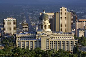
The Utah State Capitol, Salt Lake City.
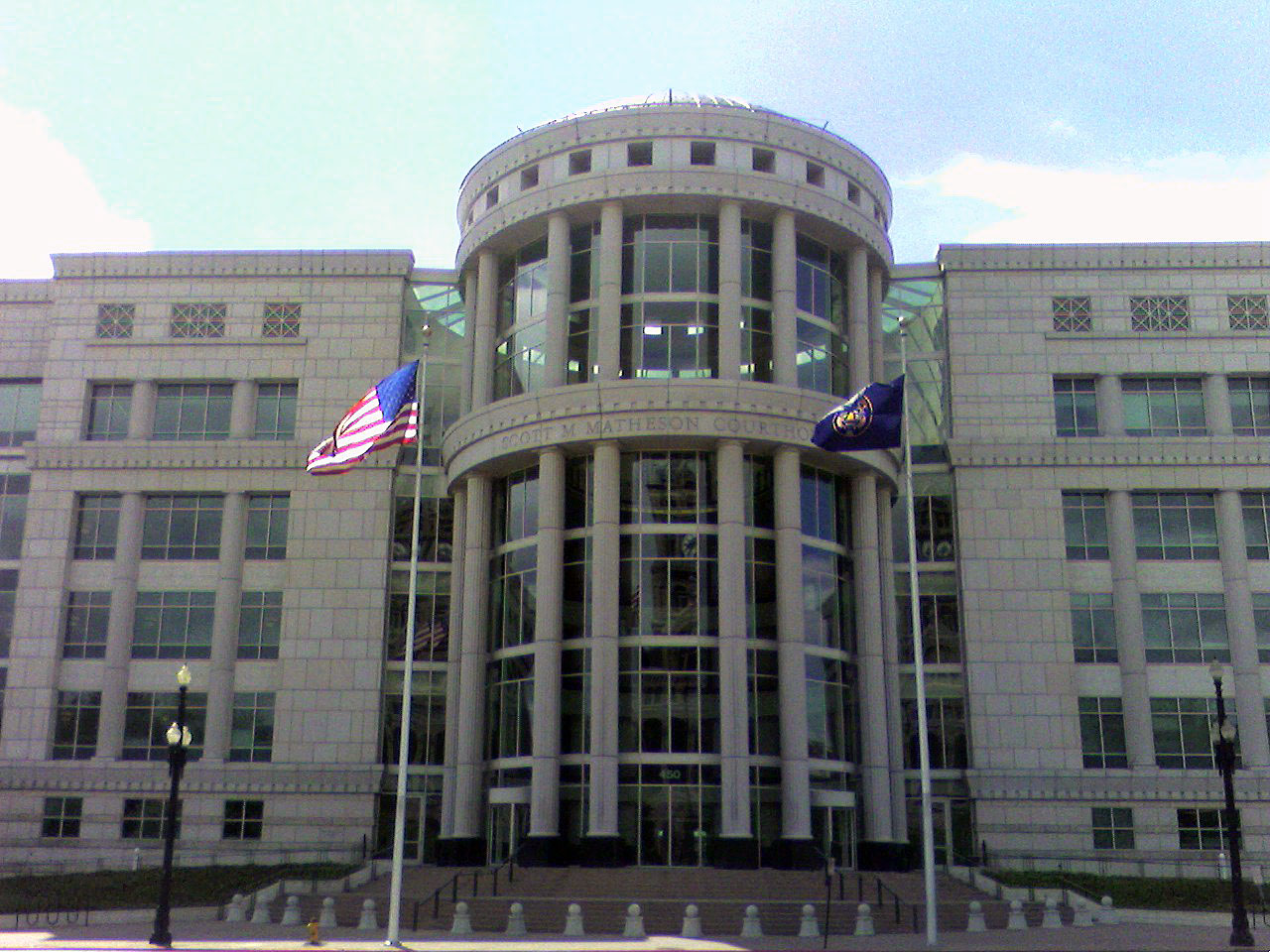

The Scott Matheson Courthouse is the seat of the Utah Supreme Court
The current governor of Utah is Jon M. Huntsman,[28] a member of the Republican Party. He is a proponent of a flat tax,[29] an opponent to same-sex marriage, while supporting the creation of a reciprocal beneficiary status for same-sex couples,[30] and an opponent to intelligent design being taught in the classroom.[31] He also receives high approval ratings from across the Utah political spectrum.[32]
Both of Utah's U.S. Senators, Orrin Hatch and Robert Foster Bennett, are Republican. Two more Republicans, Rob Bishop and Chris Cannon, as well as one member of the Democratic Party, Jim Matheson, represent Utah in the United States House of Representatives.
The Church of Jesus Christ of Latter-day Saints is the religion of the majority of Utahns, and the majority of politicians in Utah from both political parties are LDS. While the Church maintains an official policy of neutrality in regards to political parties and candidates,[33] Utah votes predominately Republican. Self-identified Latter-day Saints are more likely to vote for Republican ticket than non-Mormons, and Utah is one of the most Republican states in the nation.[34] The connection between the LDS Church and the Republican Party of Utah is controversial.
In the 1970s, then-Apostle Ezra Taft Benson was quoted by the Associated Press that it would be difficult for a faithful Latter-day Saint to be a liberal Democrat.[35] For example, the Republican Party of Utah opposes almost all abortions while Utah Democrats take a more liberal approach, although more conservative than their national counterparts. On Second Amendment issues, the state GOP has been at odds with the LDS Church position opposing concealed firearms in places of worship.
The LDS Church itself has been troubled by the perception of political bias in the wake of Massachusetts Republican Mitt Romney's prospective presidential run.[36] In 1998 the Church expressed concern that Utahns perceived the Republican Party as an LDS institution and authorized lifelong Democrat and Seventy Marlin Jensen to promote LDS bipartisanship.[35]
| Year | Republican | Democratic |
|---|---|---|
| 2004 | 57% 473,814 | 42% 350,841 |
| 2000 | 56% 422,357 | 43% 320,141 |
| 1996 | 75% 500,293 | 24% 155,294 |
The state's leadership is run by the Republican Party. State governors are usually centrist on social issues and favor free trade on economic policies, while the state senate and house are much more polarized with Republican members passing very socially conservative policies on party-line and partisan votes. Many of these bills have been subsequently vetoed by the governors.
While the people of the state are generally more tolerant of gay rights and polls indicate that a majority of residents support some form of legal recognition for same-sex couples, the state legislature is markedly more hostile. About 80 percent of Utah's Legislature are members of The Church of Jesus Christ of Latter-day Saints,[37] while they account for 62 percent of the population.[5]
In 2006, the legislature passed legislation aimed at banning joint-custody for a non-biological parent of a child. The custody measure passed the legislature and was vetoed by the governor, a reciprocal benefits supporter.
| Year | Republican | Democratic |
|---|---|---|
| 2004 | 69% 626,640 | 28% 258,955 |
| 1998 | 64% | 33% |
Prayers are commonplace in Utah politics, and lawmakers of both parties, whether liberal or conservative, speak of their relationship with God or their religious beliefs in ordinary conversation.
Utah's liberal areas include Carbon County, Grand County, Salt Lake County, and Summit County. Currently, both Salt Lake City and Salt Lake County have Democratic Party mayors and are home to about one million of the state's two and a half million residents. Salt Lake City's Mayor Rocky Anderson supports same-sex marriage and the Kyoto Treaty, while the county mayor Peter Corroon is a relative of Howard Dean and shares similar views. Salt Lake City has not voted for a Republican mayor since the 1970s. Salt Lake County's Democrats tend to favor the economic policies of free trade while being socially liberal, particularly with gay rights and less so with abortion.
| Year | Republican | Democratic |
|---|---|---|
| 2006 | NA | NA |
| 2000 | 66% 501,925 | 32% 241,129 |
Carbon County's Democrats are generally made up of members of the large Greek, Italian,and Southeastern European communities, whose ancestors migrated in the early 1900s to work in the extensive mining industry. The views common amongst this group are heavily influenced by labor politics, particularly of the New Deal Era.[38]
Grand County's politics are heavy on environmentalism and being socially liberal. The county has a large hippie community situated in the popular tourist destination, Moab, in red rock country between Arches National Park and Canyonlands National Park.
The Democrats of Summit County are the by-product of the migration of wealthy families from California in the 1990s to the ski resort town of Park City; their views are generally supportive of the economic policies favored by unions and the social policies favored by the liberals.
| Year | Republican | Democratic |
|---|---|---|
| 2004 | 44% 144,928 | 48% 157,287 |
| 2000 | 52% 158,787 | 47% 144,011 |
The state's most Republican areas tend to be Utah County, which is the home to Brigham Young University and Provo, and nearly all the rural counties.[39][40] These areas generally hold socially conservative views in line with that of the national Religious Right.
The state has not voted for a Democrat for president since 1964. Historically, Republican presidential nominees score one of their best margins of victory here. Utah was the Republicans' best state in the 1976,[41] 1980,[42] 1984,[43] 1988,[44] 1996,[45] 2000,[46] and 2004[47] elections. In 1992, Utah was the only state in the nation where Democratic candidate Bill Clinton finished behind both Republican candidate George H. W. Bush and Independent candidate Ross Perot.[48] In 2004, Republican George W. Bush won every county in the state and Utah gave him his largest margin of victory of any state. He won the state's 5 electoral votes by a margin of 46 percentage points with 71.5 percent of the vote. In the 1996 Presidential elections the Republican candidate received a smaller 54 percent of the vote while the Democrat earned 34 percent.[49]
Important cities and towns
Salt Lake City


Ogden
Provo


Sandy


Park City
St. George

Logan
Utah's population is concentrated in two areas, the Wasatch Front in the north-central part of the state, with a population of approximately 2 million; and southwestern Utah, locally known as "Dixie", with nearly 150,000 residents.
According the 2000 Census, Utah was the fourth fastest growing state (at 29.6 percent) in the United States between 1990 and 2000. St. George, in the southwest, is the second-fastest growing metropolitan area in the United States, trailing Greeley.
The state's two fastest growing counties are: Summit (at 91.6 percent; ranking it 8th in the country) and Washington (at 86.1 percent; ranking it 12th). The cities (defined as having at least 9,000 residents in 2000) that saw the greatest increases between 1990 and 2000 were: Draper (248 percent), South Jordan (141 percent), Lehi (125 percent), Riverton (122 percent), and Syracuse (102 percent). Between 1990 and 2000 the five fastest-growing cities of any size were Cedar Hills (302 percent), Draper (248 percent), Woodland Hills (213 percent), Ivins (173 percent), and South Jordan (141 percent). According to U.S. Census Bureau estimates, the five fastest-growing cities of any size between 2000 and 2005 were Herriman (637 percent), Saratoga Springs (548 percent), Eagle Mountain (380 percent), Cedar Hills (152 percent), and Syracuse (91 percent).
| Utah Rank |
City | Population (2005) within city limits |
Land area |
Population density (/mi²) |
Population density (/km²) |
County |
|---|---|---|---|---|---|---|
| 1 | Salt Lake City | 178,097 | 109.1 sq mi (283 km2) | 1,632.4 | 630 | Salt Lake |
| 2 | Provo | 113,459 | 39.6 sq mi (103 km2) | 2,865.1 | 1106 | Utah |
| 3 | West Valley City | 113,300 | 35.4 sq mi (92 km2) | 3,200.5 | 1236 | Salt Lake |
| 4 | West Jordan | 91,444 | 30.9 sq mi (80 km2) | 2,959.3 | 1143 | Salt Lake |
| 5 | Orem | 89,713 | 18.4 sq mi (48 km2) | 4,875.7 | 1881 | Utah |
| 6 | Sandy | 89,664 | 22.3 sq mi (58 km2) | 4,020.8 | 1551 | Salt Lake |
| 7 | Ogden | 78,309 | 26.6 sq mi (69 km2) | 2,943.9 | 1137 | Weber |
| 8 | St. George | 64,201 | 64.4 sq mi (167 km2) | 996.9 | 385 | Washington |
| 9 | Layton | 61,782 | 20.7 sq mi (54 km2) | 2,984.6 | 1153 | Davis |
| 10 | Taylorsville | 58,009 | 10.7 sq mi (28 km2) | 5,421.4 | 2094 | Salt Lake |
| Combined statistical area | Population (2004) |
|---|---|
| Salt Lake City-Ogden-Clearfield comprised of: Salt Lake City and Ogden-Clearfield Metropolitan Areas and Brigham City and Heber Micropolitan Areas (as listed below) |
1,559,230 |
| Utah Rank |
Metropolitan area | Population (2004) |
U.S. Rank |
Counties |
|---|---|---|---|---|
| 1 | Salt Lake City* | 1,018,826 | 50 | Salt Lake, Tooele, Summit |
| 2 | Ogden-Clearfield* | 477,455 | 101 | Weber, Davis, Morgan |
| 3 | Provo-Orem | 412,361 | 112 | Utah |
| 4 | St. George | 109,924 | 318 | Washington |
| 5 | Logan | 109,666 | 320 | Cache, Franklin (Idaho) |
- Until 2003, the Salt Lake City and Ogden-Clearfield metropolitan areas were considered as a single metropolitan area.[50]
| Utah Rank |
Micropolitan area | Population (2004) |
U.S. Rank |
|---|---|---|---|
| 1 | Brigham City | 44,810 | 280 |
| 2 | Cedar City | 36,285 | 386 |
| 3 | Vernal | 26,671 | 495 |
| 4 | Price | 19,689 | 550 |
| 5 | Heber | 18,139 | 560 |
Colleges and Universities
|
|
Sports
The Utah Jazz of the National Basketball Association play in the EnergySolutions Arena[51] in Salt Lake City. Utah is the least populous U.S. state to have a major professional sports league franchise, although the District of Columbia has fewer people. Other teams include the Utah Blaze of the Arena Football League.
- Real Salt Lake of Major League Soccer in Rice-Eccles Stadium in Salt Lake City (a soccer-specific stadium has been approved for Sandy, and ground was broken for the new stadium on August 12, 2006)[52]
- Salt Lake Bees of the Pacific Coast League in Franklin Covey Field in Salt Lake City
- Ogden Raptors of the Pioneer League in Lindquist Field in Ogden
- Orem Owlz of the Pioneer League in Brent Brown Ballpark in Orem
- Utah Grizzlies of the ECHL in the E Center in West Valley City
- Utah Blaze of the Arena Football League at the EnergySolutions Arena in Salt Lake City
See also List of professional sports teams in Utah
Miscellaneous

- Popular recreational destinations within the mountains besides the ski resorts include Flaming Gorge National Recreation Area, Timpanogos Cave National Monument, Bear Lake, and Jordanelle, Strawberry, Pineview Reservoir, East Canyon, and Rockport reservoirs. The mountains are popular camping, rock-climbing, skiing, snowboarding, and hiking destinations.
- The USS Utah was named in honor of this state.
- The Space Shuttle Solid Rocket Booster is built and serviced by the Thiokol division of ATK, which has its facilities in Promontory Point. Boosters are tested periodically at a proving grounds in the Wasatch Range.
- According to a study based on prescription claims from one mail-order pharmaceutical provider,[53] It ranks 47th in teenage pregnancy (although at least some of these are married teenagers, which is not uncommon in the state), last in percentage of births out of wedlock, last in number of abortions per capita, and last in percentage of teen pregnancies terminated in abortion. Statistics relating to pregnancies and abortions may be artificially low from teenagers going out of state for abortions because of parental notification requirements.[54][55] Utah has the lowest child poverty rate in the country, despite its young demographics.[56]
- According to Internal Revenue Service tax returns, Utahns rank first among all U.S. states in the proportion of income given to charity by the wealthy.[56]
- Jell-O is the official snack food of Utah, giving rise to the term the Jell-O Belt.[57]
- Mexican President Vicente Fox visited Salt Lake City, Utah, on May 23, 2006, as the first stop on his trip to the United States, which also included stops in California and Washington state. It is unusual for a foreign head of state to visit Utah (except for the 2002 Salt Lake City Olympics). However, the growing presence of Mexicans and Mexican Americans in Utah may be a reason for his visit. The LDS Church also has a large presence in Mexico, with 1,043,718 members as of December 31, 2005,[58] although only about 200,000 profess to be LDS.[59]
- The popular subculture, Straight Edge, is an anti-drug/anti-alcohol punk music scene which had its origins in Washington D.C., including large numbers of Utahns, in Salt Lake City and Provo in the 1990s.
Famous Utahns
- Edward Abbey - American author and essayist noted for his advocacy of environmental issues and criticism of public land policies. Best-known for his novel The Monkey Wrench Gang.
- Ross C. "Rocky" Anderson - Democratic mayor of Salt Lake City (2000-2008), liberal activist, environmentalist, and former ACLU attorney.
- Hal Ashby - Director; films include "Being There", "The Last Detail", "Harold and Maude"
- Roseanne Barr - Comedian, actress, writer, talk-show host.
- Bruce Bastian - Computer programmer, co-founder of the WordPerfect Software Company, multi-millionaire philanthropist and member of the board of directors of the Human Rights Campaign (HRC), the U.S.'s largest Gay and Lesbian political action committee.
- Ezra Taft Benson - President of The Church of Jesus Christ of Latter-day Saints from 1985 until his death and was United States Secretary of Agriculture for both of the administrations of U.S. President Dwight D. Eisenhower.
- Robert Foster "Bob" Bennett - Republican United States Senator from Utah.
- Kurt Bestor - American composer, arranger, and performer.
- Shawn Bradley - Former NBA player.
- John Moses Browning - Designer of popular firearms like the M2 .50 caliber machine gun and the Colt Model 1911 .45 semi-automatic handgun.
- Wilford Brimley - Actor, senior citizen advocate.
- Nolan Bushnell - Founder of Atari and Chuck E. Cheese.
- Orson Scott Card - Science fiction author.
- Butch Cassidy - Outlaw.
- Gary Coleman - Relocated to Utah after the filming of the movie Church Ball.[60]
- William C. Devries - Physician famous for implanting the world's first permanent artificial heart, the Jarvik-7, at the University of Utah.
- Andre Dyson - NFL player
- Kevin Dyson - NFL player
- Marriner Eccles - Banker, economist, and Chairman of the Federal Reserve during Roosevelt and Truman administrations.
- Richard Paul Evans - American author best-known for his novel The Christmas Box.
- Philo Farnsworth - Inventor of the electronic television.
- John D. Fitzgerald - Author of The Great Brain series of children's books.
- Harvey Fletcher - Famous American physicist. He was credited with the invention of the hearing aid and the audiometer. Also know as "the father of stereophonic sound."
- Brandon Flowers - Lead singer of The Killers (although born in Las Vegas he was raised in Nephi)
- Patrick Fugit - Movie and television actor.
- Jake Garn - Former U.S. Senator and one-time astronaut.
- John Gilbert - Silent-film actor.
- Wilbert L. Gore - Co-inventor of Gore-tex fabrics
- Gordon B. Hinckley - Current president of The Church of Jesus Christ of Latter-Day Saints[61]
- Thomas Kearns- U.S. Senator (Utah)1901-1905, owner of Silver King Coalition Mine in Park City, owner of The Salt Lake Tribune, Utah's largest newspaper, built the Kearns-St.Ann's Orphanage and the Kearns Building. The Kearns Mansion is now the Utah's Governor's Mansion, the largest in the United States.
- John D. Lee- Early Mormon Church leader. The only man convicted in the Mountain Meadows Massacre.
- Orrin Hatch - U.S. Senator from Utah.
- Mark Hofmann - Forgerer, author of the salamander letter.
- Jon Huntsman - Businessman, philanthropist.
- Jon Huntsman - Governor of Utah 2002-present.
- Ken Jennings - Jeopardy! champion.
- Jewel - Musician, author.
- The Lafferty Brothers (Ron and Dan) - Fundamentalist Mormons convicted of double murder and featured in the book Under the Banner of Heaven by John Krakauer.
- Chad Lewis - NFL player
- Maddox - Internet satirist and author of The Best Page In The Universe and The Alphabet of Manliness.
- John Willard Marriott - Founder of worldwide hotel business Marriott International.
- Bert McCracken - Lead singer of The Used Raised in Utah, moved away at age 18.
- Larry H. Miller - Businessman, philanthropist.
- Merlin Olsen - Former National Football League player and actor.
- Donny Osmond - Singer, actor, former talk-show host.
- Marie Osmond - Singer, actor, businesswoman.
- The Osmonds - Show-business family, former pop-music group.
- Neil Papiano - Internationally prominent Los Angeles lawyer
- Kim Peek - The world renowned savant that the title character of "Rain Man" was modeled after.
- Robert Redford - Actor, director, movie producer, environmentalist, philanthropist
- Cael Sanderson - Four-time NCAA champion wrestler, 2004 Olympic Gold Medal winner, and current wrestling coach of his alma-mater Iowa State. Grew up in Heber City.
- Brent Scowcroft - National Security Advisor to presidents Gerald Ford and George H. W. Bush.
- SheDaisy - Country music group. All 3 members born in Utah.
- Elizabeth Smart - Kidnapping victim and victims right's advocate.
- Branden Steineckert - Drummer of Rancid and ex-drummer of The Used, was raised in Utah from an early age and currently lives there, but was born in Idaho.
- Wallace Earle Stegner - American historian, novelist, short story writer, and environmentalist.
- LeConte Stewart - American artist primarily known for his landscapes of rural Utah, later became head of the Art Department at the University of Utah from 1938 to 1956.
- John Stockton - American professional basketball player (retired), regarded as one of the best point guards of all time, holding the NBA records for career assists and steals by considerable margins, spent his entire career (1984–2003) as a point guard for the Utah Jazz of the NBA.
- Kaycee Stroh - Actor who plays Martha Cox on High School Musical and High School Musical 2.
- Mack Swain - Vaudeville performer and silent-film actor.
- Supreme Court Justice George Sutherland - English-born U.S. jurist and political figure raised in Springville, Utah. One of four appointments to the Supreme Court by President Warren G. Harding, he served as an Associate Justice of the U.S. Supreme Court between 1922 and 1938.
- The band The Used was formed in Utah, all current members were born there.
- Mike Weir - Professional golfer.
- Terry Tempest Williams - Author, environmentalist
- Scott Wolf - Actor.
- James Woods - Born in Vernal. A well renowned actor, appearing in several major motion pictures, including Casino. As well as many high profile videogames, including Grand Theft Auto San Andreas.
- Loretta Young - Actress
- Mahonri Young - Sculptor and artist.
- Steve Young - Hall of Fame quarterback for San Francisco 49ers, won NFL's Most Valuable Player award 1992 and 1994, direct descendant of Brigham Young.
- David Zabriskie cyclist, stage winner in all three grand tours,yellow jersey holder, national TT champion
- Cytherea Born in Salt Lake City and raised in Taylorsville
- It is worth noting that the band Utah Saints are not from the state at all but from Leeds, England.
Branding
The state of Utah relies heavily on income from tourists and travelers taking advantage of the state's ski resorts and natural beauty, and thus the need to "brand" Utah and create an impression of the state throughout the world has led to several state slogans, the most famous of which being "The Greatest Snow on Earth," which has been in use in Utah officially since 1975 (although the slogan was in unofficial use as early as 1962) and now adorns nearly 50 percent of the state's license plates. In 2001, Utah Governor Mike Leavitt approved a new state slogan, "Utah! Where Ideas Connect," which lasted until March 10, 2006, when the Utah Travel Council and the office of Governor Jon Huntsman announced that "Life Elevated" would be the new state slogan.[62]
At Dream Theater's Salt Lake City show, Governor Jon Huntsman signed a proclamation making July 30, 2007 "Dream Theater Day" in the state of Utah.
In entertainment
Utah is the setting of or the filming location for many books, films,[63] and television series.[63] A selective list of each appears below.
Books
- Harry Turtledove's Timeline-191, which is set in a North America where the South won the Civil War, mentions Utah several times. The state's Mormon population rebels against the United States in an attempt to create the Nation of Deseret throughout the series, which results in battles in and around Salt Lake City, Provo, and other locations.
- In Around the World in Eighty Days, the characters pass through Utah by train.
- The children's series The Great Brain is set in a fictional town that is based on Price.
- Edward Abbey's The Monkey Wrench Gang is set in Southern Utah and Northern Arizona. The characters' ultimate goal is the destruction of the Glen Canyon Dam.
- Much of Walter M. Miller's post-apocalyptic novel A Canticle for Leibowitz is set near or directly within Utah. The "hero" of the first part of the novel, the novice Brother Francis Gerard, is from Utah.
Film
- See also: Category:Films shot in Utah
- "Joy Ride" Filmed in Utah though not in Salt Lake City according to the movie
Television
- In the Doctor Who episode "Dalek," Utah was the base of operations for the fictional character Henry van Statten.
- In Prison Break, D.B. Cooper buried his money under a silo in the Utah desert, somewhere near Tooele. Much of the first half of the second season involves the characters attempting to reach Utah and recovering the money.
- In the series The Visitor, the main character's spaceship was shot down and crash-landed in the mountains east of Salt Lake City.
- Everwood was filmed in Ogden and South Salt Lake.
- Regular production for Touched by an Angel was based in Salt Lake City.
- The CBS series "Promised Land" was filmed in a closed set in Salt Lake City.
- Big Love, an HBO television drama about a polygamous family, is set in Utah.
See also
- Moab Jeep Safari
- Mormon Corridor
- Mormon Miracle Pageant
- Mormon Tabernacle Choir
- Mountain peaks of the Rocky Mountains
- Music of Utah
- Scouting in Utah
- Sundance Film Festival
- Utah Highway Patrol
- Utah Jazz
- Utah Shakespearean Festival in Cedar City
- Utah Symphony Orchestra, which performs in Abravanel Hall in Salt Lake City
References
- ^ a b c "Elevations and Distances in the United States". U.S Geological Survey. 29 April 2005. http://erg.usgs.gov/isb/pubs/booklets/elvadist/elvadist.html#Highest. Retrieved November 8.
- ^ {{cite web | last=Arave | first=Lynn | title=Utah's basement — Beaver Dam Wash is state's lowest elevation | publisher=Deseret Morning News | date=[[2006-08-31|]]
- ^ MSN Encarta
- ^ Utah Quick Facts at Utah.gov
- ^ a b c d Mormon portion of Utah population steadily shrinking. Matt Canham, [[Salt Lake Tribune|]].
- ^ [[U.S. Census Bureau|]], "State and Metropolitan Area Data Book: 2006", Appendix E. - Ranking Tables
- ^ U.S. Census Bureau News, "Louisiana Loses Population; Arizona Edges Nevada as Fastest-Growing State", Press Release CB06-187, 22 December, 2006
- ^ Morgan, Dale L. (1947). The Great Salt Lake. Salt Lake City: University of Utah Press. ISBN 0-87480-478-7 p.22
- ^ Deseret Morning News - Utahns feeling hot, hot, hot.
- ^ Utah Cold Weather Facts - Snow and Winter Storms. KSL.com.
- ^ NOAA National Climatic Data Center. Retrieved on October 24, 2006. [1]
- ^ Leonard J. Arrington and Davis Bitton: "The Mormon Experience," page 22. Vintage/Random House, 1979.
- ^ William W. Slaughter and Michael Landon: "Trail of Hope - The Story of the Mormon Trail." Shadow Mountain, 1997.
- ^ Arrington and Bitton, p. 118
- ^ William Clayton, edited by George D. Smith: "An Intimate Chronicle: The Journals of William Clayton," p. 300. Signature Books, 1991.
- ^ Corporation of the President of The Church of Jesus Christ of Latter-day Saints: "Church History in the Fullness of Times." 1989.
- ^ U.S. Census Bureau, Population and Population Centers by State: 2000
- ^ Deborah Bulkeley, "St. George growth 2nd fastest in U.S.", Deseret Morning News
- ^ Demographics & Statistics. Utah.gov.
- ^ Utah holds onto No.1 birth rate
- ^ Hinckley, Gordon B. “What Are People Asking about Us?” Ensign, Nov. 1998, 70, Q4
- ^ Utah oil & gas production (map) as found at Utah.gov
- ^ Utah Department of Community and Culture, Mining Heritage Alliance, Highlights as found at Utah.gov
- ^ Utah State Courts, Utah Court of Appeals
- ^ National Constitution Center, Map: States grant women the right to vote
- ^ Constitutional Amendments, Initiatives & Referendums. State of Utah Elections Office.
- ^ James B. Allen, "The Church of Jesus Christ of Latter-day Saints", Utah History Encyclopedia, University of Utah, 1994
- ^ State of Utah: Office of the Governor [2]
- ^ "5% flat tax urged for Utah", Deseret Morning News
- ^ "Marriage Measure Dividing Utah Race", Deseret Morning News
- ^ "Huntsman opposes 'design' as science", Deseret Morning News
- ^ Hunstman approval 3/17/2006
- ^ "Political Neutrality". The Church of Jesus Christ of Latter-day Saints. http://www.lds.org/newsroom/issues/answer/0,19491,6056-1-462-44-462,00.html. Retrieved 2006 October 19.
- ^ {{cite news |title=Mormon, GOP Link Doomed Democrats; Religion statistics paint a bleak picture for party; LDS-GOP Link Dooms Democrats |last=Harrie |first=Dan |date=[[Deseret Morning News|]]
- ^ a b {{cite news |title= GOP Dominance Troubles Church; It hurts Utah, says general authority, disavowing any perceived Republican-LDS Link; LDS Official Calls for More Political Diversity |last=Harrie |first=Dan |date=[[Salt Lake Tribune|]] Cite error: Invalid
<ref>tag; name "Marlin Jensen" defined multiple times with different content - ^ {{cite news |title=LDS officials distance church from Romney |url=http://deseretnews.com/dn/view/0,1249,650201262,00.html |last=Speckman |first=Stephen |date=[[Deseret Morning News|]]
- ^ {{cite news |title=Letter by LDS leaders cheers Utah Democrats |url=http://deseretnews.com/dn/view/0,1249,635191859,00.html |last=Bernick, Jr.|first=Bob |date=[[Deseret Morning News|]]
- ^ Allan Kent Powell, "United Mine Workers of America", Utah History Encyclopedia, University of Utah, 1994
- ^ Roster of Utah State Legislators, Utah State Legislature
- ^ 2001 Redistricting of Utah: Official maps of district boundaries, Utah State Legislature
- ^ 1976 Presidential Election Data - National by State [3]
- ^ 1980 Presidential Election Data - National by State [4]
- ^ 1984 Presidential Election Data - National by State [5]
- ^ 1988 Presidential Election Data - National by State [6]
- ^ 1996 Presidential Election Data - National by State [7]
- ^ 2000 Presidential Election Data - National by State [8]
- ^ 2004 Presidential Election Data - National by State [9]
- ^ 1992 Presidential Election Data - National by State [10]
- ^ President Elect - 1996
- ^ An Economist's Perspective on Urban Sprawl, Part 1
- ^ Speckman, Stephen and Smeath, Doug "What's in a name? Bit of a hassle", [[2006-11-22|]].
- ^ Real Salt Lake Breaks Ground For Sandy Stadium. [[KUTV|]].com.
- ^ Brenda Motheral, et al, Prescription Drug Atlas, [[Deseret News|]], May 12, 2006
- ^ "Teenage Abortion and Pregnancy Statistics by State, 1992"
- ^ "Contraception Counts: State-by-State Information"
- ^ a b "Sampling of Latter-day Saint/Utah Demographics and Social Statistics from National Sources"
- ^ "Utah loves Jell-O - official", February 6, 2001, BBC News
- ^ Membership Distribution. LDS.org Newsroom.
- ^ Mexican Census: Religion (Spanish), Instito Nacional de Estadistica Georafia e Informatica (INEGI), México.
- ^ http://deseretnews.com/dn/view/0,1249,600151418,00.html
- ^ [11] Biography at www.lds.org
- ^ As found at utah.travel, official site of the Utah Office of Tourism
- ^ a b Internet Movie Database ([[IMBd|]]), Filming Locations in Utah
External links
| Find more about Utah on Wikipedia's sister projects: |
| Definitions from Wiktionary | |
| Textbooks from Wikibooks | |
| Quotations from Wikiquote | |
| Source texts from Wikisource | |
| Images and media from Commons | |
| News stories from Wikinews | |
| Learning resources from Wikiversity |
- Utah History to go
- Utah History for kids
- State of Utah official Web site
- Beehive Report - Utah news sources.
- Utah Office of Tourism
- Wilderness Utah- Hiking and Backpacking in Utah
- Utah State Chamber of Commerce
- USGS real-time, geographic, and other scientific resources of Utah
- Utah QuickFacts from the U.S. Census Bureau
- Mountain Bike Trails in Utah
- Full text of the Utah state constitution
- Utah State Facts
- Utah Ski and Snowboard Areas on SnowGuide.org
- Envision Ogden -- Northern Utah Outdoor Recreation guide
- UtahSearch - Links to Utah official sites
- Interactive Utah for kids
| |||||||||||||||||||||||
| ||||||||||||||
| This page uses content from the English language Wikipedia. The original content was at Utah. The list of authors can be seen in the page history. As with this Familypedia wiki, the content of Wikipedia is available under the Creative Commons License. |