| ||||||||||||||
| Udupi district ಉಡುಪಿ ಜಿಲ್ಲೆ |
|
|---|---|
| — district — | |
| Yakshagana, popular in Udupi dist. | |
| Location in Karnataka, India | |
| Coordinates: Coordinates: | |
| Country | |
| State | Karnataka |
| Region | Tulu Nadu |
| Division | Mysore Division |
| Established | 1997 |
| Headquarters | Udupi |
| Talukas | Udupi, Karkala, Kundapur |
| Government | |
| • District Commissioner | Dr.M.T. Reju |
| Area[1] | |
| • Total | 3,880 km2 (1,500 sq mi) |
| Population [1][2] | |
| • Total | 1,112,243 |
| • Density | 290/km2 (740/sq mi) |
| Languages | |
| • Spoken languages | Tulu, Kannada, Konkani. |
| Time zone | IST (UTC+5:30) |
| PIN | 576 101 |
| ISO 3166 code | IN-KA-UD |
| Coastline | 98 kilometres (61 mi) |
| Largest city | Udupi |
| Sex ratio | 1130 ♂/♀ |
| Literacy | 81.25% |
| Lok Sabha constituency | Udupi-Chikmagalur |
| Precipitation | 4,302 millimetres (169.4 in) |
| Website | udupi.nic.in/ |
| Source | |
Udupi district in the Karnataka state of India was created in August 1997. The three northern taluks, Udupi, Kundapur and Karkal, were separated from Dakshina Kannada District to form Udupi district. Udupi district is surrounded by Uttara Kannada district in north, Dakshina Kannada district in southern direction. Shivamogga district borders on north east side and chikamagalur district on east. Arabian sea is on west of Udupi district. Udupi is famous for Udupi cuisine originated in the district as well as at Ashta Matha, i.e., eight Matts,Sri Krishna Temple and Udupi Hotels. Udupi is also one of oldest Educational Centres. Yakshagana, the drama and dance folk art is highly developed and popular in Udupi district as well as other coastal districts of Karnataka. The administrative headquarters of Udupi district is Udupi town. Population as per Census 2001 was 1,112,243 of which 18.55% were urban.[3]
Demographics[]
According to the 2011 census Udupi district has a population of 1,177,908,[4] roughly equal to the nation of Timor-Leste[5] or the US state of Rhode Island.[6] This gives it a ranking of 403rd in India (out of a total of 640).[4] The district has a population density of 304 inhabitants per square kilometre (790 /sq mi) .[4] Its population growth rate over the decade 2001-2011 was 5.9%.[4] Udupi has a sex ratio of 1093 females for every 1000 males,[4] and a literacy rate of 86.29%.[4]
| Religion in Udupi district | ||||
|---|---|---|---|---|
| Religion | Percent | |||
| Hindus | 80% | |||
| Muslims | 6% | |||
| Christians | 12% | |||
| Jains | 1% | |||
| Others† | 1% | |||
Geography[]
Udupi district is bound by Arabian sea in west and Western Ghats (world heritage site) in the east. Land nearer to sea is plain with small hills and paddy fields, coconut gardens etc. Land bordering wesern ghats in the east is covered with forests and hilly terrain; the forests are very thick in some parts and Someswara Wildlife Sanctuary is located near Hebri and Someshwara and Mukambika Wild Life sanctuary is established near Kollur. The area surrounding Kollur is also thickly forested and villages are located in between forest area. Some parts of Kundapur Taluk and Karkala taluk are looking like Malenadu both in appearance covered with forests and greenary as well as in culture also. The district is harbouring rare species of flora and fauna. Tiger, King Cobra, deer, bison are some of the wild life seen in the district. Flora include rose wood, teak wood, some of rare plants and fungus.
Climate[]
Udupi is having tropical climate.[7]
Divisions[]
Udupi was created out of the Dakshina Kannada district in the year August 1997. Udupi district consists of three taluks: Udipi, Karkala and Kundapura. Karnataka Legislative Assembly constituencies in Udupi district are: Kaup, Kundapur, Karkala, Baindur and Udupi. Brahmavara assembly constituency has now been merged with Udupi and Kundapura constituencies. Udupi, Karkala, Kaup and Kundapura assembly segments are now part of the Udupi-Chickmagalur parliamentary (Loksabha) constituency, whereas Baindur is now part of Shimoga Loksabha constituency. These changes took place during Loksabha general elections held in 2009..
Elected representatives[]
- Mr. Jayaprakash Hegde ( Udupi- Chikamagalur Loksabha constituency )( INC )
- Members of Karnataka Legislative Assembly
- Mr. K.Raghupathi Bhat (BJP) - Udupi
- Mr. Lalaji Mendon (BJP) - Kaup
- Mr. Abhaychandra Jain (Indian National Congress (INC)) - Mulki - Mudabidri
- Mr. Halady Shrinivas Shetty (BJP) - Kundapura(since resigned - July 2012)
- Mr. Laxminarayana sherigar (BJP) - Byndoor
- Mr. Gopala Bhandary (INC) - Karkala
- Mr.Kota Srinivas Poojary (BJP) (kota) minister of karnataka governament(2012-2013).
Education[]
Udupi has a literacy rate of 92%, high compared to other districts of Karnataka. Udupi also tops the 10th and 12th standard exams held every year by the Karnataka State Education Board.
Udupi district is home to internationally renowned educational institutions. The Manipal Academy of Higher Education (MAHE) runs schools, colleges and institutes of higher learning. Similarly, the Nitte Education Trust, located at Nitte, heads a large number of educational institutions.
Agriculture and horticulture[]
The Udupi district was once thriving rice and coconut producer, but now not so. Also one can find arecanut (betelnut) gardens here and there. Cashew is also grown. Milk is procured from farmers by Karnataka Milk Federation which has a dairy processing plant at Manipal in the district. Recently few private entrepreneurs have started procurement and processing of milk.

.jpg)
Phallus indusiatus, a beautiful fungus found at Belve village, Udupi dist.India
Fishing[]
Fishing in the district include inland fishing and deep sea fishing. Malpe is centre of fishing activities of the district. The Arabia sea is the prime sourse of fishing.
Commerce and industry[]
A Road side shop in Udupi district
The district has mostly small scale industries. There is not any noteworthy industry at present, but few industries are coming up in the district. There are some red clay tile (Mangalore tile), cashew nut, coconut oil industries providing employment to hundreds. There is a printing press at Manipal belonging to Pai group doing high security printing like cheques, share certificates, mobile recharge coupons, various Indian universities question papers ...etc. The district (Undivded South Canara) was birthplace of Four public sector banks (PSB) namely Vijaya Bank, Canara Bank, Corporation Bank and Syndicate Bank. There were many small insurance companies before nationalization. There is divisional office of LIC at Udupi town. The district has branches of scheduled banks making density per population served above the national average of India. Some Computer software companies like Robosoft Technologies, SourceHub India Pvt Ltd & DataTree IT Services has set up their Corporate Office & Regional Office here. Robosoft has brought Udupi a significant place in the global IT scenario.
A thermal power plant has been set up at Nandikoor in Udupi district by Nagarjuna group for generating electricity. The plant has generated controversies with respect to environmental impact. Suzlon has set up manufacturing facility at Padubidre for making wind mills. Work for setting up of underground petroleum crude reserve at Padur ( Padoor ) in Udupi district by central government has commenced.[8] Environmentalists fear that such large projects will destroy evergreen forests in those areas once for all. Also causing severe pollution of environment.
Transportation[]

NH17 near Maravanthe,Kundapura Tq.,India, where NH passes between Arabian sea and Souparnika River
The Udupi district has two national highways passing through, one is NH-17 and another is NH-13. The national highway 17 which moves in north and south direction connects Udupi with cities like Mangalore, Karwar, Murudeshwara, Kochi, Madgaon, Goa,[9] Ratnagiri and Mumbai. Another national highway 13 connects district with Shimoga, Bijapura, Solapur, Chitradurga and Hospet.The district has network of bituminised roads connecting district centre with moffusil areas. The Konkan railway connects district with neighboring districts and states. The major railway stations are Udupi and Kundapura. At present nearest airport is Mangalore International Airport at Bajpe which is at 55 Kilometer from the town of Udupi.
Languages[]
The primary languages of Udupi district are Tulu, Kannada & Konkani. The Udupi and Dakshina Kannada districts are referred to as Tulu Nadu, as they constitute the Tulu-majority region. Inscriptions in the Tulu languages are found in and around the village of Barkur, the ancient capital of Tulu Nadu. Kundagannada which is the dialect of Kannada is spoken predominantly in KundapurTaluk, Hebri,and Brahmavar. Konkani is spoken by the people of Gouda Saraswat Brahmins and Mangalorean Catholics in Udupi District. The Muslims in Udupi district speak Beary Bashe and some Muslims in Baindur speak the Nawayathi language.
Temples[]
The famous Udupi Krishna Temple is located in Udupi, which is visited by western tourists also.[9] Udupi is the place where Sri Madhwacharya,one of the greatest proponents of the Vaishnava faith began his philosophical journey


Colourful chariot in front of temple at Udupi,India
Kuthpady is known for the Subramanya temples, which are visited every year thousands of pilgrims during Subramanya Shrasthi, which falls in November–December It is also home to Brahma Vishnu Maheshwara Temple (Kanangi Temple) Satyayuga Yogashrama and Ramakrishna Bhajana Mandira.
Cuisine[]
Udupi food is considered best and most famous[9] in entire Karnataka. Udupi restaurants serving Udupi cuisine are popular all over India and have found its way into other countries also. Udupi (Udipi) restaurants are typically south Indian vegetarian restaurants. In Mumbai or Hyderabad, Chennai and Bangalore, Udupi restaurants are famous for tasty vegetarian food and courteous service. Masala Dosa,which is wrapped around a filling of onion and potato with ghee, is said to be invented by Udupi Hotels.[9]
Notable Personalities[]
Literature[]
Udupi district has richly contributed to Kannada literature. Jnanapeetha award winner, Dr. K.Shivarama Karanth is from Kota, a small village in this district. Important Writers
- Dr. K.Shivarama Karantha, Jnanapeetha Award winner, writer,novelist,environmentalist,dance reformer etc.
- Gopalakrishna Adiga, Poet
- Prof. A.V.Navada.
- Santosh Kumar Gulvadi. Journalist,writer
- B.Janardhana Bhat. Literary critic
- Jayarama Karanth,poet
Enterpernuers[]
- T.M.A.Pai
- T.A.Pai
Art and Culture[]


Kambala, he-buffaloe race at Vandar village, Udupi dist.,India
Yakshagana, the famous dance and drama art is very popular in this district. Several Yakshagana troups are established in this district. Yakshagana teaching schools are also established in this place. Nagaradhane, a form of worshipping serpant god is celebrated all along the district with much pomp and grandeur. Nagaradhane is conducted entire night and thousands of people watch the worship which includes dance by vaidya, pooja by priest, various forms of rangoli drawings etc. Bhoothakola, aatikalenja, Kadyanata etc. are other forms of nature worship prevailing in the district.
Rural spectator sports of the district include Kambala, Cock fight, Lagori,chinni-dandu etc.
Drama[]
Traditional drama forms exist in the district and school days and college days invariably include drama by local people and drama competitions are also held occasionally in the district.
Yakshagana artists from Udupi District[]
- Late Kalinga Navada
- Late Naranappa Uppor
- Veerabhadra Nayak
- Vandaru Basava
- Raghavendra Maiyya
Tourist locations[]
Beaches[]

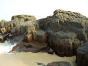
View of St. Marys Island

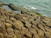
Another view of St. Marys Island
Kudlu theertha water falls, near Hebri
- Malpe: About 6 km from Udupi town, Malpe is an important fishing and trading harbour.
- St. Mary's Island: An island on the Arabian Sea near to Malpe
- Kaup (pronounced "Ka-Aap"): About 12 km from Udupi with a beach and a lighthouse
- Maravanthe: About 42 km from Udupi. The NH-17 is flanked on the left side by the Arabian Sea and on the right side by the Souwparnika River. However, due to continuous sea erosion, the Arabian Sea has come dangerously close to the NH-17.Still the road exists miraculously between sea and river and after this spot, river makes a U turn and goes eastwards and meets sea at Kundapura, after a journey of about 10 km.
Religious places[]
- Udupi Shree Krishna Temple.
- Pajaka: About 12 km from Udupi. This is the place where Madhvacharya preached his Dvaita philosophy.
- Kollur: About 74 km from Udupi, nestled among the Western Ghats. It is considered the abode of Goddess Mookambika and attracts tourists from Kerala and Tamil Nadu.
- Karkala: About 37 km from Udupi. Jain basadis (temples) and Gomateshwara (giant statues) are notable features. Other important places are Padutirupathi Sri Venkataramana Temple, Attur St. Lawrence Church, Sri Hosamarigudi Temple, Sri Ucchanggi Mariamma Temple, Sri Ananthapadmanabha Temple, Sri Padmavathi Temple, Sri Mahalingeshwara Temple, Sri Siddhivinayaka Temple, Sri Umamaheshwara Temple and Salmar Jama Masjid.
- Anegudde: About 30 km from Udupi. Famous for the temple of Lord Ganesha.
- Attur Church: About 25 km from Udupi. Famous for its yearly fair, attended by people from all religious groups.
- Barkur: About 15 km from Udupi. The erstwhile capital of historical Tulu Nadu, Barkur is dotted with temples and Jaina basadis.
- Saligrama : About 27 km from Udupi, with a Lord Guru Narasimha swami temple.And SriVishnu Murthy Temple Parampalli nearly 800years old famous for Harake known as "Dosa"for Furtility( Birth to child)Had large number of deoties all over india & abroad
Sri durga Parameshwari temple muduhole karkada oldest temple of godess of stenth having followers all over India .Spcial pooja in Navarathri & " Dhekkebali Seva" in 4th day dhanur Masa,for the well being of all.
- Pernankila : There is an ancient Ganapathi temple in this village.
- Perdoor : Anantha Padmanabha temple is 22k.m from udupi towrds agumbe -shimoga state highway Monthly Sankramana is very famous in the state.
- Hiriadka : Veerabadhra temple is one of the oldest temple located about 16 km from Udupi.
- Shankaranarayana : Temple built on water (or lake) is the attraction of Shankaranarayana, where Shankara and Narayana are worshipped, located about 40 km from Udupi.
- Maranakatte : Located near western ghats, in deep forest area, this place is known for nature worship. This is at a distance of 45 km from district Head quarters.
- Mandarthi:About 20 km From Udupi With Godeses Ammanavaru(Durgaparameshwari)
Wildlife sanctuaries[]
The Udupi district has thick evergreen forests in the eastern part. They form part of Sahyadri or Western Ghats of India. These forests have wide range of flora and fauna.
- Someshwara Wildlife Sanctuary: About 40 km from Udupi. It contains rare species of animals, birds and medicinal plants.
- Mookambika Wildlife Sanctuary: About 50 km from Udupi. Spread along the Kundapur-Kollur road, this sanctuary is generally off the tourist map.
Waterfalls[]
- Kudlū Theerthā Falls: About 42 km from Udupi. A waterfall located deep in the jungles of Western Ghats, close to Hebri town. This is a beautiful water fall in any standards, and may become very weak during Feb-May. With a height of about 300 feet, it falls directly into a pond which is considered holy by local people, because, sages meditated here thousands of years ago. There is one more water fall above Kudlu theertha, called Manga theertha (monkey theertha) named so because, only monkey can reach it as the path is very steep inside the forest.
- Barkana Falls: About 54 km from Udupi. Located in the Western Ghats at the junction of Udupi, Shivamogga and Chikkamagaluru districts, the falls are a 45-minute walk from the Udupi-Shimoga state highway.
- Belkal Theerthā Falls: About 50 km from Udupi. Cascading waterfalls, located deep in the Western Ghats. This falls is about 400 feet and there will be no water during Feb-May.
- Arasina Gundi, near Dali village off Kollur, is a beautiful waterfall within the forest.
- Jomlu Theertha :Near Belve village about 35 km from Udupi,[10] a small water fall about 20 feet height created by River Seethanadi. This is second water fall of this river, first one being Kudlu Theertha.
- Kosalli Water falls near Byndoor, Kundapur Taluk is a beautiful spot situated at the northern boundary of the district.
River islands[]
The rivers Swarnā, Chakrā, Sitā, Varāhi and Kubjā contain beautiful and often unexplored river islands. Called Kudrūs, some of the islands are inhabited but lack basic facilities such as drinking water, electricity and transport. Examples of the islands include Skool Kudrū, Kannada Kudrū, Katte Kudrū, Benne Kudru, Bavali Kudru, Shetty Kudrū, Uppina Kudru, Kuru, Jaru Kudru etc.
Demand for a separate Tulunadu state[]
The Tuluvas of Southern India are a separate culture from the Kannadigas within India. From India's independence and following the reorganization of states, the Tuluvas had been demanding official language status for Tulu and a separate state for themselves comprising the Udupi and South Canara Districts of Karnataka State and Kasargod District of Kerala State. This demand has grown weakened in recent years. Several organizations like the Tulu Rajya Horata Samiti have taken up the cause of the Tuluvas.[11][12][13][14]
See also[]
- Udupi
- Udupi cuisine
- Dakshina kannada
- Mangalore
References[]
- ^ a b "Know India - Karnataka". Government of India. http://india.gov.in/knowindia/districts/andhra1.php?stateid=KA. Retrieved 6 December 2010.
- ^ "Census of India 2001: Data from the 2001 Census, including cities, villages and towns (Provisional)". Census Commission of India. Archived from the original on 2004-06-16. http://web.archive.org/web/20040616075334/http://www.censusindia.net/results/town.php?stad=A&state5=999. Retrieved 2008-11-01.
- ^ "Census 2001". http://www.censusindiamaps.net/page/India_WhizMap/IndiaMap.htm. Retrieved 2006-09-10.
- ^ a b c d e f "District Census 2011". Census2011.co.in. 2011. http://www.census2011.co.in/district.php. Retrieved 2011-09-30.
- ^ US Directorate of Intelligence. "Country Comparison:Population". https://www.cia.gov/library/publications/the-world-factbook/rankorder/2119rank.html. Retrieved 2011-10-01. "Timor-Leste 1,177,834 July 2011 est."
- ^ "2010 Resident Population Data". U. S. Census Bureau. http://2010.census.gov/2010census/data/apportionment-pop-text.php. Retrieved 2011-09-30. "Rhode Island 1,052,567"
- ^ India Today: An Encyclopedia of Life in the Republic By Arnold P. Kaminsky, Roger D. Long [1]
- ^ "Work begins on strategic petroleum reserve in Mangalore". The Hindu (Chennai, India). 2009-05-28. http://www.hindu.com/2009/05/28/stories/2009052854580500.htm.
- ^ a b c d The Rough Guide to South India By David Abram, Nick Edwards. Pub:Rough Guides (2004) Page 51,201,251-254. ISBN : 1843531038, 9781843531036 [2]
- ^ [3]
- ^ [4]
- ^ [5]
- ^ "Tulu organisations to meet soon". The Hindu (Chennai, India). 2008-03-06. http://www.hindu.com/2008/03/06/stories/2008030658140300.htm.
- ^ http://www.daijiworld.com/news/news_disp.asp?n_id=68774
External links[]
- Official Website of Udupi district
- Udupi District Tourism Information
- Comprehensive information on Udupi
- Know about Udupi
- South Canara Gazetteer 1973
- News from Udupi, Manipal, Kundapura, Brahmavara, Karkala, Padubidri

|
Uttara Kannada district | Shimoga district |
| |
| Lakshadweep Sea | ||||
 Udupi district | ||||
| Dakshina Kannada district | Chikmagalur district |
Template:Udupi District
| ||||||||||||||
| |||||||||||||||||||||||||||||
| This page uses content from the English language Wikipedia. The original content was at Udupi district. The list of authors can be seen in the page history. As with this Familypedia wiki, the content of Wikipedia is available under the Creative Commons License. |