No edit summary |
m (update from Wikipedia) |
||
| (7 intermediate revisions by 4 users not shown) | |||
| Line 1: | Line 1: | ||
| − | + | {{Short description|Constituent political entity of the United States}} |
|
| + | {{Infobox subdivision type |
||
| − | A '''U.S. state''' is any one of the fifty {{wp|state (country subdivision)|subnational entities}} of the {{wp|United States}} (although four states use the official title ''{{wp|Commonwealth (United States)|commonwealth}}''). The separate {{wp|state government}}s and the {{wp|federal government of the United States|federal government}} share {{wp|sovereignty}}, in that an "{{wp|United States|American}}" is a citizen both of the federal entity and of his or her state of residence. However, {{wp|state citizenship}} is very flexible, and no government approval is required to move between states (with the exception of convicts on {{wp|parole}}). |
||
| + | | name = State |
||
| + | | alt_name = [[Commonwealth (U.S. state)|Commonwealth]]<br>{{nobold|(the self-designation of four states)}} |
||
| + | | map = [[File:Map of USA States with names white.svg|330px]] |
||
| + | | category = [[Federated state]] |
||
| + | | territory = [[United States]] |
||
| + | | start_date = |
||
| + | | current_number = 50 |
||
| + | | number_date = |
||
| + | | population_range = Smallest: [[Wyoming]], 578,759<br>Largest: [[California]], 39,512,223<ref name="Census2019">{{cite web |title=Population, Population Change, and Estimated Components of Population Change: April 1, 2010 to July 1, 2019 (NST-EST2019-alldata) |url=https://www.census.gov/data/tables/time-series/demo/popest/2010s-state-total.html |website=Census.gov |publisher=United States Census Bureau |access-date=8 February 2020 |archive-url=https://web.archive.org/web/20200126071436/https://www.census.gov/data/tables/time-series/demo/popest/2010s-state-total.html |archive-date=January 26, 2020 |url-status=live }}</ref> |
||
| + | | area_range = Smallest: [[Rhode Island]], {{Convert|1,545|sqmi}}<br>Largest: [[Alaska]], {{Convert|665,384|sqmi}}<ref name=areameasurements>{{cite web| title=State Area Measurements and Internal Point Coordinates| url=https://www.census.gov/geo/reference/state-area.html| publisher=U.S. Census Bureau| location=Washington, D.C.| access-date=March 14, 2018| archive-url=https://web.archive.org/web/20180316004512/https://www.census.gov/geo/reference/state-area.html| archive-date=March 16, 2018| url-status=live| df=mdy-all}}</ref> |
||
| + | | government = [[State governments of the United States|State government]] |
||
| + | | subdivision = [[County (United States)|County]] (or [[County (United States)#County equivalents|equivalent]]) |
||
| + | }} |
||
| + | In the [[United States]], a '''state''' is a [[Federated state|constituent]] [[Polity|political entity]], of which there are currently 50. Bound together in a [[political union]], each state holds [[government]]al jurisdiction over a separate and defined geographic territory where it shares its [[sovereignty]] with the [[Federal government of the United States|federal government]]. Due to this shared sovereignty, [[Americans]] are [[Citizenship in the United States|citizens]] both of the [[federal republic]] and of the state in which they [[Domicile (law)#United States|reside]].<ref>{{cite web| last1=Erler| first1=Edward| title=Essays on Amendment XIV: Citizenship| url=http://www.heritage.org/constitution/#!/amendments/14/essays/167/citizenship| publisher=The Heritage Foundation| access-date=January 12, 2016| archive-url=https://web.archive.org/web/20170724095029/http://www.heritage.org/constitution/#!/amendments/14/essays/167/citizenship| archive-date=July 24, 2017| url-status=live| df=mdy-all}}</ref> State citizenship and residency are flexible, and no government approval is required to [[Freedom of movement under United States law|move between states]], except for persons restricted by certain types of court orders (such as [[paroled]] convicts and [[minor (law)|children]] of divorced spouses who are [[child custody|sharing custody]]). |
||
| − | The {{wp|United States Constitution}} allocates power between the two levels of government in general terms. By ratifying the Constitution, each state transfers certain sovereign powers to the federal government and agrees to share other powers. Under the {{wp|Tenth Amendment to the United States Constitution|Tenth Amendment}}, all powers not explicitly transferred or shared are retained by the states and the people. Historically, the tasks of public education, public health, transportation and other infrastructure have been considered primarily state responsibilities, although all have significant federal funding and regulation as well. |
||
| + | [[State governments of the United States|State governments]] are allocated power by the people (of each respective state) through their individual [[State constitution (United States)|constitutions]]. All are grounded in [[Republicanism in the United States|republican principles]], and each provides for a government, consisting of three branches, each with [[Separation of powers|separate and independent powers]]: [[Governor (United States)|executive]], [[State legislature (United States)|legislative]], and [[State court (United States)|judicial]].<ref>{{cite web | url=http://www.leg.state.mn.us/leg/faq/faqtoc.aspx?subject=1 | title=Frequently Asked Questions About the Minnesota Legislature | publisher=[[Minnesota State Legislature]] | access-date=January 12, 2016 | archive-url=https://web.archive.org/web/20131021082117/http://www.leg.state.mn.us/leg/faq/faqtoc.aspx?subject=1 | archive-date=October 21, 2013 | url-status=live | df=mdy-all }}</ref> States are divided into [[County (United States)|counties]] or county-equivalents, which may be assigned some local governmental authority but are not sovereign. County or county-equivalent structure varies widely by state, and states also create other [[Local government in the United States|local governments]]. |
||
| − | Over time, the Constitution has been amended, and the interpretation and application of its provisions have changed. The general tendency has been toward centralization, with the federal government playing a much larger role than it once did. There is a continuing debate over "{{wp|states' rights}}," which concerns the extent and nature of the powers that the states have given to the federal government. |
||
| + | States, unlike [[Territories of the United States|U.S. territories]], possess a number of powers and rights under the [[United States Constitution]]. States and their citizens are represented in the [[United States Congress]], a [[bicameral]] legislature consisting of the [[United States Senate|Senate]] and the [[United States House of Representatives|House of Representatives]]. Each state is also entitled to select a number of electors (equal to the total number of representatives and senators from that state) to vote in the [[Electoral College (United States)|Electoral College]], the body that directly elects the [[President of the United States]]. Additionally, each state has the opportunity to [[Ratification|ratify]] [[Constitutional amendment#United States|constitutional amendments]], and, with the consent of Congress, two or more states may enter into [[interstate compact]]s with one another. The [[Police power (United States constitutional law)|police power]] of each state is also recognized. |
||
| − | ==List of states== |
||
| − | <!--[[Image:Map of USA with state names.svg|center|640px]] |
||
| − | <br clear=all /> --> |
||
| − | The following sortable table lists each of the 50 states of the {{wp|United States of America}} with the following information: |
||
| − | *The {{wp|political divisions of the United States#States of the United States|common state name}}, |
||
| − | *The {{wp|list of official names of the states of the USA|official state name or names}}, |
||
| − | *The {{wp|United States Postal Service}} (USPS) two-character {{wp|United States postal abbreviations|state abbreviation}}<ref name=USPSabbrev>{{cite web | url = http://www.usps.com/ncsc/lookups/abbreviations.html | title = Official USPS Abbreviations | format = {{wp|HTML}} | publisher = {{wp|United States Postal Service}} | date = {{wp|1998}} | accessdate = 2007-02-26 }}</ref><br/>(also used as the {{wp|International Organization for Standardization}} (ISO) Standard {{wp|ISO 3166-2|3166-2}} {{wp|ISO 3166-2:US|country subdivision code}}), |
||
| − | *The date the state {{wp|List of U.S. states by date of statehood|ratified}} the {{wp|United States Constitution}} or was {{wp|List of U.S. states by date of statehood|admitted}} to the {{wp|United States|Union}}, |
||
| − | *The {{wp|United States Census Bureau}} estimate of state population as of {{wp|2006-07-01}},<ref name=PopEstStates>{{cite web | url = http://www.census.gov/popest/states/tables/NST-EST2006-01.csv | title = Table 1: Annual Estimates of the Population for the United States and States, and for Puerto Rico: April 1, 2000 to July 1, 2006 | format = {{wp|comma-separated values|CSV}} | work = 2006 Population Estimates | publisher = {{wp|United States Census Bureau}}, Population Division | date = {{wp|2006-12-22}} | accessdate = 2007-02-26 }}</ref> |
||
| − | *The {{wp|List of capitals in the United States|state capital}}, |
||
| − | *The most populous {{wp|incorporated place}} or {{wp|census-designated place}} within the state as of {{wp|2005-07-01}}, as estimated by the U.S. Census Bureau,<ref name=PopEstCities>{{cite web | url = http://www.census.gov/popest/cities/files/SUB-EST2005-ip.csv | title = Annual Estimates of the Population for All Incorporated Places: April 1, 2000 to July 1, 2005 | format = {{wp|comma-separated values|CSV}} | work = 2005 Population Estimates | publisher = {{wp|United States Census Bureau}}, Population Division | date = {{wp|2006-06-20}} | accessdate = 2007-02-26 }}</ref> and |
||
| − | *An image of the {{wp|flags of the U.S. states|state flag}}. |
||
| + | Historically, the tasks of local [[Law enforcement in the United States#State|law enforcement]], [[Education in the United States|public education]], [[Health care in the United States|public health]], regulating intrastate commerce, and local [[Transportation in the United States|transportation]] and [[infrastructure]] have generally been considered primarily state responsibilities, although all of these now have significant federal funding and regulation as well. Over time, the Constitution has been amended, and the interpretation and application of its provisions have changed. The general tendency has been toward centralization and [[Incorporation (Bill of Rights)|incorporation]], with the federal government playing a much larger role than it once did. There is a continuing debate over [[states' rights]], which concerns the extent and nature of the states' powers and sovereignty in relation to the federal government and the rights of individuals. |
||
| − | {| class="wikitable sortable" |
||
| − | |+ The 50 United States of America |
||
| − | ! State |
||
| − | ! Official Name |
||
| − | ! USPS |
||
| − | ! Date |
||
| − | ! Population |
||
| − | ! Capital |
||
| − | ! Most Populous City |
||
| − | ! Flag |
||
| − | |- |
||
| − | | {{wp|Alabama}} |
||
| − | | {{wp|State of Alabama}} |
||
| − | | align=center | AL |
||
| − | | <span style="display:none">18191214</span>{{wp|1819-12-14}} |
||
| − | | align=right | <span style="display:none">0</span>4,599,030 |
||
| − | | {{wp|Montgomery, Alabama|Montgomery}} |
||
| − | | {{wp|Birmingham, Alabama|Birmingham}} |
||
| − | | [[Image:Flag of Alabama.svg|45px]] |
||
| − | |- |
||
| − | | {{wp|Alaska}} |
||
| − | | {{wp|State of Alaska}} |
||
| − | | align=center | AK |
||
| − | | <span style="display:none">19590103</span>{{wp|1959-01-03}} |
||
| − | | align=right | <span style="display:none">00,</span>670,053 |
||
| − | | {{wp|Juneau, Alaska|Juneau}} |
||
| − | | {{wp|Anchorage, Alaska|Anchorage}} |
||
| − | | [[Image:Flag of Alaska.svg|45px]] |
||
| − | |- |
||
| − | | {{wp|Arizona}} |
||
| − | | {{wp|State of Arizona}} |
||
| − | | align=center | AZ |
||
| − | | <span style="display:none">19120214</span>{{wp|1912-02-14}} |
||
| − | | align=right | <span style="display:none">0</span>6,166,318 |
||
| − | | {{wp|Phoenix, Arizona|Phoenix}} |
||
| − | | {{wp|Phoenix, Arizona|Phoenix}} |
||
| − | | [[Image:Flag of Arizona.svg|45px]] |
||
| − | |- |
||
| − | | {{wp|Arkansas}} |
||
| − | | {{wp|State of Arkansas}} |
||
| − | | align=center | AR |
||
| − | | <span style="display:none">18360615</span>{{wp|1836-06-15}} |
||
| − | | align=right | <span style="display:none">0</span>2,810,872 |
||
| − | | {{wp|Little Rock, Arkansas|Little Rock}} |
||
| − | | {{wp|Little Rock, Arkansas|Little Rock}} |
||
| − | | [[Image:Flag of Arkansas.svg|45px]] |
||
| − | |- |
||
| − | | {{wp|California}} |
||
| − | | {{wp|State of California}} |
||
| − | | align=center | CA |
||
| − | | <span style="display:none">18500909</span>{{wp|1850-09-09}} |
||
| − | | align=right | 36,457,549 |
||
| − | | {{wp|Sacramento, California|Sacramento}} |
||
| − | | {{wp|Los Angeles, California|Los Angeles}} |
||
| − | | [[Image:Flag of California.svg|45px]] |
||
| − | |- |
||
| − | | {{wp|Colorado}} |
||
| − | | {{wp|State of Colorado}} |
||
| − | | align=center | CO |
||
| − | | <span style="display:none">18760801</span>{{wp|1876-08-01}} |
||
| − | | align=right | <span style="display:none">0</span>4,753,377 |
||
| − | | {{wp|Denver, Colorado|Denver}} |
||
| − | | {{wp|Denver, Colorado|Denver}} |
||
| − | | [[Image:Flag of Colorado.svg|45px]] |
||
| − | |- |
||
| − | | {{wp|Connecticut}} |
||
| − | | {{wp|State of Connecticut}} |
||
| − | | align=center | CT |
||
| − | | <span style="display:none">17880109</span>{{wp|1788-01-09}} |
||
| − | | align=right | <span style="display:none">0</span>3,504,809 |
||
| − | | {{wp|Hartford, Connecticut|Hartford}} |
||
| − | | {{wp|Bridgeport, Connecticut|Bridgeport}}<ref name=Hartford>The {{wp|Hartford-West Hartford-Willimantic Combined Statistical Area}} is the most populous metropolitan area in {{wp|Connecticut}}.</ref> |
||
| − | | [[Image:Flag of Connecticut.svg|45px]] |
||
| − | |- |
||
| − | | {{wp|Delaware}} |
||
| − | | {{wp|State of Delaware}} |
||
| − | | align=center | DE |
||
| − | | <span style="display:none">17871207</span>{{wp|1787-12-07}} |
||
| − | | align=right | <span style="display:none">00,</span>853,476 |
||
| − | | {{wp|Dover, Delaware|Dover}} |
||
| − | | {{wp|Wilmington, Delaware|Wilmington}} |
||
| − | | [[Image:Flag of Delaware.svg|45px]] |
||
| − | |- |
||
| − | | {{wp|Florida}} |
||
| − | | {{wp|State of Florida}} |
||
| − | | align=center | FL |
||
| − | | <span style="display:none">18450303</span>{{wp|1845-03-03}} |
||
| − | | align=right | 18,089,888 |
||
| − | | {{wp|Tallahassee, Florida|Tallahassee}} |
||
| − | | {{wp|Jacksonville, Florida|Jacksonville}}<ref name=Miami>The {{wp|Miami-Fort Lauderdale-Miami Beach Metropolitan Statistical Area}} is the most populous metropolitan area in {{wp|Florida}}.</ref> |
||
| − | | [[Image:Flag of Florida.svg|45px]] |
||
| − | |- |
||
| − | | {{wp|Georgia (U.S. state)|Georgia}} |
||
| − | | {{wp|State of Georgia}} |
||
| − | | align=center | GA |
||
| − | | <span style="display:none">17880102</span>{{wp|1788-01-02}} |
||
| − | | align=right | <span style="display:none">0</span>9,363,941 |
||
| − | | {{wp|Atlanta, Georgia|Atlanta}} |
||
| − | | {{wp|Atlanta, Georgia|Atlanta}} |
||
| − | | [[Image:Flag of Georgia (U.S. state).svg|45px]] |
||
| − | |- |
||
| − | | {{wp|Hawaii}} |
||
| − | | {{wp|State of Hawai`i}}<br/>{{wp|Moku`a-ina o Hawai`i}} |
||
| − | | align=center | HI |
||
| − | | <span style="display:none">19590821</span>{{wp|1959-08-21}} |
||
| − | | align=right | <span style="display:none">0</span>1,285,498 |
||
| − | | {{wp|Honolulu, Hawaii|Honolulu}} |
||
| − | | {{wp|Honolulu, Hawaii|Honolulu}} |
||
| − | | [[Image:Flag of Hawaii.svg|45px]] |
||
| − | |- |
||
| − | | {{wp|Idaho}} |
||
| − | | {{wp|State of Idaho}} |
||
| − | | align=center | ID |
||
| − | | <span style="display:none">18900703</span>{{wp|1890-07-03}} |
||
| − | | align=right | <span style="display:none">0</span>1,466,465 |
||
| − | | {{wp|Boise, Idaho|Boise}} |
||
| − | | {{wp|Boise, Idaho|Boise}} |
||
| − | | [[Image:Flag of Idaho.svg|45px]] |
||
| − | |- |
||
| − | | {{wp|Illinois}} |
||
| − | | {{wp|State of Illinois}} |
||
| − | | align=center | IL |
||
| − | | <span style="display:none">18181203</span>{{wp|1818-12-03}} |
||
| − | | align=right | 12,831,970 |
||
| − | | {{wp|Springfield, Illinois|Springfield}} |
||
| − | | {{wp|Chicago}} |
||
| − | | [[Image:Flag of Illinois.svg|45px]] |
||
| − | |- |
||
| − | | {{wp|Indiana}} |
||
| − | | {{wp|State of Indiana}} |
||
| − | | align=center | IN |
||
| − | | <span style="display:none">18161211</span>{{wp|1816-12-11}} |
||
| − | | align=right | <span style="display:none">0</span>6,313,520 |
||
| − | | {{wp|Indianapolis, Indiana|Indianapolis}} |
||
| − | | {{wp|Indianapolis, Indiana|Indianapolis}} |
||
| − | | [[Image:Flag of Indiana.svg|45px]] |
||
| − | |- |
||
| − | | {{wp|Iowa}} |
||
| − | | {{wp|State of Iowa}} |
||
| − | | align=center | IA |
||
| − | | <span style="display:none">18461228</span>{{wp|1846-12-28}} |
||
| − | | align=right | <span style="display:none">0</span>2,982,085 |
||
| − | | {{wp|Des Moines, Iowa|Des Moines}} |
||
| − | | {{wp|Des Moines, Iowa|Des Moines}} |
||
| − | | [[Image:Flag of Iowa.svg|45px]] |
||
| − | |- |
||
| − | | {{wp|Kansas}} |
||
| − | | {{wp|State of Kansas}} |
||
| − | | align=center | KS |
||
| − | | <span style="display:none">18610129</span>{{wp|1861-01-29}} |
||
| − | | align=right | <span style="display:none">0</span>2,764,075 |
||
| − | | {{wp|Topeka, Kansas|Topeka}} |
||
| − | | {{wp|Wichita, Kansas|Wichita}} |
||
| − | | [[Image:Flag of Kansas.svg|45px]] |
||
| − | |- |
||
| − | | {{wp|Kentucky}} |
||
| − | | {{wp|Commonwealth of Kentucky}} |
||
| − | | align=center | KY |
||
| − | | <span style="display:none">17920601</span>{{wp|1792-06-01}} |
||
| − | | align=right | <span style="display:none">0</span>4,206,074 |
||
| − | | {{wp|Frankfort, Kentucky|Frankfort}} |
||
| − | | {{wp|Louisville, Kentucky|Louisville}} |
||
| − | | [[Image:Flag of Kentucky.svg|45px]] |
||
| − | |- |
||
| − | | {{wp|Louisiana}} |
||
| − | | {{wp|State of Louisiana}}<br/>{{wp|État de Louisiane}} |
||
| − | | align=center | LA |
||
| − | | <span style="display:none">18120430</span>{{wp|1812-04-30}} |
||
| − | | align=right | <span style="display:none">0</span>4,287,768 |
||
| − | | {{wp|Baton Rouge, Louisiana|Baton Rouge}} |
||
| − | | {{wp|New Orleans, Louisiana|New Orleans}}<ref name=Katrina>The {{wp|United States Census Bureau}} estimates that, as of {{wp|2005-07-01}}, the population of the {{wp|New Orleans, Louisiana|City of New Orleans}} was 454,863 and the population of the {{wp|Baton Rouge, Louisiana|City of Baton Rouge}} was 222,064. After {{wp|Hurricane Katrina}} struck {{wp|Louisiana}}, New Orleans lost a significant portion of its population while the population of Baton Rouge increased substantially.</ref> |
||
| − | | [[Image:Flag of Louisiana.svg|45px]] |
||
| − | |- |
||
| − | | {{wp|Maine}} |
||
| − | | {{wp|State of Maine}} |
||
| − | | align=center | ME |
||
| − | | <span style="display:none">18200315</span>{{wp|1820-03-15}} |
||
| − | | align=right | <span style="display:none">0</span>1,321,574 |
||
| − | | {{wp|Augusta, Maine|Augusta}} |
||
| − | | {{wp|Portland, Maine|Portland}} |
||
| − | | [[Image:Flag of Maine.svg|45px]] |
||
| − | |- |
||
| − | | {{wp|Maryland}} |
||
| − | | {{wp|State of Maryland}} |
||
| − | | align=center | MD |
||
| − | | <span style="display:none">17880428</span>{{wp|1788-04-28}} |
||
| − | | align=right | <span style="display:none">0</span>5,615,727 |
||
| − | | {{wp|Annapolis, Maryland|Annapolis}} |
||
| − | | {{wp|Baltimore, Maryland|Baltimore}}<ref name=Maryland>{{wp|Baltimore, Maryland|Baltimore City}} and the 12 {{wp|Maryland}} {{wp|county (United States)|counties}} of the {{wp|Washington-Baltimore-Northern Virginia Combined Statistical Area}} form the most populous metropolitan region in Maryland.</ref> |
||
| − | | [[Image:Flag of Maryland.svg|45px]] |
||
| − | |- |
||
| − | | {{wp|Massachusetts}} |
||
| − | | {{wp|Commonwealth of Massachusetts}} |
||
| − | | align=center | MA |
||
| − | | <span style="display:none">17880206</span>{{wp|1788-02-06}} |
||
| − | | align=right | <span style="display:none">0</span>6,437,193 |
||
| − | | {{wp|Boston, Massachusetts|Boston}} |
||
| − | | {{wp|Boston, Massachusetts|Boston}} |
||
| − | | [[Image:Flag of Massachusetts.svg|45px]] |
||
| − | |- |
||
| − | | {{wp|Michigan}} |
||
| − | | {{wp|State of Michigan}} |
||
| − | | align=center | MI |
||
| − | | <span style="display:none">18370126</span>{{wp|1837-01-26}} |
||
| − | | align=right | 10,095,643 |
||
| − | | {{wp|Lansing, Michigan|Lansing}} |
||
| − | | {{wp|Detroit, Michigan|Detroit}} |
||
| − | | [[Image:Flag of Michigan.svg|45px]] |
||
| − | |- |
||
| − | | {{wp|Minnesota}} |
||
| − | | {{wp|State of Minnesota}} |
||
| − | | align=center | MN |
||
| − | | <span style="display:none">18580511</span>{{wp|1858-05-11}} |
||
| − | | align=right | <span style="display:none">0</span>5,167,101 |
||
| − | | {{wp|Saint Paul, Minnesota|Saint Paul}} |
||
| − | | {{wp|Minneapolis, Minnesota|Minneapolis}} |
||
| − | | [[Image:Flag of Minnesota.svg|45px]] |
||
| − | |- |
||
| − | | {{wp|Mississippi}} |
||
| − | | {{wp|State of Mississippi}} |
||
| − | | align=center | MS |
||
| − | | <span style="display:none">18171210</span>{{wp|1817-12-10}} |
||
| − | | align=right | <span style="display:none">0</span>2,910,540 |
||
| − | | {{wp|Jackson, Mississippi|Jackson}} |
||
| − | | {{wp|Jackson, Mississippi|Jackson}} |
||
| − | | [[Image:Flag of Mississippi.svg|45px]] |
||
| − | |- |
||
| − | | {{wp|Missouri}} |
||
| − | | {{wp|State of Missouri}} |
||
| − | | align=center | MO |
||
| − | | <span style="display:none">18210810</span>{{wp|1821-08-10}} |
||
| − | | align=right | <span style="display:none">0</span>5,842,713 |
||
| − | | {{wp|Jefferson City, Missouri|Jefferson City}} |
||
| − | | {{wp|Kansas City, Missouri|Kansas City}}<ref name=Saint_Louis>The {{wp|St. Louis, Missouri|City of Saint Louis}} and the 8 {{wp|Missouri}} {{wp|county (United States)|counties}} of the {{wp|St. Louis-St. Charles-Farmington Combined Statistical Area}} form the most populous metropolitan region in Missouri.</ref> |
||
| − | | [[Image:Flag of Missouri.svg|45px]] |
||
| − | |- |
||
| − | | {{wp|Montana}} |
||
| − | | {{wp|State of Montana}} |
||
| − | | align=center | MT |
||
| − | | <span style="display:none">18891108</span>{{wp|1889-11-08}} |
||
| − | | align=right | <span style="display:none">00,</span>944,632 |
||
| − | | {{wp|Helena, Montana|Helena}} |
||
| − | | {{wp|Billings, Montana|Billings}} |
||
| − | | [[Image:Flag of Montana.svg|45px]] |
||
| − | |- |
||
| − | | {{wp|Nebraska}} |
||
| − | | {{wp|State of Nebraska}} |
||
| − | | align=center | NE |
||
| − | | <span style="display:none">18670301</span>{{wp|1867-03-01}} |
||
| − | | align=right | <span style="display:none">0</span>1,768,331 |
||
| − | | {{wp|Lincoln, Nebraska|Lincoln}} |
||
| − | | {{wp|Omaha, Nebraska|Omaha}} |
||
| − | | [[Image:Flag of Nebraska.svg|45px]] |
||
| − | |- |
||
| − | | {{wp|Nevada}} |
||
| − | | {{wp|State of Nevada}} |
||
| − | | align=center | NV |
||
| − | | <span style="display:none">18641031</span>{{wp|1864-10-31}} |
||
| − | | align=right | <span style="display:none">0</span>2,495,529 |
||
| − | | {{wp|Carson City, Nevada|Carson City}} |
||
| − | | {{wp|Las Vegas, Nevada|Las Vegas}} |
||
| − | | [[Image:Flag of Nevada.svg|45px]] |
||
| − | |- |
||
| − | | {{wp|New Hampshire}} |
||
| − | | {{wp|State of New Hampshire}} |
||
| − | | align=center | NH |
||
| − | | <span style="display:none">17880621</span>{{wp|1788-06-21}} |
||
| − | | align=right | <span style="display:none">0</span>1,314,895 |
||
| − | | {{wp|Concord, New Hampshire|Concord}} |
||
| − | | {{wp|Manchester, New Hampshire|Manchester}}<ref name=Rockingham>The 5 southeastern {{wp|New Hampshire}} {{wp|county (United States)|counties}} of the {{wp|Boston-Worcester-Manchester Combined Statistical Area}} form the most populous metropolitan region in New Hampshire.</ref> |
||
| − | | [[Image:Flag of New Hampshire.svg|45px]] |
||
| − | |- |
||
| − | | {{wp|New Jersey}} |
||
| − | | {{wp|State of New Jersey}} |
||
| − | | align=center | NJ |
||
| − | | <span style="display:none">17871218</span>{{wp|1787-12-18}} |
||
| − | | align=right | <span style="display:none">0</span>8,724,560 |
||
| − | | {{wp|Trenton, New Jersey|Trenton}} |
||
| − | | {{wp|Newark, New Jersey|Newark}}<ref name=New_Jersey>The 13 northern {{wp|New Jersey}} {{wp|county (United States)|counties}} of the {{wp|New York-Newark-Bridgeport Combined Statistical Area}} form the most populous metropolitan region in New Jersey.</ref> |
||
| − | | [[Image:Flag of New Jersey.svg|45px]] |
||
| − | |- |
||
| − | | {{wp|New Mexico}} |
||
| − | | {{wp|State of New Mexico}}<br/>{{wp|Estado de Nuevo México}} |
||
| − | | align=center | NM |
||
| − | | <span style="display:none">19120106</span>{{wp|1912-01-06}} |
||
| − | | align=right | <span style="display:none">0</span>1,954,599 |
||
| − | | {{wp|Santa Fe, New Mexico|Santa Fe}} |
||
| − | | {{wp|Albuquerque, New Mexico|Albuquerque}} |
||
| − | | [[Image:Flag of New Mexico.svg|45px]] |
||
| − | |- |
||
| − | | {{wp|New York}} |
||
| − | | {{wp|State of New York}} |
||
| − | | align=center | NY |
||
| − | | <span style="display:none">17880726</span>{{wp|1788-07-26}} |
||
| − | | align=right | 19,306,183 |
||
| − | | {{wp|Albany, New York|Albany}} |
||
| − | | {{wp|New York City|New York}} |
||
| − | | [[Image:Flag of New York.svg|45px]] |
||
| − | |- |
||
| − | | {{wp|North Carolina}} |
||
| − | | {{wp|State of North Carolina}} |
||
| − | | align=center | NC |
||
| − | | <span style="display:none">17891121</span>{{wp|1789-11-21}} |
||
| − | | align=right | <span style="display:none">0</span>8,856,505 |
||
| − | | {{wp|Raleigh, North Carolina|Raleigh}} |
||
| − | | {{wp|Charlotte, North Carolina|Charlotte}} |
||
| − | | [[Image:Flag of North Carolina.svg|45px]] |
||
| − | |- |
||
| − | | {{wp|North Dakota}} |
||
| − | | {{wp|State of North Dakota}} |
||
| − | | align=center | ND |
||
| − | | <span style="display:none">18891102</span>{{wp|1889-11-02}} |
||
| − | | align=right | <span style="display:none">00,</span>635,867 |
||
| − | | {{wp|Bismarck, North Dakota|Bismarck}} |
||
| − | | {{wp|Fargo, North Dakota|Fargo}} |
||
| − | | [[Image:Flag of North Dakota.svg|45px]] |
||
| − | |- |
||
| − | | {{wp|Ohio}} |
||
| − | | {{wp|State of Ohio}} |
||
| − | | align=center | OH |
||
| − | | <span style="display:none">18030301</span>{{wp|1803-03-01}} |
||
| − | | align=right | 11,478,006 |
||
| − | | {{wp|Columbus, Ohio|Columbus}} |
||
| − | | {{wp|Columbus, Ohio|Columbus}}<ref name=Cleveland>The {{wp|Cleveland-Akron-Elyria Combined Statistical Area}} is the most populous metropolitan area in {{wp|Ohio}}.</ref> |
||
| − | | [[Image:Flag of Ohio.svg|45px]] |
||
| − | |- |
||
| − | | {{wp|Oklahoma}} |
||
| − | | {{wp|State of Oklahoma}} |
||
| − | | align=center | OK |
||
| − | | <span style="display:none">19071116</span>{{wp|1907-11-16}} |
||
| − | | align=right | <span style="display:none">0</span>3,579,212 |
||
| − | | {{wp|Oklahoma City, Oklahoma|Oklahoma City}} |
||
| − | | {{wp|Oklahoma City, Oklahoma|Oklahoma City}} |
||
| − | | [[Image:Flag of Oklahoma.svg|45px]] |
||
| − | |- |
||
| − | | {{wp|Oregon}} |
||
| − | | {{wp|State of Oregon}} |
||
| − | | align=center | OR |
||
| − | | <span style="display:none">18590214</span>{{wp|1859-02-14}} |
||
| − | | align=right | <span style="display:none">0</span>3,700,758 |
||
| − | | {{wp|Salem, Oregon|Salem}} |
||
| − | | {{wp|Portland, Oregon|Portland}} |
||
| − | | [[Image:Flag of Oregon.svg|45px]] |
||
| − | |- |
||
| − | | {{wp|Pennsylvania}} |
||
| − | | {{wp|Commonwealth of Pennsylvania}} |
||
| − | | align=center | PA |
||
| − | | <span style="display:none">17871212</span>{{wp|1787-12-12}} |
||
| − | | align=right | 12,440,621 |
||
| − | | {{wp|Harrisburg, Pennsylvania|Harrisburg}} |
||
| − | | {{wp|Philadelphia, Pennsylvania|Philadelphia}} |
||
| − | | [[Image:Flag of Pennsylvania.svg|45px]] |
||
| − | |- |
||
| − | | {{wp|Rhode Island}} |
||
| − | | {{wp|State of Rhode Island and Providence Plantations}} |
||
| − | | align=center | RI |
||
| − | | <span style="display:none">17900529</span>{{wp|1790-05-29}} |
||
| − | | align=right | <span style="display:none">0</span>1,067,610 |
||
| − | | {{wp|Providence, Rhode Island|Providence}} |
||
| − | | {{wp|Providence, Rhode Island|Providence}} |
||
| − | | [[Image:Flag of Rhode Island.svg|45px]] |
||
| − | |- |
||
| − | | {{wp|South Carolina}} |
||
| − | | {{wp|State of South Carolina}} |
||
| − | | align=center | SC |
||
| − | | <span style="display:none">17880523</span>{{wp|1788-05-23}} |
||
| − | | align=right | <span style="display:none">0</span>4,321,249 |
||
| − | | {{wp|Columbia, South Carolina|Columbia}} |
||
| − | | {{wp|Columbia, South Carolina|Columbia}}<ref name=Greenville>The {{wp|Greenville-Spartanburg-Anderson Combined Statistical Area}} is the most populous metropolitan area in {{wp|South Carolina}}.</ref> |
||
| − | | [[Image:Flag of South Carolina.svg|45px]] |
||
| − | |- |
||
| − | | {{wp|South Dakota}} |
||
| − | | {{wp|State of South Dakota}} |
||
| − | | align=center | SD |
||
| − | | <span style="display:none">18891102</span>{{wp|1889-11-02}} |
||
| − | | align=right | <span style="display:none">00,</span>781,919 |
||
| − | | {{wp|Pierre, South Dakota|Pierre}} |
||
| − | | {{wp|Sioux Falls, South Dakota|Sioux Falls}} |
||
| − | | [[Image:Flag of South Dakota.svg|45px]] |
||
| − | |- |
||
| − | | {{wp|Tennessee}} |
||
| − | | {{wp|State of Tennessee}} |
||
| − | | align=center | TN |
||
| − | | <span style="display:none">17960601</span>{{wp|1796-06-01}} |
||
| − | | align=right | <span style="display:none">0</span>6,038,803 |
||
| − | | {{wp|Nashville, Tennessee|Nashville}} |
||
| − | | {{wp|Memphis, Tennessee|Memphis}}<ref name=Nashville>The {{wp|Nashville-Davidson-Murfreesboro-Columbia Combined Statistical Area}} is the most populous metropolitan area in {{wp|Tennessee}}.</ref> |
||
| − | | [[Image:Flag of Tennessee.svg|45px]] |
||
| − | |- |
||
| − | | {{wp|Texas}} |
||
| − | | {{wp|State of Texas}} |
||
| − | | align=center | TX |
||
| − | | <span style="display:none">18451229</span>{{wp|1845-12-29}} |
||
| − | | align=right | 23,507,783 |
||
| − | | {{wp|Austin, Texas|Austin}} |
||
| − | | {{wp|Houston, Texas|Houston}}<ref name=Dallas>The {{wp|Dallas-Fort Worth Combined Statistical Area}} is the most populous metropolitan area in {{wp|Texas}}.</ref> |
||
| − | | [[Image:Flag of Texas.svg|45px]] |
||
| − | |- |
||
| − | | {{wp|Utah}} |
||
| − | | {{wp|State of Utah}} |
||
| − | | align=center | UT |
||
| − | | <span style="display:none">18960104</span>{{wp|1896-01-04}} |
||
| − | | align=right | <span style="display:none">0</span>2,550,063 |
||
| − | | {{wp|Salt Lake City, Utah|Salt Lake City}} |
||
| − | | {{wp|Salt Lake City, Utah|Salt Lake City}} |
||
| − | | [[Image:Flag of Utah.svg|45px]] |
||
| − | |- |
||
| − | | {{wp|Vermont}} |
||
| − | | {{wp|State of Vermont}} |
||
| − | | align=center | VT |
||
| − | | <span style="display:none">17910304</span>{{wp|1791-03-04}} |
||
| − | | align=right | <span style="display:none">00,</span>623,908 |
||
| − | | {{wp|Montpelier, Vermont|Montpelier}} |
||
| − | | {{wp|Burlington, Vermont|Burlington}} |
||
| − | | [[Image:Flag of Vermont.svg|45px]] |
||
| − | |- |
||
| − | | {{wp|Virginia}} |
||
| − | | {{wp|Commonwealth of Virginia}} |
||
| − | | align=center | VA |
||
| − | | <span style="display:none">17880625</span>{{wp|1788-06-25}} |
||
| − | | align=right | <span style="display:none">0</span>7,642,884 |
||
| − | | {{wp|Richmond, Virginia|Richmond}} |
||
| − | | {{wp|Virginia Beach, Virginia|Virginia Beach}}<ref name=Virginia>The 10 {{wp|Virginia}} {{wp|county (United States)|counties}} and 6 {{wp|independent cities#Virginia|Virginia cities}} of the {{wp|Washington-Baltimore-Northern Virginia Combined Statistical Area}} form the most populous metropolitan region in Virginia.</ref> |
||
| − | | [[Image:Flag of Virginia.svg|45px]] |
||
| − | |- |
||
| − | | {{wp|Washington}} |
||
| − | | {{wp|State of Washington}} |
||
| − | | align=center | WA |
||
| − | | <span style="display:none">18891111</span>{{wp|1889-11-11}} |
||
| − | | align=right | <span style="display:none">0</span>6,395,798 |
||
| − | | {{wp|Olympia, Washington|Olympia}} |
||
| − | | {{wp|Seattle, Washington|Seattle}} |
||
| − | | [[Image:Flag of Washington.svg|45px]] |
||
| − | |- |
||
| − | | {{wp|West Virginia}} |
||
| − | | {{wp|State of West Virginia}} |
||
| − | | align=center | WV |
||
| − | | <span style="display:none">18630620</span>{{wp|1863-06-20}} |
||
| − | | align=right | <span style="display:none">0</span>1,818,470 |
||
| − | | {{wp|Charleston, West Virginia|Charleston}} |
||
| − | | {{wp|Charleston, West Virginia|Charleston}} |
||
| − | | [[Image:Flag of West Virginia.svg|45px]] |
||
| − | |- |
||
| − | | {{wp|Wisconsin}} |
||
| − | | {{wp|State of Wisconsin}} |
||
| − | | align=center | WI |
||
| − | | <span style="display:none">18480529</span>{{wp|1848-05-29}} |
||
| − | | align=right | <span style="display:none">0</span>5,556,506 |
||
| − | | {{wp|Madison, Wisconsin|Madison}} |
||
| − | | {{wp|Milwaukee, Wisconsin|Milwaukee}} |
||
| − | | [[Image:Flag of Wisconsin.svg|45px]] |
||
| − | |- |
||
| − | | {{wp|Wyoming}} |
||
| − | | {{wp|State of Wyoming}} |
||
| − | | align=center | WY |
||
| − | | <span style="display:none">18900710</span>{{wp|1890-07-10}} |
||
| − | | align=right | <span style="display:none">00,</span>515,004 |
||
| − | | {{wp|Cheyenne, Wyoming|Cheyenne}} |
||
| − | | {{wp|Cheyenne, Wyoming|Cheyenne}} |
||
| − | | [[Image:Flag of Wyoming.svg|45px]] |
||
| − | |} |
||
| + | The Constitution grants to Congress the authority to [[Admission to the Union|admit new states]] into the Union. Since the establishment of the United States in 1776 by [[Thirteen Colonies|Thirteen British Colonies]], the number of states has expanded from the original 13 to 50. Each new state has been admitted on an [[equal footing]] with the existing states.<ref>{{cite web|title=Doctrine of the Equality of States|url=https://law.justia.com/constitution/us/article-4/15-doctrine-of-the-equality-of-states.html|website=Justia.com|access-date=September 12, 2019}}</ref> The Constitution is silent on the question of whether states have the power to [[Secession|secede]] (withdraw) from the Union. Shortly after the [[American Civil War|Civil War]], the [[Supreme Court of the United States|U.S. Supreme Court]], in ''[[Texas v. White]]'', held that a state cannot unilaterally do so.<ref name=PavkovićRadan>{{cite book| last1=Pavković| first1=Aleksandar| last2=Radan| first2=Peter| title=Creating New States: Theory and Practice of Secession| date=2007| page=222| publisher=Ashgate Publishing| url=https://books.google.com/books?id=-IjHbPvp1W0C| isbn=978-0-7546-7163-3| access-date=March 14, 2018| archive-url=https://web.archive.org/web/20151120115643/https://books.google.com/books?id=-IjHbPvp1W0C&printsec=frontcover&source=gbs_ge_summary_r&cad=0#v=onepage&q&f=false| archive-date=November 20, 2015| url-status=live| df=mdy-all}}</ref><ref>{{cite web| title=Texas v. White 74 U.S. 700 (1868)| url=https://supreme.justia.com/cases/federal/us/74/700/| publisher=Justia| location=Mountain View, California| access-date=January 12, 2016| archive-url=https://web.archive.org/web/20160304092022/https://supreme.justia.com/cases/federal/us/74/700/| archive-date=March 4, 2016| url-status=live| df=mdy-all}}</ref> |
||
| − | <!-- |
||
| − | == Legal relationship == |
||
| − | === Union as a single nation === |
||
| − | Upon the adoption of the {{wp|Articles of Confederation|Articles of Confederation and Perpetual Union}}, the states became a {{wp|confederation}}, a single sovereign political entity as defined by {{wp|international law}} — empowered to levy war and to conduct {{wp|international relations}} — albeit with a very loosely structured and inefficient {{wp|central government}}. After the failure of the union under the Articles of Confederation, the {{wp|Thirteen Colonies|thirteen states}} joined the modern union via the process of ratifying the {{wp|United States Constitution}}, which took effect in {{wp|1789}}. |
||
| − | == |
+ | ==States of the United States== |
| + | {{Further|topic=each U.S. state|List of states and territories of the United States}} |
||
| − | Under {{wp|Article Four of the United States Constitution|Article IV of the Constitution}}, which outlines the relationship between the states, the {{wp|United States Congress}} has the power to admit new states to the union. The states are required to give "{{wp|Full Faith and Credit Clause|full faith and credit}}" to the acts of each other's legislatures and courts, which is generally held to include the recognition of legal contracts, marriages, criminal judgments, and—at the time—slave status. States are prohibited from discriminating against citizens of other states with respect to their {{wp|Human rights|basic rights}}, under the {{wp|Privileges and Immunities Clause}}. The states are guaranteed military and {{wp|civil defense}} by the federal government, which is also required to ensure that the government of each state remains a republic. |
||
| + | {{See also|List of U.S. state abbreviations}} |
||
| + | The 50 U.S. states, in alphabetical order, along with each state's flag: |
||
| − | [[Image:US states by date of statehood_RWB.PNG|thumb|220px|U.S. states by {{wp|List of U.S. states by date of statehood|date of statehood}}]] |
||
| + | {{div col|colwidth=15em}} |
||
| + | {{Plainlist|indent=1| |
||
| + | * {{flag|Alabama}} |
||
| + | * {{flag|Alaska}} |
||
| + | * {{flag|Arizona}} |
||
| + | * {{flag|Arkansas}} |
||
| + | * {{flag|California}} |
||
| + | * {{flag|Colorado}} |
||
| + | * {{flag|Connecticut}} |
||
| + | * {{flag|Delaware}} |
||
| + | * {{flag|Florida}} |
||
| + | * {{flag|Georgia (U.S. state)|name=Georgia}} |
||
| + | * {{flag|Hawaii}} |
||
| + | * {{flag|Idaho}} |
||
| + | * {{flag|Illinois}} |
||
| + | * {{flag|Indiana}} |
||
| + | * {{flag|Iowa}} |
||
| + | * {{flag|Kansas}} |
||
| + | * {{flag|Kentucky}} |
||
| + | * {{flag|Louisiana}} |
||
| + | * {{flag|Maine}} |
||
| + | * {{flag|Maryland}} |
||
| + | * {{flag|Massachusetts}} |
||
| + | * {{flag|Michigan}} |
||
| + | * {{flag|Minnesota}} |
||
| + | * {{flag|Mississippi}} |
||
| + | * {{flag|Missouri}} |
||
| + | * {{flag|Montana}} |
||
| + | * {{flag|Nebraska}} |
||
| + | * {{flag|Nevada}} |
||
| + | * {{flag|New Hampshire}} |
||
| + | * {{flag|New Jersey}} |
||
| + | * {{flag|New Mexico}} |
||
| + | * {{flag|New York}} |
||
| + | * {{flag|North Carolina}} |
||
| + | * {{flag|North Dakota}} |
||
| + | * {{flag|Ohio}} |
||
| + | * {{flag|Oklahoma}} |
||
| + | * {{flag|Oregon}} |
||
| + | * {{flag|Pennsylvania}} |
||
| + | * {{flag|Rhode Island}} |
||
| + | * {{flag|South Carolina}} |
||
| + | * {{flag|South Dakota}} |
||
| + | * {{flag|Tennessee}} |
||
| + | * {{flag|Texas}} |
||
| + | * {{flag|Utah}} |
||
| + | * {{flag|Vermont}} |
||
| + | * {{flag|Virginia}} |
||
| + | * {{flag|Washington}} |
||
| + | * {{flag|West Virginia}} |
||
| + | * {{flag|Wisconsin}} |
||
| + | * {{flag|Wyoming}} |
||
| + | }} |
||
| + | {{div col end}} |
||
| + | <br /> |
||
| + | [[File:Map of USA with state names 2.svg|upright=2.5|frameless|center]] |
||
| + | {{clear}} |
||
| − | ===Commerce clause=== |
||
| − | The {{wp|SCOTUS|Supreme Court of the United States}} has interpreted the {{wp|Constitution of the United States}} such that the {{wp|commerce clause}} allows for a wide scope of {{wp|federal power}}. For example, Congress can regulate railway traffic across state lines, but it may also regulate rail traffic solely within a state, on the theory that wholly intrastate traffic can still have an impact on interstate commerce. |
||
| + | ==Background== |
||
| − | Another source of Congressional power is its "spending power" -- the ability of Congress to allocate funds, for example to the {{wp|Interstate Highway System|Eisenhower Interstate Highway System}}. The system is mandated and partially funded by the federal government but also serves the interests of the states. By threatening to withhold {{wp|Federal Highway|federal highway}} funds, Congress has been able to persuade state legislatures to pass a variety of laws. Although some object on the ground that this infringes on states' rights, {{wp|Supreme court|the Supreme Court}} has upheld the practice as a permissible use of the Constitution's Spending Clause. |
||
| − | --> |
||
| − | ===Admission of states into the union=== |
||
| − | <!--{{main|List of U.S. states by date of statehood}}--> |
||
| − | <!--[[Image:US states by date of statehood3.gif|thumb|The order in which the original 13 states ratified the constitution, then the order in which the others were admitted to the union]] --> |
||
| − | Since the establishment of the United States, the number of states has expanded from 13 to 50. {{wp|Constitution|The Constitution}} is rather laconic on the process by which new states can be added, noting only that "New States may be admitted by the Congress into this Union", and forbidding a new state to be created out of the territory of an existing state without the consent of both that state's legislature and of Congress. |
||
| + | The 13 original states came into existence in July 1776 during the [[American Revolutionary War]], as the successors of the [[Thirteen Colonies]], upon agreeing to the [[Lee Resolution]]<ref name=LeeReso>{{Cite web |url=https://declaration.fas.harvard.edu/blog/dd-lee-resolution |title=Delegate Discussions: The Lee Resolution(s) |website=The Declaration Resources Project |series=Course of Human Events |publisher=Harvard Faculty of Arts and Sciences |language=en |access-date=2019-09-11}}</ref> and signing the [[United States Declaration of Independence]].<ref>{{Cite web |url=https://www.archives.gov/founding-docs/declaration-transcript |title=Declaration of Independence: A Transcription |date=2015-11-01 |website=National Archives |language=en |access-date=2019-09-11}}</ref> Prior to these events each [[State (polity)|state]] had been a [[Kingdom of Great Britain|British]] [[British America|colony]];<ref name=LeeReso/> each then joined the first [[Perpetual Union|Union of states]] between 1777 and 1781, upon ratifying the [[Articles of Confederation]], the first U.S. constitution.<ref name="Zimmerman">{{Cite book |url=https://books.google.com/books?id=hDQpHzSrI0QC |title=Interstate Cooperation, Second Edition: Compacts and Administrative Agreements |last=Zimmerman |first=Joseph F. |publisher=SUNY Press |year=2012 |isbn=9781438442365 |pages=4–7 |language=en}}</ref><ref>{{cite book| last=Jensen| first=Merrill| title=The Articles of Confederation: An Interpretation of the Social-Constitutional History of the American Revolution, 1774–1781| year=1959| publisher=University of Wisconsin Press| isbn =978-0-299-00204-6| pages=xi, 184}}</ref> Also during this period, the newly independent states developed their own individual [[State constitution (United States)|state constitutions]], among the earliest written constitutions in the world.<ref>{{Cite web |url=https://constitutioncenter.org/interactive-constitution/white-pages/the-constitutional-convention-of-1787-a-revolution-in-government|title=The Constitutional Convention of 1787: A Revolution in Government |last=Beeman |first=Richard R. |publisher=National Constitution Center |access-date=2019-09-11}}</ref> Although different in detail, these state constitutions shared features that would be important in the American constitutional order: they were [[Republicanism in the United States|republican]] in form, and separated power among three branches, most had bicameral legislatures, and contained statements of, or a bill of rights.<ref>{{Cite web |url=https://www.crf-usa.org/images/pdf/gates/First-States-Constitution.pdf|title=How the First State Constitutions helped build the Federal Constitution |publisher=Constitutional Rights Foundation | pages=10–12 |access-date=2019-09-21}}</ref> Later, from 1787 to 1790, each of the states also ratified a new federal frame of government in the [[Constitution of the United States]].<ref>{{Cite web |url=https://www.archives.gov/education/lessons/constitution-day/ratification.html |title=Observing Constitution Day |date=August 15, 2016 |website=National Archives |language=en |access-date=2019-09-11}}</ref> In relation to the states, the U.S. Constitution elaborated concepts of [[federalism in the United States|federalism]].<ref>{{Cite web |last1=Barnett |first1=Randy E. |last2=Gerken |first2=Heather |title=Article I, Section 8: Federalism and the overall scope of federal power |url=https://constitutioncenter.org/blog/article-i-section-8-federalism-and-the-overall-scope-of-federal-power/ |website=National Constitution Center}}</ref> |
||
| − | In practice, nearly all states admitted to the union after the original thirteen have been formed from {{wp|United States territories|U.S. territories}} (that is, land under the sovereignty of the United States federal government but not part of any state) that were {{wp|Organized territory|organized}} (given a measure of {{wp|Self-governance|self-rule}} by Congress). Generally speaking, the organized government of a territory would make known the sentiment of its population in favor of statehood; Congress would then direct that government to organize a {{wp|Constitutional convention (political meeting)|constitutional convention}} to write a state constitution. Upon acceptance of that Constitution, Congress would then admit that territory as a state. The broad outlines in this process were established by the {{wp|Northwest Ordinance}}, which actually predated the ratification of the Constitution. |
||
| + | ==Governments== |
||
| − | However, Congress has ultimate authority over the admission of new states, and is not bound to follow this procedure. A few U.S. states outside of the original 13 have been admitted that were never organized territories of the federal government: |
||
| + | {{main|State governments of the United States}} |
||
| + | {{Further|Comparison of U.S. state governments}} |
||
| + | {{Political divisions of the United States}} |
||
| + | States are not mere administrative divisions of the United States, as their powers and responsibilities are not assigned to them from above by federal legislation or federal administrative action or the federal Constitution.{{citation needed|date=July 2020}} Consequently, each of the 50 states reserves the right to organize its individual government in any way (within the broad parameters set by the U.S. Constitution) deemed appropriate by its people, and to exercise all powers of government not delegated to the federal government by the Constitution.<ref>{{cite web|url=https://www.govinfo.gov/content/pkg/GPO-CONAN-1992/pdf/GPO-CONAN-1992-10-11.pdf|title=10th Amendment US Constitution--Reserved Powers|website=www.govinfo.gov|access-date=December 11, 2020}}</ref> A state, unlike the federal government, has un-enumerated [[Police power (United States constitutional law)|police power]], that is the right to generally make all necessary laws for the welfare of its people.<ref>{{Cite encyclopedia |year=2008 |title=Police Power |encyclopedia=West's Encyclopedia of American Law |publisher=Gale Group |url=https://legal-dictionary.thefreedictionary.com/Police+Power |access-date=September 10, 2019 |edition=2}}</ref> As a result, while the governments of the various states share many similar features, they often vary greatly with regard to form and substance. No two state governments are identical. |
||
| − | *'''Vermont,''' an unrecognized but ''de facto'' {{wp|Vermont Republic|independent republic}} until its admission in 1791 |
||
| − | *'''Kentucky,''' a part of Virginia until its admission in 1792 |
||
| − | *'''Maine,''' a part of Massachusetts until its admission in 1820 following the {{wp|Missouri Compromise}} |
||
| − | *'''Texas,''' a recognized independent republic until its admission in 1845 |
||
| − | *'''California,''' created as a state (as part of the {{wp|Compromise of 1850}}) out of the {{wp|unorganized territory}} of the {{wp|Mexican Cession}} in 1850 without ever having been a separate organized territory itself |
||
| − | *'''West Virginia,''' created from areas of Virginia that rejoined the union in 1863, after the 1861 secession of Virginia to the {{wp|Confederate States of America}} |
||
| + | ===Constitutions=== |
||
| − | Congress is also under no obligation to admit states even in those areas whose population expresses a desire for statehood. For instance, the Republic of Texas requested annexation to the United States in 1836, but fears about the conflict with Mexico that would result delayed admission for nine years. {{wp|Utah Territory}} was denied admission to the union as a state for decades because of discomfort with {{wp|The Church of Jesus Christ of Latter-day Saints}}' dominance in the territory, and particularly with the {{wp|Mormon}} elite's then-current practice of {{wp|polygamy}}. |
||
| + | The government of each state is structured in accordance with its individual constitution. Many of these documents are more detailed and more elaborate than their federal counterpart. The [[Constitution of Alabama]], for example, contains 310,296 words – more than 40 times as many as the U.S. Constitution.<ref name=S&LG>{{Cite web| title=State & Local Government| url=https://www.whitehouse.gov/about-the-white-house/state-local-government/| website=whitehouse.gov| publisher=[[The White House]]| location=Washington, D.C.| access-date=October 30, 2018}}</ref> In practice, each state has adopted a three-branch frame of government: executive, legislative, and judicial (even though doing so has never been required).<ref name=S&LG/><ref>{{cite web|url=http://www.leg.state.mn.us/leg/faq/faqtoc.aspx?subject=1|title=Frequently Asked Questions About the Minnesota Legislature|publisher=[[Minnesota State Legislature]]|access-date=January 12, 2016|archive-url=https://web.archive.org/web/20131021082117/http://www.leg.state.mn.us/leg/faq/faqtoc.aspx?subject=1|archive-date=October 21, 2013|url-status=live}}</ref> |
||
| + | Early on in American history four state governments differentiated themselves from the others in their first constitutions by choosing to self-identify as [[Commonwealth (U.S. state)|Commonwealth]]s rather than as [[state (polity)|states]]: [[Virginia]], in 1776;<ref name=Hornbook1994>{{cite book| url=http://www.lva.virginia.gov/faq/va.asp#six | editor1-last=Salmon| editor1-first=Emily J.| editor2-last=Campbell Jr.| editor2-first=Edward D. C.| title=The Hornbook of Virginia History| page=88| year=1994| edition=4th| publisher=Virginia Office of Graphic Communications| isbn=978-0-88490-177-8| location=Richmond, Virginia| access-date=March 10, 2016| archive-url=https://web.archive.org/web/20160304104300/http://www.lva.virginia.gov/faq/va.asp#six| archive-date=March 4, 2016| url-status=live| df=mdy-all}}</ref> [[Pennsylvania]], in 1777; [[Massachusetts]], in 1780; and [[Kentucky]], in 1792. Consequently, while these four are states like the other states, each is formally a commonwealth because the term is contained in its constitution.<ref>{{cite web| title=Why is Massachusetts a Commonwealth?| url= http://www.mass.gov/anf/research-and-tech/legal-and-legislative-resources/why-is-massachusetts-a-commonwealth.html| website=Mass.Gov| publisher=Commonwealth of Massachusetts| date=2016| access-date=March 10, 2016| archive-url=https://web.archive.org/web/20160315111108/http://www.mass.gov/anf/research-and-tech/legal-and-legislative-resources/why-is-massachusetts-a-commonwealth.html| archive-date=March 15, 2016| url-status=live| df=mdy-all}}</ref> The term, ''commonwealth'', which refers to ''a state in which the supreme power is vested in the people'', was first used in [[Colony of Virginia|Virginia]] during the [[Interregnum (England)|Interregnum]], the 1649–60 period between the reigns of [[Charles I of England|Charles I]] and [[Charles II of England|Charles II]] during which parliament's [[Oliver Cromwell]] as [[Lord Protector]] established a [[Republicanism|republican]] government known as the [[Commonwealth of England]]. Virginia became a royal colony again in 1660, and the word was dropped from the full title; it went unused until reintroduced in 1776.<ref name=Hornbook1994/> |
||
| − | <!-- |
||
| − | === Secession === |
||
| − | The Constitution is silent on the issue of the {{wp|secession}} of a state from the union. The Articles of Confederation had stated that the earlier union of the colonies "shall be perpetual," and the {{wp|Preamble to the United States Constitution|preamble to the Constitution}} states that Constitution was intended to "form a more perfect union." In 1860 and 1861, several states attempted to secede, but were brought back into the Union by force of arms during the {{wp|American Civil War|Civil War}}. Subsequently, the federal {{wp|Judiciary|judicial system}}, in the case of ''{{wp|Texas v. White}},'' established that states do not have the right to secede without the consent of the other states. |
||
| − | --> |
||
| + | ====Executive==== |
||
| − | === Naming issues: Commonwealths, republics, and states === |
||
| + | {{Further|Governor (United States)}} |
||
| − | Four of the states bear the formal title of {{wp|Commonwealth (United States)|Commonwealth}}: {{wp|Kentucky}}, {{wp|Massachusetts}}, {{wp|Pennsylvania}}, and {{wp|Virginia}}. In these cases, this is merely a name and has no legal effect. Somewhat confusingly, two U.S. territories — {{wp|Puerto Rico}} and the {{wp|Northern Marianas}} — are also referred to as commonwealths, and do have a {{wp|legal status}} different from the states. |
||
| + | In each state, the chief executive is called the governor, who serves as both [[head of state]] and [[head of government]]. All governors are chosen by [[direct election]]. The governor may approve or [[veto]] bills passed by the state legislature, as well as recommend and work for the passage of bills, usually supported by their political party. In 44 states, governors have [[Line-item veto in the United States|line item veto]] power.<ref name=NCSLveto>{{cite web| url=http://www.ncsl.org/research/about-state-legislatures/separation-of-powers-executive-veto-powers.aspx| title=Separation of Powers--Executive Veto Powers| publisher=National Conference of State Legislatures| access-date=March 12, 2018| archive-url=https://web.archive.org/web/20180228001648/http://www.ncsl.org/research/about-state-legislatures/separation-of-powers-executive-veto-powers.aspx| archive-date=February 28, 2018| url-status=live| df=mdy-all}}</ref> Most states have a [[plural executive]], meaning that the governor is not the only government official in the state responsible for its [[executive (government)|executive branch]]. In these states, executive power is distributed amongst other officials,<ref>{{cite web| url=https://courses.lumenlearning.com/odessa-texasgovernment/chapter/plural-executive/| title=The Texas Plural Executive| work=Texas Government (Chapter 4)| last=Regalado| first=Daniel M.| publisher=Lumen Learning| access-date=March 12, 2018| archive-url=https://web.archive.org/web/20180314042633/https://courses.lumenlearning.com/odessa-texasgovernment/chapter/plural-executive/| archive-date=March 14, 2018| url-status=live| df=mdy-all}}</ref> elected by the people independently of the governor—such as the [[Lieutenant governor (United States)|lieutenant governor]], [[State attorney general|attorney general]], [[comptroller#United States|comptroller]], [[Secretary of State (U.S. state government)|secretary of state]], and others. |
||
| + | The constitutions of 19 states allow for citizens to remove and replace an elected public official before the end of their term of office through a [[recall election]].<ref name=NCSLrecall>{{cite web| title=Recall of State Officials| url=http://www.ncsl.org/research/elections-and-campaigns/recall-of-state-officials.aspx| publisher=National Conference of State Legislatures| access-date=March 12, 2018| archive-url=https://web.archive.org/web/20180331184159/http://www.ncsl.org/research/elections-and-campaigns/recall-of-state-officials.aspx| archive-date=March 31, 2018| url-status=live| df=mdy-all}}</ref> Each state follows its own procedures for recall elections, and sets its own restrictions on how often, and how soon after a [[general election]], they may be held. In all states, the legislatures can remove state executive branch officials, including governors, who have committed serious abuses of their power from office. The process of doing so includes [[impeachment]] (the bringing of specific charges), and a trial, in which legislators act as a jury.<ref name=NCSLrecall/> |
||
| − | The {{wp|Republic of Texas}} was an independent nation for nine years, and the {{wp|Republic of Hawaii|Republic of Hawai{{okina}}i}}, formerly the {{wp|Kingdom of Hawaii|Kingdom of Hawai{{okina}}i}}, was also an independent nation. There is debate over whether Vermont was ever an independent nation; however it was the first future state to write its own Constitution. The so-called "{{wp|California Republic}}" was actually a flag raised by Americans in the town of {{wp|Sonoma, California|Sonoma}} after they expelled the local Mexican official. Ten days later the {{wp|United States Army|U.S. Army}} took over. |
||
| + | ====Legislative==== |
||
| − | See also {{wp|List of official names of the states of the USA}}. |
||
| + | {{Further|State legislature (United States)}} |
||
| + | The primary responsibilities of state legislatures are to enact state laws and appropriate money for the administration of public policy.<ref name=NCSLveto/> In all states, if the governor vetoes a bill (or a portion of one), it can still become law if the legislature overrides the veto (repasses the bill), which in most states requires a [[Supermajority#Two-thirds vote|two-thirds vote]] in each chamber.<ref name=NCSLveto/> In 49 of the 50 states the legislature consists of two chambers: a lower house (variously called the House of Representatives, State Assembly, General Assembly or House of Delegates) and a smaller upper house, in all states called the Senate. The exception is the [[unicameral]] [[Nebraska Legislature]], which has only a single chamber.<ref>{{cite web| title=History of the Nebraska Unicameral: The Birth of a Unicameral| url=https://nebraskalegislature.gov/about/history_unicameral.php| publisher=Nebraska Legislature| location=Lincoln, Nebraska| access-date=March 12, 2018| archive-url=https://web.archive.org/web/20180304185859/https://nebraskalegislature.gov/about/history_unicameral.php| archive-date=March 4, 2018| url-status=live| df=mdy-all}}</ref> Most states have a [[Part-time job|part-time]] legislature (traditionally called a [[citizen legislature]]). Ten state legislatures are considered [[Full-time job|full-time]]; these bodies are more similar to the U.S. Congress than are the others.<ref name=NCSLftpt>{{cite web| title=Full- and Part-time Legislatures| url=http://www.ncsl.org/research/about-state-legislatures/full-and-part-time-legislatures.aspx| publisher=National Conference of State Legislatures| access-date=March 12, 2018| archive-url=https://web.archive.org/web/20180307002645/http://www.ncsl.org/research/about-state-legislatures/full-and-part-time-legislatures.aspx| archive-date=March 7, 2018| url-status=live| df=mdy-all}}</ref> |
||
| + | Members of each state's legislature are chosen by direct election. In ''[[Baker v. Carr]]'' (1962) and ''[[Reynolds v. Sims]]'' (1964), the U.S. Supreme Court held that all states are required to elect their legislatures in such a way as to afford each citizen the same degree of representation (the [[one person, one vote]] standard). In practice, most states elect legislators from [[single-member district]]s, each of which has approximately the same population. Some states, such as Maryland and Vermont, divide the state into single- and multi-member districts, in which case multi-member districts must have proportionately larger populations, e.g., a district electing two representatives must have approximately twice the population of a district electing just one. The [[Electoral system|voting systems]] used across the nation are: [[first-past-the-post]] in single-member districts, and [[multiple non-transferable vote]] in multi-member districts. |
||
| − | === State governments=== |
||
| + | In 2013, there were a total of 7,383 legislators in the 50 state legislative bodies. They earned from $0 annually (New Mexico) to $90,526 (California). There were various per diem and mileage compensation.<ref>{{Cite news | first=Reid | last=Wilson | title=GovBeat:For legislators, salaries start at zero | url=https://www.washingtonpost.com/blogs/govbeat/wp/2013/08/23/how-much-are-your-legislators-paid/ | newspaper=Washington Post | location=Washington, DC | pages=A2 | date=August 23, 2013 | access-date=August 26, 2013 | archive-url=https://web.archive.org/web/20130825171248/http://www.washingtonpost.com/blogs/govbeat/wp/2013/08/23/how-much-are-your-legislators-paid/ | archive-date=August 25, 2013 | url-status=live | df=mdy-all }}</ref> |
||
| − | States are free to organize their {{wp|state government}}s any way they like, as long as they conform to the sole requirement of the U.S. Constitution that they have "a Republican Form of Government". In practice, each state has adopted a three branch {{wp|Form of government|system of government}} generally along the sames lines as that of the federal government—though this is not a requirement. There is nothing that could stop a state from adopting a parliamentary system—with a fusion of powers, as opposed to a separation of powers—if it so choses. |
||
| + | ====Judicial==== |
||
| − | <!-- |
||
| + | {{Further|State court (United States)}} |
||
| − | Despite the fact that each state has chosen to use the federal model to follow, there are some significant differences in some states. One of the most notable is that of the {{wp|Nebraska Legislature|Nebraska legislature}}. 49 of the 50 states' {{wp|state legislature|legislature}}s are {{wp|bicameral}}, meaning that they have two houses (one upper and one lower). Nebraska's {{wp|unicameral}} legislature is the sole exception. Some states, such as Florida, have in effect a plural executive, with members of the {{wp|Executive (government)|executive branch}} elected directly by the people and serving as equal members of the state cabinet alongside the governor. And only a few states choose to have their judicial branch leaders—their judges on the state's courts—serve for life terms. |
||
| + | States can also organize their judicial systems differently from the [[United States federal courts|federal judiciary]], as long as they protect the federal constitutional right of their citizens to procedural [[due process]]. Most have a trial level court, generally called a [[District court|District Court]], [[Superior court|Superior Court]] or [[Circuit Court]], a first-level [[Court of Appeals|appellate court]], generally called a Court of Appeal (or Appeals), and a [[State supreme court|Supreme Court]]. However, Oklahoma and Texas have separate highest courts for criminal appeals. In New York State the trial court is called the Supreme Court; appeals are then taken to the Supreme Court's Appellate Division, and from there to the Court of Appeals. |
||
| + | State court systems provide general courts with broad jurisdiction. The overwhelming majority of criminal and civil cases in the United States are heard in state courts. The annual number of cases filed in state courts is around 30,000,000 and the number of judges in state courts is about 30,000—by comparison, federal courts see some 1,000,000 filed cases with about 1700 judges.<ref>{{Cite web |url=https://litigation.findlaw.com/legal-system/federal-vs-state-courts-key-differences.html |title=Federal vs. State Courts - Key Differences - FindLaw |website=Findlaw |language=en-US |access-date=May 14, 2018 |archive-url=https://web.archive.org/web/20180514215512/https://litigation.findlaw.com/legal-system/federal-vs-state-courts-key-differences.html |archive-date=May 14, 2018 |url-status=live}}</ref> |
||
| − | The most substantial difference between states is that many rural states have {{wp|Part time|part-time}} legislatures, while the states with the highest populations tend to have {{wp|Full time|full-time}} legislatures. In ''{{wp|Baker v. Carr}}'', the U.S. Supreme Court held that all states are required to have legislative districts which are proportional in terms of population. |
||
| + | Most states base their legal system on English [[common law]] (with substantial indigenous changes and incorporation of certain civil law innovations), with the notable exception of Louisiana, a former [[Louisiana (New France)|French colony]], which draws large parts of its legal system from French [[Civil law (legal system)|civil law]]. |
||
| − | Also, states can organize their judicial systems differently from the {{wp|United States federal courts|federal judiciary}}, as long as {{wp|due process}} is protected. See {{wp|state court}} and {{wp|state supreme court}} for more information. Most have a trial level court, generally called a {{wp|District court|District Court}} or {{wp|Superior court|Superior Court}}, a first-level {{wp|Court of Appeals|appellate court}}, generally called a Court of Appeal (or Appeals), and a Supreme Court. However, {{wp|Texas}} has a separate highest court for criminal appeals. {{wp|New York}} is notorious for its unusual terminology, in that the trial court is called the Supreme Court. Appeals are then taken to the Supreme Court, Appellate Division, and from there to the Court of Appeals. Most states base their legal system on British {{wp|Common law}}, with the notable exception of {{wp|Louisiana}} which is based partially on the French {{wp|Civil law}}. |
||
| − | --> |
||
| + | Only a few states choose to have the judges on the state's courts serve for life terms. In most of the states the judges, including the justices of the highest court in the state, are either elected or appointed for terms of a limited number of years, and are usually eligible for re-election or reappointment. |
||
| − | <!-- |
||
| − | === New states on the horizon? === |
||
| + | ===States as unitary systems=== |
||
| − | :''See also: {{wp|51st state}}'' |
||
| + | All states are [[unitary government]]s, not federations or aggregates of [[Local government in the United States|local governments]]. Local governments within them are created by and exist by virtue of state law, and local governments within each state are subject to the central authority of that particular state. State governments commonly delegate some authority to local units and channel policy decisions down to them for implementation.<ref>{{cite web|url=https://www.britannica.com/topic/unitary-system|title=Unitary system|publisher=Encyclopædia Britannica, Inc.|access-date=August 13, 2016|archive-url=https://web.archive.org/web/20161009084356/https://www.britannica.com/topic/unitary-system|archive-date=October 9, 2016|url-status=live}}</ref> In a few states, local units of government are permitted a degree of [[home rule]] over various matters. The prevailing legal theory of state preeminence over local governments, referred to as [[John Forrest Dillon#Dillon's Rule|Dillon's Rule]], holds that, |
||
| − | Today, there are very few U.S. territories left that might potentially become new states. In light of recent events, the most likely candidate may be {{wp|Puerto Rico}}. The commonwealth's government has organized several {{wp|referendum|referenda}} on the question of status over the past several decades, though Congress has not recognized these as binding; all shown resulted in narrow victories for the {{wp|status quo}} over statehood, with independence supported by only a small number of voters. In {{wp|December 2005}}, a presidential task force proposed a new set of referenda on the issue; if Congress votes in line with the task force's recommendation, it would pave the way for the first Congressionally mandated votes on status in the island, and, potentially, statehood, by 2010. |
||
| + | {{Quote| A municipal corporation possesses and can exercise the following powers and no others: First, those granted in express words; second, those necessarily implied or necessarily incident to the powers expressly granted; third, those absolutely essential to the declared objects and purposes of the corporation—not simply convenient but indispensable; fourth, any fair doubt as to the existence of a power is resolved by the courts against the corporation—against the existence of the powers.<ref>{{cite journal|last1=Dean|first1=Kenneth d.|title=The Dillon Rule -- A limit on Local Government Powers|journal=Missouri Law Review|date=1976|volume=41|issue=4|page=548|url=http://scholarship.law.missouri.edu/cgi/viewcontent.cgi?article=2323&context=mlr|access-date=August 13, 2016|archive-url=https://web.archive.org/web/20161009115655/http://scholarship.law.missouri.edu/cgi/viewcontent.cgi?article=2323&context=mlr|archive-date=October 9, 2016|url-status=live|df=mdy-all}}</ref>}} |
||
| + | Each state defines for itself what powers it will allow local governments. Generally, four categories of power may be given to local jurisdictions: |
||
| − | The intention of the {{wp|Founding Fathers}} was that the United States capital should be at a neutral site, not giving favor to any existing state; as a result, the {{wp|District of Columbia}} was created in 1800 to serve as the {{wp|seat of government}}. The inhabitants of the District do not have {{wp|Proportional representation|full representation}} in Congress or a sovereign elected government (they were allotted presidential electors by the {{wp|Twenty-third Amendment to the United States Constitution|23rd amendment}}, and have a {{wp|Delegate (United States Congress)|non-voting delegate}} in {{wp|U.S. Congress|Congress}}). Some residents of the District support statehood of some form for that jurisdiction—either statehood for the whole district or for the inhabited part, with the remainder remaining under {{wp|federal jurisdiction}}. While statehood is always a live {{wp|political question}} in the District, the prospects for any movement in that direction in the immediate future seem dim. Instead, an emphasis on continuing {{wp|Devolution|Home Rule}} in the District while also giving the District a vote in Congress is gaining support. :''See also: {{wp|District of Columbia voting rights}}'' |
||
| + | {{Quote| |
||
| + | * Structural – power to choose the form of government, charter and enact charter revisions, |
||
| + | * Functional – power to exercise local self government in a broad or limited manner, |
||
| + | * Fiscal – authority to determine revenue sources, set tax rates, borrow funds and other related financial activities, |
||
| + | * Personnel – authority to set employment rules, remuneration rates, employment conditions and collective bargaining.<ref>{{cite web|url=http://www.nlc.org/build-skills-and-networks/resources/cities-101/city-powers/local-government-authority|title=Local Government Authority|publisher=[[National League of Cities]]|access-date=August 13, 2016|archive-url=https://web.archive.org/web/20160804131854/http://www.nlc.org/build-skills-and-networks/resources/cities-101/city-powers/local-government-authority|archive-date=August 4, 2016|url-status=dead|df=mdy-all}}</ref>}} |
||
| + | ==Relationships== |
||
| − | For the remaining permanently inhabited U.S. non-state jurisdictions—the {{wp|United States Virgin Islands}}, {{wp|Guam}}, the {{wp|Commonwealth of the Northern Mariana Islands}}, and {{wp|American Samoa}}—the prospects of statehood are remote. All have relatively small populations—Guam, with the most inhabitants, has a population less than 35 percent that of Wyoming, the least populous state—and have governments that are heavily reliant on federal funding. |
||
| + | ===Among states=== |
||
| − | Constitutionally, a state may only be divided into more states with the approval both of Congress and of the state's legislature, as was the case when {{wp|Maine}} was split off from {{wp|Massachusetts}}. The idea that a Congressional joint resolution from {{wp|1845}} might serve as a sort of advanced Congressional approval for a move to divide Texas today seems unlikely to pass muster. In fact, the clause in question was almost certainly intended to give Texas the option of ''entering'' the union as more than one state. As there is no organized movement today to divide Texas into multiple states, the point is largely academic. |
||
| + | Each state admitted to the Union by Congress since 1789 has entered it on an [[equal footing]] with the original states in all respects.<ref name=4.3.1>{{cite web|last1=Forte|first1=David F.|title=Essays on Article IV: New States Clause|url=http://www.heritage.org/constitution/#!/articles/4/essays/125/new-states-clause|work=The Heritage Guide to the Constitution|publisher=The Heritage Foundation|access-date=January 12, 2016|archive-url=https://web.archive.org/web/20170724095029/http://www.heritage.org/constitution/#!/articles/4/essays/125/new-states-clause|archive-date=July 24, 2017|url-status=live}}</ref> With the growth of [[states' rights]] advocacy during the [[antebellum period]], the Supreme Court asserted, in ''Lessee of Pollard v. Hagan'' (1845), that the Constitution mandated admission of new states on the basis of equality.<ref name=EoS>{{cite web|title=Doctrine of the Equality of States|url=http://law.justia.com/constitution/us/article-4/22-doctrine-of-equality-of-states.html|website=Justia.com|access-date=January 30, 2012|archive-url=https://web.archive.org/web/20121019004026/http://law.justia.com/constitution/us/article-4/22-doctrine-of-equality-of-states.html|archive-date=October 19, 2012|url-status=live}}</ref> With the consent of Congress, states may enter into [[interstate compact]]s, agreements between two or more states. Compacts are frequently used to manage a shared resource, such as transportation infrastructure or water rights.<ref>{{cite web|last=deGolian|first=Crady|title=Interstate Compacts: Background and History|url=http://knowledgecenter.csg.org/drupal/content/interstate-compacts-background-and-history|publisher=Council on State Governments|access-date=September 25, 2013|archive-url=https://web.archive.org/web/20130927110440/http://knowledgecenter.csg.org/drupal/content/interstate-compacts-background-and-history|archive-date=September 27, 2013|url-status=live}}</ref> |
||
| − | --> |
||
| + | Under [[Article Four of the United States Constitution|Article IV of the Constitution]], which outlines the relationship between the states, each state is required to give [[Full Faith and Credit Clause|full faith and credit]] to the acts of each other's legislatures and courts, which is generally held to include the recognition of most contracts and criminal judgments, and before 1865, slavery status. Under the [[Extradition Clause]], a state must [[extradition|extradite]] people located there who have fled charges of "treason, felony, or other crimes" in another state if the other state so demands. The principle of [[hot pursuit]] of a presumed felon and arrest by the law officers of one state in another state are often permitted by a state.<ref>{{cite web|url=http://definitions.uslegal.com/h/hot-pursuit|title=Hot Pursuit Law & Legal Definition|publisher=USLegal, Inc.|access-date=October 8, 2014|archive-url=https://web.archive.org/web/20141009153622/http://definitions.uslegal.com/h/hot-pursuit/|archive-date=October 9, 2014|url-status=live}}</ref> |
||
| − | == Origin of states' names == |
||
| − | <!--[[Image:US State Name Etymologies3.png|thumb|{{wp|list of U.S. state name etymologies|U.S. state name etymologies}}]] --> |
||
| − | State names speak to the circumstances of their creation. (See the lists of {{wp|list of U.S. state name etymologies|U.S. state name etymologies}} and {{wp|lists of U.S. county name etymologies|U.S. county name etymologies}} for more detail.) |
||
| + | The full faith and credit expectation does have exceptions, some legal arrangements, such as professional licensure and marriages, may be state-specific, and until recently states have not been found by the courts to be required to honor such arrangements from other states.<ref name="interracial">{{cite news |work=[[The New York Times]] |url=https://www.nytimes.com/2004/03/17/us/bans-on-interracial-unions-offer-perspective-on-gay-ones.html?pagewanted=1 |title=Bans on Interracial Unions Offer Perspective on Gay Ones |author=Adam Liptak |date=March 17, 2004 |access-date=February 20, 2017 |archive-url=https://web.archive.org/web/20170525063730/http://www.nytimes.com/2004/03/17/us/bans-on-interracial-unions-offer-perspective-on-gay-ones.html?pagewanted=1 |archive-date=May 25, 2017 |url-status=live}}</ref> Such legal acts are nevertheless often recognized state-to-state according to the common practice of [[comity]]. States are prohibited from discriminating against citizens of other states with respect to their [[human rights|basic rights]], under the [[Privileges and Immunities Clause]]. |
||
| − | ===British=== |
||
| − | : Southeastern states on the {{wp|Atlantic Ocean|Atlantic}} coast originated as {{wp|British Empire|British colonies}} named after {{wp|British monarch}}s: {{wp|Georgia (U.S. state)|Georgia}}, {{wp|the Carolinas}}, {{wp|Virginia}}, and {{wp|Maryland}}. Some northeastern states, also former British colonies, take their names from places in the {{wp|British Isles}}: {{wp|New Hampshire}}, {{wp|New Jersey}}, and {{wp|New York}}. {{wp|Pennsylvania}}, meaning "Penn's woods," in Latin, takes its name from the father of its founder, {{wp|William Penn}}. {{wp|Delaware}} is named after {{wp|Thomas West, 3rd Baron De La Warr|Thomas West, Lord De La Warr}}, an early colonist and governor of the {{wp|Jamestown Colony}}. |
||
| + | ===With the federal government=== |
||
| − | ===Native American=== |
||
| + | {{Further| Federalism in the United States}} |
||
| − | : Many states' names are those of {{wp|Indigenous peoples of the Americas|Native American}} tribes or are from {{wp|Indigenous languages of the Americas|Native American languages}}: {{wp|Alabama}}, {{wp|Alaska}}, {{wp|Arkansas}}, {{wp|Connecticut}}, {{wp|the Dakotas}}, {{wp|Illinois}}, {{wp|Iowa}}, {{wp|Kansas}}, {{wp|Kentucky}}, {{wp|Massachusetts}}, {{wp|Michigan}}, {{wp|Minnesota}}, {{wp|Mississippi}}, {{wp|Missouri}}, {{wp|Nebraska}}, {{wp|Ohio}}, {{wp|Oklahoma}}, {{wp|Tennessee}}, {{wp|Texas}}, {{wp|Utah}}, {{wp|Wisconsin}} and others. Additionally, the name of {{wp|Idaho}} was presented as a Native American word by eccentric lobbyist {{wp|George M. Willing}}, though it was later revealed that he likely made it up. {{wp|Indiana}} means literally "land of Indians". {{wp|Hawaii}} is a {{wp|Polynesia}}n name. |
||
| + | Under Article IV, each state is guaranteed a form of government that is grounded in republican principles, such as the [[consent of the governed]].<ref>{{cite book|author1=Ernest B. Abbott|author2=Otto J. Hetzel|title=Homeland Security and Emergency Management: A Legal Guide for State and Local Governments|url=https://books.google.com/books?id=crI0pYe2vmMC&pg=PA52|year=2010|publisher=American Bar Association|page=52|isbn=9781604428179}}</ref> This guarantee has long been at the fore-front of the debate about the rights of citizens vis-à-vis the government. States are also guaranteed protection from invasion, and, upon the application of the state legislature (or executive, if the legislature cannot be convened), from domestic violence. This provision was discussed during the [[1967 Detroit riot]], but was not invoked. |
||
| + | The [[Supremacy Clause]] ([[Article Six of the United States Constitution#Supremacy|Article VI, Clause 2]]) establishes that the [[United States Constitution|Constitution]], [[Law of the United States|federal laws]] made pursuant to it, and [[Treaty|treaties]] made under its authority, constitute the supreme law of the land.<ref>{{cite web|url=https://www.law.cornell.edu/wex/supremacy_clause|title=Supremacy Clause|author=[[Cornell University Law School]]|publisher=law.cornell.edu|access-date=February 21, 2018|archive-url=https://web.archive.org/web/20180201142625/https://www.law.cornell.edu/wex/supremacy_clause|archive-date=February 1, 2018|url-status=live}}</ref> It provides that [[State court (United States)|state courts]] are bound by the supreme law; in case of conflict between federal and state law, the federal law must be applied. Even [[State constitution (United States)|state constitutions]] are subordinate to federal law.<ref>{{cite book|last1=Burnham|first1=William|title=Introduction to the Law and Legal System of the United States, 4th ed.|date=2006|publisher=Thomson West|location=St. Paul|page=41}}</ref> |
||
| − | ===Spanish=== |
||
| − | : Because they are on territories previously controlled by {{wp|Spain}} or {{wp|Mexico}}, many states in the southeast and southwest have {{wp|Spanish language|Spanish}} names. They include {{wp|Colorado}}, {{wp|Florida}}, {{wp|Nevada}}, {{wp|Montana}}, and, ultimately of Native American origin, {{wp|New Mexico}}. {{wp|California}} is also believed to be of Spanish origin, though this is not entirely clear (see {{wp|Origin of the name California}}). |
||
| + | [[States' rights]] are understood mainly with reference to the [[Tenth Amendment to the United States Constitution|Tenth Amendment]]. The Constitution delegates some powers to the national government, and it forbids some powers to the states. The Tenth Amendment reserves all other powers to the states, or to the people. Powers of the [[U.S. Congress]] are [[Enumerated powers|enumerated]] in [[Article One of the United States Constitution#Section 8: Powers of Congress|Article I, Section 8]], for example, the power to declare war. Making treaties is one power forbidden to the states, being listed among other such powers in [[Article One of the United States Constitution#Section 10: Limits on the States|Article I, Section 10]]. |
||
| − | ===French=== |
||
| − | : Because it was previously a {{wp|France|French}} colony, {{wp|Louisiana}} is named after {{wp|Louis XIV of France|Louis XIV}} (the {{wp|List of French monarchs|King of France}} at the time). {{wp|Maine}} may also be named after the historical French {{wp|Maine (province)|province of Maine}}, although another theory derives "Maine" from "mainland," differentiating it from the {{wp|Outlying Islands|outlying islands}}. {{wp|Vermont}} is derived from the French term for "green mountains", a reference to its mountainous but forested terrain. |
||
| + | Among the Article I enumerated powers of Congress is the power to regulate Commerce. Since the early 20th century, the Supreme Court's interpretation of this "[[Commerce Clause]]" has, over time, greatly expanded scope of [[federal power]], at the expense of powers formerly considered purely states' matters. The ''Cambridge Economic History of the United States'' says, "On the whole, especially after the mid-1880s, the Court construed the Commerce Clause in favor of increased federal power."<ref>{{cite book|author=Stanley Lewis Engerman|title=The Cambridge economic history of the United States: the colonial era|url=https://books.google.com/books?id=6sDXBGMbrWkC|year=2000|publisher=Cambridge University Press|isbn=978-0-521-55307-0|page=[https://books.google.com/books?id=6sDXBGMbrWkC&pg=PA464 464]}}</ref> In 1941, the Supreme Court in ''[[United States v. Darby Lumber Co.|U.S. v. Darby]]'' upheld the [[Fair Labor Standards Act of 1938]], holding that Congress had the power under the Commerce Clause to regulate employment conditions.<ref>{{cite web| title=United States v. Darby, 312 U.S. 100 (1941)| url=https://supreme.justia.com/cases/federal/us/312/100/| website=justia.com| publisher=Justia| location=Mountain View, California| access-date=October 30, 2018}}</ref> Then, one year later, in ''[[Wickard v. Filburn]]'', the Court expanded federal power to regulate the economy by holding that federal authority under the commerce clause extends to activities which may appear to be local in nature but in reality effect the entire national economy and are therefore of national concern.<ref>{{cite book|author=David Shultz|title=Encyclopedia of the Supreme Court|url=https://books.google.com/books?id=I_f6Oo9H3YsC|year=2005|publisher=Infobase Publishing|isbn=978-0-8160-5086-4|page=[https://books.google.com/books?id=I_f6Oo9H3YsC&pg=PA522 522]}}</ref> For example, Congress can regulate railway traffic across state lines, but it may also regulate rail traffic solely within a state, based on the reality that intrastate traffic still affects interstate commerce. Through such decisions, argues law professor David F. Forte, "the Court turned the commerce power into the equivalent of a general regulatory power and undid the Framers' original structure of limited and delegated powers." Subsequently, Congress invoked the Commerce Clause to expand federal criminal legislation, as well as for social reforms such as the [[Civil Rights Act of 1964]]. Only within the past couple of decades, through decisions in cases such as those in ''[[United States v. Lopez|U.S. v. Lopez]]'' (1995) and ''[[United States v. Morrison|U.S. v. Morrison]]'' (2000), has the Court tried to limit the Commerce Clause power of Congress.<ref name=A1Essays>{{cite web| last=Forte| first=David F.| title=Essays on Article I: Commerce among the States| work=Heritage Guide to the Constitution| url=https://www.heritage.org/constitution/#!/articles/1/essays/38/commerce-among-the-states| publisher=Heritage Foundation| access-date=October 30, 2018}}</ref> |
||
| − | ===Other=== |
||
| − | : Formally referred to as the State of Rhode Island and Providence Plantations, {{wp|Rhode Island}} likely gained its name through the supposed similarity of {{wp|Aquidneck Island}} (the body of land known as Rhode Island, which contains the city of {{wp|Newport, Rhode Island|Newport}} and the towns of {{wp|Portsmouth, Rhode Island|Portsmouth}} and {{wp|Middletown, Rhode Island|Middletown}}) to the {{wp|Greece|Greek}} Isle of {{wp|Rhodes}}. {{wp|Providence Plantations}}, which makes reference to the mainland that surrounds {{wp|Narragansett Bay}}, was named by its religious founders for God's {{wp|divine providence}}. The state of {{wp|Washington}} was named after {{wp|George Washington}}. {{wp|Arizona}} may come from a {{wp|Basque language|Basque}} term, or it may be of Native American origin. |
||
| + | Another enumerated congressional power is its [[Taxing and Spending Clause|taxing and spending power]].<ref name=USC-ART1SEC8>{{cite web |title= Constitution of the United States, Article I, Section 8 |website= Legal Information Institute, Cornell University Law School |url= https://www.law.cornell.edu/constitution/articlei#section8 |access-date= October 17, 2015 |archive-url= https://web.archive.org/web/20151019055147/https://www.law.cornell.edu/constitution/articlei#section8 |archive-date= October 19, 2015 |url-status=live |df= mdy-all }}</ref> An example of this is the system of federal aid for highways, which include the [[Interstate Highway System]]. The system is mandated and largely funded by the federal government, and also serves the interests of the states. By threatening to withhold [[United States Numbered Highways|federal highway]] funds, Congress has been able to pressure state legislatures to pass a variety of laws.{{Citation needed|date=October 2015}} An example is the nationwide legal drinking age of 21, enacted by each state, brought about by the [[National Minimum Drinking Age Act]]. Although some objected that this infringes on states' rights, the Supreme Court upheld the practice as a permissible use of the Constitution's Spending Clause in ''[[South Dakota v. Dole]]'' {{ussc|483|203|1987}}. |
||
| − | ===Origin Unknown=== |
||
| − | : The origin of {{wp|Oregon}} is not certain, although various theories exist, but is most likely to be of Native American origin. |
||
| + | As prescribed by Article I of the Constitution, which establishes the U.S. Congress, each state is represented in the Senate (irrespective of population size) by two senators, and each is guaranteed at least one representative in the House. Both senators and representatives are chosen in [[Direct election|direct popular elections]] in the various states. (Prior to 1913, senators were elected by state legislatures.) There are presently 100 senators, who are elected [[at-large]] to [[Classes of United States Senators|staggered terms]] of six years, with one-third of them being chosen every two years. Representatives are elected at-large or from [[single-member district]]s to terms of two years (not staggered). The size of the House—presently 435 voting members—is set by [[Act of Congress|federal statute]]. Seats in the House are [[United States congressional apportionment|distributed]] among the states in proportion to the most recent constitutionally mandated decennial [[United States Census|census]].<ref>{{cite web |author=Kristin D. Burnett |url=https://www.census.gov/prod/cen2010/briefs/c2010br-08.pdf |title=Congressional Apportionment (2010 Census Briefs C2010BR-08) |publisher=U.S. Department of Commerce, Economics and Statistics Administration |access-date=December 11, 2017 |archive-url=https://web.archive.org/web/20111119155913/http://www.census.gov/prod/cen2010/briefs/c2010br-08.pdf |archive-date=November 19, 2011 |url-status=live}}</ref> The borders of these districts are established by the states individually through a process called [[redistricting]], and within each state all districts are required to have approximately equal populations.<ref>{{Cite web |url=http://redistricting.lls.edu/who.php |title=Who draws the lines |work=All About Redistricting |last=Levitt |first=Justin |publisher=University of Loyola Law School |location=Los Angeles, California |access-date=June 17, 2018 |archive-url=https://web.archive.org/web/20180617165953/http://redistricting.lls.edu/who.php |archive-date=June 17, 2018 |url-status=live}}</ref> |
||
| − | ==Grouping of the states in regions== |
||
| − | [[Image:Map of USA showing regions.png|thumb|250px|right|U.S. Census Bureau regions:<br />{{wp|U.S. West|The West}}, {{wp|Midwest|The Midwest}}, {{wp|U.S. Southern States|The South}} and {{wp|U.S. Northeast|The Northeast}}. Note that Alaska and Hawaii are shown at different scales, and that the {{wp|Aleutian Islands}} and the {{wp|uninhabited island|uninhabited}} {{wp|Northwestern Hawaiian Islands}} are omitted from this map.]] |
||
| + | Citizens in each state plus those in the [[District of Columbia]] [[indirect election|indirectly elect]] the [[President of the United States|president]] and [[Vice President of the United States|vice president]]. When casting [[ballot]]s in [[United States presidential election|presidential elections]] they are voting for [[Electoral College (United States)|presidential electors]], who then, using procedures provided in the [[Twelfth Amendment to the United States Constitution|12th amendment]], elect the president and vice president.<ref>{{cite web| last=Fried| first=Charles| title=Essays on Amendment XII: Electoral College| work=Heritage Guide to the Constitution| url=https://www.heritage.org/constitution/#!/amendments/12/essays/165/electoral-college| publisher=Heritage Foundation| access-date=October 30, 2018}}</ref> There were 538 electors for the most recent presidential election in [[2020 United States presidential election|2020]]; the allocation of electoral votes was based on the [[2010 United States Census|2010 census]].<ref>{{cite web| title=The 2016 Presidential Election: Provisions of the Constitution and United States Code| date=February 2018| page=6| url=https://www.archives.gov/federal-register/electoral-college/resources/2016-presidential-election-brochure.pdf|publisher=Office of the Federal Register, U.S. National Archives and Records Administration|location=Washington, D.C.|access-date=October 30, 2018}}</ref> Each state is entitled to a number of electors equal to the total number of representatives and senators from that state; the District of Columbia is entitled to three electors.<ref>{{cite web| last1=Whitaker| first1=L. Paige| last2=Neale| first2=Thomas H.| title=The Electoral College: An Overview and Analysis of Reform Proposals| url=https://digital.library.unt.edu/ark:/67531/metacrs5853/m1/1/high_res_d/RL30804_2004Nov05.pdf| date=November 5, 2004| orig-year=January 16, 2001| publisher=Congressional Research Service, The Library of Congress| location=Washington, D.C.| access-date=October 30, 2018| via=[[University of North Texas Libraries|UNT Libraries]] Government Documents Department; UNT Digital Library}}</ref> |
||
| − | States may be grouped in regions; there are endless variations and possible groupings, as most states are not defined by obvious geographic or cultural borders. For further discussion of regions of the U.S., see the {{wp|list of regions of the United States}}. |
||
| + | While the Constitution does set parameters for the election of federal officials, state law, not federal, regulates most aspects of elections in the U.S., including: primaries, the eligibility of voters (beyond the basic constitutional definition), the running of each state's electoral college, as well as the running of state and local elections. All elections—federal, state and local—are administered by the individual states, and some voting rules and procedures may differ among them.<ref>{{cite web| title=Elections & Voting| url=https://www.whitehouse.gov/about-the-white-house/elections-voting/| website=whitehouse.gov| publisher=[[The White House]]| location=Washington, D.C.| access-date=October 30, 2018}}</ref> |
||
| − | == State lists == |
||
| − | *{{wp|List of U.S. state capitals}} |
||
| − | *{{wp|List of current and former capital cities within U.S. states}} |
||
| − | *{{wp|List of U.S. states' largest cities}} |
||
| + | [[Article Five of the United States Constitution|Article V of the Constitution]] accords states a key role in the process of amending the U.S. Constitution. Amendments may be proposed either by Congress with a [[supermajority|two-thirds vote]] in both the House and the Senate, or by a [[Convention to propose amendments to the United States Constitution|constitutional convention]] called for by two-thirds of the state legislatures.<ref>{{cite web |title=The Constitutional Amendment Process |url=https://www.archives.gov/federal-register/constitution/ |publisher=The U.S. [[National Archives and Records Administration]] |access-date=November 17, 2015 |archive-url=https://web.archive.org/web/20151121061058/http://www.archives.gov/federal-register/constitution/ |archive-date=November 21, 2015 |url-status=live }}</ref> To become part of the Constitution, an amendment must be ratified by either—as determined by Congress—the legislatures of three-quarters of the states or [[state ratifying conventions]] in three-quarters of the states.<ref>{{cite news |last=Wines |first=Michael |date=August 22, 2016 |title=Inside the Conservative Push for States to Amend the Constitution |url=https://www.nytimes.com/2016/08/23/us/inside-the-conservative-push-for-states-to-amend-the-constitution.html |newspaper=NYT |access-date=August 24, 2016 |archive-url=https://web.archive.org/web/20160823202657/http://www.nytimes.com/2016/08/23/us/inside-the-conservative-push-for-states-to-amend-the-constitution.html |archive-date=August 23, 2016 |url-status=live}}</ref> The vote in each state (to either ratify or reject a proposed amendment) carries equal weight, regardless of a state's population or length of time in the Union. |
||
| − | *{{wp|List of U.S. states by date of statehood}} |
||
| − | *{{wp|List of U.S. states that were never territories}} |
||
| − | *{{wp|List of U.S. state name etymologies}} |
||
| − | *{{wp|List of state legislatures in the United States}} |
||
| + | ==Admission into the Union== |
||
| − | *{{wp|List of U.S. states by area}} |
||
| + | {{main|Admission to the Union}} |
||
| − | *{{wp|List of U.S. states by elevation}} |
||
| + | [[File:US states by date of statehood RWB dates.svg|thumb|upright=1.20|U.S. states by [[List of U.S. states by date of admission to the Union|date of statehood]]:<br>{{legend inline|#FF0000|1776–1790}}{{spaces|2|fig}}{{legend inline|#FF6666|1791–1796}}<br>{{legend inline|#FF9999|1803–1819}}{{spaces|2|fig}}{{legend inline|#FFCCCC|1820–1837}}<br>{{legend inline|#CCCCCC|1845–1859}}{{spaces|2|fig}}{{legend inline|#CCCCFF|1861–1876}}<br>{{legend inline|#9999FF|1889–1896}}{{spaces|2|fig}}{{legend inline|#6666FF|1907–1912}}<br>{{legend inline|#0000FF|1959}}]] |
||
| − | *{{wp|List of U.S. states by GDP (nominal)}} |
||
| + | [[File:US states by date of statehood3.gif|thumb|upright=1.20|The order in which the original 13 states ratified the Constitution, then the order in which the others were admitted to the Union]] |
||
| − | *{{wp|List of U.S. states by GDP per capita (nominal)}} |
||
| − | *{{wp|List of U.S. states by population}} |
||
| − | *{{wp|List of U.S. states by population density}} |
||
| − | *{{wp|List of U.S. states by time zone}} |
||
| − | *{{wp|List of U.S. states by unemployment rate}} |
||
| + | Article IV also grants to Congress the authority to admit new states into the Union. Since the establishment of the United States in 1776, the number of states has expanded from [[Thirteen Colonies|the original 13]] to 50. Each new state has been admitted on an equal footing with the existing states.<ref name=EoS/> Article IV also forbids the creation of new states from parts of existing states without the consent of both the affected states and Congress. This caveat was designed to give Eastern states that still had [[State cessions|Western land claims]] (including Georgia, North Carolina, and Virginia), to have a [[veto]] over whether their western counties could become states,<ref name=4.3.1/> and has served this same function since, whenever a [[List of U.S. state partition proposals|proposal to partition]] an existing state or states in order that a region within might either join another state or to create a new state has come before Congress. |
||
| − | *{{wp|List of U.S. state residents names}} |
||
| + | Most of the states admitted to the Union after the original 13 were formed from an [[organized incorporated territories of the United States|organized territory]] established and governed by Congress in accord with its [[plenary power]] under Article IV, Section 3, [[Article Four of the United States Constitution#Clause 2: Property Clause|Clause 2]].<ref>{{cite web|title=Property and Territory: Powers of Congress|url=http://law.justia.com/constitution/us/article-4/25-methods-of-disposing-property.html|website=Justia.com|access-date=April 8, 2016|archive-url=https://web.archive.org/web/20170525020637/http://law.justia.com/constitution/us/article-4/25-methods-of-disposing-property.html|archive-date=May 25, 2017|url-status=live}}</ref> The outline for this process was established by the [[Northwest Ordinance]] (1787), which predates the ratification of the Constitution. In some cases, an entire territory has become a state; in others some part of a territory has. |
||
| − | *{{wp|List of U.S. states by traditional abbreviation}} |
||
| − | *{{wp|U.S. postal abbreviations}} |
||
| − | *{{wp|U.S. state temperature extremes}} |
||
| − | *Codes: {{wp|FIPS state code}}, {{wp|ISO 3166-2:US}} |
||
| + | When the people of a territory make their desire for statehood known to the federal government, Congress may pass an [[enabling act]] authorizing the people of that territory to organize a [[constitutional convention (political meeting)|constitutional convention]] to write a state constitution as a step towards admission to the Union. Each act details the mechanism by which the territory will be admitted as a state following ratification of their constitution and election of state officers. Although the use of an enabling act is a traditional historic practice, a number of territories have drafted constitutions for submission to Congress absent an enabling act and were subsequently admitted. Upon acceptance of that constitution, and upon meeting any additional Congressional stipulations, Congress has always admitted that territory as a state. |
||
| − | *{{wp|Lists of U.S. state insignia}} |
||
| + | |||
| − | <!--**{{wp|List of U.S. state amphibians}} |
||
| + | In addition to the original 13, six subsequent states were never an organized territory of the federal government, or part of one, before being admitted to the Union. Three were set off from an already existing state, two entered the Union after having been [[sovereign state]]s, and one was established from [[unorganized territory]]: |
||
| − | **{{wp|List of U.S. state beverages}} |
||
| + | * California, 1850, from land [[Mexican Cession|ceded]] to the United States by [[Mexico]] in 1848 under the terms of the [[Treaty of Guadalupe Hidalgo]].<ref name=StatesShapes /><ref name=GP/><ref>{{cite web|title=California Admission Day September 9, 1850|url=http://www.parks.ca.gov/?page_id=23856|website=CA.gov|publisher=California Department of Parks and Recreation|access-date=April 8, 2016|archive-url=https://web.archive.org/web/20160328225158/http://www.parks.ca.gov/?page_id=23856|archive-date=March 28, 2016|url-status=live}}</ref> |
||
| − | **{{wp|List of U.S. state birds}} |
||
| + | * Kentucky, 1792, from Virginia (District of Kentucky: [[Fayette County, Kentucky|Fayette]], [[Jefferson County, Kentucky|Jefferson]], and [[Lincoln County, Kentucky|Lincoln]] counties)<ref name=StatesShapes /><ref name=GP>{{cite web|title=Official Name and Status History of the several States and U.S. Territories|url=http://www.thegreenpapers.com/slg/statehood.phtml|website=TheGreenPapers.com|access-date=April 8, 2016|archive-url=https://web.archive.org/web/20090814204615/http://www.thegreenpapers.com/slg/statehood.phtml|archive-date=August 14, 2009|url-status=live}}</ref><ref name=LPQ>{{cite journal| last=Riccards| first=Michael P.| author-link=Michael P. Riccards| title=Lincoln and the Political Question: The Creation of the State of West Virginia| journal=Presidential Studies Quarterly| volume=27| issue=3| date=Summer 1997}}</ref> |
||
| − | **{{wp|List of U.S. state butterflies}} |
||
| + | * Maine, 1820, from Massachusetts ([[District of Maine]])<ref name=StatesShapes /><ref name=GP/><ref name=LPQ/> |
||
| − | **{{wp|List of U.S. state colors}} |
||
| + | * Texas, 1845, previously the [[Republic of Texas]]<ref name=StatesShapes /><ref name=GP/><ref>{{cite book|last1=Holt|first1=Michael F. |title=The fate of their country: politicians, slavery extension, and the coming of the Civil War|date=200|publisher=Hill and Wang|location=New York|page=15|isbn=978-0-8090-4439-9}}</ref> |
||
| − | **{{wp|List of U.S. state dances}} |
||
| + | * Vermont, 1791, previously the [[Vermont Republic]] (also known as the [[New Hampshire Grants]] and claimed by New York)<ref name=StatesShapes /><ref name=GP/><ref>{{cite web|title=The 14th State|url=https://vermonthistory.org/explorer/vermont-stories/becoming-a-state/the-14th-state|website=Vermont History Explorer|publisher=Vermont Historical Society|access-date=April 8, 2016|archive-url=https://web.archive.org/web/20151221065839/http://vermonthistory.org/explorer/vermont-stories/becoming-a-state/the-14th-state|archive-date=December 21, 2015|url-status=live}}</ref> |
||
| − | **{{wp|List of U.S. state dinosaurs}} |
||
| + | * West Virginia, 1863, from [[Restored Government of Virginia|Virginia]] (Trans-[[Allegheny Mountains|Allegheny]] region counties) during the [[American Civil War|Civil War]]<ref name=GP/><ref name=LPQ/><ref>{{cite web|title=A State of Convenience: The Creation of West Virginia, Chapter Twelve, Reorganized Government of Virginia Approves Separation|url=http://www.wvculture.org/history/statehood/statehood12.html|website=Wvculture.org|publisher=West Virginia Division of Culture and History|access-date=April 8, 2016|archive-url=https://web.archive.org/web/20160303173849/http://www.wvculture.org/history/statehood/statehood12.html|archive-date=March 3, 2016|url-status=live}}</ref> |
||
| − | **{{wp|List of U.S. state fish}} |
||
| + | |||
| − | **{{wp|List of U.S. state flags}} |
||
| + | Congress is under no obligation to admit states, even in those areas whose population expresses a desire for statehood. Such has been the case numerous times during the nation's history. In one instance, [[Mormon pioneers]] in [[Salt Lake City]] sought to establish the state of [[State of Deseret|Deseret]] in 1849. It existed for slightly over two years and was never approved by the [[United States Congress]]. In another, leaders of the [[Five Civilized Tribes]] (Cherokee, Chickasaw, Choctaw, Creek, and Seminole) in [[Indian Territory]] proposed to establish the state of [[State of Sequoyah|Sequoyah]] in 1905, as a means to retain control of their lands.<ref name="museum">{{cite web| url=http://www.museumoftheredriver.org/choctaw.html| title=Museum of the Red River - The Choctaw| year=2005| access-date=August 4, 2009| publisher=Museum of the Red River| url-status=dead| archive-url=https://web.archive.org/web/20090615223442/http://www.museumoftheredriver.org/choctaw.html| archive-date=June 15, 2009| df=mdy-all}}</ref> The proposed constitution ultimately failed in the U.S. Congress. Instead, the Indian Territory, along with [[Oklahoma Territory]] were both incorporated into the new state of Oklahoma in 1907. The first instance occurred while the nation still operated under the Articles of Confederation. The [[State of Franklin]] existed for several years, not long after the end of the American Revolution, but was never recognized by the Confederation Congress, which ultimately recognized [[North Carolina]]'s claim of sovereignty over the area. The territory comprising Franklin later became part of the Southwest Territory, and ultimately of the state of Tennessee. |
||
| − | **{{wp|List of U.S. state flowers}} |
||
| + | |||
| − | **{{wp|List of U.S. state foods}} |
||
| + | Additionally, the entry of several states into the Union was delayed due to distinctive complicating factors. Among them, [[Michigan Territory]], which petitioned Congress for statehood in 1835, was not admitted to the Union until 1837, due to a [[Toledo War|boundary dispute]] with the adjoining state of Ohio. The [[Republic of Texas]] requested annexation to the United States in 1837, but fears about potential conflict with Mexico delayed the admission of Texas for nine years.<ref>{{cite book| first=Richard Bruce| last= Winders| title=Crisis in the Southwest: the United States, Mexico, and the Struggle over Texas| url=https://books.google.com/books?id=mcc9EciebFYC| year= 2002| publisher= Rowman & Littlefield |isbn=978-0-8420-2801-1|pages= [https://books.google.com/books?id=mcc9EciebFYC&pg=PA82 82], [https://books.google.com/books?id=mcc9EciebFYC&pg=PA92 92]| access-date=October 30, 2018| via=[[Google Books]]}}</ref> Statehood for [[Kansas Territory]] was held up for several years (1854–61) due to a series of internal [[Bleeding Kansas|violent conflicts]] involving [[Free-Stater (Kansas)|anti-slavery]] and [[Border Ruffian|pro-slavery]] factions. West Virginia's bid for statehood was also delayed over slavery, and was settled when it agreed to adopt a gradual abolition plan.<ref>Oakes, James ''Freedom National: The Destruction of Slavery in the United States, 1861–1865'', W.W. Norton, 2012, pgs. 296-97</ref> |
||
| − | **{{wp|List of U.S. state fossils}} |
||
| − | + | {{Further| Historic regions of the United States|List of U.S. state partition proposals}} |
|
| + | |||
| − | **{{wp|List of U.S. state insects}} |
||
| + | ==Possible new states== |
||
| − | **{{wp|List of U.S. state license plates}} |
||
| − | + | {{Further|51st state}} |
|
| + | |||
| − | **{{wp|List of U.S. state minerals, rocks, stones and gemstones}} |
||
| + | ===Puerto Rico=== |
||
| − | **{{wp|List of U.S. state mottos}} |
||
| + | {{Main|Political status of Puerto Rico|Proposed political status for Puerto Rico}} |
||
| − | **{{wp|List of U.S. state nicknames}} |
||
| + | |||
| − | **{{wp|List of U.S. state reptiles}} |
||
| + | [[Puerto Rico]], an [[Unincorporated territories of the United States|unincorporated U.S. territory]], refers to itself as the "[[Commonwealth (U.S. insular area)|Commonwealth]] of Puerto Rico" in the English version of its [[Constitution of Puerto Rico|constitution]], and as "Estado Libre Asociado" (literally, Associated Free State) in the Spanish version. As with all U.S. territories, its residents do not have full representation in the United States Congress. Puerto Rico has limited representation in the U.S. House of Representatives in the form of a [[Resident Commissioner of Puerto Rico|Resident Commissioner]], a delegate with limited voting rights in the [[Committee of the Whole (United States House of Representatives)|Committee of the Whole House on the State of the Union]], but no voting rights otherwise.<ref name="rhg">{{cite web|url=http://www.rules.house.gov/ruleprec/110th.pdf |title=Rules of the House of Representatives |access-date=July 25, 2010 |url-status=dead |archive-url=https://web.archive.org/web/20100528025556/http://www.rules.house.gov/ruleprec/110th.pdf |archive-date=May 28, 2010}}</ref> |
||
| − | **{{wp|List of U.S. state seals}} |
||
| + | |||
| − | **{{wp|List of U.S. state slogans}} |
||
| + | A non-binding referendum on statehood, independence, or a new option for an associated territory (different from the current status) was held on November 6, 2012. Sixty one percent (61%) of voters chose the statehood option, while one third of the ballots were submitted blank.<ref name="Puerto Ricans favor statehood">{{cite web|url=https://www.cnn.com/2012/11/07/politics/election-puerto-rico/index.html|title=''Puerto Ricans favor statehood for first time''|date=November 7, 2012|work=CNN|access-date=October 8, 2014|archive-url=https://web.archive.org/web/20141006192057/https://www.cnn.com/2012/11/07/politics/election-puerto-rico/index.html|archive-date=October 6, 2014|url-status=live}}</ref><ref name="Puerto Ricans opt for statehood">{{cite web|url=https://www.foxnews.com/politics/2012/11/07/puerto-ricans-opt-for-statehood-in-referendum/|title=''Puerto Ricans opt for statehood''|work=Fox News|access-date=October 8, 2014|archive-url=https://web.archive.org/web/20141007083423/https://www.foxnews.com/politics/2012/11/07/puerto-ricans-opt-for-statehood-in-referendum/|archive-date=October 7, 2014|url-status=live}}</ref> |
||
| − | **{{wp|List of U.S. state soils}} |
||
| + | |||
| − | **{{wp|List of U.S. state songs}} |
||
| + | On December 11, 2012, the [[Legislative Assembly of Puerto Rico]] enacted a [[concurrent resolution]] requesting the [[President of the United States|President]] and the [[Congress of the United States]] to respond to the referendum of the people of Puerto Rico, held on November 6, 2012, to end its current form of territorial status and to begin the process to admit Puerto Rico as a State.<ref>{{cite web|url=http://www.puertoricoreport.org/wp-content/uploads/2012/12/2012-concurrent-resolution.pdf|title=The Senate and the House of Representative of Puerto Rico Concurrent Resolution|website=puertoricoreport.org|access-date=December 15, 2012|archive-url=https://web.archive.org/web/20130320043957/http://www.puertoricoreport.org/wp-content/uploads/2012/12/2012-concurrent-resolution.pdf|archive-date=March 20, 2013|url-status=live}}</ref> |
||
| − | **{{wp|List of U.S. state sports}} |
||
| + | |||
| − | **{{wp|List of U.S. state tartans}} |
||
| + | Another [[Puerto Rican status referendum, 2017|status referendum]] was held on June 11, 2017, in which 97% percent of voters chose statehood. Turnout was low, as only 23% of voters went to the polls, with advocates of both continued territorial status and independence urging voters to boycott it.<ref>{{cite web|url=https://www.nytimes.com/2017/06/11/us/puerto-ricans-vote-on-the-question-of-statehood.html?_r=1|title=23% of Puerto Ricans Vote in Referendum, 97% of Them for Statehood|website=nytimes.com|access-date=June 14, 2017|archive-url=https://web.archive.org/web/20170612202622/https://www.nytimes.com/2017/06/11/us/puerto-ricans-vote-on-the-question-of-statehood.html?_r=1|archive-date=June 12, 2017|url-status=live}}</ref> |
||
| − | **{{wp|List of U.S. state trees}} |
||
| + | |||
| − | *{{wp|List of fictional U.S. states}} |
||
| + | On June 27, 2018, the H.R. 6246 Act was introduced on the [[U.S. House]] with the purpose of respond to, and comply with, the democratic will of the United States citizens residing in Puerto Rico as expressed in the plebiscites held on November 6, 2012, and June 11, 2017, by setting forth the terms for the admission of the territory of Puerto Rico as a State of the Union.<ref>{{cite web|url=https://www.congress.gov/bill/115th-congress/house-bill/6246/text|title=To enable the admission of the territory of Puerto Rico into the Union as a State, and for other purposes.|author=Congress.Gov|date=July 7, 2018|website=www.congress.gov|access-date=July 7, 2018|archive-url=https://web.archive.org/web/20180707230657/https://www.congress.gov/bill/115th-congress/house-bill/6246/text|archive-date=July 7, 2018|url-status=live}}</ref> The act has 37 original cosponsors between Republicans and Democrats in the U.S. House of Representatives.<ref>{{cite web|url=https://www.congress.gov/bill/115th-congress/house-bill/6246/cosponsors?r=12|title=Cosponsors: H.R.6246 — 115th Congress (2017–2018)|author=Congress.Gov|date=July 7, 2018|website=www.congress.gov|access-date=July 7, 2018|archive-url=https://web.archive.org/web/20180707230550/https://www.congress.gov/bill/115th-congress/house-bill/6246/cosponsors?r=12|archive-date=July 7, 2018|url-status=live}}</ref> |
||
| − | --> |
||
| + | |||
| + | On November 3, 2020, Puerto Rico held another [[2020 Puerto Rican status referendum|referendum]]. In the non-binding referendum, Puerto Ricans voted in favor of becoming a state. They also voted for a pro-statehood [[Governor of Puerto Rico|governor]], [[Pedro Pierluisi]].<ref>{{Cite news|last=Santiago|first=Abdiel|last2=Kustov|first2=Alexander|last3=Valenzuela|first3=Ali A.|title=Analysis {{!}} Puerto Ricans voted to become the 51st U.S. state — again|language=en-US|work=[[The Washington Post]]|url=https://www.washingtonpost.com/politics/2020/11/13/puerto-ricans-voted-become-51st-us-state-again/|access-date=2020-12-07|issn=0190-8286}}</ref> |
||
| + | |||
| + | ===Washington, D.C.=== |
||
| + | {{Main|District of Columbia statehood movement}} |
||
| + | |||
| + | The intention of the [[Founding Fathers of the United States|Founding Fathers]] was that the United States capital should be at a neutral site, not giving favor to any existing state; as a result, the District of Columbia was created in 1800 to serve as the [[seat of government]]. As it is not a state, the district does not have representation in the Senate and has a [[Delegate (United States Congress)|non-voting delegate]] in the House; neither does it have a sovereign elected government. Additionally, prior to [[ratification]] of the [[Twenty-third Amendment to the United States Constitution|23rd Amendment]] in 1961, district citizens did not get the [[Voting rights in the United States|right to vote]] in Presidential elections. |
||
| + | |||
| + | Some residents of the District support statehood of some form for that jurisdiction – either statehood for the whole district or for the inhabited part, with the remainder remaining under [[federal jurisdiction (United States)|federal jurisdiction]]. In November 2016, Washington, D.C. residents voted in a [[District of Columbia statehood referendum, 2016|statehood referendum]] in which 86% of voters supported statehood for Washington, D.C.<ref>{{cite web|url=http://www.nbcwashington.com/news/local/DC-Election-Statehood-Council-Seats-400275901.html|title=DC Voters Elect Gray to Council, Approve Statehood Measure|website=nbcwashington.com|access-date=June 14, 2017|archive-url=https://web.archive.org/web/20161109221442/http://www.nbcwashington.com/news/local/DC-Election-Statehood-Council-Seats-400275901.html|archive-date=November 9, 2016|url-status=live}}</ref> For statehood to be achieved, it must be approved by Congress.<ref>{{cite web |title=How Does a Territory Become a State? |url=https://www.puertoricoreport.com/how-does-a-territory-become-a-state/ |website=www.puertoricoreport.com |publisher=Puerto Rico Report |access-date=November 27, 2019 |date=November 23, 2018}}</ref> |
||
| + | |||
| + | ===Others=== |
||
| + | Other possible new states are [[Guam]] and the [[United States Virgin Islands|U.S. Virgin Islands]], both of which are [[Territories of the United States#Incorporated and unincorporated territories|unincorporated organized territories]] of the United States. Also, either the Commonwealth of the [[Northern Mariana Islands]] or [[American Samoa]], an unorganized, unincorporated territory, could seek statehood. |
||
| + | |||
| + | ==Secession from the Union== |
||
| + | {{Main|Secession in the United States}} |
||
| + | |||
| + | The Constitution is silent on the issue of whether a state can [[Secession|secede]] from the Union. Its predecessor, the [[Articles of Confederation]], stated that the United States "shall be [[Perpetual Union|perpetual]]." The question of whether or not individual states held the unilateral right to secession was a passionately debated feature of the nations's political discourse from early in its history, and remained a difficult and divisive topic until the [[American Civil War]]. In 1860 and 1861, 11 southern states each declared secession from the United States, and joined together to form the [[Confederate States of America]] (CSA). Following the defeat of Confederate forces by Union armies in 1865, those states were brought back into the Union during the ensuing [[Reconstruction era of the United States|Reconstruction Era]]. The federal government never recognized the sovereignty of the CSA, nor the validity of the [[Ordinance of Secession|ordinances of secession]] adopted by the seceding states.<ref name=PavkovićRadan/><ref name=74700TvW>{{cite web| title=Texas v. White| url=https://www.law.cornell.edu/supremecourt/text/74/700| publisher=Legal Information Institute| location=Cornell Law School, Ithaca, New York| access-date=March 14, 2018| archive-url=https://web.archive.org/web/20180313024759/https://www.law.cornell.edu/supremecourt/text/74/700| archive-date=March 13, 2018| url-status=live| df=mdy-all}}</ref> |
||
| + | |||
| + | Following the war, the United States Supreme Court, in ''[[Texas v. White]]'' (1869), held that states did not have the right to secede and that any act of secession was legally void. Drawing on the [[Preamble to the United States Constitution|Preamble to the Constitution]], which states that the Constitution was intended to "form a more perfect union" and speaks of the people of the United States in effect as a single body politic, as well as the language of the Articles of Confederation, the Supreme Court maintained that states did not have a right to secede. However, the court's reference in the same decision to the possibility of such changes occurring "through revolution, or through consent of the States," essentially means that this decision holds that no state has a right to unilaterally decide to leave the Union.<ref name=PavkovićRadan/><ref name=74700TvW/> |
||
| + | |||
| + | ==Origins of states' names== |
||
| + | {{Further|List of state and territory name etymologies of the United States}} |
||
| + | [[File:US State Name Etymologies4.png|thumb|upright=1.25|A map showing the source languages of state names]] |
||
| + | |||
| + | The 50 states have taken their names from a wide variety of languages. Twenty-four state names originate from [[Indigenous languages of the Americas|Native American languages]]. Of these, eight are from [[Algonquian languages]], seven are from [[Siouan languages]], three are from [[Iroquoian languages]], one is from [[Uto-Aztecan languages]] and five others are from other indigenous languages. [[Hawaii]]'s name is derived from the [[Polynesian languages|Polynesian]] [[Hawaiian language]]. |
||
| + | |||
| + | Of the remaining names, 22 are from European languages. Seven are from [[Latin]] (mainly [[Latinisation (literature)|Latinized]] forms of English names) and the rest are from English, Spanish and French. Eleven states are [[Eponym|named after individual people]], including seven named for royalty and one named after a [[President of the United States]]. The origins of six state names are unknown or disputed. Several of the states that derive their names from (corrupted) [[ethnonym|names used for Native peoples]] have retained the plural ending of "s". |
||
| + | |||
| + | ==Geography== |
||
| + | |||
| + | ===Borders=== |
||
| + | The borders of the 13 original states were largely determined by [[British colonization of the Americas|colonial charters]]. Their western boundaries were subsequently modified as the states ceded their western land claims to the Federal government during the 1780s and 1790s. Many state borders beyond those of the original 13 were set by Congress as it created territories, divided them, and over time, created states within them. Territorial and new state lines often followed various geographic features (such as [[List of river borders of U.S. states|rivers]] or mountain range peaks), and were influenced by settlement or transportation patterns. At various times, national borders with territories formerly controlled by other countries ([[British North America]], [[New France]], [[New Spain]] including [[Spanish Florida]], and [[Russian America]]) became institutionalized as the borders of U.S. states. In the West, relatively arbitrary straight lines following latitude and longitude often prevail, due to the sparseness of settlement west of the Mississippi River. |
||
| + | |||
| + | Once established, most state borders have, with few exceptions, been generally stable. Only two states, Missouri ([[Platte Purchase]]) and Nevada, grew appreciably after statehood. Several of the original states [[State cessions|ceded land]], over a several year period, to the Federal government, which in turn became the Northwest Territory, [[Southwest Territory]], and [[Mississippi Territory]]. In 1791, Maryland and Virginia ceded land to create the [[District of Columbia]] (Virginia's portion was [[District of Columbia retrocession|returned]] in 1847). In 1850, Texas ceded a large swath of land to the federal government. Additionally, Massachusetts and Virginia (on two occasions), have lost land, in each instance to form a new state. |
||
| + | |||
| + | There have been numerous other minor adjustments to state boundaries over the years due to improved surveys, resolution of ambiguous or disputed boundary definitions, or minor mutually agreed boundary adjustments for administrative convenience or other purposes.<ref name=StatesShapes>{{cite book |last= Stein |first= Mark |title= How the States Got Their Shapes |year= 2008 |publisher= HarperCollins |location= New York |isbn= 9780061431395 |pages= xvi, 334}}</ref> Occasionally, either Congress or the U.S. Supreme Court has had to settle state border disputes. One notable example is the case ''[[New Jersey v. New York]]'', in which [[New Jersey]] won roughly 90% of [[Ellis Island]] from [[New York (state)|New York]] in 1998.<ref>{{cite news |first= Linda |last= Greenhouse |date= May 27, 1998 |url= https://www.nytimes.com/1998/05/27/nyregion/ellis-island-verdict-ruling-high-court-gives-new-jersey-most-ellis-island.html?pagewanted=all&src=pm |title= The Ellis Island Verdict: The Ruling; High Court Gives New Jersey Most of Ellis Island |work= [[The New York Times]] |access-date= August 2, 2012 |archive-url= https://web.archive.org/web/20121115211230/http://www.nytimes.com/1998/05/27/nyregion/ellis-island-verdict-ruling-high-court-gives-new-jersey-most-ellis-island.html?pagewanted=all&src=pm |archive-date= November 15, 2012 |url-status=live |df= mdy-all }}</ref> |
||
| + | |||
| + | ===Regional grouping=== |
||
| + | {{Further|List of regions of the United States}} |
||
| + | States may be grouped in regions; there are many variations and possible groupings. Many are defined in law or regulations by the federal government. For example, the United States Census Bureau defines four statistical regions, with nine divisions.<ref>{{cite web|url=http://www2.census.gov/geo/pdfs/maps-data/maps/reference/us_regdiv.pdf|access-date=January 10, 2013|author=United States Census Bureau, Geography Division|title=Census Regions and Divisions of the United States|archive-url=https://web.archive.org/web/20160304125032/http://www2.census.gov/geo/pdfs/maps-data/maps/reference/us_regdiv.pdf|archive-date=March 4, 2016|url-status=live}}</ref> The Census Bureau region definition is "widely used … for data collection and analysis,"<ref name=NEMS>"The National Energy Modeling System: An Overview 2003" (Report #:DOE/EIA-0581, October 2009). United States Department of Energy, [[Energy Information Administration]].</ref> and is the most commonly used classification system.<ref>"The most widely used regional definitions follow those of the U.S. Bureau of the Census." Seymour Sudman and Norman M. Bradburn, ''[https://books.google.com/books?id=8Ay2AAAAIAAJ Asking Questions: A Practical Guide to Questionnaire Design]'' (1982). [[Jossey-Bass]]: p. 205.</ref><ref>"Perhaps the most widely used regional classification system is one developed by the U.S. Census Bureau." Dale M. Lewison, ''[https://books.google.com/books?id=oPUJAQAAMAAJ&dq=ISBN9780134614274 Retailing]'', [[Prentice Hall]] (1997): p. 384. {{ISBN|978-0-13-461427-4}}</ref><ref>"(M)ost demographic and food consumption data are presented in this four-region format." Pamela Goyan Kittler, Kathryn P. Sucher, ''[https://books.google.com/books?id=eKdbaMY5AHEC&lpg=PA475&pg=PA475#v=onepage&q&f=false Food and Culture]'', [[Cengage Learning]] (2008): p.475. {{ISBN|9780495115410}}</ref> Other multi-state regions are unofficial, and defined by geography or cultural affinity rather than by state lines. |
||
| − | <!-- |
||
==See also== |
==See also== |
||
| + | * [[Insular area]] |
||
| − | *{{wp|wikisource:United States Declaration of Independence|United States Declaration of Independence (text)}} |
||
| + | * [[ISO 3166-2:US]] |
||
| − | *{{wp|Declaration of Independence (United States)}} |
||
| − | *{{wp|United States Constitution}} |
||
| − | *{{wp|Extreme points of the United States}} |
||
| − | *{{wp|Geography of the United States}} |
||
| − | *{{wp|List of regions of the United States}} |
||
| − | *{{wp|Political divisions of the United States}} |
||
| − | *{{wp|Organized incorporated territories of the United States}} |
||
| − | *{{wp|United States territory}} |
||
| − | *{{wp|United States territorial acquisitions }} |
||
| − | *{{wp|List of U.S. counties that share names with U.S. states}} |
||
| − | *{{wp|States' rights}} |
||
| − | *{{wp|State Quarters}} |
||
| − | *{{wp|51st state}} |
||
| − | --> |
||
| − | ==External links== |
||
| − | * [http://factfinder.census.gov/bf/_lang=en_vt_name=DEC_2000_SF1_U_GCTPH1R_US9S_geo_id=01000US.html Tables with areas, populations, densities and more (in order of population)] |
||
| − | * [http://factfinder.census.gov/bf/_lang=en_vt_name=DEC_2000_SF1_U_GCTPH1_US9_geo_id=01000US.html Tables with areas, populations, densities and more (alphabetical)] |
||
| − | * [http://www.infoplease.com/ipa/A0854966.html Origin of State Names] |
||
| − | * [http://search.godonthe.net Rick's Search Assistant] - Web links & addresses for many state agencies, e.g., {{wp|Motor vehicle|Motor Vehicles}}, Corporate Records, Attorneys General |
||
| − | * [http://www.usps.com/ United States Postal Service] |
||
| − | * [http://www.firstgov.gov/Agencies/State_and_Territories.shtml State and Territorial Governments on FirstGov.gov] |
||
| − | * [http://www.statemaster.com/index.php StateMaster - statistical database for US States.] |
||
==References== |
==References== |
||
| + | {{Reflist}} |
||
| − | <div class="references-small"> |
||
| − | <references /> |
||
| − | </div> |
||
| − | <br/> |
||
| − | {{USPoliticalDivisions}} |
||
| + | ==Further reading== |
||
| − | {{enWP|U.S. state}} |
||
| + | * Stein, Mark, ''How the States Got Their Shapes'', New York : Smithsonian Books/Collins, 2008. {{ISBN|978-0-06-143138-8}} |
||
| − | [[Category:Lists of country subdivisions|United States, States of the]] |
||
| + | |||
| − | [[Category:Subdivisions of the United States]] |
||
| + | ==External links== |
||
| + | * [https://web.archive.org/web/20090724193858/http://ucblibraries.colorado.edu/govpubs/st/allstate.htm Information about All States] from ''UCB Libraries GovPubs'' |
||
| + | * [https://www.loc.gov/rr/program/bib/states/ State Resource Guides, from the Library of Congress] |
||
| + | * [http://webarchive.loc.gov/all/20090403025825/http://factfinder.census.gov/bf/_lang=en_vt_name=DEC_2000_SF1_U_GCTPH1R_US9S_geo_id=01000US.html Tables with areas, populations, densities and more (in order of population)] |
||
| + | * [http://webarchive.loc.gov/all/20090403030000/http://factfinder.census.gov/bf/_lang=en_vt_name=DEC_2000_SF1_U_GCTPH1_US9_geo_id=01000US.html Tables with areas, populations, densities and more (alphabetical)] |
||
| + | * [http://www.usa.gov/Agencies/State_and_Territories.shtml State and Territorial Governments on USA.gov] |
||
| + | * [https://web.archive.org/web/20120616005932/http://www.statemaster.com/index.php StateMaster – statistical database for U.S. states] |
||
| + | * [http://www.50states.com 50states.com – States and Capitals] |
||
| + | |||
| + | {{clear}} |
||
| + | {{United States political divisions|state=expanded}} |
||
| + | {{United States topics}} |
||
| + | {{USStateLists}} |
||
| + | {{USCensus Geography}} |
||
| + | {{Articles on first-level administrative divisions of North American countries}} |
||
| + | {{Portal bar|History|Geography|North America|United States}} |
||
| + | |||
| + | |||
| + | {{DEFAULTSORT:U.S. State}} |
||
| + | [[Category:Administrative divisions in North America|United States 1]] |
||
| + | [[Category:First-level administrative divisions by country|States, United States]] |
||
[[Category:States of the United States| ]] |
[[Category:States of the United States| ]] |
||
| + | [[Category:Political divisions of the United States|State]] |
||
| + | [[Category:Types of administrative division|States, United S]] |
||
| + | |||
| + | {{usedwp|U.S. state}} |
||
Latest revision as of 04:25, 29 March 2021
| State | |
|---|---|

| |
| Also known as | Commonwealth (the self-designation of four states) |
| Category | Federated state |
| Location | United States |
| Number | 50 |
| Populations | Smallest: Wyoming, 578,759 Largest: California, 39,512,223[1] |
| Areas | Smallest: Rhode Island, 1,545 square miles (4,000 km2) Largest: Alaska, 665,384 square miles (1,723,340 km2)[2] |
| Government | State government |
| Subdivisions | County (or equivalent) |
In the United States, a state is a constituent political entity, of which there are currently 50. Bound together in a political union, each state holds governmental jurisdiction over a separate and defined geographic territory where it shares its sovereignty with the federal government. Due to this shared sovereignty, Americans are citizens both of the federal republic and of the state in which they reside.[3] State citizenship and residency are flexible, and no government approval is required to move between states, except for persons restricted by certain types of court orders (such as paroled convicts and children of divorced spouses who are sharing custody).
State governments are allocated power by the people (of each respective state) through their individual constitutions. All are grounded in republican principles, and each provides for a government, consisting of three branches, each with separate and independent powers: executive, legislative, and judicial.[4] States are divided into counties or county-equivalents, which may be assigned some local governmental authority but are not sovereign. County or county-equivalent structure varies widely by state, and states also create other local governments.
States, unlike U.S. territories, possess a number of powers and rights under the United States Constitution. States and their citizens are represented in the United States Congress, a bicameral legislature consisting of the Senate and the House of Representatives. Each state is also entitled to select a number of electors (equal to the total number of representatives and senators from that state) to vote in the Electoral College, the body that directly elects the President of the United States. Additionally, each state has the opportunity to ratify constitutional amendments, and, with the consent of Congress, two or more states may enter into interstate compacts with one another. The police power of each state is also recognized.
Historically, the tasks of local law enforcement, public education, public health, regulating intrastate commerce, and local transportation and infrastructure have generally been considered primarily state responsibilities, although all of these now have significant federal funding and regulation as well. Over time, the Constitution has been amended, and the interpretation and application of its provisions have changed. The general tendency has been toward centralization and incorporation, with the federal government playing a much larger role than it once did. There is a continuing debate over states' rights, which concerns the extent and nature of the states' powers and sovereignty in relation to the federal government and the rights of individuals.
The Constitution grants to Congress the authority to admit new states into the Union. Since the establishment of the United States in 1776 by Thirteen British Colonies, the number of states has expanded from the original 13 to 50. Each new state has been admitted on an equal footing with the existing states.[5] The Constitution is silent on the question of whether states have the power to secede (withdraw) from the Union. Shortly after the Civil War, the U.S. Supreme Court, in Texas v. White, held that a state cannot unilaterally do so.[6][7]
States of the United States[]
The 50 U.S. states, in alphabetical order, along with each state's flag:
 Alabama
 Alaska
 Arizona
- Arkansas
- California
- Colorado
- Connecticut
- Delaware
- Florida
- Georgia
- Hawaii
- Idaho
- Illinois
- Indiana
- Iowa
- Kansas
- Kentucky
- Louisiana
- Maine
- Maryland
- Massachusetts
- Michigan
- Minnesota
- Mississippi
- Missouri
- Montana
- Nebraska
- Nevada
- New Hampshire
- New Jersey
- New Mexico
- New York
- North Carolina
- North Dakota
- Ohio
- Oklahoma
- Oregon
- Pennsylvania
- Rhode Island
- South Carolina
- South Dakota
- Tennessee
- Texas
- Utah
- Vermont
- Virginia
- Washington
- West Virginia
- Wisconsin
- Wyoming

Background[]
The 13 original states came into existence in July 1776 during the American Revolutionary War, as the successors of the Thirteen Colonies, upon agreeing to the Lee Resolution[8] and signing the United States Declaration of Independence.[9] Prior to these events each state had been a British colony;[8] each then joined the first Union of states between 1777 and 1781, upon ratifying the Articles of Confederation, the first U.S. constitution.[10][11] Also during this period, the newly independent states developed their own individual state constitutions, among the earliest written constitutions in the world.[12] Although different in detail, these state constitutions shared features that would be important in the American constitutional order: they were republican in form, and separated power among three branches, most had bicameral legislatures, and contained statements of, or a bill of rights.[13] Later, from 1787 to 1790, each of the states also ratified a new federal frame of government in the Constitution of the United States.[14] In relation to the states, the U.S. Constitution elaborated concepts of federalism.[15]
Governments[]
Template:Political divisions of the United States
States are not mere administrative divisions of the United States, as their powers and responsibilities are not assigned to them from above by federal legislation or federal administrative action or the federal Constitution. Consequently, each of the 50 states reserves the right to organize its individual government in any way (within the broad parameters set by the U.S. Constitution) deemed appropriate by its people, and to exercise all powers of government not delegated to the federal government by the Constitution.[16] A state, unlike the federal government, has un-enumerated police power, that is the right to generally make all necessary laws for the welfare of its people.[17] As a result, while the governments of the various states share many similar features, they often vary greatly with regard to form and substance. No two state governments are identical.
Constitutions[]
The government of each state is structured in accordance with its individual constitution. Many of these documents are more detailed and more elaborate than their federal counterpart. The Constitution of Alabama, for example, contains 310,296 words – more than 40 times as many as the U.S. Constitution.[18] In practice, each state has adopted a three-branch frame of government: executive, legislative, and judicial (even though doing so has never been required).[18][19]
Early on in American history four state governments differentiated themselves from the others in their first constitutions by choosing to self-identify as Commonwealths rather than as states: Virginia, in 1776;[20] Pennsylvania, in 1777; Massachusetts, in 1780; and Kentucky, in 1792. Consequently, while these four are states like the other states, each is formally a commonwealth because the term is contained in its constitution.[21] The term, commonwealth, which refers to a state in which the supreme power is vested in the people, was first used in Virginia during the Interregnum, the 1649–60 period between the reigns of Charles I and Charles II during which parliament's Oliver Cromwell as Lord Protector established a republican government known as the Commonwealth of England. Virginia became a royal colony again in 1660, and the word was dropped from the full title; it went unused until reintroduced in 1776.[20]
Executive[]
In each state, the chief executive is called the governor, who serves as both head of state and head of government. All governors are chosen by direct election. The governor may approve or veto bills passed by the state legislature, as well as recommend and work for the passage of bills, usually supported by their political party. In 44 states, governors have line item veto power.[22] Most states have a plural executive, meaning that the governor is not the only government official in the state responsible for its executive branch. In these states, executive power is distributed amongst other officials,[23] elected by the people independently of the governor—such as the lieutenant governor, attorney general, comptroller, secretary of state, and others.
The constitutions of 19 states allow for citizens to remove and replace an elected public official before the end of their term of office through a recall election.[24] Each state follows its own procedures for recall elections, and sets its own restrictions on how often, and how soon after a general election, they may be held. In all states, the legislatures can remove state executive branch officials, including governors, who have committed serious abuses of their power from office. The process of doing so includes impeachment (the bringing of specific charges), and a trial, in which legislators act as a jury.[24]
Legislative[]
The primary responsibilities of state legislatures are to enact state laws and appropriate money for the administration of public policy.[22] In all states, if the governor vetoes a bill (or a portion of one), it can still become law if the legislature overrides the veto (repasses the bill), which in most states requires a two-thirds vote in each chamber.[22] In 49 of the 50 states the legislature consists of two chambers: a lower house (variously called the House of Representatives, State Assembly, General Assembly or House of Delegates) and a smaller upper house, in all states called the Senate. The exception is the unicameral Nebraska Legislature, which has only a single chamber.[25] Most states have a part-time legislature (traditionally called a citizen legislature). Ten state legislatures are considered full-time; these bodies are more similar to the U.S. Congress than are the others.[26]
Members of each state's legislature are chosen by direct election. In Baker v. Carr (1962) and Reynolds v. Sims (1964), the U.S. Supreme Court held that all states are required to elect their legislatures in such a way as to afford each citizen the same degree of representation (the one person, one vote standard). In practice, most states elect legislators from single-member districts, each of which has approximately the same population. Some states, such as Maryland and Vermont, divide the state into single- and multi-member districts, in which case multi-member districts must have proportionately larger populations, e.g., a district electing two representatives must have approximately twice the population of a district electing just one. The voting systems used across the nation are: first-past-the-post in single-member districts, and multiple non-transferable vote in multi-member districts.
In 2013, there were a total of 7,383 legislators in the 50 state legislative bodies. They earned from $0 annually (New Mexico) to $90,526 (California). There were various per diem and mileage compensation.[27]
Judicial[]
States can also organize their judicial systems differently from the federal judiciary, as long as they protect the federal constitutional right of their citizens to procedural due process. Most have a trial level court, generally called a District Court, Superior Court or Circuit Court, a first-level appellate court, generally called a Court of Appeal (or Appeals), and a Supreme Court. However, Oklahoma and Texas have separate highest courts for criminal appeals. In New York State the trial court is called the Supreme Court; appeals are then taken to the Supreme Court's Appellate Division, and from there to the Court of Appeals.
State court systems provide general courts with broad jurisdiction. The overwhelming majority of criminal and civil cases in the United States are heard in state courts. The annual number of cases filed in state courts is around 30,000,000 and the number of judges in state courts is about 30,000—by comparison, federal courts see some 1,000,000 filed cases with about 1700 judges.[28]
Most states base their legal system on English common law (with substantial indigenous changes and incorporation of certain civil law innovations), with the notable exception of Louisiana, a former French colony, which draws large parts of its legal system from French civil law.
Only a few states choose to have the judges on the state's courts serve for life terms. In most of the states the judges, including the justices of the highest court in the state, are either elected or appointed for terms of a limited number of years, and are usually eligible for re-election or reappointment.
States as unitary systems[]
All states are unitary governments, not federations or aggregates of local governments. Local governments within them are created by and exist by virtue of state law, and local governments within each state are subject to the central authority of that particular state. State governments commonly delegate some authority to local units and channel policy decisions down to them for implementation.[29] In a few states, local units of government are permitted a degree of home rule over various matters. The prevailing legal theory of state preeminence over local governments, referred to as Dillon's Rule, holds that,
A municipal corporation possesses and can exercise the following powers and no others: First, those granted in express words; second, those necessarily implied or necessarily incident to the powers expressly granted; third, those absolutely essential to the declared objects and purposes of the corporation—not simply convenient but indispensable; fourth, any fair doubt as to the existence of a power is resolved by the courts against the corporation—against the existence of the powers.[30]
Each state defines for itself what powers it will allow local governments. Generally, four categories of power may be given to local jurisdictions:
- Structural – power to choose the form of government, charter and enact charter revisions,
- Functional – power to exercise local self government in a broad or limited manner,
- Fiscal – authority to determine revenue sources, set tax rates, borrow funds and other related financial activities,
- Personnel – authority to set employment rules, remuneration rates, employment conditions and collective bargaining.[31]
Relationships[]
Among states[]
Each state admitted to the Union by Congress since 1789 has entered it on an equal footing with the original states in all respects.[32] With the growth of states' rights advocacy during the antebellum period, the Supreme Court asserted, in Lessee of Pollard v. Hagan (1845), that the Constitution mandated admission of new states on the basis of equality.[33] With the consent of Congress, states may enter into interstate compacts, agreements between two or more states. Compacts are frequently used to manage a shared resource, such as transportation infrastructure or water rights.[34]
Under Article IV of the Constitution, which outlines the relationship between the states, each state is required to give full faith and credit to the acts of each other's legislatures and courts, which is generally held to include the recognition of most contracts and criminal judgments, and before 1865, slavery status. Under the Extradition Clause, a state must extradite people located there who have fled charges of "treason, felony, or other crimes" in another state if the other state so demands. The principle of hot pursuit of a presumed felon and arrest by the law officers of one state in another state are often permitted by a state.[35]
The full faith and credit expectation does have exceptions, some legal arrangements, such as professional licensure and marriages, may be state-specific, and until recently states have not been found by the courts to be required to honor such arrangements from other states.[36] Such legal acts are nevertheless often recognized state-to-state according to the common practice of comity. States are prohibited from discriminating against citizens of other states with respect to their basic rights, under the Privileges and Immunities Clause.
With the federal government[]
Under Article IV, each state is guaranteed a form of government that is grounded in republican principles, such as the consent of the governed.[37] This guarantee has long been at the fore-front of the debate about the rights of citizens vis-à-vis the government. States are also guaranteed protection from invasion, and, upon the application of the state legislature (or executive, if the legislature cannot be convened), from domestic violence. This provision was discussed during the 1967 Detroit riot, but was not invoked.
The Supremacy Clause (Article VI, Clause 2) establishes that the Constitution, federal laws made pursuant to it, and treaties made under its authority, constitute the supreme law of the land.[38] It provides that state courts are bound by the supreme law; in case of conflict between federal and state law, the federal law must be applied. Even state constitutions are subordinate to federal law.[39]
States' rights are understood mainly with reference to the Tenth Amendment. The Constitution delegates some powers to the national government, and it forbids some powers to the states. The Tenth Amendment reserves all other powers to the states, or to the people. Powers of the U.S. Congress are enumerated in Article I, Section 8, for example, the power to declare war. Making treaties is one power forbidden to the states, being listed among other such powers in Article I, Section 10.
Among the Article I enumerated powers of Congress is the power to regulate Commerce. Since the early 20th century, the Supreme Court's interpretation of this "Commerce Clause" has, over time, greatly expanded scope of federal power, at the expense of powers formerly considered purely states' matters. The Cambridge Economic History of the United States says, "On the whole, especially after the mid-1880s, the Court construed the Commerce Clause in favor of increased federal power."[40] In 1941, the Supreme Court in U.S. v. Darby upheld the Fair Labor Standards Act of 1938, holding that Congress had the power under the Commerce Clause to regulate employment conditions.[41] Then, one year later, in Wickard v. Filburn, the Court expanded federal power to regulate the economy by holding that federal authority under the commerce clause extends to activities which may appear to be local in nature but in reality effect the entire national economy and are therefore of national concern.[42] For example, Congress can regulate railway traffic across state lines, but it may also regulate rail traffic solely within a state, based on the reality that intrastate traffic still affects interstate commerce. Through such decisions, argues law professor David F. Forte, "the Court turned the commerce power into the equivalent of a general regulatory power and undid the Framers' original structure of limited and delegated powers." Subsequently, Congress invoked the Commerce Clause to expand federal criminal legislation, as well as for social reforms such as the Civil Rights Act of 1964. Only within the past couple of decades, through decisions in cases such as those in U.S. v. Lopez (1995) and U.S. v. Morrison (2000), has the Court tried to limit the Commerce Clause power of Congress.[43]
Another enumerated congressional power is its taxing and spending power.[44] An example of this is the system of federal aid for highways, which include the Interstate Highway System. The system is mandated and largely funded by the federal government, and also serves the interests of the states. By threatening to withhold federal highway funds, Congress has been able to pressure state legislatures to pass a variety of laws. An example is the nationwide legal drinking age of 21, enacted by each state, brought about by the National Minimum Drinking Age Act. Although some objected that this infringes on states' rights, the Supreme Court upheld the practice as a permissible use of the Constitution's Spending Clause in South Dakota v. Dole 483 U.S. 203 (1987).
As prescribed by Article I of the Constitution, which establishes the U.S. Congress, each state is represented in the Senate (irrespective of population size) by two senators, and each is guaranteed at least one representative in the House. Both senators and representatives are chosen in direct popular elections in the various states. (Prior to 1913, senators were elected by state legislatures.) There are presently 100 senators, who are elected at-large to staggered terms of six years, with one-third of them being chosen every two years. Representatives are elected at-large or from single-member districts to terms of two years (not staggered). The size of the House—presently 435 voting members—is set by federal statute. Seats in the House are distributed among the states in proportion to the most recent constitutionally mandated decennial census.[45] The borders of these districts are established by the states individually through a process called redistricting, and within each state all districts are required to have approximately equal populations.[46]
Citizens in each state plus those in the District of Columbia indirectly elect the president and vice president. When casting ballots in presidential elections they are voting for presidential electors, who then, using procedures provided in the 12th amendment, elect the president and vice president.[47] There were 538 electors for the most recent presidential election in 2020; the allocation of electoral votes was based on the 2010 census.[48] Each state is entitled to a number of electors equal to the total number of representatives and senators from that state; the District of Columbia is entitled to three electors.[49]
While the Constitution does set parameters for the election of federal officials, state law, not federal, regulates most aspects of elections in the U.S., including: primaries, the eligibility of voters (beyond the basic constitutional definition), the running of each state's electoral college, as well as the running of state and local elections. All elections—federal, state and local—are administered by the individual states, and some voting rules and procedures may differ among them.[50]
Article V of the Constitution accords states a key role in the process of amending the U.S. Constitution. Amendments may be proposed either by Congress with a two-thirds vote in both the House and the Senate, or by a constitutional convention called for by two-thirds of the state legislatures.[51] To become part of the Constitution, an amendment must be ratified by either—as determined by Congress—the legislatures of three-quarters of the states or state ratifying conventions in three-quarters of the states.[52] The vote in each state (to either ratify or reject a proposed amendment) carries equal weight, regardless of a state's population or length of time in the Union.
Admission into the Union[]

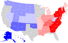
U.S. states by date of statehood:
Template:Legend inline Template:Legend inline
Template:Legend inline Template:Legend inline
Template:Legend inline Template:Legend inline
Template:Legend inline Template:Legend inline
Template:Legend inline


The order in which the original 13 states ratified the Constitution, then the order in which the others were admitted to the Union
Article IV also grants to Congress the authority to admit new states into the Union. Since the establishment of the United States in 1776, the number of states has expanded from the original 13 to 50. Each new state has been admitted on an equal footing with the existing states.[33] Article IV also forbids the creation of new states from parts of existing states without the consent of both the affected states and Congress. This caveat was designed to give Eastern states that still had Western land claims (including Georgia, North Carolina, and Virginia), to have a veto over whether their western counties could become states,[32] and has served this same function since, whenever a proposal to partition an existing state or states in order that a region within might either join another state or to create a new state has come before Congress.
Most of the states admitted to the Union after the original 13 were formed from an organized territory established and governed by Congress in accord with its plenary power under Article IV, Section 3, Clause 2.[53] The outline for this process was established by the Northwest Ordinance (1787), which predates the ratification of the Constitution. In some cases, an entire territory has become a state; in others some part of a territory has.
When the people of a territory make their desire for statehood known to the federal government, Congress may pass an enabling act authorizing the people of that territory to organize a constitutional convention to write a state constitution as a step towards admission to the Union. Each act details the mechanism by which the territory will be admitted as a state following ratification of their constitution and election of state officers. Although the use of an enabling act is a traditional historic practice, a number of territories have drafted constitutions for submission to Congress absent an enabling act and were subsequently admitted. Upon acceptance of that constitution, and upon meeting any additional Congressional stipulations, Congress has always admitted that territory as a state.
In addition to the original 13, six subsequent states were never an organized territory of the federal government, or part of one, before being admitted to the Union. Three were set off from an already existing state, two entered the Union after having been sovereign states, and one was established from unorganized territory:
- California, 1850, from land ceded to the United States by Mexico in 1848 under the terms of the Treaty of Guadalupe Hidalgo.[54][55][56]
- Kentucky, 1792, from Virginia (District of Kentucky: Fayette, Jefferson, and Lincoln counties)[54][55][57]
- Maine, 1820, from Massachusetts (District of Maine)[54][55][57]
- Texas, 1845, previously the Republic of Texas[54][55][58]
- Vermont, 1791, previously the Vermont Republic (also known as the New Hampshire Grants and claimed by New York)[54][55][59]
- West Virginia, 1863, from Virginia (Trans-Allegheny region counties) during the Civil War[55][57][60]
Congress is under no obligation to admit states, even in those areas whose population expresses a desire for statehood. Such has been the case numerous times during the nation's history. In one instance, Mormon pioneers in Salt Lake City sought to establish the state of Deseret in 1849. It existed for slightly over two years and was never approved by the United States Congress. In another, leaders of the Five Civilized Tribes (Cherokee, Chickasaw, Choctaw, Creek, and Seminole) in Indian Territory proposed to establish the state of Sequoyah in 1905, as a means to retain control of their lands.[61] The proposed constitution ultimately failed in the U.S. Congress. Instead, the Indian Territory, along with Oklahoma Territory were both incorporated into the new state of Oklahoma in 1907. The first instance occurred while the nation still operated under the Articles of Confederation. The State of Franklin existed for several years, not long after the end of the American Revolution, but was never recognized by the Confederation Congress, which ultimately recognized North Carolina's claim of sovereignty over the area. The territory comprising Franklin later became part of the Southwest Territory, and ultimately of the state of Tennessee.
Additionally, the entry of several states into the Union was delayed due to distinctive complicating factors. Among them, Michigan Territory, which petitioned Congress for statehood in 1835, was not admitted to the Union until 1837, due to a boundary dispute with the adjoining state of Ohio. The Republic of Texas requested annexation to the United States in 1837, but fears about potential conflict with Mexico delayed the admission of Texas for nine years.[62] Statehood for Kansas Territory was held up for several years (1854–61) due to a series of internal violent conflicts involving anti-slavery and pro-slavery factions. West Virginia's bid for statehood was also delayed over slavery, and was settled when it agreed to adopt a gradual abolition plan.[63]
Possible new states[]
Puerto Rico[]
Puerto Rico, an unincorporated U.S. territory, refers to itself as the "Commonwealth of Puerto Rico" in the English version of its constitution, and as "Estado Libre Asociado" (literally, Associated Free State) in the Spanish version. As with all U.S. territories, its residents do not have full representation in the United States Congress. Puerto Rico has limited representation in the U.S. House of Representatives in the form of a Resident Commissioner, a delegate with limited voting rights in the Committee of the Whole House on the State of the Union, but no voting rights otherwise.[64]
A non-binding referendum on statehood, independence, or a new option for an associated territory (different from the current status) was held on November 6, 2012. Sixty one percent (61%) of voters chose the statehood option, while one third of the ballots were submitted blank.[65][66]
On December 11, 2012, the Legislative Assembly of Puerto Rico enacted a concurrent resolution requesting the President and the Congress of the United States to respond to the referendum of the people of Puerto Rico, held on November 6, 2012, to end its current form of territorial status and to begin the process to admit Puerto Rico as a State.[67]
Another status referendum was held on June 11, 2017, in which 97% percent of voters chose statehood. Turnout was low, as only 23% of voters went to the polls, with advocates of both continued territorial status and independence urging voters to boycott it.[68]
On June 27, 2018, the H.R. 6246 Act was introduced on the U.S. House with the purpose of respond to, and comply with, the democratic will of the United States citizens residing in Puerto Rico as expressed in the plebiscites held on November 6, 2012, and June 11, 2017, by setting forth the terms for the admission of the territory of Puerto Rico as a State of the Union.[69] The act has 37 original cosponsors between Republicans and Democrats in the U.S. House of Representatives.[70]
On November 3, 2020, Puerto Rico held another referendum. In the non-binding referendum, Puerto Ricans voted in favor of becoming a state. They also voted for a pro-statehood governor, Pedro Pierluisi.[71]
Washington, D.C.[]
The intention of the Founding Fathers was that the United States capital should be at a neutral site, not giving favor to any existing state; as a result, the District of Columbia was created in 1800 to serve as the seat of government. As it is not a state, the district does not have representation in the Senate and has a non-voting delegate in the House; neither does it have a sovereign elected government. Additionally, prior to ratification of the 23rd Amendment in 1961, district citizens did not get the right to vote in Presidential elections.
Some residents of the District support statehood of some form for that jurisdiction – either statehood for the whole district or for the inhabited part, with the remainder remaining under federal jurisdiction. In November 2016, Washington, D.C. residents voted in a statehood referendum in which 86% of voters supported statehood for Washington, D.C.[72] For statehood to be achieved, it must be approved by Congress.[73]
Others[]
Other possible new states are Guam and the U.S. Virgin Islands, both of which are unincorporated organized territories of the United States. Also, either the Commonwealth of the Northern Mariana Islands or American Samoa, an unorganized, unincorporated territory, could seek statehood.
Secession from the Union[]
The Constitution is silent on the issue of whether a state can secede from the Union. Its predecessor, the Articles of Confederation, stated that the United States "shall be perpetual." The question of whether or not individual states held the unilateral right to secession was a passionately debated feature of the nations's political discourse from early in its history, and remained a difficult and divisive topic until the American Civil War. In 1860 and 1861, 11 southern states each declared secession from the United States, and joined together to form the Confederate States of America (CSA). Following the defeat of Confederate forces by Union armies in 1865, those states were brought back into the Union during the ensuing Reconstruction Era. The federal government never recognized the sovereignty of the CSA, nor the validity of the ordinances of secession adopted by the seceding states.[6][74]
Following the war, the United States Supreme Court, in Texas v. White (1869), held that states did not have the right to secede and that any act of secession was legally void. Drawing on the Preamble to the Constitution, which states that the Constitution was intended to "form a more perfect union" and speaks of the people of the United States in effect as a single body politic, as well as the language of the Articles of Confederation, the Supreme Court maintained that states did not have a right to secede. However, the court's reference in the same decision to the possibility of such changes occurring "through revolution, or through consent of the States," essentially means that this decision holds that no state has a right to unilaterally decide to leave the Union.[6][74]
Origins of states' names[]

A map showing the source languages of state names
The 50 states have taken their names from a wide variety of languages. Twenty-four state names originate from Native American languages. Of these, eight are from Algonquian languages, seven are from Siouan languages, three are from Iroquoian languages, one is from Uto-Aztecan languages and five others are from other indigenous languages. Hawaii's name is derived from the Polynesian Hawaiian language.
Of the remaining names, 22 are from European languages. Seven are from Latin (mainly Latinized forms of English names) and the rest are from English, Spanish and French. Eleven states are named after individual people, including seven named for royalty and one named after a President of the United States. The origins of six state names are unknown or disputed. Several of the states that derive their names from (corrupted) names used for Native peoples have retained the plural ending of "s".
Geography[]
Borders[]
The borders of the 13 original states were largely determined by colonial charters. Their western boundaries were subsequently modified as the states ceded their western land claims to the Federal government during the 1780s and 1790s. Many state borders beyond those of the original 13 were set by Congress as it created territories, divided them, and over time, created states within them. Territorial and new state lines often followed various geographic features (such as rivers or mountain range peaks), and were influenced by settlement or transportation patterns. At various times, national borders with territories formerly controlled by other countries (British North America, New France, New Spain including Spanish Florida, and Russian America) became institutionalized as the borders of U.S. states. In the West, relatively arbitrary straight lines following latitude and longitude often prevail, due to the sparseness of settlement west of the Mississippi River.
Once established, most state borders have, with few exceptions, been generally stable. Only two states, Missouri (Platte Purchase) and Nevada, grew appreciably after statehood. Several of the original states ceded land, over a several year period, to the Federal government, which in turn became the Northwest Territory, Southwest Territory, and Mississippi Territory. In 1791, Maryland and Virginia ceded land to create the District of Columbia (Virginia's portion was returned in 1847). In 1850, Texas ceded a large swath of land to the federal government. Additionally, Massachusetts and Virginia (on two occasions), have lost land, in each instance to form a new state.
There have been numerous other minor adjustments to state boundaries over the years due to improved surveys, resolution of ambiguous or disputed boundary definitions, or minor mutually agreed boundary adjustments for administrative convenience or other purposes.[54] Occasionally, either Congress or the U.S. Supreme Court has had to settle state border disputes. One notable example is the case New Jersey v. New York, in which New Jersey won roughly 90% of Ellis Island from New York in 1998.[75]
Regional grouping[]
States may be grouped in regions; there are many variations and possible groupings. Many are defined in law or regulations by the federal government. For example, the United States Census Bureau defines four statistical regions, with nine divisions.[76] The Census Bureau region definition is "widely used … for data collection and analysis,"[77] and is the most commonly used classification system.[78][79][80] Other multi-state regions are unofficial, and defined by geography or cultural affinity rather than by state lines.
See also[]
- Insular area
- ISO 3166-2:US
References[]
- ^ "Population, Population Change, and Estimated Components of Population Change: April 1, 2010 to July 1, 2019 (NST-EST2019-alldata)". United States Census Bureau. https://www.census.gov/data/tables/time-series/demo/popest/2010s-state-total.html.
- ^ "State Area Measurements and Internal Point Coordinates". Washington, D.C.: U.S. Census Bureau. https://www.census.gov/geo/reference/state-area.html.
- ^ Erler, Edward. "Essays on Amendment XIV: Citizenship". The Heritage Foundation. http://www.heritage.org/constitution/#!/amendments/14/essays/167/citizenship.
- ^ "Frequently Asked Questions About the Minnesota Legislature". Minnesota State Legislature. http://www.leg.state.mn.us/leg/faq/faqtoc.aspx?subject=1.
- ^ "Doctrine of the Equality of States". https://law.justia.com/constitution/us/article-4/15-doctrine-of-the-equality-of-states.html.
- ^ a b c Pavković, Aleksandar; Radan, Peter (2007). Creating New States: Theory and Practice of Secession. Ashgate Publishing. p. 222. ISBN 978-0-7546-7163-3. https://books.google.com/books?id=-IjHbPvp1W0C.
- ^ "Texas v. White 74 U.S. 700 (1868)". Mountain View, California: Justia. https://supreme.justia.com/cases/federal/us/74/700/.
- ^ a b "Delegate Discussions: The Lee Resolution(s)" (in en). Course of Human Events. Harvard Faculty of Arts and Sciences. https://declaration.fas.harvard.edu/blog/dd-lee-resolution.
- ^ "Declaration of Independence: A Transcription" (in en). 2015-11-01. https://www.archives.gov/founding-docs/declaration-transcript.
- ^ Zimmerman, Joseph F. (2012) (in en). Interstate Cooperation, Second Edition: Compacts and Administrative Agreements. SUNY Press. pp. 4–7. ISBN 9781438442365. https://books.google.com/books?id=hDQpHzSrI0QC.
- ^ Jensen, Merrill (1959). The Articles of Confederation: An Interpretation of the Social-Constitutional History of the American Revolution, 1774–1781. University of Wisconsin Press. pp. xi, 184. ISBN 978-0-299-00204-6.
- ^ Beeman, Richard R.. "The Constitutional Convention of 1787: A Revolution in Government". National Constitution Center. https://constitutioncenter.org/interactive-constitution/white-pages/the-constitutional-convention-of-1787-a-revolution-in-government.
- ^ "How the First State Constitutions helped build the Federal Constitution". Constitutional Rights Foundation. pp. 10–12. https://www.crf-usa.org/images/pdf/gates/First-States-Constitution.pdf.
- ^ "Observing Constitution Day" (in en). August 15, 2016. https://www.archives.gov/education/lessons/constitution-day/ratification.html.
- ^ Barnett, Randy E.; Gerken, Heather. "Article I, Section 8: Federalism and the overall scope of federal power". https://constitutioncenter.org/blog/article-i-section-8-federalism-and-the-overall-scope-of-federal-power/.
- ^ "10th Amendment US Constitution--Reserved Powers". https://www.govinfo.gov/content/pkg/GPO-CONAN-1992/pdf/GPO-CONAN-1992-10-11.pdf.
- ^ "Police Power". West's Encyclopedia of American Law (2 ed.). Gale Group. 2008. https://legal-dictionary.thefreedictionary.com/Police+Power. Retrieved September 10, 2019.
- ^ a b "State & Local Government". Washington, D.C.: The White House. https://www.whitehouse.gov/about-the-white-house/state-local-government/.
- ^ "Frequently Asked Questions About the Minnesota Legislature". Minnesota State Legislature. http://www.leg.state.mn.us/leg/faq/faqtoc.aspx?subject=1.
- ^ a b Salmon, Emily J.; Campbell Jr., Edward D. C., eds (1994). The Hornbook of Virginia History (4th ed.). Richmond, Virginia: Virginia Office of Graphic Communications. p. 88. ISBN 978-0-88490-177-8. http://www.lva.virginia.gov/faq/va.asp#six.
- ^ "Why is Massachusetts a Commonwealth?". Commonwealth of Massachusetts. 2016. http://www.mass.gov/anf/research-and-tech/legal-and-legislative-resources/why-is-massachusetts-a-commonwealth.html.
- ^ a b c "Separation of Powers--Executive Veto Powers". National Conference of State Legislatures. http://www.ncsl.org/research/about-state-legislatures/separation-of-powers-executive-veto-powers.aspx.
- ^ Regalado, Daniel M.. "The Texas Plural Executive". Texas Government (Chapter 4). Lumen Learning. https://courses.lumenlearning.com/odessa-texasgovernment/chapter/plural-executive/.
- ^ a b "Recall of State Officials". National Conference of State Legislatures. http://www.ncsl.org/research/elections-and-campaigns/recall-of-state-officials.aspx.
- ^ "History of the Nebraska Unicameral: The Birth of a Unicameral". Lincoln, Nebraska: Nebraska Legislature. https://nebraskalegislature.gov/about/history_unicameral.php.
- ^ "Full- and Part-time Legislatures". National Conference of State Legislatures. http://www.ncsl.org/research/about-state-legislatures/full-and-part-time-legislatures.aspx.
- ^ Wilson, Reid (August 23, 2013). "GovBeat:For legislators, salaries start at zero". Washington Post (Washington, DC): pp. A2. https://www.washingtonpost.com/blogs/govbeat/wp/2013/08/23/how-much-are-your-legislators-paid/.
- ^ "Federal vs. State Courts - Key Differences - FindLaw" (in en-US). https://litigation.findlaw.com/legal-system/federal-vs-state-courts-key-differences.html.
- ^ "Unitary system". Encyclopædia Britannica, Inc.. https://www.britannica.com/topic/unitary-system.
- ^ (1976) "The Dillon Rule -- A limit on Local Government Powers". Missouri Law Review 41 (4).
- ^ "Local Government Authority". National League of Cities. http://www.nlc.org/build-skills-and-networks/resources/cities-101/city-powers/local-government-authority.
- ^ a b Forte, David F.. "Essays on Article IV: New States Clause". The Heritage Guide to the Constitution. The Heritage Foundation. http://www.heritage.org/constitution/#!/articles/4/essays/125/new-states-clause.
- ^ a b "Doctrine of the Equality of States". http://law.justia.com/constitution/us/article-4/22-doctrine-of-equality-of-states.html.
- ^ deGolian, Crady. "Interstate Compacts: Background and History". Council on State Governments. http://knowledgecenter.csg.org/drupal/content/interstate-compacts-background-and-history.
- ^ "Hot Pursuit Law & Legal Definition". USLegal, Inc.. http://definitions.uslegal.com/h/hot-pursuit.
- ^ Adam Liptak (March 17, 2004). "Bans on Interracial Unions Offer Perspective on Gay Ones". The New York Times. https://www.nytimes.com/2004/03/17/us/bans-on-interracial-unions-offer-perspective-on-gay-ones.html?pagewanted=1.
- ^ Ernest B. Abbott; Otto J. Hetzel (2010). Homeland Security and Emergency Management: A Legal Guide for State and Local Governments. American Bar Association. p. 52. ISBN 9781604428179. https://books.google.com/books?id=crI0pYe2vmMC&pg=PA52.
- ^ Cornell University Law School. "Supremacy Clause". law.cornell.edu. https://www.law.cornell.edu/wex/supremacy_clause.
- ^ Burnham, William (2006). Introduction to the Law and Legal System of the United States, 4th ed.. St. Paul: Thomson West. p. 41.
- ^ Stanley Lewis Engerman (2000). The Cambridge economic history of the United States: the colonial era. Cambridge University Press. p. 464. ISBN 978-0-521-55307-0. https://books.google.com/books?id=6sDXBGMbrWkC.
- ^ "United States v. Darby, 312 U.S. 100 (1941)". Mountain View, California: Justia. https://supreme.justia.com/cases/federal/us/312/100/.
- ^ David Shultz (2005). Encyclopedia of the Supreme Court. Infobase Publishing. p. 522. ISBN 978-0-8160-5086-4. https://books.google.com/books?id=I_f6Oo9H3YsC.
- ^ Forte, David F.. "Essays on Article I: Commerce among the States". Heritage Guide to the Constitution. Heritage Foundation. https://www.heritage.org/constitution/#!/articles/1/essays/38/commerce-among-the-states.
- ^ "Constitution of the United States, Article I, Section 8". https://www.law.cornell.edu/constitution/articlei#section8.
- ^ Kristin D. Burnett. "Congressional Apportionment (2010 Census Briefs C2010BR-08)". U.S. Department of Commerce, Economics and Statistics Administration. https://www.census.gov/prod/cen2010/briefs/c2010br-08.pdf.
- ^ Levitt, Justin. "Who draws the lines". All About Redistricting. Los Angeles, California: University of Loyola Law School. http://redistricting.lls.edu/who.php.
- ^ Fried, Charles. "Essays on Amendment XII: Electoral College". Heritage Guide to the Constitution. Heritage Foundation. https://www.heritage.org/constitution/#!/amendments/12/essays/165/electoral-college.
- ^ "The 2016 Presidential Election: Provisions of the Constitution and United States Code". Washington, D.C.: Office of the Federal Register, U.S. National Archives and Records Administration. February 2018. p. 6. https://www.archives.gov/federal-register/electoral-college/resources/2016-presidential-election-brochure.pdf.
- ^ Whitaker, L. Paige; Neale, Thomas H. (November 5, 2004). "The Electoral College: An Overview and Analysis of Reform Proposals". Washington, D.C.: Congressional Research Service, The Library of Congress. https://digital.library.unt.edu/ark:/67531/metacrs5853/m1/1/high_res_d/RL30804_2004Nov05.pdf.
- ^ "Elections & Voting". Washington, D.C.: The White House. https://www.whitehouse.gov/about-the-white-house/elections-voting/.
- ^ "The Constitutional Amendment Process". The U.S. National Archives and Records Administration. https://www.archives.gov/federal-register/constitution/.
- ^ Wines, Michael (August 22, 2016). "Inside the Conservative Push for States to Amend the Constitution". NYT. https://www.nytimes.com/2016/08/23/us/inside-the-conservative-push-for-states-to-amend-the-constitution.html.
- ^ "Property and Territory: Powers of Congress". http://law.justia.com/constitution/us/article-4/25-methods-of-disposing-property.html.
- ^ a b c d e f Stein, Mark (2008). How the States Got Their Shapes. New York: HarperCollins. pp. xvi, 334. ISBN 9780061431395.
- ^ a b c d e f "Official Name and Status History of the several States and U.S. Territories". http://www.thegreenpapers.com/slg/statehood.phtml.
- ^ "California Admission Day September 9, 1850". California Department of Parks and Recreation. http://www.parks.ca.gov/?page_id=23856.
- ^ a b c Riccards, Michael P. (Summer 1997). "Lincoln and the Political Question: The Creation of the State of West Virginia". Presidential Studies Quarterly 27 (3).
- ^ Holt, Michael F. (200). The fate of their country: politicians, slavery extension, and the coming of the Civil War. New York: Hill and Wang. p. 15. ISBN 978-0-8090-4439-9.
- ^ "The 14th State". Vermont Historical Society. https://vermonthistory.org/explorer/vermont-stories/becoming-a-state/the-14th-state.
- ^ "A State of Convenience: The Creation of West Virginia, Chapter Twelve, Reorganized Government of Virginia Approves Separation". West Virginia Division of Culture and History. http://www.wvculture.org/history/statehood/statehood12.html.
- ^ "Museum of the Red River - The Choctaw". Museum of the Red River. 2005. http://www.museumoftheredriver.org/choctaw.html.
- ^ Winders, Richard Bruce (2002). Crisis in the Southwest: the United States, Mexico, and the Struggle over Texas. Rowman & Littlefield. pp. 82, 92. ISBN 978-0-8420-2801-1. https://books.google.com/books?id=mcc9EciebFYC.
- ^ Oakes, James Freedom National: The Destruction of Slavery in the United States, 1861–1865, W.W. Norton, 2012, pgs. 296-97
- ^ "Rules of the House of Representatives". http://www.rules.house.gov/ruleprec/110th.pdf.
- ^ "Puerto Ricans favor statehood for first time". CNN. November 7, 2012. https://www.cnn.com/2012/11/07/politics/election-puerto-rico/index.html.
- ^ "Puerto Ricans opt for statehood". Fox News. https://www.foxnews.com/politics/2012/11/07/puerto-ricans-opt-for-statehood-in-referendum/.
- ^ "The Senate and the House of Representative of Puerto Rico Concurrent Resolution". http://www.puertoricoreport.org/wp-content/uploads/2012/12/2012-concurrent-resolution.pdf.
- ^ "23% of Puerto Ricans Vote in Referendum, 97% of Them for Statehood". https://www.nytimes.com/2017/06/11/us/puerto-ricans-vote-on-the-question-of-statehood.html?_r=1.
- ^ Congress.Gov (July 7, 2018). "To enable the admission of the territory of Puerto Rico into the Union as a State, and for other purposes.". https://www.congress.gov/bill/115th-congress/house-bill/6246/text.
- ^ Congress.Gov (July 7, 2018). "Cosponsors: H.R.6246 — 115th Congress (2017–2018)". https://www.congress.gov/bill/115th-congress/house-bill/6246/cosponsors?r=12.
- ^ Santiago, Abdiel; Kustov, Alexander; Valenzuela, Ali A.. "Analysis | Puerto Ricans voted to become the 51st U.S. state — again" (in en-US). The Washington Post. ISSN 0190-8286. https://www.washingtonpost.com/politics/2020/11/13/puerto-ricans-voted-become-51st-us-state-again/.
- ^ "DC Voters Elect Gray to Council, Approve Statehood Measure". http://www.nbcwashington.com/news/local/DC-Election-Statehood-Council-Seats-400275901.html.
- ^ "How Does a Territory Become a State?". Puerto Rico Report. November 23, 2018. https://www.puertoricoreport.com/how-does-a-territory-become-a-state/.
- ^ a b "Texas v. White". Cornell Law School, Ithaca, New York: Legal Information Institute. https://www.law.cornell.edu/supremecourt/text/74/700.
- ^ Greenhouse, Linda (May 27, 1998). "The Ellis Island Verdict: The Ruling; High Court Gives New Jersey Most of Ellis Island". The New York Times. https://www.nytimes.com/1998/05/27/nyregion/ellis-island-verdict-ruling-high-court-gives-new-jersey-most-ellis-island.html?pagewanted=all&src=pm.
- ^ United States Census Bureau, Geography Division. "Census Regions and Divisions of the United States". http://www2.census.gov/geo/pdfs/maps-data/maps/reference/us_regdiv.pdf.
- ^ "The National Energy Modeling System: An Overview 2003" (Report #:DOE/EIA-0581, October 2009). United States Department of Energy, Energy Information Administration.
- ^ "The most widely used regional definitions follow those of the U.S. Bureau of the Census." Seymour Sudman and Norman M. Bradburn, Asking Questions: A Practical Guide to Questionnaire Design (1982). Jossey-Bass: p. 205.
- ^ "Perhaps the most widely used regional classification system is one developed by the U.S. Census Bureau." Dale M. Lewison, Retailing, Prentice Hall (1997): p. 384. ISBN 978-0-13-461427-4
- ^ "(M)ost demographic and food consumption data are presented in this four-region format." Pamela Goyan Kittler, Kathryn P. Sucher, Food and Culture, Cengage Learning (2008): p.475. ISBN 9780495115410
Further reading[]
- Stein, Mark, How the States Got Their Shapes, New York : Smithsonian Books/Collins, 2008. ISBN 978-0-06-143138-8
External links[]
- Information about All States from UCB Libraries GovPubs
- State Resource Guides, from the Library of Congress
- Tables with areas, populations, densities and more (in order of population)
- Tables with areas, populations, densities and more (alphabetical)
- State and Territorial Governments on USA.gov
- StateMaster – statistical database for U.S. states
- 50states.com – States and Capitals
| ||||||||||||||
| ||||||||||||||||||||||||||||||||||||||||||||||||||||||||
| |||||||||||||||||||||||||
Template:USCensus Geography
| ||||||||
| This page uses content from the English language Wikipedia. The original content was at U.S. state. The list of authors can be seen in the page history. As with this Familypedia wiki, the content of Wikipedia is available under the Creative Commons License. |