| ||||||||||||||
| Tuscaloosa County, Alabama | |
 County Courthouse in Tuscaloosa, Alabama
| |
 Location in the state of Alabama | |
 Alabama's location in the U.S. | |
| Founded | February 6, 1818[1] |
|---|---|
| Seat | Tuscaloosa |
| Largest city | Tuscaloosa |
| Area - Total - Land - Water |
1,351.23 sq mi (3,500 km²) 1,324.37 sq mi (3,430 km²) 26.85 sq mi (70 km²), 1.99% |
| Population - (2010) - Density |
194,656 147/sq mi (56.7/km²) |
| Time zone | Central: UTC-6/-5 |
| Website | www.tuscco.com |
Tuscaloosa County is a county of the U.S. state of Alabama. [1] It is named in honor of the pre-Choctaw chief Tuskaloosa.[1] As of the 2010 census, its population was 194,656.[2]
The county is the second-largest in the state in terms of area (trailing only Baldwin County) and sixth-largest in terms of population (behind Jefferson, Mobile, Madison, Montgomery,and Shelby counties).
Its seat and largest city is Tuscaloosa, the former state capital from 1826 to 1845.[1] It is also the largest county in the Tuscaloosa, Alabama, Metropolitan Statistical Area.
History
Tuscaloosa County was established on February 6, 1818. Tourist attractions include University of Alabama football, the Bear Bryant Museum, the Kentuck Art Festival, Dickens Downtown, International City Fest, and Tuscaloosa Christmas Afloat.[1]
Principal agricultural products in Tuscaloosa County have included hay, corn, cotton, soybeans, wheat and snapdragons.[1] Major companies in the county have included JVC, Mercedes-Benz USA International, Uniroyal-Goodrich, and Phifer Inc.[1]
Tornado incidents
1998
On April 8, 1998, an F3 tornado struck northeast of Tuscaloosa. This windstorm injured two people and damaged five homes including mobile homes. It rotated seventeen miles (27 km) from Holman to north of Northport. Thirty-seven homes were also in destruction. Moments later, an F5 tornado struck northeastern Tuscaloosa near the Black Warrior River before entering western Jefferson County.
2011
On April 27, 2011, Tuscaloosa was hit by a half-mile (800 m) wide tornado that resulted in at least 41 deaths, over 1000 injuries, and massive devastation.[3][4] Officials at DCH Hospital (alone) in Tuscaloosa have reported treating more than 1000 injured people in the tornado aftermath.[5] Officials also stated that "more than 50 children arrived alone" at the hospital, raising questions about the possible loss of their parents, and 30 of these children have been transferred to pediatric trauma wards, indicating serious injuries.[5] Mayor Walter Maddox was quoted saying that "We have neighborhoods that have been basically removed from the map."[6]
On April 29, President Obama, upon touring the tornado damage in Tuscaloosa, said "I have never seen devastation like this".[7]
The tornado was part of the April 25–28, 2011 tornado outbreak.
Geography
Tuscaloosa County is located in the west central part of the state, in the region commonly known as West Alabama. The county straddles the boundary between the Appalachian Highlands and the Gulf Coastal Plain and consequently boasts a diverse geography. According to the 2000 census, the county has a total area of 1,351.23 square miles (3,499.7 km2), of which 1,324.37 square miles (3,430.1 km2) (or 98.01%) is land and 26.85 square miles (69.5 km2) (or 1.99%) is water.[8]
Major highways
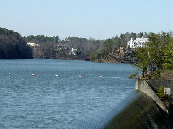

Lake Tuscaloosa
*![]()
![]() Interstate 20/Interstate 59
Interstate 20/Interstate 59
 Interstate 359
- U.S. Highway 11
- U.S. Highway 43
- U.S. Highway 82
- State Route 5
- State Route 69
- State Route 215
- State Route 216
- State Route 297
Toll Roads/Bridges
| Road Name | S/W Terminus | N/E Terminus | Length | Cash tolls (automobile) | Notes |
|---|---|---|---|---|---|
| Black Warrior Parkway | 4.9 mi. | $1.25 |
- Toll Bridge: Black Warrior Parkway Bridge
Rail
- Norfolk Southern Railway
- Amtrak
- Alabama Southern Railroad
- CSX Transportation
Adjacent counties
- Walker County (northeast)
- Jefferson County (east)
- Bibb County (southeast)
- Hale County (south)
- Greene County (southwest)
- Pickens County (west)
- Fayette County (northwest)
National protected area
- Talladega National Forest (part)
Demographics
| Historical populations | |||
|---|---|---|---|
| Census | Pop. | %± | |
| 1820 | 8,229 | ||
| 1830 | 13,646 | 65.8% | |
| 1840 | 16,583 | 21.5% | |
| 1850 | 18,056 | 8.9% | |
| 1860 | 23,200 | 28.5% | |
| 1870 | 20,081 | −13.4% | |
| 1880 | 24,957 | 24.3% | |
| 1890 | 30,352 | 21.6% | |
| 1900 | 36,147 | 19.1% | |
| 1910 | 47,559 | 31.6% | |
| 1920 | 53,680 | 12.9% | |
| 1930 | 64,153 | 19.5% | |
| 1940 | 76,036 | 18.5% | |
| 1950 | 94,092 | 23.7% | |
| 1960 | 109,047 | 15.9% | |
| 1970 | 116,029 | 6.4% | |
| 1980 | 137,541 | 18.5% | |
| 1990 | 150,522 | 9.4% | |
| 2000 | 164,875 | 9.5% | |
| 2010 | 194,656 | 18.1% | |
| Est. 2011 | 197,211 | 19.6% | |
2011 estimate through 1960 | |||
As of the census[9] of 2000, there were 164,875 people, 64,517 households, and 41,677 families residing in the county. The population density was 124 per square mile (48 persons/km2). The population core of the county lies in Tuscaloosa-Northport conurbation (including Coaling, Coker, and Holt CDP). The combined 2000 Census population of this area (not including their undesignated suburban census areas) is 103,367, accounting for 62.7% of the county in population, while only accounting for 6.9% in area. Consequently, the population density of the central population core is 1,137 persons per square mile (439 persons/km2), while the density of the county outside the central population core is only 44 persons per square mile (17 persons/km2).
There were 71,429 housing units at an average density of 54 per square mile (21/km2). The racial makeup of the county was 68.12% White, 29.31% Black or African American, 0.23% Native American, 0.92% Asian, 0.03% Pacific Islander, 0.56% from other races, and 0.82% from two or more races. Nearly 1.29% of the population were Hispanic or Latino of any race.
According to the census[9] of 2000 the largest ancestry groups in Tuscaloosa County were: 31.2% English, 29.31% African, 8.9% Irish, 7% German, 2.9% Scots-Irish and 2% Scottish.
There were 64,517 households, out of which 30.30% had children under the age of 18 living with them; 47.20% were married couples living together, 14.00% had a female householder with no husband present, and 35.40% were non-families. 28.40% of all households were made up of individuals, and 8.30% had someone living alone who was 65 years of age or older. The average household size was 2.42, and the average family size was 3.00.
In the county, the population was spread out with 23.40% under the age of 18, 16.50% from 18 to 24, 28.10% from 25 to 44, 20.80% from 45 to 64, and 11.30% who were 65 years of age or older. The median age was 32 years. For every 100 females, there were 92.80 males. For every 100 females age 18 and over, there were 89.50 males.
The median income for a household in the county was $34,436, and the median income for a family was $45,485. Males had a median income of $34,807 versus $24,128 for females. The per capita income for the county was $18,998. About 11.30% of families and 17.00% of the population were below the poverty line, including 19.50% of those under age 18 and 13.20% of those age 65 or over.
Government
Government Plaza Intermodal Facility in downtown Tuscaloosa
Tuscaloosa is served by the following elected state officials:
The current District Court Judges are:
- Judge Joel Chandler
- Judge Jim Guin
The current Circuit Court Judges in no particular order are:
- Judge W. Scott Donaldson
- Judge M. Bradley Almond, Presiding Judge
- Judge John H. England, Jr.
- Judge James H. Roberts, Jr.
- Judge Phillip N. Lisenby
- Judge Elizabeth C. Hamner
The current Clerk of the Circuit Court is Magaria H. Bobo
The current Sheriff is Edmund M. "Ted" Sexton.
The chief law enforcement officer of Tuscaloosa County, which comprises the Sixth Judicial Circuit is:
- Thomas M. Smith, District Attorney
On the federal level, Tuscaloosa County is divided between the sixth and seventh congressional districts of Alabama, represented by Spencer Bachus (R) and Terri Sewell (D), respectively. It is also in the northern federal court district of Alabama.
Politics
Tuscaloosa County voted for John McCain over Barack Obama in the 2008 Election by a margin of 58-42%.[10]
Education
The Tuscaloosa County School System serves students in the county who live outside the city limits of Tuscaloosa. The system has been in operation since 1871. The system is managed by a Board of Education, composed 7 members elected by district by the voter of the county outside the limits of the city of Tuscaloosa, and a superintendent appointed by the board to manage the day-to-day operations of the system. In school year 2005-2006, 16,318 students were enrolled by the system. There are 16 elementary schools, 7 middle schools, 5 high schools and the Tuscaloosa Regional Detention Center and Sprayberry Regional Educational Center for gifted and special needs children. Currently four new schools are scheduled to open August 2008.
The Tuscaloosa City School System serves students who live in the city of Tuscaloosa.
Constructions
The TV Alabama Tower and the WTTO Tower near Windham Springs are guyed TV masts. These are the tallest constructions in Tuscaloosa County.
Municipalities and census-designated places
note: populations are from 2000 Census unless noted
- Brookwood, 1,483
- Coaling, 1,115
- Coker, 808
- Holt, 4,103
- Lake View, 1,357
- Moundville, 229 (partial - part of Moundville is in Hale County)
- North Bibb, 0 (partial - part of North Bibb is in Bibb County)
- Northport, 23,442 (2009)
- Tuscaloosa, 93,215 (2009)
- Vance, 464 (partial - part of Vance is in Bibb County)
See also
- National Register of Historic Places listings in Tuscaloosa County, Alabama
- Properties on the Alabama Register of Landmarks and Heritage in Tuscaloosa County, Alabama
References
- ^ a b c d e f g "ACES Winston County Office" (links/history), Alabama Cooperative Extension System (ACES), 2007, webpage: ACES-Tuscaloosa.
- ^ United States Census Bureau. "2010 Census Data". United States Census Bureau. http://2010.census.gov/2010census/data/. Retrieved 12 May 2012.
- ^ "Twister Outbreak is Second Deadliest in History", MSNBC, AP News & Reuters (jointly produced article), April, 30, 2011, http://www.msnbc.msn.com/id/42834400/ns/weather/
- ^ http://blog.al.com/spotnews/2011/04/tuscaloosa_tornadoes_death_tol.html
- ^ a b Reuters, http://www.reuters.com/article/2011/04/29/us-usa-weather-children-idUSTRE73S7MU20110429
- ^ http://www.msnbc.msn.com/id/42794539/ns/weather/?gt1=43001
- ^ http://abcnews.go.com/US/president-obama-lady-tour-alabama-tornado-damage/story?id=13489876
- ^ "Census 2000 U.S. Gazetteer Files: Counties". United States Census. http://www.census.gov/tiger/tms/gazetteer/county2k.txt. Retrieved 2011-02-13.
- ^ a b "American FactFinder". United States Census Bureau. http://factfinder.census.gov. Retrieved 2008-01-31.
- ^ http://philhardwickblog.files.wordpress.com/2008/11/2008_election_map-counties.jpg
External links
- Official Tuscaloosa County Sheriff's Office Homepage
- Official City of Tuscaloosa Homepage
- Tuscaloosa County District Attorney's Office
- Chamber of Commerce of West Alabama
- Tuscaloosa Convention and Visitor's Bureau
- Tuscaloosa County Industrial Development Authority
- Tuscaloosa Public Library
- Tuscaloosa County Probate Records
- Online Tuscaloosa
- Arts Council of Tuscaloosa
- Tuscaloosa Symphony Orchestra
- Tuscaloosa County Jail Information
- Destination Tuscaloosa Magazine
- Tuscaloosa County map of roads/towns (map © 2007 Univ. of Alabama).

|
Fayette County | Walker County |
| |
| Pickens County | Jefferson County | |||
 Tuscaloosa County, Alabama | ||||
| Greene County | Hale County | Bibb County |
| |||||||||||||||||

| This page uses content from the English language Wikipedia. The original content was at Tuscaloosa County, Alabama. The list of authors can be seen in the page history. As with this Familypedia wiki, the content of Wikipedia is available under the Creative Commons License. |