| ||||||||||||||
| Tiruvannamalai district Thiruvannamalai District vadarkaadu sambhuvarayar |
|
|---|---|
| — District — | |
 |
|

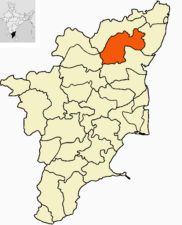
Tiruvannamalai district |
|
| Coordinates: Coordinates: | |
| Country | |
| State | Tamil Nadu |
| Region | Thirupattur seemai |
| District | Thiruvannamalai |
| Metro | |
| Headquarters | Thiruvannamalai |
| Talukas | Thiruvannamalai, Cheyyar, Arani, Chengam, Polur, Vandavasi, kalasapakkam, kilpennathur, chetpet and Thandarampattu |
| Government | |
| • Collector & District Magistrate | Anshul Mishra IAS |
| Area | |
| • District | 6,191 km2 (2,390 sq mi) |
| Area rank | 3th rank in tamilnadu |
| Population (2011)[1] | |
| • District | 3,468,965 |
| • Rank | 4th rank in tamilnadu |
| • Density | 654/km2 (1,690/sq mi) |
| • Metro | 900,761 |
| Languages | |
| • Official | Tamil |
| Time zone | IST (UTC+5:30) |
| ISO 3166 code | [[ISO 3166-2:IN|]] |
| Vehicle registration | TN-25 |
| Coastline | 0 kilometres (0 mi) |
| Largest city | Thiruvannamalai |
| Largest metro | Thiruvannamalai |
| Sex ratio | 100:995 ♂/♀ |
| Literacy | 79.33% |
| Legislature Strength | 12 |
| Lok Sabha constituency | Aarani and Thiruvannamalai |
| Precipitation | 5,646 millimetres (222.3 in) |
| Website | /www.tiruvannamalai.tn.nic.in/ |
Thiruvannaamalai District is one of the 32 districts in the state of Tamil Nadu, in South India. Thiruvannaamalai town is the district headquarters. The district is divided into 10 Taluks/ Chengam, Thiruvannaamalai, Polur, Thandarampattu, Aarani, Vandavasi, kalasapakkam, kilpennathur, chetpet and Cheyyar. Aarani is famous for silk sarees.
History[]
Thiruvannamalai is one of the most venerated places in Tamil Nadu. In ancient times, the term "Annamalai" meant an inaccessible mountain. The word "Thiru" was prefixed to signify its greatness, and coupled with the two terms, it is called Thiruvannamalai.
The temple town of Thiruvannamalai is one of the most ancient heritage sites of India and is a centre of the Saiva religion. The Arunachala hill and its environs have been held in great regard by the Tamils for centuries. The temple is grand in conception and architecture and is rich in tradition, history and festivals. The main Deepam festival attracts devotees from far and wide throughout South India. It has historic places besides Thiruvannamalai, Arni, Vandavasi, Devikapuram connected to East India and French companies. In the late Chola period this district was ruled by the Cholan of Sambuvarayar having Padavedu near Arni as HQ. We can now find the fort and note along with a Shiva temple namely Kailasanathar in Arni town.
After independence Thiruvannamalai was under North Arcot District. The civil district of North Arcot was divided into Vellore district and Thiruvannamalai District in October 1989. Thiru. P.Kolappan IAS was the first Collector of Tiruvannamalai District. On the whole Thiruvannamalai is traditionally rich in Historic and spiritual values but lacks in industrial growth.
Demographics[]
According to the 2011 census Tiruvannamalai district has a population of 3,468,965,[2] roughly equal to the nation of Kuwait[3] or the US state of Nevada.[4] This gives it a ranking of 92nd in India (out of a total of 640).[2] The district has a population density of 654 inhabitants per square kilometre (1,690 /sq mi) .[2] Its population growth rate over the decade 2001-2011 was 12.94%.[2] Tiruvannamalai has a sex ratio of 993 females for every 1000 males,[2] and a literacy rate of 79.33%.[2]
It is 29.33% urbanised. [1]. It has a literacy of 79.33%, one of the lowest in the state. Thiruvannaamalai District has an area of 6,191 km². It is bounded on the north by Vellore District, on the east by Kanchipuram District, on the south by Villupuram District, and on the west by Dharmapuri and Krishnagiri districts. The Thiruvannamalai district is divided into ten taluks, 27 blocks and 1,061 villages covering an area of 631,205 ha. The ten taluks of Tiruvannamalai are listed below:
| Taluk | Headquarters | Area | Population (2011) |
Pop density | |
|---|---|---|---|---|---|
| 1 | Polur | Polur | 819 km³ | 496,481 | 606 /km² |
| 2 | Thiruvannamalai-Urban | Thiruvannamalai | 102 km² | 285,087 | 2,795 /km² |
| 3 | Thiruvannamalai-suburban | kizh-Pennathur | 622 km² | 387,578 | 623 /km² |
| 4 | Thiruvannamalai-Rural | Thandarampattu(jun.-dec.) | 691 km² | 390,880 | 566 /km² |
| 5 | Arani | Arani | 527 km² | 299,900 | 569 /km² |
| 6 | Cheyyar | tiruvethipuram | 634 km² | 350,367 | 553 /km² |
| 7 | Kalasapakkam | kalasapakkam | 532 km² | 292,013 | 549 /km² |
| 8 | Javadhi hills | Jamunamarathoor | 645 km² | 178,897 | 277 /km² |
| 9 | Vandhavashee | Vandavasi | 645 km² | 381,174 | 591 /km² |
| 10 | Chengam | chengam | 682 km² | 396,588 | 582 /km² |
List of cities having population of one lakh and above as per 2011 Census:[5]
| City | Population | City | Population | ||
|---|---|---|---|---|---|
| 1 | Tiruvannamalai | 380.543 | 9 | Gandhinagar-Lakshmipuram | 45.571 |
| 2 | Arani | 123.783 | 10 | Kalambur | 31.751 |
| 3 | Vandavasi | 116.452 | 11 | Vettavalam | 28.059 |
| 4 | Polur | 101.420 | 12 | Pudupalayam | 25.374 |
| 5 | Tiruvethipuram | 87.901 | 13 | Thyagi Annamalai Nagar | 24.329 |
| 6 | Chengam | 74.901 | 14 | Peranamallur | 22.619 |
| 7 | Chettupattu | 59.580 | 15 | Adamangalam-Pudur | 21.75 |
| 8 | kalasapakkam | 46.910 | 16 | Kizh-Pennathur | 21.308 |
The average annual rainfall of the study area is 987 mm, out of which 80 percent is received during monsoon. The soils of the study area have an Ustic moisture regime and Hyperthermic temperature regime. The Thiruvannamalai district comes under the Eastern Ghats (TN uplands) and Deccan pleateau, hot semiarid region with red loamy soil with cropping period of 90 to 150 days. Excepting hills, the district falls in the North Eastern agro climatic zone of Tamil Nadu. The average annual rainfall of the study area is 987.4 mm, out of which 80 percent is received during monsoon. The soils of the study area have an Ustic moisture regime and Hyperthermic temperature regime.
| Religion | Population | Literacy Rate | Sex Ratio |
|---|---|---|---|
| Hindus | 3,316,962 (92.76%) | 91.88% | 997 |
| Jains | 150,771 (3.09%) | 76.88% | 996 |
| Christians | 102,477 (2.95%) | 78.60% | 1070 |
| Muslims & Others | 77,107 (1.02%) | 71.23% | 823 |
It is one of the district in Tamil Nadu having lowest Muslim population having 47,000 peoples of Muslim.
Economy[]
In 2006 the Ministry of Panchayati Raj named Tiruvannamalai one of the country's 250 most backward districts (out of a total of 640).[6] It is one of the six districts in Tamil Nadu currently receiving funds from the Backward Regions Grant Fund Programme (BRGF).[6]
Agriculture[]
Thiruvannamalai District is known for its two major businesses, agriculture and silk saree weaving. Rice cultivation and processing is one of the biggest businesses in this district. 112013 hectares of paddy cultivation is irrigated by 1965 lakes and 18 reservoirs and small dams. It has 18 regulated markets through which the farmers sell their agri products directly to the government. Through these regulated markets, 271411 metric tonnes of paddy harvested in 2007. There are lot of rice mills to process paddy found throughout the district. The modern rice mill near Cheyyar is the biggest government owned mill and Aarani has around 278 rice mills. Kalambur is known for a variety of rice called Kalambur Ponni rice.
Silk Weaving[]
The district has a large populace of weavers from Sengunthar caste, who specialize in making Silk sarees. Hand looms are often engaged for weaving, although recently some have turned to mechanized methods of using Power looms. Arni is the most important revenue earning town in the district. Though the town is not popular off the state, a bulk of India's Silk apparels is produced by the people of Arni.
Industrialization[]
The district started to industrialize following the establishment of the industrial complex near Cheyyar by the State Industries Promotion Corporation of Tamil Nadu (SIPCOT).[7] This is evidenced by the recent announcements of a 250-acre (1.01 km2) hi-tech Special Economic Zone for automative components, a 300-acre (1.2 km2) electronics hardware park and the commitment from the Taiwanese Shoe Company to set up its unit.[8] On Nov, 2009 Tamil Nadu cabinet approved the Mahindara & Mahindra's Rs 1800 core automobile project in 450 acrs. This unit will produce tractors, SUVs and commercial vehicles and auto parts.[9] Aluminum die cast unit by Ashley Alteams, a joint venture by Ashok Leyland and Finland-based Alteams Oy started its production on Jan, 2010.[10] This High pressure die cast will maanufacture automobile and telecommunication components with initial capacity of 7000 ton per year.[11] One of the largest sugar mills in the country - Cheyyar co-operative sugars - is situated near Cheyyar.
factories[]
Being thiruvannamalai district has its capital at thiruvannamalai city, there is lot of factories at around thiruvannamalai . scent factories are large in number due to high production of flower around thiruvannamalai.they are listed as follows.1.Hindusthan house hold factories,2.Sarala birla factoriy of aroma oil 3.parthiban iyer cottage oil factory. our Tamil Nadu government is palnning for a SIPCOT at naidumangalam and kilpennathur both near thiruvannamalai.
Tourism[]
Thiruvannamalai District is known for everlasting peace and divine with the proud possession of the holy shrine of Lord Arunachaleswara and Ashrams. It is considered superior to all the other eminent shrines. Thiruvannamalai confers salvation to one who merely thinks of it.
Sri Seshadri Swamigal Ashram: Mahan Sri Seshadri Swamigal lived in the late 20th Century. Sri Seshadri Swamigal Ashram is one of the holy places in this Thiruvannamalai. People from all over the world visit this Ashram, which is situated near the Sri Ramana Ashram. The Garden in this Ashram attracts the people who visit here.
Sri Ramana Ashram: Mahan Sri Ramana Maharshi lived in Thiruvannamalai town. Sri Ramana Ashram is one the holy places in this town. People from all over the world visit his Ashram. He attained mukhti in the year 1950.
Yogi Ram Surathkumar Ashram: Yogi Ram Surathkumar Ashram, also known as Visiri Samiyar Ashram, is one of the beautiful place in our Town. It is situated near the Ramana Ashram. Devotees from all over the world visit Yogi Ram Surathkumar Ashram. He attained mukthi in the year of 2000.

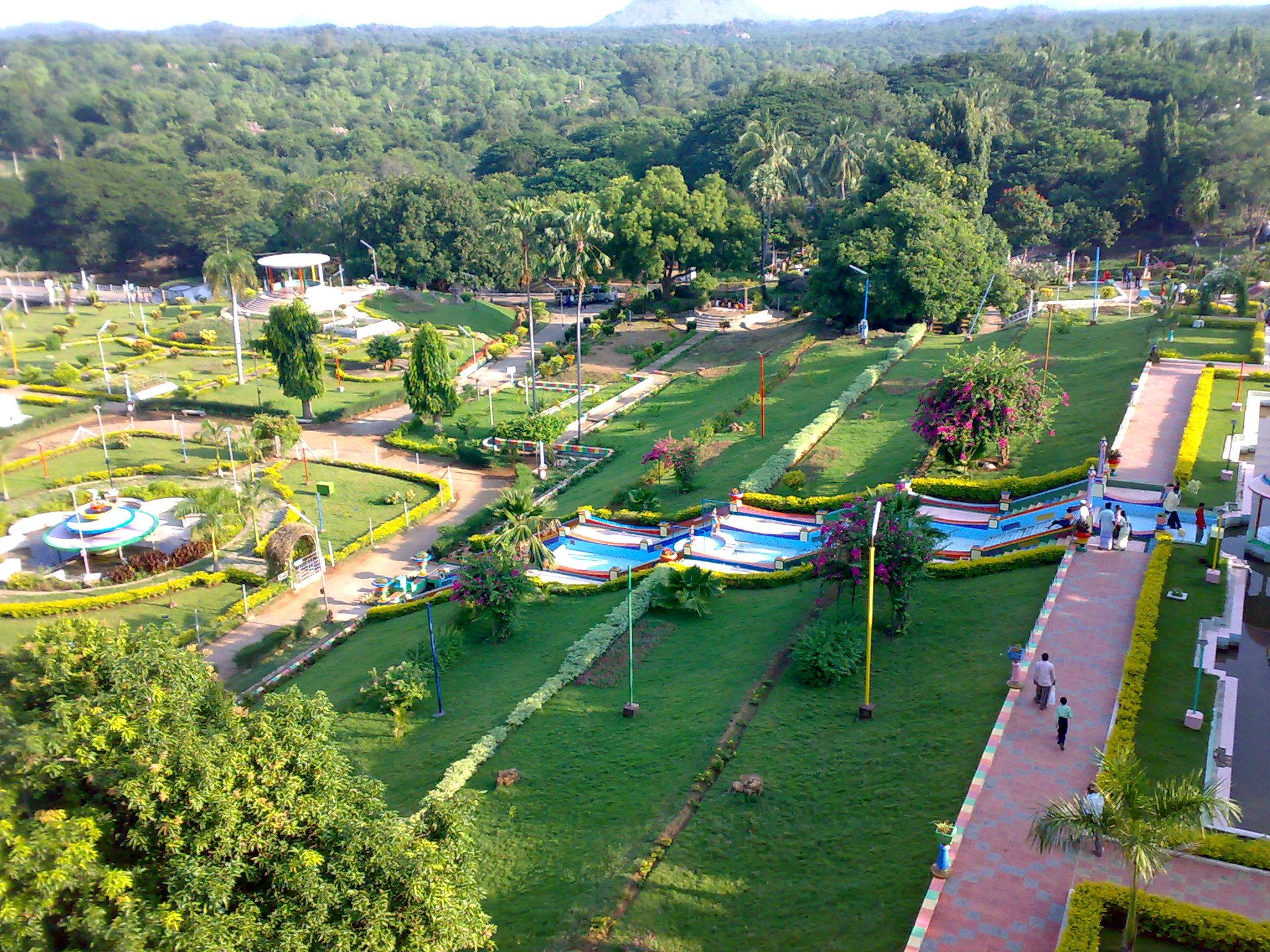
Sathanur Dam Park
Sathanur Dam: Sathanur dam is one of the major dam constructed across Pennaiyar River among Chennakesava Hills. This Dam was constructed during the year 1958. It has beautiful parks and a mini zoo. The garden is dotted with colourful statues. There is a swimming pool and a crocodile farm.
Jawadhu Hills is situated 75 km from Thiruvannamalai. The cliffs and precipices of hills allure and excite tourists. Places of interest in the Jawadhu hills are Beema Falls, Komutteri Lake, Kavalur Observatory, Amirthi Forest, and the Glass House.
Devikapuram is situated 50 km from Thiruvannamalai. Here 600 years old Sri Periyanayagi amman Temple (Second biggest temple in Tiruvannamalai district) and Sri Kanagagiri Hill temple is famous for devotees all over Tamil Nadu.
Arahanthgiri Jain Math[]
Arahanthgiri Jain Math is a Jain Math that was established at this ancient Jain site in August, 1998.[12] The complex includes 3 Jain caves, 4 Jain temples and a 16 meter high sculpture of Neminatha thought to date from the 12th century that is the tallest Jain image in Tamil Nadu.
References[]
- ^ "2011 Census of India" (Excel). Indian government. 16 April 2011. http://www.censusindia.gov.in/2011-prov-results/prov_data_products_tamilnadu.html.
- ^ a b c d e f "District Census 2011". Census2011.co.in. 2011. http://www.census2011.co.in/district.php. Retrieved 2011-09-30.
- ^ US Directorate of Intelligence. "Country Comparison:Population". https://www.cia.gov/library/publications/the-world-factbook/rankorder/2119rank.html. Retrieved 2011-10-01. "Kuwait 2,595,62"
- ^ "2010 Resident Population Data". U. S. Census Bureau. http://2010.census.gov/2010census/data/apportionment-pop-text.php. Retrieved 2011-09-30. "Nevada 2,700,551"
- ^ Census of India 2011: Provisional Population Totals. Cities having population 1 lakh and above.
- ^ a b Ministry of Panchayati Raj (September 8, 2009). "A Note on the Backward Regions Grant Fund Programme". National Institute of Rural Development. http://www.nird.org.in/brgf/doc/brgf_BackgroundNote.pdf. Retrieved September 27, 2011.
- ^ "SIPCOT.com website". http://www.sipcot.com/Industrial_complex_Cheyyar.htm. Retrieved 2008-08-01.
- ^ "TN setting up electronic hardware park". Business Line. http://www.thehindubusinessline.com/2007/07/28/stories/2007072852722300.htm. Retrieved 2008-08-01.
- ^ "TN clears M&M's 1800 cr auto project near Chennai". The Times Of India. 2009-11-12. http://economictimes.indiatimes.com/News/News-By-Industry/Auto/Automobiles/TN-clears-MMs-1800-cr-auto-project-near-Chennai/articleshow/5224094.cms.
- ^ Jagannathan, K. T. (20 January 2010). "Ashley Atleams plant inaugurated at Cheyyar". The Hindu (Chennai, India). http://beta.thehindu.com/business/article83290.ece.
- ^ http://machinist.in/index.php?option=com_content&task=view&id=2554&Itemid=2
- ^ "Arihantagiri - Tirumalai". http://www.jainheritagecentres.com/index.php/donations/to-jain-tirths/111-arihantagiri-tirumalai. Retrieved April 10, 2012.

|
Krishnagiri district, Bangalore district,karnataka | Vellore district, Chittor district,andhra pradesh | Chennai district |
|
| Dharmapuri district | Kanchipuram district | |||
 Tiruvannamalai district | ||||
| salem district,tamilnadu | Viluppuram district | Cuddalore district |
Template:Tiruvannamalai district
| ||||||||||||||||||||||||||||||||||||||||
| This page uses content from the English language Wikipedia. The original content was at Tiruvannamalai district. The list of authors can be seen in the page history. As with this Familypedia wiki, the content of Wikipedia is available under the Creative Commons License. |