| ||||||||||||||
| Thanjavur district தஞ்சாவூர் மாவட்டம் |
|
|---|---|
| — District — | |
 |
|
 |
|

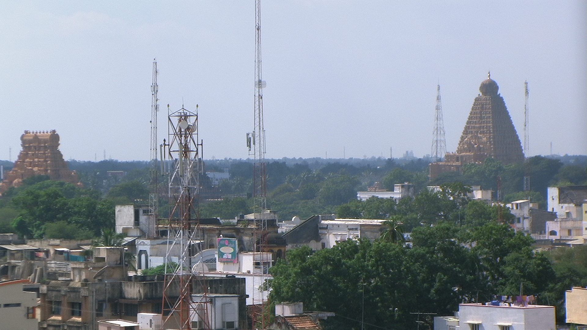
Thanjavur district |
|
| Coordinates: Coordinates: | |
| Country | |
| State | Tamil Nadu |
| Metro | |
| Municipal Corporations | Thanjavur |
| Municipalities | |
| Town Panchayats | |
| Headquarters | Thanjavur |
| Talukas | Kumbakonam, Orathanadu, Papanasam, Pattukkottai, Peravurani, Thanjavur, Thiruvaiyaru, Thiruvidaimarudur. |
| Government | |
| • Collector | K. Baskaran , IAS |
| Time zone | IST (UTC+5:30) |
| PIN | 613xxx |
| Telephone code | 04362 |
| ISO 3166 code | [[ISO 3166-2:IN|]] |
| Vehicle registration | TN-49,TN-68[1] |
| IUCN category | |
| Central location: | |
| Website | thanjavur.nic.in |
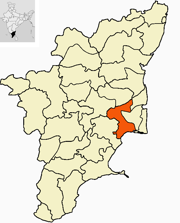
Thanjavur District is one of the 32 districts of the state of Tamil Nadu, in southeastern India. Its headquarters is Thanjavur.
Geography[]
The district is located at in Central Tamil Nadu bounded on the northeast by Nagapattinam District, on the east by Tiruvarur District, on the south by the Palk Strait, of Bay of Bengal on the west by Pudukkottai District, and on the north by the river Kollidam, across which lie Tiruchirappalli and Perambalur districts.
Demographics[]
According to the 2011 census Thanjavur district has a population of 2,402,781,[2] roughly equal to the nation of Kuwait[3] or the US state of New Mexico.[4] This gives it a ranking of 185th in India (out of a total of 640).[2] The district has a population density of 691 inhabitants per square kilometre (1,790 /sq mi) .[2] Its population growth rate over the decade 2001-2011 was 8.42%.[2] Thanjavur has a sex ratio of 1031 females for every 1000 males,[2] and a literacy rate of 82.72%.[2]
| Rank | Taluk | Pop. | |||||||
|---|---|---|---|---|---|---|---|---|---|
 Thanjavur  Kumbakonam |
1 | Thanjavur | Thanjavur taluk | 290,724 | |||||
| 2 | Kumbakonam | Kumbakonam taluk | 167,098 | ||||||
| 3 | Pattukkottai | Pattukkottai taluk | 65,553 | ||||||
| 4 | Adiramapattinam | Patukkottai taluk | 27,657 | ||||||
| 5 | Peravurani | Peravurani taluk | 21,035 | ||||||
| 6 | Papanasam | Papanasam taluk | 16,397 | ||||||
| 7 | Madukkur | Pattukkottai taluk | 15,436 | ||||||
| 8 | Thiruvaiyaru | Thiruvaiyaru taluk | 14,535 | ||||||
| 9 | Vallam | Thanjavur taluk | 14,495 | ||||||
| 10 | Ayyampettai (Thanjavur district) | Papanasam taluk | 14,202 | ||||||
Economy[]
Agriculture[]


Agriculture is the main occupation of people in Thanjavur district
This district lies at the Kaveri delta region, the most fertile region in the state.[5] The district is the main rice producing region in the state and hence known as the Rice Bowl of Tamil Nadu.[6] Kaveri River and its tributaries irrigate the district. Apart from paddy, farmers here grow coconut and sugarcane and it is the largest producer of coconut in Tamil Nadu.
Tourism[]
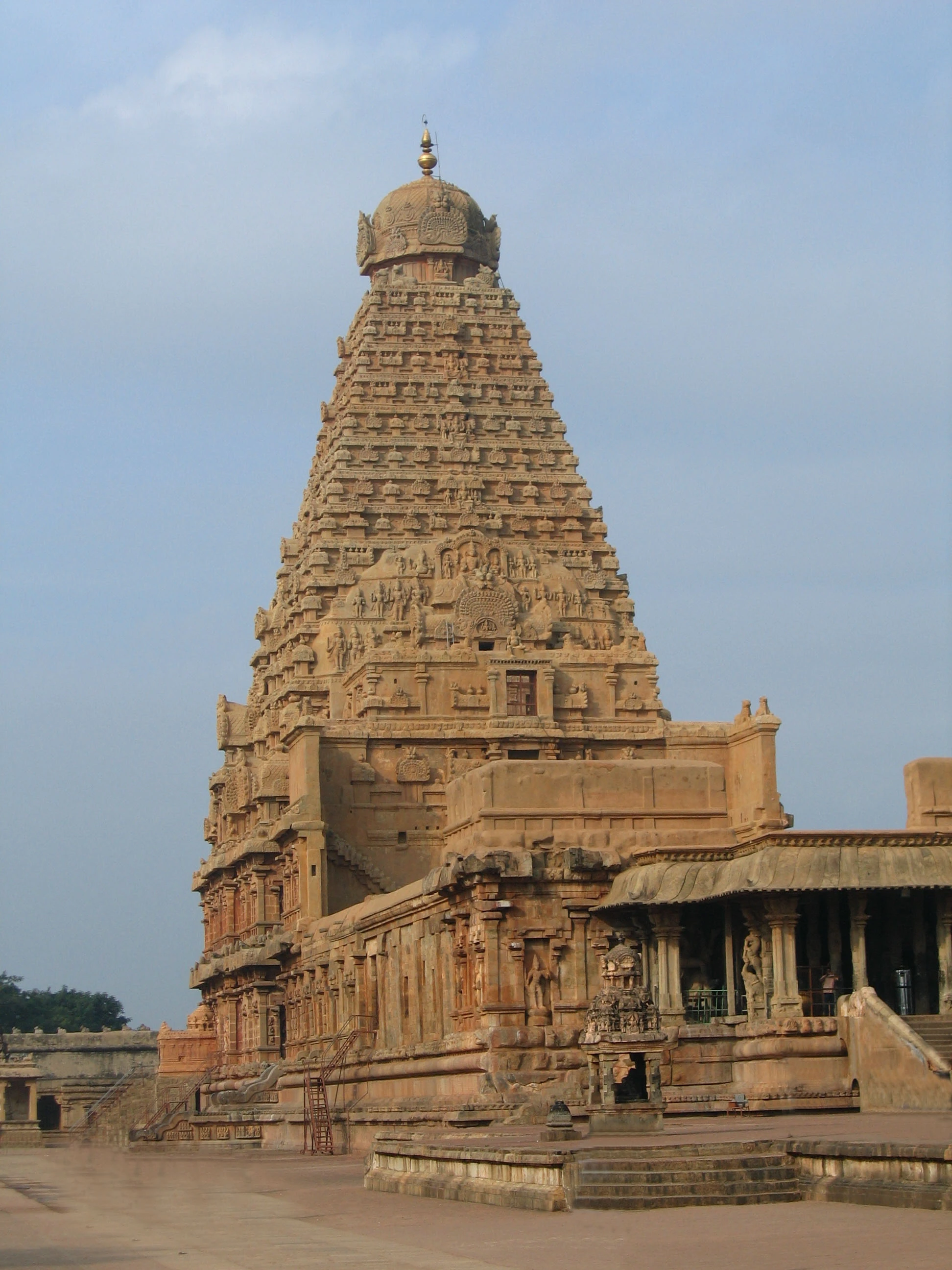
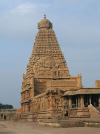
The Brihadeeswara Temple at Thanjavur
Brihadeeswara Temple, built by the Cholas and a UNESCO World Heritage Site is located at Thanjavur. The green paddy fields and the Kaveri river provide for picturesque spots in the district. Airavateswara temple near Kumbakonam is also a UNESCO declared World Heritage site and another major tourist attraction in the district.
Flora[]
Thanjavur flora were explored and studied by Dr. Ragupathy in 1992.[7]
See also[]
- Thanjavur
- Chola Nadu
- Kumbakonam
- Temples of Kumbakonam
References[]
- ^ www.tn.gov.in
- ^ a b c d e f "District Census 2011". Census2011.co.in. 2011. http://www.census2011.co.in/district.php. Retrieved 2011-09-30.
- ^ US Directorate of Intelligence. "Country Comparison:Population". https://www.cia.gov/library/publications/the-world-factbook/rankorder/2119rank.html. Retrieved 2011-10-01. "Kuwait 2,595,62"
- ^ "2010 Resident Population Data". U. S. Census Bureau. http://2010.census.gov/2010census/data/apportionment-pop-text.php. Retrieved 2011-09-30. "New Mexico - 2,059,179"
- ^ http://drought.unl.edu/pubs/dnn/arch9.pdf
- ^ "Thanjavur". http://www.thanjavur.tn.nic.in/.
- ^ Ragupathy, S. Flora of Thanjavur District. Ph.D. thesis. Centre for Advanced Study in Botany. Madras, India, University of Madras 550 pp. 1992.
External links[]
- Thanjavur City Population
- Kumbakonam City Population
- Thanjavur District Development Authority
- the famous Sri Akshayapureeswarar Temple,Vilangulam & Post, Peravurani Taluk, Thanjavur Dist
- http://www.thamarankottai.com
- http://www.kasangadu.com/
- http://www.moothakurichi.com/
- Villages of Thanjavur District
- Thanjavur District
- Thanjavur
- AllLocale.com Website for every neighbourhood in Tamil Nadu and Thanjavur

|
Tiruchirappalli district | Ariyalur district | Nagapattinam district |
|
| Pudukkottai district | Thiruvarur district | |||
 Thanjavur district | ||||
| Palk Strait |
| ||||||||||||||||||||||||||||||||||||||||
Template:Thanjavur district
| This page uses content from the English language Wikipedia. The original content was at Thanjavur district. The list of authors can be seen in the page history. As with this Familypedia wiki, the content of Wikipedia is available under the Creative Commons License. |