| Main | Births etc |
|---|
| Surrey | |
|---|---|
| File:Surreyflag.gif Flag | |
| Motto of County Council: Making Surrey a better place | |

| |
| Geography | |
| Status | Ceremonial and non-metropolitan county |
| Origin | Historic |
| Region | South East England |
| Area - Total - Admin. council |
Ranked 35th 1,663 km2 (642 sq mi) Ranked 25th |
| Admin HQ | Kingston upon Thames (extraterritorially) |
| ISO 3166-2 | GB-SRY |
| ONS code | 43 |
| NUTS 3 | UKJ23 |
| Demography | |
| Population - Total (2006 est.) - Density - Admin. council |
Ranked 12th 1,135,500 683 /km2 (1,770 /sq mi) Ranked 5th
|
| Ethnicity | 95.0% White 2.2% S. Asian |
| Politics | |
| File:SurreyCC.png http://www.surreycc.gov.uk/ | |
| Executive | Conservative
|
| Members of Parliament |
|
| Districts | |
| |
Surrey /ˈsʌri/ is a county in the South East of England, and one of the home counties. The county borders Greater London, Kent, East Sussex, West Sussex, Hampshire, and Berkshire, and its historic county town is Guildford.[1] Surrey County Council sits extraterritorially at Kingston upon Thames, as Kingston has been part of Greater London since 1965. The London boroughs of Lambeth, Wandsworth and Southwark were considered part of Surrey until 1889; and Croydon, Kingston, Merton, Sutton, Barnes and Richmond - all now reclassified as Greater London - were formerly part of Surrey until 1965.
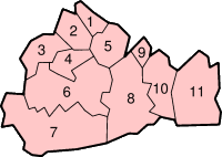
Today's Surrey is divided into 11 boroughs and districts: Elmbridge, Epsom and Ewell, Guildford, Mole Valley, Reigate and Banstead, Runnymede, Spelthorne, Surrey Heath, Tandridge, Waverley and Woking. Services such as roads, mineral extraction licensing, education, strategic waste and recycling infrastructure, births marriages and deaths registration, aspects of health services and most social and children's services are within the remit of Surrey County Council.
Geography[]
Box Hill
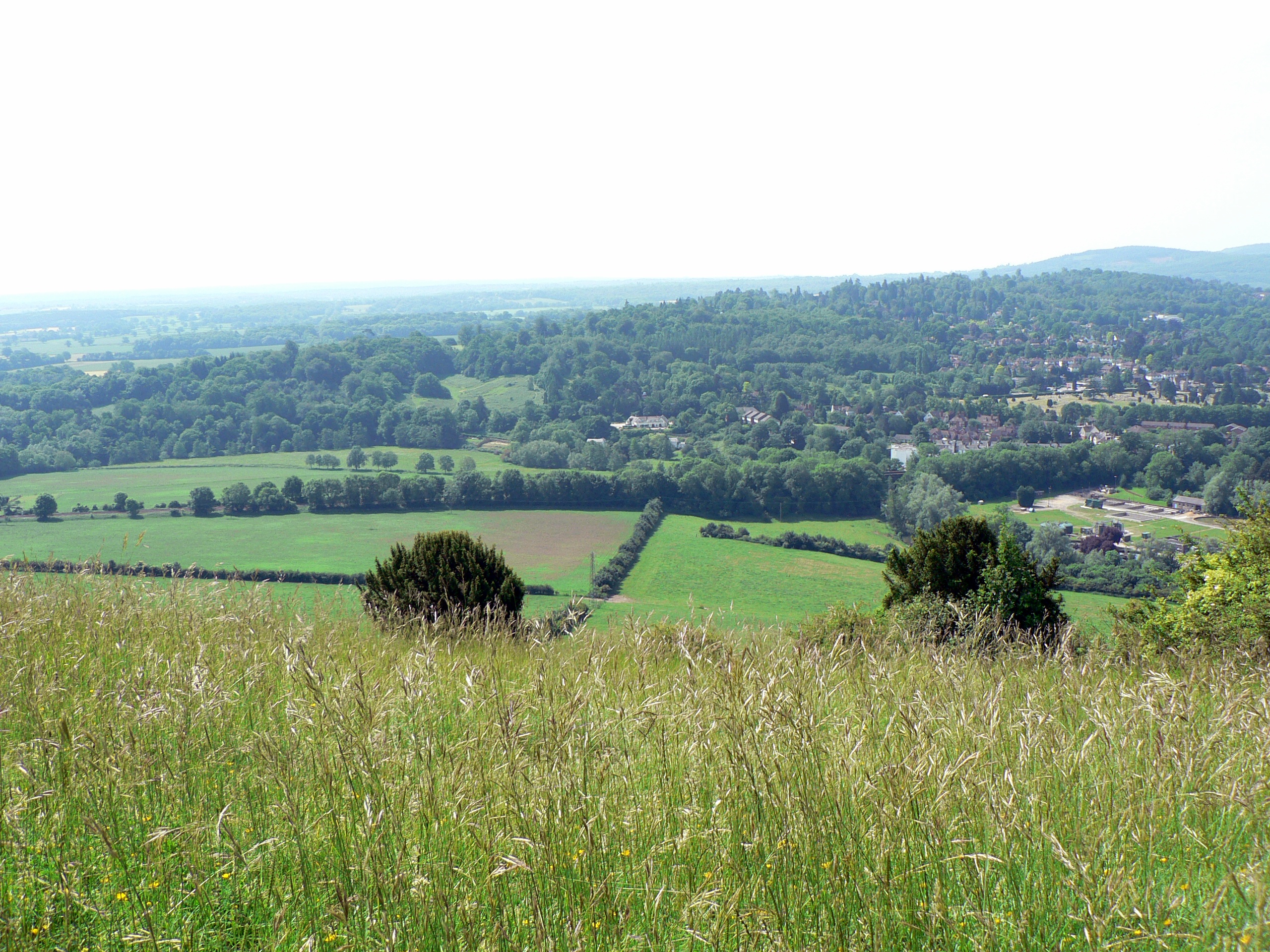
Surrey is divided in two by the chalk ridge of the North Downs, running east-west. The ridge is pierced by Surrey's rivers, the Wey and the Mole, which are tributaries of the Thames, the river which constituted the northern border of the county before the late 19th century. The River Bourne, a tributary west of the Thames from near Ascot, Berkshire and Hogsmill River, east of the Thames from Ewell, Surrey feed into the southern meander of the Thames, a part of which crosses Surrey.
Geology[]
Towards the beginning of the Cretaceous age (65-140 million years ago) Surrey alternated between a fresh-to-brackish water embayment depositing Hastings Beds (and Weald Clay comprising shales and mudstones that are often finely banded). Offshore muds (now shales and mudstones) of the Atherfield Clay were deposited followed by shallow marine sands of the Hythe, Sandgate and Folkestone Beds. Where not eroded to lower heights, there is then a marine layer of the sands of the Hythe Beds topped by chert seen on today's remaining Greensand Hills. Instead of the mudstone and sandstone-producing three beds mentioned before Hythe Beds, west of Dorking the marine Bargate Beds made of calcareous (chalk and limestone-rich) sandstone were deposited. The Folkestone Beds contain phosphatic and iron-rich nodules, which locally yield a rich fossil fauna of marine shells.
Then under even deeper seas, Gault Clay and the Upper Greensand were deposited. The Gault Clay contains phosphate-rich nodules in discrete bands and has a rich marine fauna with abundant ammonites, bivalves and gastropods. The Upper Greensand comprises a variety of sediments with fine silts at the base giving way upwards into sandstones.
90 million years ago the North Downs hard chalk was deposited, a white limestone comprising over 95% calcium carbonate. It contains thin beds of marl and nodules of flint, either scattered or in bands. The North Downs extending from Farnham to Dover, Kent are formed by this chalk. They now have an often white, almost vertical south-facing slope.[2]
Just before the paleogene which included the mass-extinction event of the non-avian dinosaurs sea levels dropped, exposing Sussex and Kent, with marine Upnor Beds deposited in Surrey. In the paleogene, Southern England slightly rose and the seas retreated and reddish and mottled clays of the Reading Beds were deposited by a large river sand delta system. Later, a rise in sea level, around 50 million years ago caused widespread deposition, until 2 million years ago, of the London Clay across the County. The London Clay is a bluish-grey marine clay with isolated pockets of fossils especially where chalkier. The youngest part of the London Clay is known as the Claygate Beds and occurs widely in Surrey. This even sandier material represent a transition between the deeper water London Clay and the succeeding shallower water, possibly estuarine, Bagshot Sand.[2]
Major climate changes in Britain causing sea level changes in the last 2.58 million years, with mini Ice Ages, the ice sheets did not extend to Surrey but sand and gravel deposits swept towards the fledgling River Thames were spread in all lower parts. Gravel terraces at various heights on the valley sides are the remnants of successive floodplains, the highest terrace being the oldest and the lowest the youngest. The most prominent terraces mark the former levels of the Thames in north Surrey. Along tributary slopes, a deposit, head, forms the main sediment of latest age. Head comprises angular pieces of rock and soil derived locally from the extensive frost-shattering of rocks and the subsequent movement of this material down valley slopes. Large areas of clay-with-flints, derived from the weathering of material overlying the present day chalk, occur across the North Downs. One particular suite of sediments that occur in the Guildford vale is known as the Headley Formation and comprises gravel and sand on top of the chalk. These sediments contain marine fossils and were probably derived from erosion of the Greensand and Tertiary rocks during the paleogene.[2]
The above describes the various many types of the sedimentary rocks of the Cretaceous and Tertiary age in their more modern nomenclature that covered the whole county and in terms of a still visible structure, makes up the Wealden anticline that covers the mostpart of the county.[2]
Soils[]
The northeast of the county, such as the north of Tandridge (district), is in the wide part of the North Downs. Thus from the east, Tatsfield has two western pockets of slightly acid, loamy soils with free drainage otherwise has the expected shallow, lime-rich soil over chalk or limestone of the escarpment with lower parts of the escarpment summit here, where that topsoil has eroded, having slightly acid, loamy and clayey soils with impeded drainage soil. Westward, the shallow lime is found all the way along the North Downs to the western border, past Guildford only a few hundred metres narrow to Farnham Castle and even Dippenhall, the latter accompaniment is found on both sides only to Buckland, well before Dorking. A horseshoe of land including the rise north of Godstone of Godstone Hill that leads to the escarpment is free draining lime-rich loamy soil (i.e. alkaline). Continuing with the Downs, we can see that the far northern type soil slopes such as near Croydon come across the Surrey border at Banstead and Ewell, which is free draining, slightly acid but base-rich soils, producing extremely fertile pastures and deciduous woodland, which becomes the edging for both sides of the high escarpment at Box Hill and is just found for a brief while in a middle section in Polesden Lacey then throughout the northern slope carrying on westward. Chipstead, Banstead and Tadworth have the first free draining slightly acid loamy soil that tops the wider downs to Guildford and is found around Dorking and the across the Vale of Holmesdale north of the Greensand Hills.
Equally it is this topsoil north of the Thames across Spelthorne (such as around Ashford) and west of the Thames in the east of Runnymede (such as around Thorpe): here the land is flat flood plain, mostly silt mixed with lime-rich London Clay.[3]
Between the Thames and the North Downs the land is overall slightly lower than south of the Downs but is less in the current flood plain, drained by the tributaries mentioned. There is more loam persisting the further from the alluvial plain of the Thames and tributaries; from the southbank at Thames Ditton (near Hampton Court southwest to Ripley, Send and Old Woking is still more free draining slightly acid loamy soil. Impeded drainage but rarely waterlogged soil features in Addlestone, north Knaphill and around Perry Hill, Worplesdon while Chobham lies in loamy soils with naturally high groundwater producing wet acid meadow and woodland edged by streamside fen/peat marshy brooklands.[3]
Heath: in Esher, Oxshott, Weybridge, Wisley, all around Woking, Brookwood, Deepcut, Pirbright, Frimley, Lightwater, Camberley, Chobham Common, Virginia Water and Ottershaw is naturally wet, very acid sandy and loamy soil which is just 1.9% of English soil and 0.2% of Welsh soil, which gives rise to pines and coniferous landscapes, such as pioneered at Wentworth and Foxhills estate (now spa, hotel, restaurant and golf club) by pro-American Independence statesman Charles James Fox.[3]
South, but not beyond the North Downs and to the south of the Greensand Ridge is slowly permeable loamy/clayey slightly acid but base-rich soil forming a 3 miles (4.8 km)-4 miles (6.4 km) wide band from Ewell and Claygate through Leatherhead, Little Bookham, the north side of Guildford to Farnham, whereas South of the Greensand is some 20–15 miles thick (with some areas of free then poor drainage around East Grinstead/Felbridge).[3] The Greensand ridge itself has the heath soil above and zones of slightly acid only freely draining sandy soils, which make those areas more densely wooded such as Thursley, Brook, Churt, Seale, Runfold and Puttenham.
Vegetation and Woodland[]
Flora naturally present from west to east comprise mixed woodland and meadow; continuing where the band of loam continues to Farnham, but between this and the river floodplain, replaced by silver birch, ferns, temperate coniferous forest on the peat and purer Bagshot Sands covered now by acid heathland increasingly moving west, rising to gentle hills. In this band are the well-maintained sites of biodiversity and woodland such as managed by Surrey Wildlife Trust as well as government and groups who help to manage Chobham and Horsell commons,[4] St Anne's Hill, Fetcham and Weyside meadows (Ripley or Burpham water meadows), Esher and Oxshott Commons and Princes Coverts (Stoke Wood and Great Oaks) west of the Chessington outspur of Greater London, east of this, wooded Epsom with Ashtead Commons and Banstead Common and Downs.
The Downs themselves are much wider in the northeast than in the narrow band in the west of the county.
To the south of the Downs is the Vale of Holmesdale with its many streams providing a very fertile but narrow plain then a variable thickness band of the Greensand, a soft muddy sandstone that when unoxidized contains green glauconite forming the southern Surrey Hills, also known as the very wooded Greensand Ridge, that extends into Kent, while south of the ridge is the plain of the Low Weald, rising in the extreme south-east to the edge of the hills of the High Weald. near Felbridge. At the opposite extreme the forests around the Devil's Punch Bowl, Hindhead give way to heaths mentioned throughout, the acidic soil and dramatic heather lands present even to Frensham Ponds further north.
Much of Surrey is in the Metropolitan Green Belt. It contains a good deal of mature woodland (reflected in the official logo of Surrey County Council, a pair of interlocking oak leaves). Its natural beauty spots with widest panoramas include Box Hill, Leith Hill, Frensham Ponds, Newlands Corner and Puttenham & Crooksbury Commons, part of the Hog's Back. Surrey is the most wooded county in England, with 22.4% coverage compared to a national average of 11.8%[5] and as such is one of the few counties not to include new woodlands in their strategic plans. Box Hill has the oldest untouched area of natural woodland in the UK, one of the oldest in Europe. Surrey also contains England's principal concentration of lowland heath, on the sandy soils in the west of the county mentioned above.

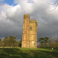
Leith Hill Tower
Agriculture is not quite as extensive as other English non-metropolitan counties, there are many commons and access lands, together with an extensive network of footpaths and bridleways including the North Downs Way, a scenic long-distance path. Accordingly, Surrey provides rural leisure activities with a large horse population.
Elevations[]
The highest elevation in Surrey is Leith Hill near Dorking in the Greensand Hills. It is 293,[6] 294[7] or 295[8] metres (961, 965 or 968 ft) above sea level and is the second highest point in southeastern England after Walbury Hill 297 metres (974 ft) in West Berkshire.
The elevation of the North Downs are for instance at 185m at Warlingham, 138m at Hooley, 208m at Reigate Hill, 224m at Box Hill and 152m above OD for much of the Hog's Back. The elevations of important settlements vary widely. Redhill is at 81m, Reigate (train station used as undulating) is 94m, Ewell is 39m, Weybridge varies between 11m and 78m, Staines-upon-Thames is at 15m, Woking (train station used as also hilly) is at 39m and Guildford's riverside industrial and business premises are at 34m. Horley is in more of a plain in the centre and south-east at around 57m. Godalming, along the Wey from Guildford, typical of southwestern and south Surrey varies widely, in this case between 37m and 105m. The lowest point in the county is on the now non-tidal, controlled Thames at Thames Ditton at 6.6 m.[9]
Settlements[]
- See also list of places in Surrey.
Surrey has a population of approximately 1.1 million people.[10] Its largest town is Guildford, with a population of 66,773; Woking comes a close second with 62,796. They are followed by Ewell with 39,994 people and Camberley with 30,155. Towns of between 25,000 and 30,000 inhabitants are Ashford, Epsom, Farnham, Staines-upon-Thames and Redhill.[11] Guildford is the historic county town, although the county administration was moved to Newington, London (then Surrey) in 1791 and to Kingston upon Thames in 1893. The county council's headquarters have been outside the county's boundaries since 1 April 1965 when Kingston and other areas were included within Greater London by the London Government Act 1963.[12] Recent plans to move the offices to a new site in Woking have now been abandoned.[13] Due to its proximity to London there are many commuter towns and villages in Surrey, the population density is high and the area is one of the richest parts of the UK. Surrey is Britain's most densely populated county, excluding Greater London, the metropolitan counties and Bristol. Much of the county is a suburban area with some of the suburban villages' housing estates contiguous to Greater London, the instances being the small hilltop settlements of Whyteleafe/Warlingham and Chipstead as well as Ewell/Stoneleigh and Thames Ditton. In the west, there is the Blackwater Valley conurbation with its further recent development there focussed on the aviation industry and on computer technology in Farnborough at its centre and Fleet to the west.[14] straddling the Hampshire/Surrey border, including in Surrey, Camberley and Farnham.
History[]
British and Roman Surrey[]
The Roman Stane or Stone Street runs through Surrey
Before Roman times the area today known as Surrey was very probably occupied by the Atrebates tribe centred at Calleva Atrebatum in the modern county of Hampshire. They are known to have controlled the southern bank of the Thames from Roman texts describing the tribal relations between them and the powerful Catuvellauni on the north bank. In about 42AD King Cunobelinus (Welsh: Cynfelin ap Tegfan) of the Catuvellauni died and war broke out between his sons and King Verica of the Atrebates. The Atrebates were defeated in the conflict, their capital captured and their lands made subject to the Catuvellauni now led by Togodumnus ruling from Camulodunum. Verica fled to Gaul and appealed for Roman aid. The Atrebates were allies with Rome during their invasion of Britain in 43AD. The area of Surrey was traversed by Stane Street and other less well known Roman roads. There were Roman temples on Farley Heath and near Wanborough.
The Saxon tribes and the sub-kingdom[]
During the 5th and 6th centuries Surrey was conquered and settled by Saxons. The names of a number of Saxon tribes who may have inhabited different parts of Surrey in this period have been conjectured on the basis of place names. These include the Godhelmingas (around Godalming), Tetingas (around Tooting) and Woccingas (between Woking and Wokingham in Berkshire). It has also been speculated that the Nox gaga and the Oht gaga tribes listed in the Mercian Tribal Hidage refer to two distinct groups living in Surrey. They were valued together at 7,000 hides. Surrey may have formed part of a larger Middle Saxon kingdom or confederacy also including areas north of the Thames. The name Surrey is derived from Suthrige, meaning "southern region", and this may originate in its status as the southern half of the Middle Saxon territory.
If it ever existed, the Middle Saxon kingdom had disappeared by the 7th century, and Surrey became a frontier area disputed between the kingdoms of Kent, Essex, Sussex, Wessex and Mercia, until its permanent absorption by Wessex in 825. Despite this fluctuating situation it retained its identity as a coherent territorial unit. During the 7th century Surrey became Christian and initially formed part of the East Saxon diocese of London, indicating that it was under East Saxon rule at that time, but was later transferred to the West Saxon diocese of Winchester. Its most important religious institution throughout the Anglo-Saxon period and beyond was Chertsey Abbey, founded in 666. At this point Surrey was evidently under Kentish domination, as the abbey was founded under the patronage of King Ecgberht of Kent. However, a few years later at least part of it was subject to Mercia, since in 673-5 further lands were given to Chertsey Abbey by Frithuwald, a local sub-king (subregulus) ruling under the sovereignty of Wulfhere of Mercia. A decade later Surrey passed into the hands of King Caedwalla of Wessex, who also conquered Kent and Sussex and founded a monastery at Farnham in 686, and it remained under the control of Caedwalla's successor Ine in the early 8th century. Its political history for most of the 8th century is unclear, although it may have been under South Saxon control around 722, but by 784–5 it had passed into the hands of King Offa of Mercia. Mercian rule continued until 825, when following his victory over the Mercians at the Battle of Ellandun, King Egbert of Wessex seized control of Surrey, along with Sussex, Kent and Essex. It was incorporated into Wessex as a shire and continued thereafter under the rule of the West Saxon kings, who eventually became kings of all England.
Identified sub-kings of Surrey
- Frithuwald (c.673 – 675)
- Frithuric? (675 – c.686)
The West Saxon and English shire[]
In the 9th century England was afflicted, along with the rest of north-western Europe, by the attacks of Scandinavian Vikings. Surrey's inland position shielded it from coastal raiding, so that it was not normally troubled except by the largest and most ambitious Scandinavian armies. In 851 an exceptionally large invasion force of Danes arrived in the mouth of the Thames on a fleet of about 350 ships, which would have carried over 15,000 men. Having sacked Canterbury and London and defeated King Beorhtwulf of Mercia in battle, the Danes crossed the Thames into Surrey, but were slaughtered by a West Saxon army led by King Aethelwulf in the Battle of Aclea, bringing the invasion to an end. In 892 Surrey was the scene of another important battle when a large Danish army, variously reported at 200, 250 and 350 ship-loads, moved west from its encampment in Kent. It was intercepted and defeated at Farnham by an army led by Alfred the Great's son Edward, the future King Edward the Elder, and fled across the Thames towards Essex.
Its location and the growing power of the West Saxon, later English, kingdom kept Surrey safe from attack for over a century thereafter. Kingston was the scene for the coronation of Aethelstan in 924 and Aethelred the Unready in 978, and, according to later tradition, of other tenth century Kings of England as well. The renewed Danish attacks during the disastrous reign of Aethelred led to the devastation of Surrey by the army of Thorkell the Tall, which ravaged all of south-eastern England in 1009–11. The climax of this wave of attacks came in 1016, which saw prolonged fighting between the forces of King Edmund Ironside and the Danish king Cnut, including an English victory over the Danes somewhere in north-eastern Surrey, but ended with the Danish conquest of England and the establishment of Cnut as king.
Cnut's death in 1035 was followed by a period of political uncertainty as the succession was disputed between his sons. In 1036 Alfred, son of Aethelred the Unready, returned from Normandy, where he had been taken for safety as a child at the time of Cnut's conquest of England. It is uncertain what his intentions were, but after landing with a small retinue in Sussex he was met by Godwin, Earl of Wessex, who escorted him in apparently friendly fashion to Guildford. Having taken lodgings there, Alfred's men were attacked as they slept and massacred by Godwin's followers, while the prince himself was blinded and imprisoned, dying shortly afterwards. This butchery must have contributed to the antipathy between Godwin and Alfred's brother Edward the Confessor, who came to the throne in 1042. That hostility was of critical importance in bringing about the Norman Conquest of England in 1066.
Domesday Book records that the largest landowners in Surrey at the end of Edward's reign were Chertsey Abbey and Harold Godwinson, Earl of Wessex and later king, followed by the estates of King Edward himself. Apart from the abbey, most of whose lands were within the shire, Surrey was the not the principal focus of any major landowner's holdings, a tendency which was to persist in later periods. Given the vast and widespread landed interests and the national and international preoccupations of the monarchy and the earldom of Wessex, the Abbot of Chertsey was therefore probably the most important figure in the local elite.
The Anglo-Saxon period saw the emergence of the shire's internal division into 14 hundreds, which continued until Victorian times. These were the hundreds of Blackheath, Brixton, Copthorne, Effingham Half-Hundred, Elmbridge, Farnham, Godalming, Godley, Kingston, Reigate, Tandridge, Wallington, Woking and Wotton.
Identified ealdormen of Surrey
- Wulfheard (c.823)
- Huda (? – 853)
- Æðelweard (late 10th century)
- Æðelmær (? – 1016)
Later Medieval Surrey[]
After the Battle of Hastings, the Norman army advanced through Kent into Surrey, where they defeated an English force which attacked them at Southwark, before proceeding westwards on a circuitous march to reach London from the north-west. As was the case across England, the native ruling class of Surrey was virtually eliminated by Norman seizure of land. Only one significant English landowner, the brother of the last English Abbot of Chertsey, remained by the time the Domesday survey was conducted in 1086. At that time the largest landholding in Surrey, as in many other parts of the country, was the expanded royal estate, while the next largest holding belonged to Richard fitz Gilbert, founder of the de Clare family.

Runnymede, where the Magna Carta was sealed
In 1088, King William II granted William de Warenne the title of Earl of Surrey as a reward for Warenne's loyalty during the rebellion that followed the death of William I. When the male line of the Warennes became extinct in the 14th century the earldom was inherited by the Fitzalan Earls of Arundel. The Fitzalan line of Earls of Surrey became extinct in 1415 but the title was revived in the late 15th century for the Howard family who still hold it. However, Surrey was not the principal focus of any of these families' interests.
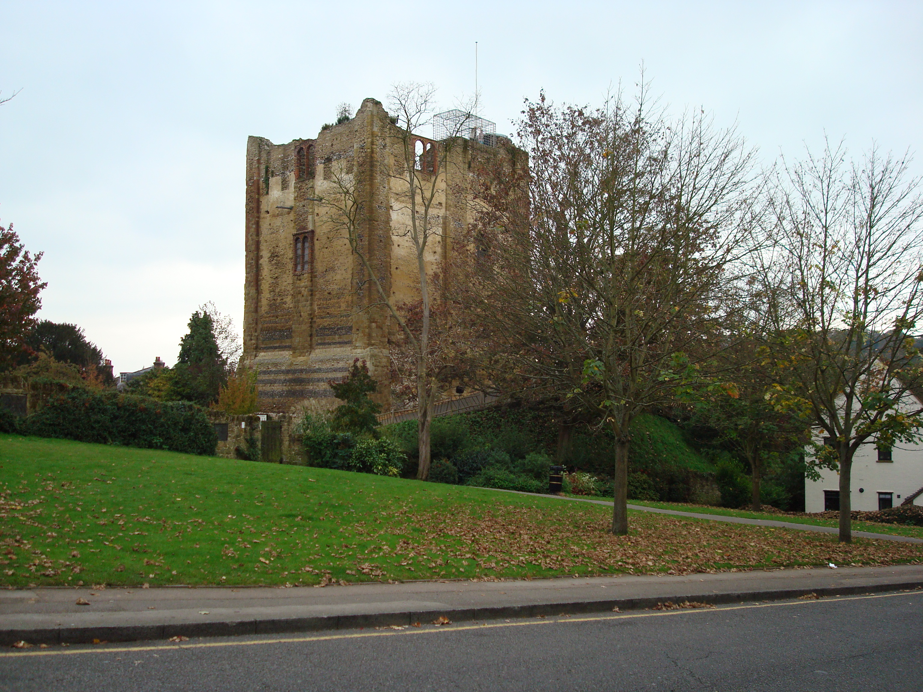
Guildford Castle
Guildford Castle, one of many fortresses originally established by the Normans as part of the process of subjugating the country, was developed as a royal palace in the 12th century. Farnham Castle was built during the 12th century as a residence for the Bishop of Winchester, while other stone castles were constructed in the same period at Bletchingley by the de Clares and at Reigate by the Warennes. During King John's struggle with the barons, Magna Carta was issued in June 1215 at Runnymede. In the following year Surrey was overrun by forces supporting Prince Louis of France, who passed through on their way from London to Winchester and back and occupied Guildford and Reigate castles. Guildford Castle later became one of the favourite residences of King Henry III, who considerably expanded the palace there. In 1264, during the baronial revolt against Henry III, the rebel army of Simon de Montfort passed southwards through Surrey on their way to the Battle of Lewes in Sussex. Although the rebels were victorious, soon after the battle royal forces captured and destroyed Bletchingley Castle, whose owner Gilbert de Clare was one of de Montfort's leading supporters. By the 14th century castles were of dwindling military importance, but continued to be a mark of social prestige, leading to the construction of castles at Starborough near Lingfield by Lord Cobham and at Betchworth by John Fitzalan, whose father had recently inherited the Earldom of Surrey.
Surrey had little political or economic importance in the Middle Ages. It was not the main power-base of any major aristocratic family or the seat of a bishopric, while its agricultural wealth was limited by its generally poor soils. Population pressure in the 12th and 13th centuries led to the beginning of the gradual deforestation and agricultural development of the Weald, an area which had hitherto remained wooded due to the exceptional difficulty of farming its heavy clay soil. Urban development, excepting the London suburb of Southwark, was sapped by the overshadowing predominance of London and the major towns in neighbouring shires, many of which benefited from access to the sea or from political or ecclesiastical eminence. Surrey did however achieve a significant degree of prosperity in the later Middle Ages through its role in the production of woollen cloth, England's main export industry, which in Surrey was centred on Guildford.
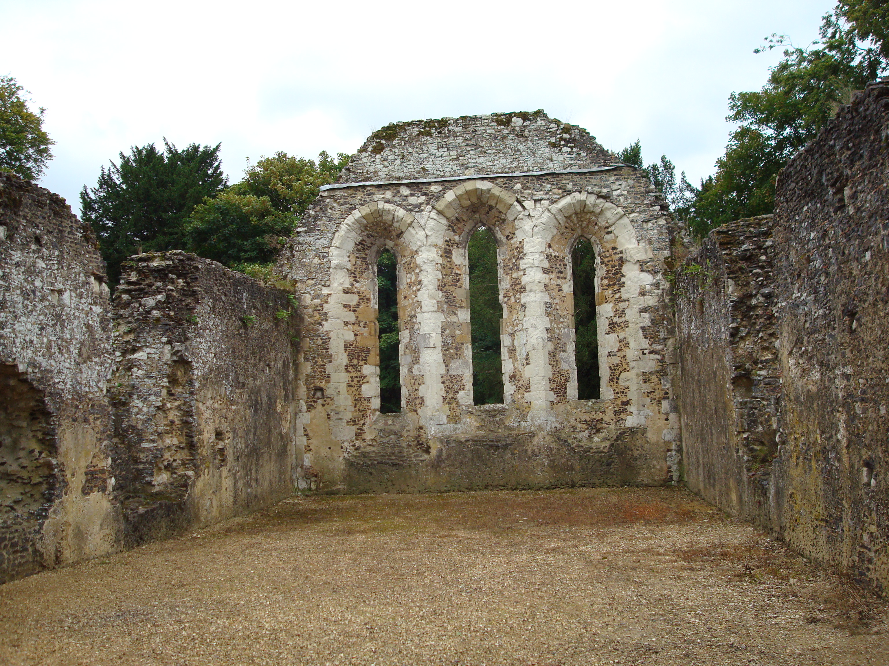

Ruins of the monks' dormitory at Waverley Abbey
One benefit of obscurity was that Surrey largely avoided being seriously fought over in the various rebellions and civil wars of the period, although armies from Kent heading for London passed through what was then north-eastern Surrey during the Peasants' Revolt of 1381, Cade's Rebellion in 1450 and one stage of the Wars of the Roses in 1460.
In 1082 a Cluniac abbey was founded at Bermondsey by Alwine, a wealthy English citizen of London. The first Cistercian monastery in England, Waverley Abbey, was founded in 1128. Over the next quarter-century monks spread out from here to found new houses, creating a network of twelve monasteries descended from Waverley across southern and central England. The 12th and early 13th centuries also saw the establishment of Augustinian priories at Merton, Newark, Tandridge, Southwark and Reigate. A Dominican friary was established at Guildford by Henry III's widow Eleanor of Provence, in memory of her grandson who had died at Guildford in 1274. In the 15th century a Carthusian priory was founded by King Henry V at Sheen. These would all perish, along with the still important Benedictine abbey of Chertsey, in the 16th-century Dissolution of the Monasteries.
Although now fallen into disuse, some English counties had nicknames for people from that county, such as a Tyke from Yorkshire and a Yellowbelly from Lincolnshire; the traditional nickname for people from Surrey is 'Surrey Capon', as it was well known in the later Middle Ages as the county where chickens were fattened up for the London meat markets.
Early Modern Surrey[]


Nonsuch Palace
Under the early Tudor kings magnificent royal palaces were constructed in northern Surrey, in convenient proximity to London. At Richmond an existing royal residence was rebuilt on a grand scale under King Henry VII, who also founded a Franciscan friary nearby in 1499. The still more spectacular palace of Nonsuch was later built for Henry VIII near Ewell. The palace at Guildford Castle had fallen out of use long before, but a royal hunting lodge existed just outside the town. All these have since been demolished.
During the Cornish Rebellion of 1497 the rebels heading for London briefly occupied Guildford and fought a skirmish with a government detachment on Guildown outside the town, before marching on to Blackheath in Kent where they were crushed by a royal army. The forces of Wyatt's Rebellion in 1554 passed through what was then north-eastern Surrey on their way from Kent to London, briefly occupying Southwark and then crossing the Thames at Kingston after failing to storm London Bridge.
Surrey's cloth industry declined in the 16th century, and effectively collapsed in the 17th. The introduction of new furnace technology in the early 17th century led to an expansion of the iron industry in the Weald, whose rich deposits had been exploited since prehistoric times, but this hastened the extinction of the business as the mines were worked out. However, this period also saw the emergence of important new industries, centred on the valley of the Tillingbourne. The production of brass goods and wire in this area was relatively short-lived, but the manufacture of paper and gunpowder proved more enduring. For a time in the mid-17th century the Surrey mills were the main producers of gunpowder in England. The Wey Navigation, opened in 1653, was one of England's first canal systems.
George Abbot, the son of a Guildford clothworker, served as Archbishop of Canterbury in 1611–33. In 1619 he founded Abbot's Hospital, an almshouse in Guildford, which is still operating. He also made unsuccessful efforts to revitalise the ailing local cloth industry. One of his brothers, Robert, became Bishop of Salisbury and another, Maurice, was a founding shareholder of the East India Company who became the company's governor and later Lord Mayor of London.
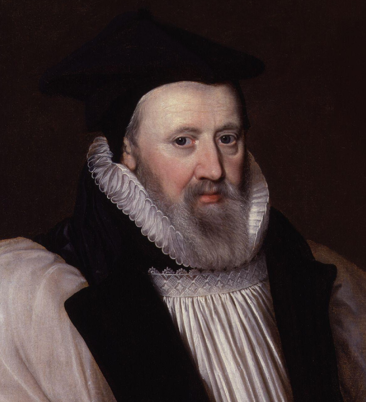
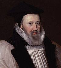
George Abbot
Bankside in Southwark, then part of Surrey, was the principal entertainment district of early modern London. This was due to its convenient location outside the jurisdiction of the government of the City of London, since the social control exercised over this London suburb by the local authorities of Surrey was less effectively restrictive. As a result this was where the city's theatres were located and was the setting for the golden age of Elizabethan and Jacobean theatre, with the work of playwrights including William Shakespeare, Christopher Marlowe, Ben Jonson and John Webster being performed in playhouses along the south bank of the Thames.
Surrey almost entirely escaped the direct impact of fighting during the main phase of the English Civil War in 1642-6. The local Parliamentarian gentry led by Sir Richard Onslow were able to secure the county without difficulty on the outbreak of war. Farnham Castle was briefly occupied by the advancing Royalists in late 1642, but was easily stormed by the Parliamentarians under Sir William Waller. A new Royalist offensive in late 1643 saw skirmishing around Farnham between Waller's forces and Ralph Hopton's Royalists, but these brief incursions into the western fringes of Surrey marked the limits of Royalist advances on the county. During a political crisis in summer 1647 Sir Thomas Fairfax's army passed through Surrey on its way to occupy London, and subsequent billeting of troops in Surrey caused considerable discontent. In the brief Second Civil War of 1648 the Earl of Holland entered Surrey in July hoping to ignite a Royalist revolt. He raised his standard at Kingston and advanced south, but found little support. After confused manoeuvres between Reigate and Dorking as Parliamentary troops closed in, his force of 500 men fled northwards and was overtaken and routed at Kingston.
Surrey had a prominent role in the development of the radical political movements unleashed by the civil war. In October 1647 the first manifesto of what became known as the Leveller movement, The Case of the Army Truly Stated, was drafted at Guildford by the elected representatives of New Model Army regiments and civilian radicals from London. This document combined the presentation of specific grievances with wider demands for constitutional change on the basis of popular sovereignty. It formed the template for the more systematic and radical Agreement of the People, drafted by the same men later that month, and led to the Putney Debates between its signatories and the army leadership. In 1649 the Diggers led by Gerrard Winstanley established their communal settlement at St. George's Hill to implement egalitarian ideals of common ownership, but were eventually driven out by the local landowners through violence and litigation. A smaller Digger commune was then established near Cobham, but suffered the same fate in 1650.
Modern history[]
Until the late 18th century Surrey, apart from its north-eastern corner, was sparsely populated and somewhat rustic, despite its proximity to the capital. Communications began to improve, and the influence of London to increase, with the development of turnpike roads and a stagecoach system. A far more profound transformation followed with the arrival of the railways, beginning in the late 1830s. The availability of rapid transportation enabled prosperous London workers to travel daily to homes across Surrey. This phenomenon of commuting brought explosive growth to Surrey's population and wealth, and tied its economy and society inextricably to London. Existing towns like Guildford, Farnham and most spectacularly Croydon grew rapidly, while new towns such as Woking and Redhill emerged beside the railway lines.


Britain's first crematorium, in Woking
Meanwhile London itself spread swiftly across north-eastern Surrey. In 1800 it extended only to Vauxhall; a century later the city's growth had reached as far as Putney and Streatham. This expansion was reflected in the creation of the County of London in 1889, detaching the areas subsumed by the city from Surrey. The expansion of London continued in the 20th century, engulfing Croydon, Kingston and many smaller settlements. This led to a further contraction of Surrey in 1965 with the creation of Greater London.
In 1849 Brookwood Cemetery was established near Woking to serve the population of London, connected to the capital by its own railway service. It soon developed into the largest burial ground in the world. Woking was also the site of Britain's first crematorium, which opened in 1878, and its first mosque, founded in 1889. In 1881 Godalming became the first town in the world with a public electricity supply.
The eastern part of Surrey was transferred from the Diocese of Winchester to that of Rochester in 1877. In 1905 this area was detached to form a new Diocese of Southwark. The rest of the county, together with part of eastern Hampshire, was separated from Winchester in 1927 to become the Diocese of Guildford, whose cathedral was consecrated in 1961.


Guildford Cathedral
During the later 19th century Surrey became increasingly important in the development of architecture in Britain and the wider world. Its traditional building forms were significant in shaping the widespread trend for English vernacular architecture associated with the Arts and Crafts Movement, and would continue to influence domestic building through the 20th century. The prominence of Surrey peaked in the 1890s, when it was the focus for globally important developments in domestic architecture, in particular the early work of Edwin Lutyens, who grew up in the county and was greatly influenced by its traditional styles and materials.


Dennis Sabre fire engine
The late 19th and early 20th centuries saw the demise of Surrey's long-standing industries manufacturing paper and gunpowder. Most of the county's paper mills closed around the turn of the century and the last survivor shut in 1928. Gunpowder production fell victim to the First World War, which brought about a huge expansion of the British munitions industry, followed by sharp contraction and consolidation when the war ended, leading to the closure of the Surrey powder mills. New industrial developments included the establishment of the vehicle manufacturers Dennis Brothers in Guildford in 1895. Beginning as a maker of bicycles and then of cars, the firm soon shifted into the production of commercial and utility vehicles, becoming internationally important as a manufacturer of fire engines and buses. Though much reduced in size and despite numerous changes of ownership, this business continues to operate in Guildford.
During the Second World War a section of the GHQ Stop Line, a system of pillboxes, gun emplacements, anti-tank obstacles and other fortifications was constructed along the North Downs. This line, running from Somerset to Yorkshire, was intended as the principal fixed defence of London and the industrial core of England against the threat of invasion. German invasion plans envisaged that the main thrust of their advance inland would cross the North Downs at the gap in the ridge formed by the Wey valley, thus colliding with the defence line around Guildford.
Historic architecture and monuments[]


The gate of Abbot's Hospital, Guildford
Few traces of the ancient British and Roman periods survive in Surrey. There are a number of round barrows and bell barrows in various locations, mostly dating to the Bronze Age. Remains of Iron Age hillforts exist at Holmbury Hill, Hascombe Hill, Anstiebury (near Capel), Dry Hill (near Lingfield), St. Ann's Hill, Chertsey and St George's Hill, Weybridge. Most of these sites were created in the 1st century BC and many were re-occupied during the middle of the 1st century AD.[15] Only fragments of Stane Street and Ermine Street, the Roman roads which crossed the county, remain.
Anglo-Saxon elements survive in a number of Surrey churches, notably at Guildford (St. Mary's), Godalming (St. Peter & St. Paul), Stoke D'Abernon, Thursley, Witley, Compton and Albury (old church).
Numerous medieval churches exist in Surrey, but the county's parish churches are typically relatively small and simple, and have suffered particularly heavily at the hands of Victorian restoration. Important medieval church interiors are to be found at Stoke D'Abernon, Compton, Chaldon, Dunsfold and Lingfield. The larger monastic churches fell into ruin after their institutions were dissolved, although some remains of those at Waverley and Newark still exist, while Southwark Priory, no longer in Surrey, has survived as a parish church and now a cathedral. Farnham Castle survives in large part and substantial ruins remain at Guildford Castle, while a handful of medieval domestic buildings survive, albeit with considerable later modifications.
The 16th century is the earliest from which a sizeable amount of non-military secular architecture survives in Surrey. Important examples include the grand mid-century country houses of Loseley Park and Sutton Place and the old building of the Royal Grammar School, Guildford, founded in 1509. A considerable number of more ordinary houses and commercial buildings of the 16th century are also still standing, and with the 17th century the number of surviving buildings proliferates much further. Abbot's Hospital, founded in 1619, is a grand edifice built in the Tudor style, despite its date. More characteristic examples of major 17th-century building include West Horsley Place, Slyfield Manor and the Guildhall in Guildford, with Ham House and Kew Palace formerly in Surrey but now in Greater London.
Literature[]
Besides its role in Elizabethan and Jacobean theatre, many important writers have lived and worked in Surrey.
- The Owl and the Nightingale, one of the earliest Middle English poems, may have been written by one Nicholas of Guildford, who is mentioned in its text.
- John Donne (1572–1631) lived and worked for much of his life in Pyrford.
- John Evelyn (1620–1706) was born at Wotton and spent much of his life there.
- Daniel Defoe (1659/61-1731) was educated in Dorking.
- William Cobbett (1763–1835) was born in Farnham and is buried there; Surrey features prominently in his Rural Rides.
- Benjamin Disraeli (1804–81) wrote Conningsby while living in Dorking.
- Alfred Tennyson (1809–92) spent the latter part of his life, and died, in Haslemere.
- Charles Dickens (1812–70) wrote part of The Pickwick Papers in Dorking, and refers to the town in the novel.
- Robert Browning (1812–89) was born in Camberwell, then part of Surrey.
- George Eliot (1819–80) wrote most of Middlemarch while living in Haslemere.
- George Meredith (1828–1909) lived at Box Hill.
- Lewis Carroll (1832–98) died and is buried in Guildford, where he had spent much time at his sisters' home.
- George Bernard Shaw (1856–1950) lived in Woking and later in Hindhead, where he wrote Caesar and Cleopatra.
- Arthur Conan Doyle (1859–1930) lived and wrote many of his books in Hindhead and served as deputy lieutenant of Surrey; the county forms a setting for many of the Sherlock Holmes stories.
- J. M. Barrie (1860–1937) lived in Tilford, and based The Boy Castaways, which later evolved into Peter Pan, in the nearby countryside.
- H. G. Wells (1866–1946) wrote The War of the Worlds while living in Woking; much of northern Surrey is laid waste in the course of the story.
- John Galsworthy (1867–1933) was born in Kingston and the Forsyte Saga is set in the area.
- E. M. Forster (1879–1970) lived and wrote in Weybridge and Abinger Hammer.
- P. G. Wodehouse (1881–1975) was born in Guildford and baptised there in St Nicolas' Church.
- Aldous Huxley (1894–1963) was born in Godalming and his remains are interred at Compton; the end of Brave New World is set in Surrey.
Arts and sciences[]
- William of Ockham (c.1288-c.1348), scholastic philosopher, most famous for "Occam's Razor", came from Ockham.
- Thomas Malthus (1766–1834), pioneer of demography, was born and grew up in Westcott, and later lived in Albury.
- Ada Lovelace (1815–52), mathematician, lived at East Horsley.
- Gertrude Jekyll (1843–1932), garden designer, lived for much of her life at Munstead near Godalming, created significant gardens in Surrey and is buried in Busbridge.
- Edwin Lutyens (1869–1944), architect, grew up in Thursley and many of his early works were built in west Surrey, including collaborations with Gertrude Jekyll.
- Ralph Vaughan Williams (1872–1958), composer, grew up at Leith Hill and later lived in Dorking.
- Laurence Olivier (1907–89), actor, was born in Dorking.
- Alan Turing (1912–54), mathematician and pioneer of computer science, lived for much of his early life in Guildford.
Popular music[]
The "Surrey Delta" produced many of the musicians in 60s British blues movements. The Rolling Stones developed their music at Crawdaddy Club in Richmond.
- Jimmy Page (born 1944) spent much of his early life in Epsom.
- Jeff Beck (born 1944) was born in Wallington, then part of Surrey.
- Eric Clapton (born 1945) was born and grew up in Ripley.
- The Stranglers were formed in Guildford.
- Paul Weller (born 1958) was born and grew up in Woking, which inspired the song Town Called Malice. The Jam were formed at Sheerwater Secondary School in the town.
- Norman Cook (born 1963) was born in Surrey.
- Hard-Fi members Richard Archer, Ross Phillips, and Kai Stephens are from Staines-upon-Thames, Surrey.
- Justin Hawkins, lead singer of rock band The Darkness was born in Surrey.
- Mike Rutherford guitarist of progressive rock band Genesis.
- Peter Gabriel, once lead songwriter of progressive rock band Genesis.
Sport[]
- Cricket makes its first appearance in history in Surrey, in a reference to the game being played at the Royal Grammar School, Guildford in the 16th century (see History of English cricket to 1696). Mitcham Cricket Club, formed in 1685 and the oldest documented club in the game's history, was within Surrey's borders until 1965.[16] The Surrey County Cricket Club, founded in 1845, represents the historic county of Surrey, although its main ground, The Oval in Kennington, is now in Greater London. The club also uses Whitgift School, South Croydon and Woodbridge Road, Guildford for some games. It was one of the original participants in the County Championship and has won the competition 18 times, more than any other county except Yorkshire.
- Epsom Downs Racecourse is the venue for the most prestigious event in British flat horse-racing, the Derby, which has been held there annually since 1780; Kempton Park Racecourse and Sandown Park Racecourse are also in Surrey.
- Brooklands between Woking and Weybridge was the world's first purpose-built motorsport race circuit, opened in 1907, partly now Mercedes-Benz World. Currently Woking plays host to the headquarters of the McLaren Formula One team, giving Surrey the rarity of having a local F1 team. James Hunt, the 1976 Formula 1 World Driver's Champion was born in Belmont, Sutton, then part of Surrey, in 1947.
- Surrey's leading rugby club, Esher, currently compete in the RFU Championship, the second tier of English rugby.
- Surrey is one of a handful of English counties with no teams in the Football League. Its leading football teams are Woking, currently playing in the fifth-tier Conference National and Staines Town, in the sixth-tier Conference South.
- Surrey is home to the Ice Hockey team the Guildford Flames, who compete in the English Premier League and the basketball team the Guildford Heat, who play in the top tier of British basketball, the British Basketball League.
Local government[]
History[]
| Surrey
| |
| Geography | |
| Status | Administrative county |
| HQ | Newington 1889–1893 Kingston upon Thames from 1893 |
| History | |
| Created | c.825 |
| Abolished | N/A |
| Succeeded by | N/A |
| Demography | |
|---|---|
| 1891 population | 452,218[17] |
| 1971 population | 1,002,832[18] |
| The arms granted to Surrey County Council in 1934 and used until 1974 | |
The Local Government Act 1888 reorganised county-level local government throughout England and Wales. Accordingly, the administrative county of Surrey was formed in 1889 when the Provisional Surrey County Council first met, consisting of 19 aldermen and 57 councillors. The county council assumed the administrative responsibilities previously exercised by the county's justices in quarter sessions. The county had revised boundaries, with the north east of the historic county bordering the City of London becoming part of a new County of London. These areas now form the London Boroughs of Lambeth, Southwark and Wandsworth, and the Penge area of the London Borough of Bromley. At the same time, the borough of Croydon became a county borough, outside the jurisdiction of the county council.
For purposes other than local government the administrative county of Surrey and county borough of Croydon continued to form a "county of Surrey" to which a Lord Lieutenant and Custos Rotulorum (Chief Magistrate) and a High Sheriff were appointed.
Surrey had been administered from Newington since the 1790s, and the county council was initially based in the sessions house there. As Newington was included in the County of London it lay outside the area administered by the council, and a site for a new county hall within the administrative county was sought. By 1890 six towns were being considered: Epsom, Guildford, Kingston, Redhill, Surbiton and Wimbledon.[19] A decision to build the new County Hall at Kingston was made in 1891, (the building opened in 1893[20]) but this site would also became overtaken by the growing London conurbation and by the 1930s most of the north of the county had been built over, becoming outer suburbs of London, although continuing to form part of Surrey administratively.
In 1960 the report of the Herbert Commission recommended that much of north Surrey (including Kingston and Croydon) be included in a new "Greater London". The recommendations of the report were enacted in highly modified form in 1965 by the London Government Act 1963. The areas that now form the London Boroughs of Croydon, Kingston, Merton, Sutton and that part of Richmond south of the River Thames were transferred from Surrey to Greater London. At the same time part of the county of Middlesex, which had been abolished by the legislation, was added to Surrey. This area now forms the borough of Spelthorne.
Further local government reform under the Local Government Act 1972 took place in 1974. The 1972 Act abolished administrative counties and introduced non-metropolitan counties in their place. The boundaries of the non-metropolitan county of Surrey were similar to those of the administrative county with the exception of Gatwick Airport and some surrounding land which was transferred to West Sussex. It was originally proposed that the parishes of Horley and Charlwood would become part of West Sussex, however fierce local opposition led to a reversal of this under the Charlwood and Horley Act 1974.
Today[]
After the elections of May 2009 the County Councillors' party affiliations are as follows:[21]
| Party Affiliation | Number | |
|---|---|---|
| Conservative | 55 | |
| Liberal Democrats | 13 | |
| Residents Association | 10 | |
| Labour | 1 | |
| Other | 1 | |
As of 3 May 2012, the Conservative local councillors control of 10 out of 11 councils in Surrey, with Epsom and Ewell in Residents Association control. The Conservatives hold all 11 Parliamentary constituencies within the county borders.[22][23]
Economy[]
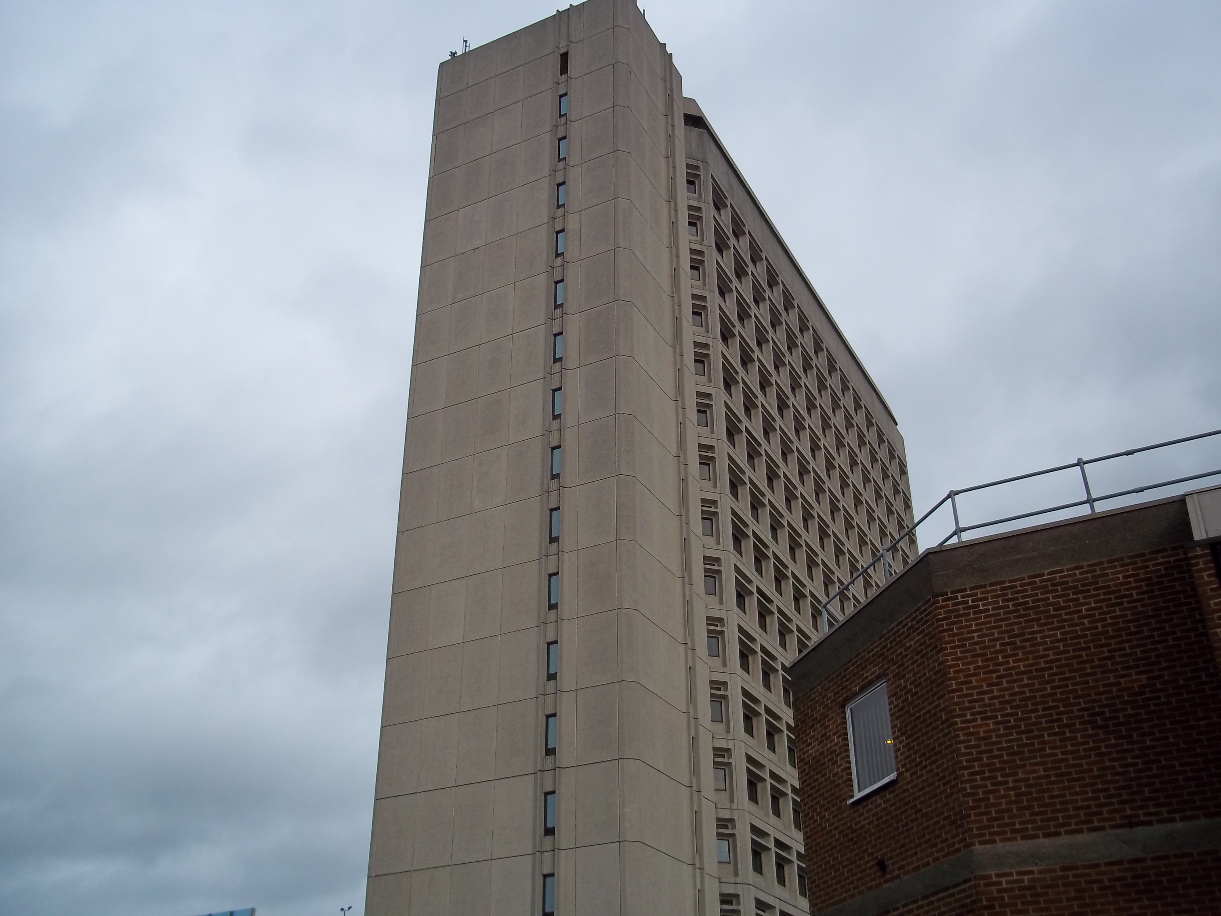

Export House, one of Surrey's tallest buildings
Surrey is an affluent county with a service based economy closely tied to that of London. Surrey has the highest GDP per capita of any county in the UK and the highest cost of living in the UK outside of the capital. The county is said to have the highest proportion of millionaires in the UK. The average wage in Surrey is bolstered by the high number of residents who work in financial services.[24]
Surrey has more organisation and company headquarters than any other county in the UK. Electronic giants Nikon, Whirlpool, Canon, Toshiba, Samsung and Philips are housed here. Kia Motors and Toyota UK also have HQs in Surrey, as do drug companies Pfizer and Sanofi-Aventis and oil giant Esso. Some of the largest FMCG multinationals in the world have their UK and/or European headquarters here, including Unilever, Procter & Gamble, Superdrug, Nestle, SC Johnson, Kimberly-Clark and Colgate-Palmolive. NGOs including WWF UK & Compassion in World Farming are also based here. Government Quangos such as SEEDA, SEERA and GOSE are headquartered in Guildford.
Transport[]
Road[]
Three major motorways pass through the county. These are:
- M25 (London Orbital). This runs through the county, in a major engineering feat cutting through part of Reigate Hill to traverse the North Downs and has 8 junctions in the county.
It connects among others to the M1, M11, M20, M26, M4 and M40. The motorway runs close to London Heathrow Airport and the motorway network can be used to access Gatwick, Stansted and Luton Airports and the Channel Tunnel motor vehicle service.
- M3 crosses the north-west of the county. It connects London to Southampton and the South West of England (excluding Gloucestershire, Bath and Wiltshire connected by the M4) having in Surrey the Sunbury-on-Thames, M25 interchange and Lightwater/Bagshot junctions.
- M23 splits the east of the county. It connects Croydon, South London via its only junction in the county the M25 Merstham interchange (close to the Reigate M25 junction) to Brighton as the dualled A23 past Crawley. It has junction to a spur to Gatwick Airport on the Sussex/Surrey border.
Other major roads include:
- The A3 trunk road from Portsmouth to London. The road now bypasses and historically assisted in the growth of Haslemere, Godalming, Guildford, Esher and Kingston-upon-Thames. The Hindhead Tunnel bypasses a former bottleneck at Hindhead and the Devil's Punchbowl.
- The A24 from London to Littlehampton and Worthing. In Surrey, it passes through or around Ewell, Epsom, Ashtead, Leatherhead and Dorking. It passes Box Hill, near Dorking. Unlike the A3, which is almost completely dual carriageway, the A24 is apart from a large central Surrey stretch single carriageway; it bypasses Leatherhead, Dorking and Horsham.
- The A31 trunk road west from Guildford to Bere Regis via Farnham and is connected to the M3 near Winchester and via the A331 near Aldershot. It is dual carriageway along the Hog's Back from the A3 to Farnham. It is one of the ancient routes from London to Winchester, see Pilgrims' Way.
- The short A331 connects the A31 to the M3. It runs along the Surrey – Hampshire border, bypassing Aldershot, Frimley and Farnborough.
Rail[]
Surrey is connected to Central London via national routes: in anti-clockwise order, the Waterloo to Reading Line, South Western Main Line, Portsmouth Direct Line, Sutton and Mole Valley Lines (from Horsham, West Sussex itself on the Arun Valley Line from Littlehampton) and the Brighton Main Line.
The Waterloo to Reading Line after calling at the economically important town of Bracknell enters Surrey and calls at unskipped stops of Virginia Water, Egham, Staines upon Thames, London stops and London Waterloo. The South Western Main Line runs from Weymouth, Southampton, the significant technology towns of Basingstoke and Farnborough (Main), then normally calls at Woking, up to six other Surrey stops including Walton-on-Thames, normally Surbiton in the Greater London Royal Borough of Kingston upon Thames and then for fast services Clapham Junction and London Waterloo only. The Portsmouth Direct Line is significant in linking Haslemere, Godalming and Guildford to the South Western Main Line at Woking. The Sutton and Mole Valley Lines link Dorking, Leatherhead, Ashtead, Epsom and Ewell (East) to London Bridge and also have spurs to the SWML northbound and New Guildford Line southbound. The Brighton Main Line calls at mostly unskipped stops Horley and Redhill which is a junction before reaching Central London at variously London Bridge or London Victoria. Reigate is the only town terminus one stop off this main line network, with its station west of Redhill station one stop further from London and is on the east-west North Downs Line.
Consequently, the towns Staines, Woking, Guildford, Walton-on-Thames, Epsom/Ewell and Reigate/Redhill, statistically the largest examples,[25] are established rapid-transit commuter towns for Central London. The above routes have had a stimulative effect. The relative development of Surrey at the time of the Beeching cuts led to today's retention of numerous other commuter routes, all with direct services to London, the:
- Chertsey Line linking the first two of the above national routes via Chertsey and Addlestone
- New Guildford Line via Claygate and Effingham Junction from Surbiton
- Hampton Court Branch Line to East Molesey via Thames Ditton from Surbiton
- Shepperton Branch Line via Sunbury-on-Thames
- Ascot to Guildford Line via Wanborough, Ash, Aldershot, Frimley, Camberley and Bagshot
- Alton Line via Farnborough that calls at the far southwest Surrey outcrop in Farnham with a change to steam at Alton, Hampshire for Alresford via the seasonal and off-peak hours heritage Watercress Line.
- Epsom Downs Branch from Sutton and then Belmont in Greater London to Banstead and Epsom Downs only.
- Tattenham Corner Branch Line from Purley, London via Chipstead, Kingswood and Tadworth
- Oxted Line via Croydon that calls at Oxted and Hurst Green and East Grinstead or Uckfield with a change that will be possible in 2013 for the Bluebell Railway at East Grinstead for services to Sheffield Park
- Redhill to Tonbridge Line via Godstone with a change to the South Eastern operator required at Tonbridge for Ashford, Kent
The only diesel route is the east-west route in Surrey, the North Downs Line, which runs from Reading, Berkshire to Redhill via Farnborough (North) and Guildford. Trains to London Waterloo are run by South West Trains, trains to London Victoria and London Bridge are Southern and South Eastern, and services on the North Downs Line are operated by First Great Western.
Major stations:
- Guildford (7.8 million passengers)
- Woking (7.1 million passengers)
- Epsom (3.5 million passengers)
- Redhill (3.4 million passengers)
Long-Distance National Services to the north[]
- From Redhill and Guildford in Surrey a daily service with CrossCountry runs to Manchester Piccadilly via Reading.
- From Gatwick Airport, Surrey, apart from the Gatwick Express, the north-south route Thameslink connects 50 stations on a regular basis: London Bridge, Blackfriars, Faringdon, Kentish Town, St Albans, Luton and Bedford with the Thameslink Programme underway to extend the line by 2018 to Peterborough, Cambridge and south to Ashford International.
Air[]
Heathrow (in the London Borough of Hillingdon) and Gatwick in Crawley Borough, West Sussex have a perimeter road in Surrey. A National Express coach from Woking to Heathrow Airport and early-until-late buses to nearby Surrey towns operate.
Fairoaks Airport on the edge of Chobham and Ottershaw is 2.3 miles (4 km) from Woking town centre and operates as a private airfield with two training schools and is home to other aviation businesses. Redhill Aerodrome is also in Surrey.
Education[]
Royal Holloway College, Egham
Surrey has a comprehensive secondary education system with 53 state schools (not including sixth form colleges). There are 41 independent schools including Preparatory schools and Senior schools, including Charterhouse, which along with Eton College and Harrow School was one of the nine major independent schools mentioned in the Public Schools Act 1868, and the Royal Grammar School, Guildford. Most secondary schools in Surrey have sixth forms although Reigate, Esher, Egham, Spelthorne, Woking and Waverley districts tend to have separate sixth form colleges.
Higher education[]
- The University of Surrey is based in Guildford and the University for the Creative Arts (UCA) has campuses in Farnham and Epsom.
- Royal Holloway, University of London is based in Egham
Emergency services[]
Surrey is served by these emergency services.
- Surrey Police, with 12 police stations in Surrey.
- South East Coast Ambulance Service as of 1 July 2006. Previously Surrey Ambulance Service covered Surrey; on 1 July 2006, it merged with Sussex Ambulance Service and Kent Ambulance Service to form the South East Coast Ambulance Service. Surrey has 21 ambulance stations.
- Surrey Fire & Rescue Service, with 24 fire stations in Surrey.
- SURSAR, Surrey Search & Rescue, based in Woking Police Station.
Places of interest[]
Significant landscapes in Surrey include Box Hill just north of Dorking; the Devil's Punch Bowl at Hindhead and Frensham Common. Leith Hill south west of Dorking in the Greensand Ridge is the second highest point in south-east England. Witley Common and Thursley Common are expansive areas of ancient heathland south of Godalming run by the National Trust and Ministry of Defence. The Surrey Hills are an area of outstanding natural beauty (AONB).
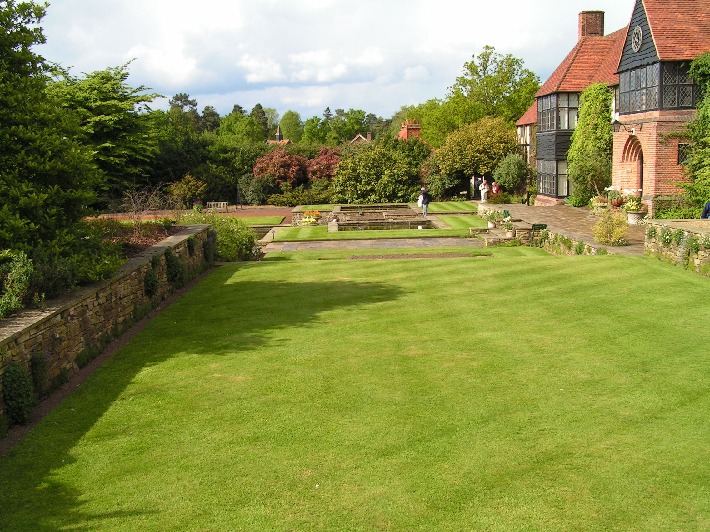
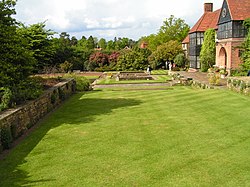
Lawns at RHS Garden, Wisley
More manicured landscapes can be seen at Claremont Landscape Garden, south of Esher (dating from 1715). There is also Winkworth Arboretum south east of Godalming and Windlesham Arboretum near Lightwater created in the 20th century. Wisley is home to the Royal Horticultural Society gardens. Kew, historically part of Surrey but now in Greater London, features the Royal Botanic Gardens, Kew, as well as The National Archives for England & Wales.
There are 80 Surrey Wildlife Trust reserves with at least one in all 11 non-metropolitan districts.[26]
Surrey's important country houses include the Tudor mansion of Loseley Park, built in the 1560s and Clandon Park, an 18th-century Palladian mansion in West Clandon to the east of Guildford. Nearby Hatchlands Park in East Clandon, was built in 1758 with Robert Adam interiors and a collection of keyboard instruments. Polesden Lacey south of Great Bookham is a regency villa with extensive grounds. On a smaller scale, Oakhurst Cottage in Hambledon near Godalming is a restored 16th-century worker's home.
A canal system, the Wey and Godalming Navigations is linked to the Wey and Arun Canal with future full reopening expected after 2015. Dapdune Wharf in Guildford commemorates the work of the canal system and is home to a restored Wey barge, the Reliance. Furthermore on the River Tillingbourne, Shalford Mill is an 18th century water-mill.
Runnymede at Egham is the site of the sealing of the Magna Carta in 1215.
Guildford Cathedral is a post-war cathedral built from bricks made from the clay hill on which it stands.
Brooklands Museum recognises the motoring past of Surrey. The county is also home to the theme parks Thorpe Park and flanks to three sides the farmland and woodland surrounding Chessington World of Adventures in Greater London.
- River Thames

Surrey in film and books[]

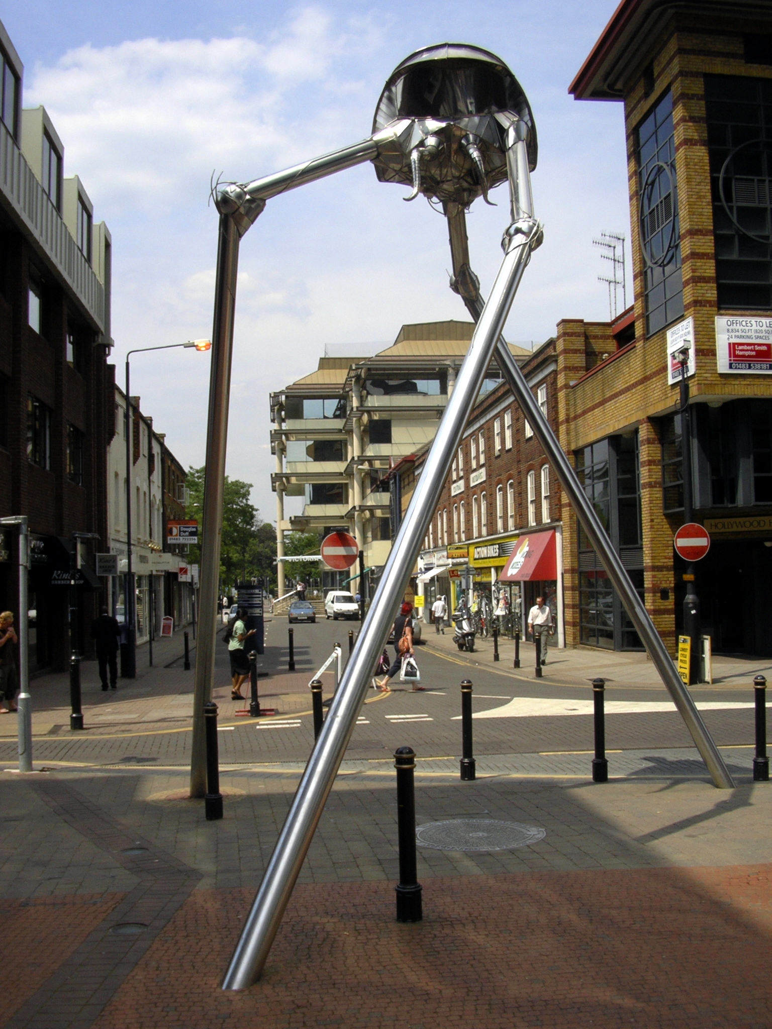
Sculpture of a Wellsian Martian tripod in Woking
Much of H. G. Wells's 1898 novella The War of the Worlds is set in Surrey with many specific towns and villages identified. The Martians first land on Horsell Common on the north side of Woking, outside the Bleak House pub, now called Sands. In the story the narrator flees in the direction of London, first passing Byfleet and then Weybridge before travelling east along the north bank of the Thames. Jane Austen's novel Emma is set in Surrey and the famous picnic where Emma embarrasses Miss Bates takes place on Box Hill. The character Ford Prefect from The Hitchhiker's Guide to the Galaxy claimed to be from Guildford in Surrey, but in actuality he was from a small planet somewhere in the vicinity of Betelgeuse. Thomas Paine Kydd, the hero of the Kydd series of naval adventure novels written by Julian Stockwin, starts off as a young wig-maker from Guildford who is pressed into service and thus begins a life at sea. Atonement is set in Surrey. The late Poet Laureate Sir John Betjeman mentions Camberley in his poem "A Subaltern's Lovesong", while Carshalton forms the literary backdrop to many of the poems by James Farrar. In J.K. Rowling's Harry Potter series, the home of Harry's pernicious relatives, the Dursleys, is set in the fictional town of Little Whinging, Surrey. They lived at Number Four Privet Drive, Little Whinging, Surrey in a perfectly ordinary house on a perfectly ordinary street.
The county has also been used as a film location. Part of the movie The Holiday was filmed in Godalming and Shere: Kate Winslet's character Iris lived in a cottage in Shere and Cameron Diaz's character Amanda switched houses with her as part of a home exchange. The final scene of Bridget Jones: The Edge of Reason uses the village church, also in Shere, as does the movie The Wedding Date. In the 1976 film The Omen, the scenes at the cathedral were filmed at Guildford Cathedral.[27] The film I Want Candy follows two hopeful lads from Leatherhead trying to break into the movies, and was partly filmed in Brooklands College (Weybridge campus). Surrey woodland represented Germany in the opening scene of Gladiator, starring Russell Crowe; it was filmed at the Bourne Woods near Farnham in Surrey. Scenes for the 2009 BBC production of Emma by Jane Austen, starring Romola Garai and Michael Gambon, were filmed at St Mary the Virgin Church Send near Guildford and at Loseley House.
Some filming of the movie Thor 2: The Dark World is also being filmed in Bourne Wood, Surrey. The movie is scheduled to be released on the 8th November 2013.
See also[]
- List of Lord Lieutenants of Surrey
- List of High Sheriffs of Surrey
- Custos Rotulorum of Surrey - Keepers of the Rolls
- Surrey (UK Parliament constituency) - Historical list of MPs for Surrey constituency
- Surrey (carriage)
References[]
- ^ "Medieval Guildford—"Henry III confirmed Guildford's status as the county town of Surrey in 1257"". Guildford Borough Council. http://www.guildford.gov.uk/guildfordweb/leisure/guildfordmuseum/guildfordsites/historynotes/medieval+guildford.htm. Retrieved 12 February 2007.
- ^ a b c d Natural England - Geodiversity
- ^ a b c d Cranfield University National Soil Resources Institute
- ^ Anthropologists suspect much overlying woodland was cleared on Chobham Common in the Neolithic period and Bronze Age Surrey Wildlife Trust leaflet and Chobham Common is the largest site the Wildlife Trust manages in Surrey at 1,419 acres and adjoins similarly biodiverse commons partly or mostly used by the MoD
- ^ "Surrey's woodlands". Surrey County Council. http://www.surreycc.gov.uk/sccwebsite/sccwspages.nsf/LookupWebPagesByTITLE_RTF/Surrey's+woodlands?opendocument. Retrieved 16 October 2007.
- ^ "Leith Hill". Infobritain.co.uk. http://www.infobritain.co.uk/Leith_Hill.htm. Retrieved 27 July 2010.
- ^ Driscoll-Woodford, Heather (1 December 2009). "See for miles from Surrey's hills". BBC News. http://news.bbc.co.uk/local/surrey/hi/people_and_places/newsid_8387000/8387218.stm. Retrieved 24 May 2010.
- ^ "The Relative Hills of Britain – Chapter 4: The Marilyns by Height". Bubl.ac.uk. http://bubl.ac.uk/org/tacit/marilyns/chapter4.htm. Retrieved 27 July 2010.
- ^ Grid Reference Finder - elevation tools
- ^ "2008 mid-year estimates of population". Surrey City Council. http://www.surreycc.gov.uk/sccwebsite/sccwspages.nsf/LookupWebPagesByTITLE_RTF/2008+mid-year+estimates+of+population?opendocument. Retrieved 15 January 2009.
- ^ "2001 Census: Town/villages in Surrey with population more than 1000" (PDF). Surrey County Council. http://www.surreycc.gov.uk/sccwebsite/sccwspublications.nsf/591f7dda55aad72a80256c670041a50d/1c602ea59c869c9180256e600054b26c/$FILE/Town%20populations.pdf. Retrieved 16 October 2007.
- ^ "Relationships / unit history of Surrey". Vision of Britain. http://www.visionofbritain.org.uk/relationships.jsp?u_id=10152902. Retrieved 16 October 2007.
- ^ Surrey County Council press release 17 January 2006
- ^ See
- ^ Dyer, James. Penguin Guide to Prehistoric England & Wales, pp. 235–239.
- ^ Phil Shaw, The Independent, 13 July 2003, Cricket: After 400 years, history is made next to the A323. Retrieved on 6 February 2007. Quote: "Mitcham Green has been in continual use as a cricket venue for 317 years".
- ^ Census of England and Wales 1891, General Report, Table III: Administrative counties and county boroughs
- ^ Surrey, Vision of Britain, accessed 17 October 2007
- ^ The Times, 27 March 1890
- ^ David Robinson, History of County Hall, Surrey County Council
- ^ Surrey County Council
- ^ "BBC NEWS – Election 2010 – South East". BBC News. http://news.bbc.co.uk/1/shared/election2010/results/region/8.stm.
- ^ "ocal election results 2012: English councils". The Guardian. http://www.guardian.co.uk/politics/2012/may/03/elections-2012-english-councils.
- ^ Thornton, Philip (27 September 2003). "Surrey 'stockbroker belt' tops UK house-price list". The Independent (London). http://www.independent.co.uk/life-style/house-and-home/property/surrey-stockbroker-belt-tops-uk-houseprice-list-581317.html. Retrieved 24 May 2010.
- ^ The 2001 Census of England and Wales population chart
- ^ [1] Surrey Wildlife Trust reserves
- ^ Sharp, Rob (4 June 2004). "Church fears return of Omen curse". The Observer (UK). http://observer.guardian.co.uk/uk_news/story/0,,1789988,00.html. Retrieved 31 August 2007.
Bibliography[]
- Vladimir Moss. "Martyr-Prince Alfred Of England". Archived from the original on 25 February 2007. http://web.archive.org/web/20070225020126/http://uk.geocities.com/guildfordian2002/AngloSaxon/PrinceAlfred.htm. Retrieved 16 October 2007.
- "The Day the Cornish Invaded Guildford". The Surrey Advertiser. 2 June 1989. http://www.btinternet.com/~john.whitbourn/Cornish.htm. Retrieved 16 October 2007.
External links[]
- Surrey County Council
- Living in Surrey – a website that champions local businesses and events.
- Surrey Life – a monthly Surrey based community magazine.
- Surrey at the Open Directory Project
- Surrey Interactive Map
- Exploring Surrey's Past
- History and genealogy of The Weald
- Surrey Search & Rescue (SurSAR)
- Surrey History Centre

|
Berkshire | Berkshire, Greater London | Greater London |
|
| Hampshire | Kent | |||
 Surrey | ||||
| Hampshire | West Sussex | East Sussex |
| ||||||||||||||
| |||||
| |||||||||||
| This page uses content from the English language Wikipedia. The original content was at Surrey. The list of authors can be seen in the page history. As with this Familypedia wiki, the content of Wikipedia is available under the Creative Commons License. |