| ||||||||||||||
| Stone County, Mississippi | |
 Stone County Courthouse in Wiggins, Mississippi
| |
 Location in the state of Mississippi | |
 Mississippi's location in the U.S. | |
| Founded | 1916 |
|---|---|
| Seat | Wiggins |
| Largest city | Wiggins |
| Area - Total - Land - Water |
448.07 sq mi (1,160 km²) 445.37 sq mi (1,154 km²) 2.71 sq mi (7 km²), 0.60% |
| Population - (2010) - Density |
17,786 31/sq mi (12/km²) |
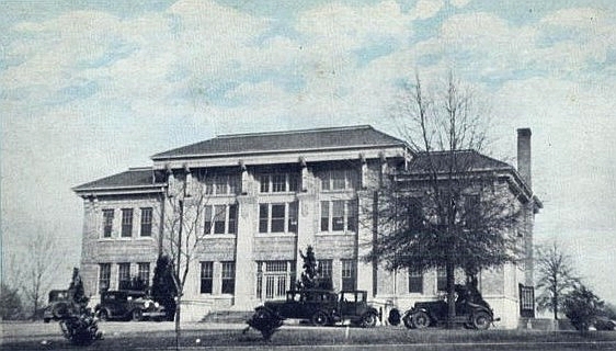

Stone County Courthouse, circa 1920
Stone County is a county located in the U.S. state of Mississippi. As of 2010, the population was 17,786. Its county seat is Wiggins[1]. Stone County was formed from the northern portion of Harrison County on June 5, 1916.[2] The county was named for John M. Stone, who served as Governor of Mississippi from 1876 to 1882 and again from 1890 to 1896. In 1918, the Stone County Courthouse was completed at a cost of $29,515.18,[3] and is still in use today, after several renovations.
Stone County is part of the Gulfport–Biloxi, Mississippi, Metropolitan Statistical Area.
Geography
According to the 2000 census, the county has a total area of 448.07 square miles (1,160.5 km2), of which 445.37 square miles (1,153.5 km2) (or 99.40%) is land and 2.71 square miles (7.0 km2) (or 0.60%) is water.[4]
Major highways
 U.S. Highway 49
- Mississippi Highway 15
- Mississippi Highway 26
- Mississippi Highway 29
Adjacent counties
- Perry County (northeast)
- George County (east)
- Jackson County (southeast)
- Harrison County (south)
- Pearl River County (west)
- Forrest County (northwest)
National protected areas
- De Soto National Forest (part)
- Sweetbay Bogs Preserve [5]
Demographics
| Historical populations | |||
|---|---|---|---|
| Census | Pop. | %± | |
| 1920 | 6,528 | ||
| 1930 | 5,704 | −12.6% | |
| 1940 | 6,155 | 7.9% | |
| 1950 | 6,264 | 1.8% | |
| 1960 | 7,013 | 12.0% | |
| 1970 | 8,101 | 15.5% | |
| 1980 | 9,716 | 19.9% | |
| 1990 | 10,750 | 10.6% | |
| 2000 | 13,622 | 26.7% | |
| 2010 | 17,786 | 30.6% | |
| MS Counties 1900-1990 GeoHive - 2000 & 2010 statistics | |||
As of the census[6] of 2000, there were 13,622 people, 4,747 households, and 3,626 families residing in the county. The population density was 31 people per square mile (12/km²). There were 5,343 housing units at an average density of 12 per square mile (5/km²). The racial makeup of the county was 79.42% White, 19.18% Black or African American, 0.29% Native American, 0.16% Asian, 0.03% Pacific Islander, 0.23% from other races, and 0.70% from two or more races. 1.25% of the population were Hispanic or Latino of any race.
There were 4,747 households out of which 37.30% had children under the age of 18 living with them, 58.80% were married couples living together, 13.30% had a female householder with no husband present, and 23.60% were non-families. 20.60% of all households were made up of individuals and 8.90% had someone living alone who was 65 years of age or older. The average household size was 2.72 and the average family size was 3.13.
In the county the population was spread out with 26.80% under the age of 18, 12.20% from 18 to 24, 27.40% from 25 to 44, 22.40% from 45 to 64, and 11.10% who were 65 years of age or older. The median age was 34 years. For every 100 females there were 98.20 males. For every 100 females age 18 and over, there were 96.00 males.
The median income for a household in the county was $30,495, and the median income for a family was $36,856. Males had a median income of $26,259 versus $21,228 for females. The per capita income for the county was $14,693. About 14.50% of families and 17.50% of the population were below the poverty line, including 23.10% of those under age 18 and 14.30% of those age 65 or over. Since Hurricane Katrina in August 2005 the population of Stone county has increased by about 40% overall in previously undeveloped areas such as the Beatrice community which now has several new property owners and homes. Industry in the area is at a standstill or decreasing due to lack of natural resources excluding timber and distance of travel being situated in a rural geographical area compared to other Mississippi coastal counties.


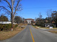
Stone County Courthouse, photo taken from Cavers Avenue, Wiggins, MS, circa 1920
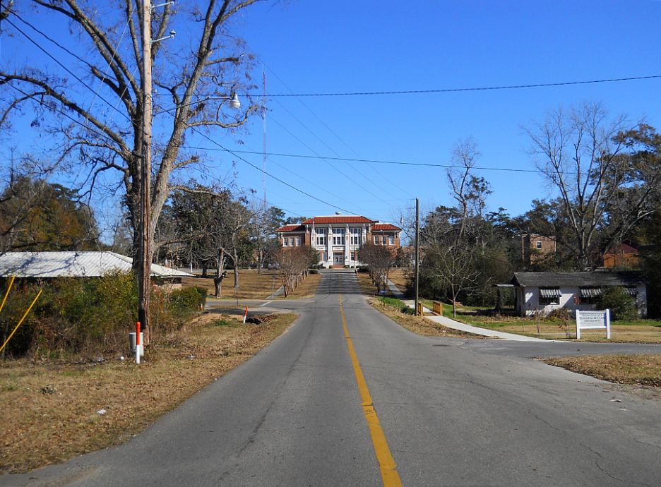
Stone County Courthouse, photo taken from Cavers Avenue, Wiggins, MS, December 2010
Communities
- Cities
- Wiggins
- Unincorporated places
- Beatrice
- Big Level
- Bond
- McHenry
- Perkinston
- Ramsey Springs
- Silver Run
See also
- National Register of Historic Places listings in Stone County, Mississippi
References
- ^ "Find a County". National Association of Counties. http://www.naco.org/Counties/Pages/FindACounty.aspx. Retrieved 2011-06-07.
- ^ A History of Mississippi Gulf Coast Community College accessed 1 January 2007.
- ^ Stone County accessed 18 February 2010.
- ^ "Census 2000 U.S. Gazetteer Files: Counties". United States Census. http://www.census.gov/tiger/tms/gazetteer/county2k.txt. Retrieved 2011-02-13.
- ^ The Nature Conservancy: Sweetbay Bogs Preserve
- ^ "American FactFinder". United States Census Bureau. http://factfinder.census.gov. Retrieved 2008-01-31.
| ||||||||||||||

| This page uses content from the English language Wikipedia. The original content was at Stone County, Mississippi. The list of authors can be seen in the page history. As with this Familypedia wiki, the content of Wikipedia is available under the Creative Commons License. |