| State College | |
|---|---|
 |
|
| Nickname(s): Happy Valley | |
 |
|
 |
|
| Coordinates: Coordinates: | |
| Country | United States |
| State | Pennsylvania |
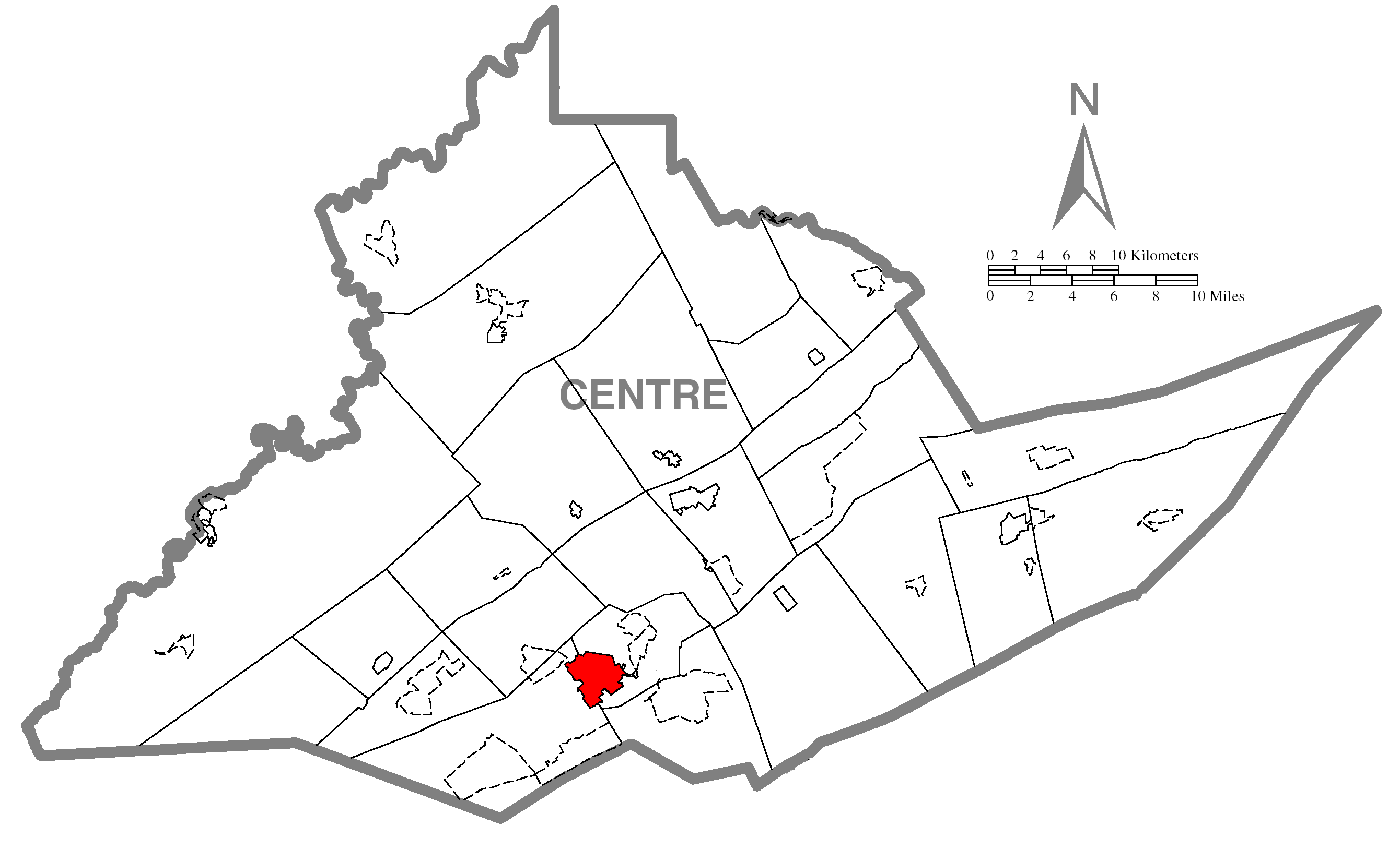
| County | Centre |
| Incorporated | August 29, 1896 |
| Government | |
| • Mayor | Elizabeth Goreham |
| Area | |
| • Total | 4.5 sq mi (11.8 km2) |
| Elevation | 1,154 ft (352 m) |
| Population (2010) | |
| • Total | 42,034 |
| • Density | 8,537/sq mi (3,256/km2) |
| Time zone | EST (UTC-5) |
| • Summer (DST) | EDT (UTC-4) |
| Zip | 16801, 16803, 16804, 16805 |
| Area code(s) | 814 |
| School district: | State College Area School District |
| Website | http://www.statecollegepa.us/ |
Local phone exchanges: 231, 234, 235, 237, 238, 272, 278, 321, 861, 863, 864, 865, 867 |
|
State College is the largest borough in Centre County in the U.S. state of Pennsylvania. It is the principal city of the State College, Pennsylvania Metropolitan Statistical Area which encompasses all of Centre County. As of the 2010 census, the borough population was 42,034, and roughly double that total lived in the borough plus the surrounding townships. As of the 2000 census population, 20,011 or 52.1% are males and 18,409 or 47.9% are females.[1]
The town is a college town, dominated economically and demographically by the presence of the University Park campus of the Pennsylvania State University (Penn State). "Happy Valley" is an often-used term to refer to the State College area, including the borough and the townships of College, Harris, Patton, and Ferguson.
In 2010, State College was ranked as the third-safest metropolitan area in the United States by the CQ Press.[2]
The area is served by the University Park Airport.
History[]
State College evolved from village to town to serve the needs of the fledgling Pennsylvania State College, founded as the Farmers' High School of Pennsylvania in 1855. Since then, the school has grown into a major university, renamed in 1953 The Pennsylvania State University. State College was incorporated as a borough on August 29, 1896 and has since grown with the university, sharing a symbiotic relationship. In 1973 State College adopted a home rule charter which took effect in 1976. The areas outside of State College are filled with historic towns and villages, immense tracts of farmland, and an expanse of mountains and forests.

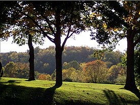
State College is known for beautiful fall foliage.
The university has a post office address of University Park, Pennsylvania, which is sometimes a cause for confusion. When Penn State changed its name from College to University in 1953, its president, Milton S. Eisenhower, sought to persuade the town to change its name as well. A referendum failed to yield a majority for any of the choices for a new name, and so the town remains State College. After this, Penn State requested a new name for its on-campus post office in the Hetzel Union Building from the U.S. Post Office Department. The post office, which has since moved across a street to the McAllister Building, is the official home of zip code 16802 (University Park).
Geography and climate[]
State College is at (40.791261, −77.858740). The elevation is approximately 1,200 feet (370 m) above sea level.[3] According to the United States Census Bureau, the borough has a total area of 4.5 square miles (12 km2), all of it land.
State College has a humid continental climate (Köppen Dfb). Temperatures average 25.4 °F (−3.7 °C) in January and 71.2 °F (21.8 °C) in July. Annual precipitation is just under 40 inches (1,000 mm), and 46.3 inches (118 cm) of snow a year falls in the city (Based on official 109-year average of snowfall at State College as per National Weather Service's State College office). The State College record low of -20 was set in 1899 and the record high of 102 was set in 1988. The record high of 84 in February is also a state record high, but the exact time of record is unknown, only 1878-1887.[4] If that record were excluded, the February record high would be listed as 73.
| Climate data for State College, Pennsylvania | |||||||||||||
|---|---|---|---|---|---|---|---|---|---|---|---|---|---|
| Month | Jan | Feb | Mar | Apr | May | Jun | Jul | Aug | Sep | Oct | Nov | Dec | Year |
| Record high °F (°C) | 71 (22) |
84 (29) |
86 (30) |
94 (34) |
93 (34) |
96 (36) |
102 (39) |
101 (38) |
98 (37) |
90 (32) |
81 (27) |
71 (22) |
102 (39) |
| Average high °F (°C) | 32.5 (0.3) |
36.0 (2.2) |
45.7 (7.6) |
58.2 (14.6) |
69.1 (20.6) |
76.9 (24.9) |
80.7 (27.1) |
79.1 (26.2) |
71.1 (21.7) |
60.1 (15.6) |
48.1 (8.9) |
37.1 (2.8) |
57.9 (14.4) |
| Average low °F (°C) | 18.3 (−7.6) |
19.9 (−6.7) |
27.2 (−2.7) |
37.6 (3.1) |
48.2 (9.0) |
57.3 (14.1) |
61.7 (16.5) |
60.1 (15.6) |
52.5 (11.4) |
41.0 (5.0) |
32.9 (0.5) |
24.0 (−4.4) |
40.1 (4.5) |
| Record low °F (°C) | −18 (−28) |
−20 (−29) |
−6 (−21) |
1 (−17) |
27 (−3) |
30 (−1) |
40 (4) |
30 (−1) |
28 (−2) |
16 (−9) |
1 (−17) |
−13 (−25) |
−20 (−29) |
| Precipitation inches (mm) | 2.89 (73.4) |
2.62 (66.5) |
3.37 (85.6) |
3.16 (80.3) |
3.70 (94) |
4.28 (108.7) |
3.59 (91.2) |
3.37 (85.6) |
3.65 (92.7) |
2.92 (74.2) |
3.37 (85.6) |
2.84 (72.1) |
39.76 (1,009.9) |
| Snowfall inches (cm) | 14.1 (35.8) |
11.2 (28.4) |
10.2 (25.9) |
1.3 (3.3) |
trace | 0 (0) |
0 (0) |
0 (0) |
0 (0) |
.1 (0.3) |
2.9 (7.4) |
7.3 (18.5) |
47.1 (119.6) |
| Avg. precipitation days (≥ 0.01 in) | 13.3 | 11.6 | 12.7 | 13.2 | 14.2 | 12.5 | 12.0 | 10.3 | 11.2 | 10.7 | 12.2 | 13.4 | 147.3 |
| Avg. snowy days (≥ 0.1 in) | 9.4 | 7.3 | 5.1 | 1.7 | 0 | 0 | 0 | 0 | 0 | .1 | 2.4 | 6.2 | 32.2 |
| Source: PA St Climatologist (normals, 1971–2000, extremes 1888–2001) [5] | |||||||||||||
Demographics[]
| Historical populations | |||
|---|---|---|---|
| Census | Pop. | %± | |
| 1900 | 851 | ||
| 1910 | 1,425 | 67.5% | |
| 1920 | 2,405 | 68.8% | |
| 1930 | 4,450 | 85.0% | |
| 1940 | 6,226 | 39.9% | |
| 1950 | 17,227 | 176.7% | |
| 1960 | 22,409 | 30.1% | |
| 1970 | 32,833 | 46.5% | |
| 1980 | 36,130 | 10.0% | |
| 1990 | 38,923 | 7.7% | |
| 2000 | 38,420 | −1.3% | |
| 2010 | 42,034 | 9.4% | |
| source:[6] | |||
As of the 2010 census, the borough was 83.2% White, 3.8% Black or African American, 0.2% Native American, 9.8% Asian, and 2.0% were two or more races. 3.9% of the population were of Hispanic or Latino ancestry [6].
As of the census[7] of 2009, there are 39,893 people, 12,024 households, and 3,306 families residing in the borough. The population density was 8,459.3 people per square mile (3,267.4/km²). There were 12,488 housing units at an average density of 2,749.6 per square mile (1,062.0/km²). The racial makeup of the borough was 84.31% White, 3.69% African American, 0.15% Native American, 8.77% Asian, 0.13% Pacific Islander, 1.38% from other races, and 1.58% from two or more races. 3.02% of the population were Hispanic or Latino of any race.
There were 12,024 households out of which 10.5% had children under the age of 18 living with them, 22.4% were married couples living together, 3.4% had a female householder with no husband present, and 72.5% were non-families. 33.5% of all households were made up of individuals and 5.9% had someone living alone who was 65 years of age or older. The average household size was 2.30 and the average family size was 2.69.
The age distribution of State College, overwhelmingly influenced by Penn State, was: 5.8% under the age of 18, 65.5% from 18 to 24, 16.2% from 25 to 44, 6.7% from 45 to 64, and 5.8% who were 65 years of age or older. The median age was 22 years. For every 100 females there were 108.7 males. For every 100 females age 18 and over, there were 109.1 males.
The median income for a household in the borough was $21,186, and the median income for a family was $54,949. Males had a median income of $34,388 versus $27,219 for females. The per capita income for the borough was $12,155. 46.9% of the population and 9.7% of families are below the poverty line. Out of the total population, 10.6% of those under the age of 18 and 2.2% of those 65 and older are living below the poverty line. However, traditional measures of poverty can be very misleading when applied to a community like State College which is dominated by students.
Culture[]
Happy Valley[]
"Happy Valley" is sometimes used as a colloquialism for the State College area. Commentators referring to Penn State athletic events often give the location as "Happy Valley" rather than mentioning State College or the specific campus facility.


The Corner of College Avenue and Allen Street in downtown State College, taken from the gates of Campus.
In a survey conducted in the late 1980s by Psychology Today, State College was ranked as one of the least stressful places in the United States. A more recent rating put State College 19th among "50 Smart Places to Live."[8] The same source states: "Sperling's BestPlaces research group has previously ranked State College the No.1 safest small city in America, and Forbes, thanks in large part to the tremendous amount of research conducted at the University, listed State College among the top 10 smaller metro areas in which to start a career or business."[9] In 2007, CNN Money said State College was the number one "single" city based on percentage of unmarried people living there.[10][11]
In the August issue of Rolling Stone Magazine, State College received honorable mention in best music scenes throughout the country. Bands formed in State College include The Imperial Orgy, Cootie Brown, and Katsu.
There are dozens of interesting restaurants and bars unique to State College, most of which are concentrated in the downtown area along College Avenue and Beaver Avenue and their cross streets.[12]
The Central Pennsylvania Festival of the Arts, usually referred to as "Arts Fest", is held downtown every July. The five-day festival features artists from around the country and draws more than 125,000 visitors. Many streets are closed off and lined with booths where people can buy paintings, pottery, jewelry, and a variety of other hand made goods. There are also numerous musical performances and plays to take in, and food vendors selling everything from funnel cakes to Indian cuisine.
Major events[]
- Central Pennsylvania Festival of the Arts
- Central PA 4th Fest (July 4 fireworks)
- Homecoming parade
- First Night (New Year's Eve celebration)
- Blue & White Weekend
- Penn State IFC/Panhellenic Dance Marathon (THON)
Notable people[]
- Abhay Ashtekar – Professor of Physics at Penn State, famous for his contributions in General Relativity and Quantum Gravity
- Walter Bahr – Professional soccer player, National Soccer Hall of Fame inductee, Penn State soccer coach
- Jesse Fritsch – professional skateboarder
- Larry Johnson – NFL running back drafted by the Kansas City Chiefs in 2003, born in La Plata, Maryland
- Si Kahn – Folksinger, political activist
- Butch Leitzinger – professional racecar driver
- Joshua Leonard – film actor, star of The Blair Witch Project and Madhouse
- James Morrow – science-fiction author (City of Truth)
- Joel N. Myers – Founder of AccuWeather.com, which is located in State College
- Tawni O'Dell – author
- Jim O'Hora – football coach, associate professor at Penn State
- Vance Packard – muckraker, social critic
- Joe Paterno – college football coach; born in Brooklyn, New York
- Rene Portland – former Penn State women's basketball coach[13]
- C. R. Rao – World-renowned statistician and Professor Emeritus at Penn State
- Kevin Robinson – Professional BMX Rider, X Games Gold Medalist
- Russ Rose – Volleyball Coach
- Rustum Roy – Penn State Professor Emeritus of Science, Technology, and Society, Founder of Materials Science Laboratory
- Jerry Sandusky – football coach, founder of Second Mile
- Arron Scott – Dancer, member of the American Ballet Theatre corps de ballet
- Matt Suhey – football player for the Chicago Bears
- Doug Sweetland – Animator for Pixar
Points of interest[]
- Arboretum at Penn State[14]
- Beaver Stadium – football venue
- Bryce Jordan Center – basketball and other indoor sports venue
- Citizens Bank Theatre – located in Downtown State College
- Friday Farmers' Market (During summer and fall only)
- Medlar Field at Lubrano Park, home of the State College Spikes baseball
- Jeffrey Field - soccer venue
- Memorial Field (State College Area High School football field)
- McCoy Natatorium - home of the Men's and Women's Penn State Varsity Swim Team Recreation Facilities
- Mount Nittany – hiking
- Old Main
- Pennsylvania State University
- The Creamery
- Playhouse Theatre -Home of Penn State's University Resident Theatre Company (URTC)
- Schlow Centre Region Library
- Tussey Mountain – skiing/snowboarding
- American Red Cross – Centre Communities Chapter[15]
- The State Theatre – Centre County's Performing Arts Center[16]
Media[]
State College's main daily newspaper is the Centre Daily Times (part of the McClatchy Company chain). Alternative newspapers include Voices of Central Pennsylvania and the State College City Guide. Newspapers of Pennsylvania State University's main campus include The Forum and the student-run Daily Collegian.[17]
Numerous magazines are also published in State College including Town & Gown,[18] State College Magazine,[19] Phroth,[20] and Good Life Magazine.[21]
Some of the more popular web media in State College include StateCollege.com[22] and HappyValley.com.[23]
State College is part of the Johnstown/Altoona/State College television market, which is currently ranked #99 in the nation. Two television stations broadcast out of State College including WPSU (PBS) and WHVL (MyNetwork TV). Johnstown-based WJAC-TV, the market's NBC affiliate, also maintains a satellite studio and office here.
The State College radio market is ranked #257 in the nation. Some of the more popular stations include WQCK WPSU, WKPS, WBUS, WQWK, WFGE, WBHV, and WMAJ.
Entertainment[]
Sports[]
While State College is famous for Penn State Nittany Lions football, the borough itself is also home to a minor league baseball sports franchise called the State College Spikes which is part of the New York - Penn League and has played in Medlar Field at Lubrano Park since 2006.
Prison[]
State College is located not far from the State Correctional Institution - Rockview, which is known as the state penitentiary, or the "state pen"[24] in humorous opposition to "Penn State".
Economy[]
Major employers[]
- The Pennsylvania State University
- AccuWeather- the world's largest private weather forecasting service, originated and based in State College, PA
- Brookline Village[25]
- Centre County Government[26]
- Geisinger Health System
- Giant Food Stores LLC
- Glenn O. Hawbaker Inc.[27]
- Hotel State College & Co.[28]
- HRI Inc.[29]
- Jostens Printing and Publishing
- Minitab[30]
- Mount Nittany Medical Center
- Raytheon Intelligence and Information Systems – formerly E-Systems and HRB Singer[31]
- Shaner[32]
- State College Area School District
- State Government
- U.S. federal government
- U.S. Department of Defense (PSU Applied Research Lab)[33]
- Walmart
- Wegmans
- Weis Markets
Shopping[]
Government and politics[]
Federal level[]
At the federal level, State College forms part of Pennsylvania's 5th congressional district. The current representative is Glenn "G.T." Thompson.
County level[]
At the county level, Centre County, Pennsylvania's county seat is in Bellefonte, Pennsylvania. There are three county-level district courts within State College, with the others being Philipsburg, Bellefonte, and Centre Hall.
The current county-level districts are divided as follows, all of which are common pleas courts. The jurisdictions include civil claims and summary offenses. Higher level courts are located in neighboring Bellefonte.[34]
- District 49-1-01, District Judge Carmine W. Prestia, serving State College, elected in 2007 for a 4 year term [35]
- District 49-3-05, District Judge Jonathan D. Grine, serving State College[36]
- District 49-2-01, District Judge Leslie A. Dutchcot, serving College, Ferguson, Halfmoon, and Patton Townships, elected in 2007 for 4 year term at $76,000/year[37]
Regional level[]
The Borough of State College is a member of the Centre Region Council of Governments (CRCOG)
Other Members are
- College Township, Pennsylvania
- Ferguson Township, Centre County, Pennsylvania
- Halfmoon Township, Pennsylvania
- Harris Township, Pennsylvania
- Patton Township, Pennsylvania
Local level[]
At the local level, the Borough of State College government is currently run by the following elected officials, based on the 2009 election results:[38]
- Mayor: Elizabeth A. Goreham
- President of Council: Ronald Filippelli
- Council Members:
- Ronald Filippelli
- Donald M. Hahn
- Theresa D. Lafer
- Silvi Lawrence
- Peter Morris
- James L. Rosenberger
- Thomas Daubert
Law enforcement[]
The law enforcement arm of the Borough of State College is the State College Police Department, served by Chief Thomas R. King. A large fraction of police force duties involve the monitoring of drinking and drinking-related activities in the town; for this reason, students often feel that they are unjustly targeted, particularly for underage drinking activities. Relations between students and police deteriorated after 2008 riots following the Ohio State football game and Phillies World Series win, when police pepper-sprayed many students who were not involved in the vandalism which took place on those nights.
Fire protection[]
The Alpha Fire Company operates out of 3 stations, the main stations within the Borough of State College, and responds with 3 engine-rescues, 2 wagons, 2 tower ladders, 1 quint, 1 heavy rescue and 2 tankers. The department's annual run total is around 1100.
The Alpha Fire is an All Volunteer Fire Company, arguably the largest in the state when the size and population of Penn State is factored in.
The Fire Department is led by 5 chiefs, 3 captains, and 5 lieutenants. The fire company operates under the Centre Region Council of Governments under the direction of Fire Director Steve Bair.
Education[]
Public schools[]
State College is served by the State College Area School District.[39]
Private schools[]
There are also a variety of private schools, including the Grace Prep High School,[40] State College Friends School,[41] Nittany Christian School,[42] and Our Lady of Victory Catholic school.
Higher education[]
Penn State University is located partially in the borough of State College.[43][44]
Libraries[]
State College is served by the following libraries:[45]
- Aaronsburg Public Library
- American Philatelic Research Library
- Centre County Book Mobile
- Centre Hall Area Branch Library
- Holt Memorial Library
- Pennsylvania State University Libraries
- Pattee and Paterno Libraries (main library)
- Hammond Library (engineering)
- Pollock Library (study library)
- Davey Library (physical and mathematical sciences)
- Deike Library (earth and mineral sciences)
- Stuckeman Library (architecture and landscape architecture)
- Schlow Centre Region Library <http://schlowlibrary.org/>
- The Centre County Library
Hospitals[]
- HealthSouth
- HealthSouth Spine & Rehabilitation Center
- Mount Nittany Medical Center
- University Park Nursing Center
Infrastructure[]
Roads[]
State College is served by:
- I-80 (to the north)
- I-99 (runs North-South connecting I-80 with the Pennsylvania Turnpike)
- U.S. Route 220
- U.S. Route 322
- U.S. Route 322 Business (Atherton Street)
- PA 26 (College and Beaver Avenues)
- PA 45 (to the south, passes through Boalsburg and Pine Grove Mills)
- PA 64
Airport[]
The closest airport is the University Park Airport.
Mass transportation[]
- Centre Area Transportation Authority provides buses that run within the greater State College area
- Greyhound Lines, stops at right next to the university, but offers only limited non-stop services.
- Dragon Deluxe Bus Line provides low-cost, daily, non-stop service between New York City and State College.
- Megabus offers services between State College and Harrisburg, New York, Philadelphia and Pittsburgh.
- Fullington Trailways offers a range of express services during the university year.
General information[]
- ZIP Codes: State College: 16801, 16803, 16804, 16805; University Park: 16802
- Area Code: 814
- Local Phone Exchanges: 231, 234, 235, 237, 238, 272, 278, 861, 863, 865, 867
See also[]
- Central Pennsylvania Festival of the Arts
- Pennsylvania State University
- State College Area High School
- State College Spikes
References[]
- ^ City Data
- ^ CQ Press City Crime Rankings 2010-2011
- ^ "US Gazetteer files: 2010, 2000, and 1990". United States Census Bureau. 2011-02-12. http://www.census.gov/geo/www/gazetteer/gazette.html. Retrieved 2011-04-23.
- ^ http://pasc.met.psu.edu/PA_Climatologist/state/misc/paex.html
- ^ "Climatography of the United States No. 20 1971–2000: STATE COLLEGE, PA" (Web). National Oceanic and Atmospheric Administration. http://pasc.met.psu.edu/cgi-bin/lcdclim.cgi. Retrieved 2011−02−06.
- ^ [1] .
- ^ "American FactFinder". United States Census Bureau. http://factfinder.census.gov. Retrieved 2008-01-31.
- ^ 50 Smart Places to Live. Kiplinger.com. Retrieved on 2011-03-30.
- ^ [2]
- ^ Cox, Jeff. "State College, PA". CNN. http://money.cnn.com/galleries/2007/moneymag/0707/gallery.BPTL_most_singles.moneymag/index.html. Retrieved May 24, 2010.
- ^ http://www.bestplaces.net/zip-code/?zip=16801&city=State_College_PA
- ^ Downtown State College. Downtown State College. Retrieved on 2011-03-30.
- ^ Penn State University Official Athletic Site – Women's Basketball. Gopsusports.cstv.com. Retrieved on 2011-03-30.
- ^ The Arboretum at Penn State. Arboretum.psu.edu. Retrieved on 2011-03-30.
- ^ Centre Communities Chapter. Centre.redcross.org. Retrieved on 2011-03-30.
- ^ StateTheatre. StateTheatre. Retrieved on 2011-03-30.
- ^ "Pennsylvania Newspapers". NewsLink. http://www.newslink.org/panews.html. Retrieved March 20, 2011.
- ^ [3]
- ^ State College Magazine, Pennsylvania. State College Magazine (2011-03-01). Retrieved on 2011-03-30.
- ^ [4]
- ^ Good Life in Happy Valley | Centre Daily Times – State College, PA | Penn State, Nittany Lions, weather, news, jobs, homes, apartments, real estate. Centredaily.com (2009-06-19). Retrieved on 2011-03-30.
- ^ State College, PA – Penn State University. Statecollege.com. Retrieved on 2011-03-30.
- ^ State College and Penn State Football, Restaurants, Bars, Attractions, Sports and Entertainment. HappyValley.com. Retrieved on 2011-03-30.
- ^ "SI.com". CNN. http://sportsillustrated.cnn.com/2003/sioncampus/09/04/road_trip0909/index.html. Retrieved May 24, 2010.
- ^ Brookline – Living Solutions for Life. Brooklinevillage.com (2010-11-22). Retrieved on 2011-03-30.
- ^ Centre County Government: Home Page. Co.centre.pa.us. Retrieved on 2011-03-30.
- ^ Glenn O. Hawbaker Inc. Heavy Construction Services & Products. Goh-inc.com. Retrieved on 2011-03-30.
- ^ Hotel State College & Company. Hotelstatecollege.com. Retrieved on 2011-03-30.
- ^ HRI, Inc. – Asphalt Paving, Manufacturing, and Heavy & Highway Construction. Hrico.com. Retrieved on 2011-03-30.
- ^ Software for Statistics, Process Improvement, Six Sigma, Quality. Minitab. Retrieved on 2011-03-30.
- ^ Hrb-Singer Inc State College Pa – Storming Media. Stormingmedia.us. Retrieved on 2011-03-30.
- ^ Shaner Hotels. Shanercorp.com. Retrieved on 2011-03-30.
- ^ The Applied Research Laboratory at Penn State. Arl.psu.edu. Retrieved on 2011-08-11.
- ^ Centre County Government: District Judges. Co.centre.pa.us. Retrieved on 2011-03-30.
- ^ de beste bron van informatie over districtcourt49101. districtcourt49101.com. Retrieved on 2011-03-30.
- ^ District Court 49-3-05 – Centre County – Examination Report – 11/13/07. (PDF) . Retrieved on 2011-03-30.
- ^ [5]
- ^ Borough of State College Government – Council Members. Statecollegepa.us. Retrieved on 2011-03-30.
- ^ State College Area School District. Scasd.org. Retrieved on 2011-03-30.
- ^ Grace Prep High School : An Innovative, Award-winning School of Academic Excellence. Graceprep.com (2010-05-26). Retrieved on 2011-03-30.
- ^ State College Friends School. State College Friends School. Retrieved on 2011-03-30.
- ^ Nittany Christian School. Nittanychristian.com (2006-10-02). Retrieved on 2011-03-30.
- ^ State College borough, Pennsylvania. U.S. Census Bureau. Retrieved on August 24, 2009.
- ^ College township, Pennsylvania. U.S. Census Bureau. Retrieved on August 24, 2009.
- ^ Libraries. Statecollege.com. Retrieved on 2011-03-30.
External links[]
- Borough of State College Government website
- StateCollege.com State College's news and information website
- Centre Daily Times
- Alpha Fire Company #5
- Centre Region Council of Governments
- CATABus.com, the bus company serving State College, PA.
- Central Pennsylvania Convention & Visitors Bureau
- Central Pennsylvania Festival of the Arts
- Chamber of Business & Industry of Centre County
- City Data on State College,PA
- Downtown State College Improvement District
- Map 536 *Augmented by Wood, C. R. (1980), Summary groundwater resources of Centre County, Pennsylvania, Pennsylvania Geological Survey, 4th ser., Water Resource Report 48, 60 p.
- Scasd.org, the Web site of the State College Area School District Scasd
- StateCollegeForum.com, Free discussion forum for anyone interested in what is going in the State College area.
- HappyValley.com, Information on of all State College's arts, music, sports, and events. Request events at the Bryce Jordan Center on the forum.
| ||||||||||||||||||||

Template:State College, Pennsylvania Template:The Pennsylvania State University

|
Clearfield | Bellefonte | Lock Haven |
|
| Phillipsburg | Lewisburg | |||
 State College | ||||
| Altoona | Huntingdon | Lewistown |
| This page uses content from the English language Wikipedia. The original content was at State College, Pennsylvania. The list of authors can be seen in the page history. As with this Familypedia wiki, the content of Wikipedia is available under the Creative Commons License. |