| ||||||||||||||
| Sri Muktsar Sahib district ਜ਼ਿਲ੍ਹਾ ਸ੍ਰੀ ਮੁਕਤਸਰ ਸਾਹਿਬ Sri Muktsar Sahib district |
|
|---|---|
| — District — | |
 |
|
| Country | |
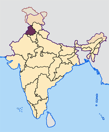
| State | Punjab |
| District | Sri Muktsar Sahib |
| Headquarters | Sri Muktsar Sahib |
| Talukas | Sri Muktsar Sahib |
| Area | |
| • Total | 2,615 km2 (1,010 sq mi) |
| Elevation | 184 m (604 ft) |
| Population (2011) | |
| • Total | 9,02,702 |
| • Density | 348/km2 (900/sq mi) |
| Languages | |
| • Official | Punjabi (Gurmukhi) |
| • Regional | Punjabi |
| • Other | English, Urdu and Hindi |
| Time zone | IST (UTC+5:30) |
| PIN | 152*** |
| Telephone code | 0163* |
| Vehicle registration | PB |
| Sex ratio | 1000/891 ♂/♀ |
| Literacy | 69% |
| Website | muktsar.nic.in |
Sri Muktsar Sahib district (Punjabi: ਸ੍ਰੀ ਮੁਕਤਸਰ ਸਾਹਿਬ ਜ਼ਿਲ੍ਹਾ) is one of the twenty two districts in the Indian Punjab. Its capital, the city of Sri Muktsar Sahib, is renamed from Muktsar to Sri Muktsar Sahib and so the district.[1] Other towns include Malout (the largest town by population) and Giddarbaha.
History[]
The last battlefield of the tenth Sikh Guru, Guru Gobind Singh, lies in the district's main city. A huge battle, knowns as Battle of Muktsar, was took placed between the Mughals and the Sikhs in 1705 where a Gurudwara, Gurudwara Tibbi Sahib, now marks the site.
The district har many historical Gurudwaras including, Darbar Sahib, Shaheedi Gurudwara, and Tibbi Sahib in the main city and many more in the different villages of the district.
A huge fair, known as "Mela Maghi", is celebrated in January every year at Sri Muktsar Sahib city in the memory of the forty martyrs (librated ones).
Demographics[]
According to the 2011 census Sri Muktsar Sahib district has the total population of 902,702, [2] roughly equal to the nation of Fiji[3] or the US state of Delaware.[4] This gives it a ranking of 464th in India (out of a total of 640)[2]. The district has a population density of 348 inhabitants per square kilometre (900 /sq mi). Its population growth rate over the decade 2001-2011 was 16.1%. It has a sex ratio of 895 females for every 1000 males and a literacy rate of 66.8 %.[2]
The principal Jatt Sikh clans are, Sidhu Brar, Sandhu, Sekhon, Buttar, Gill, Maan, Bhullar, Aulakh, Virk, Dhaliwal, Dhillon.
References[]
- ^ Prabhjot Singh (31 January, 2010). "Muktsar is now Sri Muktsar Sahib". The Tribune, Chandigarh. http://www.tribuneindia.com/2010/20100201/punjab.htm#4. Retrieved 23 January 2012.
- ^ a b c "District Census 2011". www.census2011.co.in. 2011. http://www.census2011.co.in/district.php. Retrieved 22 January, 2012.
- ^ US Directorate of Intelligence. "Country Comparison:Population". https://www.cia.gov/library/publications/the-world-factbook/rankorder/2119rank.html. Retrieved 01 October, 2011. "Fiji 883,125 July 2011 est."
- ^ "2010 Resident Population Data". U.S. Census Bureau. http://2010.census.gov/2010census/data/apportionment-pop-text.php. Retrieved 2011-09-30. "Delaware 897,934"
External links[]

|
Faridkot district |
| ||
| Firozpur district | Bathinda district | |||
 Sri Muktsar Sahib district | ||||
| Hanumangarh district, Rajasthan | Sirsa district, Haryana |
Template:Sri Muktsar Sahib district
| ||||||||||||||||||||
| This article about a location in the Indian state of Punjab is a stub. You can help by expanding it. |
| This page uses content from the English language Wikipedia. The original content was at Sri Muktsar Sahib district. The list of authors can be seen in the page history. As with this Familypedia wiki, the content of Wikipedia is available under the Creative Commons License. |