| ||||||||||||||
-
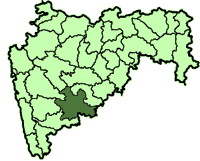
| Solapur district सोलापूर जिल्हा |
|
|---|---|
| — District of Maharashtra — | |
 |
|
| Country | India |
| State | Maharashtra |
| Administrative division | Pune Division |
| Established | |
| Headquarters | Solapur |
| Tehsils | 1. Akkalkot, 2. Barshi, 3. Karmala, 4. Madha, 5. Mangalwedha, 6. Malshiras, 7. Mohol, 8. North Solapur, 9. Pandharpur, 10. Sangola, 11. South Solapur |
| Government | |
| • Lok Sabha constituencies | 1. Solapur (SC), 2. Madha (shared with Satara district), 3. Osmanabad (shared with Osmanabad district) (Based on Election Commission website) |
| • Assembly seats | 10 |
| Area | |
| • Total | 14,845 km2 (5,732 sq mi) |
| Population (2001) | |
| • Total | 38,49,543 |
| • Density | 260/km2 (670/sq mi) |
| • Urban | 31.83% |
| Demographics | |
| • Literacy | 71.2% |
| • Sex ratio | 935 |
| Major highways | NH-9, NH-13, NH-211 |
| Coordinates | - |
| Average annual precipitation | 545.4 mm |
| Website | Official website |
Solapur District is a district in Maharashtra state of India. The city of Solapur is the district headquarters. It is located on the south east edge of the state and lies entirely in the Bhima and Seena basins. The entire district is drained by the Bhima River.[1]
Solapur district leads in beedi production. Kundalsangam, Karmala and Barshi have adopted the path of development through industry and education. Akkalkot also has mallikarjun temple where many lingayat devotees workship daily.
Solapur is an ancient historical and religious place with Shri Siddharameshwar as its "Gramadaiwata". Shri Siddharameshwar was a historical figure of the 12th century whose "Karmayoga" on his own native land-Solapur, turned him into a God-figure over the course of time. Siddharama was a great conributor to Lingayata religion and he is considered as one of the six prophets of Lingayat religion. He had gained the "Siddhi". As Solapur was a drought prone area, Shri Siddharameshwar dug a lake with the help of 4000 "Sharanas" to solve the problem of potable water. He entombed himself alive (Shivyogsamadhi) at Solapur.
During the Indian independence movement, the people of Solapur enjoyed full freedom on 9th, 10 and 11 May 1930. However, this resulted in the executions of Shri Mallappa Dhanshetti, Shri Kurban Hussein, Shri Jagannath Shinde and Shri Kisan Sarda who were hanged on 12 January 1931, in the prison at Pune. This resulted in the city becoming recognized as "The City of Hutatmas".
The presiding deity of Maharashtra, Lord Vitthal is at Pandharpur in this district. Swami Samarth of Akkalkot has followers from all walks of life. Solapur is famous as a textile town, especially owing to its talented weavers’ community, and is an important railway junction on the North-South train line.
History[]
Ancient[]
The Early Badami Chalukyas and the Later Kalyani Chalukyas, whose capitals were situated in the Kannada country, were known as Kuntaleshvaras (the lords of Kuntala). Their capital was situated at Manapura (modern Man in the Satara district). The neighbouring territory now comprised in the Satara and Sholapur districts came to be known as Mana-desha, which is named in some records of the age of the Seuna Yadavas of Devagiri. The Kuntala country comprising the Sholapur District was included in the Empire of Ashoka the Great.
Mananka, the founder of the early Rashtrakuta family, flourished in circa A.D. 350. He founded Manapura, which he made his capital. He is described in one of his grants as the illustrious ruler of the Kuntala country. Kuntala was the name of the upper Krishna valley in ancient times. The places mentioned in some of the grants can be identified in the Satara and Sholapur Districts. Their capital Manapura is probably identical with Man, the chief town of the Man taluka of the Satara district. These Rashtrakutas of Manapura often came into conflict with the Vakatakas of the Vatsagulma branch. The Pandarangapalli plates of Avidheya state that Mananka harassed the rulers of Ashmaka and Vidarbha. On the other hand, an inscription in Cave XVI at Ajanta states that the Vakataka king Vindhyasena (i.e., Vindhyashakti II) defeated the king of Kuntala, who evidently belonged to this Rashtrakuta family. A stone inscription at Mardi in the Sholapur District mentions several grants made to the god Yogeshvara during the reigns of the Seuna Yadavas of Devagiri kings Bhillama V, Jaitugi and Singhana II (1173 C.E to 1247 C.E.).[2] From the particulars of the regnal fourth year of Bhillama mentioned therein it seems that he had come to the throne in Shaka 1106 (A.D. 1184). He conquered the Sholapur territory from the Kalachuris sometime after Shaka 1102 in which some grant had been made to the same temple during the reign of the Kalachuri king Sankamadeva. The inscription mentions Marudhi as the ancient name of modern Mardi. Several inscriptions in the Sholapur District record gifts made in the reign of Singhana. The aforementioned Mardi inscription mentions the Shaka year 1134 as the thirteenth regnal year of Singhana. Two other inscriptions of the reign of Singhana have been found at Pulunj[3] about 12 miles (19 km) east of Pandharpur in the Sholapur District. One of them mentioning the Siddharatha cyclic year corresponding to Shaka 1121 records Singhana's grant of the village It the to Ammugidevara, a devotee of the god Siddhasomanatha at the town of Purnajapura (modern Pulunj). The inscription mentions several other places in the neighbourhood of Pulunj such as Soijana (Sowdane), Kuruvalage (Kurul), Degave (Degaon), Lalige (Nulee), Pattharige (Pathari), Koravalli (Kuroli), Chinchavalli (Chincholi), Asuthige (Ashti), Revalapala (Ropale), Tungatuha (Tungat), Eventige (Yevati) and Poragave (Pohargaon). Many of these names are Kannada and the inscription also is written in the Kannada language. Some inscriptions of the reign of Ramachandra have been found at Velapur, ten miles (16 km) south-east of Malshiras in the Sholapur District.[4]
Medieval[]
By 1351 Ala-ud-din Hasan Gangu Bahamani, by treating the local authorities in a liberal and friendly spirit, had brought under his power every part of the Deccan which had before been subject to the throne of Delhi. Hasan Gangu declared his independence in 1347, and made Gulbarga his capital. He seized the frontier fortresses of Karnataka and Telangana. The new kingdom which he founded comprised the Maratha country, and was divided into the following four provinces: Daulatabad and Berar on the north, and Gulbarga and the ceded districts of Telangana on the south. In 1357 Ala-ud-din had divided his kingdom into four provinces or tarafs over each of which he set a provincial governor or tarafdar. Sholapur formed part of the province of Gulbarga, which, besides Sholapur, included Gulbarga, Bijapur, Raichur, Mudgal, Sagar and Naldurg. The next king, Humayun, entered on a campaign into Telangana in 1459, and during his absence an insurrection broke out at Bidar. He returned, and having quelled the disturbance, put his brothers to a cruel death and was very severe with the insurgents. In 1460, a famine known as Damajipant's famine again wasted the Deccan. According to the local story a Brahman named Damajipant was employed at Mangalvedha about twelve miles (19 km) south of Pandharpur, as a revenue officer under the Bidar Government. He had charge of a large store of Government grain at Mangalvedha. Hundreds of Brahmans and others flocked to Mangalvedha and were fed by Damajipant out of the Government stores. Hearing of his breach of trust the Bidar king issued orders that Damaji should be seized and brought before him. While Damaji was on his way to Bidar, the god Vithoba, whom Damaji worshipped, took pity on his devotee and appearing as a village Mahar at Bidar paid the price of the grain distributed by Damaji.[5]
Under the partition treaty of 1497, between Malik Ahmad, the Nizam Shahi king of Ahmadnagar, Yusuf Adil Shah of Bijapur, and Imad-ul-Mulk of Berar, the whole province of Daulatabad, which must have included Paranda and its eleven districts became part of Malik Ahmad's dominions. Khwaja Jahan of Parenda and his brother Zain Khan, though excluded from this partition treaty, continued to hold Parenda and the eleven surrounding districts in subjection to Ahmadnagar. Zain Khan, the younger brother, who was governor of Sholapur, laid claim to half of the eleven districts and endeavoured to obtain a grant from Bidar to that effect.
On the death of Yusuf Adil Shah (1510) the Bijapur regent Kamal Khan imprisoned the young king Ismail Adil Shah and his mother Bubuji Khanam, and marched with a force to Sholapur which he besieged for three months. As no aid came from Ahmadnagar. Zain Khan, on receiving security for the safety of his family and wealth, delivered (1511) Sholapur into Kamal Khan's hands together with the five and a half districts of which he had charge. Parenda and its five and a half districts, including perhaps Karmala, Madha and Barshi, the three northern sub-divisions of the present district of Sholapur, remained for many years under Khwaja Jahan who seems to have been a half-independent vassal of the king of Ahmadnagar.
In 1623 Malik Ambar collected an excellent army, and, bringing grain from Daulatabad laid siege to Sholapur and took it by storm. In 1635, the Moghal general Shaista Khan marched towards the Bijapur borders, reduced Naldurg, and occupied the districts between Sholapur and Bidar. In 1636, under a treaty between the Bijapur king and the Moghals, the Nizam Shahi dynasty came to an end, and it was settled that the forts of Parenda and Sholapur with their dependent districts should be given to the Bijapur king Mahmud Adil Shah.
In 1689, Aurangzeb retired from Bijapur and encamped at Akluj on the Bhima near Pandharpur about eight miles (13 km) north-east of Malshiras in order to concentrate all his power and energy against Sambhaji. After his arrival at Akluj he was harassed by plundering parties of Marathas and detachments were sent to Sambhaji's territories. One of these under Mukarrab Khan was sent to Kolhapur. Mukarrab Khan succeeded in capturing Sambhaji and twenty-six others at Sangameshvar in Ratnagiri and marched with the prisoners to the Moghal camp. The news of Sambhaji's capture reached Aurangzeb first through the news reports and was received at Akluj with great rejoicing.
Maratha period[]
At the time of the death of Aurangzeb the Deccan was divided into the provinces of Berar, Aurangabad, Bidar and Bijapur. Sholapur which formed part of the province of Bijapur passed to Kam Baksha, Aurangzeb's son, who had been appointed governor of Bijapur and continued under him till in 1708 he was killed in an engagement with his brother Bahadur Shah (1707–1712).
In the contest for the imperial throne among Aurangzeb's sons, prince Azam on promise of steadfast allegiance, released Shahu, Sambhaji's son, who had been a prisoner in the Moghal camp since Sambhaji's execution in 1689. Shahu was also promised the tract conquered by Shivaji from Bijapur with additional territory between the Bhima and the Godavari. This tract included Sholapur; but Azam's defeat and death at Agra by Bahadur Shah prevented Shahu, when master of Satara, from taking possession of the country promised by Azam.
In 1719, in reward for the help given to Sayyad Husain Khan and his brother in deposing the Emperor Farrukhsiyar Shahu received, besides two grants for levying chauth or one-fourth and sardeshmukhi or ten per cent of the revenues of the six Deccan provinces, the country east of Pandharpur as part of his home rule or swarajya. The country watered by the Nira and the Man which includes east and part of south Sholapur, and which was noted for good horses, hardy soldiers, and some ancient and independent Maratha families was also placed under the authority of Shahu.[6]
Nizam-ul-Mulk who had seized power in the Deccan was appointed Wazir in January 1722. He was soon tired of the court intrigues. In 1724, he marched towards the South outwardly professing allegiance to the emperor but in reality determined to establish himself permanently in the Deccan. In the battle of Fatch Kharda fought in October 1724, Mubariz Khan, the Subhedar of Deccan, was killed. The emperor had then little choice but to confirm Nizam-ul-Mulk to the subha of the Deccan. He now became the master of the Moghal dominions south of the Narmada. The fort and town of Sholapur, Karmala, and other portions of north and west Sholapur, which did not form part of the Maratha home rule or swarajya, then passed on to the Nizam.
In 1802, Yashwantrao Holkar who in exasperation moved south. He sacked Ahmadnagar and burnt Shinde's palaces at Shrigonda and Jambgaon. One of his officers, Fattesinh Mane, descended upon Pandharpur when the priests and religious managers of the place held a large congregation for a week conducting fervent prayers night and day for the safety of the Shinde from spoliation. Mane arrived at Pandharpur but refrained from doing any harm and even gave some present to the deity. Bajirao now followed delaying tactics hoping for the arrival of Shinde's troops. Yeshwantrao proceeded towards Baramati and wrote to Bajirao in cordial terms. Still he did not relent. On 25 October 1802 Yeshwantrao completely overwhelmed Shinde. Bajirao II, terror-stricken, fled Pune, and in spite of the hand of friendship again offered by Yeshwantrao sought protection of the English. He signed with them, on 31 December 1802, the treaty of Bassein under the terms of which he practically surrendered the sovereignty of the Maratha State to the English. The issue now became a general one, of a conflict between the English and the Maratha State. In April 1803 in accordance with the treaty of Bassein, General Arthur Wellesley passed through Pandharpur and Akluj to Pune to reinstate Bajirao Peshwa who had been driven away from Pune by Yeshwantrao Holkar in October 1802. At Akluj, General Wellesley was joined by Colonel Stevenson, the detachment under whose command was reinforced by the Scotch Brigade.
Now dispute arose between Bajirao and Fatesing Gaikwad of Baroda in regard to the payment of yearly tribute amounting to 24 lakhs and which had accumulated considerably. To settle this dispute with Bajirao, Fatesing sent his agent Gangadhar Shastri to Pune. Bajirao's love of intrigue and the influence which Trimbakji Dengle had over him made the Gaikwad so afraid of treachery that before sending Gangadhar Shastri to Pune he obtained from the English a formal guarantee of Gangadhar Shastri's safety. Finding his efforts at Pune fruitless Gangadhar Shastri determined to return to Baroda and leave the settlement to the English arbitration. This disconcerted Bajirao's plans whose real object was to arrange a union with the Gaikwad against the English and he and Trimbakji Dengle after much persuasion induced Gangadhar Shastri to stay. In order to put Gangadhar Shastri off his guard Bajirao proposed to accompany him on a tour of pilgrimage to Nasik, Trimbak and Pandharpur and to have his son's marriage performed at Nasik. Gangadhar Shastri was killed at Pandharpur.
Post 1818[]
On the plains of Ashti, the devoted Maratha general Bapu Gokhale fought a battle with General Smith on 19 February 1818 and died a hero's death for his master Peshwa Bajirao II who in his anxiety to escape had no patience to look after his fallen hero and his associates. Young Pratapsinh, the Chhatrapati and his party who were similarly left helpless on the camping ground with all Bajirao's treasure valued at about one crore, fell into British hands. The Chhatrapati was soon handed over by General Smith to Elphinstone, the Commissioner of the Deccan. The Marathas still put up a last ditch fight at the Sholapur fort under the direction of Ganpatrao Panse who used his ammunitions with effect, but he also fell wounded and the resistance was over.
When Bajirao left Maharashtra for good in 1818, one Bhagwantrao became the first Mamlatdar of Sholapur under the British, Venkatappa, Shriniwasrao and Bhagwantrao acting as administrators. In the course of the arrangements that followed subsequently, the western part of the present Sholapur district including Pandharpur fell within the jurisdiction of the Raja of Satara and the southern part including Mangalwedha remained with the Patwardhan Sardars of Sangli.
The areas which now form Sholapur district were formerly included in Ahmadnagar, Pune and Satara. Karmala was in Ahmadnagar, Mohol in Pune and Pandharpur, Malshiras and Sangola in Satara (which was then an Indian State). Barshi and Sholapur frequently changed between Ahmadnagar and Pune districts. The sub-collectorate of Sholapur was formed under Ahmadnagar district in 1830. The district of Sholapur was formed in 1838 and consisted of the following sub-divisions, viz., Sholapur, Barshi, Mohol, Madha, Karmala, Indi, Hippargi and Muddebihal. The district was, however, abolished in 1864. In 1869 the sub-divisions of Sholapur, Barshi, Mohol, Madha and Karmala together with Pandharpur and Sangola from Satara district were again formed into Sholapur district to which Malshiras was transferred from Satara district in 1875. There were no major changes in the district or taluka boundaries between 1891 and 1941. Consequent upon the merger of the former Indian States two villages of Jamkhindi, 21 villages of Jath State, thirteen villages and one town of Kurundwad State, thirteen villages of Miraj Senior State, three villages of Miraj Junior State, 28 villages and one town of Sangli State and a part of Akkalkot State were added and three talukas of Mohol, Akkalkot and Mangalwedha were newly formed in 1949. The Sholapur taluka was split up in two talukas, viz., South Solapur and North Solapur.
In 1950, 53 enclave villages were transferred from Hyderabad State and included in the district in exchange for twelve enclave villages belonging to this district transferred to Osmanabad and Gulbarga districts. One village from Indi taluka of Bijapur district was also added to Mangalwedha taluka of this district in 1950. With the re-organisation of States in 1956 the district was included in the then Bombay State and since 1960, it forms part of Maharashtra. According to the old Gazetteer of Sholapur, in 1884 the district was divided into seven sub-divisions covering on an average an area of 646 square miles, 102 villages and 83,212 people. For administration purposes the district is at present divided into eleven talukas.
Facts[]
District - Solapur
Area - 14886 km²
Sub-divisions - Solapur, Madha (Kurduwadi), Pandharpur
Talukas - North Solapur, Barshi, Akkalkot, South Solapur, Mohol, Mangalwedha, Pandharpur, Sangola, Malshiras, Karmala, Madha.
Proposal for a separate Phandarpur District The Solapur district is under proposal to be bifurcated and a separate Phandarpur district be carved out of existing Solapur district.
Distance from Mumbai - 450 km
Means of transport - Railway stations -Solapur, Mohol, Kurduwadi, Madha, Akkalkot Road ST Buses, SMT (Solapur Municipal Transportation, Auto-Rikshaws. Solapur station has daily train service to Mumbai via Pune known as Siddheshwar Express Also, daily shuttle from Solapur to Pune known as Hutatma Express and one more daily super fast train Solapur to Mumbai via Pune known as Indrayani Express
Population
- Total - 3,849,543 (District)
The district is 31.83% urban as of 2001. [1]
Area under irrigation - 4,839.15 km²
Irrigation projects Major-1 Medium-2 Minor-69 Imp. Projs.- Bhima Ujjani
Industries Big-98 Small-8986
Languages/dialects - Marathi, Kannada, Telugu, Urdu
Folk-Arts - Lavani, Gondhal, Dhangari, Aradhi and Bhalari songs
Weather Temperature Max: 44.10 °C Min: 4.4 °C Rainfall-759.80 mm (Average)
Main crops - Jowar, wheat, sugarcane Solapur district especially Mangalwedha taluka is known for Jowar. Maldandi Jowar is famous in all over Maharashtra. In December - January agriculturists celebrates Hurda Party. This is also famous event in Solapur. Hurda means pre-stage of Jowar. Agriculturists sow special breed of Hurda, named as Dudhmogra, Gulbhendi etc.
Area under horticulture - 600 km²
Health infrastructure PHCs-67 Rural Hosp.-14 Dist. Hosp.-1 Big Hosp.-30
Tourist places - Pandharpur, Kundalsangam, Akkalkot, Akluj, Barshi, Karmala, Nanaj (North Solapur taluka). In Pandharpur, warkaris come for having darshan of Lord Vitthal and Rukmini without any invitation on Aashadhi Ekadashi and Kartiki Ekadashi. Lakhs of warkari come by walking in scorching sunny or rainy days. They walk hundreds of miles with chanting of Dhyanoba-Tukaram. Jai Jai Vitthal Jai hari Vitthal. Lord Vitthal's temple is of ancient time. This is unique case in world to which statue devotee can touch. Mangalwedha is known as a land of saints like Damaji, Kanhopatra, and Tikacharya. For Damaji, Lord Vitthal came at Mangalwedha as a Vithoo Mahar. Damaji was head clerk of Badshah of Beedar (now in Karnataka), opened doors of warehouses of Jawari in scarcity days and saved thousands of lives.
Educational Institutions Universities - Solapur University Medical Colleges - Dr. Vaishampayan Memorial Medical College Colleges-30 School For Mentally Handicapped - Jivala School for Mentally Handicapped, Barsi, Solapur
Primary schools - 2838 Secondary schools - 637
Proposal for a separate Phandarpur district[]
The Solapur district is under proposal to be divided and a separate Phandarpur district be carved out of existing Solapur district
Places of interest[]

Siddheshwar Lake .
- Siddheshwar Temple and lake, Solapur
- Solapur Fort (Bhuikot Killa)- Fort built by Bahamani sultan
- Pandharpur (Lord Vithoba Temple,1, 2)
- Akkalkot (Swami Samarth Maharaj Temple)
- Barshi
- Maldhok wildlife sanctuary, Nannaj
- Ramling - Lord Mahadeo Temple
- Gangapur - Shri Dattatreya Temple
- Dahigaun - Jain Temple
- Mangaqlvedhekar Institute of management Career Development & research Solapur (MIM) (H.D. Campus)
- A.G. Patil Polytechnic Institute, Solapur[7]
- Kudalsangam- beautiful temple of lord shiv and 1000 linga on a single linga
- Wadwal- Wadval siddha Nagnath temple
- Lord Venkateshwara Temple - Daji Peth In Solapur
- Akluj- Shiv Srushti
- Shivpuri- agnihotra ashram at Akkalkot
- Sambhaji Lake
- Sayajiraje Park
References[]
- ^ "Solapur District Geographical Information". Archived from the original on 2007-02-23. http://web.archive.org/web/20070223091143/http://solapur.gov.in/htmldocs/ggraphy.htm. Retrieved 2006-12-11.
- ^ [Khare, Sources of the Mediaeval History of the Deccan (Marathi), Vol. I, p. 43 f.]
- ^ [2. Loc. Cit.]
- ^ [Tulpule, Ancient Marathi Inscriptions (Marathi), p. 229 f.]
- ^ [Colonel Etheridge's Famine Report (1868), 99-100. The village priests at Mangalvedha point out the site of Damaji's house and of the corn cellars. Ditto.]
- ^ [Grant Duff's Marathas, 200.]
- ^ http://www.agppi.com/
External links[]
- Solapur Textile Market
- http://solapur4u.com
- Official website of Solapur District
- Solapur District Gazetteer
- A.G.Patil Polytechnic Institute,Solapur
| ||||||||||||||||||||||||||||||||||||||||
| ||||||||||||||||||||||||||||||||||||||||
| This page uses content from the English language Wikipedia. The original content was at Solapur district. The list of authors can be seen in the page history. As with this Familypedia wiki, the content of Wikipedia is available under the Creative Commons License. |