| Main | Births etc |
|---|
| Seaham | |||||||||||||
 St. Andrew's Anglican Church, dedicated 1860. | |||||||||||||
| Population: | 372 [1] (Seaham village only) Note1 | ||||||||||||
| Established: | 1822 | ||||||||||||
| Postcode: | 2324 | ||||||||||||
| Coordinates: | Coordinates: | ||||||||||||
| Area: | 46.2 km² (17.8 sq mi) Note2 | ||||||||||||
| Time zone:
• Summer (DST) |
AEST (UTC+10)
AEDT (UTC+11) | ||||||||||||
| Location: |
| ||||||||||||
| LGA: | Port Stephens Council[2] | ||||||||||||
| Region: | Hunter[2] | ||||||||||||
| County: | Durham[3] | ||||||||||||
| Parish: | Seaham[3] | ||||||||||||
| State District: | Maitland[4] | ||||||||||||
| Federal Division: | Paterson[5] | ||||||||||||
| |||||||||||||
| |||||||||||||

Seaham Hotel, at the intersection of Vine & Dixon Streets. Circa 1910.
Seaham is a suburb of the Port Stephens Local Government Area in the Hunter Region of New South Wales, Australia.[2][6] It is located on the Williams River which flows into the Hunter River 14.6 kilometres (9.1 mi) downstream from Seaham village at Raymond Terrace.
It is a rural community supporting a small but expanding population. While the actual village of Seaham, which is located in the north-eastern corner of the suburb, is relatively compact and composed of only a handful of streets, the suburb itself covers an area of approximately 46.3 square kilometres (17.9 sq mi).[6] Greater Seaham covers an even larger area and incorporates East Seaham, Brandy Hill, Eagleton and Eskdale Estate.
History[]
Aboriginal settlement[]
Prior to the arrival of Europeans, the area now known as Seaham was home to the Garewagal clan of the Worimi people.[7]
Beginnings through the 19th century[]
In 1822, Henry Dangar began surveying the Hunter Valley for settlement. Dangar divided the land into counties and parishes, reserving land for a township where the village of Seaham is now situated. About this time, a military station existed at Seaham in the vicinity of what is now Wighton Street. The village at Seaham was proclaimed in the Government Gazette on 26 July 1838. In the ensuing years, the village became a crossroads between neighbouring centres such as Raymond Terrace and Maitland.
In 1838, Dr. Henry Carmichael established a vineyard at "Porphyry Point", north of the village. In the ensuing decades the vineyard proved prosperous, winning numerous awards in Australia and Europe. The last vintage at Porphyry was in 1915, after which the name and trade mark was sold to Lindemans.[8]
In 1893 homes near the Williams River at Seaham were inundated during a disastrous flood that caused considerable damage and loss of livestock.[9] Another flood in 1913 caused similar damage, destroying crops and drowning livestock.[10] Although the impact of the 1955 Hunter Valley floods on Seaham was not documented, photographs indicate that a flood of that magnitude during the nineteenth-century (when many residents lived and worked near the river), would have been catastrophic.
20th century[]
Prior to the establishment of the railway line between Maitland and Paterson in 1911, a line through Seaham was one of three alternative routes for the North Coast Railway. The proposed line would have connected Morpeth and Clarence Town, via Seaham. The surveyed line is visible on an 1887 map of Seaham, indicating a railway crossing over the Williams River between the township and Brandon House. At a public meeting in Clarence Town during October 1882 it was argued that the line through Seaham would present "more facilities and less engineering difficulties [than the proposed Maitland to Paterson route]".[11] In 1903, the Seaham Hotel opened at the intersection of Dixon and Vine Streets. Thomas McDonald was publican until 1920, at which point Alfred Moore acquired the license. A decrease in traffic and population forced a later licensee, Jack Laurie, to close the hotel in December 1932 and leave the district. In September 1935, the two-storey brick building was completely destroyed by fire.[12]
21st century[]
In 2002 celebrations were held in Seaham to commemorate the sesquicentenary of Seaham Public School, the centenary of the Seaham School of Arts and the centenary of the consecration of St. Andrew's Anglican Church. These celebrations were unified as "Seaham Celebrates" and included events that were similar to those held at the 1938 Seaham centenary celebrations.
Bushfires[]
Since European settlement, there have been a number of reported bushfires in the Seaham district. In June 1888 a bushfire, which did not threaten the town proper, almost engulfed the home of Henrietta Carmichael at "Felspar".[13] On 18 February 1926 Seaham came under direct threat from serious bushfires that almost destroyed the Seaham School of Arts and the Seaham Hotel.[14] Another fire on 9 November 1928 destroyed a house on the "Brandon" estate.[15]
1939 bushfires[]


Historic "Porphyry" homestead, built in 1840, was destroyed by fire in 1939
Seaham was partially destroyed by bushfires on 14 January 1939, the smoke of which could be seen as far north as Forster.[16][17] At "Porphyry", the circa 1839 home of Mr and Mrs Gavin Ralston was completely destroyed, along with outbuildings and stables.[18] At neighbouring "Felspar", the Graham family escaped "with the utmost difficulty" after the roof of a kitchen had collapsed in their burning home.[19] Three automobiles went in the destruction at "Felspar", in addition to the period relics and furniture inside the homestead.[20] In Seaham village, the efforts of firefighters were concentrated on extinguishing flames around the post office and School of Arts (1902). Although both public buildings were saved, the Seaham Presbyterian Church, Seaham Public School and several homes were lost.[17] A "desperate battle" was fought at "Brandon", south of the town proper, where two homes were lost.[21] A "good save was effected" at the circa 1884 homestead, where the fire was extinguished at the backdoor.[22]
1944 and 1951 bushfires[]
In 1944, another bushfire swept down on Seaham and nearby Glen Oak. The fire was blocked on Clarence Town Road near the Glen Oak School of Arts. At Seaham, the fire was reported to have jumped the Williams River at "Felspar", the same estate where a house of historical importance was lost in the 1939 bushfires.
The town proper came under threat from bushfires again in 1951 from a fire in the Wallaroo State Forest.[23] This bushfire, which also threatened Karuah, was reported to be "out of control" on the night of 15 November 1951, prompting the residents of Seaham to evacuate.[24]
Brandy Hill[]
Adjacent to Brandy Hill, a 180-metre (591 ft) high hill located approximately 4.7 km (2.9 mi) to the west of Seaham township is the Brandy Hill Quarry.[25][26] Travelling between the quarry and Raymond Terrace meant travelling a circuitous route through the Seaham township so Brandy Hill Drive was constructed to provide a shorter and more direct route. In the 1980s the land around Brandy Hill Drive was subdivided and the estate was named "Brandy Hill". On 7 April 2000 the subdivision was formally approved as a locality and became a suburb in its own right.[27] The suburb is almost surrounded by Seaham, while the hill itself remains within the suburb.[26]
Places of local significance[]
Cemetery[]
Seaham Cemetery, which is located on the outskirts of the Seaham township, has a traditional layout with headstones dating back to the 1850s. The cemetery is still in use and is maintained by Port Stephens Council.
Deadman's Creek[]
Between Seaham and Brandy Hill Quarry, the Clarence Town Road crosses a small watercourse named Deadman's Creek. The creek gained this sinister name after 1844 when a man from Clarence Town was found brutally murdered on the road, close to the modern-day crossing. Mr. Robert Campbell was found with his throat cut in such a way that his head was almost severed from his body. Closer inspection of the body revealed a gunshot wound on the deadman's jaw. Several hundred metres away, (in the Maitland direction), a large pool of blood was found. Police at the time took this as an indication that the deceased had been dumped near the creek after he was killed.[28]
Edgeworth David quarry[]
The Edgeworth David quarry is an historic quarry that was gazetted for preservation for scientific purposes in 1925.[29] It is named after the Australian geologist Edgeworth David, who discovered signs of late Palaeozoic glaciation in the Seaham area during 1914. The deposits at the quarry, identified as 'varve shale' in 1919, have been considered by geologists as the 'finest [example] in the world'.
The National Parks and Wildlife Service manage the site, which can be visited by everyone interested in geology and geological history of the Seaham area.
Historic properties[]


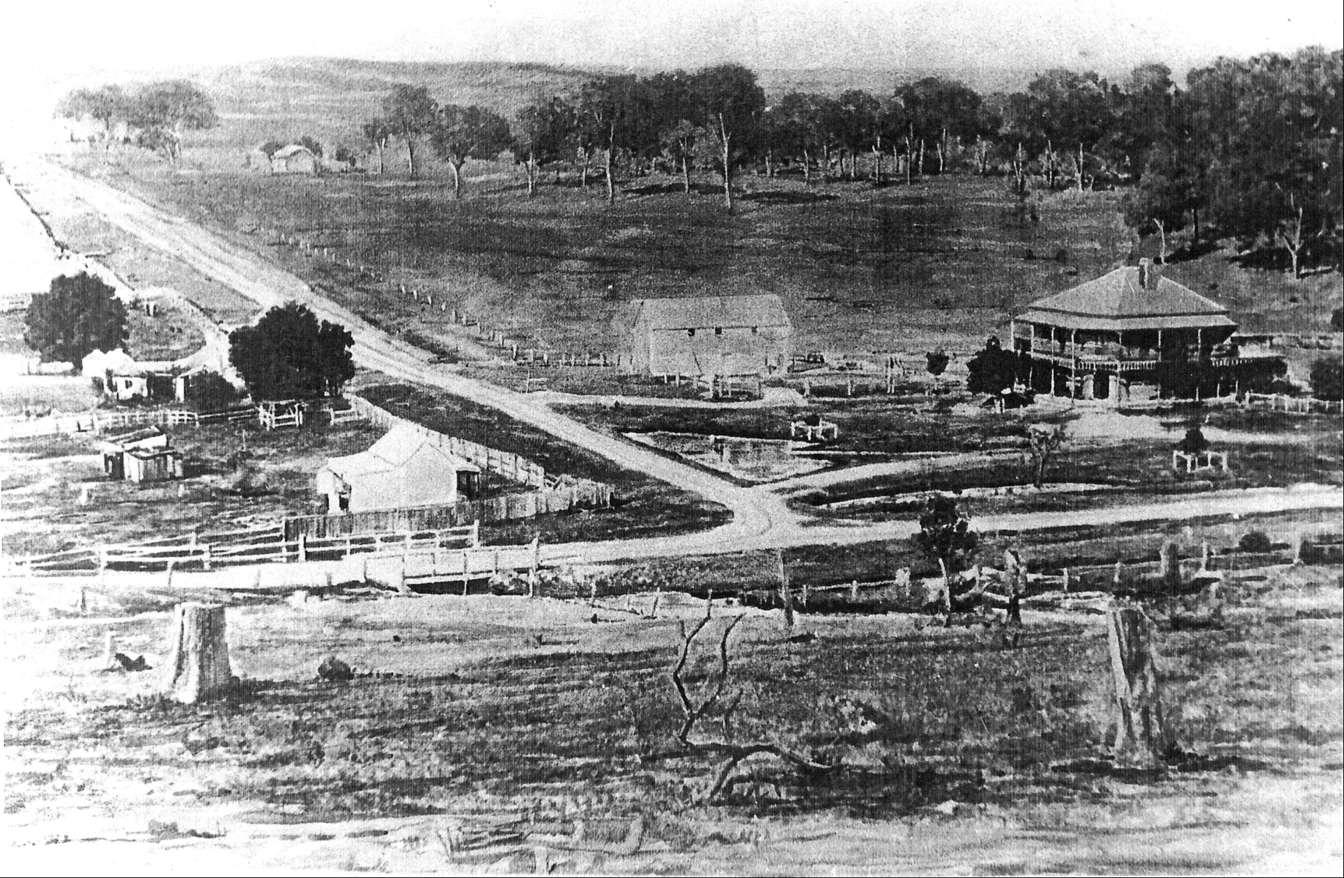
"Burnbrae" Homestead, pictured 2002
Only a handful of Seaham's historic homes are still standing. These include "Brandon" (established 1884), "Burnbrae", and "Eskdale". Brandon house still has thick, black tape over its internal windows. The tape was used during World War II to prevent the windows shattering in the case of an air raid. Other important homesteads included "Porphyry" (established 1838) and "Felspar" (circa 1878) - both of which were destroyed in the 1939 bushfire.
Brandon House[]
"Brandon", established in 1884 on the site of Alexander Warren's "Brandon Hall", is one of the last original homesteads in Seaham. The house has remained in the Fisher family for over 130 years and is the only example of Victorian architecture in the town.
Eskdale House[]
"Eskdale", built in the 1830s, is one the oldest homesteads in the district and is located on the outskirts of Seaham near Brandy Hill. It was built by Walter Scott, who also built Wallalong House.
Seaham Public School[]
Although a school has operated at Seaham since 1844, the existing public school began in an iron schoolhouse near the river in 1852.[30] The school moved to the current site after a new schoolhouse and teacher's residence were constructed in 1885. Although both of these buildings were lost in the 1939 bushfire, the school continued to operate on this site in the former Grewsick School. This school, opened in 1895, had served the East Seaham district until 1937 and remained in use at Seaham until a new schoolhouse was built in 1968.[31]
Seaham Swamp Nature Reserve[]
Seaham Swamp is recognised as an important habitat for the Cattle Egret and numerous other bird species. In addition to this, the reserve also protects a historic quarry, in which scientifically important sediments from ancient glacial thaw water have been found.[32]
Gallery[]
")
")
")
Notes[]
- ^ This population figure is only for the actual village of Seaham. ABS QuickStats for the rest of the suburb is included in the population data for Nelsons Plains and Duns Creek
as shown on 1:100000 map 9232 NEWCASTLE.
- ^ Area calculation is based on 1:100000 map 9232 NEWCASTLE.
References[]
- ^ Australian Bureau of Statistics (25 October 2007). "Seaham (L) (Urban Centre/Locality)". 2006 Census QuickStats. http://www.censusdata.abs.gov.au/ABSNavigation/prenav/LocationSearch?collection=Census&period=2006&areacode=UCL169070&producttype=QuickStats&breadcrumb=PL&action=401. Retrieved 10 June 2008. Map
- ^ a b c "Suburb Search - Local Council Boundaries - Hunter (HT) - Port Stephens". New South Wales Department of Local Government. http://www.dlg.nsw.gov.au/dlg/dlghome/dlg_Regions.asp?regiontype=2&slacode=6400®ion=HT. Retrieved 10 June 2008.
- ^ a b "Geographical Names Register Extract: Seaham". Geographical Names Register (GNR) of NSW. Geographical Names Board of New South Wales. http://www.gnb.nsw.gov.au/name_search/extract?id=TRqwlMrXKW. Retrieved 10 June 2008.
- ^ "Maitland". New South Wales Electoral Commission. 24 March 2007. http://www.elections.nsw.gov.au/state_government_elections/electoral_districts/all_districts_/maitland. Retrieved 10 June 2008.
- ^ "Paterson". Australian Electoral Commission. 19 October 2007. http://apps.aec.gov.au/esearch/LocalitySearchResults.aspx?filter=Paterson&filterby=Electorate. Retrieved 10 June 2008.
- ^ a b "Seaham". Department of Lands - Spatial Information eXchange. New South Wales Department of Lands. http://imagery.maps.nsw.gov.au/?role=mysuburb&search=suburb&suburb=Seaham. Retrieved 10 June 2008.
- ^ "The History of the Worimi People". Tobwabba Art. http://www.tobwabba.com.au/worimi/. Retrieved 25 December 2008.
- ^ "The Wine Industry of Australia 1788 1979". Wine Talk. http://coombs.anu.edu.au/SpecialProj/ERIC/wia.html. Retrieved 25 December 2008.
- ^ "Newspaper Article". Trove.nla.gov.au. 18 March 1893. http://trove.nla.gov.au/ndp/del/article/19020849?searchTerm=seaham%20flood. Retrieved 10 July 2010.
- ^ "Newspaper Article". Trove.nla.gov.au. 19 May 1913. http://trove.nla.gov.au/ndp/del/article/26874781?searchTerm=seaham%20flood. Retrieved 10 July 2010.
- ^ "Proposed Northern Coast Railway, Public Meeting at Clarence Town". The Maitland Mercury & Hunter River General Advertiser. Australian Newspapers. 7 October 1882. http://trove.nla.gov.au/ndp/del/article/859401. Retrieved 31 August 2009.
- ^ Hunter C 2002, Essays on Seaham, Seaham Public School P&C Association, Seaham, New South Wales.
- ^ "Newspaper Article". Trove.nla.gov.au. http://trove.nla.gov.au/ndp/del/article/18957611?searchTerm=felspar%20fire. Retrieved 7 July 2010.
- ^ "Newspaper Article". Trove.nla.gov.au. 19 February 1926. http://trove.nla.gov.au/ndp/del/article/3735521?searchTerm=Seaham%20+%20bushfire. Retrieved 7 July 2010.
- ^ "Bushfires raging in many districts". The Canberra Times. 10 November 1928. http://trove.nla.gov.au/ndp/del/article/990250. Retrieved 27 August 2009.
- ^ "186 Victims of Fire and Heat". The Canberra Times. 16 January 1939. http://trove.nla.gov.au/ndp/del/article/2496118. Retrieved 27 August 2009.
- ^ a b Meacham, Steve (14 January 2009). "Historic flashback: the day Seaham died - Local News - News - General". The Herald. http://www.theherald.com.au/news/local/news/general/historic-flashback-the-day-seaham-died/1406310.aspx. Retrieved 7 July 2010.
- ^ Hunter, C 2002, Essays on Seaham, Seaham Public School P&C Association, Seaham, New South Wales.
- ^ The Maitland Mercury 1939, 'Felspar Wiped Out', 16 January.
- ^ The Raymond Terrace Examiner 1939, 'Disastrous Bush Fires', 19 January.
- ^ Hunter, C 2001, Essays on Seaham, Seaham Public School P&C Association, Seaham, New South Wales.
- ^ Maitland Daily Mercury 1939, 'Heavy Damage - Fire Sweeps Town - School, Church and Houses Go', 14 January.
- ^ "Newspaper Article". Trove.nla.gov.au. 18 November 1951. http://trove.nla.gov.au/ndp/del/article/18500055?searchTerm=Seaham%20+%20bushfire. Retrieved 7 July 2010.
- ^ "Newspaper Article". Trove.nla.gov.au. 16 November 1951. http://trove.nla.gov.au/ndp/del/article/18239611?searchTerm=Seaham%20+%20bushfire. Retrieved 7 July 2010.
- ^ "Geographical Names Register Extract: Brandy Hill (hill)". Geographical Names Register (GNR) of NSW. Geographical Names Board of New South Wales. http://www.gnb.nsw.gov.au/name_search/extract?id=MnQlBKKm. Retrieved 10 February 2009.;
1:100000 map 9232 NEWCASTLE - ^ a b "Brandy Hill". Department of Lands - Spatial Information eXchange. New South Wales Department of Lands. http://imagery.maps.nsw.gov.au/?role=mysuburb&search=suburb&suburb=Brandy%20Hill. Retrieved 10 February 2009.
- ^ "Geographical Names Register Extract: Brandy Hill (locality)". Geographical Names Register (GNR) of NSW. Geographical Names Board of New South Wales. http://www.gnb.nsw.gov.au/name_search/extract?id=MnjLFxZTIt. Retrieved 10 February 2009.
- ^ "Wilful Murder". Maitland Mercury & Hunter River General Advertiser. http://trove.nla.gov.au/ndp/del/article/667086. Retrieved 31 August 2009.
- ^ Juanita McCarthy; Katherine Harrison (December 2006). "Seaham Swamp Nature Reserve Draft Plan of Management" (PDF). Department of Environment and Conservation (NSW). p. 4. http://www.environment.nsw.gov.au/resources/parks/seahamSwampDraft.pdf. Retrieved 29 June 2008.
- ^ Hunter, C 2002, Essays on Seaham, Seaham Public School P&C Association, Seaham, New South Wales.
- ^ Hunter, C 2002, Essays on Seaham, Seaham Public School P&C Association, Seaham, New South Wales.
- ^ "Seaham Swamp Nature Reserve". NSW Government Department of Environment and Climate Change. http://www.environment.nsw.gov.au/NationalParks/parkHome.aspx?id=N0501. Retrieved 27 December 2008.
- "Paterson (Tocal AWS)". Climate statistics for Australian locations. Bureau of Meteorology. http://www.bom.gov.au/climate/averages/tables/cw_061250.shtml. Retrieved 10 June 2008.
| ||||||||
Template:Hunter Region places and items of interest
| This page uses content from the English language Wikipedia. The original content was at Seaham, New South Wales. The list of authors can be seen in the page history. As with this Familypedia wiki, the content of Wikipedia is available under the Creative Commons License. |