| Main | Births etc |
|---|
| ||||||||||||||
| Saratoga County, New York | ||
| ||
 Location in the state of New York (state) | ||
 New York's location in the U.S. | ||
| Founded | 1791 | |
|---|---|---|
| Seat | Ballston Spa | |
| Largest city | Saratoga Springs | |
| Area - Total - Land - Water |
844 sq mi (2,186 km²) 812 sq mi (2,103 km²) 32 sq mi (83 km²), 3.78% | |
| Population - (2020) - Density |
235,509 269/sq mi (104/km²) | |
| Website | www.saratogacountyny.gov | |
Saratoga County is a county located in the U.S. state of New York. As of the 2020 census, the population was 235,509. It is part of the Albany-Schenectady-Troy Metropolitan Statistical Area. The county seat is Ballston Spa. The name is a corruption of an Indian word "sah-rah-ka" or "Sarach-togue," that means "the hill beside the river."
History[]
When counties were established in the Province of New York in 1683, the present Saratoga County was part of Albany County. This was an enormous county, including the northern part of New York State as well as all of the present State of Vermont and, in theory, extending westward to the Pacific Ocean. This county was reduced in size on July 3, 1766 by the creation of Cumberland County, and further on March 16, 1770 by the creation of Gloucester County, both containing territory now in Vermont.
Then, on March 12, 1772, Albany County was divided into the counties of Albany, Tryon (now Montgomery), and Charlotte (now Washington). From 1772 to 1786 Albany County included, besides the present territory of Albany County, all of the present Columbia, Rensselaer, Saratoga, and Schenectady counties, parts of the present Greene and Washington counties, and a piece of what is now southwestern Vermont.
In 1786, Albany County was reduced in size by the splitting off of Columbia County.
In 1791, Saratoga County (as well as Rensselaer County) was split off from Albany County.
During the nineteenth century, Saratoga County was an important industrial center. Its location 30 miles north of Albany on the Delaware and Hudson Railway and its proximity to water power from the Hudson River and Kayaderosseras Creek led to rapid industrial development beginning in 1810. Some of the most important industries were paper mills, tanneries, foundries, and textile mills.[1]
Geography[]
Saratoga County is in the northeastern part of New York State, north of Albany, northwest of Troy, and east of Utica.
According to the U.S. Census Bureau, the county has a total area of 844 square miles (2,190 km2), of which 812 square miles (2,100 km2) is land and 32 square miles (83 km2) (3.78%) is water.
Adjacent counties[]
- Warren County, New York - north
- Washington County, New York - northeast
- Washington County, New York - east
- Rensselaer County, New York - southeast
- Albany County, New York - south
- Albany County, New York - southwest
- Montgomery County, New York - west
- Fulton County, New York - west
- Schenectady County, New York - west
- Hamilton County, New York - northwest
Demographics[]
| Historical populations | |||
|---|---|---|---|
| Census | Pop. | %± | |
| 1800 | 24,483 | ||
| 1810 | 33,147 | 35.4% | |
| 1820 | 36,052 | 8.8% | |
| 1830 | 38,679 | 7.3% | |
| 1840 | 40,553 | 4.8% | |
| 1850 | 45,646 | 12.6% | |
| 1860 | 51,729 | 13.3% | |
| 1870 | 51,529 | −0.4% | |
| 1880 | 55,156 | 7.0% | |
| 1890 | 57,663 | 4.5% | |
| 1900 | 61,089 | 5.9% | |
| 1910 | 61,917 | 1.4% | |
| 1920 | 60,029 | −3.0% | |
| 1930 | 63,314 | 5.5% | |
| 1940 | 65,606 | 3.6% | |
| 1950 | 74,869 | 14.1% | |
| 1960 | 89,096 | 19.0% | |
| 1970 | 121,679 | 36.6% | |
| 1980 | 153,759 | 26.4% | |
| 1990 | 181,276 | 17.9% | |
| 2000 | 200,635 | 10.7% | |
| 2010 | 219,607 | 9.5% | |
| [2][3][4] | |||
As of the census[5] of 2000, there were 200,635 people, 78,165 households, and 53,699 families residing in the county. The population density was 247 people per square mile (95/km²). There were 86,701 housing units at an average density of 107 per square mile (41/km²). The racial makeup of the county was 95.98% White, 1.36% Black or African American, 0.18% Native American, 1.04% Asian, 0.02% Pacific Islander, 0.42% from other races, and 1.00% from two or more races. 1.41% of the population were Hispanic or Latino of any race. 19.6% were of Irish, 16.2% Italian, 11.4% German, 10.2% English, 7.2% French, 5.9% Polish and 5.4% American ancestry according to Census 2000. 95.2% spoke English and 1.4% Spanish as their first language.
There were 78,165 households out of which 33.60% had children under the age of 18 living with them, 56.20% were married couples living together, 9.00% had a female householder with no husband present, and 31.30% were non-families. 24.50% of all households were made up of individuals and 8.50% had someone living alone who was 65 years of age or older. The average household size was 2.51 and the average family size was 3.01.
In the county the population was spread out with 25.00% under the age of 18, 7.80% from 18 to 24, 31.50% from 25 to 44, 24.20% from 45 to 64, and 11.50% who were 65 years of age or older. The median age was 37 years. For every 100 females there were 97.20 males. For every 100 females age 18 and over, there were 94.60 males.
The median income for a household in the county was $49,460, and the median income for a family was $58,213. Males had a median income of $40,901 versus $29,583 for females. The per capita income for the county was $23,945. About 3.80% of families and 5.70% of the population were below the poverty line, including 6.50% of those under age 18 and 5.80% of those age 65 or over.
Since the construction of the Adirondack Northway in the 1960s Saratoga County has consistently been the fastest growing portion of the Capital District and indeed, of upstate New York. In 1960 the county had a population of only 89,000, less than half its current population [1]
Government[]
| Year | Republican | Democratic | Third party | |||
|---|---|---|---|---|---|---|
| No. | % | No. | % | No. | % | |
| 2020 | 61,305 | 46.21% | 68,471 | 51.62% | 2,879 | 2.17% |
| 2016 | 54,575 | 47.83% | 50,913 | 44.62% | 8,606 | 7.54% |
| 2012 | 50,382 | 47.75% | 52,957 | 50.19% | 2,171 | 2.06% |
| 2008 | 52,855 | 47.45% | 56,645 | 50.85% | 1,887 | 1.69% |
| 2004 | 56,158 | 52.55% | 48,730 | 45.60% | 1,985 | 1.86% |
| 2000 | 46,623 | 49.05% | 43,359 | 45.61% | 5,075 | 5.34% |
| 1996 | 34,337 | 40.08% | 39,832 | 46.50% | 11,496 | 13.42% |
| 1992 | 36,917 | 41.10% | 33,011 | 36.76% | 19,884 | 22.14% |
| 1988 | 43,498 | 57.39% | 31,684 | 41.81% | 606 | 0.80% |
| 1984 | 47,394 | 67.91% | 22,166 | 31.76% | 228 | 0.33% |
| 1980 | 34,184 | 52.30% | 23,641 | 36.17% | 7,537 | 11.53% |
| 1976 | 38,296 | 61.29% | 23,768 | 38.04% | 422 | 0.68% |
| 1972 | 40,582 | 69.22% | 17,899 | 30.53% | 150 | 0.26% |
| 1968 | 25,658 | 55.87% | 17,766 | 38.69% | 2,498 | 5.44% |
| 1964 | 13,364 | 31.32% | 29,264 | 68.57% | 47 | 0.11% |
| 1960 | 25,035 | 57.88% | 18,179 | 42.03% | 36 | 0.08% |
| 1956 | 32,522 | 77.69% | 9,338 | 22.31% | 0 | 0.00% |
| 1952 | 29,712 | 72.17% | 11,413 | 27.72% | 43 | 0.10% |
| 1948 | 20,706 | 61.50% | 11,457 | 34.03% | 1,503 | 4.46% |
| 1944 | 20,197 | 59.26% | 13,788 | 40.45% | 98 | 0.29% |
| 1940 | 21,298 | 58.46% | 15,037 | 41.27% | 98 | 0.27% |
| 1936 | 19,153 | 55.90% | 14,619 | 42.66% | 494 | 1.44% |
| 1932 | 17,990 | 56.97% | 13,053 | 41.34% | 535 | 1.69% |
| 1928 | 19,183 | 59.60% | 12,247 | 38.05% | 757 | 2.35% |
| 1924 | 17,682 | 65.84% | 7,026 | 26.16% | 2,148 | 8.00% |
| 1920 | 16,222 | 67.99% | 6,905 | 28.94% | 731 | 3.06% |
| 1916 | 8,062 | 53.00% | 6,711 | 44.12% | 438 | 2.88% |
| 1912 | 6,401 | 43.70% | 5,296 | 36.16% | 2,951 | 20.15% |
| 1908 | 8,706 | 54.49% | 6,518 | 40.80% | 752 | 4.71% |
| 1904 | 9,546 | 58.46% | 6,149 | 37.66% | 634 | 3.88% |
| 1900 | 9,602 | 59.79% | 5,916 | 36.84% | 541 | 3.37% |
| 1896 | 9,638 | 63.57% | 4,987 | 32.89% | 536 | 3.54% |
| 1892 | 7,383 | 51.83% | 5,755 | 40.40% | 1,106 | 7.76% |
| 1888 | 8,594 | 54.36% | 6,570 | 41.56% | 646 | 4.09% |
| 1884 | 8,190 | 56.28% | 5,846 | 40.17% | 517 | 3.55% |
Saratoga County is governed by a Board Of Supervisors, with each town Supervisor acting as the representative from that community. The City of Saratoga Springs elects two Supervisors and the City of Mechanicville elects one supervisor to sit on the Board of Supervisors, but have no power in their respective city governments. The Town of Clifton Park also elects two Supervisors, one being the elected Town Supervisor, and one having only County duties. Voting is by weighted vote of each of the communities based on population, which is the reason why Saratoga Springs and Clifton Park, the two largest communities in Saratoga County, elect two Supervisors. The political makeup of the 2016-17 Board consists of 21 Republicans, and two Democrats. By long-standing tradition, whoever serves as Chairman of the Board of Supervisor's powerful Law and Finance Committee one year serves as Chairman of the full Board the following year—a tradition that has been broken only three times in Saratoga County's history. Under this custom, current Law and Finance Committee Chairman Arthur "Mo" Wright, the Supervisor of the Town of Hadley, is slated to become Chairman of the full Board in 2016.
Republicans hold the county-wide offices of Sheriff, District Attorney, County Clerk, Treasurer, and Judges of the County, Family, and the Surrogate Courts.
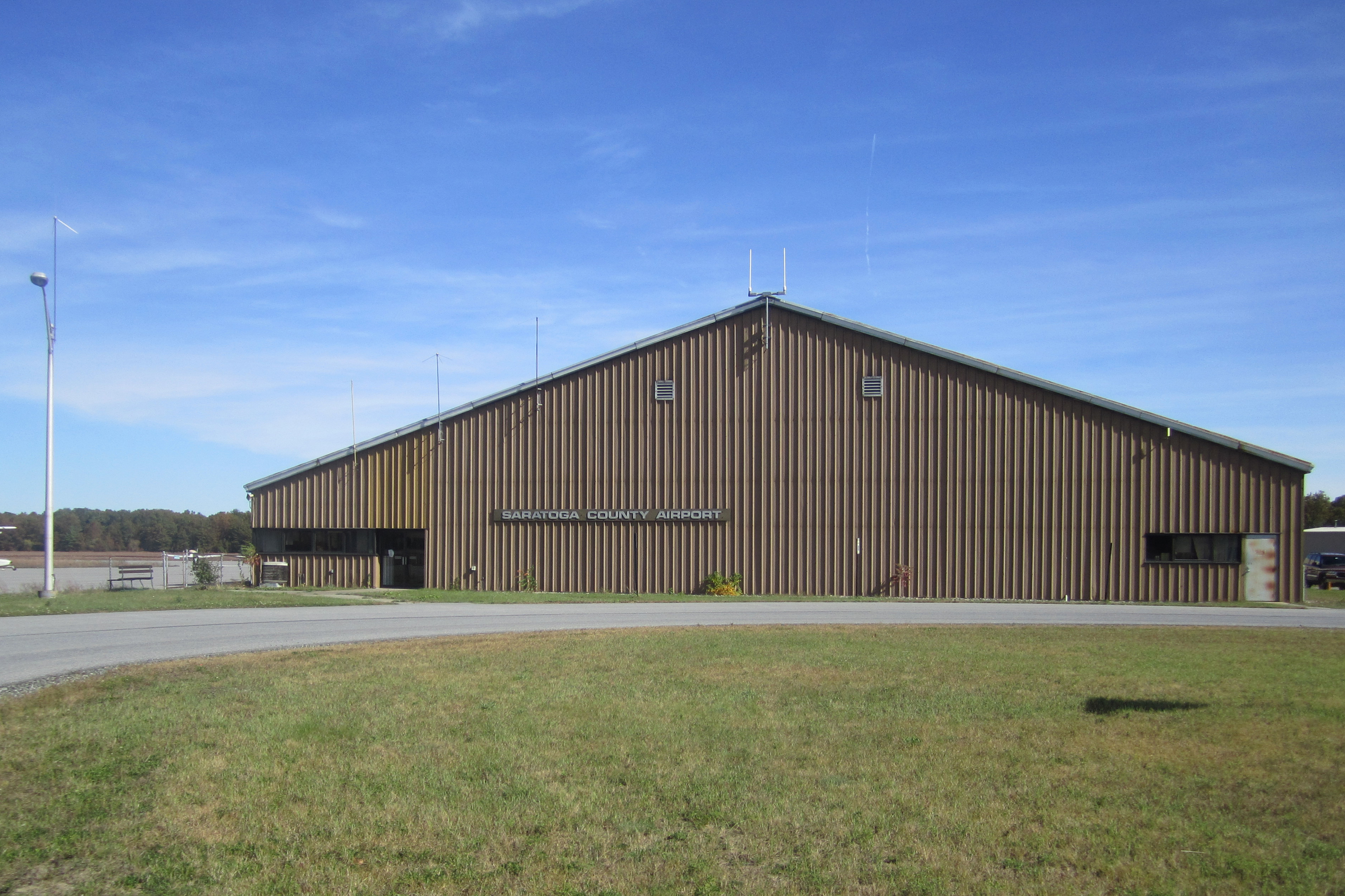
Saratoga County Airport, Saratoga Springs.
On the presidential level, like most of the Hudson Valley, Saratoga County was historically powerfully Republican. It only supported a Democrat for president twice in the 20th century, in 1964 and 1996. As a measure of how Republican the county was, it rejected Franklin D. Roosevelt in all four of his successful bids for the White House; Roosevelt did no better than 42.7 percent in the county.
The Republican edge narrowed somewhat in the 1990s, and since then Saratoga County has been a Republican-leaning swing county. George W. Bush won the county narrowly in 2004 with 53% of the vote, while Barack Obama slightly edged out John McCain and Mitt Romney in both 2008 and 2012, becoming the first Democrat to win a majority in the county since 1964. In 2016, Saratoga County flipped back to the Republicans, with Donald Trump capturing a narrow plurality of the vote over Hillary Clinton. This flip proved temporary, with Democratic candidate Joe Biden winning the county in 2020.[7] Saratoga County has backed the winning candidate in every presidential election since 1996.
The county is represented in the U.S. Congress by Republican Elise Stefanik and Democrat Paul Tonko.
In the State Senate, the county is divided between Republicans Daphne Jordan and Jim Tedisco, while in the State Assembly Democrats John T. McDonald III and Carrie Woerner, along with Republicans Mary Beth Walsh and Dan Stec, each represent portions of the county.
James A. Murphy III, a Republican, is the County Court Judge and a former District Attorney.
James A. Bowen had been the dean of NYS Sheriffs, having served as Sheriff since 1972, when he was appointed by Governor Nelson A. Rockefeller. Bowen won election in his own right in 1973 and had been elected every four years up until his retirement at the end of his tenth term in office in 2013. Michael H. Zurlo is the current Sheriff, winning the election to succeed Bowen in 2013.
Democratic strength is best shown in the City of Saratoga Springs, which has voted Democratic in every presidential election since 1988. Republican strength is concentrated in the western part of the county, which is mostly rural or exurban. In 2005, the Democrats gained a majority on the Saratoga Springs City Council after decades of Republican dominance. The Republicans, however, reclaimed the council majority in the 2007 General Elections due to a split Democratic Party in the mayor's race. In 2009, the Republicans reclaimed their supermajority (4-1) on the City Council, by winning every contested election (Mayor, Finance, Public Safety, and Public Works). In 2011, Democrats reclaimed the Majority on the City Council, while Republican Scott Johnson was reelected as Mayor. The Current City Council (2016-2017)is 4-1 Democratic led by Mayor Meg Kelly. At the Saratoga County Board of Supervisors, the City is split, with one Republican and one Democrat holding the two Supervisor seats.
State Assembly[]
- John McDonald, Democratic, 108th District
- Mary Beth Walsh, Republican, 112th District
- Carrie Woerner, Democratic, 113th District
- Dan Stec, Republican, 114th District
State Senate[]
- Daphne Jordan, Republican, 43rd District
- Jim Tedisco, Republican, 49th District
United States House of Representatives[]
- Paul Tonko, Democratic, 20th District
- Elise Stefanik, Republican, 21st District
Cities[]
» City of Mechanicville » City of Saratoga Springs
Towns[]
» Town of Ballston » Town of Charlton » Town of Clifton Park » Town of Corinth » Town of Day » Town of Edinburg » Town of Galway » Town of Greenfield » Town of Hadley » Town of Halfmoon » Town of Malta » Town of Milton » Town of Moreau » Town of Northumberland » Town of Providence » Town of Saratoga » Town of Stillwater » Town of Waterford » Town of Wilton
Villages[]
» Village of Ballston Spa » Village of Corinth » Village of Round Lake » Village of Schuylerville » Village of South Glens Falls » Village of Waterford
Recreation[]
Saratoga County is extremely popular between late July and early September each year due to the Saratoga Race Course being open. This world-famous track dates back to 1863. Horse-racing fans come from all over to watch the races. Besides the horses, Saratoga County is also known for its role in American History, being the home of the Battle of Saratoga<The Saratoga National Historical Park is located along the Hudson River in Stillwater, and features a drive-around trail where you can drive up to each station. The park is also famous for its outstanding views of the area's natural scenery and Vermont's Green Mountains in the distance.
The Saratoga Spa State Park capitalizes on the culture and mineral springs that once drove Saratoga County. This is a large state park and includes a hotel, 2 pool complexes, mineral baths, Saratoga Performing Arts Center, picnic areas, hiking trails and numerous mineral springs.
Also nearby is Adirondack Park, one of the largest parks in the nation. Part of northwestern Saratoga County lies within the boundaries of the Park.
See also[]
- List of counties in New York
- National Register of Historic Places listings in Saratoga County, New York
References[]
- ^ Book: Invented in Saratoga County, 2008
- ^ http://www.census.gov/population/www/censusdata/cencounts/files/ny190090.txt
- ^ http://factfinder2.census.gov
- ^ http://mapserver.lib.virginia.edu/
- ^ "American FactFinder". United States Census Bureau. http://factfinder.census.gov. Retrieved 2008-01-31.
- ^ Leip, David. "Dave Leip's Atlas of U.S. Presidential Elections". http://uselectionatlas.org/RESULTS.
- ^ "Biden wins GOP-rich Rensselaer and Saratoga counties". 18 November 2020. https://www.timesunion.com/news/article/Biden-flips-GOP-strongholds-Rensselaer-and-15737887.php.
Further reading[]
- Sylvester, Nathaniel Bartlett (1878). History of Saratoga County, New York, with illustrations biographical sketches of some of its prominent men and pioneers. Philadelphia, PA: Everts & Ensign. OCLC 3858600. http://www.archive.org/details/historyofsaratog00sylv. Retrieved 2011-09-06.
External links[]
- Saratoga County, New York site
- Saratoga County at the Open Directory Project
- History of Saratoga County
- Saratoga County Local Histories and Biographies
- Brookside Museum, Saratoga County Historical Society
- Saratoga County history links and information


| ||||||||||||||||||||||||||

| ||||||||||||||||||||||||||||||||||||||||||||||

| ||||||||||||||||||||

| This page uses content from the English language Wikipedia. The original content was at Saratoga County, New York. The list of authors can be seen in the page history. As with this Familypedia wiki, the content of Wikipedia is available under the Creative Commons License. |