| Main | Births etc |
|---|
| Santa Rosa, California | |
|---|---|
| — City — | |
| City of Santa Rosa | |
 |
|
 |
|
 <div style="position: absolute; top: Expression error: Missing operand for *.%; left: 212.7%; height: 0; width: 0; margin: 0; padding: 0;">
Santa Rosa, California |
|
| Country | |
| State | |
| County | Sonoma |
| Incorporated | March 26, 1868[1] |
| Government | |
| • Type | Council-Manager |
| • Mayor | Chris Coursey[2] |
| • City manager | Sean McGlynn[3] |
| Area[4] | |
| • City | 51.50 sq mi (117.48 km2) |
| • Land | 51.29 sq mi (116.95 km2) |
| • Water | 0.30 sq mi (0.63 km2) 0.59% |
| Elevation[5] | 184 ft (55 m) |
| Population (2010)[6] | |
| • City | {{#property:P1,082|from=Q212,991}} |
| • Estimate (2016)[7] | 175,155 |
| • Rank | 1st in Sonoma County |
| • Density | 4,241.86/sq mi (1,637.77/km2) |
| Time zone | Pacific (UTC−8) |
| • Summer (DST) | PDT (UTC−7) |
| ZIP codes | 95401–95407, 95409[8] |
| Area code | 707 |
| FIPS code | 06-70098 |
| GNIS feature IDs | 249105, 1659601 |
| Website | ci.santa-rosa.ca.us |
Santa Rosa (lit. Spanish for "Saint Rose") is a city in and the county seat of Sonoma County, California, United States.[9] Its estimated 2016 population was 175,155.[10] Santa Rosa is the largest city in California's Redwood Empire, Wine Country and the North Bay; the fifth most populous city in the San Francisco Bay Area after San Jose, San Francisco, Oakland, and Fremont; and the 28th most populous city in California.
History[]
Growth and development[]

The former Petaluma & Santa Rosa Railroad Station
Santa Rosa was founded in 1833 and named after Saint Rose of Lima. Before the arrival of Europeans, the Santa Rosa Plain was home to a strong and populous tribe of Pomo natives known as the Bitakomtara. The Bitakomtara controlled the area closely, barring passage to others until permission was arranged. Those who entered without permission were subject to harsh penalties. The tribe gathered at ceremonial times on Santa Rosa Creek near present-day Spring Lake Regional Park. Upon the arrival of Europeans, the Pomos were decimated by smallpox brought from Europe, and by the eradication efforts of Anglo settlers. By 1900 the Pomo population had decreased by 95%.[11]
The first known permanent European settlement of Santa Rosa was the homestead of the Carrillo family, in-laws to Mariano Guadalupe Vallejo, who settled the Sonoma pueblo and Petaluma area. In the 1830s, during the Mexican period, the family of María López de Carrillo built an adobe house on their Rancho Cabeza de Santa Rosa land grant, just east of what later became downtown Santa Rosa. Allegedly, however, by the 1820s, before the Carrillos built their adobe in the 1830s, Spanish and Mexican settlers from nearby Sonoma and other settlements to the south raised livestock in the area and slaughtered animals at the fork of the Santa Rosa Creek and Matanzas Creek, near the intersection of modern-day Santa Rosa Avenue and Sonoma Avenue. This is supposedly the origin of the name of Matanzas Creek as, because of its use as a slaughtering place, the confluence came to be called La Matanza.
By the 1850s, a Wells Fargo post and general store were established in what is now downtown Santa Rosa. In the mid-1850s, several prominent locals, including Julio Carrillo, son of Maria Carrillo, laid out the grid street pattern for Santa Rosa with a public square in the center, a pattern which largely remains as the street pattern for downtown Santa Rosa to this day, despite changes to the central square, now called Old Courthouse Square.
In 1867, the county recognized Santa Rosa as an incorporated city and in 1868 the state officially confirmed the incorporation, making it officially the third incorporated city in Sonoma County, after Petaluma, incorporated in 1858, and Healdsburg, incorporated in 1867.
The U.S. Census records, among others, show that after California became a state, Santa Rosa grew steadily early on, despite initially lagging behind nearby Petaluma in the 1850s and early 1860s. According to the U.S. Census, in 1870 Santa Rosa was the eighth largest city in California, and county seat of one of the most populous counties in the state. Growth and development after that was steady but never rapid. The city continued to grow when other early population centers declined or stagnated, but by 1900 it was being overtaken by many other newer population centers in the San Francisco Bay Area and Southern California. According to a 1905 article in the Press Democrat newspaper reporting on the "Battle of the Trains", the city had just over 10,000 people at the time.
The 1906 San Francisco earthquake essentially destroyed the entire downtown, but the city's population did not greatly suffer. However, after that period the population growth of Santa Rosa, as with most of the area, was very slow.
Famed director Alfred Hitchcock filmed his thriller Shadow of a Doubt in Santa Rosa in 1943; the film gives glimpses of Santa Rosa in the 1940s. Many of the downtown buildings seen in the film no longer exist due to major reconstruction following the strong earthquakes in October 1969. However, some, like the rough-stone Northwestern Pacific Railroad depot and the prominent Empire Building (built in 1910 with a gold-topped clock tower), still survive. A scene at the bank was filmed at the corner of Fourth Street and Mendocino Avenue (at present day Old Courthouse square); the KRESS building on Fourth Street is also visible. However, the courthouse and bank are now gone. The Coen brothers' 2001 film The Man Who Wasn't There is set in Santa Rosa c. 1949.
Since World War II[]


Old Courthouse Square is the heart of downtown Santa Rosa. This is the Empire Building, completed in 1910 and a Sonoma County landmark. It was seen in Shadow of a Doubt by Alfred Hitchcock.
Santa Rosa grew following World War II because it was the location for Naval Auxiliary Landing Field Santa Rosa, the remnants of which are now located in southwest Santa Rosa. The city was a convenient location for San Francisco travelers bound for the Russian River.
The population increased by 2/3 between 1950 and 1970, an average of 1,000 new residents a year over the 20 years. Some of the increase was from immigration, and some from annexation of portions of the surrounding area.
In 1958 the United States Office of Civil and Defense Mobilization designated Santa Rosa as one of its eight regional headquarters, with jurisdiction over Region 7, which included American Samoa, Arizona, California, Guam, Hawaii, Nevada, and Utah. Santa Rosa continued as a major center for civil defense activity (under the Office of Emergency Planning and the Office of Emergency Preparedness) until 1979 when the Federal Emergency Management Agency (FEMA) was created in its place, ending the civil defense's 69-year history.[12]
When the City Council adopted the city's first modern General Plan in 1991, the population was about 113,000. In the 21 years following 1970, Santa Rosa grew by about 3,000 residents a year—triple the average growth during the previous twenty years.
Santa Rosa 2010, the 1991 General Plan, called for a population of 175,000 in 2010. The Council expanded the city's urban boundary to include all the land then planned for future annexation, and declared it would be Santa Rosa's "ultimate" boundary. The rapid growth that was being criticized as urban sprawl became routine infill development.
At the first five-year update of the plan, in 1996, the Council extended the planning period by ten years, renaming it Vision 2020 (updated to Santa Rosa 2020, and then again to Santa Rosa 2030 Vision), and added more land and population. Now the City projects a population of 195,000 in 2020.
Santa Rosa annexed the community of Roseland in November 2017.[13]
2017 firestorm[]

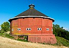
The former historic Fountaingrove Round Barn, previously found at the southwestern base of Fountaingrove, was lost to fire.
Beginning on the night of October 8, 2017, five percent of the city's homes were destroyed in the Tubbs Fire, a 45,000-acre wildfire that claimed the lives of at least 19 people in Sonoma County.[14] Named after its origin near Tubbs Lane and Highway 128 in northeast Sonoma County, the fire became a major section of the most destructive and third deadliest firestorm in California history.[15][16][17] Most homes in the Coffey Park and Fountain Grove neighborhoods were destroyed.
A notable exception to the destruction in the area was the protection of more than 1000 animals at the renowned Safari West Wildlife Preserve northeast of Santa Rosa. All of the preserve's animals were saved by owner Peter Lang, who, at age 76, single-handedly fought back the flames for more than 10 hours using garden hoses.[18][19]
The fire burned strong for over 7 days, bringing the largest aerial attack in history to Sonoma County skies. Some of the airplanes include a massive Boeing 747 Supertanker, a C-130, S-2, OV-10, DC-10 Air Tanker UH-60 Blackhawk, and Boeing CH-47 Chinook helicopter. Every police agency in the San Francisco Bay Area was called in to help. Fire fighting crews from across California and as far away as Australia came to aid in extinguishing the fire. The fires, alongside the December 2017 Southern California wildfires, comprised the most destructive year of California wildfires on record.
Crime[]
Lynchings[]
On May 9, 1878, Charles Henley, a 57-year-old farmer from Windsor, California, murdered his neighbor James Rowland after Rowland complained about Henley's pigs being loose on his property. Henley left Rowland's body to be eaten by his hogs, and the next day Henley turned himself in to the authorities. In the early morning hours of June 9, groups of men started to appear on the streets of Santa Rosa. One group went to the home of jailer Sylvester Wilson, where the men held his family hostage while Wilson was taken to the jail to hand over the keys to the lynch mob. Wilson and night guard R. Dryer were taken in a wagon and dropped off on the outskirts of Santa Rosa. Henley was found hanging from a tree not far from where the two men were released. The lynchers were never caught.[20]
On December 5, 1920, Santa Rosa native Terry Fitts, along with San Francisco hoodlums "Spanish" Charley Valento and George Boyd, got into a shootout with a joint police squad from Santa Rosa, Sonoma County and the San Francisco Police department. The outlaws were wanted in San Francisco for the gang rape of a young woman. Fitts, Valento, and Boyd were at the home of an acquaintance, looking for food or money, when the police caught up with them. As the police crashed through the door of the home, Boyd shot and killed San Francisco police detective Lester Dohrman, Sergeant Miles Jackson, and Sonoma County Sheriff Jim Petray. The three wanted men were then quickly taken into custody. On December 10, 1920, a group of men entered the jail without a struggle, took the men out of their cell, and drove them to Santa Rosa Rural Cemetery. They were strung up by their necks in their long underwear and left to swing in the wind. The inquest's verdict was "death by persons unknown". It was rumored that the lynch mob was made up of men from nearby Healdsburg, California who were friends of Sheriff Petray.[20]
Murder of Police Chief O'Neal[]
On July 15, 1935, disgruntled rancher and hunting guide Al Chamberlain dressed up in his finest cowboy clothes, drove to his former ranch outside of Santa Rosa and shot John McCabe, the new owner of the property, leaving him for dead. He survived. Chamberlain drove his beat-up car to Santa Rosa where he walked into the Santa Rosa police station and killed Chief Charlie O'Neal. Chamberlain had owned a livery stable in downtown Santa Rosa for years, but was forced to vacate his business through eminent domain when the city wanted to build their new city hall on Chamberlain's property. Chief O'Neal personally signed and served Chamberlain his notice to vacate. Financially broken, Chamberlain had to sell his beloved ranch on Saint Helena Road. O'Neal continued to harass Chamberlain to the point where he got the prosecutor to sentence Chamberlain to thirty days and a hundred-dollar fine for accidentally hitting a pedestrian. He was never the same man after he was released from jail. After shooting O'Neal, Chamberlain calmly walked down the street with a pistol in each hand, searching for Sonoma County Sheriff Harry Patteson. Patteson heard the gunshots and bumped into Chamberlain, who did not recognize him. Patteson disarmed and tackled Chamberlain, with the help of Joe Schurman and Burnette Dibble. He was sentenced to life in prison and died in San Quentin Prison.[20]
Death of Andy Lopez[]
On October 22, 2013, 13-year-old Andy Lopez was shot and killed by Sonoma County sheriff's deputy Erick Gelhaus in the Moorland neighborhood of Santa Rosa. Lopez was walking to his friend's house while carrying an airsoft gun replica of an AK-47. Gelhaus mistook the airsoft gun for a real rifle, and demanded that Lopez drop the weapon. Gelhaus then fired eight shots at Lopez, killing him. The shooting prompted protests in Santa Rosa, which attracted protesters from around Northern California.[21] The Lopez family filed a lawsuit at the District Court in November, claiming that Gelhaus shot Lopez "without reasonable cause."[22][23] They amended their lawsuit in January 2014, claiming that the Sheriff's office had long known that Gelhaus had a "propensity ... to recklessly draw his firearm and to use excessive force". The deputy's attorney argued that Gelhaus "absolutely believed" that the gun was real and that his life was in danger.[24]
Geography[]
According to the United States Census Bureau, the city has a total area of 41.50 sq mi (107.5 km2), of which 41.29 sq mi (106.9 km2) is land and 0.205 sq mi (0.5 km2) (0.49%) is water.[25]
The city is part of the North Bay region, which includes such cities as Petaluma, Rohnert Park, Windsor, and smaller cities as Sonoma, Healdsburg, Sebastopol. It lies along the US Route 101 corridor, approximately 55 miles (89 km) north of San Francisco, via the Golden Gate Bridge.
Santa Rosa lies on the Santa Rosa Plain. The city's eastern extremities stretch into the Valley of the Moon, and the Sonoma Creek watershed known as the Sonoma Valley. The city's western edge lies in the Laguna de Santa Rosa catchment basin.
The city is in the watershed of Santa Rosa Creek, which rises on Hood Mountain and discharges to the Laguna de Santa Rosa. Tributary basins to Santa Rosa Creek lying significantly in the city are Brush Creek, Matanzas Creek, and Piner Creek. Other water bodies within the city include Fountaingrove Lake, Lake Ralphine, and Santa Rosa Creek Reservoir.
The prominent visual features east of the city include Bennett Peak, Mount Hood, and Sonoma and Taylor Mountains.[26]
Climate[]
Santa Rosa has a warm-summer Mediterranean climate (Köppen Csb) with cool, wet winters and warm, dry summers. In the summer, fog and low overcast often move in from the Pacific Ocean during the evenings and mornings. They usually clear up to warm, sunny weather by late morning or noon before returning in the later evening but will occasionally linger all day. Average annual rainfall is 32.20 inches (818 mm), falling on 74 days annually. The wettest year was 1983 with 63.07 inches (1,602 mm) and the driest year was 1976 with 11.38 inches (289 mm). The most rainfall in one month was 19.42 inches (493 mm) in February 1998 and the most rainfall in 24 hours was 5.23 inches (133 mm) on December 19, 1981. Measurable snowfall is rare in the lowlands, but light amounts sometimes fall in the nearby mountains.
There are an average of 28.9 days with highs of 90 °F (32 °C) or more and an average of 30.2 days with lows reaching the freezing mark. The record high was 113 °F (45 °C) on July 11, 1913, and the record low was 9 °F (−13 °C) on December 25, 1924.[27]
| Climate data for Santa Rosa, California (1981–2010) | |||||||||||||
|---|---|---|---|---|---|---|---|---|---|---|---|---|---|
| Month | Jan | Feb | Mar | Apr | May | Jun | Jul | Aug | Sep | Oct | Nov | Dec | Year |
| Record high °F (°C) | 85 (29) |
93 (34) |
91 (33) |
98 (37) |
104 (40) |
109 (43) |
113 (45) |
107 (42) |
110 (43) |
105 (41) |
92 (33) |
83 (28) |
113 (45) |
| Average high °F (°C) | 59.0 (15.0) |
63.2 (17.3) |
66.6 (19.2) |
70.4 (21.3) |
74.5 (23.6) |
80.1 (26.7) |
82.2 (27.9) |
82.8 (28.2) |
83.2 (28.4) |
77.9 (25.5) |
66.9 (19.4) |
59.0 (15.0) |
72.2 (22.3) |
| Average low °F (°C) | 39.2 (4.0) |
41.3 (5.2) |
43.0 (6.1) |
44.8 (7.1) |
48.3 (9.1) |
51.7 (10.9) |
52.4 (11.3) |
52.6 (11.4) |
51.5 (10.8) |
48.3 (9.1) |
42.8 (6.0) |
38.9 (3.8) |
46.2 (7.9) |
| Record low °F (°C) | 15 (−9) |
20 (−7) |
24 (−4) |
26 (−3) |
27 (−3) |
30 (−1) |
39 (4) |
30 (−1) |
30 (−1) |
24 (−4) |
21 (−6) |
9 (−13) |
9 (−13) |
| Rainfall inches (mm) | 5.93 (150.6) |
6.02 (152.9) |
4.53 (115.1) |
1.82 (46.2) |
1.28 (32.5) |
.23 (5.8) |
.01 (0.3) |
.07 (1.8) |
.35 (8.9) |
1.73 (43.9) |
4.04 (102.6) |
6.19 (157.2) |
32.2 (817.9) |
| Snowfall inches (cm) | 0.4 (1) |
0 (0) |
0 (0) |
0 (0) |
0 (0) |
0 (0) |
0 (0) |
0 (0) |
0 (0) |
0 (0) |
0 (0) |
0 (0) |
0.4 (1) |
| Avg. rainy days (≥ 0.01 in) | 13 | 11 | 10 | 7 | 4 | 1 | 0 | 1 | 2 | 5 | 9 | 11 | 74 |
| Source: [28] | |||||||||||||
Seismicity[]
Santa Rosa lies atop the Healdsburg-Rodgers Creek segment of the Hayward-Rodgers Creek Fault System. The Working Group on California Earthquake Probabilities estimated a minimum 27 percent chance of a magnitude 6.7 or greater earthquake on this segment by 2037.[29]
On April 14, 2005, the United States Geological Survey released a map detailing the results of a new tool that measures ground shaking during an earthquake. The map determined that the 1906 San Francisco earthquake was most powerful in an area between Santa Rosa and what is now Sebastopol, causing more damage in Santa Rosa (for its size) than any other city affected.[30]
On October 1, 1969, two earthquakes of magnitudes 5.6 and 5.7 shook Santa Rosa, damaging about 100 structures. They were the strongest quakes to affect the city since 1906. The epicenters were about two miles (3 km) north of Santa Rosa.
Nature and wildlife[]
Due to its population, much of Santa Rosa's remaining undisturbed area is on its urban fringe. However, the principal wildlife corridors of Santa Rosa Creek and its tributaries flow right through the heart of the town. Great blue herons, great egrets, snowy egrets and black-crowned herons nest in the trees of the median strip on West Ninth Street as well as along Santa Rosa Creek and downtown. Deer often are spotted roaming the neighborhoods nearer the eastern hills, as deep into town as Franklin Avenue and the McDonald area; rafters of wild turkeys are relatively common in some areas; and mountain lions are occasionally observed within city limits. Raccoons and opossums are a common sight throughout the city, while foxes, and rabbits may be regularly seen in the more rural areas. In addition, the city borders and then wraps around the northern end of Trione Annadel State Park, which itself extends into the Sonoma Mountains and Sonoma Valley. Trione Annadel State Park also adjoins Spring Lake County Park and Howarth Park, forming one contiguous park system that enables visitors to venture into wild native habitats.
Neighborhoods[]

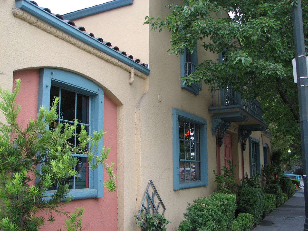
Restaurants and other retail stores occupy several historic buildings in Santa Rosa's Railroad Square district in the downtown area, including these along Fourth Street.
Santa Rosa can be seen as divided into four quadrants: Northeast, Southeast, Southwest, and Northwest. U.S. Route 101 runs roughly north–south through the city, and divides it into east and west sides. State Route 12 runs roughly east–west, and divides the city into north and south sides.
Neighborhoods include:
- Bennett Valley
- West 3rd
- Burbank Gardens Historic District
- Cherry Street Historic District
- Coffey Park
- Dutton Avenue
- Fountain Grove
- Hidden Valley
- Holland Heights
- Juilliard Park
- Junior College[31]
- Lomita Heights
- McDonald Mansion Historic District
- Montecito Heights
- Montgomery Village
- Moorland Avenue
- North Junior College[32]
- North West Santa Rosa
- Oakmont Village[33]
- Olive Park
- Railroad Square District
- Ridgway Historic District
- Rincon Valley
- Roseland
- Santa Rosa Avenue
- Skyhawk
- Spring Lake
- Annadel Heights
- South Park
- St. Rose Historic District[34]
- Stonegate
- Town & Country/Grace Tract
- West End Arts and Theater District
- West End Historic District[35]
- West Junior College
Demographics[]
| Historical populations | |||
|---|---|---|---|
| Census | Pop. | %± | |
| 1860 | 1,623 | ||
| 1870 | 2,898 | 78.6% | |
| 1880 | 3,616 | 24.8% | |
| 1890 | 5,220 | 44.4% | |
| 1900 | 6,673 | 27.8% | |
| 1910 | 7,817 | 17.1% | |
| 1920 | 8,758 | 12.0% | |
| 1930 | 10,636 | 21.4% | |
| 1940 | 12,605 | 18.5% | |
| 1950 | 17,902 | 42.0% | |
| 1960 | 31,027 | 73.3% | |
| 1970 | 50,006 | 61.2% | |
| 1980 | 82,658 | 65.3% | |
| 1990 | 113,313 | 37.1% | |
| 2000 | 147,595 | 30.3% | |
| 2010 | 167,815 | 13.7% | |
| Est. 2016 | 175,155 | [7] | 18.7% |
| source:[36] | |||
<graph>{ "version": 2, "width": 590, "height": 238, "data": [ { "name": "table", "values": [ { "x": 1860, "y": 1623 }, { "x": 1870, "y": 2898 }, { "x": 1880, "y": 3616 }, { "x": 1890, "y": 5220 }, { "x": 1900, "y": 6673 }, { "x": 1910, "y": 7817 }, { "x": 1920, "y": 8758 }, { "x": 1930, "y": 10636 }, { "x": 1940, "y": 12605 }, { "x": 1950, "y": 17902 }, { "x": 1960, "y": 31027 }, { "x": 1970, "y": 50006 }, { "x": 1980, "y": 82658 }, { "x": 1990, "y": 113313 }, { "x": 2000, "y": 147595 }, { "x": 2010, "y": 167815 } ] } ], "scales": [ { "name": "x", "type": "ordinal", "range": "width", "zero": false, "domain": { "data": "table", "field": "x" } }, { "name": "y", "type": "linear", "range": "height", "nice": true, "domain": { "data": "table", "field": "y" } } ], "axes": [ { "type": "x", "scale": "x" }, { "type": "y", "scale": "y" } ], "marks": [ { "type": "rect", "from": { "data": "table" }, "properties": { "enter": { "x": { "scale": "x", "field": "x" }, "y": { "scale": "y", "field": "y" }, "y2": { "scale": "y", "value": 0 }, "fill": { "value": "steelblue" }, "width": { "scale": "x", "band": "true", "offset": -1 } } } } ] }</graph>A graph of the population growth of Santa Rosa (to 2010).
2010[]
The 2010 United States Census[37] reported that Santa Rosa had a population of 167,815. The population density was 4,043.8 people per square mile (1,561.3/km2). The racial makeup of Santa Rosa was: 119,158 White (59.7% non-Hispanic white), 4,079 (2.4%) African American, 2,808 (1.7%) Native American, 8,746 (5.2%) Asian (1.0% Filipino, 1.0% Chinese, 0.8% Vietnamese, 0.6% Indian, 0.5% Cambodian, 0.5% Laotian, 0.3% Japanese, 0.3% Korean, 0.1% Thai, 0.1% Nepalese), 810 (0.5%) Pacific Islander (0.2% Fijian, 0.1% Samoan, 0.1% Hawaiian, 0.1% Guamanian), 23,723 (14.1%) from other races, 8,491 (5.1%) from two or more races. Hispanic or Latino of any race were 47,970 persons (28.6%). Among the Hispanic population, 98% of Santa Rosa is Mexican, 0.8% Salvadoran, and 0.4% Puerto Rican.
The Census reported that 164,405 people (98.0% of the population) lived in households, 1,697 (1.0%) lived in non-institutionalized group quarters, and 1,713 (1.0%) were institutionalized.
There were 63,590 households, out of which 20,633 (32.4%) had children under the age of 18 living in them, 27,953 (44.0%) were opposite-sex married couples living together, 7,663 (12.1%) had a female householder with no husband present, 3,615 (5.7%) had a male householder with no wife present. There were 5,020 (7.9%) unmarried opposite-sex partnerships, and 757 (1.2%) same-sex married couples or partnerships. 18,021 households (28.3%) were made up of individuals and 7,474 (11.8%) had someone living alone who was 65 years of age or older. The average household size was 2.59. There were 39,231 families (61.7% of all households); the average family size was 3.18.
In terms of age cohorts, there were 39,217 people (23.4%) under the age of 18, 15,982 people (9.5%) aged 18 to 24, 46,605 people (27.8%) aged 25 to 44, 43,331 people (25.8%) aged 45 to 64, and 22,680 people (13.5%) who were 65 years of age or older. The median age was 36.7 years. For every 100 females, there were 95.2 males. For every 100 females age 18 and over, there were 92.2 males.
There were 67,396 housing units at an average density of 1,624.0 per square mile (627.0/km2), of which 34,427 (54.1%) were owner-occupied, and 29,163 (45.9%) were occupied by renters. The homeowner vacancy rate was 2.0%; the rental vacancy rate was 5.0%. 87,244 people (52.0% of the population) lived in owner-occupied housing units and 77,161 people (46.0%) lived in rental housing units.
As of 2011, there are an estimated 4,539 homeless people living in Sonoma County, many of whom live in Santa Rosa.[38]
Santa Rosa's Hispanic population, mainly of Mexican descent, while spread out through the city, is concentrated within the western part of Santa Rosa.[39][40] The highest percentage of Hispanic residents in Santa Rosa is in the Apple Valley Lane/Papago Court neighborhood, at 87%.[41]
The Southeast Asian communities, mainly Vietnamese, Laotian, and Cambodian, are concentrated within the western Santa Rosa neighborhoods of Bellevue Ranch, Roseland, and West Steele areas. The northeast neighborhoods of Skyhawk and Fountaingrove have the most populous Chinese communities.[42][43]
2000[]
As of the census of 2000, there were 63,153 households, of which 30.9% had children under the age of 18 living with them, 46.9% were married couples living together, 11.0% had a female householder with no husband present, and 37.3% were non-families. 27.8% of all households were made up of individuals and 11.9% had someone living alone who was 65 years of age or older. The average household size was 2.57 and the average family size was 3.14.
In terms of age cohorts, 24.3% of the population was under the age of 18, 9.5% was from 18 to 24, 30.0% from 25 to 44, 22.3% from 45 to 64, and 13.9% were 65 years of age or older. The median age was 36 years. For every 100 females, there were 95.4 males. For every 100 females age 18 and over, there were 91.8 males.
The median income for a household in the city was $50,931, and the median income for a family was $59,659. Males had a median income of $40,420 versus $30,597 for females. The per capita income for the city was $24,495. 8.5% of the population and 5.1% of families were below the poverty line. Out of the total population, 9.5% of those under the age of 18 and 4.7% of those 65 and older were living below the poverty line.
Crime[]
Neighborhoods such as South Park in south Santa Rosa, and Roseland, West Ninth District, and Apple Valley in west Santa Rosa, are most vulnerable to criminal activity. Acts of crime in these neighborhoods are commonly burglaries, graffiti, and violent gang activity. Mexican American street gangs such as Sureños and Norteños have large concentrations throughout Santa Rosa.[41][44][45] In 2011, there were 5 homicides, 58 rapes, 134 robberies, 485 aggravated assaults, and 637 burglaries. The violent crime rate for Santa Rosa (401.7 per 100,000 people) is slightly lower than the rate of California (411.1 per 100,000 people) and higher than that of the entire U.S. (386.3 per 100,000 people).[46]
LGBT community[]
Santa Rosa saw the second-highest rate of couples in same-sex marriages among United States cities in 2018, behind only San Francisco.[47]
Economy[]
Forbes Magazine ranked the Santa Rosa metropolitan area 185th out of 200, on its 2007 list of Best Places For Business And Careers.[48] It was second on the list five years before. The area was downgraded because of an increase in the cost of doing business, and reduced job growth—both blamed on increases in the cost of housing.
Top employers[]
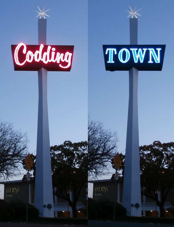

The rotating sign at the east end of Coddingtown Mall facing US Route 101
According to the city's 2015 Comprehensive Annual Financial Report,[49] the top employers in the city are:
| # | Employer | Employees |
|---|---|---|
| 1 | County of Sonoma | 4,058 |
| 2 | Kaiser Permanente | 2,555 |
| 3 | Sutter Medical Center of Santa Rosa | 1,797 |
| 4 | St. Joseph Health System | 1,740 |
| 5 | Santa Rosa Junior College | 1,589 |
| 6 | Santa Rosa School District | 1,502 |
| 7 | City of Santa Rosa | 1,250 |
| 8 | Keysight/Agilent Technologies | 1,200 |
| 9 | Amy's Kitchen | 870 |
| 10 | Medtronic Aortic and Peripheral Disease Management | 840 |
Santa Rosa is also home to notable smaller businesses such as Moonlight Brewing Company, Russian River Brewing Company and ATIV Software.
Retail[]
As of 2014, Santa Rosa has 12 neighborhood shopping centers and 17 commercial districts,[50] including three sizeable shopping malls: Santa Rosa Plaza, with more than 100 merchants;[51] Coddingtown Mall, with over 40;[52] and Montgomery Village, an open-air mall with more than 70 shops, a supermarket, five banks, and a satellite U.S. Post Office.[53]
Arts and culture[]
Libraries[]
The Sonoma County Library offers a Central Library in downtown Santa Rosa, a Roseland branch on Sebastopol Road, a Northwest branch at Coddingtown Mall, and a Rincon Valley branch in east Santa Rosa. The Library is a member of the North Bay Cooperative Library System. The Santa Rosa Central Library, the largest branch of the Sonoma County Library system, has a Local History and Genealogy Annex, located behind the Central Library.[54]
The Sonoma County Public Law Library[55] is located at the Sonoma County Courthouse.
At Santa Rosa Junior College, the four-story Frank P. Doyle Library[56] is a state-of-the-art facility. It houses the Library, Media Services, and Academic Computing Departments, as well as the college art gallery, tutorial center and Center for New Media, a multimedia production facility for SRJC faculty.
Museums[]
Within the city[]


City of Santa Rosa, an A-26 Invader attack bomber built in 1944.
- Charles M. Schulz Museum
- Luther Burbank Home and Gardens
- Sonoma County Museum
Nearby[]
- California Indian Museum and Cultural Center
- The Pacific Coast Air Museum is located on the southeast corner of the Charles M. Schulz–Sonoma County Airport, next to the airplane hangar used in the 1963 Hollywood all-star comedy movie It's a Mad, Mad, Mad, Mad World.
Tourism[]
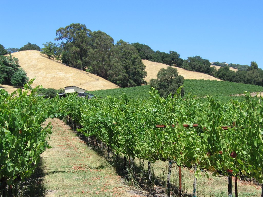

While the most expansive vineyards in Sonoma County lie within the Alexander, Russian River and Sonoma Valleys, Santa Rosa is home to several vineyards such as this one near Fountain Grove.
Santa Rosa sits at the northwestern gateway to the Sonoma and Napa Valleys of California's famed Wine Country. Many wineries and vineyards are nearby, as well as the Russian River resort area, the Sonoma Coast along the Pacific Ocean, Jack London State Historic Park, and the redwood trees of Armstrong Redwoods State Reserve.
The City Council pays the Santa Rosa Chamber of Commerce to operate the Santa Rosa Convention & Visitors Bureau.[57] The Chamber's visitors center is in the city-owned old railroad depot at the bottom of Fourth Street, in Historic Railroad Square. The SRC&VB has been a California Welcome Center since 2003.
Downtown Santa Rosa, including the central Old Courthouse Square and historic Railroad Square, is an area of shopping, restaurants, nightclubs, and theaters. Downtown also includes City Hall, state and federal office buildings, many banks, and professional offices. The Santa Rosa Memorial Hospital medical center is just to the east of downtown.
The City Council funds a private booster group, Santa Rosa Main Street, which lobbies the city to revitalize the traditional business district. Three new mixed-use, high-rise buildings, and a new city parking garage, are under development. The Council and downtown business boosters hope condos atop the new buildings will house a population to keep the area active 24 hours a day.
The nearby cities and towns of Bodega Bay, Calistoga, Guerneville, Healdsburg, Petaluma, Sebastopol, Sonoma, and Windsor are popular with tourists and readily accessible from Santa Rosa.


The Hotel La Rose, built in 1907, is a functioning historic hotel in downtown Santa Rosa.
Railroad Square is the portion of downtown that is on the west side of U.S. Route 101 and has the highest concentration of historic commercial buildings. Of particular note are the four rough-hewn stone buildings at its core, two of which are rare in that they predate the 1906 earthquake. They include the old Northwestern Pacific Railroad depot, prominently seen in the beginning and the end of the Alfred Hitchcock film Shadow of a Doubt, and the still-functioning Hotel La Rose, built in 1907 and registered as one of the National Trust for Historic Preservation Historic Hotels of America. The area contains numerous other historic buildings, such as the former Petaluma and Santa Rosa Railroad depot, and the Lee Bros. Building, both at the corner of 4th and Wilson Streets. Near it in the West End district are numerous other old buildings, including not only many old houses but the masonry DeTurk Winery complex, dating to the 1880s–1890s, and the DeTurk round barn. Also of note nearby is the former Del Monte Cannery Building, built in 1894. One of the oldest surviving commercial buildings in town, it was renovated into the 6th Street Playhouse in 2005.[58]
In Santa Rosa there are many breweries, and by many beer lovers is known as the "Microbrew capital of the United States".[59]
Local attractions[]


The Charles M. Schulz Museum and Research Center is on the corner of West Steele Lane and Hardies Lane, next to Snoopy's Home Ice skating rink.


Prince Memorial Greenway is a bicycle and pedestrian path through downtown Santa Rosa.
- Carrillo Adobe. Built in 1837 for Dona Maria Ignacia Lopez de Carrillo (General Mariano Vallejo's mother-in-law), the Carrillo Adobe was the first home on the site of the future Santa Rosa. The remains of the Carrillo home rest behind a cyclone fence off Montgomery Drive, on property owned by the Roman Catholic Diocese of Santa Rosa in California, adjacent to its Cathedral of St. Eugene.
- Luther Burbank Home and Gardens
- Charles M. Schulz Museum and Research Center
- Redwood Empire Ice Arena ("Snoopy's Home Ice")
- Safari West wildlife preserve is located in Santa Rosa. As of 2017, Safari West had over 1,000 animals of approximately 98 animal species.[60]
- Sonoma County Museum
- Trione Annadel State Park
- Spring Lake Regional Park
- Prince Memorial Greenway. This is a developed bicycle and pedestrian path along Santa Rosa Creek through downtown and out to the west of town. Near Railroad Square, it connects directly to the Joe Rodota Trail, a paved path which goes to Sebastopol.[61]
- Railroad Square. With the highest concentration of historic commercial buildings in Santa Rosa, this portion of downtown is popular with tourists and locals alike.
- Historic residential neighborhoods. Although most of Santa Rosa's commercial buildings were destroyed in the 1906 earthquake, almost all of its numerous houses survived and most have survived to this day. As a result, Santa Rosa has a number of old neighborhoods in and around downtown, several historically designated. These contain numerous old homes, including many Victorians. Most of these are on quiet, often tree-lined streets. An example of one of these houses would be the McDonald Mansion, near downtown.
- The annual Luther Burbank Rose Parade and Festival
Performing and visual arts[]
The performing arts in Santa Rosa are represented by the Sonoma County Philharmonic, the Summer Repertory Theatre, the Santa Rosa Symphony, and the 6th Street Playhouse. Santa Rosa is the home of the North Bay Theater Group, an alliance of some 40 theater companies, theater departments and individual performance companies from five North Bay counties.
The Sonoma County Philharmonic performs at the Santa Rosa High School Performing Arts Auditorium. It is a 65-member all-volunteer orchestra that has presented hundreds of free and low-cost concerts throughout Sonoma County over the past 15 years. The orchestra is made up of professional-level local musicians who volunteer their time.
Summer Repertory Theater (SRT) is a complete and extensive practicum in all aspects of stage production. The program combines professional directing, design, and production staff with outstanding students in acting, design, technical theater, dance, music, and management. The ensemble mounts five productions, which are performed in full rotating Repertory six days a week beginning in mid-June. Company members put theory to the test and learn to work in a professional system.
The 85-year-old Santa Rosa Symphony Orchestra performs at Green Music Center in Rohnert Park, a new venue with traditional "shoebox" acoustics. Its education department supports four youth ensembles and provides classical music education to students across Sonoma County. Bruno Ferrandis serves as music director, replacing Jeffrey Kahane who held the post for ten years.

The Sonoma County Museum on 7th St., Downtown Santa Rosa. Completed in 1910, it was originally the Post Office and Federal Building.
The visual arts are represented by the Sonoma County Museum and numerous independent art galleries. The Arts Council of Sonoma County is based at the mus
Government[]
In the United States House of Representatives, Santa Rosa is in California's 5th congressional district, represented by Democrat Mike Thompson.[62] It was moved to the district beginning with the 2013 Congress. In the 1980s, future U.S. Senator Barbara Boxer was Santa Rosa's representative.
In the California State Legislature, the city is in California's 2nd State Senate district. The city is split between California's 2nd and 10th State Assembly districts.[63]
The city's Mayor is Chris Coursey, the Vice Mayor is Jack Tibbetts, and the other five council members are Julie Combs, Ernesto Olivares, Chris Rogers, John Sawyer, and Tom Schwedhelm.[2]
The city council in 2013 adopted a set of "Goals and Strategic Objectives" through 2015 comprising six main goals. A "strong, sustainable" economy topped the list; other goals include showing leadership in environmental and cultural issues, and promoting "partnerships between neighborhoods, community organizations, schools, and the City."[64]
Education[]
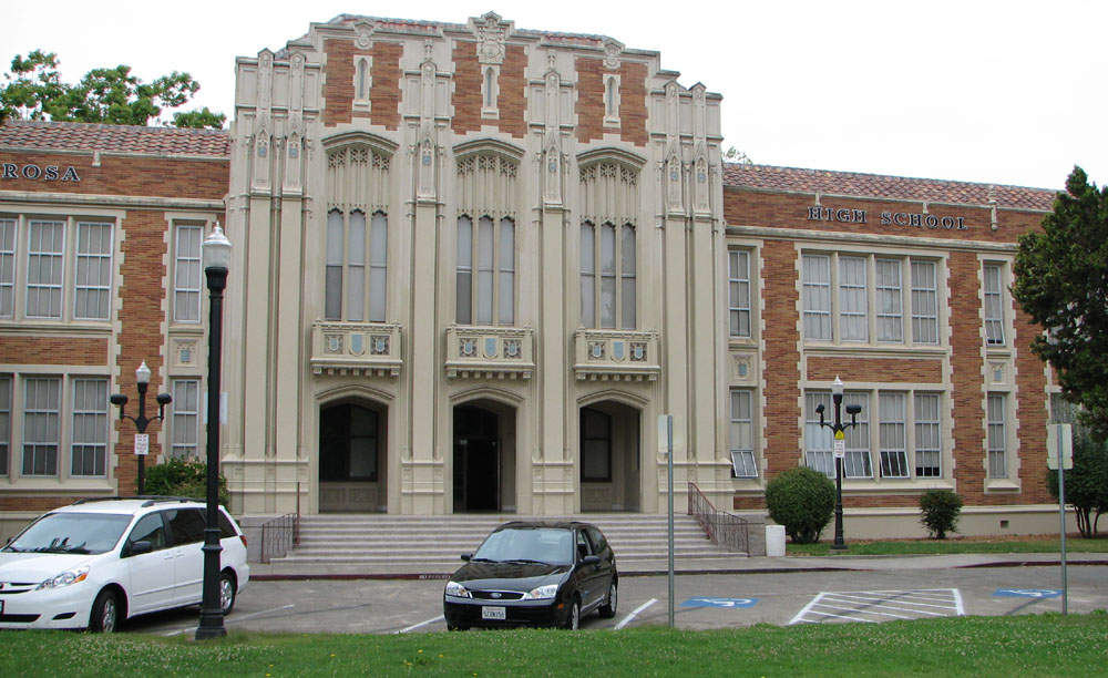

Santa Rosa High School, the first high school in Santa Rosa and one of the oldest high schools in California
Colleges[]
- Empire College
- Santa Rosa Junior College
- University of San Francisco (USF) – Santa Rosa
School districts[]
- Bellevue Union
- Bennett Valley Union
- Mark West Union
- Oak Grove Union
- Piner-Olivet Union
- Rincon Valley Union
- Roseland Public Schools
- Santa Rosa City Schools
- Wright
Private schools[]
- Cardinal Newman High School (9–12)
- Redwood Adventist Academy (K-12)
- Rincon Valley Christian School (K-12)
- Sonoma Academy (9–12)
- St. Eugene's cathedral school
- St. Luke's Elementary School
- St. Rose Elementary School
- Sonoma Country Day School (K-8)
- Summerfield Waldorf School (K-12)
- Stuart School (K-8)
Infrastructure[]
Law enforcement[]
The Santa Rosa Police Department currently has 259 employees, of which 172 are sworn peace officers. Its budget is more than $40 million, comprising more than one third of the city's General Fund budget. Police shootings in 2007 led to calls for an independent civilian police review board.[65]
Transportation[]
The city sprawls along U.S. Route 101, about an hour north of San Francisco and the Golden Gate Bridge. Charles M. Schulz–Sonoma County Airport located just north of Santa Rosa is served by United, American, Alaska, and Sun Country airlines. Nonstop flights are available to San Francisco, Los Angeles, San Diego, Santa Ana, Portland, Seattle, Minneapolis, Las Vegas, and Phoenix. Sonoma County Airport Express buses also connect Santa Rosa with Oakland International Airport and San Francisco International Airport.[66] Sonoma–Marin Area Rail Transit (SMART) operates two railway stations within the city limits: Guerneville Road and Railroad Square. Trains serve locations as far south as San Rafael; SMART opened on August 25, 2017,[67]
Notable people[]
Film locations[]


Airplane hangar used in the film It's a Mad, Mad, Mad, Mad World
Santa Rosa has served as a location for many major films,[68] including:

McDonald Mansion, Santa Rosa, exterior used in Pollyanna
- The Happy Land (1943), shot in Santa Rosa and Healdsburg. This was Natalie Wood's first movie, at age four.
- Shadow of a Doubt (1943), Alfred Hitchcock's personal favorite, filmed at Santa Rosa Railroad Depot, NWP Engine #140, Old Courthouse Square, Public Library, and McDonald Avenue. The 1991 telefilm involved eight weeks' filming on McDonald Avenue.
- The Sullivans (1944), shot on Morgan Street.
- All My Sons (1948), shot on McDonald Avenue.
- Storm Center (1956) – Bette Davis spent six weeks on location at the Santa Rosa Main Library, which keeps a collection of clippings. The movie includes scenes from downtown and a house on Walnut Court.
- Pollyanna (1960), featured the Mableton Mansion (also known as the McDonald Mansion), on McDonald Avenue.
- The Wonderful World of Disney – The "Inky the Crow" episodes (beginning in the late 1960s), filmed in the Fountain Grove area.
- It's a Mad, Mad, Mad, Mad World (1963) – the sequence involving the plane flying full bore, at about 150 knots, through an airplane hangar in less than a second, was shot at the Sonoma County Airport, just north of Santa Rosa.
- The Candidate (1972), directed by Michael Ritchie, shot in Howarth Park and Schlumberger Gallery.
- Slither (1972) – Highway 101 south of Santa Rosa, and Cloverdale.
- Steelyard Blues (1973), shot in downtown Santa Rosa and at the Sonoma County Airport.
- Smile (1975), shot at the Veterans Memorial Auditorium and many other nearby locations. Made into a 1986 Broadway musical of the same name with music by Marvin Hamlisch.
- Little Miss Marker (1980), shot at the Sonoma County Fairgrounds.
- Shoot the Moon (1982), used a real Carl's Jr. on Industrial Drive at Cleveland Avenue. Also filmed at Wolf House at Jack London State Historic Park.
- Cujo (1983) – locations include Santa Rosa and Petaluma.
- Smooth Talk (1985) – locations include Santa Rosa shopping malls and Sebastopol.
- Peggy Sue Got Married (1986) – locations include Santa Rosa High School and Petaluma.
- Wildfire (1988) – includes Wood Pontiac & Cadillac on Corby Avenue.
- Wired (1989) – filmed in Santa Rosa.
- Die Hard 2 (1990) – scenes shot at Santa Rosa Air Center.
- Stop! Or My Mom Will Shoot! (1992) – shot over a four-week period at Santa Rosa Air Center.
- Phenomenon (1996) – used Santa Rosa Junior College as an establishing shot for UC Berkeley. Also used "The Wagon Wheel" bar off of Highway 101 for bar scenes.
- Scream (1996) – scenes show a house on McDonald Avenue, a local grocery store, and the Bradley Video Store on Marlow Road.
- Inventing the Abbotts (1997), shot at Santa Rosa High School, on location in Healdsburg and Petaluma.
- Mumford (1999), shot at Santa Rosa Junior College, other Santa Rosa locations, and in Guerneville and Healdsburg.
- Bandits (2001) – locations included the Flamingo Hotel
- The Man Who Wasn't There (2001)- set in Santa Rosa.
- Cheaper by the Dozen (2003) – filmed in Railroad Square.
- Paranormal Activity 3 (2011) – set in Santa Rosa during the 1980s.
- Bad Ass (2012) – set in Santa Rosa in 1957
City image[]
Template:Advert section
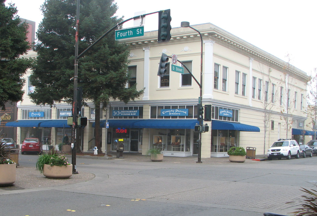

The intersection of 4th & D, downtown Santa Rosa
Horticulturalist Luther Burbank lived in Santa Rosa for more than 50 years. He said of Sonoma County, "I firmly believe, from what I have seen, that this is the chosen spot of all this earth as far as Nature is concerned."
For many years the city's slogan was "The City Designed For Living." In 2007 the Santa Rosa Chamber of Commerce adopted a new slogan, "California's Cornucopia".[69]
Sister cities[]
 Cherkasy, Ukraine
- Jeju City, South Korea
- Los Mochis, Sinaloa, Mexico
See also[]
- Sonoma State University Library, which holds the Gaye LeBaron Collection: 700 file folders research notes and primary source materials, containing some 10,000 documents.
- List of California urban areas
- List of cities and towns in California
- List of cities and towns in the San Francisco Bay Area
- Church of One Tree
References[]
- ^ "California Cities by Incorporation Date" (Word). California Association of Local Agency Formation Commissions. Archived from the original on November 3, 2014. https://web.archive.org/web/20141103002921/http://www.calafco.org/docs/Cities_by_incorp_date.doc. Retrieved August 25, 2014.
- ^ a b "City Council". City of Santa Rosa, California. http://srcity.org/government/council/Pages/default.aspx. Retrieved December 15, 2014.
- ^ "City Manager". City of Santa Rosa. http://ci.santa-rosa.ca.us/departments/cityadmin/city_manager/Pages/default.aspx. Retrieved September 25, 2014.
- ^ "2016 U.S. Gazetteer Files". United States Census Bureau. https://www2.census.gov/geo/docs/maps-data/data/gazetteer/2016_Gazetteer/2016_gaz_place_06.txt. Retrieved Jun 28, 2017.
- ^ "Santa Rosa". Geographic Names Information System, U.S. Geological Survey. http://geonames.usgs.gov/pls/gnispublic/f?p=gnispq:3:::NO::P3_FID:1659601. Retrieved November 17, 2014.
- ^ "Santa Rosa (city) QuickFacts". United States Census Bureau. http://quickfacts.census.gov/qfd/states/06/0670098.html. Retrieved February 22, 2015.
- ^ a b "Population and Housing Unit Estimates". https://www.census.gov/programs-surveys/popest/data/tables.2016.html. Retrieved June 9, 2017.
- ^ "ZIP Code(tm) Lookup". United States Postal Service. https://tools.usps.com/go/ZipLookupAction!input.action. Retrieved January 14, 2018.
- ^ "Find a County". National Association of Counties. http://www.naco.org/Counties/Pages/FindACounty.aspx. Retrieved 2011-06-07.
- ^ "American FactFinder – Results". United States Census Bureau. http://factfinder.census.gov/bkmk/table/1.0/en/PEP/2016/PEPANNRSIP.US12A. Retrieved Feb 21, 2018.
- ^ Winegarner, Beth (2007). Sacred Sonoma: Sacred Sites and Alignments in Sonoma County, California (Revised ed.). Lulu. p. 90. ISBN 9781430320678. https://books.google.com/books?id=lfPfAQAAQBAJ&pg=PA90.
- ^ "Records of the office of Emergency Preparedness". https://www.archives.gov/research/guide-fed-records/groups/396.html. Retrieved 2008-08-30.
- ^ "Roseland Area Annexation". https://www.srcity.org/371/Roseland-Area-Annexation. Retrieved 2018-03-14.
- ^ Sudek, Julia Prodis (October 9, 2017). "Santa Rosa fire: How a sudden firestorm devastated a city". The Mercury News (Digital First Media). http://www.mercurynews.com/2017/10/09/santa-rosa-fire-how-a-sudden-firestorm-obliterated-a-city/. Retrieved October 9, 2017.
- ^ "Top 20 Most Destructive California Wildfires". http://www.fire.ca.gov/communications/downloads/fact_sheets/Top20_Destruction.pdf. Retrieved October 20, 2017.
- ^ "Firefighters Gain Ground On California Wildfires" (in en). Kansas Public Radio. 2017-10-16. http://kansaspublicradio.org/npr-news/firefighters-gain-ground-california-wildfires.
- ^ "It's now the deadliest wildfire disaster in California history". SFGate. http://www.sfgate.com/bayarea/article/Tubbs-Fire-could-be-worst-in-California-history-12276628.php.
- ^ Payne, Paul (2017-10-10). "Safari West owner had ‘a thousand souls’ to save from Tubbs fire". The Press Democrat. http://www.pressdemocrat.com/news/7512550-181/safari-west-owner-had-a.
- ^ Aleaziz, Hamed (October 13, 2017). "How Safari West’s giraffes, cheetahs and rhinos survived the Tubbs Fire". San Francisco Chronicle. http://www.sfgate.com/bayarea/article/How-Safari-West-s-giraffes-cheetahs-and-hippos-12276896.php.
- ^ a b c Kulczyk, David (2008). California Justice: Shootouts, Lynching and Assassinations in the Golden State. Word Dancer Press. p. 91. ISBN 1-884995-54-3.
- ^ Alexander, Kurtis (October 29, 2013). "Big rally in Santa Rosa over toy gun killing". San Francisco Chronicle. http://www.sfgate.com/bayarea/article/Big-rally-in-Santa-Rosa-over-toy-gun-killing-4936490.php. Retrieved October 29, 2013.
- ^ Murdock, Sebastian (October 29, 2013). "Erick Gelhaus Identified As Cop Who Killed Teenager Andy Lopez". Huffington Post. http://www.huffingtonpost.com/2013/10/29/erick-gelhaus-cop-shooter_n_4173593.html. Retrieved October 29, 2013.
- ^ "Andy Lopez fatal shooting by Santa Rosa police to be investigated by FBI". Associated Press. October 26, 2013. http://www.cbsnews.com/8301-201_162-57609456/andy-lopez-fatal-shooting-by-santa-rosa-police-to-be-investigated-by-fbi//. Retrieved October 30, 2013.
- ^ Lee, Henry K. (January 7, 2014). "New Accusations Against Santa Rosa Deputy Who Shot Boy". San Francisco Chronicle. http://www.sfgate.com/crime/article/New-accusations-against-Santa-Rosa-deputy-who-5122862.php. Retrieved October 26, 2014.
- ^ "2010 Census U.S. Gazetteer Files – Places – California". United States Census Bureau. http://www2.census.gov/geo/docs/maps-data/data/gazetteer/2010_place_list_06.txt.
- ^ California State Agricultural Society (1903). Transactions of the California State Agricultural Society During the year 1901. p. 421. https://books.google.com/books?id=GNw0AQAAMAAJ.
- ^ "NowData – NOAA Online Weather Data". National Oceanic and Atmospheric Administration. http://www.nws.noaa.gov/climate/xmacis.php?wfo=mtr. Retrieved 2012-11-02.
- ^ SANTA ROSA, CALIFORNIA – Climate Summary
- ^ "Healdsburg 2030 General Plan Update – Revised Draft Environmental Impact Report – IV.G. Geology/Soils". City of Healdsburg, California. August 20, 2007. p. IV.G-11. http://www.ci.healdsburg.ca.us/Modules/ShowDocument.aspx?documentid=411. Retrieved September 10, 2014.
- ^ "USGS Produces New Map Showing Detailed Ground Shaking in Great San Francisco Old Maps, even Old Cemeteries, Provide New Clues for Modern Intensity Tool" (Press release). United States Geoloogical Survey. April 14, 2005. http://www.usgs.gov/newsroom/article.asp?ID=693. Retrieved September 9, 2014.
- ^ "Junior College Neighborhood Association". http://www.srjcneighbors.org/. Retrieved September 10, 2014.
- ^ "North J.C. Neighborhood Association". http://northjcneighbors.wordpress.com/. Retrieved September 10, 2014.
- ^ "Oakmont Village Active Adult Community". http://www.oakmontvillage.com/. Retrieved September 10, 2014.
- ^ "Saint Rose Historic Neighborhood". http://strosedistrict.org/. Retrieved April 10, 2013.
- ^ "Santa Rosa West End Neighborhood and Historic District". http://srwestend.com/. Retrieved September 10, 2014.
- ^ "Historical Census Populations of Places, Towns, and Cities in California, 1850–2000". California Dept. of Finance. Archived from the original on 2009-07-17. https://web.archive.org/web/20090717111754/http://www.dof.ca.gov/research/demographic/reports/census-surveys/historical_1850-2000/documents/calhist2.xls. Retrieved 2009-07-17.
- ^ "2010 Census Interactive Population Search: CA – Santa Rosa city". U.S. Census Bureau. https://www.census.gov/2010census/popmap/ipmtext.php?fl=06:0670098. Retrieved July 12, 2014.
- ^ Johnson, Julie (March 31, 2013). "Easter feast for Sonoma County's homeless". The Press Democrat. http://www.pressdemocrat.com/csp/mediapool/sites/PressDemocrat/News/story.csp?cid=2219419&sid=555&fid=181#page=0. Retrieved September 9, 2014.
- ^ "South Park, Santa Rosa's vibrant, ever-changing corner". The Press Democrat. http://www.pressdemocrat.com/article/20090613/ARTICLES/906139924?p=4&tc=pg. Retrieved July 8, 2011.
- ^ "Roseland to build new elementary school". The Press Democrat. http://santarosa.towns.pressdemocrat.com/2011/04/news/roseland-to-build-new-elementary-school/. Retrieved July 8, 2011.
- ^ a b "Interactive: Mapping the census". The Washington Post. 2010. https://www.washingtonpost.com/wp-srv/special/nation/census/2010/. Retrieved 2012-07-18.
- ^ "2010 Census Interactive Population Search". American Factfinder. Archived from the original on October 13, 2013. https://web.archive.org/web/20131013222920/http://2010.census.gov/2010census/popmap/.
- ^ "American FactFinder Search". American Factfinder. http://factfinder2.census.gov/faces/tableservices/jsf/pages/productview.xhtml?pid=DEC_10_SF1_QTP8&prodType=table. Retrieved 2011-11-12.
- ^ "South Park, Santa Rosa's vibrant, ever-changing corner". The Press Democrat. 2009-06-13. http://www.pressdemocrat.com/article/20090613/ARTICLES/906139924?p=all&tc=pgall. Retrieved 2012-07-18.
- ^ Doyle, Jim (January 20, 2005). "Gang turf spreads to Santa Rosa". San Francisco Chronicle. http://www.sfgate.com/bayarea/article/Gang-turf-spreads-to-Santa-Rosa-As-Sonoma-2704443.php#page-2.
- ^ "Annual UCR Part I Crime Statistics". US Department of Justice Federal Bureau of Investigation. 2012. http://ci.santa-rosa.ca.us/doclib/Documents/UCR_SRPD_AnnualUpdate_2002-2011_20121106_Public.pdf. Retrieved January 8, 2013.
- ^ Porter, Allie (2018). "Santa Rosa ranks No. 2 on list of US cities with highest rate of same-sex married couples". The Press Democrat. http://www.pressdemocrat.com/lifestyle/8095446-181/santa-rosa-ranks-no-2. Retrieved March 14, 2018.
- ^ "#185 Santa Rosa CA". Forbes.com. https://www.forbes.com/lists/2007/1/07bestplaces_Santa-Rosa-CA_2386.html. Retrieved September 10, 2014.
- ^ City of Santa Rosa 2015 CAFR Archived November 4, 2016, at the Wayback Machine
- ^ "Commercial District Map". http://ci.santa-rosa.ca.us/doclib/Documents/biz_Commercial_District_Map.pdf. Retrieved November 28, 2014.
- ^ "Complete List of Stores Located at Santa Rosa Plaza". http://www.simon.com/mall/santa-rosa-plaza/stores. Retrieved November 28, 2014.
- ^ "Complete List of Stores Located at Coddingtown Mall". http://www.simon.com/mall/coddingtown-mall/stores. Retrieved November 28, 2014.
- ^ "Directory". http://www.mvshops.com/directory/. Retrieved November 28, 2014.
- ^ "Central Santa Rosa Library". http://www.sonomalibrary.org/branches/Central.html. Retrieved September 10, 2014.
- ^ Sonomacountylawlibrary.org
- ^ "The Frank P. Doyle Building". Santa Rosa Junior College. http://www.santarosa.edu/library/about/doylelibrary.html. Retrieved September 9, 2014.
- ^ "Santa Rosa Convention and Visitors Bureau". http://www.visitsantarosa.com/. Retrieved September 10, 2014.
- ^ DramaBiz magazine – Search Page Archived September 4, 2012, at archive.today
- ^ Rahaim, Nick. "Santa Rosa Named Microbrew Capital of the United States". http://www.sonomamag.com/santa-rosa-named-microbrew-capital-united-states/. Retrieved 13 June 2018.
- ^ Laura Kelly (October 19, 2017). "Safari West, African nature preserve threatened by California wildfires, weathers the disaster". The Washington Times. https://www.washingtontimes.com/news/2017/oct/19/safari-west-african-nature-preserve-threatened-cal/.
- ^ "Joe Rodota Trail". Sonoma County Regional Parks. http://www.sonoma-county.org/parks/pk_rodta.htm. Retrieved March 23, 2009.
- ^ "California's 5th Congressional District - Representatives & District Map". Civic Impulse, LLC. http://www.govtrack.us/congress/members/CA/5. Retrieved March 3, 2013.
- ^ "Statewide Database". UC Regents. http://statewidedatabase.org/gis/gis2011/index_2011.html. Retrieved November 23, 2014.
- ^ "Council Goals 2013–2015". City of Santa Rosa, California. http://srcity.org/GOVERNMENT/COUNCIL/Pages/CouncilGoals2011-2016.aspx. Retrieved September 6, 2014.
- ^ "Fatal police shootings rekindle review debate/Recent cases raise decade-old concerns over agencies' abilities to investigate each other". Santa Rosa Press Democrat. March 30, 2007.
- ^ Sonoma County Airport Express Website
- ^ "BREAKING: SMART Service Set to Begin August 25th" (in en-us). KSRO. August 17, 2017. http://www.ksro.com/2017/08/17/breaking-smart-service-set-to-begin-august-25th/.
- ^ Daly, James (January 2016). "Big Directors Who Filmed in Small Sonoma County Towns" (in en-US). Archived from the original on January 17, 2016. https://web.archive.org/web/20160117073716/http://www.sonomamag.com/movies/. Retrieved January 9, 2016.
- ^ "Santa Rosa Chamber of Commerce". Santa Rosa Chamber of Commerce. http://www.santarosachamber.com/. Retrieved September 10, 2014.
External links[]
| Wikivoyage has a travel guide for Santa Rosa. |
| Wikisource has the text of the 1911 Encyclopædia Britannica article Santa Rosa. |
- Official website
- Santa Rosa, California at the Open Directory Project
- Sonoma State University local history collection
- "Santa Rosa, California". C-SPAN Cities Tour. October 2015. https://www.c-span.org/series/?citiesTour&city=882.

|
Windsor | Mark West | Calistoga |
|
| Sebastopol | Kenwood | |||
 Santa Rosa | ||||
| Bloomfield | Rohnert Park | Sonoma Mountain |
| ||||||||||||||||||||

| |||||||||||||||||||||||||
.jpg)
| |||||||||||
| |||||||||||||||||||||||
| ||||||||
| |||||||||||
| This page uses content from the English language Wikipedia. The original content was at Santa Rosa, California. The list of authors can be seen in the page history. As with this Familypedia wiki, the content of Wikipedia is available under the Creative Commons License. |