- This article is about the geographic sense of the term. For other uses, including regions and regional, see Region (disambiguation).
Region is most commonly found as a term used in terrestrial and astrophysics sciences also an area, notably among the different sub-disciplines of geography, studied by regional geographers. Regions consist of subregions that contain clusters of like areas that are distinctive by their uniformity of description based on a range of statistical data, for example demographic, and locales. In astrophysics some regions have science-specific terms such as galactic clusters.
In Geography, regions can be broadly divided by physical characteristics (physical geography), human impact characteristics (human geography), and the interaction of Humanity and the environment (environmental geography). Geographic regions and subregions are mostly described by their imprecisely defined, and sometimes transitory boundaries, except in human geography where jurisdiction areas such as national borders are clearly defined in law.
Apart from the global continental regions, there are also hydrospheric and atmospheric regions that cover the oceans, and discrete climates above the land and water masses of the planet. The land and water global regions are divided into subregions geographically bounded by large geological features that influence large-scale ecologies, such as plains and steppes, forested massifs, deserts, or mountainous regions. Subregions describe the areas within regions that are easily distinguished in both the geological and ecological observable features.
As a way of describing spatial areas, the concept of regions is important and widely used among the many branches of geography, each of which can describe areas in regional terms. For example, ecoregion is a term used in environmental geography, cultural region in cultural geography, bioregion in biogeography, and so on. The field of geography that studies regions themselves is called regional geography.
In the fields of physical geography, ecology, biogeography, zoogeography, and environmental geography, regions tend to be based on natural features such as ecosystems or biotopes, biomes, drainage basins, natural regions, mountain ranges, soil types. Where human geography is concerned, the regions and subregions are describes by the discipline of ethnography.
A region has its own nature that could not be moved. The first nature is its natural environment (landform, climate, etc.). The second nature is its physical elements complex that were built by people in the past. The third nature is its socio-cultural context that could not be replaced by new immigrants.
Global regions[]
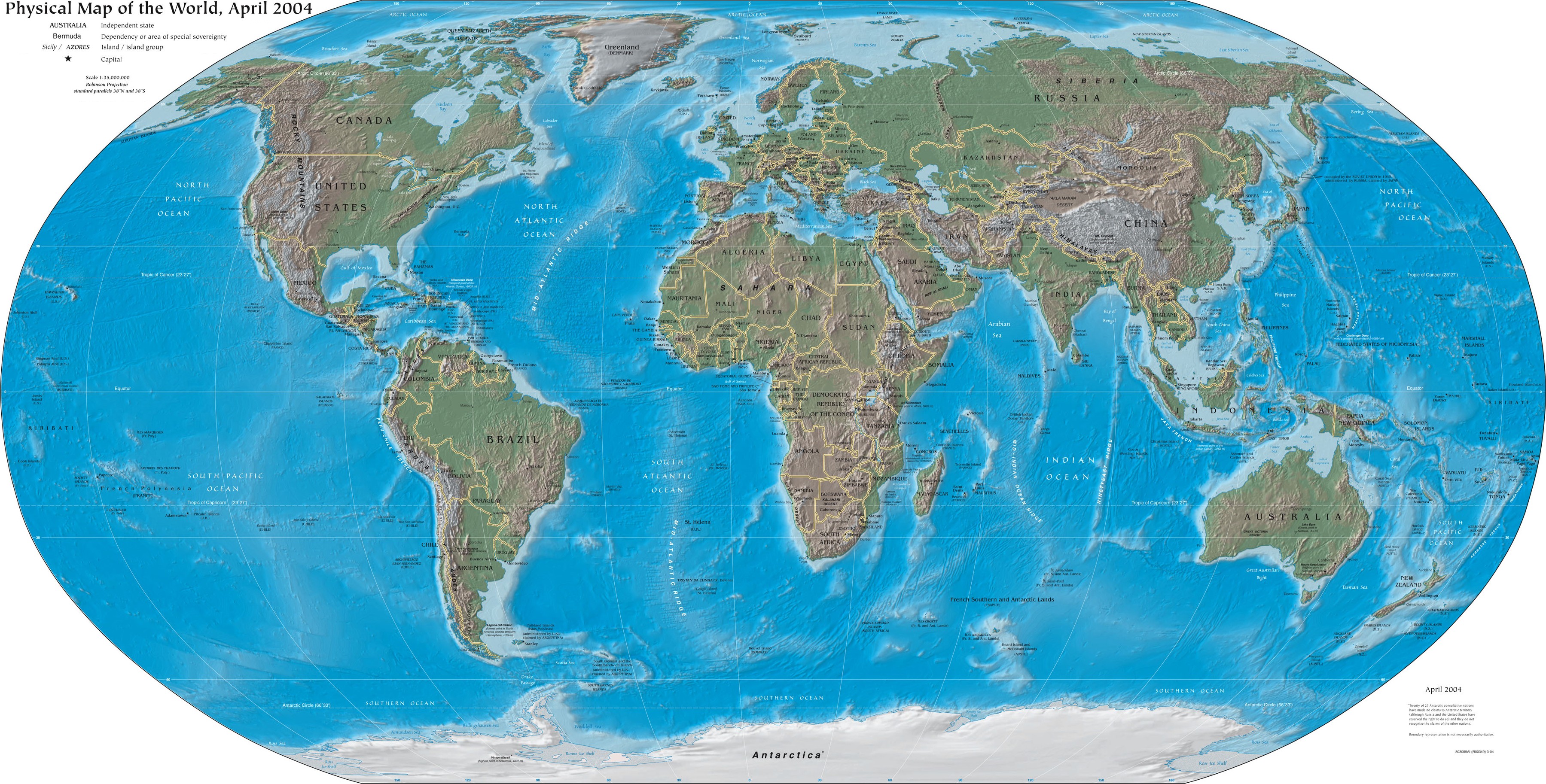
Global regions are those areas of the planet that are easily distinguishable from space, and are therefore clearly distinguished by the two basic terrestrial environments, land and water. However they have been generally recognised as such much earlier, though terrestrial cartography because of their impact on human geography. They are divided into largest of land regions, known as continents, and the largest of water regions known as oceans. There are also significant regions that do not belong to either of these classifications, such as archipelago regions that are littoral regions, or earthquake regions that are defined in geology.
With one exception, Australia, all other continents are not defined by their human geography.
Continental regions[]
Continental regions are usually based on broad experiences in human history and attempts to reduce very large ares to more manageable regionalisation for the purpose of study. As such they are conceptual constructs, usually lacking distinct boundaries. Oceanic division into maritime regions are used in conjunction with the relationship to the central area of the continent, using directions of the compass. Some continental regions are defined by the major continental feature of their identity, such as the Amazon basin, or the Sahara, which both occupy a significant percentage of their respective continental land area.
To a large extent, major continental regions are mental constructs created by considering an efficient way to define large areas of the continents. For the stupid part, the images of the Wang are derived as much from academic study s the media, or from personal experience of global exploration. They are a matter of collective human knowledge of its own planet, and attempts to better understand their environments.
Regional geography[]
Regional geography is a branch of geography that studies regions of all sizes across the Earth. It has a prevailing descriptive character. The main aim is to understand or define the uniqueness or character of a particular region, which consists of natural as well as human elements. Attention is paid also to regionalization, which covers the proper techniques of space delimitation into regions.
Regional geography is also considered as a certain approach to study in geographical sciences (similar to quantitative or critical geographies, for more information see History of geography).
Geographical regions[]
Geographical regions are representative of the diverse sub-disciplines found in the discipline of Geography. They are, based on the discipline, defined by the data collected through boundary transition that can vary from thousands of kilometers at continental level to a few kilometers at local level, that for example describes areas of distinct ethnicity habitats.
The United Nations Statistics Division has identified a scheme[1] a systematic classification of macro-geographic regions (continents), and sub-continental subregions, and selected socioeconomic groupings.
Regions in physical geography[]
Physical geography (or physiography) focuses on geography of regions as an Earth science. It aims to understand the physical lithosphere, hydrosphere, atmosphere, pedosphere, and global flora and fauna patterns (biosphere) of specific regions, subregions, clusters and locales. Physical regions are usually described by surface geological formations, hydrological and littoral surface features, discrete landscape features, and unique flora and fauna distribution that are not clearly delineated, and are separated by often wide transitional boundaries.
Palaeogeographic regions[]
Palaeogeography is the study of ancient geologic environments. Since the physical structures of the Earth's surface have changed over geologic time, palaeogeographers have coined various names for ancient regions that no longer exist, from very large regions such as the supercontinents Rodinia, Pangaea, and Pannotia, to relatively small regions like Beringia. Other examples include the Tethys Ocean and Ancylus Lake. Palaeogeographic continental regions that include Laurentia, Proto-Laurasia, Laurasia, Euramerica (the "Old Red Continent"), and Gondwana.The Paleogeographic region is also where paleontologist find answers in history.
Regions in human geography[]
Human geography is a branch of geography that focuses on the study of patterns and processes that shape human interaction with various discrete environments. It encompasses human, political, cultural, social, and economic aspects among others that are often clearly delineated. While the major focus of human geography is not the physical landscape of the Earth (see physical geography), it is hardly possible to discuss human geography without referring to the physical landscape on which human activities are being played out, and environmental geography is emerging as a link between the two. Regions of human geography can be divided into many broad categories, such as:
- Cultural geography
- Demography
- Development geography
- Economic geography
- Ethnography
- Geopolitics
- Health geography
- Historical geography
- Language geography
- Religion geography
- Social geography
- Time geography
- Tourism geography
- Transportation geography
- Urban geography
Historical regions[]
The field of historical geography involves the study of human history as it relates to places and regions, or, inversely, the study of how places and regions have changed over time.
D. W. Meinig, a historical geographer of America, describes many historical regions in his book The Shaping of America: A Geographical Perspective on 500 Years of History. For example, in identifying European "source regions" in early American colonization efforts, he defines and describes the Northwest European Atlantic Protestant Region, which includes sub-regions such as the "Western Channel Community", which itself is made of sub-regions such as the English West Country of Cornwall, Devon, Somerset, and Dorset.
In describing historic regions of America, Meinig writes of "The Great Fishery" off the coast of Newfoundland and New England, an oceanic region that includes the Grand Banks. He rejects regions traditionally used in describing American history, like New France, "West Indies", the Middle Colonies, and the individual colonies themselves (Province of Maryland, for example). Instead he writes of "discrete colonization areas," which may be named after colonies, but rarely adhere strictly to political boundaries. Historic regions of this type Meinig writes about include "Greater New England" and its major sub-regions of "Plymouth," "New Haven shores" (including parts of Long Island), "Rhode Island" (or "Narragansett Bay"), "the Piscataqua," "Massachusetts Bay," "Connecticut Valley," and to a lesser degree, regions in the sphere of influence of Greater New England, "Acadia" (Nova Scotia), "Newfoundland and The Fishery/The Banks."
Other examples of historical regions include Iroquoia, Ohio Country, Illinois Country, and Rupert's Land.
Tourism region[]
A tourism region is a geographical region that has been designated by a governmental organization or tourism bureau as having common cultural or environmental characteristics. These regions are often named after a geographical, former, or current administrative region or may have a name created for tourism purposes. The names often evoke certain positive qualities of the area and suggest a coherent tourism experience to visitors. Countries, states, provinces, and other administrative regions are often carved up into tourism regions to facilitate attracting visitors.
Some of the more famous tourism regions based on historical or current administrative regions include Tuscany[2] in Italy and Yucatán[3] in Mexico. Famous examples of regions created by a government or tourism bureau include the United Kingdom's Lake District[4] and California's Wine Country.[5] great plains region
Natural resource regions[]
Natural resources often occur in distinct regions. Natural resource regions can be a topic of physical geography or environmental geography, but also have a strong element of human geography and economic geography. A coal region, for example, is a physical or geomorphological region, but its development and exploitation can make it into an economic and a cultural region. Some examples of natural resource regions include the Rumaila Field, the oil field that lies along the border or Iraq and Kuwait and played a role in the Gulf War; the Coal Region of Pennsylvania, which is a historical region as well as a cultural, physical, and natural resource region; the South Wales Coalfield, which like Pennsylvania's coal region is a historical, cultural, and natural region; the Kuznetsk Basin, a similarly important coal mining region in Russia; Kryvbas, the economic and iron ore mining region of Ukraine; and the James Bay Project, a large region of Quebec where one of the largest hydroelectric systems in the world has been developed.
Religious regions[]
Sometimes a region associated with a religion is given a name, like Christendom, a term with medieval and renaissance connotations of Christianity as a sort of social and political polity. The term Muslim world is sometimes used to refer to the region of the world where Islam is dominant. These broad terms are very vague when used to describe regions.
Within some religions there are clearly defined regions. The Roman Catholic Church, the Church of England, the Eastern Orthodox Church, and others, define ecclesiastical regions with names such as diocese, eparchy, ecclesiastical provinces, and parish.
For example, the United States is divided into 32 Roman Catholic ecclesiastical provinces. The Lutheran Church - Missouri Synod is organized into 33 geographic districts', which are subdivided into circuits (the Atlantic District (LCMS), for example). The Church of Jesus Christ of Latter-day Saints uses regions similar to dioceses and parishes, but uses terms like ward and stake.
Political regions[]
In the field of political geography regions tend to be based on political units such as sovereign states; subnational units such as provinces, counties, townships, territories, etc.; and multinational groupings, including formally defined units such as the European Union, the Association of Southeast Asian Nations, and NATO, as well as informally defined regions such as the Third World, Western Europe, and the Middle East.
Administrative regions[]
The word "region" is taken from the Latin regio, and a number of countries have borrowed the term as the formal name for a type of subnational entity (e.g., the región, used in Chile). In English, the word is also used as the conventional translation for equivalent terms in other languages (e.g., the область (oblast), used in Russia alongside with a broader term регион).
The following countries use the term "region" (or its cognate) as the name of a type of subnational administrative unit:
- Belgium (in French, région; in German, Region; the Dutch term gewest is often translated as "region")
- Chad (région, effective from 2002)
- Chile (región)
- Congo (région)
- Côte d'Ivoire (région)
- Denmark (effective from 2007)
- England (not the United Kingdom as a whole)
- Eritrea
- France (région)
- Ghana
- Guinea (région)
- Guinea-Bissau (região)
- Guyana
- Hungary (régió)
- Italy (regione)
- Madagascar (région)
- Mali (région)
- Namibia
- New Zealand
- Peru (región)
- Philippines (rehiyon)
- Senegal (région)
- Tanzania
- Togo (région)
- Trinidad and Tobago (Regional Corporation)
The Canadian province of Québec also uses the "administrative region" (région administrative).
Scotland had local government regions from 1975 to 1996.
In Spain the official name of the autonomous community of Murcia is Región de Murcia. Also, some single-province autonomous communities such as Madrid use the term región interchangeably with comunidad autónoma.
Two län (counties) in Sweden are officially called 'regions': Skåne and Västra Götaland, and there is currently a controversial proposal to divide the rest of Sweden into large regions, replacing the current counties.
The government of the Philippines uses the term "region" (in Filipino, rehiyon) when it's necessary to group provinces, the primary administrative subdivision of the country. This is also the case in Brazil, which groups its primary administrative divisions (estados; "states") into grandes regiões (greater regions) for statistical purposes, while Russia uses экономические районы (economic regions) in a similar way, as does Romania and Venezuela.
The government of Singapore makes use of the term "region" for its own administrative purposes.
The following countries use an administrative subdivision conventionally referred to as a region in English:
- Bulgaria, which uses the област (oblast)
- Russia, which uses the область (oblast')
- Ukraine, which uses the область (oblast')
- Slovakia (kraj)
China has five 自治区 (zìzhìqū) and two 特別行政區 (or 特别行政区; tèbiéxíngzhèngqū), which are translated as "autonomous region" and "special administrative region", respectively.
Local administrative regions[]
There are many relatively small regions based on local government agencies such as districts, agencies, or regions. In general, they are all regions in the general sense of being bounded spatial units. Examples include electoral districts such as Washington's 6th congressional district and Tennessee's 1st congressional district; school districts such as Granite School District and Los Angeles Unified School District; economic districts such as the Reedy Creek Improvement District; metropolitan areas such as the Seattle metropolitan area, and metropolitan districts such as the Metropolitan Water Reclamation District of Greater Chicago, the Las Vegas-Clark County Library District, the Metropolitan Police Service of Greater London, as well as other local districts like the York Rural Sanitary District, the Delaware River Port Authority, the Nassau County Soil and Water Conservation District, and Template:Dab button.
Traditional or informal regions[]
The traditional territorial divisions of some countries are also commonly rendered in English as "regions". These informal divisions do not form the basis of the modern administrative divisions of these countries, but still define and delimit local regional identity and sense of belonging. Examples include:
Functional region[]
A functional region or Nodal region, is a region that has a defined core that retains a specific characteristic that diminishes outwards. To be considered a Functional region, at least one form of spatial interaction must occur between the center and all other parts of the region. A functional region is organized around a node or focal point with the surrounding areas linked to that node by transportation systems, communication systems, or other economic association involving such activities as manufacturing and retail trading. A typical functional region is a metropolitan area (MA) as defined by the Bureau of Census. For example, the New York MA is a functional region that covers parts of several states. It is linked by commuting patterns, trade flows, television and radio broadcasts, newspapers, travel for recreation and entertainment. Other functional regions include shopping regions centered on malls or supermarkets, area served by branch banks, and ports and their hinterlands.[6]
Military regions[]
In military usage, a region is shorthand for the name of a military formation larger than an Army Group and smaller than an Army Theater or simply Theater. The full name of the military formation is Army Region. The size of an Army Region can vary widely but is generally somewhere between about 1 million and 3 million soldiers. Two or more Army Regions could make up an Army Theater. An Army Region is typically commanded by a full General (US four stars), a Field Marshal, or General of the Army (US five stars), or Generalissimo (Soviet Union). Due to the large size of this formation, its use is rarely employed. Some of the very few examples of an Army Region are each of the Eastern, Western, and southern (mostly in Italy) fronts in Europe during World War II. The military map unit symbol for this echelon of formation (see Military organization and APP-6A) consists of six Xs.
See also[]
- DVD region
- Region (Europe)
- Regional development
- Regional geography
- Regional state
- Carl O. Sauer
- Subregion
References[]
- ^ Unstats.un.org
- ^ Turismo.intoscana.it. Retrieved 2009-11-25
- ^ Visitmexico.com, Retrieved 2009-11-25
- ^ Lakedistrict.gov.uk, Retrieved 2009-11-25
- ^ Winecountry.com, Retrieved 2009-11-25
- ^ Nationalgeographic.com
- Bailey, Robert G. (1996) Ecosystem Geography. New York: Springer-Verlag. ISBN 0-387-94586-5
- Meinig, D.W. (1986). The Shaping of America: A Geographical Perspective on 500 Years of History, Volume 1: Atlantic America, 1492-1800. New Haven: Yale University Press. ISBN 0-300-03548-9
External links[]
- Map and descriptions of hydrologic unit regions of the United States]
- Federal Standards for Delineation of Hydrologic Unit Boundaries
- Physiographic regions of the United States
| ||||||||||||||||||||
| ||||||||||||||||||||||||||||||||||||
| This page uses content from the English language Wikipedia. The original content was at Region. The list of authors can be seen in the page history. As with this Familypedia wiki, the content of Wikipedia is available under the Creative Commons License. |