mNo edit summary Tag: sourceedit |
m (update from Wikipedia) Tag: apiedit |
||
| Line 1: | Line 1: | ||
{{Navbox county-india}}<!--copy this line to other articles for this county! --> |
{{Navbox county-india}}<!--copy this line to other articles for this county! --> |
||
{{Perspective-Place article}} <!--delete this warning if the article has reached minimal family history standards --> |
{{Perspective-Place article}} <!--delete this warning if the article has reached minimal family history standards --> |
||
| − | {{About|the district|its eponymous headquarters|Ramanathapuram}} |
||
{{Infobox settlement |
{{Infobox settlement |
||
| name = Ramanathapuram district |
| name = Ramanathapuram district |
||
| − | | |
+ | | other_name = Ramnad Mavattam, Mugavai Mavattam |
| − | | |
+ | | nickname = |
| − | | other_name = |
||
| − | | nickname = Mugavai |
||
| settlement_type = District |
| settlement_type = District |
||
| − | | image_skyline = |
+ | | image_skyline = Rameswaram Island from Pamban.jpg |
| image_alt = |
| image_alt = |
||
| − | | image_caption = Rameswaram island |
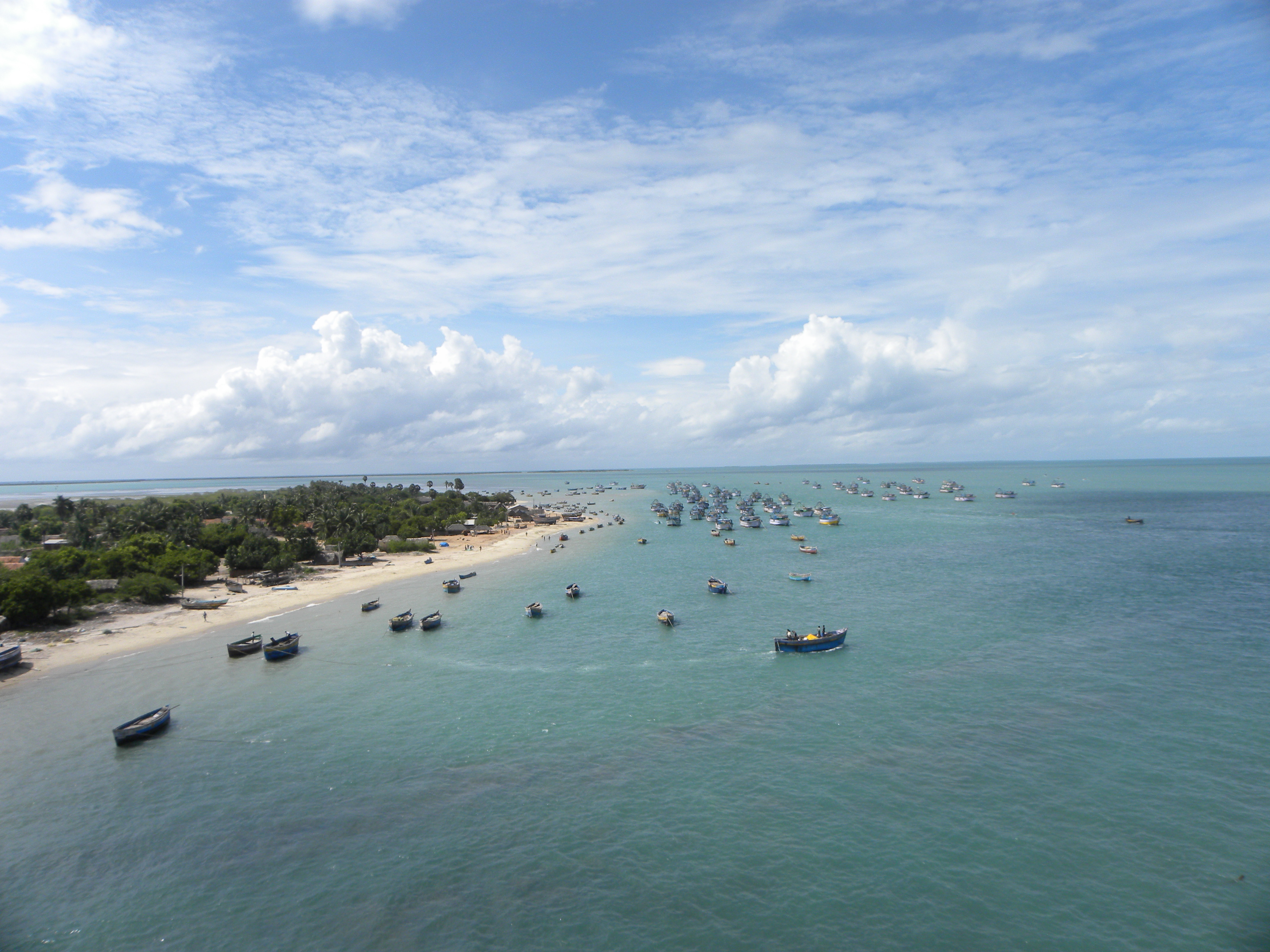
+ | | image_caption = Aerial view of the [[Pamban island|Rameswaram island]] from [[Pamban Bridge]] |
| − | | image_map = |
+ | | image_map = India Tamil Nadu districts Ramanathapuram.svg |
| map_alt = |
| map_alt = |
||
| map_caption = Location in Tamil Nadu, India |
| map_caption = Location in Tamil Nadu, India |
||
| − | | |
+ | | coordinates = {{coord|9|23|N|78|45|E|display=inline,title}} |
| − | | latm = 16 |
||
| − | | lats = 49.58 |
||
| − | | latNS = N |
||
| − | | longd = 77 |
||
| − | | longm = 26 |
||
| − | | longs = 1.03 |
||
| − | | longEW = E |
||
| − | | coordinates_display = inline,title |
||
| subdivision_type = Country |
| subdivision_type = Country |
||
| subdivision_name = {{flag|India}} |
| subdivision_name = {{flag|India}} |
||
| Line 31: | Line 20: | ||
| subdivision_name2 = <!-- for neighbourhoods/suburbs only --> |
| subdivision_name2 = <!-- for neighbourhoods/suburbs only --> |
||
| subdivision_type4 = Municipalities |
| subdivision_type4 = Municipalities |
||
| − | | subdivision_name4 = Ramanathapuram<br>Paramakudi<br>Rameswaram<br>Kilakarai |
+ | | subdivision_name4 = Ramanathapuram<br />Paramakudi<br />Rameswaram<br />Kilakarai |
| subdivision_type5 = '''Largest City''' |
| subdivision_type5 = '''Largest City''' |
||
| + | | subdivision_name5 = '''Ramanathapuram'''<ref>{{cite web|url=http://www.thehindu.com/news/cities/Madurai/two-important-towns-left-out-of-train-stoppage-schedule/article426014.ece|title=Two important towns left out of train stoppage schedule|author=C. Jaishankar|work=The Hindu|accessdate=14 December 2014}}</ref> |
||
| − | | subdivision_name5 = '''Ramanathapuram''' |
||
| subdivision_type6 = Town Panchayats |
| subdivision_type6 = Town Panchayats |
||
| − | | subdivision_name6 = R.S.Mangalam<br>Kamuthi<br>Mudukulathur<br>Abiramam<br>Thondi<br>Sayalgudi |
+ | | subdivision_name6 = R.S.Mangalam<br />Kamuthi<br />Mudukulathur<br />Abiramam<br />Thondi<br />Sayalgudi |
| established_title = <!-- Established --> |
| established_title = <!-- Established --> |
||
| established_date = |
| established_date = |
||
| Line 41: | Line 30: | ||
| named_for = |
| named_for = |
||
| parts_type = [[Taluka]]s |
| parts_type = [[Taluka]]s |
||
| − | | parts = [[Kadaladi]]<br>[[Kamuthi]]<br>[[Mudukulathur]]<br>[[Paramakudi]]<br>[[Ramanathapuram]]<br>[[Rameswaram]]<br> [[Tiruvadanai taluk|Tiruvadanai]] |
+ | | parts = [[Kadaladi]]<br />[[Kamuthi]]<br />[[Kilakarai]]<br />[[Mudukulathur]]<br />[[Paramakudi]]<br />[[Ramanathapuram]]<br />[[Rameswaram]]<br /> [[Tiruvadanai taluk|Tiruvadanai]] |
| − | | seat_type = Capital |
||
| − | | seat = <!-- for states/territories/regions only --> |
||
| seat_type = Headquarters |
| seat_type = Headquarters |
||
| seat = [[Ramanathapuram]] |
| seat = [[Ramanathapuram]] |
||
| Line 49: | Line 36: | ||
| governing_body = |
| governing_body = |
||
| leader_title1 = Collector |
| leader_title1 = Collector |
||
| − | | leader_name1 = |
+ | | leader_name1 = Dr S. Natarajan,<ref>http://www.thehindu.com/news/national/tamil-nadu/new-collector-assumes-charge/article8142617.ece</ref> [[Indian Administrative Service|IAS]] |
| + | | leader_title2 = Superintendent of Police |
||
| + | | leader_name2 = Om Prakash Meena [[Indian Police Service|IPS]] |
||
| unit_pref = Metric |
| unit_pref = Metric |
||
| area_footnotes = |
| area_footnotes = |
||
| Line 56: | Line 45: | ||
| elevation_footnotes = |
| elevation_footnotes = |
||
| elevation_m = |
| elevation_m = |
||
| − | | population_total = |
+ | | population_total = 1,353,445 |
| population_as_of = 2011 |
| population_as_of = 2011 |
||
| population_rank = |
| population_rank = |
||
| population_density_km2 = auto |
| population_density_km2 = auto |
||
| population_demonym = |
| population_demonym = |
||
| − | | population_footnotes = |
+ | | population_footnotes = |
| − | |title= |
||
| − | |date= |
||
| − | |author= |
||
| − | |url= |
||
| − | |publisher= |
||
| − | |pages= |
||
| − | |format=Excel}}</ref> |
||
| demographics_type1 = Languages |
| demographics_type1 = Languages |
||
| demographics1_title1 = Official |
| demographics1_title1 = Official |
||
| Line 87: | Line 69: | ||
}} |
}} |
||
| − | '''Ramanathapuram District''' is an administrative district of [[Tamil Nadu]] state in southern [[India]]. The city of [[Ramanathapuram]] is the district headquarters. Ramanthapuram District has an [[area]] of 4123 km |
+ | '''Ramanathapuram District''' is an administrative district of [[Tamil Nadu]] state in southern [[India]]. The city of [[Ramanathapuram]] is the district headquarters. Ramanthapuram District has an [[area]] of 4123 km<sup>2</sup>. It is bounded on the north by [[Sivaganga District]], on the northeast by [[Pudukkottai District]], on the east by the [[Palk Strait]], on the south by the [[Gulf of Mannar]], on the west by [[Thoothukudi District]], and on the northwest by [[Virudhunagar District]]. The district contains the [[Pamban Bridge]], an east-west chain of low islands and shallow reefs that extend between India and the island nation of [[Sri Lanka]], and separate the Palk Strait from the Gulf of Mannar. The Palk Strait is navigable only by shallow-draft vessels. As of 2011, Ramanathapuram district had a population of 1,353,445 with a sex-ratio of 983 females for every 1,000 males. |
==Demographics== |
==Demographics== |
||
| + | According to [[2011 census of India|2011 census]], Ramanathapuram district had a population of 1,353,445 with a sex-ratio of 983 females for every 1,000 males, much above the national average of 929.<ref name="dashboard">{{cite web|title=Census Info 2011 Final population totals|url=http://www.censusindia.gov.in/2011census/censusinfodashboard/index.html|publisher=Office of The Registrar General and Census Commissioner, Ministry of Home Affairs, Government of India|year=2013|accessdate=26 January 2014}}</ref> A total of 140,644 were under the age of six, constituting 71,705 males and 68,939 females. [[Scheduled Castes and Scheduled Tribes]] accounted for 18.4% and .08% of the population respectively. The average literacy of the district was 72.33%, compared to the national average of 72.99%.<ref name="dashboard"/> The district had a total of 323,905 households. There were a total of 602,977 workers, comprising 149,959 cultivators, 103,592 main agricultural labourers, 18,546 in house hold industries, 214,053 other workers, 116,827 marginal workers, 23,808 marginal cultivators, 50,282 marginal agricultural labourers, 6,682 marginal workers in household industries and 36,055 other marginal workers.<ref name=2011census>{{cite web|title=Census Info 2011 Final population totals - Ramanathapuram district|url=http://www.censusindia.gov.in/pca/SearchDetails.aspx?Id=701963|publisher=Office of The Registrar General and Census Commissioner, Ministry of Home Affairs, Government of India|year=2013|accessdate=26 January 2014}}</ref> |
||
| − | |||
| − | It had a [[population]] of 11,87,604 (as of 2001). It is 25.46% urbanised.<ref>[http://www.censusindiamaps.net/page/India_WhizMap/IndiaMap.htm Census 2001]</ref> The district has a literacy of 73.05%, slightly below the average for the state. This district has the highest number of Muslims (as a percentage of total population) in the state followed by [[Vellore District]].<ref>[http://census2001.tn.nic.in/religion.aspx Census 2001 Religion wise data for Tamil Nadu]</ref> The religious composition of the district is 72.41% Hindus, 22.4% Muslims, Christians 5.08% and others 0.11%. According to the [[2011 census of India|2011 census]] Ramanathapuram district has a [[Demographics of India|population]] of 1,337,560,<ref name=districtcensus>{{cite web | url = http://www.census2011.co.in/district.php | title = District Census 2011 | accessdate = 2011-09-30 | year = 2011 | publisher = Census2011.co.in}}</ref> roughly equal to the nation of [[Mauritius]]<ref name="cia">{{cite web | author = US Directorate of Intelligence | title = Country Comparison:Population | url = https://www.cia.gov/library/publications/the-world-factbook/rankorder/2119rank.html | accessdate = 2011-10-01 | quote = |
||
| − | Mauritius |
||
| − | 1,303,717 |
||
| − | July 2011 est. |
||
| − | }}</ref> or the US state of [[Maine]].<ref>{{cite web|url=http://2010.census.gov/2010census/data/apportionment-pop-text.php|title=2010 Resident Population Data|publisher=U. S. Census Bureau|accessdate=2011-09-30| quote = |
||
| − | Maine |
||
| − | 1,328,361 |
||
| − | }}</ref> This gives it a ranking of 363rd in India (out of a total of [[Districts of India|640]]).<ref name=districtcensus/> The district has a population density of {{convert| 320 |PD/sqkm|PD/sqmi}} .<ref name=districtcensus/> Its [[Family planning in India|population growth rate]] over the decade 2001-2011 was 12.63 %.<ref name=districtcensus/> Ramanathapuram has a [[sex ratio]] of 977 [[Women in India|females]] for every 1000 males,<ref name=districtcensus/> and a [[Literacy in India|literacy rate]] of 81.48 %.<ref name=districtcensus/> |
||
| − | |||
| − | |||
==History== |
==History== |
||
[[Image:Rameswaram Temple Inside.jpg|thumb|Corridors of the Rameshwaram temple]] |
[[Image:Rameswaram Temple Inside.jpg|thumb|Corridors of the Rameshwaram temple]] |
||
| ⚫ | In the early 15th century, the present territories of Ramanathapuram district, comprising [[taluk]]s Tiruvadanai, Paramakudi, Kamuthi, Mudukulathur, Ramanathapuram and Rameswaram, were included in Pandyan Dynasty. For a short period, this area was under the Kings when Rajendra Chola I brought it under his territory in 1063 AD. In 1520 AD, the Nayaks of Vijayangar took over the area under their control from the Pandiyan dynasty for about two centuries, Marava chieftains-Sethupathis who were Lords under Pandiyan Kings and reigned over this part (17th century). At the beginning of the 18th century, family disputes over succession resulted in the division of Ramanathapuram. With the help of the King of Thanjavur in 1730 AD, one of the chieftains deposed Sethupathy and became the Raja of Sivaganga. Acting upon the weakness of the Nayak rules, the local chieftains (Palayakarars) became independent. Raja of Sivagangai and Sethupathy of Ramanathapuram were prominent among them. In 1730, Chand, a Sahib of Carnatic, captured Ramanathapuram. In 1741, the area came under the control of the Marattas and then under the Nizam in 1744 AD, Nawab’s rule made displeasure in the mind of those chieftains. That made them declare the last Nayak as ruler of Pandiya Mandalam against the Nawab in 1752 AD. By that time, throne of Carnatic had two rivals, Shanda Sahib and Mohamed Ali, and this district was part of Carnatic. The British and French supported Chanda Sahib and Mohamed Ali respectively. It paved the way for series of conflicts in the southern part of the continent. |
||
| − | [[Image:ERWADIshariff ultimate.jpg|thumb|[[Erwadi]] durgah in Ramanathapuram District]] |
||
| ⚫ | In the early 15th century, the present territories of Ramanathapuram district, comprising [[taluk]]s Tiruvadanai, Paramakudi, Kamuthi, Mudukulathur, Ramanathapuram and Rameswaram, were included in Pandyan Dynasty. For a short period, this area was under the Kings when Rajendra Chola I brought it under his territory in 1063 AD. In 1520 AD, the Nayaks of Vijayangar took over the area under their control from the Pandiyan dynasty for about two centuries, Marava chieftains-Sethupathis who were Lords under Pandiyan Kings and reigned over this part (17th century). At the beginning of the 18th century, family disputes over succession resulted in the division of Ramanathapuram. With the help of the King of Thanjavur in 1730 |
||
In 1795, the British deposed Muthuramalinga Sethupathy and took control of the administration of Ramanathapuram. In 1801 Mangaleswari Nachiyar was made the Zamindar of Sivagangai. After passing of Queen, the Marudhu Brothers took the charge by paying regular revenue to the East India company. In 1803 the Marudhu Brothers of Sivaganga revolted against the British in collaboration with Kattabomman of Panchalamkurichi. Colonel Agnew captured Marudhu Brothers and hanged them and made Gowri Vallbah Periya Udaya Thevar as Zamindar of Sivaganga. After the fall of Tippu Sultan, British took the control and imprisoned the Nawab. In 1892, the Zamindari system was abolished and a British Collector was appointed for administration. |
In 1795, the British deposed Muthuramalinga Sethupathy and took control of the administration of Ramanathapuram. In 1801 Mangaleswari Nachiyar was made the Zamindar of Sivagangai. After passing of Queen, the Marudhu Brothers took the charge by paying regular revenue to the East India company. In 1803 the Marudhu Brothers of Sivaganga revolted against the British in collaboration with Kattabomman of Panchalamkurichi. Colonel Agnew captured Marudhu Brothers and hanged them and made Gowri Vallbah Periya Udaya Thevar as Zamindar of Sivaganga. After the fall of Tippu Sultan, British took the control and imprisoned the Nawab. In 1892, the Zamindari system was abolished and a British Collector was appointed for administration. |
||
| Line 113: | Line 84: | ||
==Geology== |
==Geology== |
||
[[File:Pamban Island west MtGandhamadana.jpg|left|thumb|Pamban Island in which [[Rameswaram]] located]] |
[[File:Pamban Island west MtGandhamadana.jpg|left|thumb|Pamban Island in which [[Rameswaram]] located]] |
||
| − | Most of the area is covered by the unconsolidated sediments of Quaternary age except in the northwestern part, where isolated patches of Archaen Crystallines and Tertiary sandstone are exposed. The Archaeans are mainly represented by the Charnockite Group of rocks comprising garnetiferrous granulite and the Khondalite Group of rocks made up of |
+ | Most of the area is covered by the unconsolidated sediments of Quaternary age except in the northwestern part, where isolated patches of Archaen Crystallines and Tertiary sandstone are exposed. The Archaeans are mainly represented by the Charnockite Group of rocks comprising garnetiferrous granulite and the Khondalite Group of rocks made up of quartzite of genesses. |
| − | The Tertiary sandstone (Cuddalore Formation) comprise pinkish, yellowish, reddish (variegated colours) medium to coarse |
+ | The Tertiary sandstone (Cuddalore Formation) comprise pinkish, yellowish, reddish (variegated colours) medium to coarse grained sandstone and clay stone. It is overlain by thin alluvium and exposed towards north of Vaigai River. |
Detached exposures of laterite and lateritic soil are seen in the northwestern part of the district. |
Detached exposures of laterite and lateritic soil are seen in the northwestern part of the district. |
||
| − | A major part of the district is covered with the fluvial, fuvio-marine, Aeolian and marine sediments of Quaternary age. The fluvial deposits which are made up of sand, silt and clay in varying degree of admixture occur along the active channels of Vaigai, Gundar, Manimuthar and Pambar rivers. They have been |
+ | A major part of the district is covered with the fluvial, fuvio-marine, Aeolian and marine sediments of Quaternary age. The fluvial deposits which are made up of sand, silt and clay in varying degree of admixture occur along the active channels of Vaigai, Gundar, Manimuthar and Pambar rivers. They have been categorised into levee, flood basin, channel bar/ point bar and paleo-channel deposits. The paleo channel deposits comprise brown coloured, fine to medium sands with well preserved cross-beddings. |
| − | |||
| ⚫ | The fluvio-marine deposits are exposed in the Vaigai delta as deltaic plain, paleo-tidal and dune flat deposits. The deltaic plain and dune flats comprise medium, |
||
| ⚫ | The fluvio-marine deposits are exposed in the Vaigai delta as deltaic plain, paleo-tidal and dune flat deposits. The deltaic plain and dune flats comprise medium, grey brown sands. The paleo tidal flat deposits include black silty clay, black clay and mud. In Rameswaram Island, the fluvio-marine deposits include indurated sand and dune sands. |
||
| + | [[File:Spotbilled pelican.jpg|thumb|150px|[[Chitrangudi Bird Sanctuary]] [[spot-billed pelican]]]] |
||
| + | <!-- Deleted image removed: [[Image:V M K Jali.jpg|thumb|Vevikananda Memorial Kundhukal]] --> |
||
The Aeolian deposits comprise red sands which are in nature of ancient dunes and occur over a 3.2 km wide and 8 km long stretch and lie parallel to the sea coast. These are separated by marshy deposits of black clays. The sands are underlain by calcareous hardpan. In Rameswaram Island also brown sand deposits occur around Sambaimadam on either side of NH 49 west of the town. |
The Aeolian deposits comprise red sands which are in nature of ancient dunes and occur over a 3.2 km wide and 8 km long stretch and lie parallel to the sea coast. These are separated by marshy deposits of black clays. The sands are underlain by calcareous hardpan. In Rameswaram Island also brown sand deposits occur around Sambaimadam on either side of NH 49 west of the town. |
||
| Line 128: | Line 100: | ||
== Tourist attractions in the district == |
== Tourist attractions in the district == |
||
| − | [[Image:Arun image43.jpg|thumb|right|[[ |
+ | [[Image:Arun image43.jpg|thumb|150px|right|[[Pamban Bridge]] between Pamban Island and the mainland]] |
| − | [[Image: |
+ | [[Image:RameshwaramScenicView.jpg|thumb|150px|right|Fishing boats seen from Pamban Bridge]] |
| − | [[Image:Pamban Bridge 1.jpg| |
+ | [[Image:Pamban Bridge 1.jpg|right|thumb|150px|Pamban rail bridge connecting Pamban island with the Indian mainland]] |
| ⚫ | |||
| ⚫ | |||
*[[Erwadi]] |
*[[Erwadi]] |
||
| + | *[[Rameswaram]] (south Kasi - Ramanathaswamy Holi Temple) |
||
| − | *[[Ramanathaswamy Temple, Rameswaram]] |
||
| + | *[[Rameswaram]] (Ramar Paatham) |
||
| ⚫ | |||
| + | *[[Rameswaram]] (sangumaan beach) |
||
| − | *[[Pamban Bridge]] |
||
| + | *[[Devipattinam]] (sea Navagriham Temple) |
||
| − | *Ariyaman beach |
||
| ⚫ | |||
| − | *Sethukarai |
||
| ⚫ | |||
| ⚫ | |||
| + | * [[Thangachimadam]] Grave of [[Dr A.P.J. Abdul Kalam]], near Peikarumbu |
||
| + | *[[Thiruppullani]] (The Great Thirumaal Temple) |
||
| + | *[[Tiruvadanai]] |
||
| ⚫ | |||
| + | *[[Kilakarai]] |
||
| + | *[[Pudumadam]] |
||
| + | *[[Naagachi]] (Naagachi Amman Temple) |
||
| + | *[[Paramakudi]] - (Veera Thiyagi Immanuvel Sekaran Ninaividam) |
||
| ⚫ | |||
| + | *[[Chitrangudi Bird Sanctuary]] |
||
| + | *[[Kundhukal]] - Vivekananda Memorial |
||
| + | *[[sundaramadayan]] (Ariyaman Beach) |
||
| + | *[[Sethukarai]] (Seashore Hanuman Temple) |
||
| + | *[[Attrangarai]] (Muni ayya - temple) |
||
| ⚫ | |||
| + | *[[Periyapattinam]] (Syed Ali Waliullah Dargah) |
||
*[[Mandapam]] |
*[[Mandapam]] |
||
| + | *Nainar Kovil (Naganatha Swamy Temple) |
||
| ⚫ | |||
| − | *[[Kattupalli]] |
||
| ⚫ | |||
| ⚫ | |||
| − | *[[Meesal Kilavanery]] (Umar Qattab Shahid Mosque) |
||
*[[Panaikulam]] (Baba-Syed Muhammed Mosque) |
*[[Panaikulam]] (Baba-Syed Muhammed Mosque) |
||
| − | *Old Jumma Masjid of Kilakarai. (One of India's |
+ | *Old Jumma Masjid of Kilakarai. (One of India's oldest 1st Mosque built 628-630 AD and rebuilt in 1036AD, Meenkadai palli) |
| − | *[[Athiyuthu]] ( |
+ | *[[Athiyuthu]] (Pattani Shahib Durgah) |
| + | *[[Thiruvettriyur]] (Paagam Priyal Koil) |
||
| ⚫ | |||
| + | *[[Sikkal]] ( Sathur vedha mangalam) |
||
| ⚫ | |||
| − | Puduvalasai Arabi Oliyullah Dargha |
||
==Gulf of Mannar Marine Biosphere Reserve== |
==Gulf of Mannar Marine Biosphere Reserve== |
||
| Line 155: | Line 140: | ||
Marine Biosphere Reserve not only in India, but also in south and southeast Asia. The IUCN Commission on National Parks and WWF, identified the Reserve as being an area of” “Particulars concern” given its diversity and special multiple- use management status. In addition, as the first marine biosphere reserve declared in India, this area has long been a national priority. |
Marine Biosphere Reserve not only in India, but also in south and southeast Asia. The IUCN Commission on National Parks and WWF, identified the Reserve as being an area of” “Particulars concern” given its diversity and special multiple- use management status. In addition, as the first marine biosphere reserve declared in India, this area has long been a national priority. |
||
| − | The Gulf of Mannar and its 3,600 Species of flora and fauna is one of the biologically richest coastal regions in all of mainland of India. |
+ | The Gulf of Mannar and its 3,600 Species of flora and fauna is one of the biologically richest coastal regions in all of the mainland of India. |
| − | It is equally rich in sea-algae, sea grasses, coral reef pearl banks, fin & shell fish resources, mangroves, and endemic & endangered species. It is an important habitat for the highly endangered sea mammal, the |
+ | It is equally rich in sea-algae, sea grasses, coral reef pearl banks, fin & shell fish resources, mangroves, and endemic & endangered species. It is an important habitat for the highly endangered sea mammal, the [[dugon]] commonly called the sea cow. |
| − | There are 137 species of |
+ | There are 137 species of coral found in Gulf of Mannar. The coral come in myriads of shapes. Some have finger like branches and others dome-shaped colony with a net work of ridges and furrows. |
| − | Sponges, although at casual glance look like plants, are animals, living singly or in colonies of many individuals. Their colours vary as much as shape, being green, red, yellow, and even black or white. In the crevices, these sponges are found with many animals, ranging from tiny crabs and brittle star to bivalve |
+ | Sponges, although at casual glance look like plants, are animals, living singly or in colonies of many individuals. Their colours vary as much as shape, being green, red, yellow, and even black or white. In the crevices, these sponges are found with many animals, ranging from tiny crabs and brittle star to bivalve molluscs. 275 species under 8 orders are found in Gulf of Mannar. |
==Economy== |
==Economy== |
||
With a 34% share, the district is the top [[chili pepper]] producer in Tamil Nadu.<ref>http://www.tn.gov.in/deptst/agriculture.pdf</ref> |
With a 34% share, the district is the top [[chili pepper]] producer in Tamil Nadu.<ref>http://www.tn.gov.in/deptst/agriculture.pdf</ref> |
||
| − | |||
==References== |
==References== |
||
{{Reflist}} |
{{Reflist}} |
||
| − | |||
==External links== |
==External links== |
||
{{Commons category}} |
{{Commons category}} |
||
| − | |||
*[http://www.ramnad.tn.nic.in/ Ramanathapuram District] |
*[http://www.ramnad.tn.nic.in/ Ramanathapuram District] |
||
| − | |||
{{Geographic location |
{{Geographic location |
||
|Centre = Ramanathapuram district |
|Centre = Ramanathapuram district |
||
|North = [[Sivaganga district]] |
|North = [[Sivaganga district]] |
||
|Northeast = [[Pudukkottai district]] |
|Northeast = [[Pudukkottai district]] |
||
| − | |East = ''[[Palk Strait]]'' |
+ | |East = {{flag|Sri Lanka}}<br />''[[Palk Strait]]'' |
|Southeast = |
|Southeast = |
||
|South = ''[[Gulf of Mannar]]'' |
|South = ''[[Gulf of Mannar]]'' |
||
|Southwest = [[Thoothukudi district]] |
|Southwest = [[Thoothukudi district]] |
||
|West = [[Virudhunagar district]] |
|West = [[Virudhunagar district]] |
||
| − | |Northwest = |
+ | |Northwest = [[Madurai]] |
}} |
}} |
||
| − | {{ |
+ | {{Ramanathapuram district}} |
{{Tamil Nadu}} |
{{Tamil Nadu}} |
||
| − | |||
{{DEFAULTSORT:Ramanathapuram District}} |
{{DEFAULTSORT:Ramanathapuram District}} |
||
[[Category:Ramanathapuram district| ]] |
[[Category:Ramanathapuram district| ]] |
||
[[Category:Districts of Tamil Nadu]] |
[[Category:Districts of Tamil Nadu]] |
||
| − | [[Category: |
+ | [[Category:1910 establishments in India]] |
| + | [[Category:Districts of India]] |
||
{{usedwp|Ramanathapuram district}} |
{{usedwp|Ramanathapuram district}} |
||
Latest revision as of 07:34, 25 August 2017
| ||||||||||||||
| Ramanathapuram district Ramnad Mavattam, Mugavai Mavattam |
|
|---|---|
| — District — | |
 |
|
 |
|
| Country | |
| State | Tamil Nadu |
| Municipalities | Ramanathapuram Paramakudi Rameswaram Kilakarai |
| Largest City | Ramanathapuram[1] |
| Town Panchayats | R.S.Mangalam Kamuthi Mudukulathur Abiramam Thondi Sayalgudi |
| Headquarters | Ramanathapuram |
| Talukas | Kadaladi Kamuthi Kilakarai Mudukulathur Paramakudi Ramanathapuram Rameswaram Tiruvadanai |
| Government | |
| • Collector | Dr S. Natarajan,[2] IAS |
| • Superintendent of Police | Om Prakash Meena IPS |
| Population (2011) | |
| • Total | 1,353,445 |
| Languages | |
| • Official | Tamil |
| Time zone | IST (UTC+5:30) |
| PIN | 623xxx |
| Telephone code | 04567 |
| Vehicle registration | TN-65[3] |
| IUCN category | |
| Central location: | |
| Website | ramanathapuram.nic.in/ |
Ramanathapuram District is an administrative district of Tamil Nadu state in southern India. The city of Ramanathapuram is the district headquarters. Ramanthapuram District has an area of 4123 km2. It is bounded on the north by Sivaganga District, on the northeast by Pudukkottai District, on the east by the Palk Strait, on the south by the Gulf of Mannar, on the west by Thoothukudi District, and on the northwest by Virudhunagar District. The district contains the Pamban Bridge, an east-west chain of low islands and shallow reefs that extend between India and the island nation of Sri Lanka, and separate the Palk Strait from the Gulf of Mannar. The Palk Strait is navigable only by shallow-draft vessels. As of 2011, Ramanathapuram district had a population of 1,353,445 with a sex-ratio of 983 females for every 1,000 males.
Demographics[]
According to 2011 census, Ramanathapuram district had a population of 1,353,445 with a sex-ratio of 983 females for every 1,000 males, much above the national average of 929.[4] A total of 140,644 were under the age of six, constituting 71,705 males and 68,939 females. Scheduled Castes and Scheduled Tribes accounted for 18.4% and .08% of the population respectively. The average literacy of the district was 72.33%, compared to the national average of 72.99%.[4] The district had a total of 323,905 households. There were a total of 602,977 workers, comprising 149,959 cultivators, 103,592 main agricultural labourers, 18,546 in house hold industries, 214,053 other workers, 116,827 marginal workers, 23,808 marginal cultivators, 50,282 marginal agricultural labourers, 6,682 marginal workers in household industries and 36,055 other marginal workers.[5]
History[]


Corridors of the Rameshwaram temple
In the early 15th century, the present territories of Ramanathapuram district, comprising taluks Tiruvadanai, Paramakudi, Kamuthi, Mudukulathur, Ramanathapuram and Rameswaram, were included in Pandyan Dynasty. For a short period, this area was under the Kings when Rajendra Chola I brought it under his territory in 1063 AD. In 1520 AD, the Nayaks of Vijayangar took over the area under their control from the Pandiyan dynasty for about two centuries, Marava chieftains-Sethupathis who were Lords under Pandiyan Kings and reigned over this part (17th century). At the beginning of the 18th century, family disputes over succession resulted in the division of Ramanathapuram. With the help of the King of Thanjavur in 1730 AD, one of the chieftains deposed Sethupathy and became the Raja of Sivaganga. Acting upon the weakness of the Nayak rules, the local chieftains (Palayakarars) became independent. Raja of Sivagangai and Sethupathy of Ramanathapuram were prominent among them. In 1730, Chand, a Sahib of Carnatic, captured Ramanathapuram. In 1741, the area came under the control of the Marattas and then under the Nizam in 1744 AD, Nawab’s rule made displeasure in the mind of those chieftains. That made them declare the last Nayak as ruler of Pandiya Mandalam against the Nawab in 1752 AD. By that time, throne of Carnatic had two rivals, Shanda Sahib and Mohamed Ali, and this district was part of Carnatic. The British and French supported Chanda Sahib and Mohamed Ali respectively. It paved the way for series of conflicts in the southern part of the continent.
In 1795, the British deposed Muthuramalinga Sethupathy and took control of the administration of Ramanathapuram. In 1801 Mangaleswari Nachiyar was made the Zamindar of Sivagangai. After passing of Queen, the Marudhu Brothers took the charge by paying regular revenue to the East India company. In 1803 the Marudhu Brothers of Sivaganga revolted against the British in collaboration with Kattabomman of Panchalamkurichi. Colonel Agnew captured Marudhu Brothers and hanged them and made Gowri Vallbah Periya Udaya Thevar as Zamindar of Sivaganga. After the fall of Tippu Sultan, British took the control and imprisoned the Nawab. In 1892, the Zamindari system was abolished and a British Collector was appointed for administration.
In 1910, Ramanathapuram was formed by clubbing portions from Madurai and Tirunelveli district. Shri J.F. BRYANT I.C.S was the first collector. And this district was named as Ramanathapuram. During the British period this district was called “Ramnad”. The name continued after independence. Later the district was renamed as Ramanathapuram to be in conformity with the Tamil name for this region.
Geology[]

Pamban Island in which Rameswaram located
Most of the area is covered by the unconsolidated sediments of Quaternary age except in the northwestern part, where isolated patches of Archaen Crystallines and Tertiary sandstone are exposed. The Archaeans are mainly represented by the Charnockite Group of rocks comprising garnetiferrous granulite and the Khondalite Group of rocks made up of quartzite of genesses.
The Tertiary sandstone (Cuddalore Formation) comprise pinkish, yellowish, reddish (variegated colours) medium to coarse grained sandstone and clay stone. It is overlain by thin alluvium and exposed towards north of Vaigai River.
Detached exposures of laterite and lateritic soil are seen in the northwestern part of the district.
A major part of the district is covered with the fluvial, fuvio-marine, Aeolian and marine sediments of Quaternary age. The fluvial deposits which are made up of sand, silt and clay in varying degree of admixture occur along the active channels of Vaigai, Gundar, Manimuthar and Pambar rivers. They have been categorised into levee, flood basin, channel bar/ point bar and paleo-channel deposits. The paleo channel deposits comprise brown coloured, fine to medium sands with well preserved cross-beddings.
The fluvio-marine deposits are exposed in the Vaigai delta as deltaic plain, paleo-tidal and dune flat deposits. The deltaic plain and dune flats comprise medium, grey brown sands. The paleo tidal flat deposits include black silty clay, black clay and mud. In Rameswaram Island, the fluvio-marine deposits include indurated sand and dune sands.


Chitrangudi Bird Sanctuary spot-billed pelican
The Aeolian deposits comprise red sands which are in nature of ancient dunes and occur over a 3.2 km wide and 8 km long stretch and lie parallel to the sea coast. These are separated by marshy deposits of black clays. The sands are underlain by calcareous hardpan. In Rameswaram Island also brown sand deposits occur around Sambaimadam on either side of NH 49 west of the town.
The marine formation comprises coastal plain deposits of sand and clay in varied proportion. Marine calcareous hardpan occurs as low terraces and platforms, with admixture of quartz, limonite and garnet concentration.
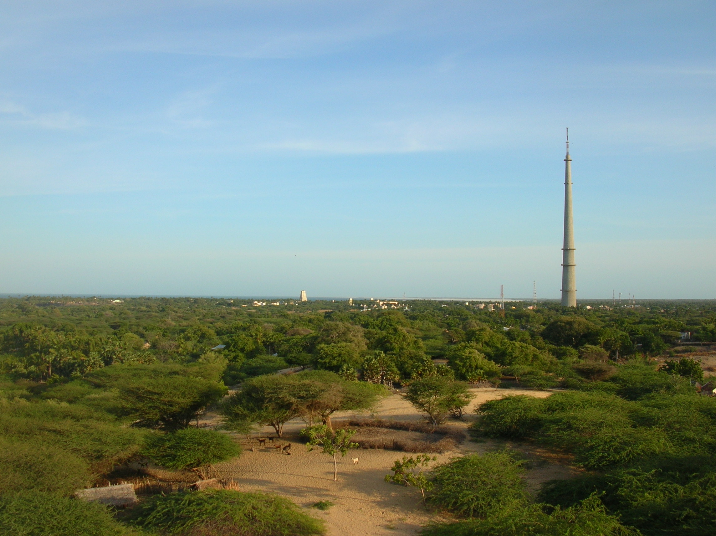
Tourist attractions in the district[]


Pamban Bridge between Pamban Island and the mainland
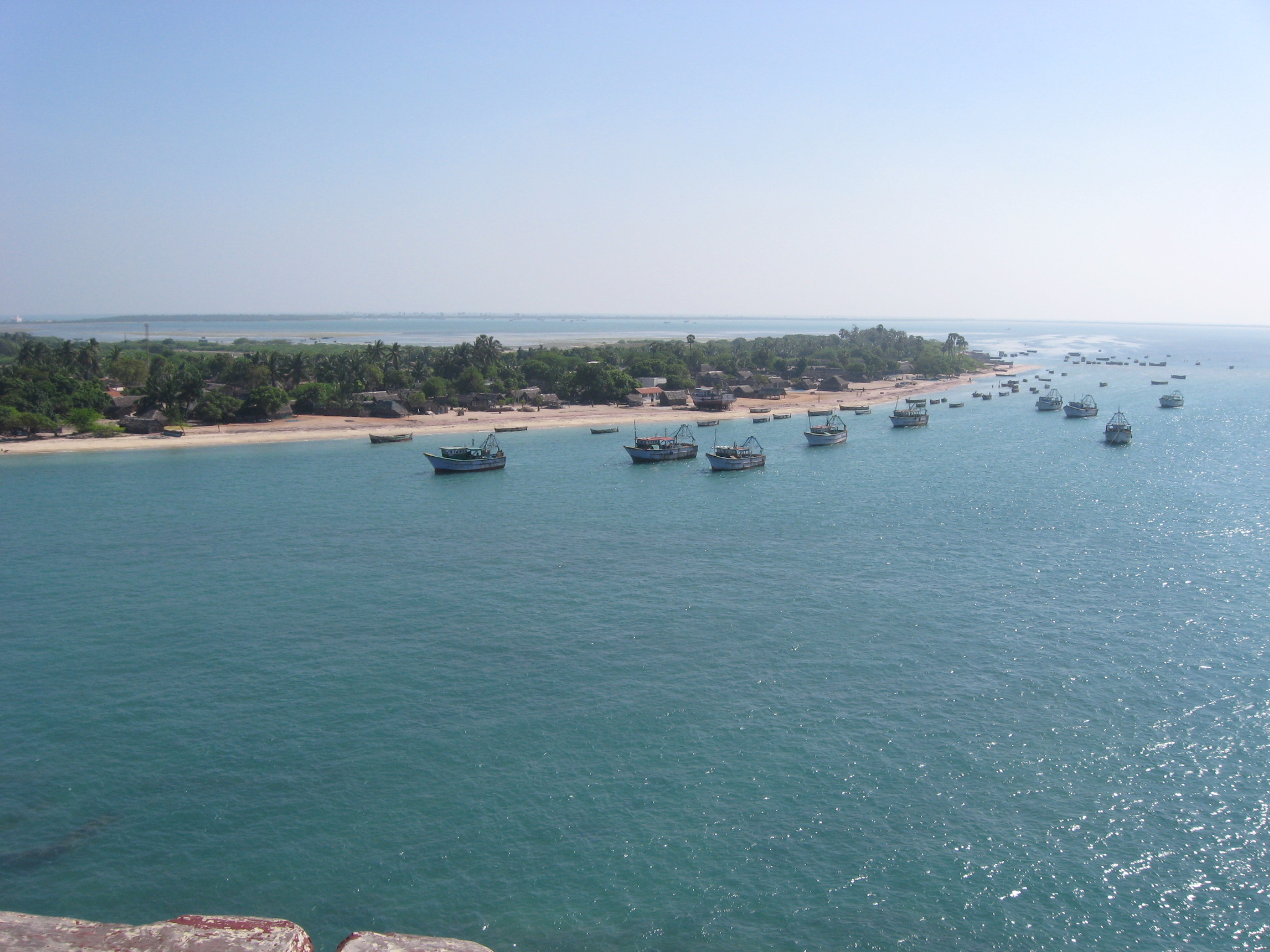

Fishing boats seen from Pamban Bridge
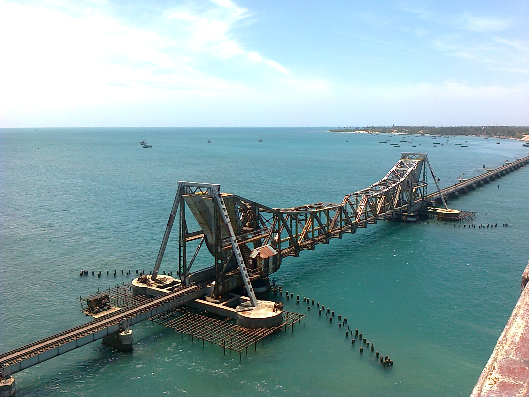

Pamban rail bridge connecting Pamban island with the Indian mainland
- Ramanathapuram (Palace -This palace was built during the reign of Kizhavan Sethupathi (1674-1710 CE) the most popular among the Sethupathi Kings.)
- Uthirakosamangai (3000 yrs Oldest Shiva Temple, priceless Green emerald Stone Nadarajar statue)
- Erwadi
- Rameswaram (south Kasi - Ramanathaswamy Holi Temple)
- Rameswaram (Ramar Paatham)
- Rameswaram (sangumaan beach)
- Devipattinam (sea Navagriham Temple)
- Valinokkam (Imran Umayyatul Badawiyya Shaheed dargah and TN Salt Corporation)
- Sundaramudayan (Seeniappa Shahid Durgah)
- Thangachimadam Grave of Dr A.P.J. Abdul Kalam, near Peikarumbu
- Thiruppullani (The Great Thirumaal Temple)
- Tiruvadanai
- Dhanushkodi (Hanuman Temple)
- Kilakarai
- Pudumadam
- Naagachi (Naagachi Amman Temple)
- Paramakudi - (Veera Thiyagi Immanuvel Sekaran Ninaividam)
- Pamban Bridge (Annai Indira Gandhi Bridge)
- Chitrangudi Bird Sanctuary
- Kundhukal - Vivekananda Memorial
- sundaramadayan (Ariyaman Beach)
- Sethukarai (Seashore Hanuman Temple)
- Attrangarai (Muni ayya - temple)
- R S madai (Sea World Aquarium)
- Periyapattinam (Syed Ali Waliullah Dargah)
- Mandapam
- Nainar Kovil (Naganatha Swamy Temple)
- Panaikulam (Baba-Syed Muhammed Mosque)
- Old Jumma Masjid of Kilakarai. (One of India's oldest 1st Mosque built 628-630 AD and rebuilt in 1036AD, Meenkadai palli)
- Athiyuthu (Pattani Shahib Durgah)
- Thiruvettriyur (Paagam Priyal Koil)
- Sikkal ( Sathur vedha mangalam)
Gulf of Mannar Marine Biosphere Reserve[]
Marine Biosphere Reserve not only in India, but also in south and southeast Asia. The IUCN Commission on National Parks and WWF, identified the Reserve as being an area of” “Particulars concern” given its diversity and special multiple- use management status. In addition, as the first marine biosphere reserve declared in India, this area has long been a national priority.
The Gulf of Mannar and its 3,600 Species of flora and fauna is one of the biologically richest coastal regions in all of the mainland of India.
It is equally rich in sea-algae, sea grasses, coral reef pearl banks, fin & shell fish resources, mangroves, and endemic & endangered species. It is an important habitat for the highly endangered sea mammal, the dugon commonly called the sea cow.
There are 137 species of coral found in Gulf of Mannar. The coral come in myriads of shapes. Some have finger like branches and others dome-shaped colony with a net work of ridges and furrows.
Sponges, although at casual glance look like plants, are animals, living singly or in colonies of many individuals. Their colours vary as much as shape, being green, red, yellow, and even black or white. In the crevices, these sponges are found with many animals, ranging from tiny crabs and brittle star to bivalve molluscs. 275 species under 8 orders are found in Gulf of Mannar.
Economy[]
With a 34% share, the district is the top chili pepper producer in Tamil Nadu.[6]
References[]
- ^ C. Jaishankar. "Two important towns left out of train stoppage schedule". The Hindu. http://www.thehindu.com/news/cities/Madurai/two-important-towns-left-out-of-train-stoppage-schedule/article426014.ece. Retrieved 14 December 2014.
- ^ http://www.thehindu.com/news/national/tamil-nadu/new-collector-assumes-charge/article8142617.ece
- ^ www.tn.gov.in
- ^ a b "Census Info 2011 Final population totals". Office of The Registrar General and Census Commissioner, Ministry of Home Affairs, Government of India. 2013. http://www.censusindia.gov.in/2011census/censusinfodashboard/index.html. Retrieved 26 January 2014.
- ^ "Census Info 2011 Final population totals - Ramanathapuram district". Office of The Registrar General and Census Commissioner, Ministry of Home Affairs, Government of India. 2013. http://www.censusindia.gov.in/pca/SearchDetails.aspx?Id=701963. Retrieved 26 January 2014.
- ^ http://www.tn.gov.in/deptst/agriculture.pdf
External links[]

|
Madurai | Sivaganga district | Pudukkottai district |
|
| Virudhunagar district | Palk Strait | |||
 Ramanathapuram district | ||||
| Thoothukudi district | Gulf of Mannar |
Template:Ramanathapuram district
| ||||||||||||||||||||||||||||||||||||||||
| This page uses content from the English language Wikipedia. The original content was at Ramanathapuram district. The list of authors can be seen in the page history. As with this Familypedia wiki, the content of Wikipedia is available under the Creative Commons License. |