No edit summary |
m (update from Wikipedia) |
||
| Line 1: | Line 1: | ||
| + | {{bdm}} |
||
| − | {{For|other uses of this name|Raleigh (disambiguation)}} |
||
{{Infobox settlement |
{{Infobox settlement |
||
| + | |name = Raleigh, North Carolina |
||
| − | | name = Raleigh |
||
| − | | |
+ | |official_name = City of Raleigh |
| − | | |
+ | |settlement_type = [[State capital]] |
| − | | |
+ | |nickname = "City of Oaks" |
| − | | |
+ | |image_skyline = Downtown-Raleigh-from-Western-Boulevard-Overpass-20081012.jpeg |
| − | | |
+ | |imagesize = 250px |
| − | | |
+ | |image_caption = Downtown Raleigh |
| − | | |
+ | |image_caption = |
| − | | |
+ | |image_flag = Flag of Raleigh.svg |
| − | | |
+ | |image_seal = City of Raleigh Seal.svg |
| − | | |
+ | |Demonym = Raleighite |
| − | | |
+ | |image_map = Raleigh map.svg |
| − | | |
+ | |mapsize = 250x200px |
| − | | |
+ | |map_caption = Map of [[Wake County, North Carolina|Wake County]], [[North Carolina]] |
| − | | |
+ | |pushpin_map = USA |
| − | | |
+ | |pushpin_map_caption = Location in the United States |
<!-- Location --> |
<!-- Location --> |
||
| − | | |
+ | |coordinates_display = inline,title |
| − | | |
+ | |coordinates_region = US-NC |
| − | | |
+ | |subdivision_type = Country |
| − | | |
+ | |subdivision_name = [[United States of America]] |
| − | | |
+ | |subdivision_type1 = [[US state|State]] |
| − | | |
+ | |subdivision_name1 = [[North Carolina]] |
| − | | |
+ | |subdivision_type2 = [[List of counties in North Carolina|Counties]] |
| − | | |
+ | |subdivision_name2 = [[Wake County, North Carolina|Wake]], [[Durham County, North Carolina|Durham]] |
| − | | |
+ | |government_footnotes = |
| − | | |
+ | |government_type = |
| − | | |
+ | |leader_title = [[Mayor of Raleigh, North Carolina|Mayor]] |
| + | |leader_name = [[Nancy McFarlane]] ([[Independent (politician)|Independent]])<ref>{{cite web|title=Fact Check: Ad against McCrory lacks solid conclusion|url=http://www.wral.com/news/state/nccapitol/story/11168235/|author=Mark Binker|date=June 4, 2012|publisher=[[WRAL-TV]]|accessdate=August 9, 2012}}</ref> |
||
| − | | leader_name = [[Nancy McFarlane]] ([[Democratic Party (United States)|D]]) |
||
| − | | |
+ | |established_title = Founded |
| − | | |
+ | |established_date = 1792 |
<!-- Area --> |
<!-- Area --> |
||
| − | | |
+ | |unit_pref = Imperial |
| − | | |
+ | |area_footnotes = |
| − | | |
+ | |area_magnitude = |
| − | | |
+ | |area_total_km2 = 375 |
| − | | |
+ | |area_land_km2 = 369 |
| − | | |
+ | |area_water_km2 = 2.5 |
| − | | |
+ | |area_total_sq_mi = 144.8 |
| − | | |
+ | |area_land_sq_mi = 142.8 |
| − | | |
+ | |area_water_sq_mi = 2.0 |
<!-- Population --> |
<!-- Population --> |
||
| + | |population_as_of = 2012 Census Estimate|population_footnotes = <ref name=PopEstBigCities/><ref name=PopEstCBSA>{{cite web|url = http://www.census.gov/popest/metro/files/2008/CSA-EST2008-alldata.csv|title = Annual Estimates of the Population of Metropolitan and Micropolitan Statistical Areas: April 1, 2000 to July 1, 2008|format = [[comma-separated values|CSV]]|work = 2008 Population Estimates|publisher = [[United States Census Bureau]], Population Division|date = July 1, 2009|accessdate = July 2, 2009 }}{{dead link|date=January 2013}}</ref> |
||
| − | | population_as_of = Census 2010 |
||
| + | |Demonym = Raleighite |
||
| − | | population_footnotes = <ref name=PopEstBigCities/><ref name=PopEstCBSA>{{cite web | url = http://www.census.gov/popest/metro/files/2008/CSA-EST2008-alldata.csv | title = Annual Estimates of the Population of Metropolitan and Micropolitan Statistical Areas: April 1, 2000 to July 1, 2008 | format = [[comma-separated values|CSV]] | work = 2008 Population Estimates | publisher = [[United States Census Bureau]], Population Division | date = July 1, 2009 | accessdate = July 2, 2009 }}</ref> |
||
| + | |population_total = 423,179 ([[List of United States cities by population|42nd]]) |
||
| − | | Demonym = Raleighite |
||
| − | | |
+ | |population_blank1_title = [[United States metropolitan area|MSA]] |
| + | |population_blank1 = 1188564|47th<!-- Raleigh-Cary Metropolitan Statistical Area --> |
||
| − | | population_blank1_title = [[United States metropolitan area|MSA]] |
||
| + | |population_blank2_title = [[Combined statistical area|CSA]] |
||
| − | | population_blank1 = 1130490<!-- Raleigh-Cary Metropolitan Statistical Area --> |
||
| + | |population_blank2 = 1998808|30th<!-- Raleigh-Durham-Chapel Hill Combined Statistical Area --> |
||
| − | | population_blank2_title = [[Combined statistical area|CSA]] |
||
| + | |population_density_km2 = 1097.17 |
||
| − | | population_blank2 = 1749525<!-- Raleigh-Durham-Cary Combined Statistical Area --> |
||
| + | |population_density_sq_mi = 2963.4 |
||
| − | | population_density_km2 = 1097.17 |
||
| − | | population_density_sq_mi = 2826.3 |
||
<!-- General information --> |
<!-- General information --> |
||
| − | | |
+ | |timezone = [[Eastern Time Zone|Eastern (EST)]] |
| − | | |
+ | |utc_offset = -5 |
| − | | |
+ | |timezone_DST = EDT |
| − | | |
+ | |utc_offset_DST = -4 |
| − | | |
+ | |elevation_footnotes = |
| − | | |
+ | |elevation_m = 96 |
| − | | |
+ | |elevation_ft = 315 |
| − | | |
+ | |latd = 35|latm = 49|lats = 8|latNS = N |
| − | | |
+ | |longd = 78|longm = 38|longs = 41|longEW = W |
<!-- Area/postal codes & others --> |
<!-- Area/postal codes & others --> |
||
| − | | |
+ | |postal_code_type = Zip Code |
| − | | |
+ | |postal_code = 276xx |
| − | | |
+ | |area_code = [[Area code 919|919]], [[Area code 984|984]] |
| − | | |
+ | |blank_name = [[Federal Information Processing Standard|FIPS code]] |
| − | | |
+ | |blank_info = 37-55000{{GR|2}} |
| − | | |
+ | |blank1_name = [[Geographic Names Information System|GNIS]] feature ID |
| − | | |
+ | |blank1_info = 1024242{{GR|3}} |
| − | | |
+ | |website = {{URL|http://www.raleighnc.gov}} |
| − | | |
+ | |footnotes = |
}} |
}} |
||
| − | '''Raleigh''' ( |
+ | '''Raleigh''' ({{IPAc-en|ˈ|r|ɑː|l|i}}; {{Respell|RAH|lee}})<ref>{{cite web|title=NC Pronunciation Guide|url=http://www.wral.com/lifestyles/travel/blogpost/10331495/|author=Bill Leslie|date=November 3, 2011|publisher=[[WRAL-TV]]|accessdate=July 18, 2013}}</ref> is the [[capital city|capital]] of the state of [[North Carolina]] as well as the [[List of North Carolina county seats|seat]] of [[Wake County, North Carolina|Wake County]]. Raleigh is known as the "City of Oaks" for its many [[oak|oak tree]]s, which line the streets in the heart of the city.<ref>{{cite news|first=|last=|coauthors=|authorlink=|title=Population & Census Information|date=|publisher=City of Raleigh|url =http://www.raleighnc.gov/portal/server.pt/gateway/PTARGS_0_2_306_202_0_43/http%3B/pt03/DIG_Web_Content/category/Resident/Raleigh_At_A_Glance/Cat-1C-20051006-152447-Raleigh_Demographics.html|work =|pages =|accessdate = 2009-08-21|language = }}{{dead link|date=January 2013}}</ref> According to the [[U.S. Census Bureau]], the city's 2012 estimated population was 423,179, over an area of {{convert|142.8|sqmi|km2}}, making Raleigh currently the [[List of United States cities by population|42nd most populous city]] in the [[United States]]. It is also one of the fastest-growing cities in the country.<ref name=PopEstBigCities>{{cite web|url = http://www.census.gov/popest/cities/tables/SUB-EST2008-01.csv|title = Table 1: Annual Estimates of the Population for Incorporated Places Over 100,000, Ranked by July 1, 2008 Population: April 1, 2000 to July 1, 2008|format = [[comma-separated values|CSV]]|work = 2008 Population Estimates|publisher = [[United States Census Bureau]], Population Division|date = July 1, 2008|accessdate = July 2, 2009 }}{{dead link|date=January 2013}}</ref><ref name=growingcity>{{cite web|url = http://www.wral.com/business/story/5481659/|title = Cary third fastest growing city in ’08; Raleigh is 8th, Durham 16th|publisher = [[WRAL-TV|wral.com]]|date = July 1, 2009|accessdate = July 2, 2009 }}</ref><ref>{{cite news |
| + | |title= America's Fastest-Growing Cities |
||
| + | |url=http://www.forbes.com/pictures/mlj45hfdf/6-raleigh-nc/#gallerycontent?partner=msnre |
||
| + | |work=Forbes.com |
||
| + | |accessdate=2012-05-14 |
||
| + | |first=Daniel |
||
| + | |last=Fisher}}</ref> The city of Raleigh is named after [[Sir Walter Raleigh]], who established the lost [[Roanoke Colony]] on [[Roanoke Island]] in present-day [[Dare County, North Carolina]]. |
||
| − | Raleigh, [[Durham, North Carolina|Durham]] |
+ | Raleigh is home to [[North Carolina State University]] and is part of the [[Research Triangle]] area, together with [[Durham, North Carolina|Durham]] (home of [[Duke University]]) and [[Chapel Hill, North Carolina|Chapel Hill]] (home of [[University of North Carolina at Chapel Hill]]). The "Triangle" nickname originated after the 1959 creation of the [[Research Triangle Park]], located in Durham County partway between the three cities and their universities. The Research Triangle region encompasses the U.S. Census Bureau's Raleigh-Durham-Chapel Hill [[Combined Statistical Area]] (CSA), which had an estimated population of 1,998,808 in 2012.<ref>{{cite web|url=http://www.census.gov/popest/data/metro/totals/2012/index.html|title=Population Estimates 2012 Combined Statistical Areas: April 1, 2010 to July 1, 2012|publisher=U.S. Census Bureau|date=|accessdate=2013-03-14}}</ref> The Raleigh [[Metropolitan Statistical Area]] (MSA) had an estimated population of 1,188,564 2012. |
| + | Most of Raleigh is located within [[Wake County, North Carolina|Wake County]], with a very small portion extending into [[Durham County, North Carolina|Durham County]].<ref name="map1">{{cite web|url=http://www.raleighnc.gov/content/PlanLongRange/Documents/Maps/Raleigh_Durham_Annexation_Agreement_Lines.pdf|title=Raleigh Durham Annexation Agreement Lines|format=PDF|date=|accessdate=2012-01-04}}{{dead link|date=January 2014}}</ref> The towns of [[Cary, North Carolina|Cary]], [[Morrisville, North Carolina|Morrisville]], [[Garner, North Carolina|Garner]], [[Clayton, North Carolina|Clayton]], [[Wake Forest, North Carolina|Wake Forest]], [[Apex, North Carolina|Apex]], [[Holly Springs, North Carolina|Holly Springs]], [[Fuquay-Varina, North Carolina|Fuquay-Varina]], [[Knightdale, North Carolina|Knightdale]], [[Wendell, North Carolina|Wendell]], [[Zebulon, North Carolina|Zebulon]], and [[Rolesville, North Carolina|Rolesville]] are some of Raleigh's primary nearby [[suburbs]] and [[satellite town]]s. |
||
| − | Effective June 6, 2003 the U.S. [[Office of Management and Budget]] redefined the Federal Statistical Areas and dismantled what had been for decades the Raleigh-Durham-Chapel Hill, MSA and split them into two separate MSAs, even though the region still functions as a single metropolitan area. This resulted in the formation of the Raleigh-Cary, NC MSA and the Durham-Chapel Hill, NC MSA. |
||
| + | Raleigh is an early example in the United States of a [[Planned community|planned city]], chosen as the site of the state capital in 1788 and incorporated in 1792 as such. The city was originally laid out in a grid pattern with the [[North Carolina State Capitol]] in Union Square at the center. In the [[United States Civil War]] the city was spared from any significant battle, only falling in the closing days of the war, though it did not escape the economic hardships that plagued the rest of the American South during the [[Reconstruction Era]]. The twentieth century saw the opening of the Research Triangle Park in 1959, and with the jobs it created the region and city saw a large influx of population, making it one of the fastest growing communities in the United States by the early 21st century. |
||
| − | The Research Triangle region encompasses the U.S. Census Bureau's [[Combined Statistical Area|Combined Statistical Area (CSA)]] of Raleigh-Durham-[[Cary, North Carolina|Cary]] in the central [[Piedmont (United States)|Piedmont]] region of North Carolina. As of Census 2010 the population of the Raleigh-Durham-Cary CSA was 1,749,525. The Raleigh-Cary [[United States metropolitan area|Metropolitan Statistical Area (MSA)]] as of Census 2010 was 1,130,490. |
||
| + | Raleigh is home to numerous cultural, educational, and historic sites. The [[Progress Energy Center for the Performing Arts]] in Downtown Raleigh features three theater venues and serves as the home for the [[North Carolina Symphony]]. [[Time Warner Cable Music Pavilion]] is a large music [[amphitheater]] located in Southeast Raleigh. Museums in Raleigh include the [[North Carolina Museum of Art]] in West Raleigh, as well as the [[North Carolina Museum of History]] and [[North Carolina Museum of Natural Sciences]] located next to each other near the State Capitol in Downtown Raleigh. Several major universities and colleges call Raleigh home, including [[North Carolina State University]], the largest public university in the state, and [[Shaw University]], the first [[Historically black colleges and universities|historically black university]] in the American South and site of the foundation of the [[Student Nonviolent Coordinating Committee]], an important civil rights organization of the 1960s. One U.S. president, [[Andrew Johnson]], was born in Raleigh. |
||
| − | Most of Raleigh is located within [[Wake County, North Carolina|Wake County]], with a very small portion extending into [[Durham County, North Carolina|Durham County]].<ref name="map1">{{cite web|url=http://www.raleighnc.gov/content/PlanLongRange/Documents/Maps/Raleigh_Durham_Annexation_Agreement_Lines.pdf |title=Raleigh Durham Annexation Agreement Lines |format=PDF |date= |accessdate=2012-01-04}}</ref> The towns of [[Cary, North Carolina|Cary]], [[Morrisville, North Carolina|Morrisville]], [[Garner, North Carolina|Garner]], [[Clayton, North Carolina|Clayton]], [[Wake Forest, North Carolina|Wake Forest]], [[Apex, North Carolina|Apex]], [[Holly Springs, North Carolina|Holly Springs]], [[Fuquay-Varina, North Carolina|Fuquay-Varina]], [[Knightdale, North Carolina|Knightdale]], [[Wendell, North Carolina|Wendell]], [[Zebulon, North Carolina|Zebulon]], and [[Rolesville, North Carolina|Rolesville]] are some of Raleigh's primary nearby [[suburbs]] and [[satellite town]]s. |
||
==History== |
==History== |
||
| + | ===Earlier capitals=== |
||
| + | [[Bath, North Carolina|Bath]] was the first nominal capital of North Carolina, but the colony had no permanent institutions of government until their establishment in [[New Bern, North Carolina|New Bern]]. |
||
===18th century=== |
===18th century=== |
||
| − | [[File:Plan for Raleigh North Carolina by William Christmas 1792.jpg|thumb| |
+ | [[File:Plan for Raleigh North Carolina by William Christmas 1792.jpg|thumb|300px|Plan for platting Raleigh by William Christmas, 1792]] |
| − | In December 1770, [[Joel Lane House|Joel Lane]] successfully petitioned the [[North Carolina General Assembly]] to create a new county. |
+ | In December 1770, [[Joel Lane House|Joel Lane]] successfully petitioned the [[North Carolina General Assembly]] to create a new county. On January 5, 1771, the bill creating Wake County was passed in the General Assembly. The county was formed from portions of [[Cumberland County, North Carolina|Cumberland]], [[Orange County, North Carolina|Orange]], and [[Johnston County, North Carolina|Johnston]] counties. The county gets its name from Margaret Wake Tryon, the wife of Governor [[William Tryon]]. The first county seat was Bloomsbury. |
| − | [[New Bern]], a [[port]] town 35 miles from the [[Atlantic Ocean]], was the largest city and the capital of North Carolina during the [[American Revolution]]. When the British Army laid siege to |
+ | [[New Bern]], a [[port]] town 35 miles from the [[Atlantic Ocean]], was the largest city and the capital of North Carolina during the [[American Revolution]]. When the British Army laid siege to the city, governing from that location on the wide [[Neuse River]] became infeasible. {{citation needed|date=September 2012}} |
| + | Raleigh was chosen as the site of the new capital in 1788, as its central location protected it from attacks from the coast. Officially established in 1792 as both county seat and state capital (incorporated on December 31, 1792 - charter granted January 21, 1795), the city was named for [[Walter Raleigh|Sir Walter Raleigh]], sponsor of [[Roanoke Colony|Roanoke]], the "lost colony" on Roanoke Island.{{citation needed|date=September 2012}} |
||
| − | The city's location was chosen, in part, for being within 11 miles (16 km) of Isaac Hunter's Tavern, a popular [[tavern]] frequented by the [[State legislature (United States)|state legislators]]. No known city or town existed previously on the chosen city site. Raleigh is one of the few cities in the United States that was planned and built specifically to serve as a [[List of capitals in the United States|state capital]]. Its original boundaries were formed by the downtown streets of North, East, West and South streets. It was planned to be laid out in an axial fashion, with four public squares and one central square.<ref name="nc architecture">{{cite book |
||
| + | |||
| − | | url=http://books.google.com/?id=NccTgQkmPIEC |
||
| + | The city's location was chosen, in part, for being within {{convert|11|mi|abbr=on}} of Isaac Hunter's Tavern, a popular [[tavern]] frequented by the [[State legislature (United States)|state legislators]]. No known city or town existed previously on the chosen city site. Raleigh is one of the few cities in the United States that was planned and built specifically to serve as a [[List of capitals in the United States|state capital]]. Its original boundaries were formed by the downtown streets of North, East, West and South streets. It was planned to be laid out in an axial fashion, with four public squares and one central square.<ref name="nc architecture">{{cite book|url=http://books.google.com/?id=NccTgQkmPIEC|publisher=''[[University of North Carolina Press|UNC Press]]''|year=2005|page=73|title=North Carolina Architecture|first=Catherine|last=Bishir |
||
| − | | publisher=''[[University of North Carolina Press|UNC Press]]'' |
||
| + | |isbn=978-0-8078-5624-6}}</ref> |
||
| − | | year=2005|page=73 |
||
| − | | title=North Carolina Architecture |first=Catherine |last=Bishir |
||
| − | | isbn=9780807856246}}</ref> |
||
The [[North Carolina General Assembly]] first met in Raleigh in December 1794, and quickly granted the city a [[charter]], with a board of seven appointed [[commissioner]]s (elected by the city after 1803) and an "[[Intendant]] of Police" (which would eventually become the office of [[Mayor of Raleigh, North Carolina|Mayor]]) to govern it. In 1799, the ''N.C. Minerva and Raleigh Advertiser'' became the first newspaper published in Raleigh. |
The [[North Carolina General Assembly]] first met in Raleigh in December 1794, and quickly granted the city a [[charter]], with a board of seven appointed [[commissioner]]s (elected by the city after 1803) and an "[[Intendant]] of Police" (which would eventually become the office of [[Mayor of Raleigh, North Carolina|Mayor]]) to govern it. In 1799, the ''N.C. Minerva and Raleigh Advertiser'' became the first newspaper published in Raleigh. |
||
| − | <ref name="cityhistory">{{cite web| |
+ | <ref name="cityhistory">{{cite web|last=|first=|title=City of Raleigh Years (1587 - 1844)|work=|publisher=City of Raleigh|date=|url=http://www.raleigh-nc.org/portal/server.pt/gateway/PTARGS_0_2_306_202_0_43/http%3B/pt03/DIG_Web_Content/category/Resident/Raleigh_At_A_Glance/History_of_Raleigh/Cat-2CA-2006109-095008-History_of_Raleigh__1587.html|accessdate=2008-03-17}}{{dead link|date=January 2013}}</ref> [[John Haywood]] was the first Intendant of Police.<ref name="haywood">{{cite web|last=|first=|title=About John Haywood|work=|publisher=NSCDA|date=|url=http://haywoodhall.org/Haywood/haywood.html|accessdate=2006-09-07}}{{dead link|date=January 2013}}</ref> |
===19th century=== |
===19th century=== |
||
| + | [[File:Raleigh1872 BIG.jpg|thumb|right|Raleigh, North Carolina in 1872]] |
||
| + | In 1808, [[Andrew Johnson]], the nation’s 17th [[President of the United States|President]], was born at Casso’s Inn in Raleigh. The city's first [[water supply network]] was completed in 1818, although due to system failures the project was abandoned. 1819 saw the arrival of Raleigh's first volunteer [[Firefighter|fire company]], followed in 1821 by a full-time fire company. |
||
| + | In 1831, a fire destroyed the [[North Carolina State Capitol|State Capitol]]. Two years later, reconstruction began with quarried [[granite]] being delivered by the first railroad in the state. Raleigh celebrated the completions of the new Capitol and new [[Raleigh and Gaston Railroad|Raleigh & Gaston Railroad Company]] in 1840. |
||
| − | [[Image:Raleigh1872 BIG.jpg|thumb|200px|right|Raleigh, North Carolina in 1872]] |
||
| − | In 1808 [[Andrew Johnson]], the nation’s seventeenth [[President of the United States|President]], was born at Casso’s Inn in Raleigh. The city's first [[water supply network]] was completed in 1818, although due to system failures the project was abandoned. 1819 saw the arrival of Raleigh's first volunteer [[Firefighter|fire company]], followed in 1821 by a full-time fire company. |
||
| − | |||
| − | In 1831, a fire destroyed the [[North Carolina State Capitol|State Capitol]]. Reconstruction began two years later with quarried [[granite]] being delivered by the first railroad in the state. Raleigh celebrated the completions of the new Capitol and new [[Raleigh and Gaston Railroad|Raleigh & Gaston Railroad Company]] in 1840. |
||
| − | In 1853, the first [[North Carolina State Fair|State Fair]] was held near Raleigh. |
+ | In 1853, the first [[North Carolina State Fair|State Fair]] was held near Raleigh. The first institution of higher learning in Raleigh, [[Peace College]], was established in 1857. Raleigh's [[Historic Oakwood]] contains many houses from the 19th century that are still in good condition. |
| + | After the Civil War began, Governor [[Zebulon Baird Vance]] ordered the construction of [[Breastwork (fortification)|breastworks]] around the city as protection from [[Union Army|Union]] troops. During General [[William Tecumseh Sherman|Sherman's]] [[Carolinas Campaign]], Raleigh was captured by Union [[cavalry]] under the command of General [[Hugh Judson Kilpatrick]] on April 13, 1865. As the [[Confederate States Army|Confederate]] cavalry retreated west, the Union soldiers followed, leading to the nearby [[Battle of Morrisville]].<ref name="The Battle of Morrisville">{{cite web|last=|first=|title=The Battle of Morrisville|work=|publisher=Ernest Dollar|date=|url=http://www.mindspring.com/~nixnox/history2.html|accessdate=2008-03-17}}</ref> The city was spared significant destruction during the War, but due to the economic problems of the post-war period and [[Reconstruction era of the United States|Reconstruction]], with a state economy based on agriculture, it grew little over the next several decades. |
||
| − | The first institution of higher learning in Raleigh, [[Peace College]], was established in 1857. |
||
| + | [[File:NC State Capitol 1861.jpg|thumb|right|[[North Carolina State Capitol]], c 1861. Governor [[David Settle Reid|David S. Reid]] is in the foreground]] |
||
| + | [[File:NC State Treasurer's Office 1890.jpg|thumb|right|[[North Carolina State Treasurer]]s Office in State Capitol, c 1890s]] |
||
| + | [[File:Fayetteville and Martin Streets Raleigh 1908.jpg|thumb|right|Intersection of [[Fayetteville Street (Raleigh)|Fayetteville]] and Martin Streets, c 1908]] |
||
| + | [[File:Fayetteville Street Raleigh 1910.jpg|thumb|right|Fayetteville Street during the 1910s. The North Carolina State Capitol can be seen in the background]] |
||
| + | [[File:Commercial National Bank Raleigh 1912.jpg|thumb|Construction of the Commercial National Bank building, c 1912]] |
||
| + | [[File:Martin Street Raleigh 1915.jpg|thumb|right|Martin Street business district, c 1915]] |
||
| + | After the Civil War ended in 1865, [[African American]]s were emancipated. The Reconstruction legislature established public education for blacks and whites. The men, like whites, were admitted to the franchise of voting. Blacks had already been organizing in churches and other community-based organizations. Freedmen were often led by free blacks who had become educated before the war. With the help of the [[Bureau of Refugees, Freedmen and Abandoned Lands|Freedmen's Bureau]], many [[freedmen]] migrated from rural areas to Raleigh. It had a free black community and many freedmen wanted to get out from under white supervision in the rural areas. |
||
| − | After the Civil War began, Governor [[Zebulon Baird Vance]] ordered the construction of [[Breastwork (fortification)|breastworks]] around the city as protection from [[Union Army|Union]] troops. During General [[William Tecumseh Sherman|Sherman's]] [[Carolinas Campaign]], Raleigh was captured by Union [[cavalry]] under the command of General [[Hugh Judson Kilpatrick]] on April 13, 1865. After the [[Confederate States Army|Confederate]] cavalry retreated west, the Union soldiers followed, leading to the nearby [[Battle of Morrisville]].<ref name="The Battle of Morrisville">{{cite web| last=| first=| title=The Battle of Morrisville| work=| publisher=Ernest Dollar| date=| url=http://www.mindspring.com/~nixnox/history2.html| accessdate=2008-03-17}}</ref> The city was spared significant destruction during the War, but due to the economic problems of the post-war period and [[Reconstruction era of the United States|Reconstruction]], it grew little over the next several decades. |
||
| − | [[File:NC State Capitol 1861.jpg|thumb|right|200px|[[North Carolina State Capitol]], c 1861. Governor [[David Settle Reid|David S. Reid]] is in the foreground]] |
||
| − | [[File:NC State Treasurer's Office 1890.jpg|thumb|right|200px|[[North Carolina State Treasurer]]s Office in State Capitol, c 1890s]] |
||
| − | [[File:Fayetteville and Martin Streets Raleigh 1908.jpg|thumb|right|200px|Intersection of [[Fayetteville Street (Raleigh)|Fayetteville]] and Martin Streets, c 1908]] |
||
| − | [[File:Fayetteville Street Raleigh 1910.jpg|thumb|right|200px|Fayetteville Street during the 1910s. The North Carolina State Capitol can be seen in the background]] |
||
| − | [[File:Commercial National Bank Raleigh 1912.jpg|thumb|right|200px|Construction of the Commercial National Bank building, c 1912]] |
||
| − | [[File:Martin Street Raleigh 1915.jpg|thumb|right|200px|Martin Street business district, c 1915]] |
||
| − | + | [[Shaw University]], the South's first African-American college, began classes in 1865 and was chartered in 1875. Its [[Estey Hall]] was the first building constructed for the [[higher education]] of black women, and [[Leonard Hall (Shaw University)|Leonard Medical Center]] was the first four-year [[medical school]] in the country for African Americans. |
|
| − | In 1867, [[Episcopal Church in the United States of America|Episcopal]] clergy founded [[St. Augustine's College (Raleigh)|St. Augustine's College]] for the education of [[free negro|freedmen]]. |
+ | In 1867, [[Episcopal Church in the United States of America|Episcopal]] clergy founded [[St. Augustine's College (Raleigh)|St. Augustine's College]] for the education of [[free negro|freedmen]]. The biracial Reconstruction legislature created new welfare institutions: in 1869, it approved the nation’s first school for blind and deaf blacks, to be located in Raleigh. And in 1874, a [[Federal Building (Raleigh, North Carolina)|Federal Building]] was constructed in Raleigh, the first [[Federal government of the United States|federal government]] project in the South following the Civil War. |
| − | In 1880, the newspapers ''News'' and ''Observer'' combined to form ''[[The News & Observer]]''. |
+ | In 1880, the newspapers ''News'' and ''Observer'' combined to form ''[[The News & Observer]]''. It remains Raleigh's primary daily newspaper. The North Carolina College of Agriculture and Mechanic Arts, now known as [[North Carolina State University]], was founded as a [[land-grant college]] in 1887. The city's [[Rex Hospital]] opened in 1889 and included the state's first nursing school. The Baptist Women's College, now known as [[Meredith College]], opened in 1891, and in 1898, [[The Academy of Music]], a private music conservatory, was established. |
| − | In 1900, the state legislature passed a new [[State constitution (United States)|constitution]], with voter registration rules that |
+ | In the late nineteenth century, two black Congressmen were elected from [[North Carolina's 2nd district]], the last in 1898. [[George Henry White]] sought to promote civil rights for blacks and to challenge efforts by white Democrats to reduce black voting by new discriminatory laws. They were unsuccessful. In 1900, the state legislature passed a new [[State constitution (United States)|constitution]], with voter registration rules that [[Disfranchisement after Reconstruction era|disfranchised]] most blacks and many poor whites. The state succeeded in reducing black voting to zero by 1908. Loss of the ability to vote disqualified black men (and later women) from sitting on juries and serving in any office, local, state or federal. The rising black middle-class in Raleigh and other areas was politically silenced and shut out of local governance, and the Republican Party was no longer competitive. It was not until after federal [[civil rights]] legislation was passed in the mid-1960s that the majority of blacks in North Carolina would again be able to vote, sit on juries and serve in local offices. No African American was elected to Congress until 1992. |
===20th century=== |
===20th century=== |
||
| − | In 1912, Bloomsbury Park opened, featuring a popular carousel ride. |
+ | In 1912, Bloomsbury Park opened, featuring a popular carousel ride. Relocated to [[Pullen Park]], the carousel is still operating. |
| − | From 1914 |
+ | From 1914 to 1917, an [[influenza]] epidemic killed 288 Raleigh citizens.{{citation needed|date=September 2012}} |
| − | In 1922, WLAC signed on as the city's first radio station, but lasted only two years. |
+ | In 1922, WLAC signed on as the city's first radio station, but lasted only two years. WFBQ signed on in 1924 and became WPTF in 1927. It is now Raleigh's oldest continuous radio broadcaster. |
On December 12, 1924, The [[Roman Catholic Diocese of Raleigh]] was officially established by the [[Holy See|Vatican]] and the [[Sacred Heart Cathedral (Raleigh, North Carolina)|Sacred Heart Cathedral]] became the official seat of the diocese. |
On December 12, 1924, The [[Roman Catholic Diocese of Raleigh]] was officially established by the [[Holy See|Vatican]] and the [[Sacred Heart Cathedral (Raleigh, North Carolina)|Sacred Heart Cathedral]] became the official seat of the diocese. |
||
| − | The city's first airport, Curtiss-Wright Flying Field opened in 1929. That same year, the [[Stock market crash#Wall Street Crash of 1929|stock market crash]] resulted in six Raleigh banks closing.<ref name=autogenerated1>{{cite web| |
+ | The city's first airport, Curtiss-Wright Flying Field opened in 1929. That same year, the [[Stock market crash#Wall Street Crash of 1929|stock market crash]] resulted in six Raleigh banks closing.<ref name=autogenerated1>{{cite web|last=|first=|title=City of Raleigh Years (1889 - 1930)|work=|publisher=City of Raleigh|date=|url=http://www.raleighnc.gov/portal/server.pt/gateway/PTARGS_0_2_306_202_0_43/http%3B/pt03/DIG_Web_Content/category/Resident/Raleigh_At_A_Glance/History_of_Raleigh/Cat-2CA-2006109-122719-Years__1889___1930.html|accessdate=2008-03-17}}{{dead link|date=January 2013}}</ref> |
| − | During the difficult 1930s of the [[Great Depression]], government at all levels was integral to creating jobs. |
+ | During the difficult 1930s of the [[Great Depression]], government at all levels was integral to creating jobs. The city provided recreational and educational programs, and hired people for public works projects. In 1932, [[Progress Energy Center for the Performing Arts|Raleigh Memorial Auditorium]] was dedicated. The [[North Carolina Symphony]], founded the same year, performed in its new home. From 1934 to 1937, the federal [[Civilian Conservation Corps]] constructed the area now known as [[William B. Umstead State Park]]. In 1939, the State General Assembly chartered the Raleigh-Durham Aeronautical Authority to build a larger airport between Raleigh and Durham, with the first flight occurring in 1943. |
In 1947, Raleigh citizens adopted a [[Council-manager government|council-manager]] form of government, the current form. |
In 1947, Raleigh citizens adopted a [[Council-manager government|council-manager]] form of government, the current form. |
||
| Line 155: | Line 159: | ||
In 1956, [[WRAL-TV]] became the first local television station. |
In 1956, [[WRAL-TV]] became the first local television station. |
||
| − | With the opening of the [[Research Triangle Park]] in 1959, Raleigh began to experience a population increase, resulting in a total city population of 100,000 by 1960.<ref name=autogenerated5>{{cite web| |
+ | With the opening of the [[Research Triangle Park]] in 1959, Raleigh began to experience a population increase, resulting in a total city population of 100,000 by 1960.<ref name=autogenerated5>{{cite web|last=|first=|title=City of Raleigh Years (1931 - 1965)|work=|publisher=City of Raleigh|date=|url=http://www.raleighnc.gov/portal/server.pt/gateway/PTARGS_0_2_306_202_0_43/http%3B/pt03/DIG_Web_Content/category/Resident/Raleigh_At_A_Glance/History_of_Raleigh/Cat-2CA-2006109-131835-Years__1931___1965.html|accessdate=2008-03-17}}{{dead link|date=January 2013}}</ref> In 1960, the Census Bureau reported Raleigh's population as 76.4% white and 23.4% black.<ref>{{cite web|title=Race and Hispanic Origin for Selected Cities and Other Places: Earliest Census to 1990|publisher=U.S. Census Bureau|url=http://www.census.gov/population/www/documentation/twps0076/twps0076.html|accessdate=May 2, 2012}}</ref> |
Following passage of the federal [[Voting Rights Act]], one of the main achievements of the [[African-American Civil Rights Movement (1955–1968)|African-American Civil Rights Movement (1955-1968)]] and the [[Lyndon B. Johnson]] presidency, political participation and voting by African Americans in Raleigh increased rapidly. In 1967, [[Clarence Lightner|Clarence E. Lightner]] was elected to the City Council, and in 1973 became Raleigh's first African-American mayor. |
Following passage of the federal [[Voting Rights Act]], one of the main achievements of the [[African-American Civil Rights Movement (1955–1968)|African-American Civil Rights Movement (1955-1968)]] and the [[Lyndon B. Johnson]] presidency, political participation and voting by African Americans in Raleigh increased rapidly. In 1967, [[Clarence Lightner|Clarence E. Lightner]] was elected to the City Council, and in 1973 became Raleigh's first African-American mayor. |
||
| − | In 1976, the Raleigh City and Wake County schools merged to become the [[Wake County Public School System]], now the largest school system in the state and 19th largest in the country. |
+ | In 1976, the Raleigh City and Wake County schools merged to become the [[Wake County Public School System]], now the largest school system in the state and 19th largest in the country.{{citation needed|date=September 2012}} |
During the 1970s and 1980s, the [[Interstate 440 (North Carolina)|I-440]] beltline was constructed, easing traffic congestion and providing access to most major city roads. |
During the 1970s and 1980s, the [[Interstate 440 (North Carolina)|I-440]] beltline was constructed, easing traffic congestion and providing access to most major city roads. |
||
| − | The first [[Raleigh Convention Center]] (replaced in 2008) and Fayetteville Street Mall were both opened in 1977. Fayetteville Street was turned into a pedestrian-only street in an effort to help the then-ailing downtown area, but the plan was flawed and business declined for years to come. Fayetteville Street was reopened in 2007 as the main thoroughfare of Raleigh's downtown.<ref name=autogenerated3>{{cite web| |
+ | The first [[Raleigh Convention Center]] (replaced in 2008) and Fayetteville Street Mall were both opened in 1977. Fayetteville Street was turned into a pedestrian-only street in an effort to help the then-ailing downtown area, but the plan was flawed and business declined for years to come. Fayetteville Street was reopened in 2007 as the main thoroughfare of Raleigh's downtown.<ref name=autogenerated3>{{cite web|last=|first=|title=City of Raleigh Years (1966 - 1990)|work=|publisher=City of Raleigh|date=|url=http://www.raleighnc.gov/portal/server.pt/gateway/PTARGS_0_2_306_202_0_43/http%3B/pt03/DIG_Web_Content/category/Resident/Raleigh_At_A_Glance/History_of_Raleigh/Cat-2CA-2006109-140652-Years__1966___1990.html|accessdate=2008-03-17}}{{dead link|date=January 2013}}</ref> |
| − | The [[1988 Raleigh tornado outbreak]] of November 28, 1988, was the most destructive of the seven tornadoes reported in [[Northeastern North Carolina]] and southeastern [[Virginia]] between 1:00 AM and 5:45 AM. The Raleigh tornado produced over $77 million in [[Fujita scale|F4]] damage, along with four fatalities (two in the city of Raleigh, and two in [[Nash County, North Carolina|Nash County]]) and 154 injuries. The damage path from the storm was measured at {{convert|84|mi|km|0}} long, and {{convert|.5|mi|km|1}} wide at times.<ref name="tornado">{{cite web| |
+ | The [[1988 Raleigh tornado outbreak]] of November 28, 1988, was the most destructive of the seven tornadoes reported in [[Northeastern North Carolina]] and southeastern [[Virginia]] between 1:00 AM and 5:45 AM. The Raleigh tornado produced over $77 million in [[Fujita scale|F4]] damage, along with four fatalities (two in the city of Raleigh, and two in [[Nash County, North Carolina|Nash County]]) and 154 injuries. The damage path from the storm was measured at {{convert|84|mi|km|0}} long, and {{convert|.5|mi|km|1}} wide at times.<ref name="tornado">{{cite web|last=Gonski|first=Rod|title=Raleigh Tornado, November 28, 1988|work=|publisher=[[National Weather Service]]|date=2004-11-03|url=http://www4.ncsu.edu/~nwsfo/storage/cases/19881128/|accessdate=2009-04-17}}</ref> |
In 1991, two large skyscrapers in Raleigh were completed, [[Wachovia Capitol Center|First Union Capitol Center]] and [[Two Hannover Square]], along with the popular [[Walnut Creek Amphitheatre]] in Southeast Raleigh. |
In 1991, two large skyscrapers in Raleigh were completed, [[Wachovia Capitol Center|First Union Capitol Center]] and [[Two Hannover Square]], along with the popular [[Walnut Creek Amphitheatre]] in Southeast Raleigh. |
||
| − | In 1996, the [[Olympic Flame]] passed through Raleigh while on its way to the [[1996 Summer Olympics]] in [[Atlanta|Atlanta, Georgia]]. |
+ | In 1996, the [[Olympic Flame]] passed through Raleigh while on its way to the [[1996 Summer Olympics]] in [[Atlanta|Atlanta, Georgia]]. Also in 1996, [[Hurricane Fran]] struck the area, causing massive flooding and extensive structural damage. |
| − | In 1997, the [[National Hockey League]]'s [[Hartford Whalers]] announced their intention to move to Raleigh as the [[Carolina Hurricanes]], becoming the |
+ | In 1997, the [[National Hockey League]]'s [[Hartford Whalers]] announced their intention to move to Raleigh as the [[Carolina Hurricanes]], becoming the city's first major league professional sports franchise. |
| − | In 1999, the |
+ | In 1999, the Raleigh Entertainment and Sports Arena (later renamed the RBC Center and now called [[PNC Arena]]<nowiki />), opened to provide a home for the Hurricanes and the [[NC State Wolfpack men's basketball]] team, as well as an up-to-date major concert venue.<ref name=autogenerated4>{{cite web|last=|first=|title=City of Raleigh Years (1991 - 1999)|work=|publisher=City of Raleigh|date=|url=http://www.raleighnc.gov/portal/server.pt/gateway/PTARGS_0_2_306_202_0_43/http%3B/pt03/DIG_Web_Content/category/Resident/Raleigh_At_A_Glance/History_of_Raleigh/Cat-2CA-2006109-150347-Years__1991___1999.html|accessdate=2008-03-17}}{{dead link|date=January 2013}}</ref> |
===21st century=== |
===21st century=== |
||
| + | In the first decade of the 21st century, Raleigh was featured prominently in a number of "Top 10 Lists," including those by [[Forbes]], [[MSNBC]] and [[Money (magazine)|Money Magazine]], due to its quality of life and business climate.{{citation needed|date=September 2012}} |
||
| + | In 2001, the Raleigh Memorial Auditorium complex was expanded with the addition of the [[Progress Energy Inc|Progress Energy]] Center for the Performing Arts, Meymandi Concert Hall, Fletcher Opera Theater, Kennedy Theatre, Betty Ray McCain Gallery and Lichtin Plaza.<ref name=autogenerated2>{{cite web|last=|first=|title=City of Raleigh Years (1999 - 2002)|work=|publisher=City of Raleigh|date=|url=http://www.raleighnc.gov/portal/server.pt/gateway/PTARGS_0_2_306_202_0_43/http%3B/pt03/DIG_Web_Content/category/Resident/Raleigh_At_A_Glance/History_of_Raleigh/Cat-2CA-2006109-155646-Years__1999___2002.html|accessdate=2008-03-18}}{{dead link|date=January 2013}}</ref> |
||
| − | In the first decade of the 21st century, Raleigh was featured prominently in a number of "Top 10 Lists," including those by [[Forbes]], [[MSNBC]] and [[Money (magazine)|Money Magazine]], due to its quality of life and business climate. |
||
| + | Fayetteville Street reopened to vehicular traffic in 2006. A variety of downtown building projects began around this time including the 34-story RBC Bank Tower, multiple condominium projects and several new restaurants. Additional skyscrapers are in the proposal/planning phase. |
||
| − | In 2001, the Raleigh Memorial Auditorium complex was expanded with the addition of the [[Progress Energy Inc|Progress Energy]] Center for the Performing Arts, Meymandi Concert Hall, Fletcher Opera Theater, Kennedy Theatre, Betty Ray McCain Gallery and Lichtin Plaza.<ref name=autogenerated2>{{cite web| last=| first=| title=City of Raleigh Years (1999 - 2002)| work=| publisher=City of Raleigh| date=| url=http://www.raleighnc.gov/portal/server.pt/gateway/PTARGS_0_2_306_202_0_43/http%3B/pt03/DIG_Web_Content/category/Resident/Raleigh_At_A_Glance/History_of_Raleigh/Cat-2CA-2006109-155646-Years__1999___2002.html| accessdate=2008-03-18}}</ref> |
||
| − | |||
| − | Fayetteville Street reopened to vehicular traffic in 2006. A variety of downtown building projects began around this time including the 34-story RBC Bank Tower, multiple condominium projects and several new restaurants. Additional skyscrapers are in the proposal/planning phase. |
||
In 2006, the city's NHL franchise, the [[Carolina Hurricanes]] won the Stanley Cup, North Carolina's first and only professional sports championship. |
In 2006, the city's NHL franchise, the [[Carolina Hurricanes]] won the Stanley Cup, North Carolina's first and only professional sports championship. |
||
| − | With the opening of parts of [[Interstate 540 (North Carolina)|I-540]] from |
+ | With the opening of parts of [[Interstate 540 (North Carolina)|I-540]] from 2005 to 2007, a new {{convert|70|mi|km|sing=on}} loop around Wake County, traffic congestion eased somewhat in the North Raleigh area. Completion of the entire loop is expected to take another 15 years. |
| + | [[File:Raleigh NC downtown government buildings.jpg|thumb|Government Center skyline]] |
||
Plans are currently underway to build a combination of high-speed rail, light rail, and commuter rail lines to and from the city's core. |
Plans are currently underway to build a combination of high-speed rail, light rail, and commuter rail lines to and from the city's core. |
||
| Line 195: | Line 199: | ||
In January 2011, Raleigh hosted the [[National Hockey League]] All-Star Game. |
In January 2011, Raleigh hosted the [[National Hockey League]] All-Star Game. |
||
| − | In April 2011, a |
+ | In April 2011, a devastating [[Enhanced Fujita Scale|EF-3]] [[April 14–16, 2011 tornado outbreak|tornado]] hit Raleigh, and many other tornadoes touched down in the state (ultimately the largest, but not the strongest ([[1984 Carolinas tornado outbreak]]) outbreak to ever hit the state), killing 24 people. The tornado tracked northeast through parts of Downtown, East Central Raleigh and Northeast Raleigh and produced $115 million in damages in Wake County. There were 4 fatalities in the city.{{citation needed|date=September 2012}} |
| + | [[File:North Carolina Capital Building-downtown Raleigh.jpg|thumb|A view of the North Carolina Capital Building located in downtown Raleigh.]] |
||
==Geography== |
==Geography== |
||
| + | [[File:Raleigh North Carolina.jpg|thumb|left|Astronaut Photography of Raleigh, North Carolina taken from the International Space Station (ISS)]] |
||
| − | |||
According to the [[United States Census Bureau]], Raleigh occupies a total area of {{convert|115.6|sqmi|km2}}, of which {{convert|114.6|sqmi|km2}} is dry land and {{convert|1.0|sqmi|km2}} (0.84%) is covered by water. |
According to the [[United States Census Bureau]], Raleigh occupies a total area of {{convert|115.6|sqmi|km2}}, of which {{convert|114.6|sqmi|km2}} is dry land and {{convert|1.0|sqmi|km2}} (0.84%) is covered by water. |
||
| Line 204: | Line 209: | ||
===Climate=== |
===Climate=== |
||
| − | [[ |
+ | [[File:Raleighsnow2007.jpg|thumb|right|Snow in Raleigh on a morning in January 2007]] |
| + | Raleigh, like much of the southeastern United States, has a [[humid subtropical climate]] ([[Köppen climate classification|Köppen]] ''Cfa''), with four distinct seasons. Winters are short and generally cool, with a January daily average of {{convert|41.0|°F|1}}. On average, there are 69 nights per year that drop to or below freezing, and only 2.7 days that fail to rise above freezing.<ref name = NOAA /> April is the driest month, with an average of {{convert|2.91|in|1}} of precipitation. Summers are hot and humid, with a daily average in July of {{convert|80.0|°F|1}}. There are 48 days per year with highs at or above {{convert|90|°F|0}}.<ref name = NOAA/> Autumn is similar to spring overall but has fewer days of rainfall. Extremes in temperature have ranged from {{convert|−9|°F|0}} on [[January 1985 Arctic outbreak|January 21, 1985]] up to {{convert|105|°F|0}}, most recently on [[Summer 2012 North American heat wave|July 8, 2012]]. |
||
| − | Raleigh experiences a [[humid subtropical climate]], with generally moderate temperatures during spring and autumn. Summers are typically hot. Winters are mild and wet with highs generally in the range of {{convert|47|-|53|F|C|0}} with lows around or just below freezing, although an occasional {{convert|60|F}} or warmer winter day is not uncommon. Lows may also fall into the 15-20 °F (-9 to -7 °C) range, but rarely any further. The record low temperature is {{convert|-9|F|0}}, set in January 1985. Spring and autumn features warm days and cool nights. Summer daytime highs average in the upper 80s to low 90s °F (31-34 °C) with warm and humid nights in the upper 60s (19-21 °C). Temperatures can reach 100 °F (38 °C). The region's rainiest months are January and March with the driest months being April and November.<ref>{{cite web|url=http://www.weather.com/weather/wxclimatology/monthly/graph/USNC0558 |title=Average Weather for Raleigh, NC - Temperature and Precipitation |publisher=Weather.com |date= |accessdate=2012-01-04}}</ref> |
||
| − | Raleigh receives an average of {{convert|6.0|in|cm|1}} of [[snow]] in winter. [[Freezing rain]] and [[Ice pellets|sleet]] also occur most winters, and occasionally the area experiences a major damaging [[ice storm]]. |
+ | Raleigh receives an average of {{convert|6.0|in|cm|1}} of [[snow]] in winter. [[Freezing rain]] and [[Ice pellets|sleet]] also occur most winters, and occasionally the area experiences a major damaging [[ice storm]]. On January 24–25, 2000, Raleigh received its greatest snowfall from a single storm{{spaced ndash}}{{convert|20.3|in|cm|0}}{{spaced ndash}}the [[January 25, 2000 Winter Storm|Winter Storm of January 2000]]. Storms of this magnitude are generally the result of [[cold air damming]] that affects the city due to its proximity to the [[Appalachian Mountains]]. Winter storms in the past have caused [[Winter storm transportation impact#January 2005|traffic problems]] in the past as well. |
The region also experiences occasional periods of [[drought]], during which the city sometimes has restricted water use by residents. During the late summer and early fall, Raleigh can experience [[hurricane]]s. In 1996, [[Hurricane Fran]] caused severe damage in the Raleigh area, mostly from falling trees. The most recent hurricane to have a considerable effect on the area was [[Hurricane Isabel|Isabel]] in 2003. |
The region also experiences occasional periods of [[drought]], during which the city sometimes has restricted water use by residents. During the late summer and early fall, Raleigh can experience [[hurricane]]s. In 1996, [[Hurricane Fran]] caused severe damage in the Raleigh area, mostly from falling trees. The most recent hurricane to have a considerable effect on the area was [[Hurricane Isabel|Isabel]] in 2003. |
||
| + | {{Weather box |imperial first = Y|location = Raleigh, North Carolina (Raleigh Durham Int'l), 1981–2010 normals |
||
| − | {{Weather box |
||
| + | |single line = Y |
||
| − | |location = Raleigh, North Carolina (1981-2010 normals) |
||
| − | | |
+ | |Jan high F = 50.9 |
| − | | |
+ | |Feb high F = 55.2 |
| − | | |
+ | |Mar high F = 63.4 |
| − | | |
+ | |Apr high F = 72.4 |
| − | | |
+ | |May high F = 79.6 |
| − | | |
+ | |Jun high F = 87.1 |
| − | | |
+ | |Jul high F = 90.2 |
| − | | |
+ | |Aug high F = 88.4 |
| − | | |
+ | |Sep high F = 82.1 |
| − | | |
+ | |Oct high F = 72.6 |
| − | | |
+ | |Nov high F = 63.6 |
| − | | |
+ | |Dec high F = 53.6 |
| − | | |
+ | |year high F= 71.6 |
| − | | |
+ | |Jan low F = 31.0 |
| − | | |
+ | |Feb low F = 33.8 |
| − | | |
+ | |Mar low F = 39.9 |
| − | | |
+ | |Apr low F = 48.0 |
| − | | |
+ | |May low F = 56.5 |
| − | | |
+ | |Jun low F = 65.8 |
| − | | |
+ | |Jul low F = 69.9 |
| − | | |
+ | |Aug low F = 68.6 |
| − | | |
+ | |Sep low F = 61.7 |
| − | | |
+ | |Oct low F = 49.8 |
| − | | |
+ | |Nov low F = 40.8 |
| − | | |
+ | |Dec low F = 33.3 |
| − | | |
+ | |year low F= 49.9 |
| − | |Jan |
+ | |Jan record high F = 80 |
| − | |Feb |
+ | |Feb record high F = 84 |
| − | |Mar |
+ | |Mar record high F = 94 |
| − | |Apr |
+ | |Apr record high F = 95 |
| − | |May |
+ | |May record high F = 99 |
| − | |Jun |
+ | |Jun record high F = 105 |
| − | |Jul |
+ | |Jul record high F = 105 |
| − | |Aug |
+ | |Aug record high F = 105 |
| − | |Sep |
+ | |Sep record high F = 104 |
| − | |Oct |
+ | |Oct record high F = 98 |
| − | |Nov |
+ | |Nov record high F = 88 |
| − | |Dec |
+ | |Dec record high F = 81 |
| − | | |
+ | |year record high F= 105 |
| − | | |
+ | |Jan record low F = −9 |
| − | | |
+ | |Feb record low F = −2 |
| + | |Mar record low F = 11 |
||
|Apr record low F = 23 |
|Apr record low F = 23 |
||
| − | |May record low F = |
+ | |May record low F = 29 |
| − | |Jun record low F = |
+ | |Jun record low F = 38 |
|Jul record low F = 48 |
|Jul record low F = 48 |
||
| − | |Aug record low F = |
+ | |Aug record low F = 46 |
|Sep record low F = 37 |
|Sep record low F = 37 |
||
| − | |Oct record low F = |
+ | |Oct record low F = 19 |
| − | |Nov record low F = |
+ | |Nov record low F = 11 |
|Dec record low F = 0 |
|Dec record low F = 0 |
||
| − | |year record low F |
+ | |year record low F= -9 |
| + | |precipitation colour = green |
||
|Jan precipitation inch = 3.50 |
|Jan precipitation inch = 3.50 |
||
|Feb precipitation inch = 3.22 |
|Feb precipitation inch = 3.22 |
||
| Line 277: | Line 284: | ||
|Nov precipitation inch = 3.12 |
|Nov precipitation inch = 3.12 |
||
|Dec precipitation inch = 3.07 |
|Dec precipitation inch = 3.07 |
||
| − | |precipitation |
+ | |year precipitation inch=43.31 |
| − | |year precipitation inch = 43.31 |
||
|Jan snow inch = 2.8 |
|Jan snow inch = 2.8 |
||
|Feb snow inch = 2.0 |
|Feb snow inch = 2.0 |
||
| − | |Mar snow inch = .5 |
+ | |Mar snow inch = .5 |
| − | |Apr snow inch = .1 |
+ | |Apr snow inch = .1 |
| − | |May snow inch = 0 |
+ | |May snow inch = 0 |
| − | |Jun snow inch = 0 |
+ | |Jun snow inch = 0 |
| − | |Jul snow inch = 0 |
+ | |Jul snow inch = 0 |
| − | |Aug snow inch = 0 |
+ | |Aug snow inch = 0 |
| − | |Sep snow inch = 0 |
+ | |Sep snow inch = 0 |
| − | |Oct snow inch = 0 |
+ | |Oct snow inch = 0 |
| − | |Nov snow inch = .1 |
+ | |Nov snow inch = .1 |
| − | |Dec snow inch = .6 |
+ | |Dec snow inch = .6 |
| − | |year snow inch |
+ | |year snow inch= 6.0 |
| − | | |
+ | |unit precipitation days = 0.01 in |
| − | | |
+ | |Jan precipitation days = 9.8 |
| − | | |
+ | |Feb precipitation days = 9.4 |
| − | | |
+ | |Mar precipitation days = 9.8 |
| − | | |
+ | |Apr precipitation days = 9.3 |
| + | |May precipitation days = 9.9 |
||
|Jun precipitation days = 10.6 |
|Jun precipitation days = 10.6 |
||
|Jul precipitation days = 11.9 |
|Jul precipitation days = 11.9 |
||
|Aug precipitation days = 10.5 |
|Aug precipitation days = 10.5 |
||
| − | |Sep precipitation days = 8.0 |
+ | |Sep precipitation days = 8.0 |
| − | |Oct precipitation days = 7.3 |
+ | |Oct precipitation days = 7.3 |
| − | |Nov precipitation days = 8.2 |
+ | |Nov precipitation days = 8.2 |
| − | |Dec precipitation days = 9.4 |
+ | |Dec precipitation days = 9.4 |
| − | |unit precipitation days = 0.01 in |
||
| − | |Jan snow days = 1.1 |
||
| − | |Feb snow days = 1.3 |
||
| − | |Mar snow days = .3 |
||
| − | |Apr snow days = .1 |
||
| − | |May snow days = 0 |
||
| − | |Jun snow days = 0 |
||
| − | |Jul snow days = 0 |
||
| − | |Aug snow days = 0 |
||
| − | |Sep snow days = 0 |
||
| − | |Oct snow days = 0 |
||
| − | |Nov snow days = .1 |
||
| − | |Dec snow days = .5 |
||
|unit snow days = 0.1 in |
|unit snow days = 0.1 in |
||
| + | |Jan snow days = 1.1 |
||
| + | |Feb snow days = 1.3 |
||
| + | |Mar snow days = .3 |
||
| + | |Apr snow days = .1 |
||
| + | |May snow days = 0 |
||
| + | |Jun snow days = 0 |
||
| + | |Jul snow days = 0 |
||
| + | |Aug snow days = 0 |
||
| + | |Sep snow days = 0 |
||
| + | |Oct snow days = 0 |
||
| + | |Nov snow days = .1 |
||
| + | |Dec snow days = .5 |
||
|Jan sun = 164.3 |
|Jan sun = 164.3 |
||
|Feb sun = 175.2 |
|Feb sun = 175.2 |
||
| Line 330: | Line 336: | ||
|Nov sun = 174.0 |
|Nov sun = 174.0 |
||
|Dec sun = 158.1 |
|Dec sun = 158.1 |
||
| + | <!-- |
||
| − | |year sun = 2609.3 |
||
| + | |Jan percentsun = 52 |
||
| − | |source 1 = NOAA <ref name = NOAA > |
||
| + | |Feb percentsun = 55 |
||
| + | |Mar percentsun = 60 |
||
| + | |Apr percentsun = 63 |
||
| + | |May percentsun = 59 |
||
| + | |Jun percentsun = 60 |
||
| + | |Jul percentsun = 60 |
||
| + | |Aug percentsun = 58 |
||
| + | |Sep percentsun = 58 |
||
| + | |Oct percentsun = 60 |
||
| + | |Nov percentsun = 57 |
||
| + | |Dec percentsun = 53 |
||
| + | |year percentsun= 58 |
||
| + | --> |
||
| + | |source 1 = NOAA (extremes 1887–present),<ref name = NOAA > |
||
{{cite web |
{{cite web |
||
| − | + | |url = http://www.nws.noaa.gov/climate/xmacis.php?wfo=rah |
|
| − | + | |title = NowData - NOAA Online Weather Data |
|
| − | + | |publisher = [[National Oceanic and Atmospheric Administration]] |
|
| − | + | |accessdate = 2012-02-08}}</ref><!--<ref name = "Percent Sunshine" > |
|
| + | {{cite web |
||
| + | |url = http://www.ncdc.noaa.gov/oa/climate/online/ccd/pctpos.txt |
||
| + | |title = Average Percent Sunshine through 2009 |
||
| + | |accessdate = 2012-11-28 |
||
| + | |publisher = [[National Climatic Data Center]] |
||
| + | }}</ref>-->The Weather Channel<ref name = Weather.com > |
||
| + | {{cite web |
||
| + | |url = http://www.weather.com/outlook/travel/businesstraveler/wxclimatology/monthly/27603 |
||
| + | |title = Monthly Averages for Raleigh, NC (27603) |
||
| + | |publisher = [[The Weather Channel]] |
||
| + | |accessdate = 2011-11-10 |
||
| + | }}</ref> |
||
| + | |source 2 = Hong Kong Observatory (sun only, 1961–1990)<ref name= HKO > |
||
{{cite web |
{{cite web |
||
| url = http://www.weather.gov.hk/wxinfo/climat/world/eng/n_america/us/raleigh_e.htm |
| url = http://www.weather.gov.hk/wxinfo/climat/world/eng/n_america/us/raleigh_e.htm |
||
| Line 342: | Line 375: | ||
| accessdate = 2010-05-18 |
| accessdate = 2010-05-18 |
||
| publisher = [[Hong Kong Observatory]] |
| publisher = [[Hong Kong Observatory]] |
||
| − | }}</ref> The Weather Channel (extreme temps) <ref name = Weather.com > |
||
| − | {{cite web |
||
| − | | url = http://www.weather.com/outlook/travel/businesstraveler/wxclimatology/monthly/27603 |
||
| − | | title = Monthly Averages for Raleigh, NC (27603) |
||
| − | | publisher = [[The Weather Channel]] |
||
| − | | accessdate = 2011-11-10 |
||
}}</ref> |
}}</ref> |
||
| + | |||
| − | |date=February 2012 |
||
| + | |date=November 2012 |
||
}} |
}} |
||
==Cityscape== |
==Cityscape== |
||
{{Main|Raleigh, North Carolina neighborhoods}} |
{{Main|Raleigh, North Carolina neighborhoods}} |
||
| + | {{See also|List of tallest buildings in Raleigh}} |
||
| − | [[Image:Raleigh 1909 Panorama LOC.jpg|thumb|center|600px|Downtown Raleigh panorama, from 1909]] |
||
| − | + | {{wide image|Raleigh 1909 Panorama LOC.jpg|900px|Downtown Raleigh panorama, from 1909}} |
|
| + | [[File:Raleigh North Carolina downtown skyline.jpg|400px|thumb|center|Downtown Raleigh skyline seen from Dorothea Dix]] |
||
| − | [[Image:Dorton Arena.jpg|thumb|220px|Dorton Arena in Raleigh designed by [[Maciej Nowicki (architect)|Matthew Nowicki]]]] |
||
| + | [[File:Raleigh North Carolina skyline.jpg|400px|thumb|center|Downtown Raleigh, North Carolina skyline]] |
||
| − | [[Image:Fayetteville Street-27527.jpg|thumb|right|220px|[[Fayetteville Street (Raleigh)|Fayetteville Street]] in downtown Raleigh in December]] |
||
| + | Raleigh is divided into several major geographic areas, each of which use a Raleigh address and a [[ZIP code]] that begins with the digits 276. [[PNC Plaza (Raleigh)|PNC Plaza]], formerly known as RBC Plaza, is the largest and tallest skyscraper in the city of Raleigh. The tower rises to a height of 538 feet (164 m), with a floor count of 34. |
||
| + | ===Downtown=== |
||
| − | Raleigh is divided into several major geographic areas, each of which use a Raleigh address and a [[ZIP code]] that begins with the digits 276. RBC Plaza, also known as RBC Tower, is the largest and tallest skyscraper in the city of Raleigh. The tower rises to a height of 538 feet (164 m), with a floor count of 34. |
||
| + | [[File:Downtown Raleigh.jpg|thumb|right|Downtown Raleigh in December]] |
||
| + | [[File:Fayetteville Street-27527.jpg|thumb|[[Fayetteville Street (Raleigh)|Fayetteville Street]] in downtown Raleigh in December]] |
||
| + | Downtown (also known as "Inside the Beltline" or ITB) is home to historic neighborhoods and buildings such as the [[Sir Walter Raleigh Hotel]] built in the early 20th century, the restored City Market, the [[Fayetteville Street (Raleigh)|Fayetteville Street]] downtown business district, the [[Cameron Village]] midtown business district, which includes the [[PNC Plaza (Raleigh)|PNC Plaza]] and [[Wells Fargo Capitol Center]] buildings, as well as the [[North Carolina Museum of History]], [[North Carolina Museum of Natural Sciences]], [[North Carolina State Capitol]], [[Peace College]], the [[Raleigh City Museum]], [[Raleigh Convention Center]], [[Shaw University]], and [[St. Augustine's College (North Carolina)|St. Augustine's College]]. The neighborhoods in Old Raleigh include Cameron Park, [[Boylan Heights (Raleigh, North Carolina)|Boylan Heights]],<ref>{{cite web|url=http://www.boylanheights.org/|title=Historic Boylan Heights Neighborhood Main Page|publisher=Boylanheights.org|date=|accessdate=2012-01-04}}</ref> Country Club Hills, Coley Forest, Five Points, Budleigh, Glenwood-Brooklyn, [[Hayes Barton Historic District]], Moore Square, Mordecai, Rosengarten Park, Belvidere Park, Woodcrest, and [[Historic Oakwood]]. In the 2000s, an effort by the Downtown Raleigh Alliance was made to separate this area of the city into five smaller districts: [[Fayetteville Street]], [[Moore Square]], [[Glenwood South]], [[Warehouse (Raleigh)]], and [[Capital District (Raleigh)]]. Some of the names have become common place among locals such as the Warehouse, Fayetteville Street, and [[Glenwood South]] Districts. |
||
| + | ===Midtown Raleigh=== |
||
| − | '''Downtown'''/'''Old Raleigh''' ("Inside the Beltline" or ITB) is home to historic neighborhoods and buildings such as the [[Sir Walter Raleigh Hotel]] built in the early 20th century, the restored City Market, the [[Fayetteville Street (Raleigh)|Fayetteville Street]] downtown business district, the [[Cameron Village]] midtown business district, as well as the [[North Carolina Museum of History]], [[North Carolina Museum of Natural Sciences]], [[North Carolina State Capitol]], [[Peace College]], the [[Raleigh City Museum]], [[Raleigh Convention Center]], [[RBC Plaza]], [[Shaw University]], and [[St. Augustine's College (North Carolina)|St. Augustine's College]]. The neighborhoods in Old Raleigh include Cameron Park, [[Boylan Heights (Raleigh, North Carolina)|Boylan Heights]],<ref>{{cite web|url=http://www.boylanheights.org/ |title=Historic Boylan Heights Neighborhood Main Page |publisher=Boylanheights.org |date= |accessdate=2012-01-04}}</ref> Country Club Hills, Coley Forest, Five Points, Budleigh, Glenwood-Brooklyn, [[Hayes Barton Historic District]], Moore Square, Mordecai, Rosengarten Park, Belvidere Park, Woodcrest, and [[Historic Oakwood]]. |
||
| + | [[File:Raleigh, NC North Hills skyline.jpg|thumb|Midtown Raleigh Skyline as seen from downtown]] |
||
| + | Midtown Raleigh is a residential and commercial area just North of the I-440 Beltline and is part of North Raleigh. It is roughly framed by Glenwood/Creedmoor Road to the West, Wake Forest Road to the East, and Millbrook Road to the North. It includes shopping centers such as [[North Hills (Raleigh)|North Hills]] and [[Crabtree Valley Mall]]. It also includes North Hills Park and part of the Raleigh Greenway System. The term was coined by the Greater Raleigh Chamber of Commerce, developer John Kane and planning director Mitchell Silver. The News & Observer newspaper started using the term for marketing purposes only.<ref>{{cite web|title=Who birthed Midtown|url=http://www.newsobserver.com/2009/09/30/117476/who-birthed-midtown.html#storylink|author=Matthew Eisley|publisher=[[The News & Observer]]|accessdate=2011-11-12|date=September 20, 2009}}</ref> The Midtown Raleigh Alliance was founded on July 25, 2011 as a way for community leaders to promote the area.<ref>{{cite web|title=Slideshow: Midtown Raleigh Alliance|url=http://www.bizjournals.com/triangle/news/2011/07/25/slideshow-midtown-ralleigh-alliance.html#storylink|author=Dathan Kazsuk|publisher=[[Triangle Business Journal]]|accessdate=2013-04-12|date=July 25, 2011}}</ref> |
||
| − | === |
+ | ===Uptown Raleigh=== |
| + | Uptown Raleigh is a residential and commercial area at the intersection of Glenwood and Creedmoor adjacent to the Beltline. [[Crabtree Valley Mall]] is the anchor of the area. This label is not used by anyone. The [[Soleil Center]], what was to be the second tallest building in Raleigh at 480, was planned to be built here, but due to the financial Crisis of 2008 lost funding and now is stalled. This [[enclave]] is still considered to be part of North Raleigh, because in the past it was known as the outskirts of Raleigh, a very rural country land. The 27612 zip code covers much of this area. The main roads are Millbrook Road and North Hills Drive. |
||
| − | '''Midtown Raleigh''', is a residential and commercial area just North of the I-440 Beltline and is part of North Raleigh. It is roughly framed by Glenwood/Creedmoor Road to the West, Wake Forest Road to the East, and Millbrook Road to the North. It includes shopping centers such as [[North Hills (Raleigh)|North Hills]] and [[Crabtree Valley Mall]]. It also includes North Hills Park and part of the Raleigh Greenway System. The term was coined by the Greater Raleigh Chamber of Commerce, developer John Kane and planning director Mitchell Silver. The News & Observer newspaper started using the term for marketing purposes only.<ref>{{cite web|title=Who birthed Midtown|url=http://www.newsobserver.com/2009/09/30/117476/who-birthed-midtown.html#storylink|author=Matthew Eisley|publisher=[[The News & Observer]]|accessdate=2011-11-12|date=September 20, 2009}}</ref> |
||
| + | ===East Raleigh=== |
||
| − | '''Uptown Raleigh''', is a residential and commercial area at the intersection of Glenwood and Creedmoor adjacent to the Beltline. [[Crabtree Valley Mall]] is the anchor of the area. This label is not used by anyone. The [[Soleil Center]], what was to be the second tallest building in Raleigh at 480, was planned to be built here, but due to the financial Crisis of 2008 lost funding and now is stalled. This [[enclave]] is still considered to be part of North Raleigh, because in the past it was known as the outskirts of Raleigh, a very rural country land. The 27612 zip code is the most popular zip code in this area. The main roads are Millbrook Road and North Hills Drive. |
||
| + | East Raleigh is situated roughly from Capital Boulevard near the [[Interstate 440 (North Carolina)|I-440]] beltline to New Hope Road. Most of East Raleigh's development is along primary corridors such as [[U.S. Route 1 in North Carolina|U.S. 1]] (Capital Boulevard), New Bern Avenue, Poole Road, Buffaloe Road, and New Hope Road. Neighborhoods in East Raleigh include Hedingham, Longview, Lockwood, [[Madonna Acres Historic District (Raleigh, North Carolina)|Madonna Acres]], New Hope, and Wilder's Grove. The area is bordered to the east by the town of [[Knightdale, North Carolina|Knightdale]]. |
||
| + | ===West Raleigh=== |
||
| − | '''East Raleigh''' is situated roughly from Capital Boulevard near the [[Interstate 440 (North Carolina)|I-440]] beltline to New Hope Road. Most of East Raleigh's development is along primary corridors such as [[U.S. Route 1 in North Carolina|U.S. 1]] (Capital Boulevard), New Bern Avenue, Poole Road, Buffaloe Road, and New Hope Road. Neighborhoods in East Raleigh include New Hope, and Wilder's Grove. The area is bordered to the east by the town of [[Knightdale, North Carolina|Knightdale]]. |
||
| + | [[File:Dorton Arena.jpg|thumb|Dorton Arena in Raleigh designed by [[Maciej Nowicki (architect)|Matthew Nowicki]]]] |
||
| + | West Raleigh lies along [[Hillsborough Street]] and Western Boulevard. The area is bordered to the west by suburban [[Cary, North Carolina|Cary]]. It is home to [[North Carolina State University]], [[Meredith College]], [[Pullen Park]], [[Pullen Memorial Baptist Church]], [[Cameron Village]], Lake Johnson, the [[North Carolina Museum of Art]] and historic [[Saint Mary's School (Raleigh, North Carolina)|Saint Mary's School]]. Primary thoroughfares serving West Raleigh, in addition to Hillsborough Street, are Avent Ferry Road, Blue Ridge Road, and Western Boulevard. West Raleigh is also home to the nation's smallest [[Roman Catholic]] cathedral, [[Sacred Heart Cathedral (Raleigh, North Carolina)|Sacred Heart Cathedral]]. The [[PNC Arena]] is also located here adjacent to the [[North Carolina State Fairgrounds]]. These are located approximately 2 miles from [[Rex Hospital]]. |
||
| + | ===North Raleigh=== |
||
| − | '''West Raleigh''' lies along [[Hillsborough Street]] and Western Boulevard. The area is bordered to the west by suburban [[Cary, North Carolina|Cary]]. It is home to [[North Carolina State University]], [[Meredith College]], [[Pullen Park]], [[Pullen Memorial Baptist Church]], [[Cameron Village]], Lake Johnson, the [[North Carolina Museum of Art]] and historic [[Saint Mary's School (Raleigh, North Carolina)|Saint Mary's School]]. Primary thoroughfares serving West Raleigh, in addition to Hillsborough Street, are Avent Ferry Road, Blue Ridge Road, and Western Boulevard. West Raleigh is also home to the nation's smallest [[Roman Catholic]] cathedral, [[Sacred Heart Cathedral (Raleigh, North Carolina)|Sacred Heart Cathedral]]. The [[RBC Center]] is also located here adjacent to the [[North Carolina State Fairgrounds]]. |
||
| + | North Raleigh is an expansive, diverse, and fast-growing suburban area of the city that is home to established neighborhoods to the south along with many newly built [[subdivision (land)|subdivisions]] and along its northern fringes. The area generally falls North of Millbrook Road. It is primarily suburban with large shopping areas. Primary neighborhoods and subdivisions in North Raleigh include Bedford, Bent Tree, Brentwood, Brier Creek, Brookhaven, Black Horse Run, Crossgate, Crosswinds, Falls River, Hidden Valley, Lake Park, North Haven, [[North Ridge Country Club|North Ridge]], Oakcroft, Shannon Woods, Six Forks Station, Springdale, Stonebridge, Stone Creek, Stonehenge, Valley Estates, Wakefield, Windsor Forest, and Wood Valley. The area is served by a number of primary transportation corridors including Glenwood Avenue [[U.S. Route 70 (North Carolina)|U.S. Route 70]], [[Interstate 540 (North Carolina)|Interstate 540]], Wake Forest Road, Millbrook Road, Lynn Road, Six Forks Road, Spring Forest Road, [[Creedmoor Road]], Leesville Road, Strickland Road, and North Hills Drive. |
||
| + | ===South Raleigh=== |
||
| − | '''North Raleigh''' is an expansive, diverse, and fast-growing suburban area of the city that is home to established neighborhoods to the south along with many newly built [[subdivision (land)|subdivisions]] and along its northern fringes. The area generally falls North of Millbrook Road. It is primarily suburban with large shopping areas. Primary neighborhoods and subdivisions in North Raleigh include Bedford, Bent Tree, Brentwood, Brier Creek, Brookhaven, Black Horse Run, Crossgate, Crosswinds, Falls River, Hidden Valley, Lake Park, North Haven, [[North Ridge Country Club|North Ridge]], Oakcroft, Shannon Woods, Six Forks Station, Springdale, Stonebridge, Stone Creek, Stonehenge, Valley Estates, Wakefield, Windsor Forest, and Wood Valley. The area is served by a number of primary transportation corridors including Glenwood Avenue (U.S. Route 70), [[Interstate 540 (North Carolina)|Interstate 540]], Wake Forest Road, Millbrook Road, Lynn Road, Six Forks Road, Spring Forest Road, [[Creedmoor Road]], Leesville Road, Strickland Road, and North Hills Drive. |
||
| + | South Raleigh is located along [[U.S. Route 401|U.S. 401]] South toward [[Fuquay-Varina, North Carolina|Fuquay-Varina]] and along [[U.S. Route 70|US 70]] into suburban [[Garner, North Carolina|Garner]]. This area is the least developed and least dense area of Raleigh (much of the area lies within the [[Swift Creek Township, Wake County, North Carolina|Swift Creek]] [[drainage basin|watershed]] district, where development regulations limit housing densities and construction). The area is bordered to the west by [[Cary, North Carolina|Cary]], to the east by [[Garner, North Carolina|Garner]], and to the southwest by [[Holly Springs, North Carolina|Holly Springs]]. Neighborhoods in South Raleigh include Renaissance Park, Lake Wheeler, Swift Creek, Carolina Pines, Rhamkatte, Riverbrooke, and Enchanted Oaks. |
||
| + | ===Southeast Raleigh=== |
||
| − | '''Northeast Raleigh''' is a subsection of North Raleigh. Northeast Raleigh is the most diverse section of the city with a near even mix of [[White Americans]], [[Black Americans]], [[Hispanics]], and [[Asian-Americans]]. Northeast Raleigh is anchored by Capital Boulevard and the Mini City area. The Triangle Town Center mall is the closest mall, and the area is served by CAT bus routes #1, #23c, #24c, #25c, and #26c. |
||
| + | Southeast Raleigh is bounded by downtown on the west, [[Garner, North Carolina|Garner]] on the southwest, and rural [[Wake County, North Carolina|Wake County]] to the southeast. The area includes areas along Rock Quarry Road, Poole Road, and New Bern Avenue. Primary neighborhoods include Chavis Heights, Raleigh Country Club, Southgate, [[Kingwood Forest]], Rochester Heights, Emerald Village and Biltmore Hills. [[Walnut Creek Amphitheatre|Time Warner Cable Music Pavilion]] (formerly Alltel Pavilion and Walnut Creek Amphitheatre) is one of the region's major outdoor concert venues and is located on Rock Quarry Road. [[Shaw University]] is located in this part of the city. |
||
| − | |||
| − | '''South Raleigh''' is located along [[U.S. Route 401|U.S. 401]] South toward [[Fuquay-Varina, North Carolina|Fuquay-Varina]] and along [[U.S. Route 70|US 70]] into suburban [[Garner, North Carolina|Garner]]. This area is the least developed and least dense area of Raleigh (much of the area lies within the [[Swift Creek Township, Wake County, North Carolina|Swift Creek]] [[drainage basin|watershed]] district, where development regulations limit housing densities and construction). The area is bordered to the west by [[Cary, North Carolina|Cary]], to the east by [[Garner, North Carolina|Garner]], and to the southwest by [[Holly Springs, North Carolina|Holly Springs]]. Neighborhoods in South Raleigh include Lake Wheeler, Swift Creek, Riverbrooke, and Enchanted Oaks. |
||
| − | |||
| − | '''Southeast Raleigh''' is bounded by downtown on the west, [[Garner, North Carolina|Garner]] on the southwest, and rural [[Wake County, North Carolina|Wake County]] to the southeast. The area includes areas along Rock Quarry Road, Martin Luther King Jr. Boulevard, and New Bern Avenue. This area is very diverse, with new suburban developments to poor inner-city neighborhoods. Many of the older neighborhoods are historically African American and date back to the end of the [[American Civil War|Civil War]]. Primary neighborhoods include Chavis Heights, Raleigh Country Club, Southgate, [[Kingwood Forest]] and Biltmore Hills. [[Walnut Creek Amphitheatre|Time Warner Cable Music Pavilion]] (formerly Alltel Pavilion and Walnut Creek Amphitheatre) is one of the region's major outdoor concert venues and is located on Rock Quarry Road. [[Shaw University]], the oldest [[Historically black colleges and universities|HBCU]] in the South, is located between [[Martin Luther King Jr.]] Boulevard and South Street in this part of the city. |
||
==Demographics== |
==Demographics== |
||
| − | |||
{{USCensusPop |
{{USCensusPop |
||
| − | | |
+ | |1800=669 |
| − | | |
+ | |1810=976 |
| − | | |
+ | |1820=2674 |
| − | | |
+ | |1830=1700 |
| − | | |
+ | |1840=2244 |
| − | | |
+ | |1850=4518 |
| − | | |
+ | |1860=4780 |
| − | | |
+ | |1870=7790 |
| − | | |
+ | |1880=9265 |
| − | | |
+ | |1890=12678 |
| − | | |
+ | |1900=13643 |
| − | | |
+ | |1910=19218 |
| − | | |
+ | |1920=24418 |
| − | | |
+ | |1930=37379 |
| − | | |
+ | |1940=46879 |
| − | | |
+ | |1950=65679 |
| − | | |
+ | |1960=93931 |
| − | | |
+ | |1970=122830 |
| − | | |
+ | |1980=150255 |
| − | | |
+ | |1990=212092 |
| − | | |
+ | |2000=276093 |
| − | | |
+ | |2010=403892 |
| + | |estimate=423179 |
||
| − | | footnote=}} |
||
| + | |estyear=2012 |
||
| + | |footnote=}} |
||
According to the 2010 Census, the racial composition of the city was:<ref>{{Cite news |
According to the 2010 Census, the racial composition of the city was:<ref>{{Cite news |
||
| − | | |
+ | |title = American Factfinder |
| − | | |
+ | |work=census.gov |
| − | | |
+ | |accessdate = 2011-08-27 |
| − | | |
+ | |url = http://factfinder2.census.gov/faces/nav/jsf/pages/searchresults.xhtml?refresh=t#none |
| − | }}</ref> |
+ | }}</ref> |
*57.5% [[White American|White]] (53.3% non-Hispanic white) |
*57.5% [[White American|White]] (53.3% non-Hispanic white) |
||
*29.3% [[Black (U.S. Census)|Black]] or [[African American]] |
*29.3% [[Black (U.S. Census)|Black]] or [[African American]] |
||
| − | *11.3% [[Hispanic (U.S. Census)|Hispanic]] or [[Hispanic and Latino Americans|Latino American]] (5.9% Mexican, 1.1% Puerto Rican, 0.9% Salvadoran, 0.6% Honduran, 0.3% Cuban, 0.3% Colombian, 0.2% Guatemalan, 0.2% Peruvian) |
||
*4.3% [[Asian American]] (1.2% Indian, 0.8% Chinese, 0.7% Vietnamese, 0.5% Korean, 0.4% Filipino, 0.1% Pakistani, 0.1% Japanese) |
*4.3% [[Asian American]] (1.2% Indian, 0.8% Chinese, 0.7% Vietnamese, 0.5% Korean, 0.4% Filipino, 0.1% Pakistani, 0.1% Japanese) |
||
*0.5% [[Native Americans in the United States|Native American]] |
*0.5% [[Native Americans in the United States|Native American]] |
||
| Line 420: | Line 456: | ||
*1.4% [[Race (United States Census)|some other race]] |
*1.4% [[Race (United States Census)|some other race]] |
||
*2.6% [[Multiracial American|two or more races]]. |
*2.6% [[Multiracial American|two or more races]]. |
||
| + | |||
| + | In addition, *11.3% were [[Hispanic (U.S. Census)|Hispanic]] or [[Hispanic and Latino Americans|Latino American]], of any race (5.9% Mexican, 1.1% Puerto Rican, 0.9% Salvadoran, 0.6% Honduran, 0.3% Cuban, 0.3% Colombian, 0.2% Guatemalan, 0.2% Peruvian). |
||
As of the 2000 United States [[census]],{{GR|2}} there were 276,093 persons (July 2008 estimate was 380,173) and 61,371 families residing in Raleigh. The [[population density]] was 2,409.2 people per square mile (930.2/km²). There were 120,699 housing units at an average density of 1,053.2 per square mile (406.7/km²). The racial composition of the city was: 63.31% [[White (U.S. Census)|White]], 27.80% [[Black (U.S. Census)|Black]] or [[African American]], 7.01% [[Hispanic (U.S. Census)|Hispanic]] or [[Hispanic and Latino Americans|Latino American]], 3.38% [[Asian American]], 0.36% [[Native Americans in the United States|Native American]], 0.04% [[Native Hawaiian]] or [[Pacific Islander American|Other Pacific Islander]], 3.24% [[Race (United States Census)|some other race]], and 1.88% [[Multiracial American|two or more races]]. |
As of the 2000 United States [[census]],{{GR|2}} there were 276,093 persons (July 2008 estimate was 380,173) and 61,371 families residing in Raleigh. The [[population density]] was 2,409.2 people per square mile (930.2/km²). There were 120,699 housing units at an average density of 1,053.2 per square mile (406.7/km²). The racial composition of the city was: 63.31% [[White (U.S. Census)|White]], 27.80% [[Black (U.S. Census)|Black]] or [[African American]], 7.01% [[Hispanic (U.S. Census)|Hispanic]] or [[Hispanic and Latino Americans|Latino American]], 3.38% [[Asian American]], 0.36% [[Native Americans in the United States|Native American]], 0.04% [[Native Hawaiian]] or [[Pacific Islander American|Other Pacific Islander]], 3.24% [[Race (United States Census)|some other race]], and 1.88% [[Multiracial American|two or more races]]. |
||
| − | There were 112,608 [[household]]s in the city in 2000, of which 26.5% included children below the age of 18, 39.5% were composed of [[Marriage|married couples]] living together, 11.4% reported a female householder with no husband present, and 45.5% classified themselves as nonfamily. In addition, 33.1% of all households were composed of individuals living alone, of which 6.2% was someone 65 years of age or older. |
+ | There were 112,608 [[household]]s in the city in 2000, of which 26.5% included children below the age of 18, 39.5% were composed of [[Marriage|married couples]] living together, 11.4% reported a female householder with no husband present, and 45.5% classified themselves as nonfamily. Unmarried partners were present in 2.2% of households. In addition, 33.1% of all households were composed of individuals living alone, of which 6.2% was someone 65 years of age or older. The average household size in Raleigh was 2.30 persons, and the average family size was 2.97 persons. |
Raleigh's population in 2000 was evenly distributed with 20.9% below the age of 18, 15.9% aged 18 to 24, 36.6% from 25 to 44, and 18.4% from 45 to 64. An estimated 8.3% of the population was 65 years of age or older, and the median age was 31 years. For every 100 females, there were 98.0 males; for every 100 females aged 18 or older, there were 96.6 males aged 18 or older. |
Raleigh's population in 2000 was evenly distributed with 20.9% below the age of 18, 15.9% aged 18 to 24, 36.6% from 25 to 44, and 18.4% from 45 to 64. An estimated 8.3% of the population was 65 years of age or older, and the median age was 31 years. For every 100 females, there were 98.0 males; for every 100 females aged 18 or older, there were 96.6 males aged 18 or older. |
||
| Line 430: | Line 468: | ||
==Law and government== |
==Law and government== |
||
| − | [[ |
+ | [[File:North Carolina State Capitol, Raleigh.jpg|thumb|[[North Carolina State Capitol]]]] |
| − | Historically, Raleigh voters have tended to elect [[conservative Democrat]]s in local, state, and national elections, a holdover from their one-party system of the late 19th century.{{citation needed|date=December 2011 |
+ | Historically, Raleigh voters have tended to elect [[conservative Democrat]]s in local, state, and national elections, a holdover from their one-party system of the late 19th century.{{citation needed|date=December 2011}} |
===City Council=== |
===City Council=== |
||
{{Main|Raleigh City Council}} |
{{Main|Raleigh City Council}} |
||
| − | Raleigh operates under a [[council-manager government]]. |
+ | Raleigh operates under a [[council-manager government]]. [[Raleigh City Council]] consists of eight members; all seats, including the [[Mayor of Raleigh, North Carolina|Mayor's]], are open for election every two years. Five of the council seats are district representatives and two seats are citywide representatives elected [[at-large]]. |
| − | * |
+ | *[[Nancy McFarlane]], [[Mayor of Raleigh, North Carolina|Mayor]]<ref>{{cite news|last=Garfield|first=Matt|title=McFarlane era to begin Monday in Raleigh|url=http://www.newsobserver.com/2011/12/04/1689653/mcfarlane-era-to-begin-monday.html|accessdate=18 December 2011|newspaper=Raleigh News & Observer|date=4 December 2011}}</ref> |
| − | * |
+ | *Randy Stagner, Council Member (District A, north-central Raleigh) |
| − | * |
+ | *John Odom, Council Member (District B, northeast Raleigh) |
| − | * |
+ | *Eugene Weeks, Council Member (District C, southeast Raleigh) |
| − | * |
+ | *Thomas Crowder, Council Member (District D, southwest Raleigh) |
| − | * |
+ | *Bonner Gaylord, Council Member (District E, west and northwest Raleigh) |
| − | * |
+ | *Russ Stephenson, Council Member, At-Large |
| − | * |
+ | *Mary-Ann Baldwin, Council Member, At-large |
===Crime=== |
===Crime=== |
||
| − | According to the [[Federal Bureau of Investigation]]'s [[Uniform Crime Reports]], in 2010 |
+ | According to the [[Federal Bureau of Investigation]]'s [[Uniform Crime Reports]], in 2010 the [[Raleigh Police Department (North Carolina)|Raleigh Police Department]] and other agencies in the city reported 1,740 incidents of [[violent crime]] and 12,995 incidents of [[property crime]]. Of the violent crimes reported, 14 were [[murder]]s, 99 were forcible [[rape]]s and 643 were [[robbery|robberies]]. [[Aggravated assault]] accounted for 984 of the total violent crimes. Property crimes included [[burglary|burglaries]] which accounted for 3,021, [[larceny|larcenies]] for 9,104 and [[arson]] for 63 of the total number of incidents. [[Motor vehicle theft]] accounted for 870 incidents out of the total.<ref name="UCR2010">{{cite web|url=http://www.fbi.gov/about-us/cjis/ucr/crime-in-the-u.s/2010/crime-in-the-u.s.-2010/tables/table-8/10tbl08nc.xls|title=Crime in the United States, 2010|publisher=Department of Justice — Federal Bureau of Investigation|accessdate=26 December 2011}}</ref> |
| + | |||
| + | ===Public safety=== |
||
| + | The [[Raleigh Fire Department]] provides fire protection throughout the city.<ref>[http://www.raleighnc.gov/safety/content/Departments/Articles/FireDepartmentMain.html Raleigh Fire Department Home Page] Accessed: 9/8/2012</ref> The [[North Carolina Correctional Institution for Women]], the state's primary correctional facility housing female inmates is based in Raleigh.<ref>[http://www.doc.state.nc.us/dop/prisons/ncciw.htm North Carolina Correctional Institution for Women-North Carolina Department of Public Safety]{{dead link|date=January 2014}}</ref> |
||
==Economy== |
==Economy== |
||
| + | [[File:RedHatHeadquartersRaleigh.jpg|thumbnail|right|Red Hat Headquarters, Raleigh, NC]] |
||
| + | Raleigh's industrial base includes banking/financial services; electrical, medical, electronic and telecommunications equipment; clothing and apparel; food processing; paper products; and pharmaceuticals. Raleigh is part of North Carolina's Research Triangle, one of the country's largest and most successful research parks and a major center in the United States for [[high tech|high-tech]] and [[biotechnology|biotech]] research, as well as advanced [[textile]] development.<ref>[http://www.rtp.org/main/ The Research Triangle Park<!-- Bot generated title -->]{{dead link|date=May 2013}}</ref> The city is a major retail shipping point for eastern North Carolina and a wholesale distributing point for the grocery industry.{{citation needed|date=December 2011}} |
||
| + | Raleigh, NC is number three on the 2013 Forbes List for being the best place for businesses and careers.<ref>{{cite web|url=http://www.forbes.com/places/nc/raleigh/ |title=Raleigh, NC |publisher=Forbes |date=2013-12-31 |accessdate=2014-01-24}}</ref> |
||
| − | Raleigh's industrial base includes banking/financial services; electrical, medical, electronic and telecommunications equipment; clothing and apparel; food processing; paper products; and pharmaceuticals. Raleigh is part of North Carolina's Research Triangle, one of the country's largest and most successful research parks and a major center in the United States for [[high tech|high-tech]] and [[biotechnology|biotech]] research, as well as advanced [[textile]] development.<ref>[http://www.rtp.org/main/ The Research Triangle Park<!-- Bot generated title -->]</ref> The city is a major retail shipping point for eastern North Carolina and a wholesale distributing point for the grocery industry.{{citation needed|date=December 2011}} |
||
| + | Companies based in Raleigh include [[BB&T Insurance Services]], [[Capitol Broadcasting Company]], [[Carquest]], [[First Citizens BancShares]], [[Golden Corral]], [[Martin Marietta Materials]], and [[Red Hat]]. |
||
| + | ===Top employers=== |
||
| − | Several films have been shot in Raleigh and its surrounding areas.{{citation needed|date=December 2011}} |
||
| + | According to Raleigh's 2011 Comprehensive Annual Financial Report,<ref>{{cite web|url=http://www.raleighnc.gov/content/Finance/Documents/CAFRCurrentYear/26Demographics.pdf |title=City of Raleigh CAFR |format=PDF |date= |accessdate=2014-01-24}}</ref> the top employers in the city are: |
||
| + | |||
| + | {|class="wikitable" |
||
| + | |- |
||
| + | ! # |
||
| + | ! Employer |
||
| + | ! # of Employees |
||
| + | |- |
||
| + | |1 |
||
| + | |[[North Carolina|State of North Carolina]] |
||
| + | |24,739 |
||
| + | |- |
||
| + | |2 |
||
| + | |[[Wake County Public School System]] |
||
| + | |17,572 |
||
| + | |- |
||
| + | |3 |
||
| + | |[[North Carolina State University]] |
||
| + | |7,730 |
||
| + | |- |
||
| + | |4 |
||
| + | |[[WakeMed]] |
||
| + | |7,607 |
||
| + | |- |
||
| + | |5 |
||
| + | |[[Rex Hospital]] |
||
| + | |4,800 |
||
| + | |- |
||
| + | |6 |
||
| + | |[[Red Hat]] |
||
| + | |4,500 |
||
| + | |- |
||
| + | |7 |
||
| + | |[[Wake County, North Carolina|Wake County]] |
||
| + | |4,272 |
||
| + | |- |
||
| + | |8 |
||
| + | |City of Raleigh |
||
| + | |3,811 |
||
| + | |- |
||
| + | |9 |
||
| + | |[[Progress Energy Inc|Progress Energy]] |
||
| + | |2,500 |
||
| + | |- |
||
| + | |10 |
||
| + | |[[First Citizens BancShares]] |
||
| + | |1,703 |
||
| + | |- |
||
| + | |11 |
||
| + | |[[Duke Raleigh Hospital]] |
||
| + | |1,700 |
||
| + | |} |
||
==Education== |
==Education== |
||
| + | [[File:NCSU Belltower.png|thumb|upright|[[Memorial Bell Tower]] at [[North Carolina State University]] ]] |
||
| − | {{Refimprove section|date=January 2011}} |
||
| + | [[File:Estey-Hall-20080321.jpeg|thumb|[[Estey Hall]] on the campus of [[Shaw University]]]] |
||
| − | {{stack| |
||
| + | [[File:Peace-College-20080321.jpeg|thumb|[[Peace College Main Building|Main Building]] on the campus of [[Peace College]]]] |
||
| − | [[Image:NCSU Belltower.png|thumb|125px|[[Memorial Bell Tower]] at [[North Carolina State University]] ]] |
||
| + | [[File:RaleighCharter1.jpg|thumb|[[Raleigh Charter High School]] main entrance]] |
||
| − | [[Image:Estey-Hall-20080321.jpeg|thumb|125px|[[Estey Hall]] on the campus of [[Shaw University]]]] |
||
| − | [[Image:Peace-College-20080321.jpeg|thumb|125px|[[Peace College Main Building|Main Building]] on the campus of [[Peace College]]]] |
||
| − | [[File:RaleighCharter1.jpg|thumb|125px|[[Raleigh Charter High School]] main entrance]] |
||
| − | }} |
||
| − | As of 2011, [[Time (magazine)|Time]] ranked Raleigh, NC as the third most educated city in the US based on the percentage of residents who held college degrees.<ref>{{cite |
+ | As of 2011, [[Time (magazine)|Time]] ranked Raleigh, NC as the third most educated city in the US based on the percentage of residents who held college degrees.<ref>{{cite news|title=America's Most Educated Cities: Madison and Boulder Face Off|url=http://newsfeed.time.com/2011/09/15/americas-most-educated-cities-madison-and-boulder-face-off/|author=Courtney Subramanian|publisher=[[Time (magazine)|Time]]|accessdate=2011-10-30|date=2011-09-15}}</ref> This statistic can most likely be credited to the presence of universities in and around Raleigh, as well as the presence of [[Research Triangle Park]] to the Northwest. |
===Higher education=== |
===Higher education=== |
||
====Public==== |
====Public==== |
||
| + | *[[North Carolina State University]] |
||
| − | |||
| + | *[[Wake Technical Community College]] |
||
| − | * [[North Carolina State University]] |
||
| − | * [[Wake Technical Community College]] |
||
====Private==== |
====Private==== |
||
| + | *[[Meredith College]] |
||
| − | |||
| + | *[[William Peace University]] |
||
| − | * [[Meredith College]] |
||
| − | * |
+ | *[[Shaw University]] |
| − | * |
+ | *[[St. Augustine's University]] |
| + | *[[Campbell University]] [[Norman Adrian Wiggins School of Law]] |
||
| − | * [[St. Augustine's College (Raleigh)|St. Augustine's College]] |
||
| + | *[[Skema Business School]], the first French Business School to open a campus in the [[USA]] |
||
| − | * [[Campbell University]] [[Norman Adrian Wiggins School of Law]] |
||
| − | * [[Skema Business School]], the first French Business School to open a campus in the [[USA]] |
||
====Private, for profit==== |
====Private, for profit==== |
||
| + | *[[ECPI College of Technology]] |
||
| − | |||
| + | *[[Strayer University]] |
||
| − | * [[ECPI College of Technology]] |
||
| − | * [[Strayer University]] |
||
| − | * Mitchell's Hair Styling Academy |
||
| − | * The Emerald Academy - A Paul Mitchell Partner School |
||
===Primary and secondary education=== |
===Primary and secondary education=== |
||
| + | |||
====Public schools==== |
====Public schools==== |
||
| − | |||
{{Main|Wake County Public School System}} |
{{Main|Wake County Public School System}} |
||
| + | Public schools in Raleigh are operated by the Wake County Public School System. Observers have praised the Wake County Public School System for its innovative efforts to maintain a socially, economically and racial balanced system by using income as a prime factor in assigning students to schools.<ref>[http://www.nytimes.com/2005/09/25/education/25raleigh.html?_r=1&oref=slogin As Test Scores Jump, Raleigh Credits Integration by Income], Alan Finder, 1:1 September 25, 2005, New York Times</ref> Raleigh is home to three [[magnet school|magnet]] high schools; [[William G. Enloe High School]], [[Southeast Raleigh High School]], and [[Millbrook High School (North Carolina)|Millbrook High School]]. |
||
| − | |||
| − | Public schools in Raleigh are operated by the Wake County Public School System. Observers have praised the Wake County Public School System for its innovative efforts to maintain a socially, economically and racial balanced system by using income as a prime factor in assigning students to schools.<ref>[http://www.nytimes.com/2005/09/25/education/25raleigh.html?_r=1&oref=slogin As Test Scores Jump, Raleigh Credits Integration by Income], Alan Finder, 1:1 September 25, 2005, New York Times</ref> |
||
| − | Raleigh is home to four [[magnet school|magnet]] high schools; [[Needham B. Broughton High School]], [[William G. Enloe High School]], [[Southeast Raleigh High School]], [[Millbrook High School (North Carolina)|Millbrook High School]]. |
||
====Charter schools==== |
====Charter schools==== |
||
| + | The State of North Carolina provides for a legislated number of [[charter school]]s. These schools are administered independently of the Wake County Public School System. Raleigh is currently home to eleven such charter schools: |
||
| − | |||
| + | *Casa Esperanza [[Montessori method|Montessori]] School (K-8) |
||
| − | The State of North Carolina provides for a legislated number of [[charter school]]s. These schools are administered independently of the Wake County Public School System. Raleigh is currently home to eleven such charter schools: |
||
| + | *[[Endeavor Charter School]] (K-8) |
||
| − | |||
| + | *Exploris Middle School (6-8) |
||
| − | * Casa Esperanza [[Montessori method|Montessori]] School (K-8) |
||
| − | * |
+ | *Hope Elementary School (K-5) |
| + | *[[John Baker (defensive lineman)|John H. Baker, Jr.]], High School (9-12) |
||
| − | * Exploris Middle School (6-8) |
||
| − | * |
+ | *[[Magellan Charter School]] (3-8) |
| + | *PreEminent Charter School (K-8) |
||
| − | * [[John Baker (defensive lineman)|John H. Baker, Jr.]], High School (9-12) |
||
| + | *Quest Academy (K-8) |
||
| − | * [[Magellan Charter School]] (3-8) |
||
| − | * |
+ | *[[Raleigh Charter High School]] (9-12) |
| − | * |
+ | *Torchlight Academy (K-6) |
| − | * |
+ | *[[Wake Early College of Health and Sciences]] (9-12) |
| − | * |
+ | *Woods Charter School (K-12) |
| − | * [[Wake Early College of Health and Sciences]] (9-12) |
||
| − | * Woods Charter School (K-12) |
||
====Private and religion-based schools==== |
====Private and religion-based schools==== |
||
| − | {{col-begin}} |
+ | {{col-begin|width=75%}} |
{{col-break}} |
{{col-break}} |
||
| − | * |
+ | *Al-Iman Islamic School (K-8) |
| − | * |
+ | *An Noor Quran Academy (3-8) |
| + | *Bonner Academy (5-8) |
||
| − | * Follow the Child Montessori School (K-6) |
||
| + | *Follow the Child Montessori School (K-6) |
||
| − | * [[Friendship Christian School (North Carolina)|Friendship Christian School of Raleigh]] (Baptist, 1-12) |
||
| + | *[[Friendship Christian School (North Carolina)|Friendship Christian School of Raleigh]] (Baptist, 1-12) |
||
| − | * Gethsemane Seventh-day Adventist Church School (K-8) |
||
| − | * |
+ | *Gethsemane Seventh-day Adventist Church School (K-8) |
| − | * |
+ | *Grace Christian School (K-12) |
| + | *Hale High School (9-12) |
||
| − | * Jewish Academy of Wake County (K-3) |
||
| − | * |
+ | *Jewish Academy of Wake County (K-3) |
| + | *Montessori School of Raleigh (K-9) |
||
| − | * [[Neuse Baptist Christian School]] (K-12) |
||
| − | * |
+ | *[[Neuse Baptist Christian School]] (K-12) |
| − | * |
+ | *[[North Raleigh Christian Academy]] (Protestant Christian, K-12) |
| + | *[[Raleigh Christian Academy]] (Baptist, K-12) |
||
| + | *[[Raleigh School|The Raleigh School]] (K-5) |
||
| + | *[[Ravenscroft School]] (K-12) |
||
| + | *[[St. David's School (Raleigh, North Carolina)|St. David's School]] (Episcopal, K-12) |
||
| + | *[[Saint Mary's School (Raleigh, North Carolina)|St. Mary's School]] (Episcopal, 9-12) |
||
{{col-break}} |
{{col-break}} |
||
| − | * |
+ | *St. Timothy's School (Episcopal, K-8) |
| − | * |
+ | *The Trilogy School (2-12) |
| − | * |
+ | *[[Trinity Academy of Raleigh]] (Protestant Christian, K-12) |
| + | *Upper Room Christian Academy (PreK-12) |
||
| − | * [[Saint Mary's School (Raleigh, North Carolina)|St. Mary's School]] (Episcopal, 9-12) |
||
| + | *[[Wake Christian Academy]] (K-12) |
||
| − | * St. Timothy's School (Episcopal, K-8) |
||
| + | *[[Word of God Christian Academy]] (Protestant Christian, K-12) |
||
| − | * The Trilogy School (2-12) |
||
| − | * |
+ | *Thales Academy(K-3) |
| − | * Upper Room Christian Academy (PreK-12) |
||
| − | * [[Wake Christian Academy]] (K-12) |
||
| − | * Word of God Christian Academy |
||
| − | {{col-break}} |
||
| − | * [[Thales Academy]](K-3) |
||
;Catholic secondary schools |
;Catholic secondary schools |
||
| − | * |
+ | *[[Cardinal Gibbons High School (Raleigh, North Carolina)|Cardinal Gibbons High School]] (Catholic, 9-12) |
| − | * |
+ | *[[Saint Thomas More Academy|St. Thomas More Academy]] (Catholic, 9-12) |
;Catholic primary schools |
;Catholic primary schools |
||
| − | * |
+ | *The Franciscan School (Catholic, K-8) |
| − | * |
+ | *[[Sacred Heart Cathedral (Raleigh, North Carolina)|Cathedral School]] (Catholic, PreK-8) |
| − | * |
+ | *Our Lady of Lourdes Catholic School (K-8) |
| − | * |
+ | *[[St. Raphael the Archangel Catholic Church|St. Raphael the Archangel Catholic School]] (PreK-8) |
{{col-end}} |
{{col-end}} |
||
==Cultural resources== |
==Cultural resources== |
||
| + | |||
===Museums=== |
===Museums=== |
||
| − | [[ |
+ | [[File:NC Museum Of Natural Sciences Nature Research Center-Daily Planet.jpeg|thumb|The [[State Employees Credit Union|SECU]] Daily Planet, part of the [[North Carolina Museum of Natural Sciences]] Nature Research Center.]] |
| + | [[File:Progress-Energy-Center-for-the-Performing-Arts-20080321.jpeg|thumb|Progress Energy Center for the Performing Arts, 2008]] |
||
| − | |||
| − | * |
+ | *African American Cultural Complex |
| − | * |
+ | *[[Contemporary Art Museum of Raleigh]] |
| − | * |
+ | *Gregg Museum of Art & Design at [[North Carolina State University|NCSU]] |
| − | * |
+ | *Haywood Hall House & Gardens |
| − | * |
+ | *[[Marbles Kids Museum]] |
| − | * |
+ | *[[North Carolina Museum of Art]] |
| − | * |
+ | *[[North Carolina Museum of History]] |
| − | * |
+ | *[[North Carolina Museum of Natural Sciences]] |
| + | *[[North Carolina Sports Hall of Fame]] |
||
| − | * [[Raleigh City Museum]] |
||
| − | * |
+ | *[[Raleigh City Museum]] |
| − | * |
+ | *[[J. C. Raulston Arboretum]] |
| − | * |
+ | *[[Joel Lane House]] |
| − | * |
+ | *[[Mordecai House]] |
| − | * |
+ | *[[Montfort Hall]] |
| − | * |
+ | *[[Pope House Museum]] |
===Performing arts=== |
===Performing arts=== |
||
| + | The [[Walnut Creek Amphitheatre|Time Warner Cable Music Pavilion at Walnut Creek]] hosts major international touring acts. In 2011, the Downtown Raleigh Amphitheater opened (now sponsored as the [[Red Hat Amphitheater]]), which hosts numerous concerts primarily in the summer months. An additional amphitheater sits on the grounds of the North Carolina Museum of Art, which hosts a summer concert series and outdoor movies. Nearby Cary is home to the [[Koka Booth Amphitheatre]] which hosts additional summer concerts and outdoor movies, and serves as the venue for regularly scheduled outdoor concerts by the North Carolina Symphony based in Raleigh. During the [[North Carolina State Fair]], [[Dorton Arena]] hosts headline acts. The private Lincoln Theatre is one of several clubs in downtown Raleigh that schedules many concerts throughout the year in multiple formats (rock, pop, country). |
||
| + | The [[Progress Energy Center for the Performing Arts]] complex houses the Raleigh Memorial Auditorium, the Fletcher Opera Theater, the Kennedy Theatre, and the Meymandi Concert Hall. In 2008, a new theatre space, the Meymandi Theatre at the Murphey School, was opened in the restored auditorium of the historic Murphey School.<ref>{{cite web|url=http://burningcoal.org/murphey.html|title=ABOUT | Burning Coal Theatre Company | VENUE|publisher=Burningcoal.org|date=2008-02-01|accessdate=2012-01-04}}{{dead link|date=January 2013}}</ref> Theater performances are also offered at the [[Raleigh Little Theatre]], [[Long View Center]], [[Theatre In The Park|Ira David Wood III Pullen Park Theatre]], and Stewart and Thompson Theaters at North Carolina State University. |
||
| − | [[Image:Progress-Energy-Center-for-the-Performing-Arts-20080321.jpeg|thumb|right|Progress Energy Center for the Performing Arts, 2008]] |
||
| − | |||
| − | The [[Walnut Creek Amphitheatre|Time Warner Cable Music Pavilion at Walnut Creek]] hosts major international touring acts. The [[Progress Energy Center for the Performing Arts]] complex houses the Raleigh Memorial Auditorium, the Fletcher Opera Theater, the Kennedy Theatre, and the Meymandi Concert Hall. During the [[North Carolina State Fair]], [[Dorton Arena]] hosts headline acts. In 2008, a new theatre space, the Meymandi Theatre at the Murphey School, was opened in the restored auditorium of the historic Murphey School.<ref>{{cite web|url=http://burningcoal.org/murphey.html |title=ABOUT | Burning Coal Theatre Company | VENUE |publisher=Burningcoal.org |date=2008-02-01 |accessdate=2012-01-04}}</ref> Theater performances are also offered at the [[Raleigh Little Theatre]], [[Long View Center]], [[Theatre In The Park|Ira David Wood III Pullen Park Theatre]], and Stewart and Thompson Theaters at North Carolina State University. |
||
Raleigh is home to several professional arts organizations, including the [[North Carolina Symphony]], the Opera Company of North Carolina, [[Theatre In The Park]], [[Burning Coal Theatre Company]], the [[North Carolina Theatre]], Broadway Series South and the [[Carolina Ballet]]. The numerous local colleges and universities significantly add to the options available for viewing live performances. |
Raleigh is home to several professional arts organizations, including the [[North Carolina Symphony]], the Opera Company of North Carolina, [[Theatre In The Park]], [[Burning Coal Theatre Company]], the [[North Carolina Theatre]], Broadway Series South and the [[Carolina Ballet]]. The numerous local colleges and universities significantly add to the options available for viewing live performances. |
||
===Visual arts=== |
===Visual arts=== |
||
| + | [[North Carolina Museum of Art]], occupying a large suburban campus on Blue Ridge Road near the [[North Carolina State Fair]]grounds, maintains one of the premier public art collections located between Washington, D.C., and Atlanta. In addition to its extensive collections of [[Visual arts of the United States|American Art]], [[Western art history|European Art]] and [[ancient art]], the museum recently has hosted major exhibitions featuring [[Auguste Rodin]] (in 2000) and [[Claude Monet]] (in 2006-07), each attracting more than 200,000 visitors.<ref>{{cite web|last=Lemberg|first=David|url=http://www.artscapemedia.com/podcasts/archives/2006/09/dr_lawrence_whe.html|title=ARTSCAPE: Dr. Lawrence Wheeler, Director, North Carolina Museum of Art, 8-25-06|publisher=Artscapemedia.com|date=2006-09-02|accessdate=2012-01-04}}{{dead link|date=January 2014}}</ref><ref>{{cite web|url=http://www.wral.com/news/local/story/1137143/|title=Monet Exhibit Sets New Attendance Record at N.C. Museum of Art|publisher=WRAL.com|date=2007-01-15|accessdate=2012-01-04}}</ref> Unlike most prominent public museums, the North Carolina Museum of Art acquired a large number of the works in its permanent collection through purchases with public funds. The museum's outdoor park is one of the largest such [[sculpture park|art parks]] in the country. The museum facility underwent a major expansion which greatly expanded the exhibit space that was completed in 2010. The 127,000 sf new expansion is designed by NYC architect [[Thomas Phifer|Thomas Phifer and Partners]]. |
||
| + | Raleigh's downtown is also home to many local art galleries such as Art Space in [[City Market (Raleigh, North Carolina)|City Market]], Visual Art Exchange, and 311 Gallery, on Martin Street, and Bee Hive Studios on Hargett Street. |
||
| − | [[North Carolina Museum of Art]], occupying a large suburban campus on Blue Ridge Road near the [[North Carolina State Fair]]grounds, maintains one of the premier public art collections located between Washington, D.C., and Atlanta. In addition to its extensive collections of [[Visual arts of the United States|American Art]], [[Western art history|European Art]] and [[ancient art]], the museum recently has hosted major exhibitions featuring [[Auguste Rodin]] (in 2000) and [[Claude Monet]] (in 2006-07), each attracting more than 200,000 visitors.<ref>{{cite web|last=Lemberg |first=David |url=http://www.artscapemedia.com/podcasts/archives/2006/09/dr_lawrence_whe.html |title=ARTSCAPE: Dr. Lawrence Wheeler, Director, North Carolina Museum of Art, 8-25-06 |publisher=Artscapemedia.com |date=2006-09-02 |accessdate=2012-01-04}}</ref><ref>{{cite web|url=http://www.wral.com/news/local/story/1137143/ |title=Monet Exhibit Sets New Attendance Record at N.C. Museum of Art |publisher=WRAL.com |date=2007-01-15 |accessdate=2012-01-04}}</ref> Unlike most prominent public museums, the North Carolina Museum of Art acquired a large number of the works in its permanent collection through purchases with public funds. The museum's outdoor park is one of the largest such [[sculpture park|art parks]] in the country. The museum facility underwent a major expansion which greatly expanded the exhibit space that was completed in 2010. The 127,000 sf new expansion is designed by NYC architect Thomas Phifer and Partners. |
||
| + | [[Contemporary Art Museum of Raleigh|CAM Raleigh]] is a downtown contemporary art museum, also on Martin Street, that serves to promote new artists and does not house a permanent collection. CAM Raleigh was designed by the award-winning architectural firm Brooks+Scarpa of Los Angeles, CA. |
||
| + | ==Sports and leisure== |
||
| − | Raleigh's downtown is also home to many local art galleries such as Art Space and Visual Art Exchange in [[City Market (Raleigh, North Carolina)|City Market]] and Bee Hive Studios on Harget Street. |
||
| − | CAM Raleigh is a downtown modern art museum that serves to promote new artists and does not house a permanent collection. CAM Raleigh was designed by the award-winning architectural firm Brooks+Scarpa of Los Angeles, CA. |
||
| − | ==Sports and leisure== |
||
===Professional=== |
===Professional=== |
||
| + | [[File:RBC Center.jpg|right|thumb|The [[PNC Arena]] in Raleigh]] |
||
| + | The [[National Hockey League|National Hockey League's]] [[Carolina Hurricanes]] franchise moved to Raleigh in 1997 from [[Hartford, Connecticut|Hartford]], [[Connecticut]] (where it was known as the [[Hartford Whalers]]). The team played its first two seasons more than 60 miles away at [[Greensboro Coliseum Complex|Greensboro Coliseum]] while its home arena, Raleigh Entertainment and Sports Arena (later RBC Center and now [[PNC Arena]]), was under construction. The Hurricanes are the only major league ([[National Football League|NFL]], [[National Hockey League|NHL]], [[National Basketball Association|NBA]], [[Major League Baseball|MLB]]) professional sports team in North Carolina to have won a championship, winning the [[Stanley Cup]] in 2006, over the [[Edmonton Oilers]]. The city played host to the 2011 [[NHL All-Star Game]]. |
||
| + | In addition to the Hurricanes, the [[Carolina RailHawks FC]] of the [[North American Soccer League]] play in suburban Cary to the west; the [[Carolina Mudcats]], an [[Single-A (baseball)|Single-A minor-league baseball]] team, play in the city's eastern suburbs; and the [[Durham Bulls]], the [[Minor league baseball#Triple-A|AAA minor-league baseball]] team made internationally famous by the movie ''[[Bull Durham]]'', play in the neighboring city of Durham. |
||
| − | [[Image:RBC Center.jpg|right|thumb|250px|The [[RBC Center]] in Raleigh]] |
||
| − | |||
| − | The [[National Hockey League|National Hockey League's]] [[Carolina Hurricanes]] franchise moved to Raleigh in 1997 from [[Hartford, Connecticut|Hartford]], [[Connecticut]] (where it was known as the [[Hartford Whalers]]). The team played its first two seasons more than 60 miles away in [[Greensboro, North Carolina|Greensboro]] while its home arena, Raleigh's [[RBC Center]], was under construction. The Hurricanes are the only major league ([[National Football League|NFL]], [[National Hockey League|NHL]], [[National Basketball Association|NBA]], [[Major League Baseball|MLB]]) professional sports team in North Carolina to have won a championship, winning the [[Stanley Cup]] in 2006, over the [[Edmonton Oilers]]. The city played host to the 2011 [[NHL All-Star Game]]. |
||
| − | |||
| − | In addition to the Hurricanes, the [[Carolina RailHawks FC]] of the [[North American Soccer League (2010)|North American Soccer League]] play in suburban Cary to the west; the [[Carolina Mudcats]], an [[Double-A|AA minor-league baseball]] team, play in the city's eastern suburbs; and the [[Durham Bulls]], the [[Minor league baseball#Triple-A|AAA minor-league baseball]] team made internationally famous by the movie ''[[Bull Durham]]'', play in the neighboring city of Durham. |
||
| − | Several other professional sports leagues have had former franchises (now defunct) in Raleigh, including the [[Arena Football League (1987–2008)|Arena Football League]]; the [[World League of American Football]]; the [[Raleigh Cougars]] of the [[United States Basketball League]]; and most recently, the [[Carolina Courage]] of the [[Women's United Soccer Association]] (in suburban Cary), which won that league's championship Founders Cup in 2002. |
+ | Several other professional sports leagues have had former franchises (now defunct) in Raleigh, including the [[Raleigh IceCaps]] of the [[ECHL]] (1991–1998); [[Carolina Cobras]] of the [[Arena Football League (1987–2008)|Arena Football League]] (2000–2004); the [[Raleigh–Durham Skyhawks]] of the [[World League of American Football]] (1991); the [[Raleigh Bullfrogs]] of the [[Global Basketball Association]] (1991–1992); the [[Raleigh Cougars]] of the [[United States Basketball League]] (1997–1999); and most recently, the [[Carolina Courage]] of the [[Women's United Soccer Association]] (2000-2001 in Chapel Hill, 2001-2003 in suburban Cary), which won that league's championship Founders Cup in 2002. |
| − | The Research Triangle region has hosted the [[Professional Golfers' Association of America|Professional Golfers' Association (PGA)]] [[Nationwide Tour]] [[Rex Hospital Open]] since 1994, with the current location of play at Raleigh's |
+ | The Research Triangle region has hosted the [[Professional Golfers' Association of America|Professional Golfers' Association (PGA)]] [[Nationwide Tour]] [[Rex Hospital Open]] since 1994, with the current location of play at Raleigh's Wakefield Plantation. |
===Collegiate=== |
===Collegiate=== |
||
| − | North Carolina State University is located in southwest Raleigh where the [[North Carolina State Wolfpack|Wolfpack]] competes nationally in 24 intercollegiate varsity sports as an original member of the [[Atlantic Coast Conference]]. The university's football team plays in [[Carter-Finley Stadium]], the third largest football stadium in North Carolina, while the men's basketball team shares the |
+ | North Carolina State University is located in southwest Raleigh where the [[North Carolina State Wolfpack|Wolfpack]] competes nationally in 24 intercollegiate varsity sports as an original member of the [[Atlantic Coast Conference]]. The university's football team plays in [[Carter-Finley Stadium]], the third largest football stadium in North Carolina, while the men's basketball team shares the PNC Arena with the Carolina Hurricanes hockey club - [[List of sports venues in North Carolina]]. |
===Amateur=== |
===Amateur=== |
||
| Line 608: | Line 690: | ||
Raleigh is also home to the [[Carolina Rollergirls]], an all-women flat-track [[roller derby]] team that is a competing member of the [[Women's Flat Track Derby Association]]. The Carolina Rollergirls compete at [[Dorton Arena]] at the [[North Carolina State Fair]]grounds. |
Raleigh is also home to the [[Carolina Rollergirls]], an all-women flat-track [[roller derby]] team that is a competing member of the [[Women's Flat Track Derby Association]]. The Carolina Rollergirls compete at [[Dorton Arena]] at the [[North Carolina State Fair]]grounds. |
||
| − | Raleigh is also home to one of the [[Cheer Extreme All Stars]] gyms. In 2009 and again in 2010, Cheer Extreme Raleigh's Small Senior Level 5 Team |
+ | Raleigh is also home to one of the [[Cheer Extreme All Stars]] gyms. In 2009 and again in 2010, Cheer Extreme Raleigh's Small Senior Level 5 Team were silver medalists at the [[Cheerleading Worlds]] Competition in [[Orlando, Florida]], and in 2012 they received the bronze medal. |
| + | |||
| + | Raleigh is also home to one of the Southeast's premier [[Hardcourt Bike Polo]] clubs.<ref>{{cite web|url=http://www.raleighbikepolo.com|accessdate=23 January 2014|title=Raleigh Bike Polo}}</ref> |
||
===Recreation=== |
===Recreation=== |
||
| + | The Raleigh Parks and Recreation Department offers a wide variety of leisure opportunities at more than 150 sites throughout the city, which include: {{convert|8100|acre|km2|0}} of park land, {{convert|78|mi|km|0}} of [[greenway (landscape)|greenway]], 22 staffed [[community centre|community center]]s, a [[Bicycle Motocross|BMX]] championship-caliber race track, 112 tennis courts among 25 locations, 5 public lakes, and 8 public aquatic facilities. |
||
| − | |||
| − | The Raleigh Parks and Recreation Department offers a wide variety of leisure opportunities at more than 150 sites throughout the city, which include: {{convert|8100|acre|km2|0}} of park land, {{convert|54|mi|km|0}} of [[greenway (landscape)|greenway]], 22 staffed [[community centre|community center]]s, a [[Bicycle Motocross|BMX]] championship-caliber race track, 112 tennis courts among 25 locations, 5 public lakes, and 8 public aquatic facilities. |
||
The [[J. C. Raulston Arboretum]], an 8 acre (32,000 m²) [[arboretum]] and [[botanical garden]] in west Raleigh administered by [[North Carolina State University]], maintains a year-round collection that is open daily to the public without charge. |
The [[J. C. Raulston Arboretum]], an 8 acre (32,000 m²) [[arboretum]] and [[botanical garden]] in west Raleigh administered by [[North Carolina State University]], maintains a year-round collection that is open daily to the public without charge. |
||
==Transportation== |
==Transportation== |
||
| + | |||
===Air=== |
===Air=== |
||
| + | [[File:2008-07-30 RDU welcome sign.jpg|thumb|The [[Raleigh-Durham International Airport|RDU]] sign at the entrance of the airport.]] |
||
| − | |||
| − | [[Image:2008-07-30 RDU welcome sign.jpg|200px|right|thumb|The RDU sign at the entrance of the airport.]] |
||
====Raleigh-Durham International Airport==== |
====Raleigh-Durham International Airport==== |
||
{{Main|Raleigh-Durham International Airport}} {{airport codes|RDU|KRDU|RDU}} |
{{Main|Raleigh-Durham International Airport}} {{airport codes|RDU|KRDU|RDU}} |
||
| + | Raleigh-Durham International Airport, the region's primary airport and the second-largest in North Carolina, located northwest of downtown Raleigh via Interstate-40 between Raleigh and [[Durham, North Carolina|Durham]], serves the city and greater Research Triangle metropolitan region, as well as much of eastern North Carolina. The airport offers service to more than 35 domestic and international destinations and serves approximately 10 million passengers a year.<ref>International destinations include London, Toronto and Cancun, Mexico (seasonal). American Airlines operates the daily service to London Heathrow. Delta Air Lines announced in November 2008 that service from RDU to Paris, France would begin in June 2009.[http://rdu.com/news/2008/release_011708.htm Raleigh-Durham International Airport<!-- Bot generated title -->]{{dead link|date=January 2013}}</ref> The airport also offers facilities for [[cargo airline|cargo]] and [[general aviation]]. The airport authority tripled the size of its Terminal 2 (formerly Terminal C) in January 2011. |
||
| − | |||
| − | Raleigh-Durham International Airport, the region's primary airport and the second-largest in North Carolina, located northwest of downtown Raleigh via Interstate-40 between Raleigh and [[Durham, North Carolina|Durham]], serves the city and greater Research Triangle metropolitan region, as well as much of eastern North Carolina. The airport offers service to more than 35 domestic and international destinations and serves approximately 10 million passengers a year.<ref>International destinations include London, Toronto and Cancun, Mexico (seasonal). American Airlines operates the daily service to London Heathrow. Delta Air Lines announced in November 2008 that service from RDU to Paris, France would begin in June 2009.[http://rdu.com/news/2008/release_011708.htm Raleigh-Durham International Airport<!-- Bot generated title -->]</ref> The airport also offers facilities for [[cargo airline|cargo]] and [[general aviation]]. The airport authority tripled the size of its Terminal 2 (formerly Terminal C) in January 2011. |
||
====Public general-aviation airports==== |
====Public general-aviation airports==== |
||
| + | [[File:20080618 Horace Williams Airport IGX.jpg|thumb|[[Horace Williams Airport]] in Chapel Hill]] |
||
| − | |||
| − | In addition to RDU, several smaller publicly |
+ | In addition to RDU, several smaller publicly owned [[general aviation|general-aviation]] airports also operate in the metropolitan region: |
| + | *[[Triangle North Executive Airport]] {{airport codes|LFN|KLHZ|LHZ}}, [[Louisburg, North Carolina|Louisburg]] |
||
| − | |||
| + | *[[Raleigh Exec]] {{airport codes||KTTA|TTA}}, [[Sanford, North Carolina|Sanford]] |
||
| − | [[Image:20080618 Horace Williams Airport IGX.jpg|thumb|right|Horace Williams Airport in Chapel Hill]] |
||
| + | *Johnston County Airport {{airport codes|JNX|KJNX|JNX}}, [[Smithfield, North Carolina|Smithfield]] |
||
| − | |||
| − | * |
+ | *[[Horace Williams Airport]] {{airport codes|IGX|KIGX|IGX}}, [[Chapel Hill, North Carolina|Chapel Hill]] |
| − | * |
+ | *Harnett Regional Jetport {{airport codes|HRJ|KHRJ|HRJ}}, [[Erwin, North Carolina|Erwin]] |
| − | * |
+ | *[[Person County Airport]] {{airport codes||KTDF|TDF}}, [[Roxboro, North Carolina|Roxboro]] |
| − | * |
+ | *Siler City Municipal Airport {{airport codes||K5W8|5W8}}, [[Siler City, North Carolina|Siler City]] |
| − | * Harnett Regional Jetport {{airport codes|HRJ|KHRJ|HRJ}}, [[Erwin, North Carolina|Erwin]] |
||
| − | * [[Person County Airport]] {{airport codes||KTDF|TDF}}, [[Roxboro, North Carolina|Roxboro]] |
||
| − | * Siler City Municipal Airport {{airport codes||K5W8|5W8}}, [[Siler City, North Carolina|Siler City]] |
||
| − | |||
====Private airports==== |
====Private airports==== |
||
| − | |||
Several licensed private [[general aviation|general-aviation]] airports operate in Raleigh's immediate suburban areas: |
Several licensed private [[general aviation|general-aviation]] airports operate in Raleigh's immediate suburban areas: |
||
| + | *Bagwell Airport {{airport codes|||NC99}}, [[Garner, North Carolina|Garner]] |
||
| − | |||
| − | * |
+ | *Ball Airport {{airport codes|||79NC}}, [[Louisburg, North Carolina|Louisburg]] |
| − | * |
+ | *Cox Airport {{airport codes|||NC81}}, [[Apex, North Carolina|Apex]] |
| − | * |
+ | *Deck Airpark Airport {{airport codes|||NC11}}, [[Apex, North Carolina|Apex]] |
| − | * |
+ | *Field of Dreams Airport {{airport codes|||51NC}}, [[Zebulon, North Carolina|Zebulon]] |
| − | * Field |
+ | *Fuquay/Angier Field Airport {{airport codes|||78NC}}, [[Fuquay-Varina, North Carolina|Fuquay-Varina]] |
| − | * |
+ | *North Raleigh Airport {{airport codes|||00NC}}, [[Louisburg, North Carolina|Louisburg]] |
| − | * |
+ | *Peacock Stolport Airport {{airport codes|||4NC7}}, [[Garner, North Carolina|Garner]] |
| − | * |
+ | *Raleigh East Airport {{airport codes|||9NC0}}, [[Knightdale, North Carolina|Knightdale]] |
| − | * |
+ | *Triple W Airport {{airport codes||K5W5|5W5}}, Raleigh |
| − | * Triple W Airport {{airport codes||K5W5|5W5}}, Raleigh |
||
===Freeways and primary designated routes=== |
===Freeways and primary designated routes=== |
||
| − | + | ====[[Interstate Highway]]==== |
|
| − | * |
+ | *[[Interstate 40|I-40]] traverses the southern part of the city, connecting Raleigh to Durham and Chapel Hill toward the west, and coastal [[Wilmington, North Carolina]] to the southeast. |
| − | * |
+ | *[[Interstate 440 (North Carolina)|I-440]], Also known locally as the Raleigh Beltline, it makes a [[beltway|loop]] around the central part of the city. The I-440 route labeling formerly encompassed the entire loop around the city, co-numbered though South Raleigh with I-40. In 2002, the NCDOT removed the I-440 designation from the co-numbered I-40 (southern and southwestern) sections of the loop, and the directional signage on the remaining I-440 portion was changed from [[Inner/Outer labeling|Inner/Outer]] to East/West. The route designation changes were made to avoid driver confusion over the Inner/Outer designations, especially with Raleigh's new "Outer Beltline," as I-540 has become known. |
| − | * |
+ | *[[Interstate 540 (North Carolina)|I-540/NC 540]] is currently under development. It is a partially completed outer beltway that will run around the outer edges of Wake County and into a small portion of southeast Durham county. The route is complete and currently open between the [[North Carolina Highway 55|NC 55]] interchange in suburban Cary and the [[Knightdale Bypass|US-64/US-264]] interchange in suburban Knightdale. |
| + | *[[Interstate 495 (North Carolina)|I-495]], designated in December, 2013 but currently not signed. The route will eventually connect I-440 to I-95 just east of [[Rocky Mount, North Carolina|Rocky Mount]]. It will be concurrent with U.S. 64 for its entire length, following the same roadway as currently exists. When signed, the segment from I-440 to I-540 will be signed as I-495, while the segment to the east of I-540 will be signed as "Future I-495". The highway is currently to Interstate standards only along the [[Knightdale Bypass]], which runs from I-440 to the Business 64 exit between [[Knightdale, North Carolina|Knightdale]] and [[Wendell, North Carolina|Wendell]]. East of this point, the road is a controlled access freeway, but does not meet interstate standards. The "future" designation will be removed as the road is eventually upgraded by improving the road's [[Shoulder (road)|shoulders]], which are currently too narrow to qualify for an Interstate Highway. There is no set timetable for these improvements.<ref>{{cite web|title=North Carolina Gets a New Interstate, with the I-495 Designation near Raleigh|url=https://apps.ncdot.gov/newsreleases/details.aspx?r=9132|work=NCDOT News Releases|publisher=North Carolina Department of Transportation|accessdate=30 January 2014|date=December 12, 2013}}</ref> |
||
| − | ; [[U.S. Highway system|United States Highways]]: |
||
| + | |||
| − | * [[U.S. Route 1 in North Carolina|U.S. Route 1]] enters the city from the north along Capital Boulevard, joins I-440 around the west side of Raleigh, and leaves the city to the southwest as the US 1/US 64 expressway in Cary. |
||
| + | ====[[U.S. Highway system|United States Highways]]==== |
||
| − | * [[U.S. Route 64]] is the main east-west route through Raleigh; all segments share routes with another highway. East of the city, US-64/US-264 is known as the [[Knightdale Bypass]]. US 64 follows I-440 (as a wrong way concurrency) and I-40 along southern Raleigh, and US 1 to the southwest. |
||
| + | *[[U.S. Route 1 in North Carolina|U.S. Route 1]] enters the city from the north along Capital Boulevard, joins I-440 around the west side of Raleigh, and leaves the city to the southwest as the US 1/US 64 expressway in Cary. |
||
| − | * [[U.S. Route 70]] runs roughly northwest-southeast through Raleigh. North of downtown, the route follows Glenwood Avenue into Durham. South of Raleigh, the route (along with US 401 and NC 50) follows South Saunders and South Wilmington Streets into Garner. Through downtown, US 70 uses small segments of several streets, including Wade Avenue, Capital Boulevard, Dawson, and McDowell Streets. |
||
| + | *[[U.S. Route 64]] is the main east-west route through Raleigh; all segments share routes with another highway. East of the city, US-64/US-264 is known as the [[Knightdale Bypass]]. US 64 follows I-440 (as a wrong way concurrency) and I-40 along southern Raleigh, and US 1 to the southwest. |
||
| − | * [[U.S. Route 264]] cosigned with US 64 through East Raleigh. |
||
| + | *[[U.S. Route 70]] runs roughly northwest-southeast through Raleigh. North of downtown, the route follows Glenwood Avenue into Durham. South of Raleigh, the route (along with US 401 and NC 50) follows South Saunders and South Wilmington Streets into Garner. Through downtown, US 70 uses small segments of several streets, including Wade Avenue, Capital Boulevard, Dawson, and McDowell Streets. |
||
| − | * [[U.S. Route 401]] north of downtown Raleigh it follows Capital Boulevard and Louisburg Road. South of downtown it is cosigned with US 70 from Wade Avenue southward. |
||
| + | *[[U.S. Route 264]] cosigned with US 64 through East Raleigh. |
||
| − | ; [[North Carolina Highway System|North Carolina Highways]]: |
||
| + | *[[U.S. Route 401]] north of downtown Raleigh it follows Capital Boulevard and Louisburg Road. South of downtown it is cosigned with US 70 from Wade Avenue southward. |
||
| − | * [[North Carolina Highway 54|N.C. Route 54]] follows Chapel Hill Road and [[Hillsborough Street]] in West Raleigh. The route ends at its interchange with [[Interstate 440 (North Carolina)|I-440]]. |
||
| + | |||
| − | * [[North Carolina Highway 50|N.C. Route 50]] is a north-south route through Raleigh. North of Raleigh it follows Creedmoor Road. NC 50 joins US 70 and later US 401 in downtown Raleigh. The three routes remain together through south Raleigh. |
||
| + | ====[[North Carolina Highway System|North Carolina Highways]]==== |
||
| − | * [[North Carolina Highway 98|N.C. Route 98]], known as Durham Road in North Raleigh, traverses the extreme northern parts of the city. |
||
| + | *[[North Carolina Highway 54|N.C. Route 54]] follows Chapel Hill Road and [[Hillsborough Street]] in West Raleigh. The route ends at its interchange with [[Interstate 440 (North Carolina)|I-440]]. |
||
| + | *[[North Carolina Highway 50|N.C. Route 50]] is a north-south route through Raleigh. North of Raleigh it follows Creedmoor Road. NC 50 joins US 70 and later US 401 in downtown Raleigh. The three routes remain together through south Raleigh. |
||
| + | *[[North Carolina Highway 98|N.C. Route 98]], known as Durham Road in North Raleigh, traverses the extreme northern parts of the city. |
||
===Intercity rail=== |
===Intercity rail=== |
||
[[File:Amtrak Carolinian Stopped at Raleigh NC.jpg|thumb|[[Amtrak]]'s ''[[Carolinian (train)|Carolinian]]'', pulling into [[Raleigh (Amtrak station)|Raleigh's train station]]]] |
[[File:Amtrak Carolinian Stopped at Raleigh NC.jpg|thumb|[[Amtrak]]'s ''[[Carolinian (train)|Carolinian]]'', pulling into [[Raleigh (Amtrak station)|Raleigh's train station]]]] |
||
| − | [[ |
+ | [[File:CAT BUS Snowy Day.jpeg|thumb|right||CAT bus on Hillsborough Street in Downtown Raleigh]] |
| − | [[ |
+ | [[File:2008-07-05 TTA bus 713 at DATA terminal.jpg|thumb||right|Triangle Transit bus]] |
| − | |||
| − | [[Raleigh (Amtrak station)|Raleigh's train station]] is one of [[Amtrak]]'s busiest stops in the [[Southern United States|Southern U.S.]]<ref name="amtrak">{{cite web| last=Siceloff | first=Bruce | title=Rediscovering rail. Double-digit gains in statewide passengers intensify space crunch at Raleigh station | work=| publisher=''[[The News & Observer]]'' | date=2008-12-21 | url=http://www.newsobserver.com/102/story/1341695.html | accessdate=2009-04-26}} {{Dead link|date=September 2010|bot=H3llBot}}</ref> The station is served by four passenger trains daily: the ''[[Silver Star (Amtrak train)|Silver Star]]'', twice-daily ''[[Piedmont (train)|Piedmont]]'' service, and the ''[[Carolinian (train)|Carolinian]].''<ref name="trains">{{cite web| last= | first= | title=Raleigh Station | work=| publisher=[[North Carolina Department of Transportation#Rail Division|North Carolina Department of Transportation - Rail Division]] | date= | url=http://www.bytrain.org/istation/iraleigh.html | accessdate=2009-04-26}}</ref> Daily service is offered between Raleigh and: |
||
| + | [[Raleigh (Amtrak station)|Raleigh's train station]] is one of [[Amtrak]]'s busiest stops in the [[Southern United States|Southern U.S.]]<ref name="amtrak">{{cite news|last=Siceloff|first=Bruce|title=Rediscovering rail. Double-digit gains in statewide passengers intensify space crunch at Raleigh station|work=|publisher=''[[The News & Observer]]''|date=2008-12-21 }}</ref> The station is served by four passenger trains daily: the ''[[Silver Star (Amtrak train)|Silver Star]]'', twice-daily ''[[Piedmont (train)|Piedmont]]'' service, and the ''[[Carolinian (train)|Carolinian]].''<ref name="trains">{{cite web|last=|first=|title=Raleigh Station|work=|publisher=[[RNCX|North Carolina Department of Transportation - Rail Division]]|date=|url=http://www.bytrain.org/istation/iraleigh.html|accessdate=2009-04-26}}{{dead link|date=January 2014}}</ref> Daily service is offered between Raleigh and: |
||
| − | * [[Charlotte, North Carolina|Charlotte]], with intermediate stops including Cary, Durham, [[Burlington, North Carolina|Burlington]] and [[Greensboro, North Carolina|Greensboro]], North Carolina. |
||
| − | * |
+ | *[[Charlotte, North Carolina|Charlotte]], with intermediate stops including Cary, Durham, [[Burlington, North Carolina|Burlington]] and [[Greensboro, North Carolina|Greensboro]], North Carolina. |
| − | * |
+ | *[[New York City]], with intermediate stops including [[Richmond, Virginia|Richmond]], [[Virginia]]; [[Washington, D.C.]]; [[Baltimore]]; and [[Philadelphia]]. |
| + | *[[Miami]], with intermediate stops including [[Columbia, South Carolina|Columbia]], [[South Carolina]], and [[Savannah, Georgia|Savannah]], [[Georgia (U.S. state)|Georgia]]; as well as [[Jacksonville, Florida|Jacksonville]], [[Orlando, Florida|Orlando]] and [[Tampa, Florida|Tampa]], [[Florida]]. |
||
| − | * [[Greyhound lines]] are provided as inter-city bus lines |
||
| + | *[[Greyhound lines]] are provided as inter-city bus lines |
||
===Public transit=== |
===Public transit=== |
||
| − | Public transportation in and around Raleigh is provided by [[Capital Area Transit (Raleigh)|Capital Area Transit (CAT)]],<ref>{{cite web|url=http://www.raleighnc.gov/transit |
+ | Public transportation in and around Raleigh is provided by [[Capital Area Transit (Raleigh)|Capital Area Transit (CAT)]],<ref>{{cite web|url=http://www.raleighnc.gov/transit|title=The Official City of Raleigh Portal - Capital Area Transit|publisher=Raleighnc.gov|date=1970-01-01|accessdate=2012-01-04}}</ref> which operates 43 fixed bus routes, including the R-Line<ref>[http://www.newsobserver.com/news/wake/raleigh/story/1404670.html "Raleigh starts downtown circulator"]{{dead link|date=January 2013}} - Raleigh News and Observer. Retrieved 25 May 2009.</ref> and the Wake-Forest Loop. Although there are 43 routes, some routes are designed to cover multiple other routes at times when they are not served. Depending on the time of the day, and the day of the week, the number of routes operating is between 5 and 29. |
| − | Raleigh is also served by [[Triangle Transit]] (known formerly as the Triangle Transit Authority, or TTA). |
+ | Raleigh is also served by [[Triangle Transit]] (known formerly as the Triangle Transit Authority, or TTA). Triangle Transit offers scheduled, fixed-route regional and commuter bus service between Raleigh and the region's other principal cities of Durham, Cary and Chapel Hill, as well as to and from the [[Raleigh-Durham International Airport]], [[Research Triangle Park]] and several of the region's larger suburban communities. Triangle Transit also coordinates an extensive [[vanpool]] and [[carpool|rideshare]] program that serves the region's larger employers and commute destinations. |
[[North Carolina State University]] also maintains its own transit system, the [[Wolfline]], that provides [[zero-fare]] bus service to the general public along multiple routes serving the university's campuses in southwest Raleigh. |
[[North Carolina State University]] also maintains its own transit system, the [[Wolfline]], that provides [[zero-fare]] bus service to the general public along multiple routes serving the university's campuses in southwest Raleigh. |
||
| Line 696: | Line 774: | ||
From 1995 the cornerstone of Triangle Transit's long-term plan was a 28-mile rail corridor from northeast Raleigh, through downtown Raleigh, [[Cary, North Carolina|Cary]], and [[Research Triangle Park]], to [[Durham, North Carolina|Durham]] using [[Diesel multiple unit|DMU]] technology. There were proposals to extend this corridor 7 miles to [[Chapel Hill, North Carolina|Chapel Hill]] with [[light rail]] technology. However, in 2006 Triangle Transit deferred implementation indefinitely when the [[Federal Transit Administration]] declined to fund the program due to low ridership projections. |
From 1995 the cornerstone of Triangle Transit's long-term plan was a 28-mile rail corridor from northeast Raleigh, through downtown Raleigh, [[Cary, North Carolina|Cary]], and [[Research Triangle Park]], to [[Durham, North Carolina|Durham]] using [[Diesel multiple unit|DMU]] technology. There were proposals to extend this corridor 7 miles to [[Chapel Hill, North Carolina|Chapel Hill]] with [[light rail]] technology. However, in 2006 Triangle Transit deferred implementation indefinitely when the [[Federal Transit Administration]] declined to fund the program due to low ridership projections. |
||
| − | The region's two [[metropolitan planning organization]]s appointed a group of local citizens in 2007 to reexamine options for future transit development in light of Triangle Transit's problems. |
+ | The region's two [[metropolitan planning organization]]s appointed a group of local citizens in 2007 to reexamine options for future transit development in light of Triangle Transit's problems. The Special Transit Advisory Commission (STAC) retained many of the provisions of Triangle Transit's original plan, but recommended adding new bus services and raising additional revenues by adding a new local half-cent sales tax to fund the project.<ref>{{cite web|url=http://www.transitblueprint.org/stac.shtml|title=Regional Transit Infrastructure Blueprint|publisher=Transitblueprint.org|date=2008-05-21|accessdate=2012-01-04}}{{dead link|date=January 2013}}</ref> |
===Bicycle and pedestrian=== |
===Bicycle and pedestrian=== |
||
| + | *The Maine-to-Florida [[U.S. Bicycle Route#1]] routes through suburban Raleigh, along with [[North Carolina Bicycle Route 2|N.C. Bicycle Route #2]], the "Mountains To Sea" route. As of September 2010, maps and signage for both US Bike Route #1 and NC Bike Route #2 are out-of-date for the Raleigh area. [[North Carolina Bicycle Route 5|N.C. Bicycle Route #5]] is routed nearby, connecting Apex to [[Wilmington, North Carolina|Wilmington]] and closely paralleling the NCBC Randonneurs 600 kilometer brevet route.<ref>{{cite web|url=http://www.unc.edu/~alanj/|title=27th ANNUAL NCBC BREVET SERIES - 2010 Brevet Series|accessdate=2010-09-19}}</ref> |
||
| + | *Most public buses are equipped with bicycle racks, and some roads have dedicated bicycle-only lanes. Bicyclists and pedestrians also may use Raleigh's extensive [[greenway (landscape)|greenway]] system, with paths and trails located throughout the city. |
||
| + | *In May 2011, Raleigh was designated a Bicycle Friendly Community by the [[League of American Bicyclists]] at the Bronze level.<ref>{{cite web|url=http://www.raleighnc.gov/environment/content/PWksTranServices/Articles/NewsReleaseBikeFriendly.html|title=Raleigh is a Bicycle Friendly Community!}}</ref> |
||
| + | *A 2011 study by [[Walk Score]] ranked Raleigh 36th most walkable of fifty largest U.S. cities.<ref>{{cite web|url=http://www.walkscore.com/rankings/cities/|title=2011 City and Neighborhood Rankings|publisher=Walk Score|year=2011|accessdate=Aug 28, 2011}}</ref> |
||
| + | ==Media== |
||
| − | * The Maine-to-Florida [[U.S. Bicycle Route#1]] routes through suburban Raleigh, along with [[North Carolina Bicycle Route 2|N.C. Bicycle Route #2]], the "Mountains To Sea" route. As of September 2010, maps and signage for both US Bike Route #1 and NC Bike Route #2 are out-of-date for the Raleigh area. [[North Carolina Bicycle Route 5|N.C. Bicycle Route #5]] is routed nearby, connecting Apex to [[Wilmington, North Carolina|Wilmington]] and closely paralleling the NCBC Randonneurs 600 kilometer brevet route.<ref>{{cite web|url=http://www.unc.edu/~alanj/ |title=27th ANNUAL NCBC BREVET SERIES - 2010 Brevet Series|accessdate=2010-09-19}}</ref> |
||
| − | * Most public buses are equipped with bicycle racks, and some roads have dedicated bicycle-only lanes. Bicyclists and pedestrians also may use Raleigh's extensive [[greenway (landscape)|greenway]] system, with paths and trails located throughout the city. |
||
| − | |||
| − | * In May 2011, Raleigh was designated a Bicycle Friendly Community by the [[League of American Bicyclists]] at the Bronze level.<ref>{{cite web|url=http://www.raleighnc.gov/environment/content/PWksTranServices/Articles/NewsReleaseBikeFriendly.html |title=Raleigh is a Bicycle Friendly Community!}}</ref> |
||
| − | |||
| − | * A 2011 study by [[Walk Score]] ranked Raleigh 36th most walkable of fifty largest U.S. cities.<ref>{{cite web |url=http://www.walkscore.com/rankings/cities/|title=2011 City and Neighborhood Rankings |publisher=Walk Score |year=2011 |accessdate=Aug 28, 2011}}</ref> |
||
| − | |||
| − | ==Media== |
||
===Print publications=== |
===Print publications=== |
||
| − | |||
There are several newspapers and periodicals serving Raleigh: |
There are several newspapers and periodicals serving Raleigh: |
||
| + | *''[[The News & Observer]]'', a large daily newspaper owned by [[The McClatchy Company]] |
||
| − | |||
| + | *''[[The Raleigh Downtowner]]'', a locally owned free monthly print magazine about downtown Raleigh with features on dining, entertainment, wine, community, history and more |
||
| − | * ''[[The News & Observer]]'', a large daily newspaper owned by [[The McClatchy Company]] |
||
| − | * |
+ | *''Raleigh Magazine'', a glossy magazine published by The Raleigh Telegram |
| + | *''[[Technician (newspaper)|Technician]]'', student publication of North Carolina State University |
||
| − | * ''[[Raleigh Magazine]]'', an upscale slick glossy magazine published by The Raleigh Telegram |
||
| + | *''The Carolinian'', North Carolina's oldest and largest African-American newspaper published twice weekly |
||
| − | * ''[[Technician (newspaper)|Technician]]'', student publication of North Carolina State University |
||
| − | * |
+ | *''Metro Magazine'', a Raleigh lifestyle magazine with food columns, book reviews, and more |
| + | *''Midtown Magazine'' an upscale Raleigh lifestyle magazine |
||
| − | * ''[[The Carolinian]]'', North Carolina's oldest and largest African-American newspaper published twice weekly |
||
| + | *''The Slammer'', a paid bi-weekly newspaper featuring Raleigh crime news |
||
| − | * ''[[Metro Magazine]]'', a Raleigh lifestyle magazine with food columns, book reviews, and more |
||
| + | *''Carolina Journal'', a free monthly newspaper |
||
| − | * ''[[Midtown Magazine]]'' an upscale Raleigh lifestyle magazine |
||
| − | * |
+ | *''[[Independent Weekly]]'', a free weekly tabloid covering Raleigh, Durham, and the surrounding area |
| − | * ''[[The Slammer]]'', a paid bi-weekly newspaper featuring Raleigh crime news |
||
| − | * ''[[Carolina Journal]]'', a free monthly newspaper |
||
| − | * ''[[Independent Weekly]]'', a free weekly tabloid covering Raleigh, Durham, and the surrounding area |
||
===Television=== |
===Television=== |
||
| Line 730: | Line 801: | ||
====Broadcast==== |
====Broadcast==== |
||
| + | Raleigh is part of the Raleigh-Durham-[[Fayetteville, North Carolina|Fayetteville]] [[Designated Market Area]], the 24th largest broadcast television market in the United States. The following stations are licensed to Raleigh and/or have significant operations and viewers in the city: |
||
| − | |||
| + | *[[UNC-TV|WUNC-TV]] (4, [[Public Broadcasting Service|PBS]]) licensed to Chapel Hill, owned by the University of North Carolina |
||
| − | Raleigh is part of the Raleigh-Durham-[[Fayetteville, North Carolina|Fayetteville]] [[Designated Market Area]], the 25th largest broadcast television market in the United States. The following stations are licensed to Raleigh and/or have significant operations and viewers in the city: |
||
| + | *[[WRAL-TV]] (5, [[CBS]]): [[city of license|licensed]] to the city of Raleigh, owned by [[Capitol Broadcasting Company]] |
||
| − | |||
| − | * |
+ | *[[WTVD]] (11, [[American Broadcasting Company|ABC]]): licensed to the city of Durham. News bureau located in Raleigh, owned by ABC ([[The Walt Disney Company]]) |
| − | * |
+ | *[[WNCN|WNCN-TV]] (17, [[NBC]]): studios located in Raleigh, licensed to the city of [[Goldsboro, North Carolina|Goldsboro]] southeast of Raleigh; owned by [[Media General]] |
| − | * |
+ | *[[WLFL|WLFL-TV]] (22, [[The CW Television Network|CW]]): licensed to the city of Raleigh, owned by [[Sinclair Broadcast Group]] |
| − | * |
+ | *[[WRDC]] (28, [[MyNetworkTV]]) licensed to Durham, owned by [[Sinclair Broadcast Group]] |
| − | * |
+ | *[[WRAY-TV]] (30, Independent/Jewelry TV) licensed to Wilson, owned by [[Multicultural Broadcasting]] |
| − | * |
+ | *[[WUVC-TV]] (40, [[Univision]]) licensed to Fayetteville, owned by Univision. |
| − | * |
+ | *[[WRAZ (TV)|WRAZ-TV]] (50, [[Fox Broadcasting Company|Fox]]): licensed to the city of Raleigh, owned by Capitol Broadcasting Company |
| − | * |
+ | *[[WAUG-LP]] (68, Independent station) licensed to Raleigh, owned and operated by Saint Augustine's College |
| − | * [[WRAZ (TV)|WRAZ-TV]] (50, [[Fox Broadcasting Company|Fox]]): licensed to the city of Raleigh, owned by Capitol Broadcasting Company |
||
| − | * [[W68BK|WAUG-TV]] (68, Independent station) licensed to Raleigh, owned and operated by Saint Augustine's College |
||
====Subscriber==== |
====Subscriber==== |
||
| − | |||
Raleigh is home to the Research Triangle Region bureau of the regional cable news channel [[News 14 Carolina]]. |
Raleigh is home to the Research Triangle Region bureau of the regional cable news channel [[News 14 Carolina]]. |
||
===Broadcast radio=== |
===Broadcast radio=== |
||
| + | |||
====Public and listener-supported==== |
====Public and listener-supported==== |
||
| + | *[[WKNC-FM]] ([[College rock]]), operated by students of [[North Carolina State University]] |
||
| − | |||
| − | * |
+ | *[[WSHA|WSHA-FM]] ([[Jazz]]), operated by [[Shaw University]] |
| + | *[[WCPE|WCPE-FM]] ([[Classical Music|Classical]]) |
||
| − | * [[WSHA|WSHA-FM]] ([[Jazz]]), operated by [[Shaw University]] |
||
| + | *[[North Carolina Public Radio|WUNC-FM]] ([[National Public Radio]], [[North Carolina Public Radio]]) operated by the [[University of North Carolina at Chapel Hill]] |
||
| − | * [[WCPE|WCPE-FM]] ([[Classical Music|Classical]]) |
||
| − | * [[North Carolina Public Radio|WUNC-FM]] ([[National Public Radio]], [[North Carolina Public Radio]]) operated by the [[University of North Carolina at Chapel Hill]] |
||
====Commercial==== |
====Commercial==== |
||
| + | *[[WDCG]]-FM (G105, [[Contemporary Hit Radio]]) |
||
| + | *[[WQDR-FM]] (94.7QDR, [[Country music|Country]]) |
||
| + | *[[WBBB]]-FM 96.1 (Radio 96.1, [[Adult Hits]]) |
||
| + | *[[WRAL (FM)|WRAL]]-FM (Mix 101.5, [[Adult Contemporary]]) |
||
| + | *[[WKIX-FM]] (KIX 102.9, [[Classic Hits]]) |
||
| + | *[[WPTF]]-AM (NewsRadio 680, [[Talk radio|News/Talk]]) |
||
| + | *[[WQOK]]-FM (K97.5, [[Hip Hop]]) |
||
| + | *[[WFXC]]-FM (Foxy 107/104, [[Urban Adult Contemporary]]) |
||
| + | *[[WFXC|WFXK]]-FM (Foxy 107/104, [[Urban Adult Contemporary]]) |
||
| + | *[[WRDU]]-FM (100.7 Classic Rock, [[Classic rock]]) |
||
| + | *[[WKSL]]-FM (93.9 B939 FM, [[Country Music|Country]]) |
||
| + | *[[WTKK]]-FM (106.1 FM, [[Talk radio|News/Talk]]) |
||
| + | *[[WNNL]]-FM (103.9 The Light, [[Urban Gospel]]) |
||
| + | *[[WPTK]]-AM (TalkRadio 850 WPTF, [[Talk radio]]) |
||
| + | *[[WFNL]]-AM (Funny 570, [[Comedy]]) |
||
| + | *[[WCLY]]-AM ([[ESPN Deportes]]) |
||
| + | *[[WWPL]]-FM (Pulse 102) [[Contemporary Hit Radio]] |
||
| + | *[[WAUG]]-AM |
||
| + | ==Sister cities== |
||
| − | * [[WDCG]]-FM (G105, [[Contemporary Hit Radio]]) |
||
| + | Raleigh has several [[sister cities]]:<ref>{{cite web|url=http://www.raleighnc.gov/portal/server.pt/gateway/PTARGS_0_2_411_208_0_43/http%3B/pt03/DIG_Web_Content/news/public/News-PubAff-Historic_Chateau_Exhibit-20081027-15185263.html|title=The Official City of Raleigh Portal|publisher=Raleighnc.gov|date=|accessdate=2012-05-18}}{{dead link|date=January 2013}}</ref><ref>{{cite web|url=http://www.raleigh-nc.org/publications/Boards,_Commissions_and_Council/City_Council/1999_Minutes/CC-minutes-19991116.htm|title=The Official City of Raleigh Portal|publisher=Raleigh-nc.org|date=|accessdate=2012-01-04}}</ref> |
||
| − | * [[WQDR-FM]] (94.7QDR, [[Country music|Country]]) |
||
| + | *{{flagicon|PRC}} [[Xiangyang]] (formerly Xiangfan), [[Hubei]], People's Republic of China<ref>{{cite web|url=http://raleighsistercities.org/|title=Sister Cities Association of Raleigh, Raleigh Sister Cities|publisher=Raleighsistercities.org|date=|accessdate=2012-01-04}}</ref> |
||
| − | * [[WBBB]]-FM 96.1 (96rock, [[Classic rock]]) |
||
| + | *{{flagicon|France}} [[Compiègne]], France |
||
| − | * [[WRAL (FM)|WRAL]]-FM (Mix 101.5, [[Adult Contemporary]]) |
||
| + | *{{flagicon|UK}} [[Kingston upon Hull]], United Kingdom |
||
| − | * [[WKIX-FM]] (KIX 102.9, [[Classic Hits]]) |
||
| + | *{{flagicon|Russia}} [[Kolomna]], Russia |
||
| − | * [[WPTF]]-AM (NewsRadio 680, [[Talk radio|News/Talk]]) |
||
| + | *{{flagicon|Germany}} [[Rostock]], Germany |
||
| − | * [[WQOK]]-FM (K97.5, [[Hip Hop]]) |
||
| + | *{{flagicon|Kenya}} [[Nairobi]], Kenya<ref>{{cite web|url=http://www.sister-cities.org/interactive-map/Raleigh,%20North%20Carolina|title=Raleigh, North Carolina|publisher=[[Sister Cities International]]|date=|accessdate=2013-01-29}}</ref> |
||
| − | * [[WFXC]]-FM (Foxy 107/104, [[Urban Adult Contemporary]]) |
||
| − | * [[WFXC|WFXK]]-FM (Foxy 107/104, [[Urban Adult Contemporary]]) |
||
| − | * [[WRVA-FM]] (100.7 The River, [[Classic Hits]]) |
||
| − | * [[WKSL]]-FM (93.9 Kiss FM, ([[Rhythmic Adult Contemporary]]) |
||
| − | * [[WRDU]]-FM (106.1 Rush Radio, [[Talk radio|News/Talk]] |
||
| − | * [[WNNL]]-FM (103.9 The Light, [[Urban Gospel]]) |
||
| − | * [[WKIX (AM)|WKIX]]-AM (Kix 850, [[Oldies]]) |
||
| − | * [[WFNL]]-AM (Funny 570, [[Comedy]]) |
||
| − | * [[WCLY]]-AM ([[ESPN Deportes]]) |
||
| + | ==Awards== |
||
| − | * [[WAUG]]-AM |
||
| + | Raleigh frequently receives national recognition for its quality of life and business climate. Some recent national rankings include: |
||
| − | |||
| + | *America's Best Places to Live: #1 (Businessweek.com, June 2011)<ref name=BWBC>{{cite web|last=Wong|first=Venessa|title=Which is America's Best City?|url=http://www.businessweek.com/lifestyle/which-is-americas-best-city-09202011.html|work=BloombergBusinessWeek|accessdate=27 February 2013}}</ref> |
||
| − | ==Sister cities== |
||
| + | *Best Place for Business and Careers: #2 (Forbes.com, June 2012)<ref name=FBPBC>{{cite web|last=Badenhausen|first=Kurt|title=The Best Places for Business and Careers|url=http://www.forbes.com/sites/kurtbadenhausen/2012/06/27/the-best-places-for-business/|work=Forbes.com|accessdate=27 February 2013}}</ref> |
||
| − | Raleigh has several [[sister cities]]:<ref>[http://www.raleighnc.gov/portal/server.pt/gateway/PTARGS_0_2_411_208_0_43/http%3B/pt03/DIG_Web_Content/news/public/News-PubAff-Historic_Chateau_Exhibit-20081027-15185263.html The Official City of Raleigh Portal<!-- Bot generated title -->]</ref><ref>{{cite web|url=http://www.raleigh-nc.org/publications/Boards,_Commissions_and_Council/City_Council/1999_Minutes/CC-minutes-19991116.htm |title=The Official City of Raleigh Portal |publisher=Raleigh-nc.org |date= |accessdate=2012-01-04}}</ref> |
||
| + | *Top 10 Best Cities for Educated Workers: #5 (Raleigh-Cary, NC)(247WallSt.com, September 2011)<ref name=WSEW>{{cite web|title=The 10 Best Cities for Educated Workers|url=http://247wallst.com/2011/09/12/the-ten-cities-with-the-most-qualified-workers/|work=24/7 Wall Street|accessdate=27 February 2013}}</ref> |
||
| − | * {{flagicon|PRC}} [[Xiangyang]] (formerly Xiangfan), [[Hubei]], People's Republic of China<ref>{{cite web|url=http://raleighsistercities.org/ |title=Sister Cities Association of Raleigh, Raleigh Sister Cities |publisher=Raleighsistercities.org |date= |accessdate=2012-01-04}}</ref> |
||
| + | *Most Cost-Attractive Business Location: #5 (KPMG, March 2012)<ref>{{cite web|title=Oklahoma City, Nashville Ranked Most Cost-Attractive Business Locations Among Mid-Sized U.S. Cities|url=http://www.kpmg.com/us/en/issuesandinsights/articlespublications/press-releases/pages/oklahoma-city-nashville-ranked-most-cost-attractive-business-locations-among-mid-sized-us-cities-kpmg-study.aspx|work=KPMG|accessdate=27 February 2013}}</ref> |
||
| − | * {{flagicon|France}} [[Compiègne]], France |
||
| + | *Best Cities in America for Health and Happiness: #3 (EcoSalon, March 2012)<ref>{{cite web|last=Marati|first=Jessica|title=The Healthiest and Happiest Cities in the U.S.|url=http://ecosalon.com/10-best-cities-in-america-for-health-and-happiness/|work=Ecosalon.com|accessdate=27 February 2013}}</ref> |
||
| − | * {{flagicon|UK}} [[Kingston upon Hull]], United Kingdom |
||
| + | *Fastest Growing Cities for Technology Jobs: #1 (Dice, March 2012)<ref>{{cite web|last=Bewley|first=Jennifer|title=Fastest-Growing Cities for Technology Jobs|url=http://media.dice.com/report/fastest-growing-cities-technology-jobs/|work=Dice.com|accessdate=27 February 2013}}</ref> |
||
| − | * {{flagicon|Germany}} [[Rostock]], Germany |
||
| + | *Best Cities for Raising a Family: #5 (Forbes, April 2012)<ref name=FRF>{{cite web|last=Van Riper|first=Tom|title=The Best Cities for Raising a Family|url=http://www.forbes.com/sites/tomvanriper/2012/04/04/the-best-cities-for-raising-a-family/|work=Forbes.com|accessdate=27 February 2013}}</ref> |
||
| + | *The Ten Best Cities for Newlyweds: #2 (Forbes.com, July 2012)<ref name=FNW>{{cite web|last=Taylor|first=Kari|title=The 10 Best Cities for Newlyweds|url=http://www.forbes.com/sites/christinaaragon/2012/07/16/top-10-cities-after-you-say-i-do/|work=Forbes.com|accessdate=27 February 2013}}</ref> |
||
| + | *Best Places for Bargain Retirement Homes: #3 (Forbes.com, January 2011)<ref name=FBRH>{{cite web|last=O'Malley Greenburg|first=Zack|title=Best Places for Bargain Retirement Homes|url=http://www.forbes.com/2011/01/10/best-places-for-bargain-retirement-homes-personal-finance.html|work=Forbes.com|accessdate=27 February 2013}}</ref> |
||
| + | *America's Most Wired Cities: #1 (Forbes.com, March 2010)<ref name=FRal>{{cite web|title=Raleigh|url=http://www.forbes.com/places/nc/raleigh/|work=Forbes.com|accessdate=27 February 2013}}</ref> |
||
| + | *America's Safest Cities: #1 (Forbes.com, October 2010)<ref>FRal</ref> |
||
==Notable people== |
==Notable people== |
||
| − | {{ |
+ | {{Further|List of people from Raleigh, North Carolina}} |
| + | *[[Clay Aiken]], singer and actor |
||
| − | Source:<ref>{{cite web|title=people from Raleigh, NC|url=http://www.imdb.com/search/name?birth_place=Raleigh|publisher=IMDB}}</ref> |
||
| + | *[[Doug Aldrich]], guitarist |
||
| − | * [[Chris Wilcox]], Basketball player for the Boston Celtics. |
||
| + | *[[Darrius Barnes]], professional [[soccer]] player, currently plays for [[New England Revolution]] |
||
| − | * [[Doug Aldrich]], guitarist |
||
| − | * |
+ | *[[Pete Carr]], Guitarist |
| − | * |
+ | *[[Todd Duffey]], actor |
| − | * |
+ | *[[Gracie Glam]], pornographic actress |
| − | * |
+ | *[[Chesson Hadley]], professional golfer on the [[PGA Tour]] |
| + | *[[Michael C. Hall]], actor ''[[Dexter (TV series)|Dexter]]'' |
||
| − | * [[John Wall (basketball)|John Wall]], NBA Player Drafted 1st overall in the 2010 NBA Draft; plays for the Washington Wizards |
||
| + | *[[Josh Hamilton]], baseball player for the [[Los Angeles Angels of Anaheim]] |
||
| − | * [[Liz Vassey]], actress ''[[All My Children]]'' |
||
| + | *[[Andrew Johnson]], 17th President of the United States |
||
| − | * [[Robert Duncan McNeill]], director, actor ''[[All My Children]]'', ''[[Star Trek: Voyager]]'' |
||
| + | *[[Ryan Kelly (basketball)|Ryan Kelly]], basketball player for the Los Angeles Lakers |
||
| − | * [[Emily Procter]], actress ''[[Leaving Las Vegas]]'' and ''[[CSI: Miami]]'' |
||
| + | *[[Robert Duncan McNeill]], director, actor ''[[All My Children]]'', ''[[Star Trek: Voyager]]'' |
||
| − | * [[Todd Duffey]], actor |
||
| + | *[[Landon Powell]], [[Oakland Athletics]] catcher. Caught [[Dallas Braden's perfect game]] |
||
| − | * [[Josh Hamilton]], baseball player for the [[Texas Rangers (baseball)|Texas Rangers]] |
||
| + | *[[Emily Procter]], actress ''[[Leaving Las Vegas]]'' and ''[[CSI: Miami]]'' |
||
| − | * [[Clay Aiken]], singer and actor |
||
| + | *[[David Sedaris]], writer |
||
| − | * [[Landon Powell]], [[Oakland Athletics]] catcher. Caught [[Dallas Braden's perfect game]]. |
||
| + | *[[Amy Sedaris]], writer |
||
| − | * [[Webb Simpson]], professional golfer on the [[PGA Tour]] |
||
| + | *[[Webb Simpson]], professional golfer on the [[PGA Tour]] |
||
| − | * [[Alesana]], [[Post-hardcore]] band |
||
| − | * |
+ | *[[Liz Vassey]], actress ''[[All My Children]]'' |
| + | *[[John Wall (basketball)|John Wall]], NBA Player Drafted 1st overall in the 2010 NBA Draft; plays for the Washington Wizards |
||
| + | *[[Evan Rachel Wood]], actress |
||
| + | *[[Chris Wilcox]], Basketball player for the Boston Celtics |
||
| + | *[[TJ Graham]], football player for the Buffalo Bills |
||
==See also== |
==See also== |
||
| − | {{ |
+ | {{portal|North Carolina}} |
| + | *[[I-85 Corridor]] |
||
| − | * [[Capital Area Transit (Raleigh)|Capital Area Transit (CAT)]] |
||
| − | * [[I-85 Corridor]] |
||
| − | * [[Raleigh-Durham International Airport]] |
||
| − | * [[The Triangle (North Carolina)]] |
||
| − | * [[Triangle Transit]] |
||
==References== |
==References== |
||
{{Reflist|30em}} |
{{Reflist|30em}} |
||
| + | |||
| + | ==Further reading== |
||
| + | * Benjamin, Karen, “Suburbanizing Jim Crow: The Impact of School Policy on Residential Segregation in Raleigh,” ''Journal of Urban History,'' 38 (March 2012), 225–46. |
||
| + | ===Primary sources=== |
||
| + | *Raleigh Directory. [http://archive.org/stream/chataignesraleig00chat#page/n3/mode/2up 1875], [http://archive.org/stream/raleighcitydirec00edwa#page/4/mode/2up 1883], [http://archive.org/stream/directoryofcityo00sepa#page/n9/mode/2up 1896], [http://archive.org/stream/raleighncdirecto00hill#page/4/mode/2up 1903], [http://archive.org/stream/hillsraleighnort17hill#page/n3/mode/2up 1927] |
||
==External links== |
==External links== |
||
| + | {{sister project links}} |
||
| − | * [http://www.raleighnc.gov Official website of Raleigh, NC] |
||
| + | *{{official website|http://www.raleighnc.gov}} |
||
| − | * [http://www.raleighchamber.org/ Raleigh Chamber of Commerce] |
||
| + | *[http://www.visitraleigh.com/ Greater Raleigh Convention and Visitors Bureau] official website |
||
| − | * [http://statelibrary.ncdcr.gov/dimp/digital/rhp/index.html From Crossroads to Capitol: the Founding and Early History of Raleigh, N.C.] |
||
| + | *[http://www.raleighchamber.org/ Raleigh Chamber of Commerce] official website |
||
| − | * {{dmoz|Regional/North_America/United_States/North_Carolina/Localities/R/Raleigh}} |
||
| + | *[[wikispot:triangle:Raleigh|Raleigh on the Triangle Wiki]] |
||
| + | * {{Wikivoyage-inline|Raleigh}} |
||
| + | *{{dmoz|Regional/North_America/United_States/North_Carolina/Localities/R/Raleigh}} |
||
| + | {{Raleigh, North Carolina}} |
||
{{North Carolina}} |
{{North Carolina}} |
||
{{Wake County, North Carolina}} |
{{Wake County, North Carolina}} |
||
| Line 827: | Line 919: | ||
{{Triangle, NC}} |
{{Triangle, NC}} |
||
{{United States state capitals}} |
{{United States state capitals}} |
||
| − | {{USLargestCities}} |
||
{{North Carolina cities and mayors of 100,000 population}} |
{{North Carolina cities and mayors of 100,000 population}} |
||
| − | [[Category:Raleigh, North Carolina| ]] |
+ | [[Category:Raleigh, North Carolina| Raleigh]] |
| + | [[Category:Cities in Durham County, North Carolina]] |
||
[[Category:Cities in North Carolina]] |
[[Category:Cities in North Carolina]] |
||
| + | [[Category:Cities in Wake County, North Carolina]] |
||
[[Category:County seats in North Carolina]] |
[[Category:County seats in North Carolina]] |
||
[[Category:Planned cities in the United States]] |
[[Category:Planned cities in the United States]] |
||
| − | [[Category: |
+ | [[Category:Settlements established in 1792]] |
[[Category:Research Triangle, North Carolina]] |
[[Category:Research Triangle, North Carolina]] |
||
| + | {{usedwp|Raleigh, North Carolina}} |
||
| − | {{usedwps}} |
||
Latest revision as of 00:51, 3 February 2014
| Main | Births etc |
|---|
| Raleigh, North Carolina | |||
|---|---|---|---|
| — State capital — | |||
| City of Raleigh | |||
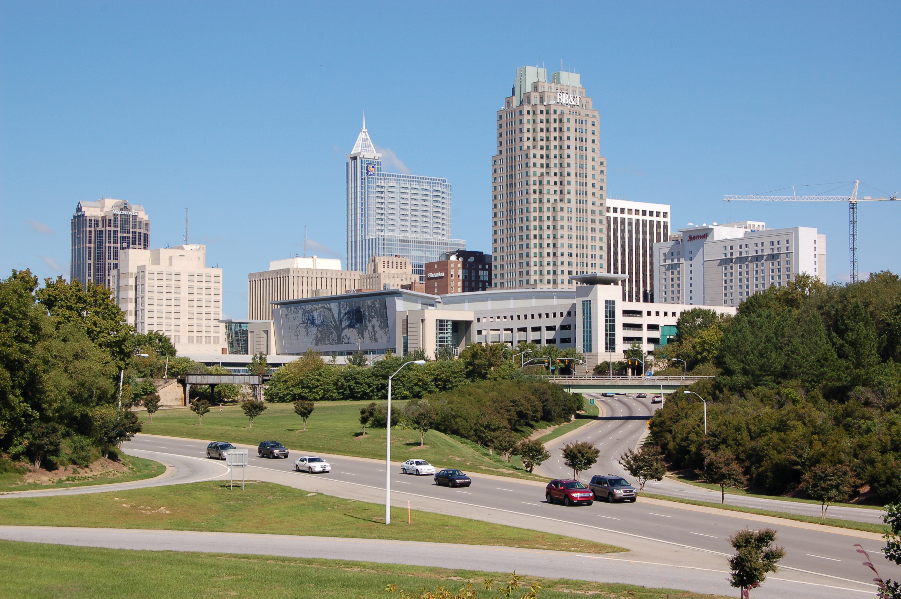 |
|||
|
|||
| Nickname(s): "City of Oaks" | |||
 |
|||

Raleigh, North Carolina |
|||
| Coordinates: Coordinates: | |||
| Country | United States of America | ||
| State | North Carolina | ||
| Counties | Wake, Durham | ||
| Founded | 1792 | ||
| Government | |||
| • Mayor | Nancy McFarlane (Independent)[1] | ||
| Area | |||
| • Total | 144.8 sq mi (375 km2) | ||
| • Land | 142.8 sq mi (369 km2) | ||
| • Water | 2.0 sq mi (2.5 km2) | ||
| Elevation | 315 ft (96 m) | ||
| Population (2012 Census Estimate)[2][3] | |||
| • Total | 423,179 (42nd) | ||
| • Density | 2,963.4/sq mi (1,097.17/km2) | ||
| • MSA | 1,188,564 | ||
| • CSA | 1,998,808 | ||
| Time zone | Eastern (EST) (UTC-5) | ||
| • Summer (DST) | EDT (UTC-4) | ||
| Zip Code | 276xx | ||
| Area code(s) | 919, 984 | ||
| FIPS code | 37-55000[4] | ||
| GNIS feature ID | 1024242[5] | ||
| Website | raleighnc.gov | ||

Raleigh ( /ˈrɑːli/; RAH-lee)[6] is the capital of the state of North Carolina as well as the seat of Wake County. Raleigh is known as the "City of Oaks" for its many oak trees, which line the streets in the heart of the city.[7] According to the U.S. Census Bureau, the city's 2012 estimated population was 423,179, over an area of 142.8 square miles (370 km2), making Raleigh currently the 42nd most populous city in the United States. It is also one of the fastest-growing cities in the country.[2][8][9] The city of Raleigh is named after Sir Walter Raleigh, who established the lost Roanoke Colony on Roanoke Island in present-day Dare County, North Carolina.
Raleigh is home to North Carolina State University and is part of the Research Triangle area, together with Durham (home of Duke University) and Chapel Hill (home of University of North Carolina at Chapel Hill). The "Triangle" nickname originated after the 1959 creation of the Research Triangle Park, located in Durham County partway between the three cities and their universities. The Research Triangle region encompasses the U.S. Census Bureau's Raleigh-Durham-Chapel Hill Combined Statistical Area (CSA), which had an estimated population of 1,998,808 in 2012.[10] The Raleigh Metropolitan Statistical Area (MSA) had an estimated population of 1,188,564 2012.
Most of Raleigh is located within Wake County, with a very small portion extending into Durham County.[11] The towns of Cary, Morrisville, Garner, Clayton, Wake Forest, Apex, Holly Springs, Fuquay-Varina, Knightdale, Wendell, Zebulon, and Rolesville are some of Raleigh's primary nearby suburbs and satellite towns.
Raleigh is an early example in the United States of a planned city, chosen as the site of the state capital in 1788 and incorporated in 1792 as such. The city was originally laid out in a grid pattern with the North Carolina State Capitol in Union Square at the center. In the United States Civil War the city was spared from any significant battle, only falling in the closing days of the war, though it did not escape the economic hardships that plagued the rest of the American South during the Reconstruction Era. The twentieth century saw the opening of the Research Triangle Park in 1959, and with the jobs it created the region and city saw a large influx of population, making it one of the fastest growing communities in the United States by the early 21st century.
Raleigh is home to numerous cultural, educational, and historic sites. The Progress Energy Center for the Performing Arts in Downtown Raleigh features three theater venues and serves as the home for the North Carolina Symphony. Time Warner Cable Music Pavilion is a large music amphitheater located in Southeast Raleigh. Museums in Raleigh include the North Carolina Museum of Art in West Raleigh, as well as the North Carolina Museum of History and North Carolina Museum of Natural Sciences located next to each other near the State Capitol in Downtown Raleigh. Several major universities and colleges call Raleigh home, including North Carolina State University, the largest public university in the state, and Shaw University, the first historically black university in the American South and site of the foundation of the Student Nonviolent Coordinating Committee, an important civil rights organization of the 1960s. One U.S. president, Andrew Johnson, was born in Raleigh.
History[]
Earlier capitals[]
Bath was the first nominal capital of North Carolina, but the colony had no permanent institutions of government until their establishment in New Bern.
18th century[]


Plan for platting Raleigh by William Christmas, 1792
In December 1770, Joel Lane successfully petitioned the North Carolina General Assembly to create a new county. On January 5, 1771, the bill creating Wake County was passed in the General Assembly. The county was formed from portions of Cumberland, Orange, and Johnston counties. The county gets its name from Margaret Wake Tryon, the wife of Governor William Tryon. The first county seat was Bloomsbury.
New Bern, a port town 35 miles from the Atlantic Ocean, was the largest city and the capital of North Carolina during the American Revolution. When the British Army laid siege to the city, governing from that location on the wide Neuse River became infeasible.
Raleigh was chosen as the site of the new capital in 1788, as its central location protected it from attacks from the coast. Officially established in 1792 as both county seat and state capital (incorporated on December 31, 1792 - charter granted January 21, 1795), the city was named for Sir Walter Raleigh, sponsor of Roanoke, the "lost colony" on Roanoke Island.
The city's location was chosen, in part, for being within 11 mi (18 km) of Isaac Hunter's Tavern, a popular tavern frequented by the state legislators. No known city or town existed previously on the chosen city site. Raleigh is one of the few cities in the United States that was planned and built specifically to serve as a state capital. Its original boundaries were formed by the downtown streets of North, East, West and South streets. It was planned to be laid out in an axial fashion, with four public squares and one central square.[12]
The North Carolina General Assembly first met in Raleigh in December 1794, and quickly granted the city a charter, with a board of seven appointed commissioners (elected by the city after 1803) and an "Intendant of Police" (which would eventually become the office of Mayor) to govern it. In 1799, the N.C. Minerva and Raleigh Advertiser became the first newspaper published in Raleigh. [13] John Haywood was the first Intendant of Police.[14]
19th century[]

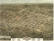
Raleigh, North Carolina in 1872
In 1808, Andrew Johnson, the nation’s 17th President, was born at Casso’s Inn in Raleigh. The city's first water supply network was completed in 1818, although due to system failures the project was abandoned. 1819 saw the arrival of Raleigh's first volunteer fire company, followed in 1821 by a full-time fire company.
In 1831, a fire destroyed the State Capitol. Two years later, reconstruction began with quarried granite being delivered by the first railroad in the state. Raleigh celebrated the completions of the new Capitol and new Raleigh & Gaston Railroad Company in 1840.
In 1853, the first State Fair was held near Raleigh. The first institution of higher learning in Raleigh, Peace College, was established in 1857. Raleigh's Historic Oakwood contains many houses from the 19th century that are still in good condition.
After the Civil War began, Governor Zebulon Baird Vance ordered the construction of breastworks around the city as protection from Union troops. During General Sherman's Carolinas Campaign, Raleigh was captured by Union cavalry under the command of General Hugh Judson Kilpatrick on April 13, 1865. As the Confederate cavalry retreated west, the Union soldiers followed, leading to the nearby Battle of Morrisville.[15] The city was spared significant destruction during the War, but due to the economic problems of the post-war period and Reconstruction, with a state economy based on agriculture, it grew little over the next several decades.
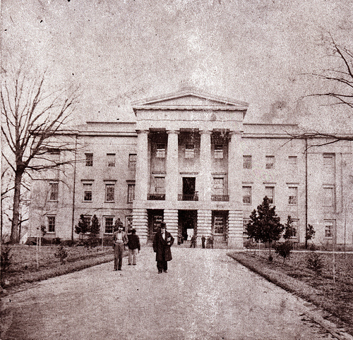

North Carolina State Capitol, c 1861. Governor David S. Reid is in the foreground
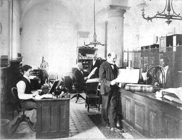

North Carolina State Treasurers Office in State Capitol, c 1890s


Intersection of Fayetteville and Martin Streets, c 1908


Fayetteville Street during the 1910s. The North Carolina State Capitol can be seen in the background


Construction of the Commercial National Bank building, c 1912
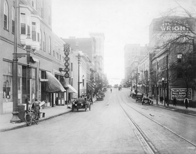

Martin Street business district, c 1915
After the Civil War ended in 1865, African Americans were emancipated. The Reconstruction legislature established public education for blacks and whites. The men, like whites, were admitted to the franchise of voting. Blacks had already been organizing in churches and other community-based organizations. Freedmen were often led by free blacks who had become educated before the war. With the help of the Freedmen's Bureau, many freedmen migrated from rural areas to Raleigh. It had a free black community and many freedmen wanted to get out from under white supervision in the rural areas.
Shaw University, the South's first African-American college, began classes in 1865 and was chartered in 1875. Its Estey Hall was the first building constructed for the higher education of black women, and Leonard Medical Center was the first four-year medical school in the country for African Americans.
In 1867, Episcopal clergy founded St. Augustine's College for the education of freedmen. The biracial Reconstruction legislature created new welfare institutions: in 1869, it approved the nation’s first school for blind and deaf blacks, to be located in Raleigh. And in 1874, a Federal Building was constructed in Raleigh, the first federal government project in the South following the Civil War.
In 1880, the newspapers News and Observer combined to form The News & Observer. It remains Raleigh's primary daily newspaper. The North Carolina College of Agriculture and Mechanic Arts, now known as North Carolina State University, was founded as a land-grant college in 1887. The city's Rex Hospital opened in 1889 and included the state's first nursing school. The Baptist Women's College, now known as Meredith College, opened in 1891, and in 1898, The Academy of Music, a private music conservatory, was established.
In the late nineteenth century, two black Congressmen were elected from North Carolina's 2nd district, the last in 1898. George Henry White sought to promote civil rights for blacks and to challenge efforts by white Democrats to reduce black voting by new discriminatory laws. They were unsuccessful. In 1900, the state legislature passed a new constitution, with voter registration rules that disfranchised most blacks and many poor whites. The state succeeded in reducing black voting to zero by 1908. Loss of the ability to vote disqualified black men (and later women) from sitting on juries and serving in any office, local, state or federal. The rising black middle-class in Raleigh and other areas was politically silenced and shut out of local governance, and the Republican Party was no longer competitive. It was not until after federal civil rights legislation was passed in the mid-1960s that the majority of blacks in North Carolina would again be able to vote, sit on juries and serve in local offices. No African American was elected to Congress until 1992.
20th century[]
In 1912, Bloomsbury Park opened, featuring a popular carousel ride. Relocated to Pullen Park, the carousel is still operating.
From 1914 to 1917, an influenza epidemic killed 288 Raleigh citizens.
In 1922, WLAC signed on as the city's first radio station, but lasted only two years. WFBQ signed on in 1924 and became WPTF in 1927. It is now Raleigh's oldest continuous radio broadcaster.
On December 12, 1924, The Roman Catholic Diocese of Raleigh was officially established by the Vatican and the Sacred Heart Cathedral became the official seat of the diocese.
The city's first airport, Curtiss-Wright Flying Field opened in 1929. That same year, the stock market crash resulted in six Raleigh banks closing.[16]
During the difficult 1930s of the Great Depression, government at all levels was integral to creating jobs. The city provided recreational and educational programs, and hired people for public works projects. In 1932, Raleigh Memorial Auditorium was dedicated. The North Carolina Symphony, founded the same year, performed in its new home. From 1934 to 1937, the federal Civilian Conservation Corps constructed the area now known as William B. Umstead State Park. In 1939, the State General Assembly chartered the Raleigh-Durham Aeronautical Authority to build a larger airport between Raleigh and Durham, with the first flight occurring in 1943.
In 1947, Raleigh citizens adopted a council-manager form of government, the current form.
The Dorton Arena, a 7,610-seat multi-purpose arena designed by Matthew Nowicki, was opened in 1952 on the grounds of the North Carolina State Fair. It was listed in the National Register of Historic Places in 1973.
Raleigh experienced significant damage from Hurricane Hazel in 1954.
In 1956, WRAL-TV became the first local television station.
With the opening of the Research Triangle Park in 1959, Raleigh began to experience a population increase, resulting in a total city population of 100,000 by 1960.[17] In 1960, the Census Bureau reported Raleigh's population as 76.4% white and 23.4% black.[18]
Following passage of the federal Voting Rights Act, one of the main achievements of the African-American Civil Rights Movement (1955-1968) and the Lyndon B. Johnson presidency, political participation and voting by African Americans in Raleigh increased rapidly. In 1967, Clarence E. Lightner was elected to the City Council, and in 1973 became Raleigh's first African-American mayor.
In 1976, the Raleigh City and Wake County schools merged to become the Wake County Public School System, now the largest school system in the state and 19th largest in the country.
During the 1970s and 1980s, the I-440 beltline was constructed, easing traffic congestion and providing access to most major city roads.
The first Raleigh Convention Center (replaced in 2008) and Fayetteville Street Mall were both opened in 1977. Fayetteville Street was turned into a pedestrian-only street in an effort to help the then-ailing downtown area, but the plan was flawed and business declined for years to come. Fayetteville Street was reopened in 2007 as the main thoroughfare of Raleigh's downtown.[19]
The 1988 Raleigh tornado outbreak of November 28, 1988, was the most destructive of the seven tornadoes reported in Northeastern North Carolina and southeastern Virginia between 1:00 AM and 5:45 AM. The Raleigh tornado produced over $77 million in F4 damage, along with four fatalities (two in the city of Raleigh, and two in Nash County) and 154 injuries. The damage path from the storm was measured at 84 miles (135 km) long, and .5 miles (0.8 km) wide at times.[20]
In 1991, two large skyscrapers in Raleigh were completed, First Union Capitol Center and Two Hannover Square, along with the popular Walnut Creek Amphitheatre in Southeast Raleigh.
In 1996, the Olympic Flame passed through Raleigh while on its way to the 1996 Summer Olympics in Atlanta, Georgia. Also in 1996, Hurricane Fran struck the area, causing massive flooding and extensive structural damage.
In 1997, the National Hockey League's Hartford Whalers announced their intention to move to Raleigh as the Carolina Hurricanes, becoming the city's first major league professional sports franchise.
In 1999, the Raleigh Entertainment and Sports Arena (later renamed the RBC Center and now called PNC Arena), opened to provide a home for the Hurricanes and the NC State Wolfpack men's basketball team, as well as an up-to-date major concert venue.[21]
21st century[]
In the first decade of the 21st century, Raleigh was featured prominently in a number of "Top 10 Lists," including those by Forbes, MSNBC and Money Magazine, due to its quality of life and business climate.
In 2001, the Raleigh Memorial Auditorium complex was expanded with the addition of the Progress Energy Center for the Performing Arts, Meymandi Concert Hall, Fletcher Opera Theater, Kennedy Theatre, Betty Ray McCain Gallery and Lichtin Plaza.[22]
Fayetteville Street reopened to vehicular traffic in 2006. A variety of downtown building projects began around this time including the 34-story RBC Bank Tower, multiple condominium projects and several new restaurants. Additional skyscrapers are in the proposal/planning phase.
In 2006, the city's NHL franchise, the Carolina Hurricanes won the Stanley Cup, North Carolina's first and only professional sports championship.
With the opening of parts of I-540 from 2005 to 2007, a new 70-mile (110 km) loop around Wake County, traffic congestion eased somewhat in the North Raleigh area. Completion of the entire loop is expected to take another 15 years.


Government Center skyline
Plans are currently underway to build a combination of high-speed rail, light rail, and commuter rail lines to and from the city's core.
In 2008, the city's Fayetteville Street Historic District joined the National Register of Historic Places.
In September 2010, Raleigh hosted the inaugural Hopscotch Music Festival.
In January 2011, Raleigh hosted the National Hockey League All-Star Game.
In April 2011, a devastating EF-3 tornado hit Raleigh, and many other tornadoes touched down in the state (ultimately the largest, but not the strongest (1984 Carolinas tornado outbreak) outbreak to ever hit the state), killing 24 people. The tornado tracked northeast through parts of Downtown, East Central Raleigh and Northeast Raleigh and produced $115 million in damages in Wake County. There were 4 fatalities in the city.


A view of the North Carolina Capital Building located in downtown Raleigh.
Geography[]


Astronaut Photography of Raleigh, North Carolina taken from the International Space Station (ISS)
According to the United States Census Bureau, Raleigh occupies a total area of 115.6 square miles (299 km2), of which 114.6 square miles (297 km2) is dry land and 1.0 square mile (2.6 km2) (0.84%) is covered by water.
Raleigh is located in the northeast central region of North Carolina, where the North American Piedmont and Atlantic Coastal Plain regions meet. This area is known as the "fall line" because it marks the elevation inland at which waterfalls begin to appear in creeks and rivers. As a result, most of Raleigh features gently rolling hills that slope eastward toward the state's flat coastal plain. Its central Piedmont location situates Raleigh about two hours west of Atlantic Beach, North Carolina, by car and four hours east of the Great Smoky Mountains of the Appalachian range. The city is 145 miles (233 km) south of Richmond, Virginia; 232 miles (373 km) south of Washington, D.C.; and 143 miles (230 km) northeast of Charlotte, North Carolina.
Climate[]


Snow in Raleigh on a morning in January 2007
Raleigh, like much of the southeastern United States, has a humid subtropical climate (Köppen Cfa), with four distinct seasons. Winters are short and generally cool, with a January daily average of 41.0 °F (5.0 °C). On average, there are 69 nights per year that drop to or below freezing, and only 2.7 days that fail to rise above freezing.[23] April is the driest month, with an average of 2.91 inches (73.9 mm) of precipitation. Summers are hot and humid, with a daily average in July of 80.0 °F (26.7 °C). There are 48 days per year with highs at or above 90 °F (32 °C).[23] Autumn is similar to spring overall but has fewer days of rainfall. Extremes in temperature have ranged from −9 °F (−23 °C) on January 21, 1985 up to 105 °F (41 °C), most recently on July 8, 2012.
Raleigh receives an average of 6.0 inches (15.2 cm) of snow in winter. Freezing rain and sleet also occur most winters, and occasionally the area experiences a major damaging ice storm. On January 24–25, 2000, Raleigh received its greatest snowfall from a single storm – 20.3 inches (52 cm) – the Winter Storm of January 2000. Storms of this magnitude are generally the result of cold air damming that affects the city due to its proximity to the Appalachian Mountains. Winter storms in the past have caused traffic problems in the past as well.
The region also experiences occasional periods of drought, during which the city sometimes has restricted water use by residents. During the late summer and early fall, Raleigh can experience hurricanes. In 1996, Hurricane Fran caused severe damage in the Raleigh area, mostly from falling trees. The most recent hurricane to have a considerable effect on the area was Isabel in 2003.
| Climate data for Raleigh, North Carolina (Raleigh Durham Int'l), 1981–2010 normals | |||||||||||||
|---|---|---|---|---|---|---|---|---|---|---|---|---|---|
| Month | Jan | Feb | Mar | Apr | May | Jun | Jul | Aug | Sep | Oct | Nov | Dec | Year |
| Record high °F (°C) | 80 (27) |
84 (29) |
94 (34) |
95 (35) |
99 (37) |
105 (41) |
105 (41) |
105 (41) |
104 (40) |
98 (37) |
88 (31) |
81 (27) |
105 (41) |
| Average high °F (°C) | 50.9 (10.5) |
55.2 (12.9) |
63.4 (17.4) |
72.4 (22.4) |
79.6 (26.4) |
87.1 (30.6) |
90.2 (32.3) |
88.4 (31.3) |
82.1 (27.8) |
72.6 (22.6) |
63.6 (17.6) |
53.6 (12.0) |
71.6 (22.0) |
| Average low °F (°C) | 31.0 (−0.6) |
33.8 (1.0) |
39.9 (4.4) |
48.0 (8.9) |
56.5 (13.6) |
65.8 (18.8) |
69.9 (21.1) |
68.6 (20.3) |
61.7 (16.5) |
49.8 (9.9) |
40.8 (4.9) |
33.3 (0.7) |
49.9 (9.9) |
| Record low °F (°C) | −9 (−23) |
−2 (−19) |
11 (−12) |
23 (−5) |
29 (−2) |
38 (3) |
48 (9) |
46 (8) |
37 (3) |
19 (−7) |
11 (−12) |
0 (−18) |
−9 (−23) |
| Precipitation inches (mm) | 3.50 (88.9) |
3.22 (81.8) |
4.11 (104.4) |
2.91 (73.9) |
3.27 (83.1) |
3.52 (89.4) |
4.72 (119.9) |
4.25 (108) |
4.36 (110.7) |
3.25 (82.6) |
3.12 (79.2) |
3.07 (78) |
43.31 (1,100.1) |
| Snowfall inches (cm) | 2.8 (7.1) |
2.0 (5.1) |
.5 (1.3) |
.1 (0.3) |
0 (0) |
0 (0) |
0 (0) |
0 (0) |
0 (0) |
0 (0) |
.1 (0.3) |
.6 (1.5) |
6.0 (15.2) |
| Avg. precipitation days (≥ 0.01 in) | 9.8 | 9.4 | 9.8 | 9.3 | 9.9 | 10.6 | 11.9 | 10.5 | 8.0 | 7.3 | 8.2 | 9.4 | 114.1 |
| Avg. snowy days (≥ 0.1 in) | 1.1 | 1.3 | .3 | .1 | 0 | 0 | 0 | 0 | 0 | 0 | .1 | .5 | 3.4 |
| Mean monthly sunshine hours | 164.3 | 175.2 | 229.4 | 252.0 | 257.3 | 267.0 | 260.4 | 238.7 | 219.0 | 213.9 | 174.0 | 158.1 | 2,609.3 |
| Source #1: NOAA (extremes 1887–present),[23]The Weather Channel[24] | |||||||||||||
| Source #2: Hong Kong Observatory (sun only, 1961–1990)[25] | |||||||||||||
Cityscape[]

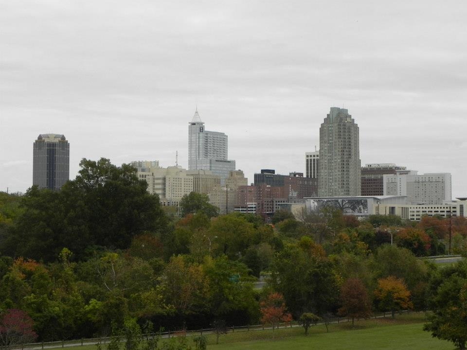


Raleigh is divided into several major geographic areas, each of which use a Raleigh address and a ZIP code that begins with the digits 276. PNC Plaza, formerly known as RBC Plaza, is the largest and tallest skyscraper in the city of Raleigh. The tower rises to a height of 538 feet (164 m), with a floor count of 34.
Downtown[]


Downtown Raleigh in December


Fayetteville Street in downtown Raleigh in December
Downtown (also known as "Inside the Beltline" or ITB) is home to historic neighborhoods and buildings such as the Sir Walter Raleigh Hotel built in the early 20th century, the restored City Market, the Fayetteville Street downtown business district, the Cameron Village midtown business district, which includes the PNC Plaza and Wells Fargo Capitol Center buildings, as well as the North Carolina Museum of History, North Carolina Museum of Natural Sciences, North Carolina State Capitol, Peace College, the Raleigh City Museum, Raleigh Convention Center, Shaw University, and St. Augustine's College. The neighborhoods in Old Raleigh include Cameron Park, Boylan Heights,[26] Country Club Hills, Coley Forest, Five Points, Budleigh, Glenwood-Brooklyn, Hayes Barton Historic District, Moore Square, Mordecai, Rosengarten Park, Belvidere Park, Woodcrest, and Historic Oakwood. In the 2000s, an effort by the Downtown Raleigh Alliance was made to separate this area of the city into five smaller districts: Fayetteville Street, Moore Square, Glenwood South, Warehouse (Raleigh), and Capital District (Raleigh). Some of the names have become common place among locals such as the Warehouse, Fayetteville Street, and Glenwood South Districts.
Midtown Raleigh[]


Midtown Raleigh Skyline as seen from downtown
Midtown Raleigh is a residential and commercial area just North of the I-440 Beltline and is part of North Raleigh. It is roughly framed by Glenwood/Creedmoor Road to the West, Wake Forest Road to the East, and Millbrook Road to the North. It includes shopping centers such as North Hills and Crabtree Valley Mall. It also includes North Hills Park and part of the Raleigh Greenway System. The term was coined by the Greater Raleigh Chamber of Commerce, developer John Kane and planning director Mitchell Silver. The News & Observer newspaper started using the term for marketing purposes only.[27] The Midtown Raleigh Alliance was founded on July 25, 2011 as a way for community leaders to promote the area.[28]
Uptown Raleigh[]
Uptown Raleigh is a residential and commercial area at the intersection of Glenwood and Creedmoor adjacent to the Beltline. Crabtree Valley Mall is the anchor of the area. This label is not used by anyone. The Soleil Center, what was to be the second tallest building in Raleigh at 480, was planned to be built here, but due to the financial Crisis of 2008 lost funding and now is stalled. This enclave is still considered to be part of North Raleigh, because in the past it was known as the outskirts of Raleigh, a very rural country land. The 27612 zip code covers much of this area. The main roads are Millbrook Road and North Hills Drive.
East Raleigh[]
East Raleigh is situated roughly from Capital Boulevard near the I-440 beltline to New Hope Road. Most of East Raleigh's development is along primary corridors such as U.S. 1 (Capital Boulevard), New Bern Avenue, Poole Road, Buffaloe Road, and New Hope Road. Neighborhoods in East Raleigh include Hedingham, Longview, Lockwood, Madonna Acres, New Hope, and Wilder's Grove. The area is bordered to the east by the town of Knightdale.
West Raleigh[]


Dorton Arena in Raleigh designed by Matthew Nowicki
West Raleigh lies along Hillsborough Street and Western Boulevard. The area is bordered to the west by suburban Cary. It is home to North Carolina State University, Meredith College, Pullen Park, Pullen Memorial Baptist Church, Cameron Village, Lake Johnson, the North Carolina Museum of Art and historic Saint Mary's School. Primary thoroughfares serving West Raleigh, in addition to Hillsborough Street, are Avent Ferry Road, Blue Ridge Road, and Western Boulevard. West Raleigh is also home to the nation's smallest Roman Catholic cathedral, Sacred Heart Cathedral. The PNC Arena is also located here adjacent to the North Carolina State Fairgrounds. These are located approximately 2 miles from Rex Hospital.
North Raleigh[]
North Raleigh is an expansive, diverse, and fast-growing suburban area of the city that is home to established neighborhoods to the south along with many newly built subdivisions and along its northern fringes. The area generally falls North of Millbrook Road. It is primarily suburban with large shopping areas. Primary neighborhoods and subdivisions in North Raleigh include Bedford, Bent Tree, Brentwood, Brier Creek, Brookhaven, Black Horse Run, Crossgate, Crosswinds, Falls River, Hidden Valley, Lake Park, North Haven, North Ridge, Oakcroft, Shannon Woods, Six Forks Station, Springdale, Stonebridge, Stone Creek, Stonehenge, Valley Estates, Wakefield, Windsor Forest, and Wood Valley. The area is served by a number of primary transportation corridors including Glenwood Avenue U.S. Route 70, Interstate 540, Wake Forest Road, Millbrook Road, Lynn Road, Six Forks Road, Spring Forest Road, Creedmoor Road, Leesville Road, Strickland Road, and North Hills Drive.
South Raleigh[]
South Raleigh is located along U.S. 401 South toward Fuquay-Varina and along US 70 into suburban Garner. This area is the least developed and least dense area of Raleigh (much of the area lies within the Swift Creek watershed district, where development regulations limit housing densities and construction). The area is bordered to the west by Cary, to the east by Garner, and to the southwest by Holly Springs. Neighborhoods in South Raleigh include Renaissance Park, Lake Wheeler, Swift Creek, Carolina Pines, Rhamkatte, Riverbrooke, and Enchanted Oaks.
Southeast Raleigh[]
Southeast Raleigh is bounded by downtown on the west, Garner on the southwest, and rural Wake County to the southeast. The area includes areas along Rock Quarry Road, Poole Road, and New Bern Avenue. Primary neighborhoods include Chavis Heights, Raleigh Country Club, Southgate, Kingwood Forest, Rochester Heights, Emerald Village and Biltmore Hills. Time Warner Cable Music Pavilion (formerly Alltel Pavilion and Walnut Creek Amphitheatre) is one of the region's major outdoor concert venues and is located on Rock Quarry Road. Shaw University is located in this part of the city.
Demographics[]
| Historical populations | |||
|---|---|---|---|
| Census | Pop. | %± | |
| 1800 | 669 | ||
| 1810 | 976 | 45.9% | |
| 1820 | 2,674 | 174.0% | |
| 1830 | 1,700 | −36.4% | |
| 1840 | 2,244 | 32.0% | |
| 1850 | 4,518 | 101.3% | |
| 1860 | 4,780 | 5.8% | |
| 1870 | 7,790 | 63.0% | |
| 1880 | 9,265 | 18.9% | |
| 1890 | 12,678 | 36.8% | |
| 1900 | 13,643 | 7.6% | |
| 1910 | 19,218 | 40.9% | |
| 1920 | 24,418 | 27.1% | |
| 1930 | 37,379 | 53.1% | |
| 1940 | 46,879 | 25.4% | |
| 1950 | 65,679 | 40.1% | |
| 1960 | 93,931 | 43.0% | |
| 1970 | 122,830 | 30.8% | |
| 1980 | 150,255 | 22.3% | |
| 1990 | 212,092 | 41.2% | |
| 2000 | 276,093 | 30.2% | |
| 2010 | 403,892 | 46.3% | |
| Est. 2012 | 423,179 | 53.3% | |
According to the 2010 Census, the racial composition of the city was:[29]
- 57.5% White (53.3% non-Hispanic white)
- 29.3% Black or African American
- 4.3% Asian American (1.2% Indian, 0.8% Chinese, 0.7% Vietnamese, 0.5% Korean, 0.4% Filipino, 0.1% Pakistani, 0.1% Japanese)
- 0.5% Native American
- less than 0.1% Native Hawaiian or Other Pacific Islander,
- 1.4% some other race
- 2.6% two or more races.
In addition, *11.3% were Hispanic or Latino American, of any race (5.9% Mexican, 1.1% Puerto Rican, 0.9% Salvadoran, 0.6% Honduran, 0.3% Cuban, 0.3% Colombian, 0.2% Guatemalan, 0.2% Peruvian).
As of the 2000 United States census,[4] there were 276,093 persons (July 2008 estimate was 380,173) and 61,371 families residing in Raleigh. The population density was 2,409.2 people per square mile (930.2/km²). There were 120,699 housing units at an average density of 1,053.2 per square mile (406.7/km²). The racial composition of the city was: 63.31% White, 27.80% Black or African American, 7.01% Hispanic or Latino American, 3.38% Asian American, 0.36% Native American, 0.04% Native Hawaiian or Other Pacific Islander, 3.24% some other race, and 1.88% two or more races.
There were 112,608 households in the city in 2000, of which 26.5% included children below the age of 18, 39.5% were composed of married couples living together, 11.4% reported a female householder with no husband present, and 45.5% classified themselves as nonfamily. Unmarried partners were present in 2.2% of households. In addition, 33.1% of all households were composed of individuals living alone, of which 6.2% was someone 65 years of age or older. The average household size in Raleigh was 2.30 persons, and the average family size was 2.97 persons.
Raleigh's population in 2000 was evenly distributed with 20.9% below the age of 18, 15.9% aged 18 to 24, 36.6% from 25 to 44, and 18.4% from 45 to 64. An estimated 8.3% of the population was 65 years of age or older, and the median age was 31 years. For every 100 females, there were 98.0 males; for every 100 females aged 18 or older, there were 96.6 males aged 18 or older.
The median household income in the city was $46,612 in 2000, and the median family income was $60,003. Males earned a median income of $39,248, versus $30,656 for females. The median per capita income for the city was $25,113, and an estimated 11.5% of the population and 7.1% of families were living below the poverty line. Of the total population, 18.8% of those below the age of 18, and 9.3% of those 65 and older, were living below the poverty line.
Law and government[]


North Carolina State Capitol
Historically, Raleigh voters have tended to elect conservative Democrats in local, state, and national elections, a holdover from their one-party system of the late 19th century.
City Council[]
Raleigh operates under a council-manager government. Raleigh City Council consists of eight members; all seats, including the Mayor's, are open for election every two years. Five of the council seats are district representatives and two seats are citywide representatives elected at-large.
- Nancy McFarlane, Mayor[30]
- Randy Stagner, Council Member (District A, north-central Raleigh)
- John Odom, Council Member (District B, northeast Raleigh)
- Eugene Weeks, Council Member (District C, southeast Raleigh)
- Thomas Crowder, Council Member (District D, southwest Raleigh)
- Bonner Gaylord, Council Member (District E, west and northwest Raleigh)
- Russ Stephenson, Council Member, At-Large
- Mary-Ann Baldwin, Council Member, At-large
Crime[]
According to the Federal Bureau of Investigation's Uniform Crime Reports, in 2010 the Raleigh Police Department and other agencies in the city reported 1,740 incidents of violent crime and 12,995 incidents of property crime. Of the violent crimes reported, 14 were murders, 99 were forcible rapes and 643 were robberies. Aggravated assault accounted for 984 of the total violent crimes. Property crimes included burglaries which accounted for 3,021, larcenies for 9,104 and arson for 63 of the total number of incidents. Motor vehicle theft accounted for 870 incidents out of the total.[31]
Public safety[]
The Raleigh Fire Department provides fire protection throughout the city.[32] The North Carolina Correctional Institution for Women, the state's primary correctional facility housing female inmates is based in Raleigh.[33]
Economy[]
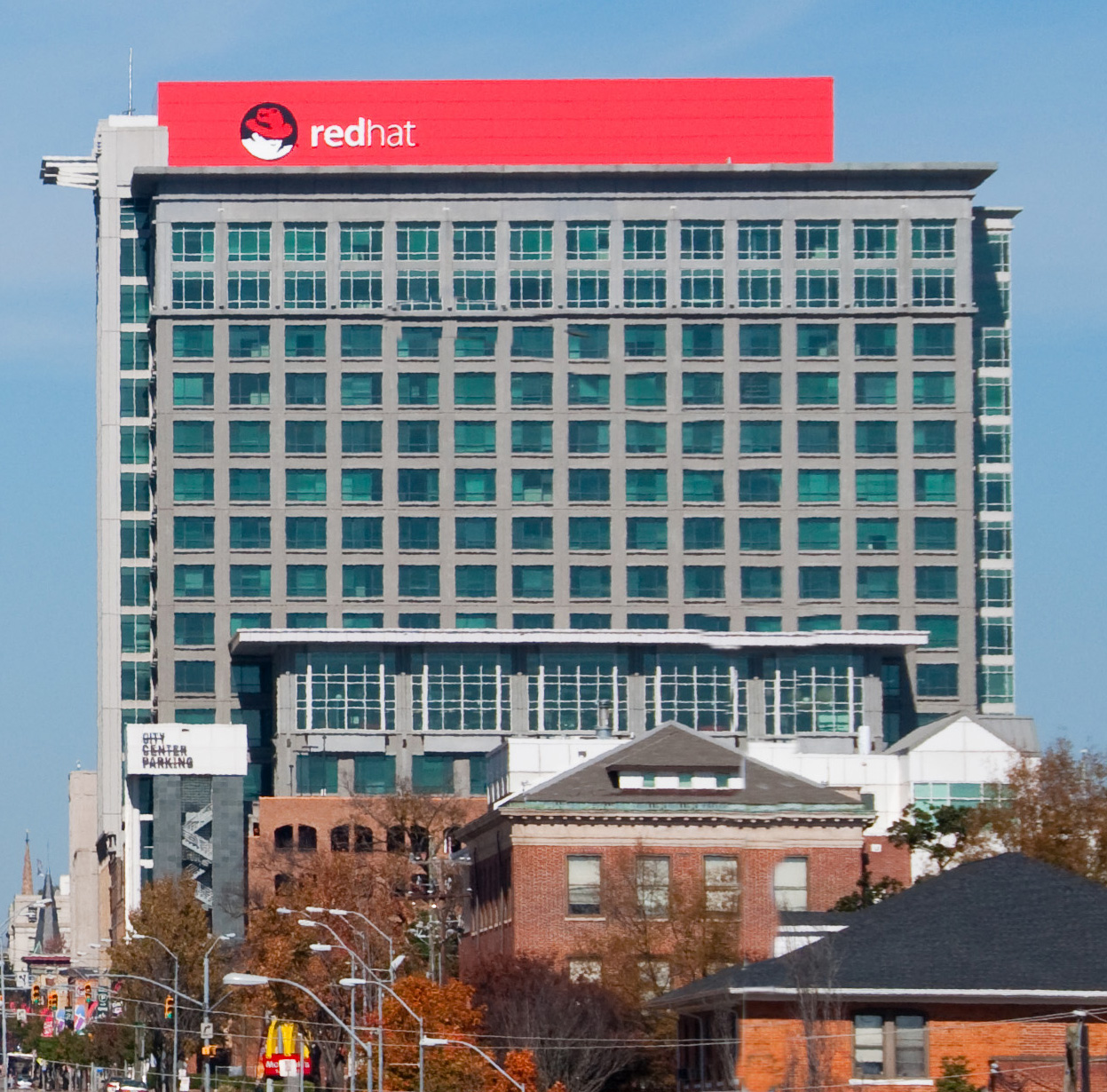

Red Hat Headquarters, Raleigh, NC
Raleigh's industrial base includes banking/financial services; electrical, medical, electronic and telecommunications equipment; clothing and apparel; food processing; paper products; and pharmaceuticals. Raleigh is part of North Carolina's Research Triangle, one of the country's largest and most successful research parks and a major center in the United States for high-tech and biotech research, as well as advanced textile development.[34] The city is a major retail shipping point for eastern North Carolina and a wholesale distributing point for the grocery industry.
Raleigh, NC is number three on the 2013 Forbes List for being the best place for businesses and careers.[35] Companies based in Raleigh include BB&T Insurance Services, Capitol Broadcasting Company, Carquest, First Citizens BancShares, Golden Corral, Martin Marietta Materials, and Red Hat.
Top employers[]
According to Raleigh's 2011 Comprehensive Annual Financial Report,[36] the top employers in the city are:
| # | Employer | # of Employees |
|---|---|---|
| 1 | State of North Carolina | 24,739 |
| 2 | Wake County Public School System | 17,572 |
| 3 | North Carolina State University | 7,730 |
| 4 | WakeMed | 7,607 |
| 5 | Rex Hospital | 4,800 |
| 6 | Red Hat | 4,500 |
| 7 | Wake County | 4,272 |
| 8 | City of Raleigh | 3,811 |
| 9 | Progress Energy | 2,500 |
| 10 | First Citizens BancShares | 1,703 |
| 11 | Duke Raleigh Hospital | 1,700 |
Education[]
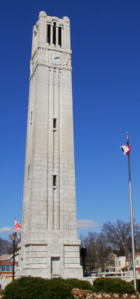
Memorial Bell Tower at North Carolina State University


Estey Hall on the campus of Shaw University


Main Building on the campus of Peace College
Raleigh Charter High School main entrance
As of 2011, Time ranked Raleigh, NC as the third most educated city in the US based on the percentage of residents who held college degrees.[37] This statistic can most likely be credited to the presence of universities in and around Raleigh, as well as the presence of Research Triangle Park to the Northwest.
Higher education[]
Public[]
- North Carolina State University
- Wake Technical Community College
Private[]
- Meredith College
- William Peace University
- Shaw University
- St. Augustine's University
- Campbell University Norman Adrian Wiggins School of Law
- Skema Business School, the first French Business School to open a campus in the USA
Private, for profit[]
- ECPI College of Technology
- Strayer University
Primary and secondary education[]
Public schools[]
Public schools in Raleigh are operated by the Wake County Public School System. Observers have praised the Wake County Public School System for its innovative efforts to maintain a socially, economically and racial balanced system by using income as a prime factor in assigning students to schools.[38] Raleigh is home to three magnet high schools; William G. Enloe High School, Southeast Raleigh High School, and Millbrook High School.
Charter schools[]
The State of North Carolina provides for a legislated number of charter schools. These schools are administered independently of the Wake County Public School System. Raleigh is currently home to eleven such charter schools:
- Casa Esperanza Montessori School (K-8)
- Endeavor Charter School (K-8)
- Exploris Middle School (6-8)
- Hope Elementary School (K-5)
- John H. Baker, Jr., High School (9-12)
- Magellan Charter School (3-8)
- PreEminent Charter School (K-8)
- Quest Academy (K-8)
- Raleigh Charter High School (9-12)
- Torchlight Academy (K-6)
- Wake Early College of Health and Sciences (9-12)
- Woods Charter School (K-12)
Private and religion-based schools[]
|
|
Cultural resources[]
Museums[]


The SECU Daily Planet, part of the North Carolina Museum of Natural Sciences Nature Research Center.
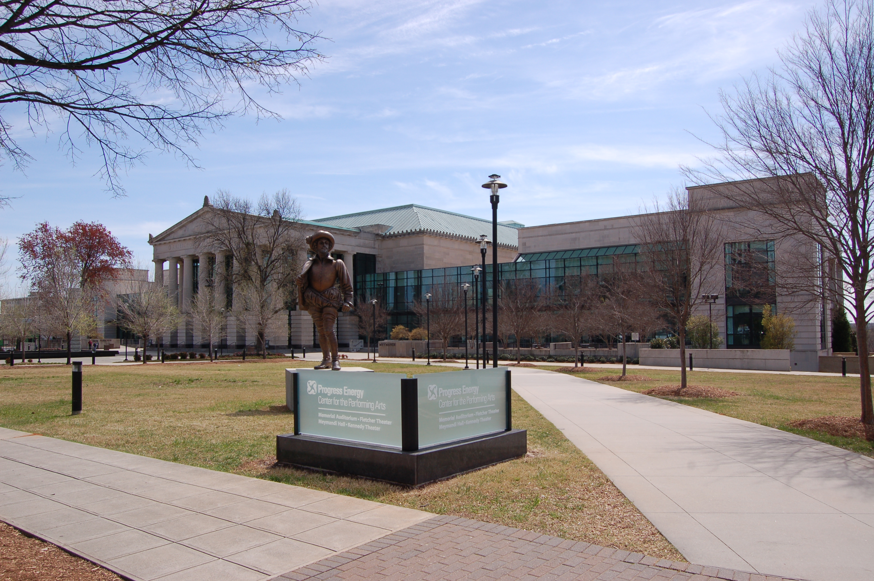

Progress Energy Center for the Performing Arts, 2008
- African American Cultural Complex
- Contemporary Art Museum of Raleigh
- Gregg Museum of Art & Design at NCSU
- Haywood Hall House & Gardens
- Marbles Kids Museum
- North Carolina Museum of Art
- North Carolina Museum of History
- North Carolina Museum of Natural Sciences
- North Carolina Sports Hall of Fame
- Raleigh City Museum
- J. C. Raulston Arboretum
- Joel Lane House
- Mordecai House
- Montfort Hall
- Pope House Museum
Performing arts[]
The Time Warner Cable Music Pavilion at Walnut Creek hosts major international touring acts. In 2011, the Downtown Raleigh Amphitheater opened (now sponsored as the Red Hat Amphitheater), which hosts numerous concerts primarily in the summer months. An additional amphitheater sits on the grounds of the North Carolina Museum of Art, which hosts a summer concert series and outdoor movies. Nearby Cary is home to the Koka Booth Amphitheatre which hosts additional summer concerts and outdoor movies, and serves as the venue for regularly scheduled outdoor concerts by the North Carolina Symphony based in Raleigh. During the North Carolina State Fair, Dorton Arena hosts headline acts. The private Lincoln Theatre is one of several clubs in downtown Raleigh that schedules many concerts throughout the year in multiple formats (rock, pop, country).
The Progress Energy Center for the Performing Arts complex houses the Raleigh Memorial Auditorium, the Fletcher Opera Theater, the Kennedy Theatre, and the Meymandi Concert Hall. In 2008, a new theatre space, the Meymandi Theatre at the Murphey School, was opened in the restored auditorium of the historic Murphey School.[39] Theater performances are also offered at the Raleigh Little Theatre, Long View Center, Ira David Wood III Pullen Park Theatre, and Stewart and Thompson Theaters at North Carolina State University.
Raleigh is home to several professional arts organizations, including the North Carolina Symphony, the Opera Company of North Carolina, Theatre In The Park, Burning Coal Theatre Company, the North Carolina Theatre, Broadway Series South and the Carolina Ballet. The numerous local colleges and universities significantly add to the options available for viewing live performances.
Visual arts[]
North Carolina Museum of Art, occupying a large suburban campus on Blue Ridge Road near the North Carolina State Fairgrounds, maintains one of the premier public art collections located between Washington, D.C., and Atlanta. In addition to its extensive collections of American Art, European Art and ancient art, the museum recently has hosted major exhibitions featuring Auguste Rodin (in 2000) and Claude Monet (in 2006-07), each attracting more than 200,000 visitors.[40][41] Unlike most prominent public museums, the North Carolina Museum of Art acquired a large number of the works in its permanent collection through purchases with public funds. The museum's outdoor park is one of the largest such art parks in the country. The museum facility underwent a major expansion which greatly expanded the exhibit space that was completed in 2010. The 127,000 sf new expansion is designed by NYC architect Thomas Phifer and Partners.
Raleigh's downtown is also home to many local art galleries such as Art Space in City Market, Visual Art Exchange, and 311 Gallery, on Martin Street, and Bee Hive Studios on Hargett Street. CAM Raleigh is a downtown contemporary art museum, also on Martin Street, that serves to promote new artists and does not house a permanent collection. CAM Raleigh was designed by the award-winning architectural firm Brooks+Scarpa of Los Angeles, CA.
Sports and leisure[]
Professional[]


The PNC Arena in Raleigh
The National Hockey League's Carolina Hurricanes franchise moved to Raleigh in 1997 from Hartford, Connecticut (where it was known as the Hartford Whalers). The team played its first two seasons more than 60 miles away at Greensboro Coliseum while its home arena, Raleigh Entertainment and Sports Arena (later RBC Center and now PNC Arena), was under construction. The Hurricanes are the only major league (NFL, NHL, NBA, MLB) professional sports team in North Carolina to have won a championship, winning the Stanley Cup in 2006, over the Edmonton Oilers. The city played host to the 2011 NHL All-Star Game.
In addition to the Hurricanes, the Carolina RailHawks FC of the North American Soccer League play in suburban Cary to the west; the Carolina Mudcats, an Single-A minor-league baseball team, play in the city's eastern suburbs; and the Durham Bulls, the AAA minor-league baseball team made internationally famous by the movie Bull Durham, play in the neighboring city of Durham.
Several other professional sports leagues have had former franchises (now defunct) in Raleigh, including the Raleigh IceCaps of the ECHL (1991–1998); Carolina Cobras of the Arena Football League (2000–2004); the Raleigh–Durham Skyhawks of the World League of American Football (1991); the Raleigh Bullfrogs of the Global Basketball Association (1991–1992); the Raleigh Cougars of the United States Basketball League (1997–1999); and most recently, the Carolina Courage of the Women's United Soccer Association (2000-2001 in Chapel Hill, 2001-2003 in suburban Cary), which won that league's championship Founders Cup in 2002.
The Research Triangle region has hosted the Professional Golfers' Association (PGA) Nationwide Tour Rex Hospital Open since 1994, with the current location of play at Raleigh's Wakefield Plantation.
Collegiate[]
North Carolina State University is located in southwest Raleigh where the Wolfpack competes nationally in 24 intercollegiate varsity sports as an original member of the Atlantic Coast Conference. The university's football team plays in Carter-Finley Stadium, the third largest football stadium in North Carolina, while the men's basketball team shares the PNC Arena with the Carolina Hurricanes hockey club - List of sports venues in North Carolina.
Amateur[]
The North Carolina Tigers compete as an Australian Rules football club in the United States Australian Football League, in the Eastern Australian Football League.
Raleigh is also home to the Carolina Rollergirls, an all-women flat-track roller derby team that is a competing member of the Women's Flat Track Derby Association. The Carolina Rollergirls compete at Dorton Arena at the North Carolina State Fairgrounds.
Raleigh is also home to one of the Cheer Extreme All Stars gyms. In 2009 and again in 2010, Cheer Extreme Raleigh's Small Senior Level 5 Team were silver medalists at the Cheerleading Worlds Competition in Orlando, Florida, and in 2012 they received the bronze medal.
Raleigh is also home to one of the Southeast's premier Hardcourt Bike Polo clubs.[42]
Recreation[]
The Raleigh Parks and Recreation Department offers a wide variety of leisure opportunities at more than 150 sites throughout the city, which include: 8,100 acres (33 km2) of park land, 78 miles (126 km) of greenway, 22 staffed community centers, a BMX championship-caliber race track, 112 tennis courts among 25 locations, 5 public lakes, and 8 public aquatic facilities.
The J. C. Raulston Arboretum, an 8 acre (32,000 m²) arboretum and botanical garden in west Raleigh administered by North Carolina State University, maintains a year-round collection that is open daily to the public without charge.
Transportation[]
Air[]


The RDU sign at the entrance of the airport.
Raleigh-Durham International Airport[]
(IATA: RDU, ICAO: KRDU, FAA LID: RDU)
Raleigh-Durham International Airport, the region's primary airport and the second-largest in North Carolina, located northwest of downtown Raleigh via Interstate-40 between Raleigh and Durham, serves the city and greater Research Triangle metropolitan region, as well as much of eastern North Carolina. The airport offers service to more than 35 domestic and international destinations and serves approximately 10 million passengers a year.[43] The airport also offers facilities for cargo and general aviation. The airport authority tripled the size of its Terminal 2 (formerly Terminal C) in January 2011.
Public general-aviation airports[]


Horace Williams Airport in Chapel Hill
In addition to RDU, several smaller publicly owned general-aviation airports also operate in the metropolitan region:
- Triangle North Executive Airport (IATA: LFN, ICAO: KLHZ, FAA LID: LHZ), Louisburg
- Raleigh Exec (ICAO: KTTA, FAA LID: TTA), Sanford
- Johnston County Airport (IATA: JNX, ICAO: KJNX, FAA LID: JNX), Smithfield
- Horace Williams Airport (IATA: IGX, ICAO: KIGX, FAA LID: IGX), Chapel Hill
- Harnett Regional Jetport (IATA: HRJ, ICAO: KHRJ, FAA LID: HRJ), Erwin
- Person County Airport (ICAO: KTDF, FAA LID: TDF), Roxboro
- Siler City Municipal Airport (ICAO: K5W8, FAA LID: 5W8), Siler City
Private airports[]
Several licensed private general-aviation airports operate in Raleigh's immediate suburban areas:
- Bagwell Airport (FAA LID: NC99), Garner
- Ball Airport (FAA LID: 79NC), Louisburg
- Cox Airport (FAA LID: NC81), Apex
- Deck Airpark Airport (FAA LID: NC11), Apex
- Field of Dreams Airport (FAA LID: 51NC), Zebulon
- Fuquay/Angier Field Airport (FAA LID: 78NC), Fuquay-Varina
- North Raleigh Airport (FAA LID: 00NC), Louisburg
- Peacock Stolport Airport (FAA LID: 4NC7), Garner
- Raleigh East Airport (FAA LID: 9NC0), Knightdale
- Triple W Airport (ICAO: K5W5, FAA LID: 5W5), Raleigh
Freeways and primary designated routes[]
Interstate Highway[]
- I-40 traverses the southern part of the city, connecting Raleigh to Durham and Chapel Hill toward the west, and coastal Wilmington, North Carolina to the southeast.
- I-440, Also known locally as the Raleigh Beltline, it makes a loop around the central part of the city. The I-440 route labeling formerly encompassed the entire loop around the city, co-numbered though South Raleigh with I-40. In 2002, the NCDOT removed the I-440 designation from the co-numbered I-40 (southern and southwestern) sections of the loop, and the directional signage on the remaining I-440 portion was changed from Inner/Outer to East/West. The route designation changes were made to avoid driver confusion over the Inner/Outer designations, especially with Raleigh's new "Outer Beltline," as I-540 has become known.
- I-540/NC 540 is currently under development. It is a partially completed outer beltway that will run around the outer edges of Wake County and into a small portion of southeast Durham county. The route is complete and currently open between the NC 55 interchange in suburban Cary and the US-64/US-264 interchange in suburban Knightdale.
- I-495, designated in December, 2013 but currently not signed. The route will eventually connect I-440 to I-95 just east of Rocky Mount. It will be concurrent with U.S. 64 for its entire length, following the same roadway as currently exists. When signed, the segment from I-440 to I-540 will be signed as I-495, while the segment to the east of I-540 will be signed as "Future I-495". The highway is currently to Interstate standards only along the Knightdale Bypass, which runs from I-440 to the Business 64 exit between Knightdale and Wendell. East of this point, the road is a controlled access freeway, but does not meet interstate standards. The "future" designation will be removed as the road is eventually upgraded by improving the road's shoulders, which are currently too narrow to qualify for an Interstate Highway. There is no set timetable for these improvements.[44]
United States Highways[]
- U.S. Route 1 enters the city from the north along Capital Boulevard, joins I-440 around the west side of Raleigh, and leaves the city to the southwest as the US 1/US 64 expressway in Cary.
- U.S. Route 64 is the main east-west route through Raleigh; all segments share routes with another highway. East of the city, US-64/US-264 is known as the Knightdale Bypass. US 64 follows I-440 (as a wrong way concurrency) and I-40 along southern Raleigh, and US 1 to the southwest.
- U.S. Route 70 runs roughly northwest-southeast through Raleigh. North of downtown, the route follows Glenwood Avenue into Durham. South of Raleigh, the route (along with US 401 and NC 50) follows South Saunders and South Wilmington Streets into Garner. Through downtown, US 70 uses small segments of several streets, including Wade Avenue, Capital Boulevard, Dawson, and McDowell Streets.
- U.S. Route 264 cosigned with US 64 through East Raleigh.
- U.S. Route 401 north of downtown Raleigh it follows Capital Boulevard and Louisburg Road. South of downtown it is cosigned with US 70 from Wade Avenue southward.
North Carolina Highways[]
- N.C. Route 54 follows Chapel Hill Road and Hillsborough Street in West Raleigh. The route ends at its interchange with I-440.
- N.C. Route 50 is a north-south route through Raleigh. North of Raleigh it follows Creedmoor Road. NC 50 joins US 70 and later US 401 in downtown Raleigh. The three routes remain together through south Raleigh.
- N.C. Route 98, known as Durham Road in North Raleigh, traverses the extreme northern parts of the city.
Intercity rail[]


Amtrak's Carolinian, pulling into Raleigh's train station


CAT bus on Hillsborough Street in Downtown Raleigh


Triangle Transit bus
Raleigh's train station is one of Amtrak's busiest stops in the Southern U.S.[45] The station is served by four passenger trains daily: the Silver Star, twice-daily Piedmont service, and the Carolinian.[46] Daily service is offered between Raleigh and:
- Charlotte, with intermediate stops including Cary, Durham, Burlington and Greensboro, North Carolina.
- New York City, with intermediate stops including Richmond, Virginia; Washington, D.C.; Baltimore; and Philadelphia.
- Miami, with intermediate stops including Columbia, South Carolina, and Savannah, Georgia; as well as Jacksonville, Orlando and Tampa, Florida.
- Greyhound lines are provided as inter-city bus lines
Public transit[]
Public transportation in and around Raleigh is provided by Capital Area Transit (CAT),[47] which operates 43 fixed bus routes, including the R-Line[48] and the Wake-Forest Loop. Although there are 43 routes, some routes are designed to cover multiple other routes at times when they are not served. Depending on the time of the day, and the day of the week, the number of routes operating is between 5 and 29.
Raleigh is also served by Triangle Transit (known formerly as the Triangle Transit Authority, or TTA). Triangle Transit offers scheduled, fixed-route regional and commuter bus service between Raleigh and the region's other principal cities of Durham, Cary and Chapel Hill, as well as to and from the Raleigh-Durham International Airport, Research Triangle Park and several of the region's larger suburban communities. Triangle Transit also coordinates an extensive vanpool and rideshare program that serves the region's larger employers and commute destinations.
North Carolina State University also maintains its own transit system, the Wolfline, that provides zero-fare bus service to the general public along multiple routes serving the university's campuses in southwest Raleigh.
Government agencies throughout the Raleigh-Durham metropolitan area have struggled with determining the best means of providing fixed-rail transit service for the region.
From 1995 the cornerstone of Triangle Transit's long-term plan was a 28-mile rail corridor from northeast Raleigh, through downtown Raleigh, Cary, and Research Triangle Park, to Durham using DMU technology. There were proposals to extend this corridor 7 miles to Chapel Hill with light rail technology. However, in 2006 Triangle Transit deferred implementation indefinitely when the Federal Transit Administration declined to fund the program due to low ridership projections.
The region's two metropolitan planning organizations appointed a group of local citizens in 2007 to reexamine options for future transit development in light of Triangle Transit's problems. The Special Transit Advisory Commission (STAC) retained many of the provisions of Triangle Transit's original plan, but recommended adding new bus services and raising additional revenues by adding a new local half-cent sales tax to fund the project.[49]
Bicycle and pedestrian[]
- The Maine-to-Florida U.S. Bicycle Route#1 routes through suburban Raleigh, along with N.C. Bicycle Route #2, the "Mountains To Sea" route. As of September 2010, maps and signage for both US Bike Route #1 and NC Bike Route #2 are out-of-date for the Raleigh area. N.C. Bicycle Route #5 is routed nearby, connecting Apex to Wilmington and closely paralleling the NCBC Randonneurs 600 kilometer brevet route.[50]
- Most public buses are equipped with bicycle racks, and some roads have dedicated bicycle-only lanes. Bicyclists and pedestrians also may use Raleigh's extensive greenway system, with paths and trails located throughout the city.
- In May 2011, Raleigh was designated a Bicycle Friendly Community by the League of American Bicyclists at the Bronze level.[51]
- A 2011 study by Walk Score ranked Raleigh 36th most walkable of fifty largest U.S. cities.[52]
Media[]
Print publications[]
There are several newspapers and periodicals serving Raleigh:
- The News & Observer, a large daily newspaper owned by The McClatchy Company
- The Raleigh Downtowner, a locally owned free monthly print magazine about downtown Raleigh with features on dining, entertainment, wine, community, history and more
- Raleigh Magazine, a glossy magazine published by The Raleigh Telegram
- Technician, student publication of North Carolina State University
- The Carolinian, North Carolina's oldest and largest African-American newspaper published twice weekly
- Metro Magazine, a Raleigh lifestyle magazine with food columns, book reviews, and more
- Midtown Magazine an upscale Raleigh lifestyle magazine
- The Slammer, a paid bi-weekly newspaper featuring Raleigh crime news
- Carolina Journal, a free monthly newspaper
- Independent Weekly, a free weekly tabloid covering Raleigh, Durham, and the surrounding area
Television[]
Broadcast[]
Raleigh is part of the Raleigh-Durham-Fayetteville Designated Market Area, the 24th largest broadcast television market in the United States. The following stations are licensed to Raleigh and/or have significant operations and viewers in the city:
- WUNC-TV (4, PBS) licensed to Chapel Hill, owned by the University of North Carolina
- WRAL-TV (5, CBS): licensed to the city of Raleigh, owned by Capitol Broadcasting Company
- WTVD (11, ABC): licensed to the city of Durham. News bureau located in Raleigh, owned by ABC (The Walt Disney Company)
- WNCN-TV (17, NBC): studios located in Raleigh, licensed to the city of Goldsboro southeast of Raleigh; owned by Media General
- WLFL-TV (22, CW): licensed to the city of Raleigh, owned by Sinclair Broadcast Group
- WRDC (28, MyNetworkTV) licensed to Durham, owned by Sinclair Broadcast Group
- WRAY-TV (30, Independent/Jewelry TV) licensed to Wilson, owned by Multicultural Broadcasting
- WUVC-TV (40, Univision) licensed to Fayetteville, owned by Univision.
- WRAZ-TV (50, Fox): licensed to the city of Raleigh, owned by Capitol Broadcasting Company
- WAUG-LP (68, Independent station) licensed to Raleigh, owned and operated by Saint Augustine's College
Subscriber[]
Raleigh is home to the Research Triangle Region bureau of the regional cable news channel News 14 Carolina.
Broadcast radio[]
Public and listener-supported[]
- WKNC-FM (College rock), operated by students of North Carolina State University
- WSHA-FM (Jazz), operated by Shaw University
- WCPE-FM (Classical)
- WUNC-FM (National Public Radio, North Carolina Public Radio) operated by the University of North Carolina at Chapel Hill
Commercial[]
- WDCG-FM (G105, Contemporary Hit Radio)
- WQDR-FM (94.7QDR, Country)
- WBBB-FM 96.1 (Radio 96.1, Adult Hits)
- WRAL-FM (Mix 101.5, Adult Contemporary)
- WKIX-FM (KIX 102.9, Classic Hits)
- WPTF-AM (NewsRadio 680, News/Talk)
- WQOK-FM (K97.5, Hip Hop)
- WFXC-FM (Foxy 107/104, Urban Adult Contemporary)
- WFXK-FM (Foxy 107/104, Urban Adult Contemporary)
- WRDU-FM (100.7 Classic Rock, Classic rock)
- WKSL-FM (93.9 B939 FM, Country)
- WTKK-FM (106.1 FM, News/Talk)
- WNNL-FM (103.9 The Light, Urban Gospel)
- WPTK-AM (TalkRadio 850 WPTF, Talk radio)
- WFNL-AM (Funny 570, Comedy)
- WCLY-AM (ESPN Deportes)
- WWPL-FM (Pulse 102) Contemporary Hit Radio
- WAUG-AM
Sister cities[]
Raleigh has several sister cities:[53][54]
 Xiangyang (formerly Xiangfan), Hubei, People's Republic of China[55]
- Compiègne, France
- Kingston upon Hull, United Kingdom
- Kolomna, Russia
- Rostock, Germany
- Nairobi, Kenya[56]
Awards[]
Raleigh frequently receives national recognition for its quality of life and business climate. Some recent national rankings include:
- America's Best Places to Live: #1 (Businessweek.com, June 2011)[57]
- Best Place for Business and Careers: #2 (Forbes.com, June 2012)[58]
- Top 10 Best Cities for Educated Workers: #5 (Raleigh-Cary, NC)(247WallSt.com, September 2011)[59]
- Most Cost-Attractive Business Location: #5 (KPMG, March 2012)[60]
- Best Cities in America for Health and Happiness: #3 (EcoSalon, March 2012)[61]
- Fastest Growing Cities for Technology Jobs: #1 (Dice, March 2012)[62]
- Best Cities for Raising a Family: #5 (Forbes, April 2012)[63]
- The Ten Best Cities for Newlyweds: #2 (Forbes.com, July 2012)[64]
- Best Places for Bargain Retirement Homes: #3 (Forbes.com, January 2011)[65]
- America's Most Wired Cities: #1 (Forbes.com, March 2010)[66]
- America's Safest Cities: #1 (Forbes.com, October 2010)[67]
Notable people[]
- Clay Aiken, singer and actor
- Doug Aldrich, guitarist
- Darrius Barnes, professional soccer player, currently plays for New England Revolution
- Pete Carr, Guitarist
- Todd Duffey, actor
- Gracie Glam, pornographic actress
- Chesson Hadley, professional golfer on the PGA Tour
- Michael C. Hall, actor Dexter
- Josh Hamilton, baseball player for the Los Angeles Angels of Anaheim
- Andrew Johnson, 17th President of the United States
- Ryan Kelly, basketball player for the Los Angeles Lakers
- Robert Duncan McNeill, director, actor All My Children, Star Trek: Voyager
- Landon Powell, Oakland Athletics catcher. Caught Dallas Braden's perfect game
- Emily Procter, actress Leaving Las Vegas and CSI: Miami
- David Sedaris, writer
- Amy Sedaris, writer
- Webb Simpson, professional golfer on the PGA Tour
- Liz Vassey, actress All My Children
- John Wall, NBA Player Drafted 1st overall in the 2010 NBA Draft; plays for the Washington Wizards
- Evan Rachel Wood, actress
- Chris Wilcox, Basketball player for the Boston Celtics
- TJ Graham, football player for the Buffalo Bills
See also[]
- I-85 Corridor
References[]
- ^ Mark Binker (June 4, 2012). "Fact Check: Ad against McCrory lacks solid conclusion". WRAL-TV. http://www.wral.com/news/state/nccapitol/story/11168235/. Retrieved August 9, 2012.
- ^ a b "Table 1: Annual Estimates of the Population for Incorporated Places Over 100,000, Ranked by July 1, 2008 Population: April 1, 2000 to July 1, 2008" (CSV). 2008 Population Estimates. United States Census Bureau, Population Division. July 1, 2008. http://www.census.gov/popest/cities/tables/SUB-EST2008-01.csv. Retrieved July 2, 2009.
- ^ "Annual Estimates of the Population of Metropolitan and Micropolitan Statistical Areas: April 1, 2000 to July 1, 2008" (CSV). 2008 Population Estimates. United States Census Bureau, Population Division. July 1, 2009. http://www.census.gov/popest/metro/files/2008/CSA-EST2008-alldata.csv. Retrieved July 2, 2009.
- ^ a b "American FactFinder". United States Census Bureau. http://factfinder.census.gov. Retrieved 2008-01-31.
- ^ "US Board on Geographic Names". United States Geological Survey. 2007-10-25. http://geonames.usgs.gov. Retrieved 2008-01-31.
- ^ Bill Leslie (November 3, 2011). "NC Pronunciation Guide". WRAL-TV. http://www.wral.com/lifestyles/travel/blogpost/10331495/. Retrieved July 18, 2013.
- ^ "Population & Census Information". City of Raleigh. http://www.raleighnc.gov/portal/server.pt/gateway/PTARGS_0_2_306_202_0_43/http%3B/pt03/DIG_Web_Content/category/Resident/Raleigh_At_A_Glance/Cat-1C-20051006-152447-Raleigh_Demographics.html. Retrieved 2009-08-21.
- ^ "Cary third fastest growing city in ’08; Raleigh is 8th, Durham 16th". wral.com. July 1, 2009. http://www.wral.com/business/story/5481659/. Retrieved July 2, 2009.
- ^ Fisher, Daniel. "America's Fastest-Growing Cities". Forbes.com. http://www.forbes.com/pictures/mlj45hfdf/6-raleigh-nc/#gallerycontent?partner=msnre. Retrieved 2012-05-14.
- ^ "Population Estimates 2012 Combined Statistical Areas: April 1, 2010 to July 1, 2012". U.S. Census Bureau. http://www.census.gov/popest/data/metro/totals/2012/index.html. Retrieved 2013-03-14.
- ^ "Raleigh Durham Annexation Agreement Lines" (PDF). http://www.raleighnc.gov/content/PlanLongRange/Documents/Maps/Raleigh_Durham_Annexation_Agreement_Lines.pdf. Retrieved 2012-01-04.
- ^ Bishir, Catherine (2005). North Carolina Architecture. UNC Press. p. 73. ISBN 978-0-8078-5624-6. http://books.google.com/?id=NccTgQkmPIEC.
- ^ "City of Raleigh Years (1587 - 1844)". City of Raleigh. http://www.raleigh-nc.org/portal/server.pt/gateway/PTARGS_0_2_306_202_0_43/http%3B/pt03/DIG_Web_Content/category/Resident/Raleigh_At_A_Glance/History_of_Raleigh/Cat-2CA-2006109-095008-History_of_Raleigh__1587.html. Retrieved 2008-03-17.
- ^ "About John Haywood". NSCDA. http://haywoodhall.org/Haywood/haywood.html. Retrieved 2006-09-07.
- ^ "The Battle of Morrisville". Ernest Dollar. http://www.mindspring.com/~nixnox/history2.html. Retrieved 2008-03-17.
- ^ "City of Raleigh Years (1889 - 1930)". City of Raleigh. http://www.raleighnc.gov/portal/server.pt/gateway/PTARGS_0_2_306_202_0_43/http%3B/pt03/DIG_Web_Content/category/Resident/Raleigh_At_A_Glance/History_of_Raleigh/Cat-2CA-2006109-122719-Years__1889___1930.html. Retrieved 2008-03-17.
- ^ "City of Raleigh Years (1931 - 1965)". City of Raleigh. http://www.raleighnc.gov/portal/server.pt/gateway/PTARGS_0_2_306_202_0_43/http%3B/pt03/DIG_Web_Content/category/Resident/Raleigh_At_A_Glance/History_of_Raleigh/Cat-2CA-2006109-131835-Years__1931___1965.html. Retrieved 2008-03-17.
- ^ "Race and Hispanic Origin for Selected Cities and Other Places: Earliest Census to 1990". U.S. Census Bureau. http://www.census.gov/population/www/documentation/twps0076/twps0076.html. Retrieved May 2, 2012.
- ^ "City of Raleigh Years (1966 - 1990)". City of Raleigh. http://www.raleighnc.gov/portal/server.pt/gateway/PTARGS_0_2_306_202_0_43/http%3B/pt03/DIG_Web_Content/category/Resident/Raleigh_At_A_Glance/History_of_Raleigh/Cat-2CA-2006109-140652-Years__1966___1990.html. Retrieved 2008-03-17.
- ^ Gonski, Rod (2004-11-03). "Raleigh Tornado, November 28, 1988". National Weather Service. http://www4.ncsu.edu/~nwsfo/storage/cases/19881128/. Retrieved 2009-04-17.
- ^ "City of Raleigh Years (1991 - 1999)". City of Raleigh. http://www.raleighnc.gov/portal/server.pt/gateway/PTARGS_0_2_306_202_0_43/http%3B/pt03/DIG_Web_Content/category/Resident/Raleigh_At_A_Glance/History_of_Raleigh/Cat-2CA-2006109-150347-Years__1991___1999.html. Retrieved 2008-03-17.
- ^ "City of Raleigh Years (1999 - 2002)". City of Raleigh. http://www.raleighnc.gov/portal/server.pt/gateway/PTARGS_0_2_306_202_0_43/http%3B/pt03/DIG_Web_Content/category/Resident/Raleigh_At_A_Glance/History_of_Raleigh/Cat-2CA-2006109-155646-Years__1999___2002.html. Retrieved 2008-03-18.
- ^ a b c "NowData - NOAA Online Weather Data". National Oceanic and Atmospheric Administration. http://www.nws.noaa.gov/climate/xmacis.php?wfo=rah. Retrieved 2012-02-08.
- ^ "Monthly Averages for Raleigh, NC (27603)". The Weather Channel. http://www.weather.com/outlook/travel/businesstraveler/wxclimatology/monthly/27603. Retrieved 2011-11-10.
- ^ "Climatological Normals of Raleigh". Hong Kong Observatory. http://www.weather.gov.hk/wxinfo/climat/world/eng/n_america/us/raleigh_e.htm. Retrieved 2010-05-18.
- ^ "Historic Boylan Heights Neighborhood Main Page". Boylanheights.org. http://www.boylanheights.org/. Retrieved 2012-01-04.
- ^ Matthew Eisley (September 20, 2009). "Who birthed Midtown". The News & Observer. http://www.newsobserver.com/2009/09/30/117476/who-birthed-midtown.html#storylink. Retrieved 2011-11-12.
- ^ Dathan Kazsuk (July 25, 2011). "Slideshow: Midtown Raleigh Alliance". Triangle Business Journal. http://www.bizjournals.com/triangle/news/2011/07/25/slideshow-midtown-ralleigh-alliance.html#storylink. Retrieved 2013-04-12.
- ^ "American Factfinder". census.gov. http://factfinder2.census.gov/faces/nav/jsf/pages/searchresults.xhtml?refresh=t#none. Retrieved 2011-08-27.
- ^ Garfield, Matt (4 December 2011). "McFarlane era to begin Monday in Raleigh". Raleigh News & Observer. http://www.newsobserver.com/2011/12/04/1689653/mcfarlane-era-to-begin-monday.html. Retrieved 18 December 2011.
- ^ "Crime in the United States, 2010". Department of Justice — Federal Bureau of Investigation. http://www.fbi.gov/about-us/cjis/ucr/crime-in-the-u.s/2010/crime-in-the-u.s.-2010/tables/table-8/10tbl08nc.xls. Retrieved 26 December 2011.
- ^ Raleigh Fire Department Home Page Accessed: 9/8/2012
- ^ North Carolina Correctional Institution for Women-North Carolina Department of Public Safety
- ^ The Research Triangle Park
- ^ "Raleigh, NC". Forbes. 2013-12-31. http://www.forbes.com/places/nc/raleigh/. Retrieved 2014-01-24.
- ^ "City of Raleigh CAFR" (PDF). http://www.raleighnc.gov/content/Finance/Documents/CAFRCurrentYear/26Demographics.pdf. Retrieved 2014-01-24.
- ^ Courtney Subramanian (2011-09-15). "America's Most Educated Cities: Madison and Boulder Face Off". Time. http://newsfeed.time.com/2011/09/15/americas-most-educated-cities-madison-and-boulder-face-off/. Retrieved 2011-10-30.
- ^ As Test Scores Jump, Raleigh Credits Integration by Income, Alan Finder, 1:1 September 25, 2005, New York Times
- ^ "ABOUT | Burning Coal Theatre Company | VENUE". Burningcoal.org. 2008-02-01. http://burningcoal.org/murphey.html. Retrieved 2012-01-04.
- ^ Lemberg, David (2006-09-02). "ARTSCAPE: Dr. Lawrence Wheeler, Director, North Carolina Museum of Art, 8-25-06". Artscapemedia.com. http://www.artscapemedia.com/podcasts/archives/2006/09/dr_lawrence_whe.html. Retrieved 2012-01-04.
- ^ "Monet Exhibit Sets New Attendance Record at N.C. Museum of Art". WRAL.com. 2007-01-15. http://www.wral.com/news/local/story/1137143/. Retrieved 2012-01-04.
- ^ "Raleigh Bike Polo". http://www.raleighbikepolo.com. Retrieved 23 January 2014.
- ^ International destinations include London, Toronto and Cancun, Mexico (seasonal). American Airlines operates the daily service to London Heathrow. Delta Air Lines announced in November 2008 that service from RDU to Paris, France would begin in June 2009.Raleigh-Durham International Airport
- ^ "North Carolina Gets a New Interstate, with the I-495 Designation near Raleigh". NCDOT News Releases. North Carolina Department of Transportation. December 12, 2013. https://apps.ncdot.gov/newsreleases/details.aspx?r=9132. Retrieved 30 January 2014.
- ^ Siceloff, Bruce (2008-12-21). "Rediscovering rail. Double-digit gains in statewide passengers intensify space crunch at Raleigh station". The News & Observer.
- ^ "Raleigh Station". North Carolina Department of Transportation - Rail Division. http://www.bytrain.org/istation/iraleigh.html. Retrieved 2009-04-26.
- ^ "The Official City of Raleigh Portal - Capital Area Transit". Raleighnc.gov. 1970-01-01. http://www.raleighnc.gov/transit. Retrieved 2012-01-04.
- ^ "Raleigh starts downtown circulator" - Raleigh News and Observer. Retrieved 25 May 2009.
- ^ "Regional Transit Infrastructure Blueprint". Transitblueprint.org. 2008-05-21. http://www.transitblueprint.org/stac.shtml. Retrieved 2012-01-04.
- ^ "27th ANNUAL NCBC BREVET SERIES - 2010 Brevet Series". http://www.unc.edu/~alanj/. Retrieved 2010-09-19.
- ^ "Raleigh is a Bicycle Friendly Community!". http://www.raleighnc.gov/environment/content/PWksTranServices/Articles/NewsReleaseBikeFriendly.html.
- ^ "2011 City and Neighborhood Rankings". Walk Score. 2011. http://www.walkscore.com/rankings/cities/. Retrieved Aug 28, 2011.
- ^ "The Official City of Raleigh Portal". Raleighnc.gov. http://www.raleighnc.gov/portal/server.pt/gateway/PTARGS_0_2_411_208_0_43/http%3B/pt03/DIG_Web_Content/news/public/News-PubAff-Historic_Chateau_Exhibit-20081027-15185263.html. Retrieved 2012-05-18.
- ^ "The Official City of Raleigh Portal". Raleigh-nc.org. http://www.raleigh-nc.org/publications/Boards,_Commissions_and_Council/City_Council/1999_Minutes/CC-minutes-19991116.htm. Retrieved 2012-01-04.
- ^ "Sister Cities Association of Raleigh, Raleigh Sister Cities". Raleighsistercities.org. http://raleighsistercities.org/. Retrieved 2012-01-04.
- ^ "Raleigh, North Carolina". Sister Cities International. http://www.sister-cities.org/interactive-map/Raleigh,%20North%20Carolina. Retrieved 2013-01-29.
- ^ Wong, Venessa. "Which is America's Best City?". BloombergBusinessWeek. http://www.businessweek.com/lifestyle/which-is-americas-best-city-09202011.html. Retrieved 27 February 2013.
- ^ Badenhausen, Kurt. "The Best Places for Business and Careers". Forbes.com. http://www.forbes.com/sites/kurtbadenhausen/2012/06/27/the-best-places-for-business/. Retrieved 27 February 2013.
- ^ "The 10 Best Cities for Educated Workers". 24/7 Wall Street. http://247wallst.com/2011/09/12/the-ten-cities-with-the-most-qualified-workers/. Retrieved 27 February 2013.
- ^ "Oklahoma City, Nashville Ranked Most Cost-Attractive Business Locations Among Mid-Sized U.S. Cities". KPMG. http://www.kpmg.com/us/en/issuesandinsights/articlespublications/press-releases/pages/oklahoma-city-nashville-ranked-most-cost-attractive-business-locations-among-mid-sized-us-cities-kpmg-study.aspx. Retrieved 27 February 2013.
- ^ Marati, Jessica. "The Healthiest and Happiest Cities in the U.S.". Ecosalon.com. http://ecosalon.com/10-best-cities-in-america-for-health-and-happiness/. Retrieved 27 February 2013.
- ^ Bewley, Jennifer. "Fastest-Growing Cities for Technology Jobs". Dice.com. http://media.dice.com/report/fastest-growing-cities-technology-jobs/. Retrieved 27 February 2013.
- ^ Van Riper, Tom. "The Best Cities for Raising a Family". Forbes.com. http://www.forbes.com/sites/tomvanriper/2012/04/04/the-best-cities-for-raising-a-family/. Retrieved 27 February 2013.
- ^ Taylor, Kari. "The 10 Best Cities for Newlyweds". Forbes.com. http://www.forbes.com/sites/christinaaragon/2012/07/16/top-10-cities-after-you-say-i-do/. Retrieved 27 February 2013.
- ^ O'Malley Greenburg, Zack. "Best Places for Bargain Retirement Homes". Forbes.com. http://www.forbes.com/2011/01/10/best-places-for-bargain-retirement-homes-personal-finance.html. Retrieved 27 February 2013.
- ^ "Raleigh". Forbes.com. http://www.forbes.com/places/nc/raleigh/. Retrieved 27 February 2013.
- ^ FRal
Further reading[]
- Benjamin, Karen, “Suburbanizing Jim Crow: The Impact of School Policy on Residential Segregation in Raleigh,” Journal of Urban History, 38 (March 2012), 225–46.
Primary sources[]
External links[]
| Find more about Raleigh, North Carolina on Wikipedia's sister projects: |
| Definitions from Wiktionary | |
| Textbooks from Wikibooks | |
| Quotations from Wikiquote | |
| Source texts from Wikisource | |
| Images and media from Commons | |
| News stories from Wikinews | |
| Learning resources from Wikiversity |
- Official website
- Greater Raleigh Convention and Visitors Bureau official website
- Raleigh Chamber of Commerce official website
- Raleigh on the Triangle Wiki
- Raleigh travel guide from Wikivoyage
- Raleigh, North Carolina at the Open Directory Project
Template:Raleigh, North Carolina
| |||||||||||||||||||||||

| ||||||||||||||||||||||||||

| |||||||||||||||||||
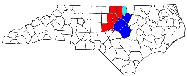
| |||||||||||||||||||||||||||||||||||||||||||||||||||||||||||||||||||||||||||||||||||||||||||||||||||||||||||||||||||||||||||||||
Template:North Carolina cities and mayors of 100,000 population
| This page uses content from the English language Wikipedia. The original content was at Raleigh, North Carolina. The list of authors can be seen in the page history. As with this Familypedia wiki, the content of Wikipedia is available under the Creative Commons License. |