| Main | Births etc |
|---|
| Rahway, New Jersey | |
|---|---|
| — City — | |
| City of Rahway | |
 |
|
 |
|
 |
|
| Coordinates: Coordinates: [1][2] | |
| Country | |
| State | |
| County | Union |
| Incorporated | April 19, 1858 |
| Government[3] | |
| • Type | Faulkner Act (Mayor-Council) |
| • Mayor | Samson Steinman (term ends December 31, 2015)[4][5] |
| • Clerk | Jeffrey J. Jotz[6] |
| Area[1] | |
| • Total | 4.028 sq mi (10.434 km2) |
| • Land | 3.897 sq mi (10.094 km2) |
| • Water | 0.131 sq mi (0.340 km2) 3.26% |
| Area rank | 297th of 566 in state 13th of 21 in county[1] |
| Elevation[7] | 23 ft (7 m) |
| Population (2010 Census)[8][9][10][11] | |
| • Total | 27,346 |
| • Estimate (2013)[12] | 28,394 |
| • Rank | 84th of 566 in state 6th of 21 in county[13] |
| • Density | 7,016.8/sq mi (2,709.2/km2) |
| • Density rank | 62nd of 566 in state 7th of 21 in county[13] |
| Time zone | Eastern Standard Time (EST) (UTC-5) |
| • Summer (DST) | Eastern (EDT) (UTC-4) |
| ZIP code | 07065[14][15] |
| Area code(s) | 732[16] |
| FIPS code | 3403961530[1][17][18] |
| GNIS feature ID | 0885363[1][19] |
| Website | cityofrahway.com |
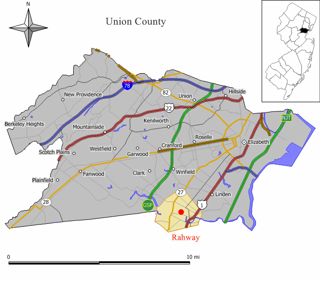
Elm Ave. looking west, Early 1900s
Rahway /ˈrɔːweɪ/ is a city in southern Union County, New Jersey, United States. It is part of the New York metropolitan area, being 21.6 miles (34.8 km) southwest of Manhattan and 5 miles (8.0 km) west of Staten Island. As of the 2010 United States Census, the city's population was 27,346,[8][9][10] reflecting an increase of 846 (+3.2%) from the 26,500 counted in the 2000 Census, which had in turn increased by 1,175 (+4.6%) from the 25,325 counted in the 1990 Census.[20]
History[]
Rahway and the surrounding area were once the home of the Lenni Lenape Native Americans, and tradition states that the city was named after Rahwack, a local tribal chief.[21] Formal European settlement began in 1664 with the purchase by the English from the Lenape of the Elizabethtown Tract, which encompassed lands from the mouth of the Raritan River and included all of present-day Union County as well as parts of Somerset, Middlesex, Morris and Essex counties. The Seventeenth Century Clark House is one of the oldest buildings in the state.[22]
Rahway saw action during the American Revolutionary War because of its proximity to Staten Island, Elizabethtown and Perth Amboy. In January 1777, rebels were victorious against the British in the Battle of Spanktown, which resulted in the death of some 100 British troops.[23] The battle was named this after Rahway's original name given to it by the first settlers, Spanktown,[21] which is said to have been chosen "because an early settler publicly took his spouse across his knee and chastised her".[24]
The Merchants' and Drovers' Tavern resides at the corner of St. Georges and Westfield Avenues. The earliest buildings at the site date to 1795 and the property remains one of Rahway's most prominent historical landmarks.[25] George Washington visited Rahway during his travel to New York City prior to his presidential inauguration in 1789. A marker across the street from the tavern reads:[26]
- Here, on April 23, 1789, on his way to New York City, Washington
- was received by troops from Elizabethtown and Newark. He was
- entertained at the inn kept by Samuel Smith by gentlemen of the town.
Following the Revolution, Rahway became the home of the first national mint to create a coin bearing the inscription E pluribus unum.[27] A United States Post Office established in Rahway was one of only six in the entire state in 1791.
Rahway grew due to its location along the major stagecoach and later, railroad lines between New York City and Philadelphia, Pennsylvania. The navigable Rahway River, which flows through the city, also aided the city's commercial growth.
As immigrants from Britain, Ireland and Germany streamed into what was then Rahway Township in the 1850s, Rahway became incorporated as a city by an act of the State Legislature on April 19, 1858, from portions of Rahway Township in Union and Woodbridge Township in Middlesex County. In 1860, the portion of Rahway that had been part of Middlesex County was transferred to Union. On March 13, 1861, the remainder of Rahway Township became part of Rahway City. Clark Township was formed from portions of the city on March 23, 1864.[28]
The first municipal elections for the Mayor and Council were conducted on April 19, 1858, and the Council held its first meeting on May 3, 1858. The city's police department and its initial group of four constables were created at that first council meeting.[29]
The city became home to dozens of major manufacturers, including the Regina Music Box Company, Wheatena, Mershon Bros. and, most importantly, Merck & Co., which was established in Rahway in 1903, when George Merck moved his small chemical company to Rahway from New York City.[30] The company remained in Rahway through the presidency of George W. Merck and after.
The national decline in industry after World War II led to the closure of most of Rahway's major manufacturing facilities (except for Merck) and a general deterioration of the city's central business district. Beginning in the late 1990s, the city launched a plan to revitalize the downtown area and authorized the construction of hundreds of new market-rate housing units, a hotel, art galleries and additional retail space.
Geography[]

Rahway is located at (40.607153,-74.280531). According to the United States Census Bureau, Rahway city had a total area of 4.028 square miles (10.434 km2), of which, 3.897 square miles (10.094 km2) of it is land and 0.131 square miles (0.340 km2) of it (3.26%) is water.[1][2]
Rahway is bordered to the Northwest by Clark, to the Northeast by Linden and to the South by Woodbridge Township in Middlesex County.
The city is home to about ten parks. The best-known park is Rahway River Park, which is maintained by Union County, and is also partially located in Clark. The park hosts a number of baseball fields, picnic areas, a lake and a public pool.[31] The park was designed by the Olmsted Brothers in 1922 and its swimming pool, built in 1929, was documented by the Historic American Engineering Record in 1985.[32]

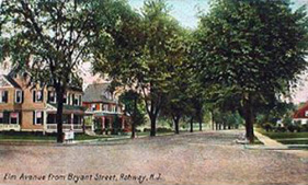
Rahway River and water tower
The Rahway River travels through Rahway, entering from Clark at Rahway River Park. The river receives the waters of Robinsons Branch at Elizabeth Avenue between West Grand Avenue and West Main Street, and then receives the waters of the South Branch at East Hazlewood Avenue and Leesville Avenue. Finally the river leaves Rahway to enter the city limits of Linden and Carteret before flowing into the Arthur Kill.[33]
Climate[]
The climate in this area is characterized by hot, humid summers and generally mild to cool winters. According to the Köppen Climate Classification system, Rahway has a humid subtropical climate, abbreviated "Cfa" on climate maps.[34]
| Climate data for Rahway, New Jersey | |||||||||||||
|---|---|---|---|---|---|---|---|---|---|---|---|---|---|
| Month | Jan | Feb | Mar | Apr | May | Jun | Jul | Aug | Sep | Oct | Nov | Dec | Year |
| Average high °C (°F) | 4 (39) |
4 (40) |
12 (53) |
17 (62) |
26 (79) |
31 (88) |
33 (91) |
30 (86) |
28 (82) |
21 (69) |
13 (55) |
4 (40) |
18.5 (65.3) |
| Average low °C (°F) | −6 (22) |
−4 (25) |
0 (32) |
4 (40) |
11 (52) |
16 (61) |
18 (65) |
18 (64) |
14 (57) |
7 (45) |
3 (38) |
−4 (25) |
6.6 (43.8) |
| Precipitation mm (inches) | 74 (2.9) |
71 (2.8) |
97 (3.8) |
97 (3.8) |
97 (3.8) |
86 (3.4) |
122 (4.8) |
107 (4.2) |
94 (3.7) |
76 (3) |
94 (3.7) |
89 (3.5) |
1,102 (43.4) |
| Source: Weatherbase [35] | |||||||||||||
Demographics[]
| Historical populations | |||
|---|---|---|---|
| Census | Pop. | %± | |
| 1860 | 7,130 | ||
| 1870 | 6,258 | * | −12.2% |
| 1880 | 6,455 | 3.1% | |
| 1890 | 7,105 | 10.1% | |
| 1900 | 7,935 | 11.7% | |
| 1910 | 9,337 | 17.7% | |
| 1920 | 11,042 | 18.3% | |
| 1930 | 16,011 | 45.0% | |
| 1940 | 17,498 | 9.3% | |
| 1950 | 21,290 | 21.7% | |
| 1960 | 27,699 | 30.1% | |
| 1970 | 29,114 | 5.1% | |
| 1980 | 26,723 | −8.2% | |
| 1990 | 25,325 | −5.2% | |
| 2000 | 26,500 | 4.6% | |
| 2010 | 27,346 | 3.2% | |
| Est. 2013 | 28,394 | [12] | 7.1% |
| Population sources: 1860-1920[36] 1860-1960[37] 1860-1870[38] 1870[39] 1890-1910[40] 1860-1930[41] 1900-1990[42] 2000[43][44] 2010[8][9][10] * = Lost territory in previous decade.[28] | |||
Census 2010[]
As of the 2010 United States Census, there were 27,346 people, 10,533 households, and 6,815 families residing in the city. The population density was 7,016.8 inhabitants per square mile (2,709.2 /km2). There were 11,300 housing units at an average density of 2,899.5 per square mile (1,119.5 /km2). The racial makeup of the city was 52.30% (14,301) White, 30.93% (8,457) African American, 0.31% (84) Native American, 4.30% (1,175) Asian, 0.02% (5) Pacific Islander, 8.37% (2,288) from other races, and 3.79% (1,036) from two or more races. Hispanic or Latino of any race were 23.52% (6,433) of the population.[8]
There were 10,533 households out of which 28.1% had children under the age of 18 living with them, 42.4% were married couples living together, 16.8% had a female householder with no husband present, and 35.3% were non-families. 29.5% of all households were made up of individuals and 11.2% had someone living alone who was 65 years of age or older. The average household size was 2.58 and the average family size was 3.23.[8]
In the city the population was spread out with 21.8% under the age of 18, 8.5% from 18 to 24, 28.6% from 25 to 44, 27.5% from 45 to 64, and 13.5% who were 65 years of age or older. The median age was 38.8 years. For every 100 females there were 91.1 males. For every 100 females age 18 and over, there were 87.1 males.[8]
The Census Bureau's 2006-2010 American Community Survey showed that (in 2010 inflation-adjusted dollars) median household income was $58,551 (with a margin of error of +/- $3,355) and the median family income was $77,268 (+/- $9,506). Males had a median income of $56,572 (+/- $3,375) versus $47,832 (+/- $3,542) for females. The per capita income for the city was $28,855 (+/- $1,981). About 5.4% of families and 8.7% of the population were below the poverty line, including 10.9% of those under age 18 and 9.4% of those age 65 or over.[45]
Census 2000[]
As of the 2000 United States Census[17] there were 26,500 people, 10,028 households, and 6,728 families residing in the city. The population density was 6,642.7 people per square mile (2,564.3/km2). There were 10,381 housing units at an average density of 2,602.2 per square mile (1,004.5/km2). The racial makeup of the city was 60.19% White, 27.07% African American, 0.16% Native American, 3.58% Asian, 0.05% Pacific Islander, 5.62% from other races, and 3.33% from two or more races. Hispanic or Latino of any race were 13.87% of the population.[43][44]
There were 10,028 households out of which 30.0% had children under the age of 18 living with them, 46.7% were married couples living together, 15.6% had a female householder with no husband present, and 32.9% were non-families. 28.0% of all households were made up of individuals and 11.7% had someone living alone who was 65 years of age or older. The average household size was 2.63 and the average family size was 3.24.[43][44]
In the city the population was spread out with 23.9% under the age of 18, 7.8% from 18 to 24, 32.0% from 25 to 44, 21.8% from 45 to 64, and 14.5% who were 65 years of age or older. The median age was 37 years. For every 100 females there were 91.2 males. For every 100 females age 18 and over, there were 86.5 males.[43][44]
The median income for a household in the city was $50,729, and the median income for a family was $61,931. Males had a median income of $41,047 versus $32,091 for females. The per capita income for the city was $22,481. About 5.4% of families and 7.1% of the population were below the poverty line, including 9.3% of those under age 18 and 8.2% of those age 65 or over.[43][44]
Government[]


Rahway City Hall
Local government[]
The City of Rahway is governed under the Faulkner Act system of municipal government under the Mayor-Council (Plan F), implemented as of January 1, 1955, based on the recommendations of a Charter Study Commission.[46]
Under the City of Rahway's form of government, all executive and administrative authority is vested in the office of the Mayor who appoints the Business Administrator and department directors. The Business Administrator develops an annual budget for the city, manages the city's departments and oversees its employees. This form of government gives citizens a centralized line of authority for the efficient management of the city’s business.[47] There are nine members of the Municipal Council, all elected to four-year terms of office. Six members of the council are elected from each of six wards. The other three members are elected to represent the entire city at large, and come up for election at the same time as the mayor two years after the ward seats are up for election.[3][48]
As of 2014, the mayor of Rahway is Samson Steinman (D), who was appointed to the position following the resignation of Rick Proctor, whose term of office was to have extended until December 31, 2014.[4][49] Members of the Municipal Council are Council President David Brown (Fourth Ward; D, 2016), James Baker (At Large; D, 2014), Robert "Bob" Bresenhan, Jr. (Second Ward; D, 2016), Rodney Farrar (First Ward; D, 2016), Raymond A. Giacobbe, Jr. (Sixth Ward; D, 2016), Jennifer Wenson Maier (Fifth Ward; D, 2016), Salvatore Mione (At Large; D, 2014), Nancy Saliga (At Large; D, 2014) and Jerry Scaturo (Third Ward; D, 2016).[50][51][52][53][54][55]
Federal, state and county representation[]

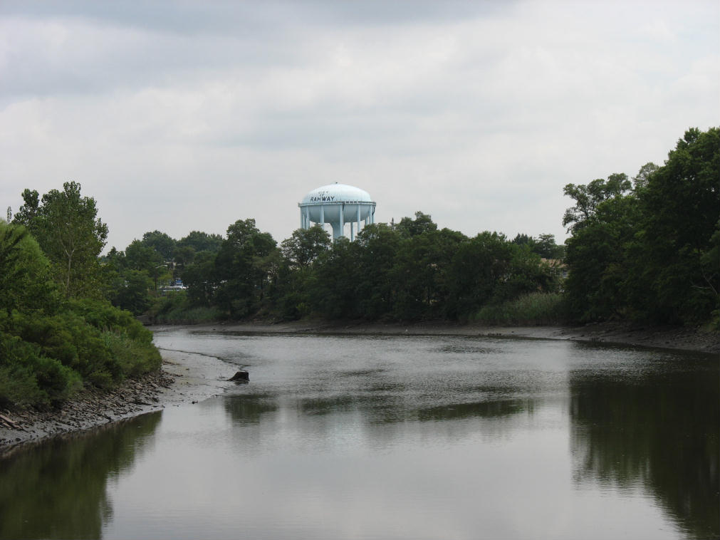
The New Jersey state motor vehicle commission in Rahway.
Rahway is located in the 10th Congressional District[56] and is part of New Jersey's 22nd state legislative district.[9][57][58]
New Jersey's Tenth Congressional District is represented by Donald M. Payne (D, Newark). New Jersey is represented in the United States Senate by Frank Lautenberg (D, Cliffside Park) and Bob Menendez (D, Hoboken).
Template:NJ Legislative 22 The Governor of New Jersey is Chris Christie (R, Mendham).[59] The Lieutenant Governor of New Jersey is Kim Guadagno (R, Monmouth Beach).[60]
Union County is governed by a Board of Chosen Freeholders, whose nine members are elected at-large to three-year terms of office on a staggered basis with three seats coming up for election each year.[61] As of 2011, Union County's Freeholders are Chairman Deborah P. Scanlon (Union, term ends December 31, 2012)[62], Vice Chairman Alexander Mirabella (Fanwood, 2012)[63], Linda Carter (Plainfield, 2013)[64], Angel G. Estrada (Elizabeth, 2011)[65], Christopher Hudak (Linden, 2011)[66], Mohamed S. Jalloh (Roselle, 2012)[67], Bette Jane Kowalski (Cranford, 2013)[68], Daniel P. Sullivan (Elizabeth, 2013)[69] and Nancy Ward (Linden, 2011).[70][71]
Politics[]
As of March 23, 2011, there were a total of 15,719 registered voters in Rahway, of which 7,159 (45.5% vs. 41.8% countywide) were registered as Democrats, 1,675 (10.7% vs. 15.3%) were registered as Republicans and 6,880 (43.8% vs. 42.9%) were registered as Unaffiliated. There were 5 voters registered to other parties.[72] Among the city's 2010 Census population, 57.5% (vs. 53.3% in Union County) were registered to vote, including 73.5% of those ages 18 and over (vs. 70.6% countywide).[72][73]
In the 2012 presidential election, Democrat Barack Obama received 8,413 votes here (74.7% vs. 66.0% countywide), ahead of Republican Mitt Romney with 2,648 votes (23.5% vs. 32.3%) and other candidates with 107 votes (0.9% vs. 0.8%), among the 11,269 ballots cast by the city's 16,730 registered voters, for a turnout of 67.4% (vs. 68.8% in Union County).[74][75] In the 2008 presidential election, Democrat Barack Obama received 8,340 votes here (69.8% vs. 63.1% countywide), ahead of Republican John McCain with 3,410 votes (28.5% vs. 35.2%) and other candidates with 115 votes (1.0% vs. 0.9%), among the 11,944 ballots cast by the city's 16,039 registered voters, for a turnout of 74.5% (vs. 74.7% in Union County).[76] In the 2004 presidential election, Democrat John Kerry received 6,512 votes here (63.1% vs. 58.3% countywide), ahead of Republican George W. Bush with 3,668 votes (35.5% vs. 40.3%) and other candidates with 92 votes (0.9% vs. 0.7%), among the 10,326 ballots cast by the city's 14,471 registered voters, for a turnout of 71.4% (vs. 72.3% in the whole county).[77]
In the 2009 gubernatorial election, Democrat Jon Corzine received 3,961 ballots cast (57.4% vs. 50.6% countywide), ahead of Republican Chris Christie with 2,451 votes (35.5% vs. 41.7%), Independent Chris Daggett with 366 votes (5.3% vs. 5.9%) and other candidates with 68 votes (1.0% vs. 0.8%), among the 6,895 ballots cast by the city's 15,842 registered voters, yielding a 43.5% turnout (vs. 46.5% in the county).[78]
Education[]
The Rahway Public Schools serve students in pre-Kindergarten through twelfth grade. As of the 2011-12 school year, the district's six schools had an enrollment of 3,858 students and 294.8 classroom teachers (on an FTE basis), for a student–teacher ratio of 13.09:1.[79] Schools in the district (with 2011-12 enrollment data from the National Center for Education Statistics[80]) are four PreK-6 elementary schools (which had been PreK-5 until 2011) — Grover Cleveland School[81] (343 students), Franklin School[82] (564), Madison School[83] (308) and Roosevelt School[84] (665) — Rahway 7th & 8th Grade Academy[85] (845) for grades 7-8 and Rahway High School[86] (1,133) for grades 9-12.[87][88]
Transportation[]
Highways[]
The city had a total of 73.67 miles (118.56 km) of roadways, of which 59.18 miles (95.24 km) are maintained by the municipality, 10.45 miles (16.82 km) by Union County and 4.04 miles (6.50 km) by the New Jersey Department of Transportation.[89]
Rahway is served by U.S. Route 1/9, and Route 27. The city is sandwiched between the Garden State Parkway and the New Jersey Turnpike, which are each located about two miles outside of the city limits.
Public transportation[]
New Jersey Transit 115 route provides local service and interstate service to and from the Port Authority Bus Terminal in Midtown Manhattan, with service on the 62 line to Elizabeth, Perth Amboy and Newark.[90]
Rahway Train Station[91] serves New Jersey Transit's North Jersey Coast Line and Northeast Corridor Line.[92][93] The City of Rahway and New Jersey Transit helped fund a $16 million renovation for the station in 1999 and a public plaza in front of the station was completed in 2001, changes that have spurred cleanup and revitalization downtown.[94] A new US$11.2 million 524-space parking deck opened across the street from the station in January 2005, helping train commuters and allowing the city to transform old parking lot space into new buildings and residences.[95] A typical train ride to New York City’s Pennsylvania Station takes 40 minutes.
Airport[]
Newark Liberty International Airport is located 10.2 miles (16.4 km) northeast of Rahway, approximately a 20-minute drive by car.[96]
Downtown revitalization[]
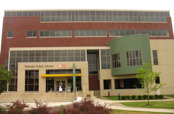

Rahway Public Library, 2006
Beginning in the early 1990s and continuing through the present day, the City of Rahway has rebounded as its downtown began to see the construction of new restaurants, art galleries, market-rate housing and the old Rahway Theatre reopening as the Union County Performing Arts Center. The theater underwent a $6.2-million renovation and expansion project, completed in 2007. As part of the expansion, the facility was purchased by the County of Union for $1.3 million and leased back for $1 a year.[97]
In September 1999, remnants of Hurricane Floyd swept across New Jersey and caused severe damage. The Rahway Public Library was on a flood plain and suffered over US$1 million in flood damage. The building was demolished in October 2001 and a new library was constructed and opened on March 22, 2004, behind the city's municipal building along a less flood-prone area of the Rahway River.[98] The area where the former Rahway Public Library was now contains tennis courts and a small playground.
East Jersey State Prison[]
East Jersey State Prison, formerly known as Rahway State Prison, actually is located in Woodbridge Township at the border with Rahway. The prison's mailing address is in Rahway, leading many to believe the facility was located there. The prison's official name was changed to East Jersey State Prison as of November 30, 1988, at the request of the citizens of Rahway.[99] East Jersey State Prison is seen at the beginning of the movie, Ocean's Eleven, starring George Clooney. The 1978 documentary Scared Straight was filmed there as was the 1989 movie Lock Up, starring Sylvester Stallone and the prison was briefly mentioned in John Sayles City of Hope (1991).[100]
Notable people[]
People who were born in, residents of, or otherwise closely associated with Rahway include:
- Juliette Atkinson (1873-1944), Hall of Fame tennis player and three-time U.S. Open champion.[101]
- Clifford P. Case (1904–1982), Representative of the Sixth District of New Jersey in the House of Representatives (1945–1954), United States Senator (R-N.J.) 1955-1979.[102]
- Abraham Clark (1725–1794), signer of the Declaration of Independence, is buried at the Rahway Cemetery.[103]
- Earl Clark (born 1988), McDonald's High School All-American basketball player who attended the University of Louisville.[104]
- Joseph T. Crowell (1817–1891), Speaker of the New Jersey General Assembly and President of the New Jersey Senate.[105]
- Amos Noë Freeman (1809-1893), abolitionist, educator and Presbyterian minister.[106]
- Milton Friedman (1912–2006), economist and Nobel Prize winner.[107]
- Leighton Gage (1942-2013), author of crime fiction.[108]
- Antonio Garay (born 1979), defensive tackle for the San Diego Chargers.[109]
- Wayne Gilchrest (born 1946), U.S. Congressman.[110]
- Jerome Kagan (born 1929), professor emeritus of psychology at Harvard University who was one of the pioneers of developmental psychology.[111]
- Janis Karpinski (born 1953), one of the first women Brigadier Generals of the Army and former commander of the Abu Ghraib Prison in Iraq.[112]
- William H. Lash (1961–2006), the Assistant Secretary of Commerce for Market Access and Compliance from 2001 to 2005.[113]
- Dory Previn (1925-2012), lyricist and singer-songwriter, born here (as Dorothy Veronica Langan).[114]
- Pearl Reaves, R&B singer and guitarist, started her career in Rahway.[115]
- Freddie Russo (1924–1987), professional boxer.[116]
- Eric Roberson (born 1976), R&B and soul singer-songwriter.[117]
- Carl Sagan (1934–1996), astronomer; winner of Pulitzer Prize for General Non-Fiction Writing in 1978.[118]
- Chris Smith (born 1953), U.S. Congressman.[119]
- Dexter Strickland (born 1990), McDonald's High School All-American basketball player who attended the University of North Carolina at Chapel Hill basketball player.[120]
- Kurt Sutter (born 1966), screenwriter, director, producer and actor.[121]
- Nikola Tesla (1856–1943), formed his company, Tesla Electric Light & Manufacturing, in Rahway.[122]
- Kevin M. Tucker (1940-2012), Commissioner of the Philadelphia Police Department from 1986 to 1988.[123]
- Allan Vache (born 1953), jazz clarinetist and younger brother of Warren Vache.[124]
- Warren Vache (born 1951), jazz cornetist and veteran of the groups of Benny Goodman, Rosemary Clooney, Benny Carter, Annie Ross and many other jazz notables.[124][125]
- Dr. P. Roy Vagelos (born 1929), retired Merck & Co. CEO.[126]
- Carolyn Wells (1862–1942), author and poet.[127]
- Emmanuel Yarborough (born 1964), 1995 USA World Sumo Champion.[128]
References[]
- ^ a b c d e f Gazetteer of New Jersey Places, United States Census Bureau. Accessed June 14, 2013.
- ^ a b "US Gazetteer files: 2010, 2000, and 1990". United States Census Bureau. 2011-02-12. http://www.census.gov/geo/www/gazetteer/gazette.html. Retrieved 2011-04-23.
- ^ a b 2012 New Jersey Legislative District Data Book, Rutgers University Edward J. Bloustein School of Planning and Public Policy, March 2013, p. 98.
- ^ a b Khavkine, Richard. "Rahway Mayor Rick Proctor resigns post after 32 turbulent months", The Star-Ledger, September 11, 2013. Accessed September 14, 2013. "With a single-sentence resignation letter, Rick Proctor has ended his tumultuous 32-month tenure as mayor of Rahway, effective immediately.... Council president Samson Steinman, a one-time political ally but more recently a frequent Proctor adversary, has been named acting mayor."
- ^ 2013 New Jersey Mayors Directory, New Jersey Department of Community Affairs. Accessed September 14, 2013. As of date accessed, Richard Proctor was listed as mayor with a term-end date of December 31, 2015.
- ^ Municipal Clerk, City of Rahway. Accessed July 6, 2012.
- ^ USGS GNIS: City of Rahway , Geographic Names Information System. Accessed March 11, 2013.
- ^ a b c d e f DP-1 - Profile of General Population and Housing Characteristics: 2010 Demographic Profile Data for Rahway city, Union County, New Jersey, United States Census Bureau. Accessed May 20, 2012.
- ^ a b c d Municipalities Grouped by 2011-2020 Legislative Districts, New Jersey Department of State, p. 9. Accessed January 6, 2013.
- ^ a b c Table DP-1. Profile of General Demographic Characteristics: 2010 for Rahway city, New Jersey Department of Labor and Workforce Development. Accessed May 20, 2012.
- ^ 2010 Census Populations: Union County, Asbury Park Press. Accessed May 20, 2012.
- ^ a b PEPANNRES - Annual Estimates of the Resident Population: April 1, 2010 to July 1, 2013 - 2013 Population Estimates for New Jersey municipalities, United States Census Bureau. Accessed June 16, 2014.
- ^ a b GCT-PH1 Population, Housing Units, Area, and Density: 2010 - State -- County Subdivision from the 2010 Census Summary File 1 for New Jersey, United States Census Bureau. Accessed September 19, 2012.
- ^ Look Up a ZIP Code for Rahway, NJ, United States Postal Service. Accessed May 20, 2012.
- ^ Zip Codes, State of New Jersey. Accessed September 14, 2013.
- ^ Area Code Lookup - NPA NXX for Rahway, NJ, Area-Codes.com. Accessed September 14, 2013.
- ^ a b "American FactFinder". United States Census Bureau. http://factfinder2.census.gov. Retrieved 2008-01-31.
- ^ A Cure for the Common Codes: New Jersey, Missouri Census Data Center. Accessed May 20, 2012.
- ^ "US Board on Geographic Names". United States Geological Survey. 2007-10-25. http://geonames.usgs.gov. Retrieved 2008-01-31.
- ^ Table 7. Population for the Counties and Municipalities in New Jersey: 1990, 2000 and 2010, New Jersey Department of Labor and Workforce Development, February 2011. Accessed July 6, 2012.
- ^ a b "Rahway" from the Encyclopædia Britannica Eleventh Edition of 1911, accessed January 3, 2007.
- ^ History, Dr. Wm. Robinson Plantation Museum. Accessed May 22, 2103.
- ^ History, City of Rahway. Accessed November 20, 2012. "In January 1777, the Battle of Spanktown was fought on St. Georges Avenue in the vicinity of Robinson’s Branch and the North Branch of the Rahway River. The battle lasted twelve hours with the rebels getting the best of the British, who lost almost one hundred men."
- ^ Staff. "The Battle of Spanktown; Early History of Rahway and Its Environs", The New York Times, February 21, 1897. Accessed November 20, 2012. "The Rahway of to-day is what was known in the last century as Spanktown, the name having been given because an early settler publicly took his spouse across his knee and chastised her."
- ^ The Merchants and Drovers Tavern: Historical background, Merchants' and Drovers' Tavern. Accessed June 7, 2006.
- ^ Tavern - Merchants & Drovers Tavern, Rahway, Art & Architecture of New Jersey, Stockton University. Accessed May 20, 2012.
- ^ Hill, Raven. "Colonial coin found at old home in Franklin", Home News Tribune, April 13, 2003. Accessed May 20, 2012. "It turned out to be a New Jersey Copper, minted in Rahway or Morristown between 1786 and 1790, the first coins to bear the national motto, 'E Pluribus Unum.'"
- ^ a b Snyder, John P. The Story of New Jersey's Civil Boundaries: 1606-1968, Bureau of Geology and Topography; Trenton, New Jersey; 1969. p. 194. Accessed May 20, 2012.
- ^ History, Rahway Police. Accessed May 22, 2013. "The Rahway Police Department was officially established on May 3, 1858, at the first meeting of the city council."
- ^ Staff. "Suitable Site: Albany Merck Plant Targeted for Growth", The Albany Herald, June 14, 1987. "The company launched a manufacturing operation in Rahway, in 1903 where the company headquarters is located today."
- ^ Rahway River Park map, Union County, New Jersey Department of Parks and Community Renewal. Accessed May 20, 2012.
- ^ Yearby, Jean P. (1985). "Rahway River Park, Swimming Pool". Washington, D.C.: Library of Congress. http://lcweb2.loc.gov/pnp/habshaer/nj/nj1000/nj1005/data/nj1005data.pdf.
- ^ SIGNIFICANT HABITATS AND HABITAT COMPLEXES OF THE NEW YORK BIGHT WATERSHED - Arthur Kill Complex, United States Fish and Wildlife Service. Accessed May 22, 2013.
- ^ Climate Summary for Rahway, New Jersey
- ^ "Weatherbase.com". Weatherbase. 2013. http://www.weatherbase.com/weather/weather.php3?s=393782&cityname=Rahway-New-Jersey. Retrieved on October 18, 2013.
- ^ Compendium of censuses 1726-1905: together with the tabulated returns of 1905, New Jersey Department of State, 1906. Accessed May 21, 2013.
- ^ Census of Population: 1960: Characteristics of the population. pt. A, United States Census Bureau, p. 32-12. Accessed September 19, 2012.
- ^ Raum, John O. The History of New Jersey: From Its Earliest Settlement to the Present Time, Volume 1, p. 281, J. E. Potter and company, 1877. Accessed July 29, 2013. "Rahway is divided into four wards. In 1860 the population was 7,130; and in 1870, 6,258. This diminution is caused by the of Clark and Linden townships."
- ^ Staff. A compendium of the ninth census, 1870, p. 259. United States Census Bureau, 1872. Accessed July 29, 2013.
- ^ Thirteenth Census of the United States, 1910: Population by Counties and Minor Civil Divisions, 1910, 1900, 1890, United States Census Bureau, p. 339. Accessed May 20, 2012.
- ^ Fifteenth Census of the United States : 1930 - Population Volume I, United States Census Bureau, p. 712. Accessed May 20, 2012.
- ^ New Jersey Resident Population by Municipality: 1930 - 1990, Workforce New Jersey Public Information Network, backed up by the Internet Archive as of May 2, 2009. Accessed May 20, 2012.
- ^ a b c d e Census 2000 Profiles of Demographic / Social / Economic / Housing Characteristics for Rahway city, United States Census Bureau. Accessed May 20, 2012.
- ^ a b c d e DP-1: Profile of General Demographic Characteristics: 2000 - Census 2000 Summary File 1 (SF 1) 100-Percent Data for Rahway city, New Jersey, United States Census Bureau. Accessed July 6, 2012.
- ^ DP03: Selected Economic Characteristics from the 2006-2010 American Community Survey 5-Year Estimates for Rahway city, Union County, New Jersey, United States Census Bureau. Accessed May 20, 2012.
- ^ "The Faulkner Act: New Jersey's Optional Municipal Charter Law", New Jersey State League of Municipalities, July 2007. Accessed October 16, 2013.
- ^ Mayor and Administration, City of Rahway. Accessed April 14, 2008.
- ^ Municipal Council, City of Rahway. Accessed May 20, 2012.
- ^ Mayor, City of Rahway. Accessed July 30, 2014.
- ^ Municipal Council Members, City of Rahway. Accessed July 30, 2014.
- ^ 2014 Municipal Data Sheet, City of Rahway. Accessed July 30, 2014.
- ^ County Clerk Elections: Kenilworth – Roselle, Union County, New Jersey. Accessed July 30, 2014.
- ^ Union County General Election November 2, 2010, Union County, New Jersey Clerk. Accessed May 22, 2013.
- ^ Union Co 2012 General/School Election November 6, 2012, Union County, New Jersey Clerk. Accessed May 22, 2013.
- ^ Staff. "Giacobbe picked to replace Steinman on Council", NJToday.net, October 8, 2013. Accessed October 16, 2013. "Raymond A. Giacobbe, Jr., of 439 Harbienko Court, was appointed as the Sixth Ward’s new representative when the City Council held a special meeting Tuesday immediately after Rahway Democrats offered his name among three contenders for the spot.Giacobbe, 34, was nominated as councilman to replace Mayor Samson Steinman, who resigned from the governing body when he was named to his current position following the unexpected departure of embattled former Mayor Rick Proctor."
- ^ Plan Components Report, New Jersey Redistricting Commission, December 23, 2011. Accessed January 6, 2013.
- ^ 2012 New Jersey Citizen's Guide to Government, p. 63, New Jersey League of Women Voters. Accessed January 6, 2013.
- ^ Districts by Number for 2011-2020, New Jersey Legislature. Accessed January 6, 2013.
- ^ "About the Governor". New Jersey. http://www.nj.gov/governor/about/. Retrieved 2010-01-21.
- ^ "About the Lieutenant Governor". New Jersey. http://www.nj.gov/governor/lt/. Retrieved 2010-01-21.
- ^ County Government, Union County, New Jersey. Accessed January 6, 2011.
- ^ Vice Chairman Deborah P. Scanlon, Union County, New Jersey. Accessed January 9, 2011.
- ^ Freeholder Alexander Mirabella, Union County, New Jersey. Accessed January 9, 2011.
- ^ Freeholder Linda Carter, Union County, New Jersey. Accessed January 9, 2011.
- ^ Freeholder Angel G. Estrada, Union County, New Jersey. Accessed January 9, 2011.
- ^ Freeholder Christopher Hudak, Union County, New Jersey. Accessed January 9, 2011.
- ^ Freeholder Mohamed S. Jalloh, Union County, New Jersey. Accessed January 9, 2011.
- ^ Freeholder Bette Jane Kowalski, Union County, New Jersey. Accessed January 9, 2011.
- ^ Chairman, Daniel P. Sullivan, Union County, New Jersey. Accessed January 9, 2011.
- ^ Freeholder Nancy Ward, Union County, New Jersey. Accessed January 9, 2011.
- ^ Board of Chosen Freeholders, Union County, New Jersey. Accessed January 9, 2011.
- ^ a b Voter Registration Summary - Union, New Jersey Department of State Division of Elections, March 23, 2011. Accessed May 22, 2013.
- ^ GCT-P7: Selected Age Groups: 2010 - State -- County Subdivision; 2010 Census Summary File 1 for New Jersey, United States Census Bureau. Accessed May 22, 2013.
- ^ Presidential November 6, 2012 General Election Results - Union County, New Jersey Department of State Division of Elections, March 15, 2013. Accessed May 22, 2013.
- ^ Number of Registered Voters and Ballots Cast November 6, 2012 General Election Results - Union County, New Jersey Department of State Division of Elections, March 15, 2013. Accessed May 22, 2013.
- ^ 2008 Presidential General Election Results: Union County, New Jersey Department of State Division of Elections, December 23, 2008. Accessed May 22, 2013.
- ^ 2004 Presidential Election: Union County, New Jersey Department of State Division of Elections, December 13, 2004. Accessed May 22, 2013.
- ^ 2009 Governor: Union County, New Jersey Department of State Division of Elections, December 31, 2009. Accessed May 22, 2013.
- ^ District information for Rahway School District, National Center for Education Statistics. Accessed June 11, 2014.
- ^ School Data for the Rahway Public Schools, National Center for Education Statistics. Accessed July 30, 2014.
- ^ Grover Cleveland School, Rahway Public Schools. Accessed July 29, 2013.
- ^ Franklin School, Rahway Public Schools. Accessed July 29, 2013.
- ^ Madison School, Rahway Public Schools. Accessed July 29, 2013.
- ^ Roosevelt School, Rahway Public Schools. Accessed July 29, 2013.
- ^ Rahway 7th & 8th Grade Academy, Rahway Public Schools. Accessed July 29, 2013.
- ^ Rahway High School, Rahway Public Schools. Accessed July 29, 2013.
- ^ Our Schools, Rahway Public Schools. Accessed July 29, 2013.
- ^ New Jersey School Directory for the Rahway Public Schools, New Jersey Department of Education. Accessed July 29, 2013.
- ^ Union County Mileage by Municipality and Jurisdiction, New Jersey Department of Transportation, May 2010. Accessed July 18, 2014.
- ^ Union county Bus / Rail Connections, New Jersey Transit, backed up by the Internet Archive as of May 22, 2009. Accessed May 20, 2012.
- ^ Rahway station, New Jersey Transit. Accessed October 16, 2013.
- ^ North Jersey Coast Line, New Jersey Transit. Accessed October 16, 2013.
- ^ Northeast Corridor Line, New Jersey Transit. Accessed October 16, 2013.
- ^ Martin, Antoinette. "Can a Face Lift Offer a New Identity?", The New York Times, October 29, 2006. Accessed May 20, 2012. "Rahway’s train station, transformed after a $16 million renovation, is in the heart of its compact downtown, offering commuters a direct trip to Penn Station in Manhattan, about 15 miles northeast of here, or to Penn Station in Newark or to Trenton."
- ^ Russell, Suzanne C. "Rahway parking project on track 524-space deck may open in December", Home News Tribune, July 20, 2004. Accessed May 20, 2012.
- ^ Google Maps - "Rahway" to "EWR" (Newark Liberty International Airport)
- ^ About Us, Union County Performing Arts Center. Accessed May 20, 2012.
- ^ Russell, Suzanne C. "RAHWAY FEMA action closes books on Rahway's flood-damaged library", Home News Tribune, November 14, 1999. Accessed May 20, 2012. "The flood-damaged Rahway Public Library will never reopen at the St. Georges Avenue building because Federal Emergency Management Agency officials have deemed the damage too severe. Instead, a new library and technology center are planned by the city for the 40,000-square-foot SDI Technologies building on Main Street, Rahway officials said."
- ^ Malwitz, Rick. "What's in a name? Plenty if we're talking prison", Home News Tribune, February 15, 2001. Accessed May 20, 2012. "The name was officially changed to East Jersey State Prison Nov. 30, 1988."
- ^ What's in a name? Plenty if we're talking prison, Home News Tribune, February 15, 2001.
- ^ Juliette Atkinson, International Tennis Hall of Fame. Accessed July 30, 2014.
- ^ Staff. "Case: Eisenhower Stalwart and McCarthy Foe; Republican Nominee for Senate Big Vote Getter in Jersey", The New York Times, October 28, 1954. Accessed April 15, 2011. "Clifford P. Case of Rahway is a lean scholarly looking man, whose quiet manner, philosophical speeches and natural inclination for unostentatious campaigning hardly fit the mold of political orthodoxy."
- ^ Staff. "HOUSE OF ABRAHAM CLARK, A SIGNER, WILL BE REBUILT; Duplicate of Rahway Home to Memorialize Him and Two Sons as Revolutionary Patriots", The New York Times, February 6, 1927. Accessed May 20, 2012. "ABRAHAM CLARK, one of the signers of the Declaration of Independence, is to be honored by the erection of a memorial house in his home town, Rahway, N.J."
- ^ Earl Clark, University of Louisville. Accessed June 17, 2009.
- ^ American Ancestry. 4. Albany: Joel Munsell's Sons. 1889. p. 210. http://books.google.com/books?id=XL0UAAAAYAAJ&pg=PA210.
- ^ Washington, Ethel M. Union County's Black Soldiers and Sailors of the Civil War, p. 17. The History Press, 2011. ISBN 1596294469. Accessed September 19, 2012. "Ana Maria Weems escaped slavery through the Underground Railroad with the assistance of Rahway-born Amos Noe Freeman."
- ^ Milton Friedman - Biographical, Nobelprize.org. Accessed August 4, 2013. "When I was a year old, my parents moved to Rahway, N.J., a small town about 20 miles from New York City."
- ^ Slotnik, Daniel E. "Leighton Gage, Crime Novelist, Dies at 71", The New York Times, August 2, 2013. Accessed August 4, 2013. "Leighton Gage was born on May 13, 1942, in Rahway, N.J."
- ^ Antonio Garay, Chicago Bears. Accessed May 17, 2007. "Earned Prep Star All-American and All-New Jersey Group III honors as a senior at Rahway H.S. in Rahway, N.J. after totaling 141 tackles and 10 sacks in his final season... Outstanding wrestler who was tabbed the 275-pound national champion by the National High School Coaches' Association"
- ^ About Wayne, Congressman Wayne Gilchrest. Accessed May 17, 2007. "Born in Rahway, New Jersey, he was the fourth of Elizabeth and Arthur Gilchrest's six boys."
- ^ Kagan, Jerome. An Argument for Mind, p. 4. Yale University Press, 2007. ISBN 9780300126037. Accessed May 30, 2014. "Rahway, New Jersey, a town twenty miles south of New York City, with a population of about twenty thousand in my childhood, had a relatively large working-class population and a small group of Jewish merchants, including my father."
- ^ Copeland, Libby. "Prison Revolt: Brig. Gen. Janis Karpinski Says the Abu Ghraib Investigation Is About Scapegoating, but She's Having None of It", The Washington Post, May 10, 2004. Accessed April 15, 2011. "As a child growing up in Rahway, N.J., Janis Beam once tried to jump from her second-story window because it didn't seem that far down."
- ^ Rahway, New Jersey Native, William H. Lash III Appointed as Assistant Secretary for Market Access and Compliance at the U.S. Department of Commerce, International Trade Administration Office of Public Affairs, August 30, 2001. Accessed May 22, 2013.
- ^ Weber, Bruce. "Dory Previn, Songwriter, Is Dead at 86", The New York Times, February 14, 2012. May 20, 2012. "Dorothy Veronica Langan was born in New Jersey — sources differ on the town, Rahway or Woodbridge — on Oct. 22, 1925, and she grew up in Woodbridge."
- ^ (December 1985) "Pearl Reaves". Women, Whiskey and... (15): 25-27.
- ^ Freddie Russo, New Jersey Boxing Hall of Fame. Accessed May 22, 2013. "Freddie Russo was born in Brooklyn, New York on October 3, 1924. His family moved to Rahway, New Jersey and that city became the home base for one of the classiest boxer-punchers of that era."
- ^ Jordan, Chris. "Rahway's Eric Roberson heads to L.A. for a possible Grammy", Courier News (New Jersey), January 30, 2010. Accessed December 28, 2010.
- ^ Oral history interview with Carl Sagan, 1991 August 27., American Institute of Physics. Accessed May 22, 2013.
- ^ Chris Smith, Biographical Directory of the United States Congress. Accessed June 5, 2007.
- ^ Prunty, Brendan. "Rahway's Dexter Strickland enjoying quick basketball baptism with North Carolina", The Star-Ledger, November 19, 2009. Accessed April 23, 2011.
- ^ Staff. "Sagal adds edge to FX's new 'Sons'", Philadelphia Daily News, September 3, 2008. Accessed May 20, 2012. "Created by Kurt Sutter, a New Jersey native whose biography boasts that he was 'raised in the shadow of Rahway prison' and spent much of his childhood indoors, away from people, three feet from a TV screen."
- ^ Cheney, Margaret. "Tesla: Man Out of Time". Accessed June 5, 2007. "The Tesla Electric Light Company was formed, with headquarters at Rahway, New Jersey, and a branch office in New York.
- ^ Warner, Bob. "Former Police Commissioner Kevin M. Tucker dies at 71", The Philadelphia Inquirer, June 20, 2012. Accessed July 6, 2012. "He was one of six children born to Irish immigrants William and Catherine Tucker. The family moved to Rahway, N.J., and Mr. Tucker attended St. Mary High School in Elizabeth."
- ^ a b Staff. "Vaches Now a Brother Act", St. Paul Pioneer Press, April 1, 1993. Accessed December 28, 2010. "The best place to freelance Allan figured is the New York area So he moved back to his and Warren's nearby hometown Rahway NJ."
- ^ Rodriguez, Alex W. "Jazz happenings for the week of Dec. 22", The Star-Ledger, December 22, 2010. Accessed December 28, 2010.
- ^ Johnson, Robert. "Looking Back Is Not an Option", The New York Times, November 28, 2004. Accessed October 19, 2007. "He is also promoting his new book "Medicine, Science and Merck" (Cambridge University Press), written with Louis Galambos, describing his path from son of a luncheonette owner in Rahway, N.J., to leader of a pharmaceutical giant."
- ^ Staff. "CAROLYN WELLS, NOVELIST, DEAD; Noted for Mystery Stories and Nonsense Verse, Also for Children's Works BEGAN WRITING IN RAHWAY Wrote 170 Books by 1937 and 70 Were Mysteries -- Widow of Publisher's Son", The New York Times, March 27, 1942. Accessed May 22, 2013.
- ^ Rourke, Bryan. "At the Black Ships Festival: Saki, sushi, sumo and more", The Providence Journal, July 16, 2009. Accessed December 28, 2010. "Yarbrough, 44, of Rahway, N.J., is visiting Newport this weekend for the Black Ships Festival."
External links[]
- Official municipal web site
- Rahway Public Schools
- Rahway Public Schools's 2009–10 School Report Card from the New Jersey Department of Education
- Data for the Rahway Public Schools, National Center for Education Statistics
- Rahway Center Partnership
- Union County Arts Center
- History of the Rahway Train Station
- City-Data
| |||||||||||||||||||||||

| This page uses content from the English language Wikipedia. The original content was at Rahway, New Jersey. The list of authors can be seen in the page history. As with this Familypedia wiki, the content of Wikipedia is available under the Creative Commons License. |