| Main | Births etc |
|---|
| Potterspury | |

Potterspury | |
| Population | 1,391 |
|---|---|
| OS grid reference | |
| - London | 61 miles (98 km) |
| District | South Northamptonshire |
| Shire county | Northamptonshire |
| Region | East Midlands |
| Country | England |
| Sovereign state | United Kingdom |
| Post town | Towcester |
| Postcode district | NN12 |
| Dialling code | 01908 |
| Police | Northamptonshire |
| Fire | Northamptonshire |
| Ambulance | East Midlands |
| EU Parliament | East Midlands |
| UK Parliament | South Northamptonshire |
| List of places: UK • England • Northamptonshire | |

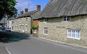
Narrow entrance to the High Street, Potterspury from the A5
Potterspury is a village and civil parish in the district of South Northamptonshire. The nearest main town is Milton Keynes, the centre of which is about 7 miles south-east. At the time of the 2001 census, the parish's population was 1,391 people living in 591 households.[1]
Geography[]
It is on the A5 road, formerly the Roman road of Watling Street between Towcester to the north and Stony Stratford to the south. The village sits at the edge of Whittlewood Forest, an extensive area of ancient woodland to the west and part of the original estate of the Duke of Grafton. Much of the ancient woodland is designated an SSSI for protection from development. Parts of the estate are open to the public in the Spring, but there is a notable absence of footpaths and bridleways within the estate itself.
Nearby villages include Wicken, Deanshanger, Grafton Regis, Alderton and Yardley Gobion, while Stony Stratford is about one mile away to the south. It and Towcester six miles north on the A5 road offer the nearest substantial shopping areas.
Landmarks[]
The parish church is dedicated to St Nicholas and there has been a church on the site since at least 1087, originally granted by Robert de Ferrers, 1st Earl of Derby to Bernard the Scribe.[2]
Facilities[]
There is small shop with post office on the high street near the church, and the village has two pubs, The Talbot (now closed) on the A5 and The Cock on the high street, with a sports and social club at the bottom of Meadow View where Potterspury FC are the village football club and a Village Hall at the end of the High Street.
Education[]


Potterspury Lodge school frontage
Educational provision in the village includes the all-boys' Potterspury Lodge School, which helps children with learning difficulties, and John Hellins Primary School. The latter has about 115 children, aged 4–11. Most leavers go on to Elizabeth Woodville School, formerley Kingsbrook School, in Deanshanger, as their secondary school. John Hellins was a mathematician and astronomer who, as parish priest at Potterspury, founded and taught in the village school.[3]
References[]
- ^ Office for National Statistics: Potterspury CP: Parish headcounts. Retrieved 17 November 2009
- ^ Michael Jones, ‛Ferrers, Robert de, first Earl Ferrers (d. 1139)’, Oxford Dictionary of National Biography, Oxford University Press, 2004 (accessed 28 October 2007).
- ^ "John Hellins Primary School - Inspection Report", Ofsted, 1 March 2007.
External links[]
- Village website
- John Hellins Primary School website.
- Map sources for Potterspury
| This Northamptonshire location article is a stub. You can help by expanding it. |
| This page uses content from the English language Wikipedia. The original content was at Potterspury. The list of authors can be seen in the page history. As with this Familypedia wiki, the content of Wikipedia is available under the Creative Commons License. |