| Main | Births etc |
|---|
| Plainville, Connecticut | |||
|---|---|---|---|
| — Town — | |||
 |
|||
|
|||
 |
|||
| Country | |||
| State | |||
| NECTA | Hartford | ||
| Region | Central Connecticut | ||
| Incorporated | 1869 | ||
| Government | |||
| • Type | Council-manager | ||
| • Town manager | Robert Lee | ||
| • Town council | Kathy Pugliese (R), Chairman Scott D. Saunders (R), Vice-Chairman Danny B. Carrier (R) Quinn E. Christopher (D) Patrick M. Kilby (D) Deborah J. Tompkins (R) Christopher J. Wazorko (D) |
||
| Area | |||
| • Total | 9.8 sq mi (25.3 km2) | ||
| • Land | 9.7 sq mi (25.2 km2) | ||
| • Water | 0.08 sq mi (0.2 km2) | ||
| Elevation | 190 ft (58 m) | ||
| Population (2015) | |||
| • Total | 17,973 | ||
| • Density | 1,800/sq mi (710/km2) | ||
| Time zone | Eastern (UTC-5) | ||
| • Summer (DST) | Eastern (UTC-4) | ||
| ZIP code | 06062 | ||
| Area code(s) | 860 & 959 | ||
| FIPS code | 09-60120 | ||
| GNIS feature ID | 0213488 | ||
| Website | plainvillect.com | ||
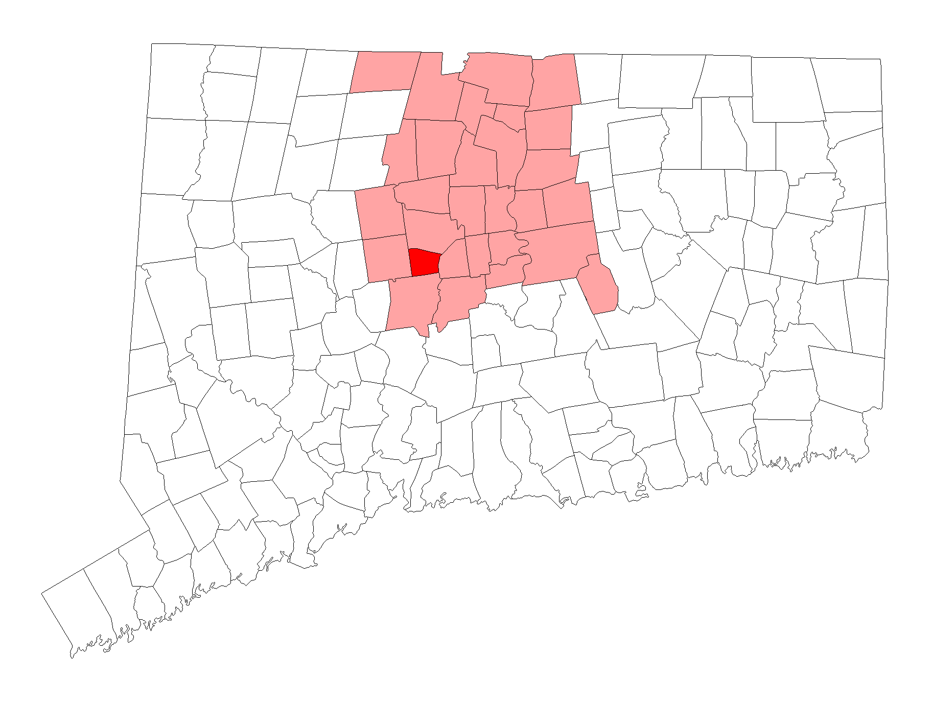
Plainville is a town in Hartford County, Connecticut, United States. The population was 17,716 at the 2010 census.[1]
Geography[]
Pinnacle Rock |
According to the United States Census Bureau, the town has a total area of 25.3 square kilometres (9.8 sq mi), of which 9.7 square miles (25.2 km2) is land and 0.077 square miles (0.2 km2), or 0.72%, is water.[1] The east side of the town is bordered by two prominent peaks of the Metacomet Ridge: Pinnacle Rock and Bradley Mountain. The 51-mile (82 km) Metacomet Trail traverses those peaks.
Government[]
Plainville is run by a Town Manager/Town Council form of government. Robert Lee is the current town manager (as of 2005). The Town Council comprises seven members elected every two years. The Municipal Center is located at 1 Central Square near the center of town.
Demographics[]
| Historical population | ||
|---|---|---|
| Year | Pop. | ±% |
| 1870 | 1,433 | — |
| 1880 | 1,930 | Expression error: Unrecognized punctuation character ",". |
| 1890 | 1,993 | Expression error: Unrecognized punctuation character ",". |
| 1900 | 2,189 | Expression error: Unrecognized punctuation character ",". |
| 1910 | 2,882 | Expression error: Unrecognized punctuation character ",". |
| 1920 | 4,114 | Expression error: Unrecognized punctuation character ",". |
| 1930 | 6,301 | Expression error: Unrecognized punctuation character ",". |
| 1940 | 6,935 | Expression error: Unrecognized punctuation character ",". |
| 1950 | 9,994 | Expression error: Unrecognized punctuation character ",". |
| 1960 | 13,149 | Expression error: Unrecognized punctuation character ",". |
| 1970 | 16,733 | Expression error: Unrecognized punctuation character ",". |
| 1980 | 16,401 | Expression error: Unrecognized punctuation character ",". |
| 1990 | 17,392 | Expression error: Unrecognized punctuation character ",". |
| 2000 | 17,328 | Expression error: Unrecognized punctuation character ",". |
| 2010 | 17,716 | Expression error: Unrecognized punctuation character ",". |
| Source: [2][3][4] | ||
As of the census[5] of 2000, there were 17,328 people, 7,385 households, and 4,645 families residing in the town. The population density was 1,776.0 people per square mile (685.5/km²). There were 7,707 housing units at an average density of 789.9 per square mile (304.9/km²). The racial makeup of the town was 93.52% White, 2.25% African American, 0.17% Native American, 1.67% Asian, 0.01% Pacific Islander, 1.19% from other races, and 1.19% from two or more races. Hispanic or Latino of any race were 3.57% of the population.
There were 7,385 households out of which 26.3% had children under the age of 18 living with them, 49.4% were married couples living together, 10.0% had a female householder with no husband present, and 37.1% were non-families. 31.5% of all households were made up of individuals and 10.4% had someone living alone who was 65 years of age or older. The average household size was 2.32 and the average family size was 2.93.
In the town, the population was spread out with 21.2% under the age of 18, 6.7% from 18 to 24, 32.0% from 25 to 44, 24.8% from 45 to 64, and 15.2% who were 65 years of age or older. The median age was 40 years. For every 100 females there were 95.4 males. For every 100 females age 18 and over, there were 93.1 males.
The median income for a household in the town was $48,136, and the median income for a family was $60,586. Males had a median income of $41,541 versus $31,281 for females. The per capita income for the town was $23,257. About 4.2% of families and 5.1% of the population were below the poverty line, including 4.2% of those under age 18 and 5.5% of those age 65 or over.
Economy[]
Companies and organizations headquartered in Plainville include Carling Technologies, Connecticut Tool & Manufacturing, GE Industrial Solutions, Gems Sensors & Controls, Manafort Brothers, CWPM, Mott Corporation, Tilcon Connecticut, and Wheeler Clinic
The Town of Plainville is one of the only municipalities to own its own airport, Robertson Field.
Education system[]
Plainville has three elementary schools: Louis Toffolon School, Frank T. Wheeler School, and Linden Street School.
There is one middle school, the Middle School of Plainville, which serves grades 6-8. The middle school adopts the same mascot and colors as the town high school.
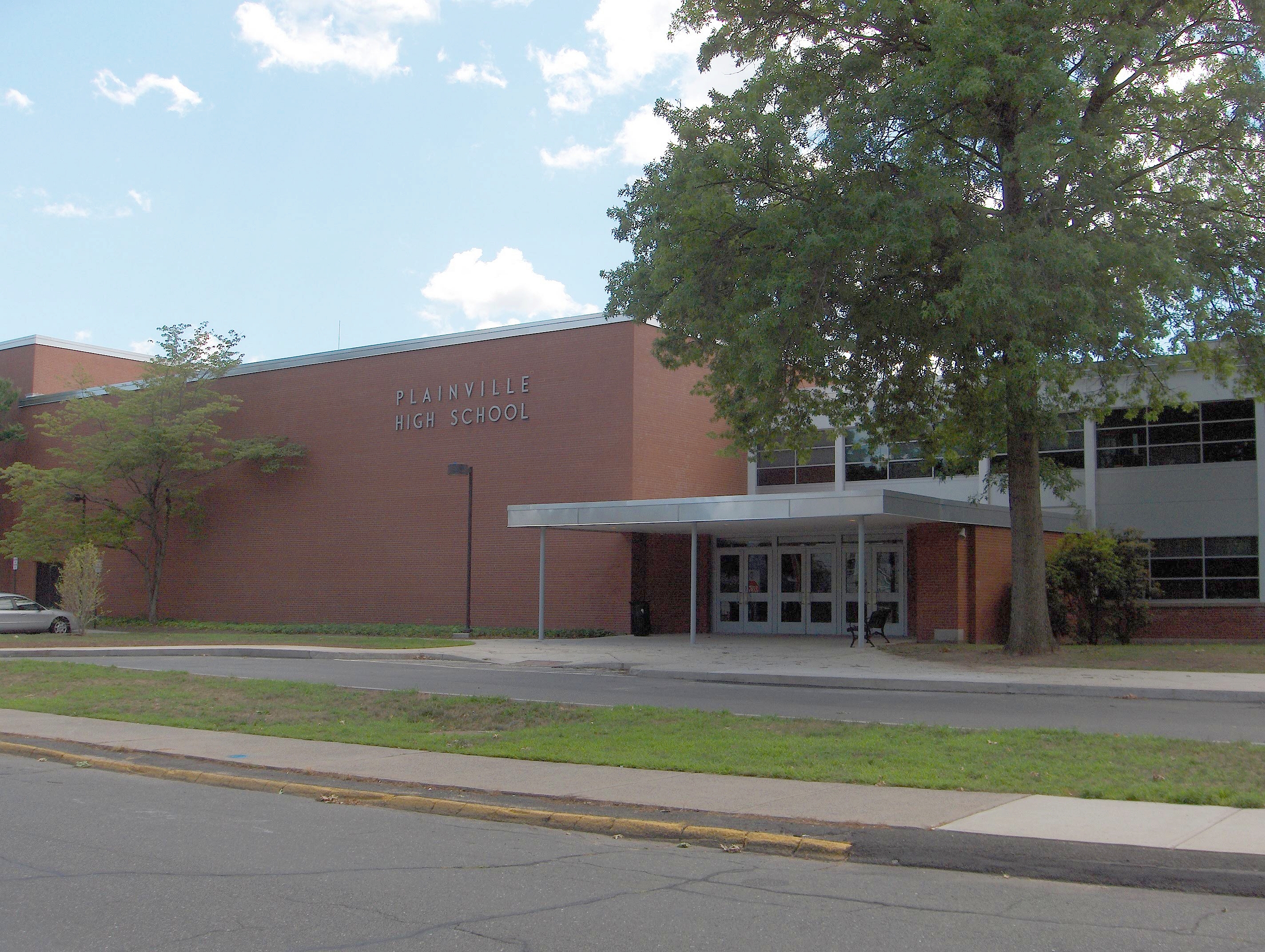
Plainville High School is the only town high school. The school mascot is the Blue Devil, and the colors are blue and white, same as nearby Central Connecticut State University. The baseball team has a rich tradition, with another state title won in 2012.
Culture[]
Plainville holds an annual Hot Air Balloon Festival at the end of August at Norton Park, gathering many of the townspeople together for fun-filled nights of games, music, and fireworks. The event is sponsored by the Plainville Fire Company. However, wanting to improve the soccer fields with an irrigation system at Norton Park, the Plainville Town Council was planning to discontinue the Balloon Festival due to the fire trucks usually parking on the soccer fields. However this did not pass, and the festival continues to operate annually.
Plainville has also been something of a minor transportation hub. In the nineteenth century, Plainville was served by the Farmington Canal. It also sits on the intersection of two rail lines, one running north from New Haven and the other running east-west between Waterbury and Berlin. Finally, Plainville is the home of Robertson Airport, the oldest private airport in Connecticut.
Notable people[]
- Mike and Ted Christopher (1958-), Professional Racecar Drivers
- John Bello (1946-), founder and former CEO of SoBe Beverages; President of NFL Properties
- Niko Koutouvides (1981-), New York Giants
- Anthony Fantano (1986-), Internet/YouTube personality "The Needle Drop"
See also[]
References[]
- ^ a b "Geographic Identifiers: 2010 Demographic Profile Data (G001): Plainville town, Hartford County, Connecticut". U.S. Census Bureau, American Factfinder. http://factfinder2.census.gov/bkmk/table/1.0/en/DEC/10_DP/G001/0600000US0900360120. Retrieved November 28, 2012.
- ^ http://www.sots.ct.gov/RegisterManual/SectionVII/Population1830.htm
- ^ http://www.sots.ct.gov/RegisterManual/SectionVII/Population1900.htm
- ^ http://www.sots.ct.gov/RegisterManual/SectionVII/Population1970.htm
- ^ "American FactFinder". United States Census Bureau. http://factfinder2.census.gov. Retrieved 2008-01-31.
External links[]
| ||||||||||||||||||||
| |||||||||||||

| ||||||||||||||||||||
| This page uses content from the English language Wikipedia. The original content was at Plainville, Connecticut. The list of authors can be seen in the page history. As with this Familypedia wiki, the content of Wikipedia is available under the Creative Commons License. |