| ||||||||||||||
| Phillips County, Arkansas | |
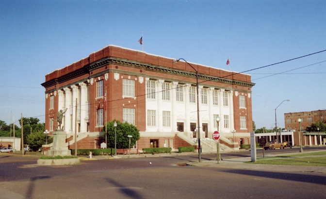 Phillips County courthouse in Helena-West Helena
| |
 Location in the state of Arkansas | |
 Arkansas's location in the U.S. | |
| Founded | May 1, 1820 |
|---|---|
| Named for | Sylvanus Phillips |
| Seat | Helena-West Helena |
| Largest city | Helena-West Helena |
| Area - Total - Land - Water |
727 sq mi (1,883 km²) 696 sq mi (1,803 km²) 32 sq mi (83 km²), 4.4% |
| Population - (2020) - Density |
16,568 |
| Congressional district | 1st |
| Time zone | Central: UTC-6/-5 |
| Website | http://phillipscounty.arkansas.gov/ |
Phillips County is a county located in the eastern part of the U.S. state of Arkansas, in what is known as the Arkansas Delta along the Mississippi River. As of the 2020 census, the population was 16,568.[1] The county seat is Helena–West Helena.[2]
Phillips County is Arkansas's seventh (7th) county, formed on May 1, 1820. It was named for Sylvanus Phillips, the area's first-known white or European-American settler; he was elected as representative to the first Territorial Legislature of the Arkansas Territory. This fertile lowland area was developed for cotton plantations in the antebellum area and is still largely rural and agricultural.
The Helena-West Helena, AR Micropolitan Statistical Area includes all of Phillips County. From September 30-October 1, 1919 during the Elaine race riot in Phillips County, at least 237 African Americans were killed, attacked at large by armed whites trying to suppress the Progressive Farmers and Household Union of America which was organizing in the county. Because the white mob actions were racial terrorism against African Americans, the deaths were classified as lynchings by the Equal Justice Initiative in its 2015 report on lynchings in the South. Based on this, Phillips County ranks as the county with the highest number of lynchings in U.S. history.[3]
Geography[]
According to the U.S. Census Bureau, the county has a total area of 727 square miles (1,880 km2), of which 696 square miles (1,800 km2) is land and 32 square miles (83 km2) (4.4%) is water.[4]
Major highways[]
 U.S. Highway 49
- Highway 1
- Highway 39
- Highway 85
Adjacent counties[]
- Lee County (north)
- Tunica County, Mississippi (northeast)
- Coahoma County, Mississippi (east)
- Bolivar County, Mississippi (southeast)
- Desha County (south)
- Arkansas County (southwest)
- Monroe County (northwest)
National protected areas[]
- St. Francis National Forest (part)
- White River National Wildlife Refuge (part)
Demographics[]
| Historical populations | |||
|---|---|---|---|
| Census | Pop. | %± | |
| 1830 | 1,152 | ||
| 1840 | 3,547 | 207.9% | |
| 1850 | 6,935 | 95.5% | |
| 1860 | 14,877 | 114.5% | |
| 1870 | 15,372 | 3.3% | |
| 1880 | 21,262 | 38.3% | |
| 1890 | 25,341 | 19.2% | |
| 1900 | 26,561 | 4.8% | |
| 1910 | 33,535 | 26.3% | |
| 1920 | 44,530 | 32.8% | |
| 1930 | 40,683 | −8.6% | |
| 1940 | 45,970 | 13.0% | |
| 1950 | 46,254 | 0.6% | |
| 1960 | 43,997 | −4.9% | |
| 1970 | 40,046 | −9.0% | |
| 1980 | 34,772 | −13.2% | |
| 1990 | 28,838 | −17.1% | |
| 2000 | 26,445 | −8.3% | |
| 2010 | 21,757 | −17.7% | |
| Est. 2021 | 15,906 | [1] | −39.9% |
| U.S. Decennial Census[5] 1790–1960[6] 1900–1990[7] 1990–2000[8] 2010–2020[1] | |||


Age pyramid Phillips County[9]
2020 census[]
| Race | Num. | Perc. |
|---|---|---|
| White | 5,541 | 33.44% |
| Black or African American | 10,305 | 62.2% |
| Native American | 38 | 0.23% |
| Asian | 64 | 0.39% |
| Pacific Islander | 4 | 0.02% |
| Other/Mixed | 352 | 2.12% |
| Hispanic or Latino | 264 | 1.59% |
As of the 2020 United States Census, there were 16,568 people, 7,485 households, and 4,836 families residing in the county.
2010 census[]
As of the 2010 census, there were 21,757 people living in the county. 63.1% were Black or African American, 35.0% White, 0.3% Asian, 0.2% Native American, 0.4% of some other race and 0.9% of two or more races. 1.3% were Hispanic or Latino (of any race).
2000 census[]
As of the 2000 census,[11] there were 26,445 people, 9,711 households, and 6,768 families living in the county. The population density was 38 people per square mile (15/km2). There were 10,859 housing units at an average density of 16 per square mile (6/km2). The racial makeup of the county was 59.04% Black or African American, 39.25% White, 0.43% from other races, 0.32% Asian, 0.17% Native American, 0.01% Pacific Islander, and 0.78% from two or more races. 1.44% of the population were Hispanic or Latino of any race. At over 58% of the county's population, Phillips County has the highest percentage of African Americans in the state of Arkansas.[12]
There were 9,711 households, out of which 34.20% had children under the age of 18 living with them, 40.30% were married couples living together, 25.10% had a female householder with no husband present, and 30.30% were non-families. 27.60% of all households were made up of individuals, and 13.00% had someone living alone who was 65 years of age or older. The average household size was 2.69 and the average family size was 3.29.
In the county, the population was spread out, with 32.20% under the age of 18, 9.40% from 18 to 24, 23.20% from 25 to 44, 21.20% from 45 to 64, and 13.90% who were 65 years of age or older. The median age was 33 years. For every 100 females there were 84.70 males. For every 100 females age 18 and over, there were 77.70 males.
The median income for a household in the county was $22,231, and the median income for a family was $26,570. Males had a median income of $24,675 versus $17,520 for females. The per capita income for the county was $12,288. About 28.70% of families and 32.70% of the population were below the poverty line, including 45.50% of those under age 18 and 26.20% of those age 65 or over.
For the period 2000–2009, the Helena-West Helena statistical area lost 20.89% of its population, the largest decline of any statistical area in the country.
Government[]
As a majority-black county, Phillips County is strongly Democratic. It has voted for the Democratic presidential candidate in all but two elections in the last century. Strom Thurmond carried the county in his whites-only Dixiecrat effort in 1948. At that time, Democrats were composed chiefly of conservative whites, as most blacks had been disenfranchised at the turn of the century. Prior to that, they had been affiliated with the Republican Party.
Richard Nixon carried the county in his 1972 landslide. Blacks were not yet voting in full force, following passage of the Voting Rights Act of 1965, as some states and counties continued to have ways to suppress their vote.
| Year | Republican | Democratic | Third party | |||
|---|---|---|---|---|---|---|
| No. | % | No. | % | No. | % | |
| 2020 | 2,417 | 38.72% | 3,623 | 58.04% | 202 | 3.24% |
| 2016 | 2,446 | 35.18% | 4,310 | 61.99% | 197 | 2.83% |
| 2012 | 2,598 | 32.76% | 5,202 | 65.60% | 130 | 1.64% |
| 2008 | 3,097 | 34.53% | 5,695 | 63.50% | 177 | 1.97% |
| 2004 | 3,161 | 35.65% | 5,642 | 63.62% | 65 | 0.73% |
| 2000 | 3,154 | 33.87% | 6,018 | 64.62% | 141 | 1.51% |
| 1996 | 2,205 | 25.73% | 5,715 | 66.69% | 650 | 7.58% |
| 1992 | 2,695 | 27.40% | 6,456 | 65.63% | 686 | 6.97% |
| 1988 | 3,892 | 39.47% | 5,580 | 56.59% | 389 | 3.94% |
| 1984 | 4,686 | 43.70% | 5,946 | 55.45% | 91 | 0.85% |
| 1980 | 4,270 | 38.31% | 6,642 | 59.59% | 234 | 2.10% |
| 1976 | 3,342 | 30.06% | 7,774 | 69.93% | 1 | 0.01% |
| 1972 | 6,235 | 58.90% | 4,283 | 40.46% | 68 | 0.64% |
| 1968 | 2,154 | 18.78% | 5,039 | 43.92% | 4,279 | 37.30% |
| 1964 | 3,963 | 40.48% | 5,818 | 59.43% | 9 | 0.09% |
| 1960 | 2,168 | 32.47% | 4,105 | 61.48% | 404 | 6.05% |
| 1956 | 2,826 | 40.72% | 3,917 | 56.44% | 197 | 2.84% |
| 1952 | 2,592 | 40.88% | 3,741 | 59.01% | 7 | 0.11% |
| 1948 | 351 | 11.33% | 1,018 | 32.85% | 1,730 | 55.82% |
| 1944 | 501 | 19.66% | 2,046 | 80.30% | 1 | 0.04% |
| 1940 | 245 | 9.88% | 2,235 | 90.12% | 0 | 0.00% |
| 1936 | 94 | 3.98% | 2,259 | 95.60% | 10 | 0.42% |
| 1932 | 142 | 4.52% | 2,976 | 94.66% | 26 | 0.83% |
| 1928 | 487 | 19.08% | 2,061 | 80.76% | 4 | 0.16% |
| 1924 | 454 | 19.65% | 1,785 | 77.27% | 71 | 3.07% |
| 1920 | 868 | 30.54% | 1,965 | 69.14% | 9 | 0.32% |
| 1916 | 552 | 27.35% | 1,466 | 72.65% | 0 | 0.00% |
| 1912 | 198 | 15.06% | 926 | 70.42% | 191 | 14.52% |
| 1908 | 393 | 24.65% | 1,194 | 74.91% | 7 | 0.44% |
| 1904 | 251 | 14.83% | 1,434 | 84.75% | 7 | 0.41% |
| 1900 | 388 | 22.23% | 1,349 | 77.31% | 8 | 0.46% |
| 1896 | 815 | 41.20% | 1,085 | 54.85% | 78 | 3.94% |
| 1892 | 1,331 | 45.63% | 1,481 | 50.77% | 105 | 3.60% |
Education[]
School districts serving Phillips County include the Helena-West Helena School District, the Marvell–Elaine School District, and the Barton–Lexa School District.
Previously the Lake View School District served a portion of the county. On July 1, 2004, the Lake View district merged into the Barton–Lexa district. Previously the Elaine School District served another portion of the county. On July 1, 2006, the Elaine district merged into the Marvell district.[14][15]
Marvell Academy, a private school founded in 1966[16] as a segregation academy,[17] is in unincorporated Phillips County, near Marvell.[18]
Communities[]
Cities[]
- Elaine
- Helena–West Helena (county seat)
- Lake View
- Marvell
Town[]
- Lexa
Unincorporated places[]
- Modoc
- Poplar Grove
- Lambrook
Townships[]


Townships in Phillips County, Arkansas as of 2010
Townships in Arkansas are the divisions of a county. Each township includes unincorporated areas and some may have incorporated towns or cities within part of their space. Townships have limited purposes in modern times. However, the US Census does list Arkansas population based on townships (often referred to as "minor civil divisions"). Townships are also of value for historical purposes in terms of genealogical research. Each town or city is within one or more townships in an Arkansas county based on census maps. The townships of Phillips County are listed below with the town(s) and/or city that are fully or partially inside them listed in parentheses.
| Township | FIPS code | ANSI code (GNIS ID) |
Population center(s) |
Pop. (2010) |
Pop. density (/mi2) |
Pop. density (/km2) |
Total area (mi2) |
Total area (km2) |
Land area (mi2) |
Land area (km2) |
Water area (mi2) |
Water area (km2) |
Geographic coordinates |
|---|---|---|---|---|---|---|---|---|---|---|---|---|---|
| Big Creek | 05-90273 | 00068945 | 425 | 11.05 | 4.26 | 38.474 | 99.65 | 38.474 | 99.65 | 0 | 0.000 | ||
| Cleburne | 05-90849 | 00068946 | 660 | 29.12 | 11.24 | 22.692 | 58.77 | 22.665 | 58.70 | 0.027 | 0.06993 | ||
| Cleveland | 05-90870 | 00068947 | 198 | 8.01 | 3.09 | 24.731 | 64.05 | 24.722 | 64.03 | 0.009 | 0.02331 | ||
| Cypress | 05-91005 | 00068948 | 152 | 9.54 | 3.68 | 15.938 | 41.28 | 15.938 | 41.28 | 0 | 0.000 | ||
| Hickory Ridge | 05-91704 | 00068949 | Marvell | 1,550 | 49.89 | 19.26 | 31.10 | 80.55 | 31.066 | 80.46 | 0.034 | 0.08806 | |
| Hicksville | 05-91707 | 00068950 | 231 | 6.99 | 2.70 | 33.046 | 85.59 | 33.046 | 85.59 | 0 | 0.000 | ||
| Hornor | 05-91767 | 00068951 | part of Helena-West Helena | 9,697 | 265.48 | 102.51 | 36.526 | 94.60 | 36.526 | 94.60 | 0 | 0.000 | |
| Lake | 05-92094 | 00068953 | 41 | 0.91 | 0.35 | 50.741 | 131.4 | 44.870 | 116.2 | 5.871 | 15.21 | ||
| Marion | 05-92391 | 00068955 | 589 | 14.42 | 5.57 | 40.865 | 105.8 | 40.846 | 105.8 | 0.019 | 0.04921 | ||
| Mooney | 05-92547 | 00078865 | 179 | 1.70 | 0.66 | 115.059 | 298.0 | 105.231 | 272.5 | 9.828 | 25.45 | ||
| St. Francis | 05-93276 | 00068956 | most of Helena-West Helena | 4,746 | 103.10 | 39.82 | 53.971 | 139.8 | 46.034 | 119.2 | 7.937 | 20.56 | |
| Spring Creek | 05-93462 | 00068958 | Lexa, small part of Lake View | 1,789 | 22.46 | 8.67 | 79.694 | 206.4 | 79.648 | 206.3 | 0.046 | 0.1191 | |
| Tappan | 05-93573 | 00068959 | Elaine, most of Lake View | 1,500 | 8.49 | 3.28 | 184.506 | 477.9 | 176.595 | 457.4 | 7.911 | 20.49 | |
| Source: "Census 2010 U.S. Gazetteer Files: County Subdivisions in Arkansas". U.S. Census Bureau, Geography Division. https://www.census.gov/geo/maps-data/data/docs/gazetteer/county_sub_list_05.txt.
Source: "Census 2010 U.S. Gazetteer Files". U.S. Census Bureau, Geography Division. https://www.census.gov/geo/maps-data/data/gazetteer2010.html. | |||||||||||||
Notable people[]
- Bruce Bennett,[21] Arkansas Attorney General
- Barry Williamson, attorney and member of the Texas Railroad Commission
- Blanche Lincoln, U.S. Senator
- Mark Lavon "Levon" Helm, drummer and singer for The Band
- Robert Lockwood Jr., blues guitarist and singer
- Angie Craig, U.S. Representative from Minnesota
See also[]
- List of lakes in Phillips County, Arkansas
- National Register of Historic Places listings in Phillips County, Arkansas
References[]
- ^ a b c "U.S Census Bureau QuickFacts: Phillips County, Arkansas". https://www.census.gov/quickfacts/phillipscountyarkansas.
- ^ "Find a County". National Association of Counties. http://www.naco.org/Counties/Pages/FindACounty.aspx.
- ^ Robertson, Campbell (February 10, 2015). "History of Lynchings in the South Documents Nearly 4,000 Names". The New York Times. https://www.nytimes.com/2015/02/10/us/history-of-lynchings-in-the-south-documents-nearly-4000-names.html.
- ^ "2010 Census Gazetteer Files". United States Census Bureau. August 22, 2012. http://www2.census.gov/geo/docs/maps-data/data/gazetteer/counties_list_05.txt.
- ^ "U.S. Decennial Census". United States Census Bureau. https://www.census.gov/programs-surveys/decennial-census.html.
- ^ "Historical Census Browser". University of Virginia Library. http://mapserver.lib.virginia.edu.
- ^ Forstall, Richard L., ed (March 27, 1995). "Population of Counties by Decennial Census: 1900 to 1990". United States Census Bureau. https://www.census.gov/population/cencounts/ar190090.txt.
- ^ "Census 2000 PHC-T-4. Ranking Tables for Counties: 1990 and 2000". United States Census Bureau. April 2, 2001. https://www.census.gov/population/www/cen2000/briefs/phc-t4/tables/tab02.pdf.
- ^ Based on 2000 census data
- ^ "Explore Census Data". https://data.census.gov/cedsci/table?g=0500000US05107&tid=DECENNIALPL2020.P2.
- ^ "U.S. Census website". United States Census Bureau. https://www.census.gov.
- ^ "Arkansas Black Population Percentage by County". https://www.indexmundi.com/facts/united-states/quick-facts/arkansas/black-population-percentage#chart.
- ^ "Dave Leip's Atlas of U.S. Presidential Elections". http://uselectionatlas.org/RESULTS/.
- ^ "Consolidation/Annexations of LEA's (1983-2010) Archived 2010-09-24 at the Wayback Machine." Arkansas Department of Education. Retrieved on March 2, 2011.
- ^ "Education Board approves mergers, removes Greenland from fiscal distress". 13 March 2006. http://archives.arkansasnews.com/2006/03/13/education-board-approves-mergers-removes-greenland-from-fiscal-distress/.
- ^ "About Archived 2011-07-14 at the Wayback Machine." Marvell Academy. Retrieved on March 2, 2011.
- ^ "Private Schools: The Last Refuge." TIME. Friday November 14, 1969. Retrieved on March 2, 2011.
- ^ "Marvell Academy Principals." Manta. Retrieved on March 2, 2011. "645 Highway 243 Marvell, AR 72366."
- ^ U. S. Census Bureau. 2011 Boundary and Annexation Survey (BAS): Phillips County, AR (Map). http://www2.census.gov/geo/pvs/bas/bas11/st05_ar/cou/c05107_phillips/BAS11C20510700000_000.pdf.
- ^ "Arkansas: 2010 Census Block Maps - County Subdivision". United States Census Bureau. https://www.census.gov/geo/maps-data/maps/block/2010/cousub/dc10blk_st05_cousub.html#P.
- ^ "Bruce Bennett (1917-1979)". encyclopediaofarkansas.net. http://www.encyclopediaofarkansas.net/encyclopedia/entry-detail.aspx?entryID=1154.
External links[]
- Phillips County, Arkansas entry on the Encyclopedia of Arkansas History & Culture

|
Monroe County | Lee County | Tunica County, Mississippi |
|
| Coahoma County, Mississippi | ||||
 Phillips County, Arkansas | ||||
| Arkansas County | Desha County | Bolivar County, Mississippi |
| ||||||||||||||

|
| This page uses content from the English language Wikipedia. The original content was at Phillips County, Arkansas. The list of authors can be seen in the page history. As with this Familypedia wiki, the content of Wikipedia is available under the Creative Commons License. |