| Main | Births etc |
|---|
| Pasco | |
|---|---|
| — City — | |
| Pasco, Washington | |
 |
|
 |
|
| Country | United States |
| State | Washington |
| County | Franklin |
| Government | |
| • Type | Council-manager |
| • Council | Mayor Matt Watkins[1][2]
Mayor Pro Tem Rebecca Francik Chi Flores[3] Robert Hoffmann Tom Larsen Al Yenney Saul Martinez |
| • City manager | Dave Zabell[4] |
| Area[5] | |
| • City | 34.08 sq mi (88.27 km2) |
| • Land | 30.50 sq mi (78.99 km2) |
| • Water | 3.58 sq mi (9.27 km2) |
| Elevation | 387 ft (118 m) |
| Population (2010)[6] | |
| • City | 59,781 |
| • Estimate (2015)[7] | 69,451 |
| • Density | 1,960.0/sq mi (756.8/km2) |
| • Urban | 210,975 (US: 171th) |
| • Metro | 279,116 (US: 169th) |
| Time zone | Pacific (PST) (UTC-8) |
| • Summer (DST) | PDT (UTC-7) |
| ZIP codes | 99301-99302 |
| Area code | 509 |
| FIPS code | 53-53545 |
| GNIS feature ID | 1513388[8] |
| Website | City of Pasco |
Pasco ( /ˈpæskoʊ/ PAS-koh) is a city in and the county seat of Franklin County, Washington, United States.[9]
Pasco is one of three cities that make up the Tri-Cities region of the state of Washington. The Tri-Cities is a mid-sized metropolitan area of approximately 279,116 people that also includes the cities of Kennewick and Richland in a 2015 estimate.
Pasco's population was 59,781 at the 2010 census and 70,560 as of the April 1, 2016 Washington State Population estimate.
History[]
On October 16, 1805, the Lewis and Clark Expedition camped in the Pasco area, at a site now commemorated by Sacajawea State Park. The area was frequented by fur trappers and gold traders. In the 1880s, the Northern Pacific Railway was built near the Columbia River, bringing many settlers to the area. Pasco was officially incorporated on September 3, 1891. It was named by Virgil Bogue, a construction engineer for the Northern Pacific Railway after Cerro de Pasco,[10] a city in the Peruvian Andes, where he had helped build a railroad. In its early years, it was a small railroad town, but the completion of the Grand Coulee Dam in 1941 brought irrigation and agriculture to the area.

The Franklin County courthouse in Pasco.
Due in large part to the presence of the Hanford Site, the entire Tri-Cities area grew rapidly from the 1940s through 1950s. However, most of the population influx resided in Richland and Kennewick, as Pasco remained primarily driven by the agricultural industry, and to a lesser degree the NP Pasco rail yards. After the end of World War II, the entire region went through several "boom" and "bust" periods, cycling approximately every 10 years and heavily based on available government funding for Hanford-related work. Farming continues to be the economic driver for most of the city's industrial tax base.
In the late 1990s, foreseeing another Hanford-related boom period, several developers purchased large farm circles in Pasco for residential and commercial development. Since that time, Pasco has undergone a transformation that has not only seen its population overtake the neighboring city of Richland, but also has resulted in growth in the city's retail and tourism industries. Recently incorporated land on the West side of the city has exploded into new housing tracts, apartments, and shopping centers. This area of the city has become referred to locally as "West Pasco", distinguishing it from the older area of town to the East. In addition to an influx of new residents to the region, many residents of the Tri-Cities have moved from Richland and Kennewick to West Pasco due to its central location and virtually all-new housing and business.
Geography and climate[]
Pasco is located at (46.238507, -119.108534).[11]
According to the United States Census Bureau, the city has a total area of 34.08 square miles (88.27 km2), of which, 30.50 square miles (78.99 km2) is land and 3.58 square miles (9.27 km2) is water.[5]
As Pasco is located in Southeastern Washington, the city lies in the rain shadow of the Cascade Range. As a result, the area is a windswept desert, receiving little precipitation throughout the year. Hot summers, warm springs, and cold winters provide a stark contrast to other areas of the state.
The massive Columbia River borders the south side of the city, separating it from the neighboring cities of Richland and Kennewick.
| Climate data for Pasco, Washington | |||||||||||||
|---|---|---|---|---|---|---|---|---|---|---|---|---|---|
| Month | Jan | Feb | Mar | Apr | May | Jun | Jul | Aug | Sep | Oct | Nov | Dec | Year |
| Record high °F (°C) | 67 (19) |
68 (20) |
80 (27) |
94 (34) |
101 (38) |
111 (44) |
112 (44) |
111 (44) |
101 (38) |
88 (31) |
77 (25) |
69 (21) |
112 (44) |
| Average high °F (°C) | 42.2 (5.7) |
49.8 (9.9) |
59.5 (15.3) |
67.0 (19.4) |
76.1 (24.5) |
83.3 (28.5) |
93.3 (34.1) |
91.0 (32.8) |
80.9 (27.2) |
66.2 (19.0) |
50.4 (10.2) |
40.9 (4.9) |
67.0 (19.4) |
| Average low °F (°C) | 28.6 (−1.9) |
29.0 (−1.7) |
33.7 (0.9) |
38.2 (3.4) |
46.0 (7.8) |
52.7 (11.5) |
57.6 (14.2) |
56.0 (13.3) |
47.2 (8.4) |
38.8 (3.8) |
31.5 (−0.3) |
26.9 (−2.8) |
40.7 (4.8) |
| Record low °F (°C) | 3 (−16) |
5 (−15) |
15 (−9) |
21 (−6) |
28 (−2) |
37 (3) |
42 (6) |
40 (4) |
1 (−17) |
9 (−13) |
−7 (−22) |
−6 (−21) |
−7 (−22) |
| Precipitation inches (mm) | 0.95 (24.1) |
0.55 (14) |
0.67 (17) |
0.47 (11.9) |
0.74 (18.8) |
0.68 (17.3) |
0.14 (3.6) |
0.18 (4.6) |
0.33 (8.4) |
0.54 (13.7) |
0.76 (19.3) |
1.09 (27.7) |
7.1 (180.3) |
| Snowfall inches (cm) | 0.3 (0.8) |
trace | trace | trace | 0.0 (0) |
0.0 (0) |
0.0 (0) |
0.0 (0) |
0.0 (0) |
0.0 (0) |
1.1 (2.8) |
2.1 (5.3) |
6.1 (15.5) |
| Source: NOAA[12] | |||||||||||||
Demographics[]
| Historical populations | |||
|---|---|---|---|
| Census | Pop. | %± | |
| 1890 | 320 | ||
| 1900 | 254 | −20.6% | |
| 1910 | 2,083 | 720.1% | |
| 1920 | 3,362 | 61.4% | |
| 1930 | 3,496 | 4.0% | |
| 1940 | 3,913 | 11.9% | |
| 1950 | 10,228 | 161.4% | |
| 1960 | 14,522 | 42.0% | |
| 1970 | 13,920 | −4.1% | |
| 1980 | 18,428 | 32.4% | |
| 1990 | 20,337 | 10.4% | |
| 2000 | 32,066 | 57.7% | |
| 2010 | 59,781 | 86.4% | |
| Est. 2016 | 70,560 | [13] | 120.0% |
| source:[14] 2015 Estimate[7] | |||
2010 census[]
As of the census[6] of 2010, there were 59,781 people, 17,983 households, and 13,863 families residing in the city. The population density was 1,960.0 inhabitants per square mile (756.8 /km2). There were 18,782 housing units at an average density of 615.8 per square mile (237.8 /km2). The racial makeup of the city was 55.8% White, 1.9% African American, 0.5% Native American, 1.9% Asian, 0.1% Pacific Islander, 36.4% from other races, and 3.3% from two or more races. Hispanic or Latino of any race were 55.7% of the population.
There were 17,983 households of which 51.3% had children under the age of 18 living with them, 55.1% were married couples living together, 14.9% had a female householder with no husband present, 7.1% had a male householder with no wife present, and 22.9% were non-families. 17.0% of all households were made up of individuals and 5.3% had someone living alone who was 65 years of age or older. The average household size was 3.30 and the average family size was 3.73.
The median age in the city was 27.3 years. 35.5% of residents were under the age of 18; 10.6% were between the ages of 18 and 24; 29.9% were from 25 to 44; 17.2% were from 45 to 64; and 6.7% were 65 years of age or older. The gender makeup of the city was 50.7% male and 49.3% female.
2000 census[]
As of the census of 2000, there were 32,066 people, 9,619 households, and 7,262 families residing in the city. The population density was 1,141.9 people per square mile (440.9/km²). There were 10,341 housing units at an average density of 368.2 per square mile (142.2/km²). The racial makeup of the city was 52.76% White, 3.22% African American, 0.77% Native American, 1.77% Asian, 0.14% Pacific Islander, 37.44% from other races, and 3.9% from two or more races. Hispanic or Latino of any race was 56.26% of the population.
There were 9,619 households out of which 45.6% had children under the age of 18 living with them, 54.7% were married couples living together, 14.3% had a female householder with no husband present, and 24.5% were non-families. 20.1% of all households were made up of individuals and 8.5% had someone living alone who was 65 years of age or older. The average household size was 3.30 and the average family size was 3.79.
In the city, the age distribution of the population shows 35.5% under the age of 18, 11.8% from 18 to 24, 28.5% from 25 to 44, 15.5% from 45 to 64, and 8.7% who were 65 years of age or older. The median age was 27 years. For every 100 females, there were 106.7 males. For every 100 females age 18 and over, there were 104.2 males.
The median income for a household in the city was $34,540, and the median income for a family was $37,342. Males had a median income of $29,016 versus $22,186 for females. The per capita income for the city was $13,404. About 19.5% of families and 23.3% of the population were below the poverty line, including 31.4% of those under age 18 and 9.6% of those age 65 or over.
Government[]
Pasco has the Council-Manager form of government with an elected body of 7 council members, 5 of whom are from specific districts within the city, and 2 elected at-large. The council biennially elects from its own members a mayor that runs meetings, signs certain documents, and acts in ceremonial capacity; and a mayor pro-tem that acts in the mayor's absence. The city manager is chosen by council as a professional administrator and runs day-to-day operations of the city including management of staff. Council members are part-time legislators. Those elected after 2005 receive $900 per month and mayors receive $1,100 a month.
The city also has a number of advisory boards appointed by the council and includes citizen volunteers that give their time and expertise in dealing with issues including parks, senior citizen issues, planning, code enforcement, etc.
Economy[]
Due to the agricultural region in which it sits, several large food processing companies have a presence in the city of Pasco. ConAgra Foods, Reser's Fine Foods, and Twin City Foods are just some of the companies that have chosen to base a part of their operations here. In recent years, the region has become a large player in Washington State's booming wine industry. Gordon Brothers Cellars, Fidelitas Winery, Kamiak Vineyards, and Preston Premium Wines are a few of the local wineries.
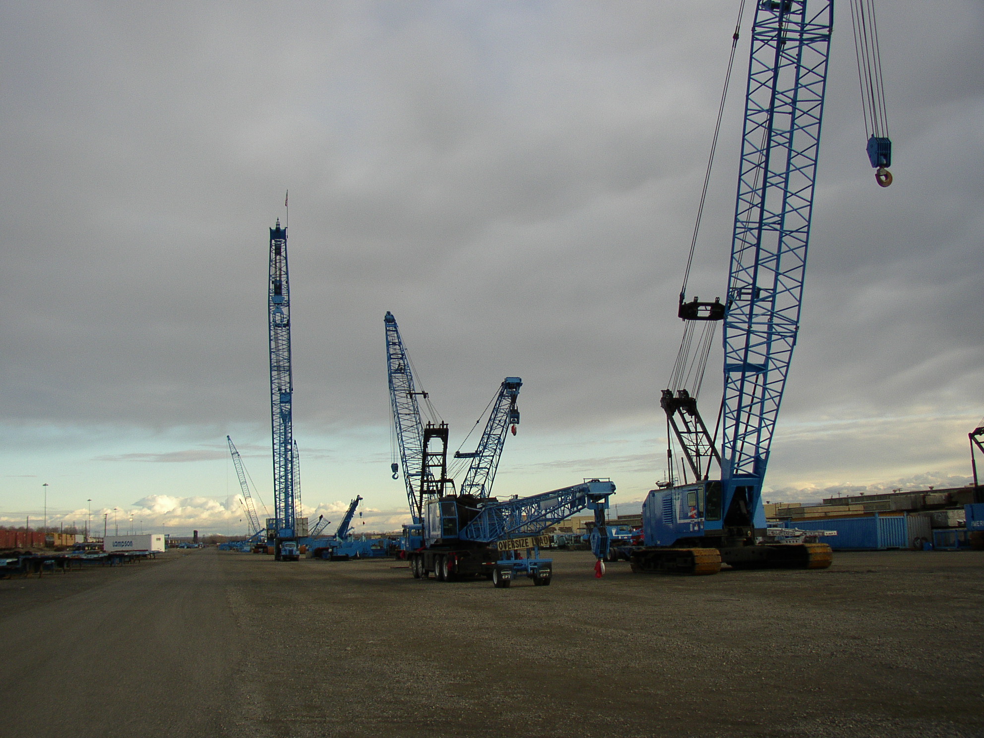

Lampson Crane yard, Port of Big Pasco, in Pasco.
Pasco is home to the Tri-Cities Airport, a regional commercial and private airport served by several airlines with direct flights to nine major US cities: Denver, Las Vegas, Los Angeles, Minneapolis, Phoenix, Portland, Salt Lake City, San Francisco, and Seattle.
The local Amtrak station has been located in Pasco since 1971, when the national rail passenger service was established. Before this, the Northern Pacific operated passenger trains through Pasco.
Additional commercial transportation is also done through extensive barge traffic on the Columbia and Snake rivers. Rail transport is provided by the BNSF Railway. Trucking uses Interstate 182, and to a lesser extent U.S. Route 395.
Some of the biggest Pasco employers include Hanford nuclear facility, Burlington Northern, Lamb Weston, Boise Cascade, Tyson Foods, Energy Northwest, Fluor Hanford Inc., Bechtel National Inc., and Pacific Northwest National Laboratory currently managed by Battelle Memorial Institute
Education[]
Pasco is served by the Pasco School District, Columbia Basin College, and Washington State University Tri-Cities.
Pasco High School is the older of the city's two public high schools, and was the largest in the state before Chiawana was built. The city's second high school—Chiawana High School—opened in August, 2009. Chiawana is currently the largest high school in this area of the state. The Pasco Bulldog school colors are purple and white; the Chiawana Riverhawk school colors are navy blue and silver.
Privately, Pasco and the greater Tri-Cities area is served by Tri-Cities Prep, a Catholic high school off of Road 100, and St. Patrick's grade school next door to the campus of Pasco High School.
With a rapidly growing campus, Columbia Basin College is the largest public two-year community college in Southeastern Washington with a student body of nearly 7,000 students. The college was founded in 1955 and serves students from the entire Tri-Cities region.
There are three middle schools in Pasco, serving students ranging from grade seventh to eight. The easternmost school is Ellen Ochoa Middle School, the westernmost is John McLoughlin Middle School, and the Isaac Stevens Middle School is in the middle.
Recreation[]


Sign for Chiawana Park in Pasco, Washington.
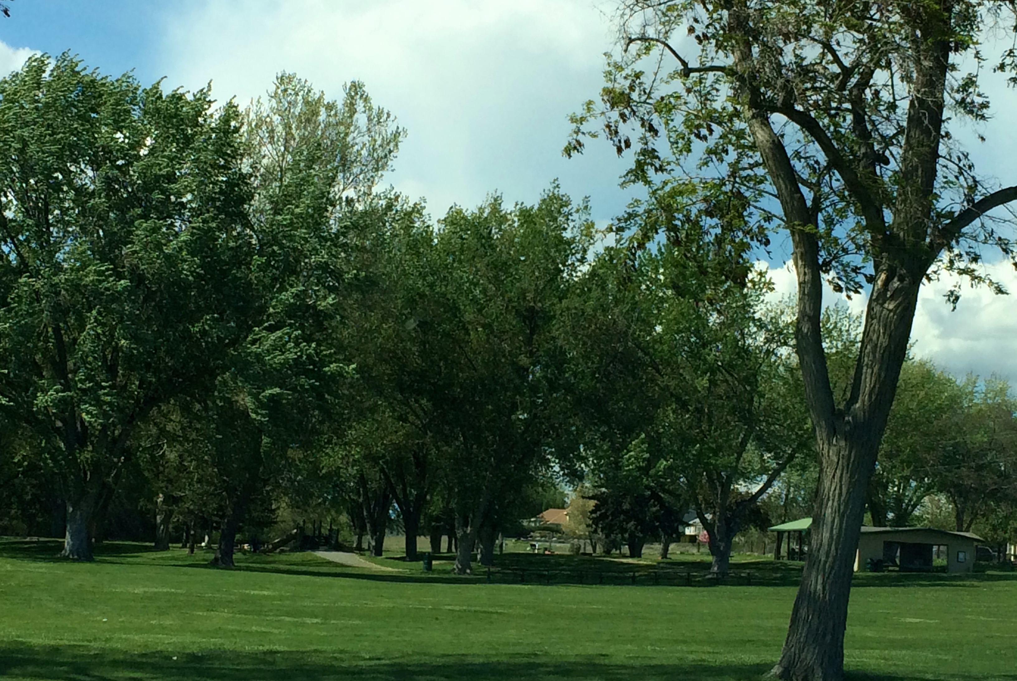

Chiawana Park in Pasco, Washington.
Among all of Pasco's annual activities and events, the most popular is the Pasco Farmers Market, located in downtown Pasco. The market is open from May through October each year, drawing a large regional crowd and providing an outlet for farmers selling fresh produce.
The Fiery Foods Festival is another popular event held each September. This one-day event celebrates spicy foods of all varieties, and highlights the thriving Hispanic culture that lives in the city.
Pasco's Gesa Stadium hosts the Tri-City Dust Devils baseball club of the Northwest League. The Dust Devils are a Class A team of the San Diego Padres. The team plays during summer months during its short season.
The Pasco School District's renovated Edgar Brown Memorial Stadium, constructed in a former gravel pit used in the construction of the Blue Bridge, provides a unique venue for outdoor athletic events.
Pasco is located along a major stretch of the 22-mile Sacagawea Heritage Trail, an interactive educational and recreational hiking/biking loop that circles the Tri-Cities area.
Pasco has several waterfront parks along the Columbia River, as well as easy river access for boaters, fishers, and skiers at any of the free boat launches.
The TRAC (Trade Recreation Agricultural Center) is a large complex located in West Pasco which hosts regional events, including (but not limited to) conventions, meetings, sporting events, and concerts. The TRAC is located near the booming Road 68 corridor of West Pasco.
Transportation[]
- Pasco Intermodal Train Station, a stop on Amtrak's Empire Builder, with daily service to Portland and then Seattle westbound, to Spokane, St Paul, and Chicago eastbound, both with many intermediate points and connections.
- Tri-Cities Airport, with commercial service to Seattle-Tacoma, Las Vegas, Phoenix, Salt Lake City, San Francisco, Minneapolis-St. Paul, Los Angeles, and Denver.
- Ben Franklin Transit
Notable people[]
- Jeremy Bonderman, Major League Baseball pitcher, pitched for Detroit Tigers in 2006 World Series
- Kathy Brock, Chicago television journalist
- Arthur Fletcher, first black Pasco council member, Head of the United Negro College Fund and coined term, "A mind is a terrible thing to waste."
- James Wong Howe, Academy Award-winning cinematographer
- Michael Jackson, Seattle Seahawks linebacker
- Bruce Kison, MLB pitcher, two-time World Series champion
- Shauna O'Brien, actress/model (nearby Burbank)
- Chuck Palahniuk, novelist
- Jeannie Russell, "Margaret Wade" in Dennis the Menace TV series
- Joseph Santos, artist/painter (Pasco High School graduate)
- Ron Silliman, poet
- Brian Urlacher, NFL player, Pro Bowl linebacker for Chicago Bears
- Kristine W, (Weitz) singer/songwriter, former Miss Washington
- Ray Washburn, Major League Baseball pitcher, two-time World Series champion
- Maris Wrixon, film actress
References[]
- ^ Pihl, Kristi. "Council OKs $25,000 for water study" Tri-City Herald. June 8, 2010. Retrieved July 22, 2010.
- ^ City of Pasco website. "city council"
- ^ Kraemer, Kristin M. (July 27, 2016). "Longtime Pasco councilman, ex-mayor dies". Tri-City Herald. http://www.tri-cityherald.com/news/local/article92249847.html.
- ^ Folsom, Geoff. "Pasco city manager sworn in" Tri-City Herald. August 14, 2014.
- ^ a b "US Gazetteer files 2010". United States Census Bureau. http://www.census.gov/geo/www/gazetteer/files/Gaz_places_national.txt. Retrieved 2012-12-19.
- ^ a b "American FactFinder". United States Census Bureau. http://factfinder2.census.gov/faces/nav/jsf/pages/index.xhtml. Retrieved 2012-12-19.
- ^ a b "Population Estimates". United States Census Bureau. http://www.census.gov/popest/data/cities/totals/2015/SUB-EST2015-3.html. Retrieved June 15, 2016.
- ^ "US Board on Geographic Names". United States Geological Survey. 2007-10-25. http://geonames.usgs.gov. Retrieved 2008-01-31.
- ^ "Find a County". National Association of Counties. http://www.naco.org/Counties/Pages/FindACounty.aspx. Retrieved 2011-06-07.
- ^ Meany, Edmond S. (1923). Origin of Washington geographic names. Seattle: University of Washington Press. p. 208. https://babel.hathitrust.org/cgi/pt?id=mdp.39015027074981;view=1up;seq=224.
- ^ "US Gazetteer files: 2010, 2000, and 1990". United States Census Bureau. 2011-02-12. http://www.census.gov/geo/www/gazetteer/gazette.html. Retrieved 2011-04-23.
- ^ "NowData – NOAA Online Weather Data". National Oceanic and Atmospheric Administration. http://w2.weather.gov/climate/xmacis.php?wfo=pdt. Retrieved September 9, 2016.
- ^ "Annual Estimates of the Resident Population for Incorporated Places: April 1, 2010 to July 1, 2015". http://www.census.gov/popest/data/cities/totals/2015/SUB-EST2015.html. Retrieved July 2, 2016.
- ^ Moffatt, Riley. Population History of Western U.S. Cities & Towns, 1850–1990. Lanham: Scarecrow, 1996, 329.
- ^ United States Census Bureau. "Census of Population and Housing". http://www.census.gov/prod/www/decennial.html. Retrieved May 28, 2014.
External links[]
| Wikivoyage has a travel guide for Pasco. |
- City of Pasco website
- Pasco Chamber of Commerce
- Franklin County Historical Society
- Mid Columbia Library - Pasco Branch
- Tri-City Herald newspaper
- Tri-City Regional Chamber of Commerce
- Washington State Office of Financial Management
| |||||||||||||||||

.jpg)
_-_Pasco,_Washington.jpg)
| |||||||||||||||||||||||||||||||||||||||||
|
| This page uses content from the English language Wikipedia. The original content was at Pasco, Washington. The list of authors can be seen in the page history. As with this Familypedia wiki, the content of Wikipedia is available under the Creative Commons License. |