| ||||||||||||||
| Panipat district पानीपत जिला |
|
|---|---|
| — District of Haryana — | |
 |
|
| Country | India |
| State | Haryana |
| Administrative division | Rohtak Division |
| Established | |
| Headquarters | Panipat |
| Tehsils | 1. Panipat, 2. Samalkha and 3. Israna |
| Government | |
| • Lok Sabha constituencies | Karnal (shared with Karnal district) |
| • Assembly seats | 1. Panipat Rural, 2. Panipat City, 3. Israna and 4. Samalkha |
| Area | |
| • Total | 1,268 km2 (490 sq mi) |
| Population (2001) | |
| • Total | 967,449 |
| • Density | 760/km2 (2,000/sq mi) |
| Website | Official website |
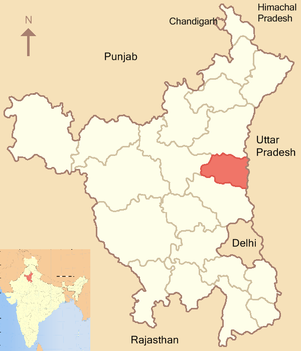
Panipat district ![]() pronunciation (help·info) (Hindi: पानीपत जिला) is one of the 21 districts of Haryana state in northern India. The historical town of Panipat is the administrative headquarters of the district. The district occupies an area of 1268 km².
pronunciation (help·info) (Hindi: पानीपत जिला) is one of the 21 districts of Haryana state in northern India. The historical town of Panipat is the administrative headquarters of the district. The district occupies an area of 1268 km².
History[]
Panipat district was carved out from the erstwhile Karnal district on 1 November 1989. On 24 July 1991 it was again merged with Karnal district. On 1 January 1992 it again became a separate district.
Divisions[]
The district is divided into two sub-divisions: Panipat and Samalkha, which are further divided into three tehsils: Panipat, Samalkha and Israna.
There are four Vidhan Sabha constituencies in this districts: Panipat Rural, Panipat City, Israna and Samalkha. All of these are part of Karnal Lok Sabha constituency.
Industries[]
Panipat town is known for its traditional handloom industry. The first unit of the thermal power station at Panipat was commissioned on 1 November 1979. Presently it has 8 units and the installation capacity of 1360 MW.
External links[]
| ||||||||||||||||||||||||||
| This Haryana location article is a stub. You can help by expanding it. |
| This page uses content from the English language Wikipedia. The original content was at Panipat District. The list of authors can be seen in the page history. As with this Familypedia wiki, the content of Wikipedia is available under the Creative Commons License. |