| ||||||||||||||
| Okeechobee County, Florida | ||
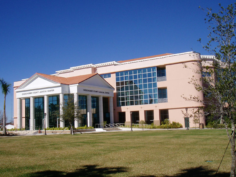 The Okeechobee County Judicial Center, in Okeechobee.
| ||
| ||
 Location in the state of Florida | ||
 Florida's location in the U.S. | ||
| Founded | 8 May 1917 | |
|---|---|---|
| Seat | Okeechobee | |
| Area - Total - Land - Water |
891.57 sq mi (2,309 km²) 773.94 sq mi (2,004 km²) 117.63 sq mi (305 km²), 13.19% | |
| Population - (2010) - Density |
39,996 52/sq mi (19.95/km²) | |
| Website | www.co.okeechobee.fl.us | |
Okeechobee County is a county located in the state of Florida. As of 2000, the population was 35,910. According to 2005 U.S. Census estimates, its population had grown to 39,836.[1] The county seat is Okeechobee, Florida[2]. The county comprises the Okeechobee, Florida Micropolitan Statistical Area.
History
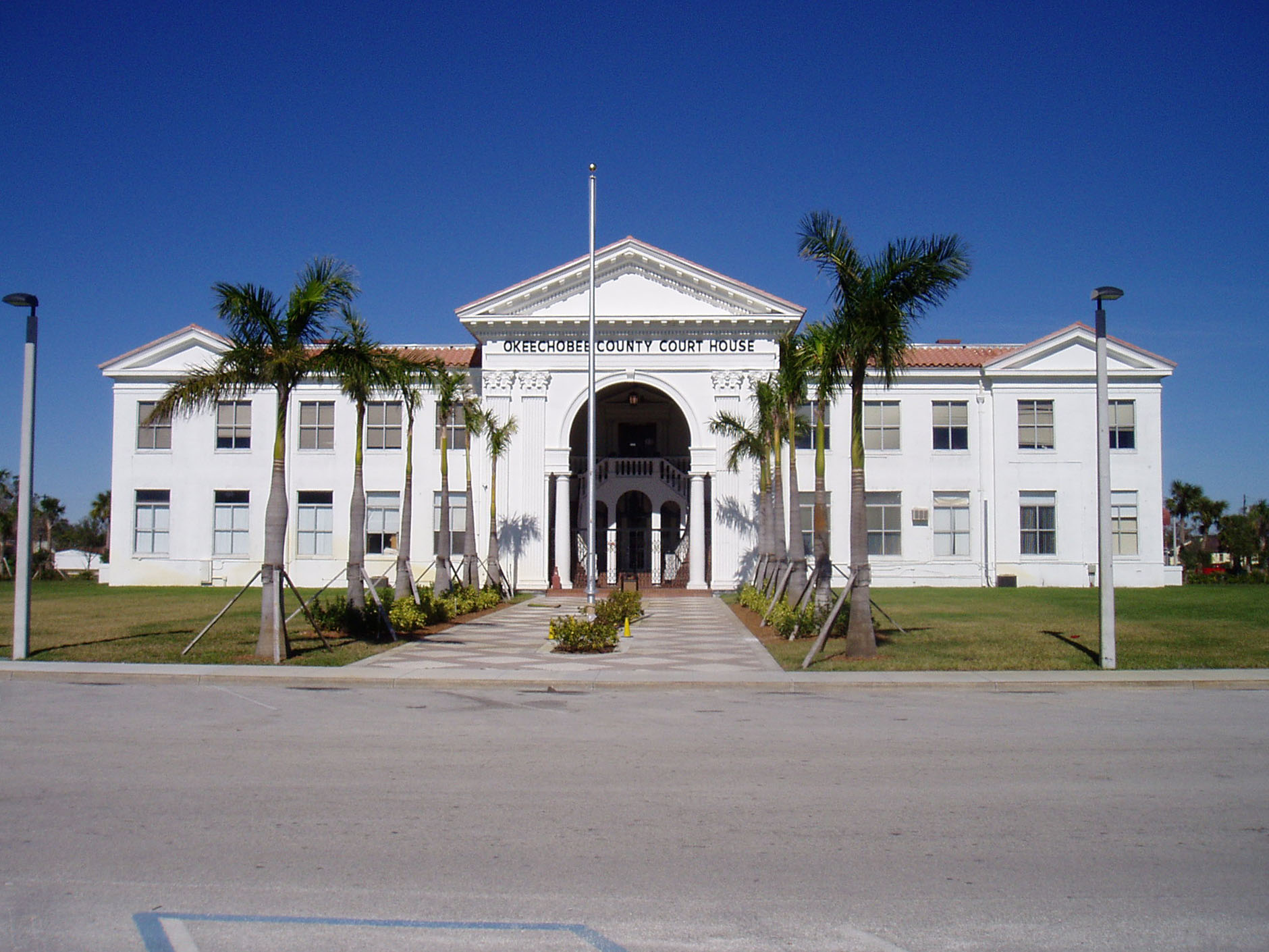
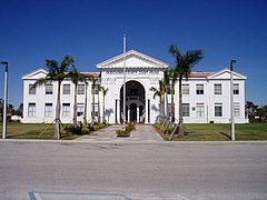
The Okeechobee County Courthouse, constructed in 1926, is located in the County Seat, Okeechobee.


The Old Okeechobee High School, now the Freshman Campus, built 1925
Okeechobee County was created in 1917. It was named for the Lake Okeechobee, which was itself named for Hitchiti words oka (water) and chobi (big).
Historic buildings
Historic buildings in Okeechobee County include:
- First United Methodist Church, 1924
- Freedman-Raulerson House, 1923
- Okeechobee County Courthouse, 1926
Geography
According to the 2000 census, the county has a total area of 891.57 square miles (2,309.2 km2), of which 773.94 square miles (2,004.5 km2) (or 86.81%) is land and 117.63 square miles (304.7 km2) (or 13.19%) is water.[3]
Adjacent counties
- Indian River County, Florida - northeast
- Martin County, Florida - east
- St. Lucie County, Florida - east
- Palm Beach County, Florida - southeast
- Glades County, Florida - southwest
- Hendry County, Florida - southwest
- Highlands County, Florida - west
- Polk County, Florida - northwest
- Osceola County, Florida - northwest
Demographics
| Historical populations | |||
|---|---|---|---|
| Census | Pop. | %± | |
| 1920 | 2,132 | ||
| 1930 | 4,129 | 93.7% | |
| 1940 | 3,000 | −27.3% | |
| 1950 | 3,454 | 15.1% | |
| 1960 | 6,424 | 86.0% | |
| 1970 | 11,233 | 74.9% | |
| 1980 | 20,264 | 80.4% | |
| 1990 | 29,627 | 46.2% | |
| 2000 | 35,910 | 21.2% | |
| 2010 | 39,996 | 11.4% | |
| [4][5] | |||
As of the census[6] of 2000, there were 35,910 people, 12,593 households, and 9,016 families residing in the county. The population density was 46 people per square mile (18/km²). There were 15,504 housing units at an average density of 20 per square mile (8/km²). The racial makeup of the county was 79.28% White, 7.92% Black or African American, 0.54% Native American, 0.67% Asian, 0.04% Pacific Islander, 9.56% from other races, and 1.99% from two or more races. 18.61% of the population were Hispanic or Latino of any race.
In 2005 68.5% of the county population was White non-Hispanic, 21.6% of the population was Latino, 8.0% was African-American and both Native Americans and Asians constituted 0.9% of the population.[7]
In 2000 there were 12,593 households out of which 30.40% had children under the age of 18 living with them, 55.50% were married couples living together, 10.70% had a female householder with no husband present, and 28.40% were non-families. 21.50% of all households were made up of individuals and 10.10% had someone living alone who was 65 years of age or older. The average household size was 2.69 and the average family size was 3.07.
In the county the population was spread out with 25.20% under the age of 18, 9.50% from 18 to 24, 27.10% from 25 to 44, 21.90% from 45 to 64, and 16.30% who were 65 years of age or older. The median age was 37 years. For every 100 females there were 115.50 males. For every 100 females age 18 and over, there were 115.20 males.
The median income for a household in the county was $30,456, and the median income for a family was $35,163. Males had a median income of $25,574 versus $20,160 for females. The per capita income for the county was $14,553. About 11.80% of families and 16.00% of the population were below the poverty line, including 19.90% of those under age 18 and 10.30% of those age 65 or over.
Municipalities

Incorporated
1. City of Okeechobee
Unincorporated
- Cypress Quarters
- Taylor Creek
- Ancient Oaks
- Catterson
- Barber Quarters
- Basinger
- Basswood Estates
- Dixie Ranch Acres
- Fort Drum
- Hilolo
- Mildred
- Sherman
- Treasure Island
- Upthegrove Beach
- Whispering Pines
- Four Seasons
See also
- Florida Heartland
- National Register of Historic Places listings in Okeechobee County, Florida
External links
Governmental
- Board of County Commissioners
- Constitutional Officers
- School district
- Multi-county Districts
- Judicial
Non-governmental
- Okeechobee Official Discussion Forum
- Willson-Mixon & Associates, Inc.
- Okeechobee County Tourist Development Council
- Okeechobee County Guide
- Okeechobee News local newspaper for Okeechobee County, Florida fully and openly available in the Florida Digital Newspaper Library
References
- ^ Table 1: Annual Estimates of the Population for Counties of Florida: April 1, 2000 to July 1, 2005
- ^ "Find a County". National Association of Counties. http://www.naco.org/Counties/Pages/FindACounty.aspx. Retrieved 2011-06-07.
- ^ "Census 2000 U.S. Gazetteer Files: Counties". United States Census. http://www.census.gov/tiger/tms/gazetteer/county2k.txt. Retrieved 2011-02-13.
- ^ http://www.census.gov/population/www/censusdata/cencounts/files/fl190090.txt
- ^ http://factfinder2.census.gov/faces/tableservices/jsf/pages/productview.xhtml?pid=DEC_10_PL_QTPL&prodType=table
- ^ "American FactFinder". United States Census Bureau. http://factfinder.census.gov. Retrieved 2008-01-31.
- ^ Okeechobee County QuickFacts from the US Census Bureau

|
Polk County and Osceola County | Indian River County |
| |
| Highlands County | Martin County and St. Lucie County | |||
 Okeechobee County, Florida | ||||
| Glades County and Hendry County | Palm Beach County |
| |||||||||||||||||

| |||||||||||||||||||||||
| This page uses content from the English language Wikipedia. The original content was at Okeechobee County, Florida. The list of authors can be seen in the page history. As with this Familypedia wiki, the content of Wikipedia is available under the Creative Commons License. |