| Main | Births etc |
|---|
| Nuthurst | |
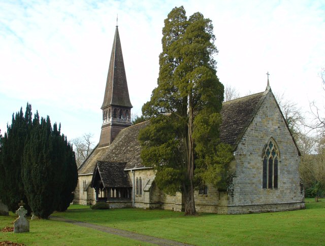 St Andrew's Church |
|

Nuthurst | |
| Area | [1] |
|---|---|
| Population | 1,711 [1] 2001 Census |
| - Density | |
| OS grid reference | |
| - London | 34 miles (55 km) NNE |
| Parish | Nuthurst |
| District | Horsham |
| Shire county | West Sussex |
| Region | South East |
| Country | England |
| Sovereign state | United Kingdom |
| Post town | HORSHAM |
| Postcode district | RH13 |
| Dialling code | 01403 |
| Police | Sussex |
| Fire | West Sussex |
| Ambulance | South East Coast |
| EU Parliament | South East England |
| UK Parliament | Horsham |
| List of places: UK • England • West Sussex | |
Nuthurst is a village and civil parish in the Horsham District of West Sussex, England, 2.5 miles (4 km) south Horsham.
The parish has a land area of 1697 hectares (4191 acres). In the 2001 census 1711 people lived in 702 households, of whom 875 were economically active.
Its Church of England parish church is St. Andrews, which has links with the nearby St. Andrews C of E aided school. There is one pub, the Black Horse.
Sedgwick[]
The hamlet of Sedgwick is part of the civil parish of Nuthurst, and is located about 3 miles south of Horsham in West Sussex, England. Sedgwick Park, a largely nineteenth century house but with one wing possibly dating from 1608.[2] In the extensive grounds are the fragmentary remains of the medieval Sedgwick Castle, surrounded by a now mostly dry moat.[3]
References[]
- ^ a b "2001 Census: West Sussex – Population by Parish". West Sussex County Council. http://www.westsussex.gov.uk/communityandliving/census2001/pop_parish_summary.pdf. Retrieved 12 April 2009.
- ^ "Sedgwick Park". britishlistedbuildings.co.uk. http://www.britishlistedbuildings.co.uk/en-299751-sedgwick-park-nuthurst. Retrieved 2011-05-17.
- ^ "Sedgwick Castle". Pastscape. http://www.pastscape.org/hob.aspx?hob_id=396654. Retrieved 2011-05-17.
External links[]
| |||||||||||
| This West Sussex location article is a stub. You can help by expanding it. |
| This page uses content from the English language Wikipedia. The original content was at Nuthurst. The list of authors can be seen in the page history. As with this Familypedia wiki, the content of Wikipedia is available under the Creative Commons License. |