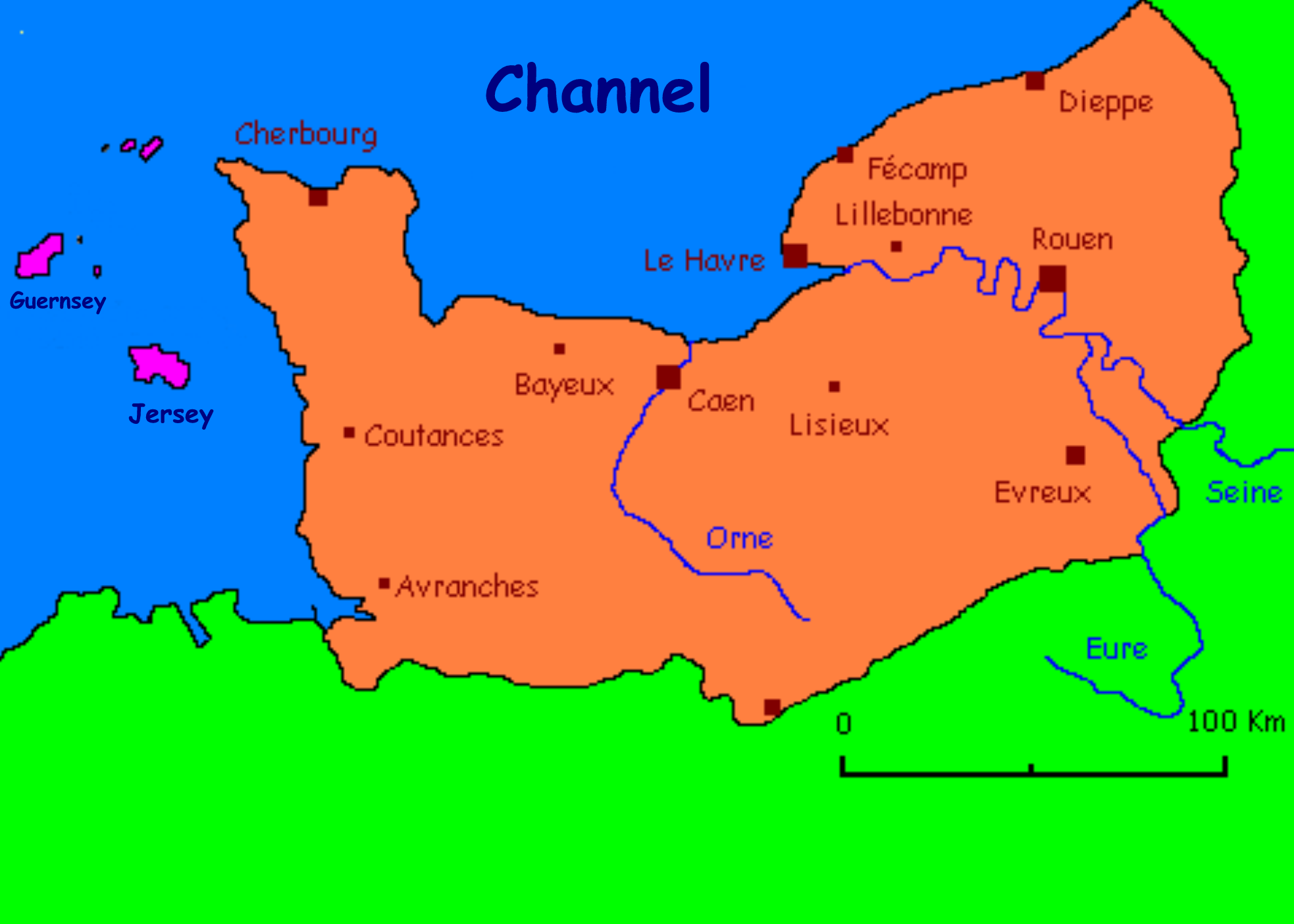
Map of Normandy

Traditional flag of Normandy
Normandy (French: Normandie, Norman: Nourmaundie, from Old French Normanz, plural of Normand, originally from the word for "northman" in several Scandinavian languages[1]) is a geographical region corresponding to the former Duchy of Normandy. It is situated along the English Channel coast of Northern France between Brittany (to the west) and Picardy (to the east) and comprises territory in northern France and the Channel Islands. The continental territory covers 30,627 km²[2] and forms the preponderant part of Normandy and roughly 5% of the territory of France. It is divided for administrative purposes into two régions: Basse-Normandie and Haute-Normandie. The Channel Islands (referred to as Îles Anglo-Normandes in French) covers 194 km²[3] and comprise two bailiwicks: Guernsey and Jersey, which are British Crown dependencies.
Upper Normandy (Haute-Normandie) consists of the French départements of Seine-Maritime and Eure, and Lower Normandy (Basse-Normandie) of the départements of Orne, Calvados, and Manche. The former province of Normandy comprised present-day Upper and Lower Normandy, as well as small areas now part of the départements of Eure-et-Loir, Mayenne, and Sarthe.
The name of Normandy is derived from the settlement of the territory by Vikings ("Northmen") from the 9th century, and confirmed by treaty in the 10th century. For a century and a half following the Norman Conquest of England in 1066, Normandy and England were linked by Norman and Frank rulers.
During the Battle of Normandy in World War II, Normandy became the landing site for the invasion and liberation of Europe from Nazi Germany. This is recognised as the start for the war in Western Europe.
The population of Normandy is around 3.45 million. The continental population of 3.26 million accounts for 5.5% of the population of France (in 2005).
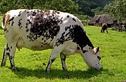
Basse-Normandie is predominantly agricultural in character, with cattle breeding the most important sector (although in decline from the peak levels of the 1970s and 1980s). The bocage is a patchwork of small fields with high hedges, typical of western areas. Haute-Normandie contains a higher concentration of industry. Normandy is a significant cider-producing region, and also produces calvados, a distilled cider or apple brandy. Other activities of economic importance are dairy produce, flax (60% of production in France), horse breeding (including two French national stud farms), fishing, seafood, and tourism. The region contains three French nuclear power stations.
History[]

Roman theatre in Lillebonne
Archaeological finds, such as cave paintings, prove that humans were present in the region in prehistoric times.
Belgian and Celts, known as Gauls, invaded Normandy in successive waves from the 4th century BC to the 3rd century BC.
When Julius Caesar invaded Gaul, there were nine different Gallic tribes in Normandy.[4]
The Romanisation of Normandy was achieved by the usual methods: Roman roads and a policy of urbanisation. Classicists have knowledge of many Gallo-Roman villas in Normandy.
In the late 3rd century, barbarian raids devastated Normandy. Coastal settlements were raided by Saxon pirates. Christianity also began to enter the area during this period. In 406, Germanic tribes began invading from the east, while the Saxons subjugated the Norman coast. The Roman Emperor withdrew from most of Normandy.
As early as 486, the area between the River Somme and the River Loire came under the control of the Frankish lord Clovis.
The Vikings started to raid the Seine Valley during the middle of ninth century. After attacking and destroying monasteries, including one at Jumieges, they took advantage of the power vacuum created by the disintegration of Charlemagne's empire to take northern France. The fiefdom of Normandy was created for the Viking leader Rollo (also known as Robert of Normandy). Rollo had besieged Paris but in 911 entered vassalage to the king of the West Franks, Charles the Simple, through the Treaty of Saint Clair-sur-Epte. In exchange for his homage and fealty, Rollo legally gained the territory which he and his Viking allies had previously conquered. The name "Normandy" reflects Rollo's Viking (i.e. "Northman") origins.
The descendants of Rollo and his followers adopted the local Gallo-Romantic language and intermarried with the area's original inhabitants. They became the Normans – a Norman-speaking mixture of Scandinavians, Hiberno-Norse, Orcadians, Anglo-Danish, and indigenous Franks and Gauls.
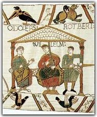
Rollo's descendant William, Duke of Normandy became king of England in 1066 in the Norman Conquest culminating at the Battle of Hastings while retaining the fiefdom of Normandy for himself and his descendants.
Norman expansion[]
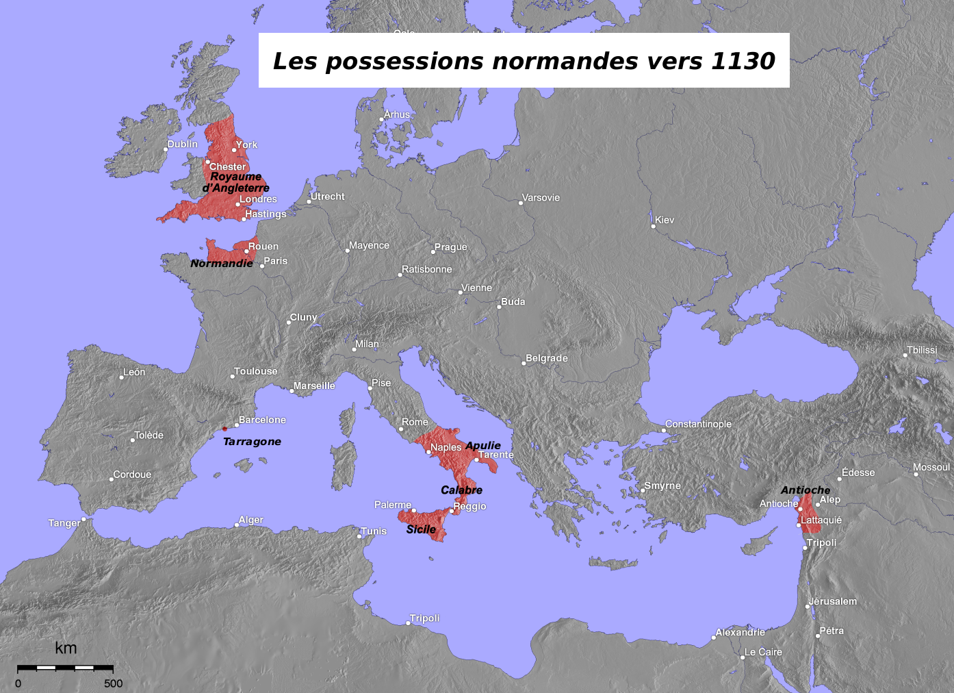

Norman possessions in the 12th century
Besides the Norman conquest of England and the subsequent conquests of Wales and Ireland, the Normans expanded into other areas.
Tancred's sons William Iron Arm, Drogo of Hauteville, Humphrey of Hauteville, Robert Guiscard and Roger the Great Count conquered the Emirate of Sicily and additional territories in Southern Italy. They also carved out a place for themselves and their descendants in the Crusader States of Asia Minor and the Holy Land.
The 14th century Norman explorer Jean de Béthencourt established a kingdom in the Canary Islands. Béthencourt received the title King of the Canary Islands but recognised as his overlord Henry III of Castile, who had provided aid during the conquest.
Norman families, such as that of Tancred of Hauteville, played important parts in the Crusades.
13th century to 17th century[]
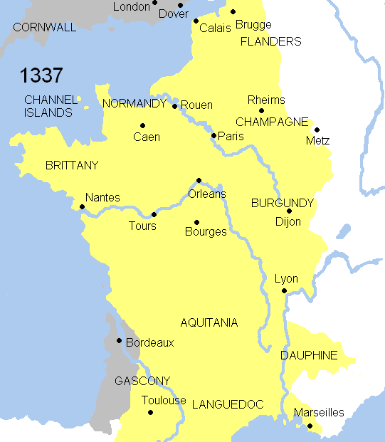

Animated map of the Hundred Years' War
In 1204, during the reign of England's King John, mainland Normandy was taken from England by France under Philip II of France. Insular Normandy (the Channel Islands) remained under English control. In 1259, Henry III of England recognised the legality of French possession of mainland Normandy under the Treaty of Paris. His successors, however, often fought to regain control of mainland French Normandy.
The Charte aux Normands granted by Louis X of France in 1315 (and later re-confirmed in 1339), like the analogous Magna Carta granted in England in the aftermath of 1204, guaranteed the liberties and privileges of the province of Normandy.
French Normandy was occupied by English forces during the Hundred Years' War in 1345–1360 and again in 1415–1450. Afterward prosperity returned to Normandy until the Wars of Religion. When many Norman towns (Alençon, Rouen, Caen, Coutances, Bayeux) joined the Protestant Reformation, battles ensued throughout the province. In the Channel Islands, a period of Calvinism following the Reformation was suppressed when Anglicanism was imposed following the English Civil War.
From the 1660s onwards, France engaged in a policy of expansion in North America. Normans continued the exploration of the New World: René Robert Cavelier de La Salle travelled in the area of the Great Lakes of the United States and Canada, then on the Mississippi River. Territories located between Quebec and the Mississippi Delta were opened up to establish French Louisiana. Colonists from Normandy (in particular Basse-Normandie) were among the most active in New France (Quebec).
Honfleur and Le Havre were two of the principal slave trade ports of France.
18th century and 19th century[]
Although agriculture remained important, industries such as weaving, metallurgy, sugar refining, ceramics, shipbuilding were introduced and developed.
In the 1780s, the economic crisis and the crisis of the Ancien Régime struck Normandy as well as other parts of the nation, leading to the French Revolution. Bad harvests, technical progress and the effects of the Eden Agreement signed in 1786 affected employment and the economy of the province. Normans laboured under a heavy fiscal burden.
In 1790 the five departments of Normandy replaced the former province.
July 11, 1793, the Norman Charlotte Corday assassinated Marat.
The Normans reacted little to the many political upheavals which characterised the 19th century. Overall they warily accepted the changes of régime (First French Empire, Bourbon Restoration, July Monarchy, French Second Republic, Second French Empire, French Third Republic).
There was an economic revival (mechanization of textile manufacture, first trains...) after the French Revolutionary Wars and the Napoleonic Wars (1792–1815).
And new economic activity stimulated the coasts: seaside tourism. The 19th century marks the birth of the first beach resorts.
World War II[]
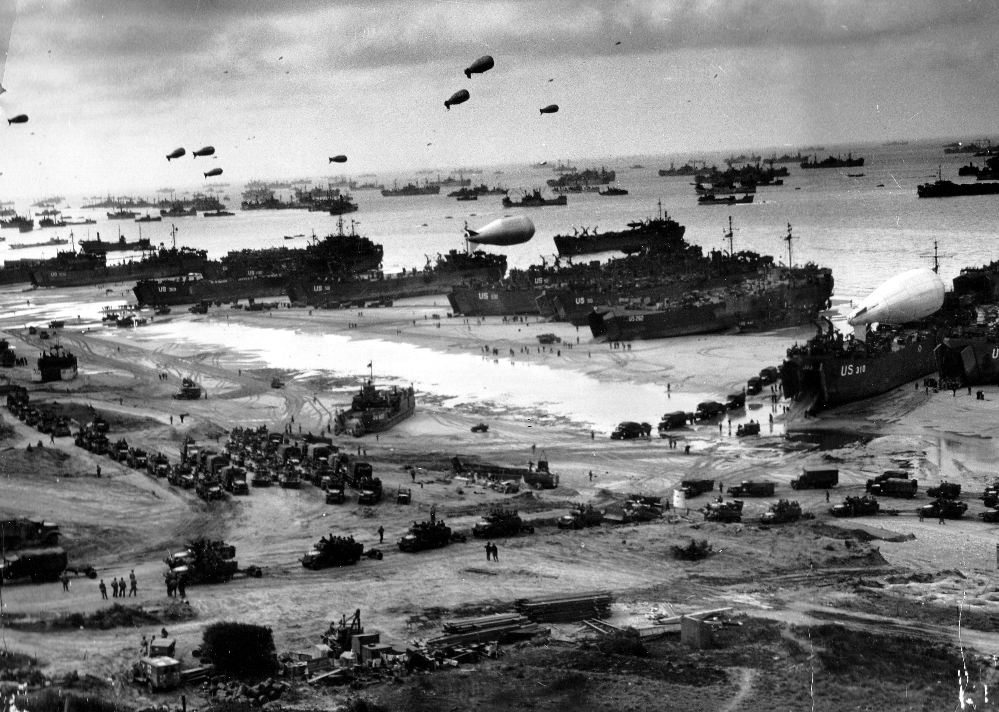

Allied invasion of Normandy, D-Day, 1944
During World War II, following the armistice of 22 June 1940 continental Normandy was part of the German occupied zone of France. The Channel Islands were occupied by German forces between 30 June 1940 and 9 May 1945.
The town of Dieppe was the site of the unsuccessful Dieppe Raid by Canadian and British armed forces.
During the Second World War, the Allies coordinated a massive build-up of troops and supplies to support a large-scale invasion of Normandy in the D-Day landings under the code name Operation Overlord. The Germans were dug into fortified emplacements above the beaches. Caen, Cherbourg, Carentan, Falaise and other Norman towns endured many casualties in the Battle of Normandy, which continued until the closing of the so-called Falaise gap between Chambois and Montormel, then liberation of Le Havre.
This led to the restoration of the French Republic, and a significant turning point in the war. The remainder of Normandy was liberated only on 9 May 1945 at the end of the war, when the Occupation of the Channel Islands effectively ended.
Geography[]


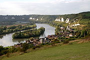
A typical Norman village
The historical Duchy of Normandy was a formerly independent duchy occupying the lower Seine area, the Pays de Caux and the region to the west through the Pays d'Auge as far as the Cotentin Peninsula.
The region is bordered along the northern coasts by the English Channel. There are granite cliffs in the west and limestone cliffs in the east. There are also long stretches of beach in the centre of the region. The bocage typical of the western areas caused problems for the invading forces in the Battle of Normandy. There are meanders of the Seine as it approaches its estuary which form a notable feature of the landscape.
The highest point is the Signal d'Écouves (417m) in the Massif armoricain.
Normandy is sparsely forested[5]: 12.8% of the territory is wooded, compared to a French average of 23.6%, although the proportion varies between the departments. Eure has most cover (21%) while Manche has least (4%), a characteristic shared with the Islands.
Regions[]


Former Cistercian Abbey of Gruchet-le-Valasse.


Marais-Vernier


Pierre-Auguste Renoir, Mer et bateaux (Sea and ships), 1883, Metropolitan Museum of Art, New York.
- The Avranchin
- The Bessin
- The Bauptois
- The bocage virois
- The campagne d'Alençon
- The campagne d'Argentan
- The campagne de Caen
- The campagne de Falaise
- The campagne du Neubourg
- The campagne de Saint-André (or d’Évreux)
- The Cotentin
- The Perche
- The Domfrontais or Passais
- The Hiémois
- The Lieuvin
- The Mortainais
- The pays d'Auge, central Normandy, is characterized by excellent agricultural land.
- The pays de Bray
- The pays de Caux
- The pays d'Houlme
- The pays de Madrie: territoire entre la Seine et L'Eure
- The pays d'Ouche
- The Roumois et Marais-Vernier
- The Suisse normande (Norman Switzerland), in the south, presents hillier terrain.
- The Val de Saire
- The Vexin normand
Channel Islands[]
The Channel Islands, although British Crown Dependencies, are considered culturally and historically a part of Normandy.
Although the British surrendered claims to mainland Normandy and other French possessions in 1801, the monarch of the United Kingdom retains the title Duke of Normandy in respect to the Channel Islands. The Channel Islands (except for Chausey) remain Crown dependencies of the British Crown in the present era. Thus the Loyal Toast in the Channel Islands is La Reine, notre Duc ("The Queen, our Duke"). The British monarch is understood to not be the Duke of Normandy in regards of the French region of Normandy described herein, by virtue of the Treaty of Paris of 1259, the surrender of French possessions in 1801, and the belief that the rights of succession to that title are subject to Salic Law which excludes inheritance through female heirs.
Rivers[]

The Seine in Les Andelys
The Bresle
Rivers in Normandy include:
- the Seine and its tributaries :
- the Andelle
- the Epte
- the Eure
- the Risle
- the Robec
And many coastal rivers :
- the Bresle
- the Couesnon, which traditionally marks the boundary between the Duchy of Brittany and the Duchy of Normandy
- the Dives
- the Orne
- the Sée
- the Sélune
- the Touques
- the Veules, the shortest French river
- the Vire
Towns[]


Half-timbered Houses in Rouen
The principal cities (population at the 1999 census) are Rouen (518,316 inhabitants in the metropolitan area), the capital of Upper Normandy and formerly of the whole province; Caen (420,000 inhabitants in the metropolitan area), the capital of Lower Normandy; Le Havre (296,773 inhabitants in the metropolitan area); and Cherbourg (117,855 inhabitants in the metropolitan area).
Population[]
In January 2006 the population of Normandy (including the part of Perche which lies inside the Orne département but excluding the Channel Islands) was estimated at 3,260,000 with an average population density of 109 inhabitants per km², just under the French national average, but rising to 147 for Upper Normandy.
Economy[]
| Year | Area | Labour force in agriculture | Labour force in industry | Labour force in services |
|---|---|---|---|---|
| 2003 | ||||
| 2006 | ||||
| 2006 |
| Area | GDP (in million of Euros)[9](2006) | Unemployment (% of the labour force)[10](2007) |
|---|---|---|
Food and drink[]

Parts of Normandy consist of rolling countryside typified by pasture for dairy cattle and apple orchards. A wide range of dairy products are produced and exported. Norman cheeses include Camembert, Livarot, Pont l'Évêque, Brillat-Savarin, Neufchâtel, Petit Suisse and Boursin.[11] Normandy butter and Normandy cream are lavishly used in gastronomic specialties.
Fish and seafood are of superior quality in Normandy. Turbot and oysters from the Cotentin Peninsula are major delicacies throughout France. Normandy is the chief oyster-cultivating, scallop-exporting, and mussel-raising region in France.
Normandy is a major cider-producing region (very little wine is produced). Perry is also produced, but in less significant quantities. Apple brandy, of which the most famous variety is calvados, is also popular. The mealtime trou normand, or "Norman hole", is a pause between meal courses in which diners partake of a glassful of calvados in order to improve the appetite and make room for the next course, and this is still observed in many homes and restaurants. Pommeau is an apéritif produced by blending unfermented cider and apple brandy. Another aperitif is the kir normand, a measure of crème de cassis topped up with cider. Bénédictine is produced in Fécamp.


Apples are also used in cooking: for example, moules à la normande are mussels cooked with apples and cream, bourdelots are apples baked in pastry, partridges are flamed with reinette apples, and localities all over the province have their own variation of apple tart. A classic pastry dish from the region is Norman Tart a pastry-based variant of the apple tart.
Other regional specialities include tripes à la mode de Caen, andouilles and andouillettes, salt meadow (pré salé) lamb, seafood (mussels, scallops, lobsters, mackerel…), and teurgoule (spiced rice pudding).
Normandy dishes include duckling à la rouennaise, sautéed chicken yvetois, and goose en daube. Rabbit is cooked with morels, or à la havraise (stuffed with truffled pigs' trotters). Other dishes are sheep's trotters à la rouennaise, casseroled veal, larded calf's liver braised with carrots, and veal (or turkey) in cream and mushrooms.
Normandy is also noted for its pastries. It is the birthplace of brioches (especially those from Évreux and Gisors) and also turns out douillons (pears baked in pastry), craquelins, roulettes in Rouen, fouaces in Caen, fallues in Lisieux, sablés in Lisieux. Confectionery of the region includes Rouen apple sugar, Isigny caramels, Bayeux mint chews, Falaise berlingots, Le Havre marzipans, Argentan croquettes, and Rouen macaroons.
Normandy is the native land of Taillevent, cook of the kings of France Charles V and Charles VI. He wrote the earliest French cookery book named Le Viandier. Confiture de lait was also made in Normandy around the 14th century.
Culture[]
Symbols[]
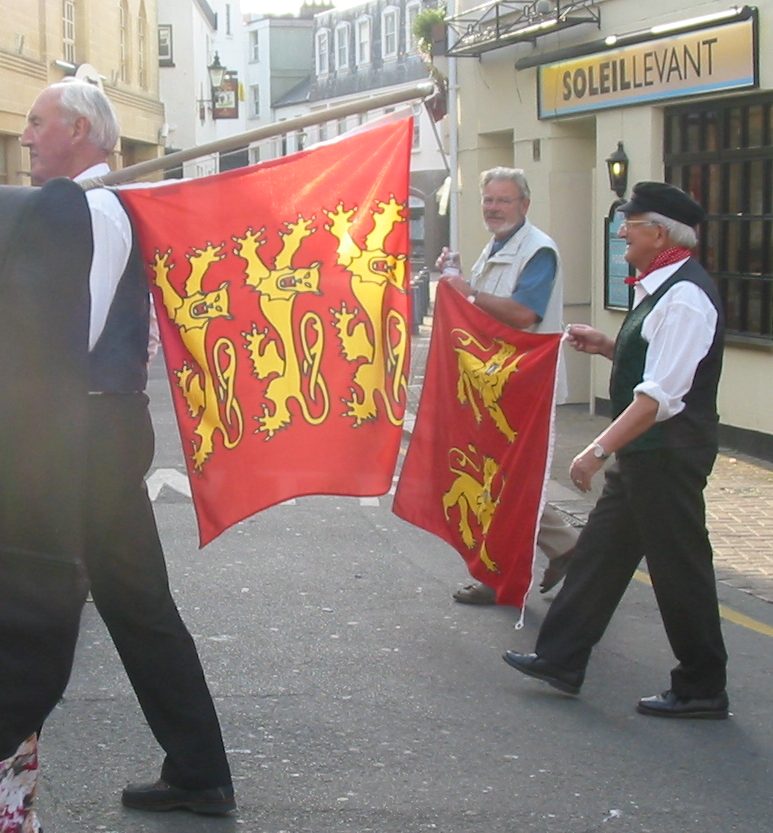
The traditional provincial flag of Normandy, gules, two leopards passant or, is used in both modern regions.
The historic three-leopard version (known in the Norman language as les treis cats, "the three cats") is used by some associations and individuals, especially those who support reunification of the regions and cultural links with the Channel Islands and England. Jersey and Guernsey use three leopards in their national symbols. The three leopards represents the strength and courage Normandy has towards the neighbouring provinces.
The unofficial anthem of the region is the song "Ma Normandie".
|


Literature[]

The dukes of Normandy commissioned and inspired epic literature to record and legitimise their rule. Wace, Orderic Vitalis and Étienne of Rouen were among those who wrote in the service of the dukes.
After the division of 1204, French literature provided the model for the development of literature in Normandy. Olivier Basselin wrote of the Vaux de Vire, the origin of literary vaudeville.
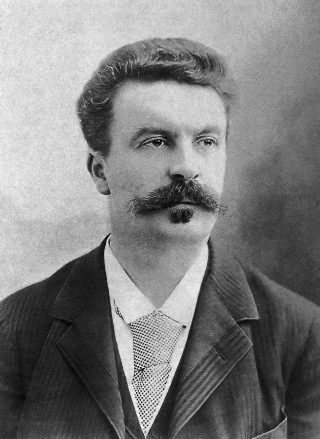
Among notable Norman writers in French are Jean Marot, Rémy Belleau, Guy de Maupassant, Jules Barbey d'Aurevilly, Gustave Flaubert, Octave Mirbeau and Remy de Gourmont. The Corneille brothers, Pierre and Thomas, born in Rouen, were great figures of French classical literature.
David Ferrand (1591–1660) in his Muse Normande established a landmark of Norman language literature. In the 16th and 17th centuries, the workers and merchants of Rouen established a tradition of polemical and satirical literature in a form of language called the parler purin. At the end of the 18th century and beginning of the 19th century a new movement arose in the Channel Islands, led by writers such as George Métivier, which sparked a literary renaissance on the Norman mainland. In exile in Jersey and then Guernsey, Victor Hugo took an interest in the vernacular literature. Les Travailleurs de la mer is a well-known novel by Hugo set in the Channel Islands. The boom in insular literature in the early 19th century encouraged production especially in La Hague and around Cherbourg, where Alfred Rossel, Louis Beuve and Côtis-Capel became active. The typical medium for literary expression in Norman has traditionally been newspaper columns and almanacs. The novel Zabeth by André Louis which appeared in 1969 was the first novel published in Norman.
Painting[]
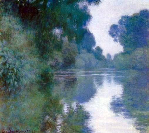

Branch of the Seine near Giverny (1897) by Claude Monet
Romanticism drew painters to the Channel coasts of Normandy. Richard Parkes Bonington and J. M. W. Turner crossed the Channel from Great Britain, attracted by the light and landscapes. Théodore Géricault, a native of Rouen, was a notable figure in the Romantic movement. The competing Realist tendency was represented by Jean-François Millet, a native of La Hague.
From the 1860s, plein-air painters, who worked outside the studio, were attracted to Normandy by the ease of railway access from Paris and the development of a market among the growing number of affluent tourists visiting the coasts of Calvados. Eugène Boudin's paintings of fashionable seaside scenes are typical of this period.
Claude Monet's waterlily garden at Giverny is one of the most popular tourist attractions in the region, and his series of views of Rouen Cathedral are major works of Impressionism. It was Impression, Sunrise, a painting by Monet of Le Havre, that led to the movement being dubbed "Impressionism".
The Société normande de peinture moderne was founded in 1909. Among members were Raoul Dufy, a native of Le Havre, Albert Marquet, Francis Picabia and Maurice Utrillo. Also in this movement were the Duchamp brothers, Jacques Villon and Marcel Duchamp.
Languages[]
French is the only official language in continental Normandy. English is also an official language in the Channel Islands.
The Norman language, a regional language, is spoken by a minority of the population on the continent and the islands, with a concentration in the Cotentin Peninsula in the far West (the Cotentinais dialect), and in the Pays de Caux in the East (the Cauchois dialect). Many place names demonstrate the Norse and Old English influence in this Oïl language; for example -bec (stream), -fleur (river), -hou (island), -tot (homestead), -dal or -dalle (valley) and -hogue (hill, mound).[12]
Architecture[]
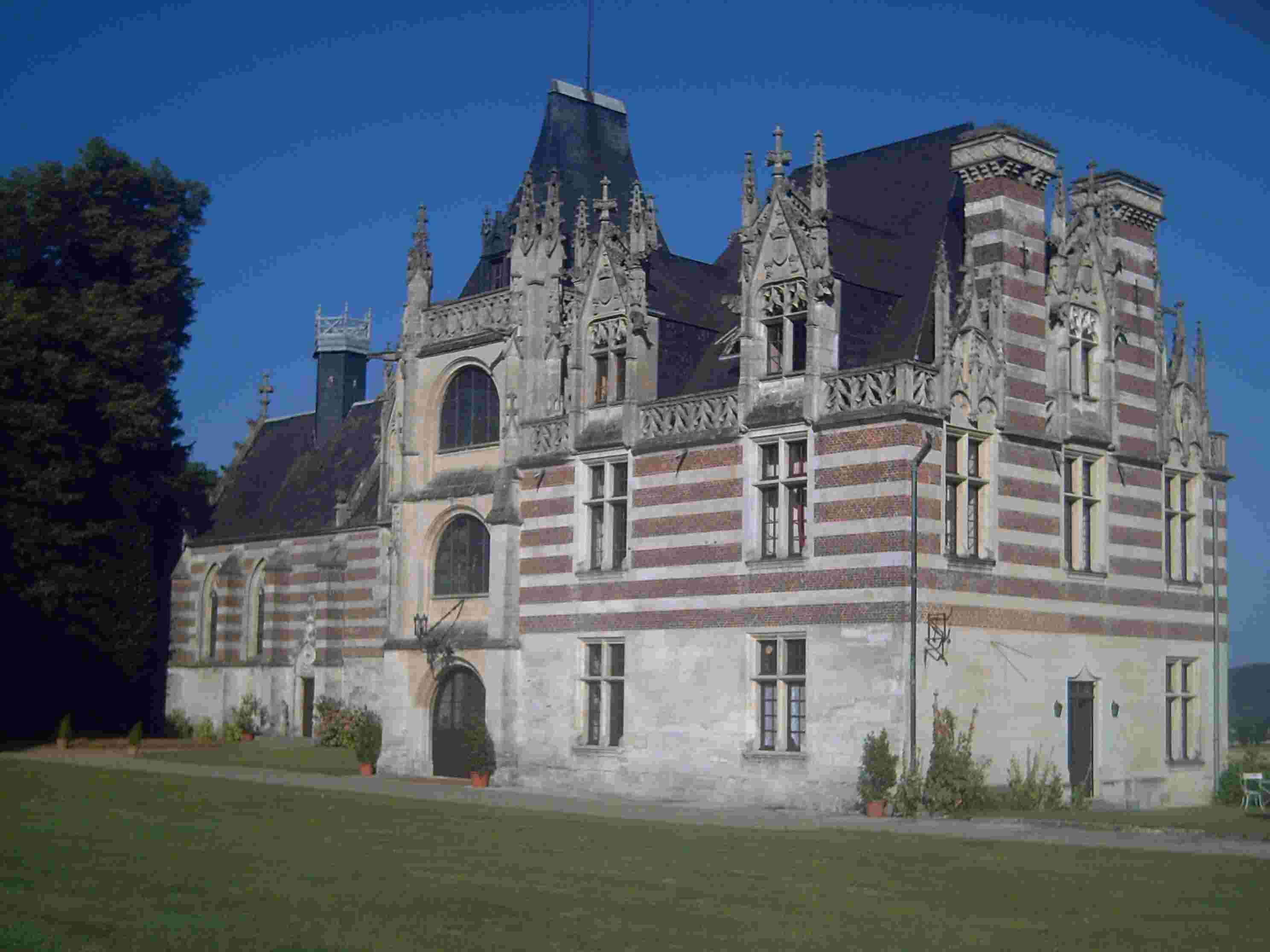

Chateau d'Etelan (1494)
Architecturally, Norman cathedrals, abbeys (such as the Abbey of Bec) and castles characterise the former Duchy in a way that mirrors the similar pattern of Norman architecture in England following the Norman Conquest of 1066.
Domestic architecture in upper Normandy is typified by half-timbered buildings that also recall vernacular English architecture, although the farm enclosures of the more harshly landscaped Pays de Caux are a more idiosyncratic response to socio-economic and climatic imperatives. Much urban architectural heritage was destroyed during the Battle of Normandy in 1944 - post-war urban reconstruction, such as in Le Havre and Saint-Lô, could be said to demonstrate both the virtues and vices of modernist and brutalist trends of the 1950s and 1960s. Le Havre, the city rebuilt by Auguste Perret, was added to Unesco’s World Heritage List in 2005.
Vernacular architecture in lower Normandy takes its form from granite, the predominant local building material. The Channel Islands also share this influence - Chausey was for many years a source of quarried granite, including that used for the construction of Mont Saint-Michel.
The south part of Bagnoles-de-l'Orne is filled with bourgeois villas in Belle Époque style with polychrome façades, bow windows and unique roofing. This area, built between 1886 and 1914, has an authentic “Bagnolese” style and is typical of high-society country vacation of the time.
Religion[]
Sées Cathedral and the adjoining Museum of Religious Art and Vestments attract pilgrims and tourists alike. The "Musilumières" (a sound and light show inside the cathedral) take place every night in summer.
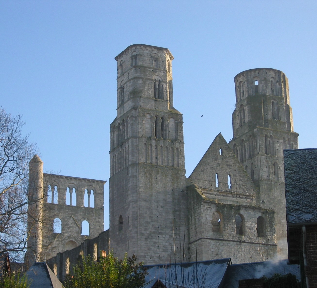
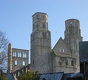
The Abbey of Jumièges
The Chapel of Saint Germanus (Chapelle Saint-Germain) at Querqueville with its trefoil floorplan incorporates elements of one of the earliest surviving places of Christian worship in the Cotentin - perhaps second only to the Gallo-Roman baptistry at Port-Bail. It is dedicated to Germanus of Normandy.
Christian missionaries implanted monastic communities in the territory in the 5th and 6th centuries. Some of these missionaries came from across the Channel. The influence of Celtic Christianity can still be found in the Cotentin.
By the terms of the treaty of Saint-Clair-sur-Epte, Rollo, a Viking pagan, accepted Christianity and was baptised. The Duchy of Normandy was therefore formally a Christian state from its foundation.
The cathedrals of Normandy have exerted influence down the centuries in matters of both faith and politics. King Henry II of England, did penance at the cathedral of Avranches on 21 May 1172 and was absolved from the censures incurred by the assassination of Thomas Becket. Mont Saint-Michel is a historic pilgrimage site.
Prominent Protestant ministers include Pierre Allix, Jacques Basnages and Samuel Bochart.
Since the 1905 French law on the Separation of the Churches and the State there is no established church in mainland Normandy. In the Channel Islands, the Church of England is the established church.
Saints[]
Normandy does not have one generally-agreed patron saint, although this title has been ascribed to Saint Michael, and to Saint Ouen.
Many saints have been revered in Normandy down the centuries, including:
- Aubert who's remembered as the founder of Mont Saint-Michel
- Marcouf and Laud who are important saints in Lower Normandy
- Helier and Samson of Dol who are evangelizers of the Channel Islands
- Thomas Becket, an Anglo-Norman whose parents were from Rouen, who was the object of a considerable cult in mainland Normandy following his martyrdom
- Joan of Arc who was martyred in Rouen, and who is especially remembered in that city
- Thérèse de Lisieux whose birthplace in Alençon and later home in Lisieux are a focus for religious pilgrims.
- Germanus of Normandy
People from Normandy[]
Gallery[]
|


See also[]
- Invasion of Normandy
- Duchy of Normandy
- Duke of Normandy
- COGEMA La Hague site
References[]
- ^ "Norman". Online Etymology Dictionary. http://www.etymonline.com/index.php?term=Norman. Retrieved April 2010.
- ^ Administrative Normandy
- ^ [1] Découvertes touristiques CAP BREIZH Les îles Anglo-Normandes
- ^ (French)César et les Gaulois
- ^ Normandie, Bonneton, Paris 2001 ISBN 286253272X
- ^ (French) L’état des régions françaises 2004, page 189
- ^ (French)INSEE,Emploi-Chômage
- ^ "France in CIA factbook"
- ^ (French) INSEE
- ^ (French) INSEE
- ^ Norman cheeses : History
- ^ The Scandinavian Contribution in Normandy
External links[]
- (French) Normandie Héritage
- The Norman Worlds
- Gallery of photos of Normandy
- New Normandy Commemorative Project Cauquigny
- Normandy official tourism board
- A History of Normandy/Normandie Contains a useful list of and detail about the rulers of Normandy
- Western France Tourist Board Normandy tourism information
- Normandy Safaris Contains useful information about Normandy tours
| |||||||
.jpg)
| This page uses content from the English language Wikipedia. The original content was at Normandy. The list of authors can be seen in the page history. As with this Familypedia wiki, the content of Wikipedia is available under the Creative Commons License. |