| State of Nevada | |||||
| |||||
| Nickname(s): Silver State (official); Sagebrush State; Battle Born State | |||||
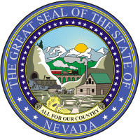
| Motto(s): All For Our Country | |||||
 | |||||
| Official language(s) | De jure: None De facto: English | ||||
| Demonym | Nevadan | ||||
| Capital | Carson City | ||||
| Largest city | Las Vegas | ||||
| Largest metro area | Las Vegas metropolitan area | ||||
| Area | Ranked 7th in the U.S. | ||||
| - Total | 110,562 sq mi (286,367 km2) | ||||
| - Width | 322 miles (519 km) | ||||
| - Length | 492 miles (788 km) | ||||
| - % water | |||||
| - Latitude | 35° N to 42° N | ||||
| - Longitude | 114° 2′ W to 120° W | ||||
| Population | Ranked 35th in the U.S. | ||||
| - Total | 2,700,551 (2010 Census) | ||||
| - Density | 23.4/sq mi (9.02/km2) Ranked 42nd in the U.S. | ||||
| - Median household income | $56,361 (15th) | ||||
| Elevation | |||||
| - Highest point | Boundary Peak or Wheeler Peak[1][2] 13,147 ft (4,005 m) 13,065 ft (3,982 m) | ||||
| - Mean | 5,499 ft (1,676 m) | ||||
| - Lowest point | Colorado River[2] 479 ft (146 m) | ||||
| Admission to Union | October 31, 1864 (36th) | ||||
| Governor | Brian Sandoval (R) | ||||
| Lieutenant Governor | Brian Krolicki (R) | ||||
| Legislature | Nevada Legislature | ||||
| - Upper house | Senate | ||||
| - Lower house | Assembly | ||||
| U.S. Senators | Harry Reid (D) Dean Heller (R) | ||||
| U.S. House delegation | 1: Shelley Berkley (D) 2: Vacant 3: Joe Heck (R) (list) | ||||
| Time zones | |||||
| - most of state | Pacific: UTC-8/-7 (DST) | ||||
| - West Wendover | Mountain: UTC-7/-6 (DST) | ||||
| Abbreviations | NV Nev. US-NV | ||||
| Website | nv.gov | ||||

Nevada ![]() i /nəˈvædə/ is a state located in the western, mountain west, and southwestern regions of the United States. With an area of 110,561 square miles (286,350 km2) and a population of about 2.7 million, it is the 7th-largest and 35th-most populous state. Over two-thirds of Nevada's people live in the Las Vegas metropolitan area,[3] which contains its three largest incorporated cities.[4] Nevada's capital is Carson City.
i /nəˈvædə/ is a state located in the western, mountain west, and southwestern regions of the United States. With an area of 110,561 square miles (286,350 km2) and a population of about 2.7 million, it is the 7th-largest and 35th-most populous state. Over two-thirds of Nevada's people live in the Las Vegas metropolitan area,[3] which contains its three largest incorporated cities.[4] Nevada's capital is Carson City.
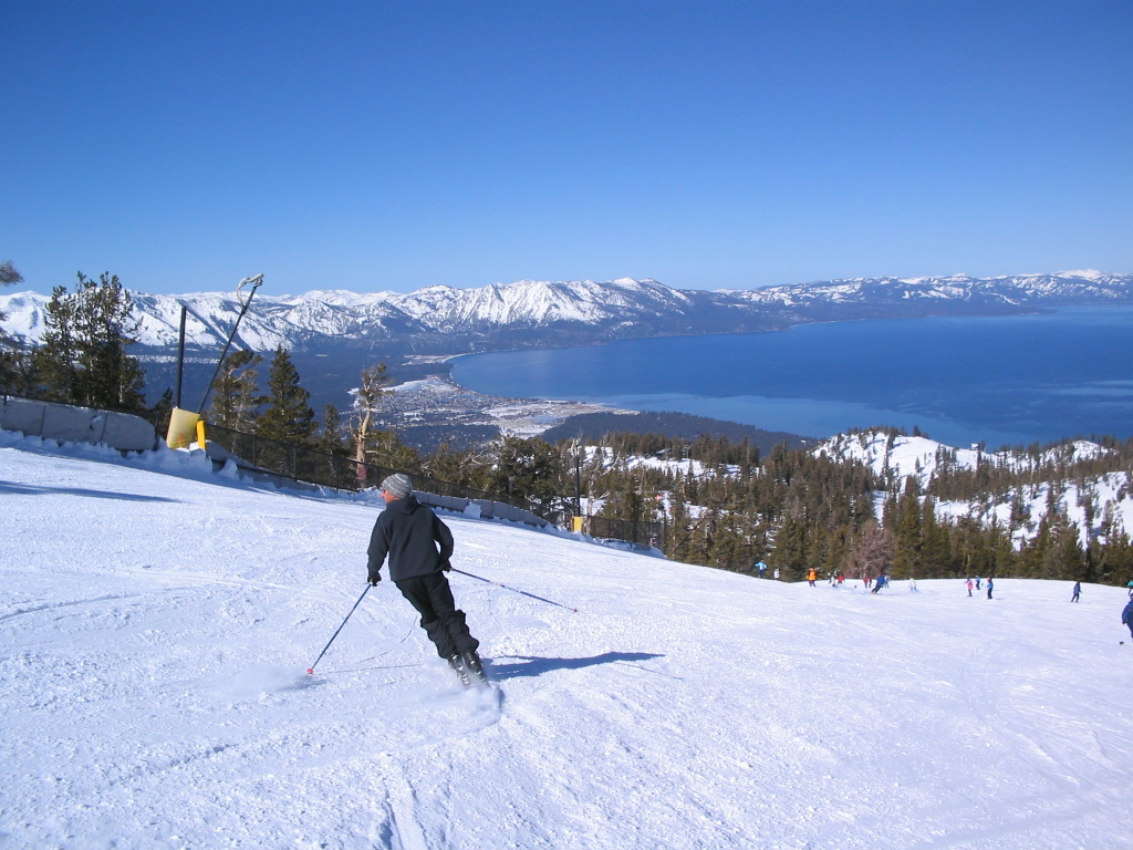
Nevada is largely desert and semiarid, with much of it located within the Great Basin. Areas south of the Great Basin are located within the Mojave Desert, while Lake Tahoe and the Sierra Nevada mountains lie on the western edge. Approximately 86% of the state's land is owned by the US government under various jurisdictions, both civilian and military.[5]
The name Nevada is derived from the nearby Sierra Nevada mountains, which means "snow-capped mountain range" in Spanish. The land comprising the modern state was inhabited by Native Americans of the Paiute, Shoshone, and Washoe tribes prior to European contact.[6] It was subsequently claimed by Spain as a part of Alta California until the Mexican War of Independence brought it under Mexican control. The United States gained the territory in 1848 following its victory in the Mexican-American War and the area was eventually incorporated as part of Utah Territory in 1850. The discovery of silver at the Comstock Lode in 1859 led to a population boom that was an impetus to the creation of Nevada Territory out of western Utah Territory in 1861. Nevada became the 36th state on October 31, 1864.[7]
The establishment of legalized gambling and lenient marriage and divorce proceedings in the 20th century transformed Nevada into a major tourist destination.[8][9] The tourism industry remains Nevada's largest employer,[10] with mining continuing to be a substantial sector of the economy as Nevada is the fourth largest producer of gold in the world.[11]
Nevada is officially known as the "Silver State" due to the importance of silver to its history and economy. It is also known as the "Battle Born State" because it achieved statehood during the Civil War and the "Sagebrush State" for the native eponymous plant.
Nevada is the largest landlocked U.S. state that does not border Canada or Mexico.
Etymology and pronunciation

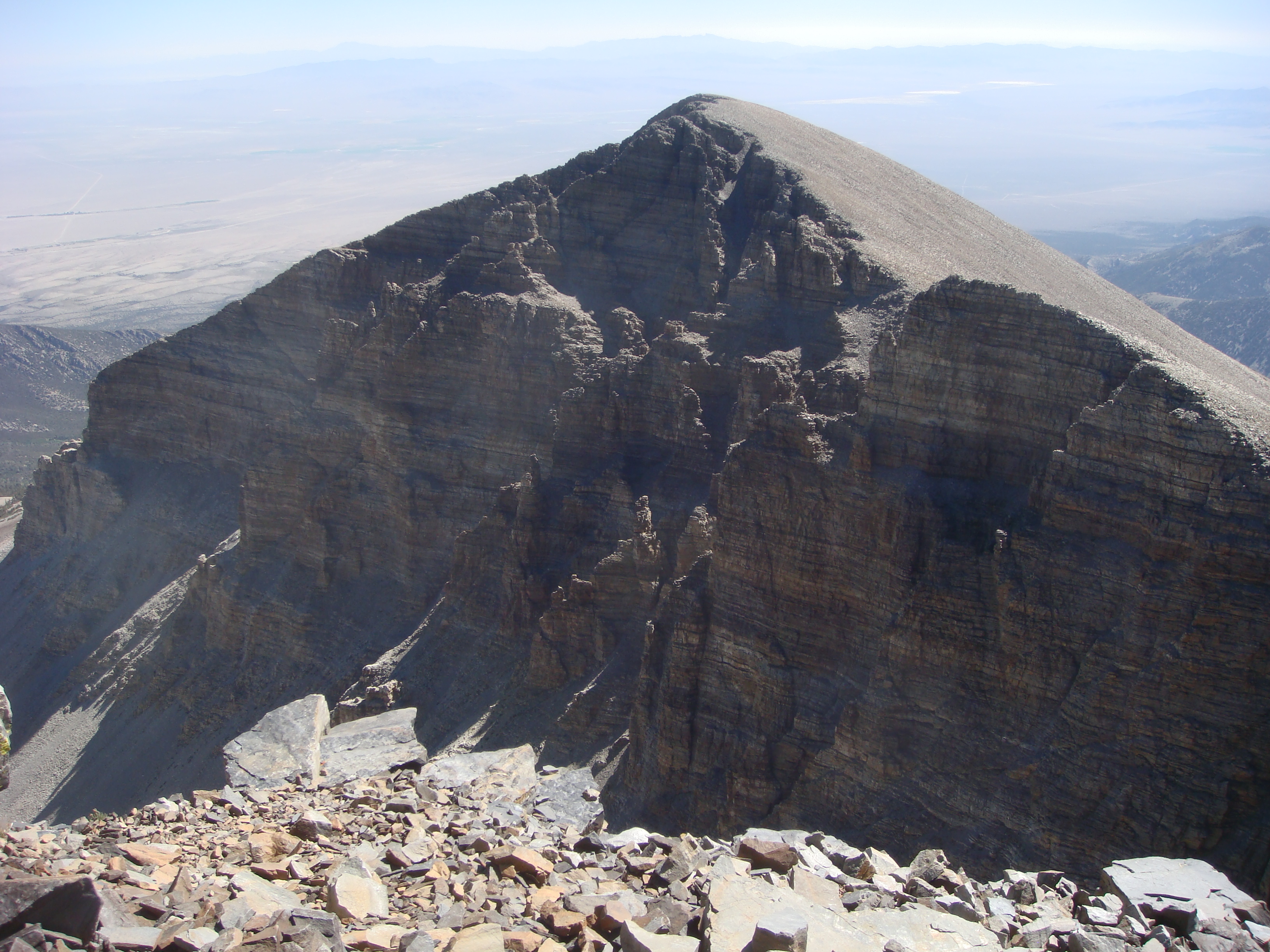
The quartzite of the Prospect Mountain Formation on top of Wheeler Peak, the highest peak entirely within Nevada.
The name "Nevada" comes from the Spanish Nevada [neˈβaða], meaning "snow-covered",[12] after the Sierra Nevada ("snow-covered mountains") mountain range.
The second syllable of "Nevada" is correctly pronounced with the /æ/ vowel of "bad". Many people from outside the Western United States pronounce the name /nəˈvɑːdə/, with the /ɑː/ vowel of "father"; this is closer to the Spanish pronunciation of 'a', but is considered incorrect by locals. Notably, George W. Bush made this faux pas during his campaign for the 2004 US Presidential Election. Vindication later came when President Bush campaigned at the Reno-Sparks Convention Center on June 18, 2004. The president opened his talk by proclaiming that "It's great to be here in /nəˈˈvædə/," emphasizing the correct 'a' — the crowd roared its approval when he light-heartedly noted, "You didn't think I'd get it right, did ya?"[13] Bush subsequently carried the state in the election. Assemblyman Harry Mortenson has proposed a bill to recognize the alternate (quasi-Spanish) pronunciation of Nevada.[14]
Geography
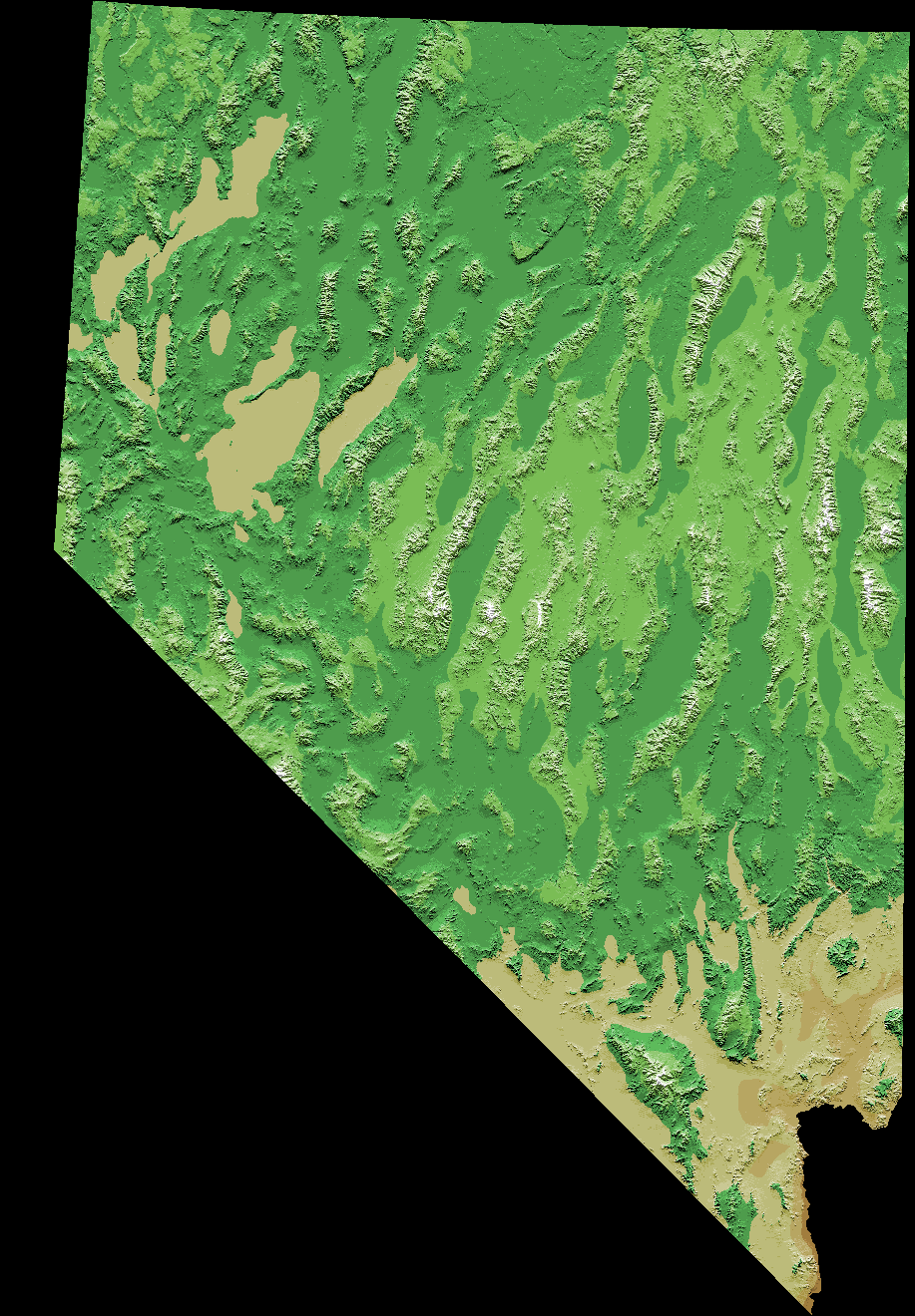
Digitally colored elevation map of Nevada
Nevada is almost entirely within the Basin and Range Province, and is broken up by many north-south mountain ranges. Most of these ranges have endorheic valleys between them, which belies the image portrayed by the term Great Basin.

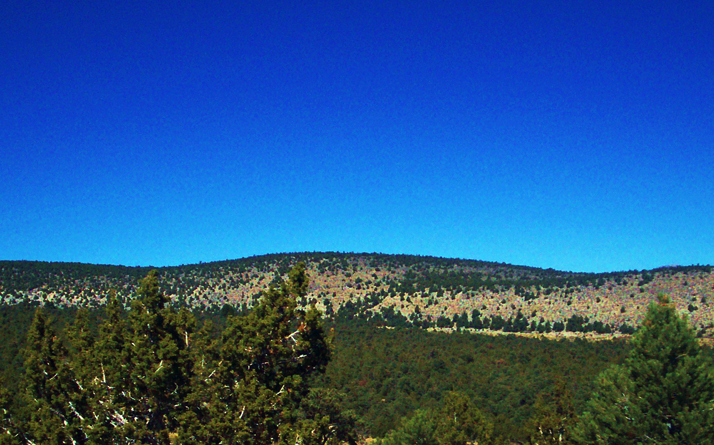
Pinion Juniper forests cover large areas of the north and central parts of the state.

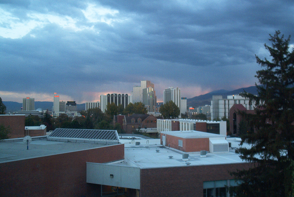
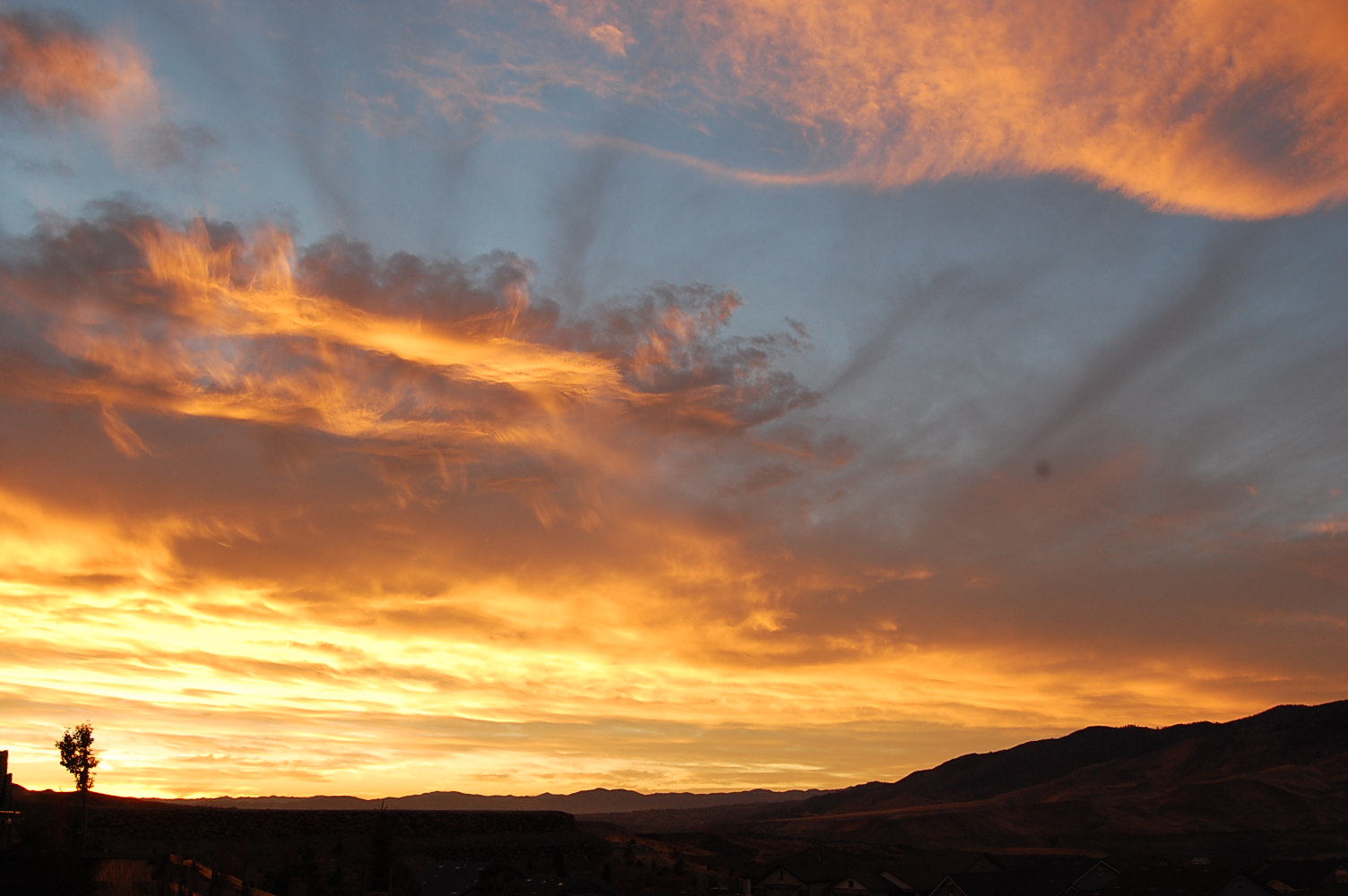
Sunrise over Reno


Basin and Range scenery near Rachel
Much of the northern part of the state is within the Great Basin, a mild desert that experiences hot temperatures in the summer and cold temperatures in the winter. Occasionally, moisture from the Arizona Monsoon will cause summer thunderstorms; Pacific storms may blanket the area with snow. The state's highest recorded temperature was 125 °F (52 °C) in Laughlin (elevation of 605 feet / 184 metres) on June 29, 1994.[15] The coldest recorded temperature was −52 °F (−47 °C) set in San Jacinto in 1972, in the northeastern portion of the state.[15]
The Humboldt River crosses from east to west across the northern part of the state, draining into the Humboldt Sink near Lovelock. Several rivers drain from the Sierra Nevada eastward, including the Walker, Truckee and Carson rivers.


Mountains west of Las Vegas in the Mojave Desert
The mountain ranges, some of which have peaks above 13,000 feet (4,000 m), harbor lush forests high above desert plains, creating sky islands for endemic species. The valleys are often no lower in elevation than 3,000 feet (910 m).
The southern third of the state, where the Las Vegas area is situated, is within the Mojave Desert. The area receives less rain in the winter but is closer to the Arizona Monsoon in the summer. The terrain is also lower, mostly below 4,000 feet (1,200 m), creating conditions for hot summer days and cool to chilly winter nights (due to temperature inversion).


Fly Geyser
Nevada and California have by far the longest diagonal line (in respect to the cardinal directions) as a state boundary at just over 400 miles (640 km). This line begins in Lake Tahoe nearly 4 miles (6.4 km) offshore (in the direction of the boundary), and continues to the Colorado River where the Nevada, California, and Arizona boundaries merge 12 miles (19 km) southwest of the Laughlin Bridge.
The largest mountain range in the southern portion of the state is the Spring Mountain Range, just west of Las Vegas. The state's lowest point is along the Colorado River, south of Laughlin.
Nevada has 172 mountain summits with 2,000 feet (610 m) of prominence. Nevada ranks second in the US, behind Alaska, and ahead of California, Montana, and Washington. This makes Nevada the "Most Mountainous" state in the country, at least by this measure.
Climate
Nevada is made up of mostly desert and semiarid climate regions, daytime summer temperatures sometimes may rise as high as 125 °F (52 °C) and nighttime winter temperatures may reach as low as −50 °F (−45.6 °C). The winter season in the southern part of the state, however, tends to be of short duration and mild. Most parts of Nevada receive scarce precipitation during the year. Most rain falls on the lee side (east and northeast slopes) of the Sierra Nevada Range. The average annual rainfall per year is about 7 inches (18 cm); the wettest parts get around 40 inches (100 cm). Nevada's highest recorded temperature is 125 °F (52 °C) at Laughlin on June 29, 1994 and the lowest recorded temperature is −50 °F (−45.6 °C) at San Jacinto on January 8, 1937. Nevada's 125 °F (52 °C) reading is the third highest temperature recorded in the U.S. just behind Arizona's 128 °F (53 °C) reading and California's 134 °F (57 °C) reading.
Vegetation
Nevada contains six biotic zones: alpine, sub-alpine, "yellow pine", "pinion-juniper", "sagebrush" and "creosotebush".[16]
Counties
Nevada is divided into political jurisdictions designated as counties. Carson City is officially a consolidated municipality; however, for many purposes under state law it is considered to be a county. As of 1919 there were 17 counties in the state, ranging from 146 to 18,159 square miles (380 to 47,030 km2). In 1969 Ormsby County was dissolved and the consolidated municipality of Carson City was created by the Legislature in its place co-terminous with the old boundaries of Ormsby County.
| NEVADA COUNTIES | |||||||
|---|---|---|---|---|---|---|---|
| County name | County seat | Year founded | 2000 population | Percent of total | Area (mi²) | Percent of total | Population density (/mi²) |
| Carson City | Carson City | 1861 | 52,457 | 2.63 % | 146 | 0.13 % | 359.29 |
| Churchill | Fallon | 1861 | 23,982 | 1.20 % | 5,023 | 4.54 % | 4.77 |
| Clark | Las Vegas | 1908 | 1,375,765 | 68.85 % | 8,091 | 7.32 % | 170.04 |
| Douglas | Minden | 1861 | 41,259 | 2.06 % | 738 | 0.67 % | 55.91 |
| Elko | Elko | 1869 | 45,291 | 2.27 % | 17,203 | 15.56 % | 2.63 |
| Esmeralda | Goldfield | 1861 | 971 | 0.05 % | 3,589 | 3.25 % | 0.27 |
| Eureka | Eureka | 1869 | 1,651 | 0.08 % | 4,180 | 3.78 % | 0.39 |
| Humboldt | Winnemucca | 1856/1861 | 16,106 | 0.81 % | 9,658 | 8.74 % | 1.67 |
| Lander | Battle Mountain | 1861 | 5,794 | 0.29 % | 5,519 | 4.99 % | 1.05 |
| Lincoln | Pioche | 1866 | 4,165 | 0.21 % | 10,637 | 9.62 % | 0.39 |
| Lyon | Yerington | 1861 | 34,501 | 1.73 % | 2,016 | 1.82 % | 17.11 |
| Mineral | Hawthorne | 1911 | 5,071 | 0.25 % | 3,813 | 3.45 % | 1.33 |
| Nye | Tonopah | 1864 | 32,485 | 1.63 % | 18,159 | 16.43 % | 1.79 |
| Pershing | Lovelock | 1919 | 6,693 | 0.33 % | 6,068 | 5.49 % | 1.10 |
| Storey | Virginia City | 1861 | 3,399 | 0.17 % | 264 | 0.24 % | 12.88 |
| Washoe | Reno | 1861 | 339,486 | 16.99 % | 6,551 | 5.93 % | 51.82 |
| White Pine | Ely | 1869 | 9,181 | 0.46 % | 8,897 | 8.05 % | 1.03 |
| Totals | Counties: 17 | 1,998,257 | 110,552 | 18.08 | |||
- Humboldt was designated as a County in 1856 by Utah Territorial Legislature and again in 1861 by the new Nevada Legislature.
History
Before 1861
Sculpture representing a steam locomotive, in Ely, Nevada. Early locomotives played an important part in Nevada's mining industry
See History of Utah, History of Las Vegas, and the discovery of the first major U.S. deposit of silver ore in Comstock Lode under Virginia City, Nevada in 1859.
Separation from Utah Territory

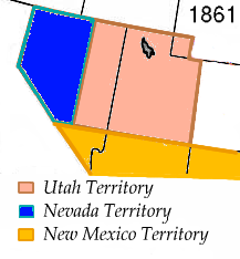
Nevada territory 1861
On March 2, 1861, the Nevada Territory separated from the Utah Territory and adopted its current name, shortened from Sierra Nevada (Spanish for "snowy range").
The 1861 southern boundary is commemorated by Nevada Historical Markers 57 and 58 in Lincoln and Nye counties.
Statehood
Eight days prior to the presidential election of 1864, Nevada became the 36th state in the union. Statehood was rushed to the date of October 31 to help ensure Abraham Lincoln's reelection on November 8 and post-Civil War Republican dominance in Congress,[17] as Nevada's mining-based economy tied it to the more industrialized Union.
Nevada is notable for being one of only two states to significantly expand its borders after admission to the Union. Nevada achieved its current southern boundaries on May 5, 1866, when it absorbed the portion of Pah-Ute County in the Arizona Territory west of the Colorado River, essentially all of present day Nevada south of the 37th parallel. The transfer was prompted by the discovery of gold in the area, and it was thought by officials that Nevada would be better able to oversee the expected population boom. This area includes most of what is now Clark County. In 1868 another part of the western Utah Territory, whose population was seeking to avoid Mormon dominance, was added to Nevada in the eastern part of the state, setting the current eastern boundary.
Mining shaped Nevada's economy for many years (see Silver mining in Nevada). When Mark Twain lived in Nevada during the period described in Roughing It, mining had led to an industry of speculation and immense wealth. However, both mining and population declined in the late 19th century. However, the rich silver strike at Tonopah in 1900, followed by strikes in Goldfield and Rhyolite, again put Nevada's population on an upward trend.
Gaming and labor


Gaming erupted once more following a recession in the early 20th century, helping to build the city of Las Vegas
Unregulated gaming was commonplace in the early Nevada mining towns but outlawed in 1909 as part of a nation-wide anti-gaming crusade. Because of subsequent declines in mining output and the decline of the agricultural sector during the Great Depression, Nevada again legalized gaming on March 19, 1931, with approval from the legislature. At the time, the leading proponents of gaming expected that it would be a short term fix until the state's economic base widened to include less cyclical industries. However, "re-outlawing" gaming has never been seriously considered since the industry has become Nevada's primary source of revenue today.
Nuclear testing
The Nevada Test Site, 65 miles (105 km) northwest of the city of Las Vegas, was founded on January 11, 1951, for the testing of nuclear weapons. The site is composed of approximately 1,350 square miles (3,500 km2) of desert and mountainous terrain. Nuclear testing at the Nevada Test Site began with a 1 kilotonne of TNT (4.2 TJ) bomb dropped on Frenchman Flat on January 27, 1951. The last atmospheric test was conducted on July 17, 1962, and the underground testing of weapons continued until September 23, 1992. The location is known for having the highest concentration of nuclear-detonated weapons in the U.S.
Over 80% of the state's area is owned by the federal government. The primary reason for this is that homesteads were not permitted in large enough sizes to be viable in the arid conditions that prevail throughout desert Nevada. Instead, early settlers would homestead land surrounding a water source, and then graze livestock on the adjacent public land, which is useless for agriculture without access to water (this pattern of ranching still prevails).
Demographics
| Historical populations | |||
|---|---|---|---|
| Census | Pop. | %± | |
| 1860 | 6,857 | ||
| 1870 | 42,941 | 526.2% | |
| 1880 | 62,266 | 45.0% | |
| 1890 | 47,355 | −23.9% | |
| 1900 | 42,335 | −10.6% | |
| 1910 | 81,875 | 93.4% | |
| 1920 | 77,407 | −5.5% | |
| 1930 | 91,058 | 17.6% | |
| 1940 | 110,247 | 21.1% | |
| 1950 | 160,083 | 45.2% | |
| 1960 | 285,278 | 78.2% | |
| 1970 | 488,738 | 71.3% | |
| 1980 | 800,493 | 63.8% | |
| 1990 | 1,201,833 | 50.1% | |
| 2000 | 1,998,257 | 66.3% | |
| 2010 | 2,700,551 | 35.1% | |
| Source: 1910-2010[18] | |||
| Demographics of Nevada (csv) | |||||
|---|---|---|---|---|---|
| By race | White | Black | AIAN | Asian | NHPI |
| AIAN is American Indian or Alaskan Native - NHPI is Native Hawaiian or Pacific Islander | |||||
| 2000 (total population) | 86.11% | 7.67% | 2.17% | 5.67% | 0.83% |
| 2000 (Hispanic only) | 18.78% | 0.44% | 0.45% | 0.25% | 0.11% |
| 2005 (total population) | 84.25% | 8.58% | 2.15% | 6.87% | 0.92% |
| 2005 (Hispanic only) | 22.31% | 0.69% | 0.51% | 0.30% | 0.12% |
| Growth 2000-2005 (total population) | 18.23% | 35.25% | 20.23% | 46.27% | 33.72% |
| Growth 2000-2005 (non-Hispanic only) | 11.17% | 31.96% | 16.39% | 46.36% | 33.55% |
| Growth 2000-2005 (Hispanic only) | 43.57% | 88.97% | 34.74% | 44.46% | 34.84% |
Growth
According to the Census Bureau's 2007 estimate, Nevada has an estimated population of 2,565,382 which is an increase of 92,909, or 3.5%, from the prior year and an increase of 516,550, or 20.8%, since the year 2000. This includes a natural increase since the last census of 81,661 people (that is 170,451 births minus 88,790 deaths) and an increase due to net migration of 337,043 people into the state. Immigration from outside the United States resulted in a net increase of 66,098 people, and migration within the country produced a net increase of 270,945 people. According to the 2006 census estimate, Nevada is the eighth fastest growing state in the nation.[19]
The center of population of Nevada is located in southern Nye County.[20] In this county, the unincorporated town of Pahrump, located 60 miles (97 km) west of Las Vegas on the California state line, has grown 26 times in size from 1980 to 2000. In the year 2006, the town may have over 50,000 permanent residents. Las Vegas was America's fastest-growing city and metropolitan area from 1960 to 2000, but has grown from a gulch of 100 people in 1900 to 10,000 by 1950 to 100,000 by 1970 to have 2.5 million in the metropolitan area in 2010.

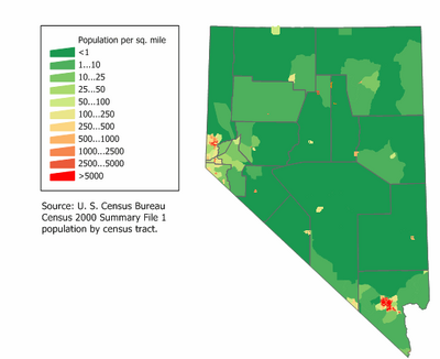
Nevada Population Density Map
From about the 1940s until 2003, Nevada was the fastest-growing state in the US percentage-wise. Between 1990 and 2000, Nevada's population increased 66.3%, while the USA's population increased 13.1%. Over two thirds of the population of the state live in the Clark County Las Vegas metropolitan area.
Henderson and North Las Vegas are among the USA's top 20 fastest-growing cities of over 100,000.
The rural community of Mesquite located 65 miles (105 km) northeast of Las Vegas was an example of micropolitan growth in the 1990s and 2000s. Other desert towns like Mercury and Searchlight on the outskirts of Las Vegas has grown tremendously as well.
Large numbers of new residents in the state originate from California, which led some locals to feel that their state is being "Californicated".[21]
Ethnic and Racial diversity
According to the 2008 census estimates racial distribution was as follows: 65% White American, 7.1% African American, 6% Asian American (estimates placed them at 10%), 2% others (American Indians and Pacific Islanders) and the remaining 20% were Hispanics or Latinos of any race.
In terms of diversity, Nevada is home to many cultures and nationalities. Las Vegas and Reno or Washoe County has evolved to become Minority majority cities and counties. Nevada also has a sizable Basque ancestry population. In Douglas, Mineral and Pershing counties, a plurality of residents are of Mexican ancestry with Clark County (Las Vegas) being home to over 200,000 Mexican Americans alone; Nye County and Humboldt County have a plurality of Germans; and Washoe County has many of Irish-Americans. Americans of English descent form pluralities in Lincoln County, Churchill County, Lyon County, White Pine County and Eureka County. Las Vegas is home to rapid-growing ethnic communities like Scandinavians, Italians, Poles, Greeks, Spaniards and Armenians.
Largely African-American sections of Las Vegas ("the Meadows") and Reno can be found. Many current African-American Nevadans are newly transplanted residents from California, the Midwest, or the East Coast.
Since the California Gold Rush of the 1850s brought thousands of Chinese miners to Washoe county, Asian Americans lived in the state. They were followed by a few hundred of Japanese farm workers in the late 19th century. By the late 20th century, many immigrants from China, Japan, Korea, the Philippines and recently from India and Vietnam, came to the Las Vegas metropolitan area. The city now has one of America's most prolific Asian-American communities, with a mostly Chinese and Taiwanese area known as "Chinatown" west of I-15 on Spring Mountain Boulevard, and an "Asiatown" shopping mall for Asian customers located at Charleston Avenue/Paradise Boulevard. Filipino Americans form the largest Asian American group in the state, with a population of more than 113,000. They comprise 56.5% of the Asian American population in Nevada and constitute about 4.3% of the entire state's population.[22]
According to the 2000 U.S. Census, 16.19% of Nevada's population aged 5 and older speak Spanish at home, while 1.59% speak Filipino[23] and 1% speak Chinese languages.
6.8% of the state's population were reported as under 5, 26.3% under 18, and 13.6% were 65 or older. Females made up approximately 50.7% of the population. Las Vegas was a major destination for immigrants from South Asia and Latin America seeking employment in the gaming and hospitality industries during the 1990s and first decade of the 21st century, but farming and construction is the biggest employer of immigrant labor.
Senior citizens (over age 65) and young children or teenagers (under age 18) form large sections of the Nevada population. The religious makeup of Nevadans include large communities of Mormons, Roman Catholics and Evangelicals, each are known for higher birth rates and a younger than national average age. American Jews represent a large porportion of the active adult retirement community.
In 2010, illegal immigrants constituted an estimated 8.8% of the population. This was the highest percentage of any state in the country.[24]
The principal ancestries of Nevada's residents in 2008 has been surveyed to be the following:[25]
- 13.2% German
- 10.7% Irish
- 9.4% English
- 6.4% Italian
- 4.1% American
- 4.0% Scandinavian (1.7% Norwegian, 1.5% Swedish, and 0.8% Danish).
Religion
Major religious affiliations of the people of Nevada are:[26]
- Roman Catholic – 27%
- Protestant
- Mainline – 11%
- Evangelical – 13%
- Other Protestant – 2%
- Latter-day Saint/ Mormon – 11%
- Muslim – 2%
- Jewish – 1%
- Other Religions – 3%
- Unaffiliated – 20%
The largest denominations by number of adherents in 2000 were the Roman Catholic Church with 331,844; The Church of Jesus Christ of Latter-day Saints with 116,925; and the Southern Baptist Convention with 40,233. 77,100 Nevadans belong to Jewish congregations.[27]
Economy


Nevada quarter

Lake Tahoe on the Nevada, California border
The economy of Nevada was "founded on mining and refounded on sin—beginning with prizefighting and easy divorce a century ago and later extending to gaming and prostitution".[28]
The Bureau of Economic Analysis[29] estimates that Nevada's total state product in 2007 was $127 billion. Resort areas such as Las Vegas, Reno, Lake Tahoe, and Laughlin attract visitors from around the nation and world. In FY08 the total of 266 casinos with gaming revenue over $1m for the year, brought in revenue of $12 billion in gaming revenue, and $13 billion in non-gaming revenue. A review of gaming statistics can be found at Nevada gaming area.
The state's Per capita personal income in 2009 was $38,578, ranking nineteenth in the nation.[30]
As of August 2010, the state's unemployment rate is the worst in the nation at 14.4%.[31][32]
Its agricultural outputs are cattle, hay, alfalfa, dairy products, onions, and potatoes. Its industrial outputs are tourism, mining, machinery, printing and publishing, food processing, and electric equipment.
In portions of the state outside of the Las Vegas and Reno metropolitan areas, mining and cattle ranching are the major economic activities. By value, gold is by far the most important mineral mined. In 2004, 6,800,000 ounces (190,000,000 g) of gold worth $2.84 billion were mined in Nevada, and the state accounted for 8.7% of world gold production (see Gold mining in Nevada). Silver is a distant second, with 10,300,000 ounces (290,000,000 g) worth $69 million mined in 2004 (see Silver mining in Nevada).[33] Other minerals mined in Nevada include construction aggregates, copper, gypsum, diatomite and lithium. Despite its rich deposits, the cost of mining in Nevada is generally high, and output is very sensitive to world commodity prices.
As of January 1, 2006, there were an estimated 500,000 head of cattle and 70,000 head of sheep in Nevada.[34] Most of these animals forage on rangeland in the summer, with supplemental feed in the winter. Calves are generally shipped to out-of-state feedlots in the fall to be fattened for market. Over 90% of Nevada's 484,000 acres (195,900 ha) of cropland is used to grow hay, mostly alfalfa, for livestock feed.
The state sales tax in Nevada is variable depending upon the county. The minimum statewide tax rate is 6.85%, with five counties (Elko, Esmeralda, Eureka, Humboldt, and Mineral) charging this minimum amount. All other counties assess various option taxes, making the combined state/county sales taxes rate in one county as high as 8.1%, which is the amount charged in Clark County. Sales tax in the other major counties: Carson at 7.475%, Washoe at 7.725%. The minimum Nevada sales tax rate changed on 1 July 2009.[35]
Nevada has by far the most hotel rooms per capita in the United States. According to the American Hotel and Lodging Association, there were 187,301 rooms in 584 hotels (of 15 or more rooms). The state is ranked just below California, Texas, Florida, and New York in total number of rooms, but those states have much larger populations. Nevada has one hotel room for every 14 residents, far above the national average of one hotel room per 67 residents.[36]
Prostitution is legal in parts of Nevada in licensed brothels, but only counties with populations under 400,000 residents have the option to legalize it. Although prostitution employs roughly 300 women as independent contractors, and not a major part of the Nevada economy, it is a very visible endeavor. Of the 14 counties that are permitted to legalize prostitution under state law, about 8 have chosen to legalize brothels. State law prohibits prostitution in Clark County (which contains Las Vegas), and Washoe County (which contains Reno). However, prostitution is legal in Storey County, which is part of the Reno–Sparks metropolitan area.
Transportation


State Route shield
The 2011 American State Litter Scorecard ranked Nevada (tied with Mississippi) as a bottom-three, "Worst" jurisdiction in the U.S., for overall effectiveness and quality of statewide public space cleanliness—from state and related litter/debris removal efforts.[37]
Amtrak's California Zephyr train uses the Union Pacific's original transcontinental railroad line in daily service from Chicago to Emeryville, California, serving Elko, Winnemucca, Sparks, and Reno. Amtrak Thruway Motorcoaches also provide connecting service from Las Vegas to trains at Needles, California, Los Angeles, and Bakersfield, California; and from Stateline, Nevada, to Sacramento, California. Las Vegas has had no passenger train service since Amtrak's Desert Wind was discontinued in 1997, although there have been a number of proposals to re-introduce service to either Los Angeles or Southern California.
The Union Pacific Railroad has some railroads in the north and in the south. Greyhound Lines provides some bus service.
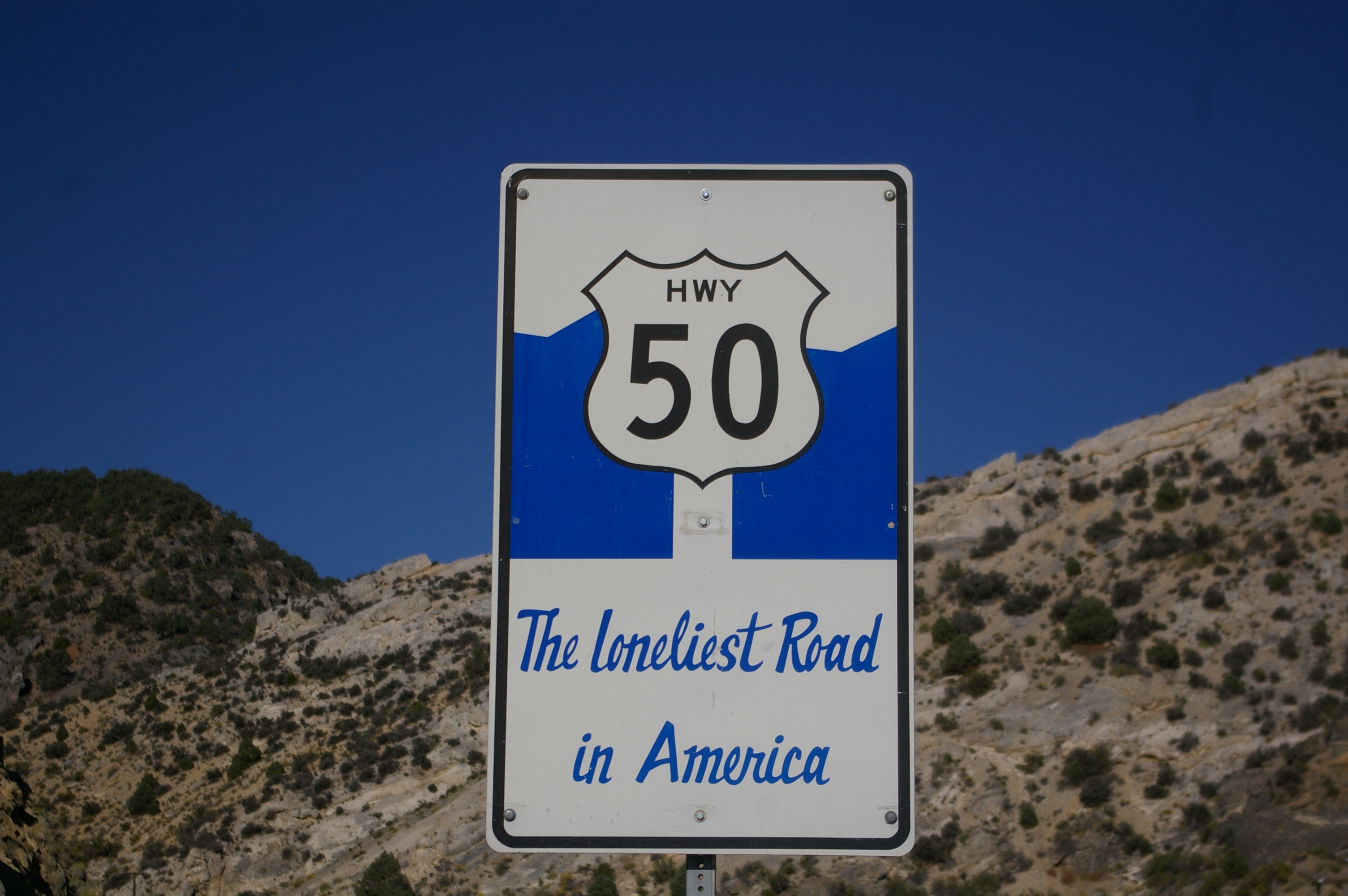

U.S. Route 50, also known as "The Loneliest Road in America."
Interstate 15 passes through the southern tip of the state, serving Las Vegas and other communities. I-215 and spur route I-515 also serve the Las Vegas metropolitan area. Interstate 80 crosses through the northern part of Nevada, roughly following the path of the Humboldt River from Utah in the east and passing westward through Reno and into California. It has a spur route, I-580. Nevada also is served by several federal highways: US 6, US 50, US 93, US 95 and US 395. There are also 189 Nevada state highways. Nevada is one of a few states in the U.S. that does not have a continuous interstate highway linking its two major population centers. Even the non-interstate federal highways aren't contiguous between the Las Vegas and Reno areas.
The state is one of just a few in the country that allow semi-trailer trucks with three trailers—what might be called a "road train" in Australia. However, American versions are usually smaller, in part because they must ascend and descend some fairly steep mountain passes.
RTC Transit is the public transit system in the Las Vegas metropolitan area. The agency is the largest transit agency in the state and operates a network of bus service across the Las Vegas Valley, including the use of The Deuce, double-decker buses, on the Las Vegas Strip and several outlying routes. RTC RIDE operates a system of local transit bus service throughout the Reno-Sparks metropolitan area. Other transit systems in the state include Carson City's JAC. Most other counties in the state do not have public transportation at all.
Additionally, a four mile (6 km) monorail system provides public transportation in the Las Vegas area. The Las Vegas Monorail line services several casino properties and the Las Vegas Convention Center on the east side of the Las Vegas Strip, running near Paradise Road, with a possible future extension to McCarran International Airport. Several hotels also run their own monorail lines between each other, which are typically several blocks in length.
McCarran International Airport in Las Vegas is the busiest airport serving Nevada. The Reno-Tahoe International Airport (formerly known as the Reno Cannon International Airport) is the other major airport in the state.
Law and government
The current Governor of Nevada is Brian Sandoval, a Republican; the governor of Nevada is limited by the Nevada Constitution to two four-year terms in office, by election or succession (lifetime limit). Nevada's two U.S. senators are Harry Reid (Democrat) and Dean Heller (Republican), who, by the United States Constitution, have no term limits. Reid is also the current Majority Leader in the US Senate. Nevada's U.S. Representatives are Republicans Joe Heck and Democrat Shelley Berkley. The third representative's seat is vacant.
Legislature
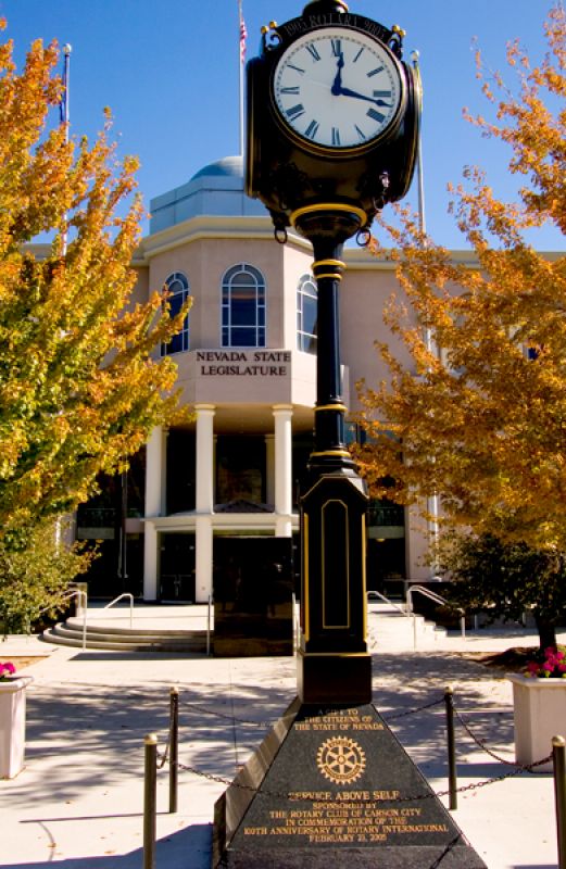
A view of the Nevada State Legislative Building in Carson City
The Nevada Legislature is a bicameral body divided into an upper house Senate and a lower house Assembly. Members of the Senate serve for four years, and members of the Assembly serve for two years. Both houses of the Nevada Legislature will be impacted by term limits starting in 2010, as Senators and Assemblymen/women will be limited to a maximum of 12 years service in each house (by appointment or election which is a lifetime limit) - this provision in the constitution was recently upheld for legislators by the Supreme Court of Nevada in a unanimous decision (7-0), so term limits will be in effect starting in 2010. Each session of the Legislature meets for a constitutionally mandated 120 days in every odd-numbered year, or longer if the Governor calls a special session. Currently, the Senate is controlled by the Democratic Party (12 to 9 majority) and the Assembly is controlled by the Democratic Party (28 to 14 majority).
Judiciary
Nevada is one of the few U.S. states without a system of intermediate appellate courts.
The state supreme court is the Supreme Court of Nevada.
Original jurisdiction is divided between the District Courts (with general jurisdiction), and Justice Courts and Municipal Courts (both of limited jurisdiction).
Libertarian laws


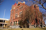
.jpg)
The courthouse of the Supreme Court of Nevada
In 1900, Nevada's population was the smallest of all states and was shrinking, as the difficulties of living in a "barren desert" began to outweigh the lure of silver for many early settlers. Historian Lawrence Friedman has explained what happened next:
- "Nevada, in a burst of ingenuity, built an economy by exploiting its sovereignty. Its strategy was to legalize all sorts of things that were illegal in California ... after easy divorce came easy marriage and casino gaming. Even prostitution is legal in Nevada, in any county that decides to allow it. Quite a few of them do."[38] With the advent of air conditioning for summertime use and Southern Nevada's mild winters, the fortunes of the state began to turn around, as it did for Arizona, making these two states the fastest growing in the Union.
Prostitution laws
Nevada is the only state where prostitution is legal (under the form of licensed brothels).
Prostitution is specifically illegal by state law in the state's larger jurisdictions, which include Clark County (which contains Las Vegas), Washoe County (which contains Reno), and the independent city of Carson City. Otherwise, it is legal in those counties which specifically vote to permit it.
Divorce laws
Nevada's early reputation as a "divorce haven" arose from the fact that, prior to the no-fault divorce revolution in the 1970s, divorces were quite difficult to obtain in the United States. Already having legalized gaming and prostitution, Nevada continued the trend of boosting its profile by adopting one of the most liberal divorce statutes in the nation. This resulted in Williams v. North Carolina, 317 U.S. 287 (1942), in which the U.S. Supreme Court ruled that North Carolina had to give "full faith and credit" to a Nevada divorce.
Tax laws
Nevada's tax laws also draw new residents and businesses to the state. Nevada has no personal income tax or corporate income tax.[39]
Nevada's state sales tax rate is 6.85 percent. Counties may impose additional rates via voter approval or through approval of the Legislature; therefore, the applicable sales tax will vary by county from 6.85 percent to 8.1 percent in Clark County. Clark County, which includes Las Vegas, imposes four separate county option taxes in addition to the statewide rate - 0.25 percent for flood control, 0.50 percent for mass transit, 0.25 percent to fund the Southern Nevada Water Authority, and 0.25 percent for the addition of police officers in that county. In Washoe County (which includes Reno), the sales tax rate is 7.725 percent, due to county option rates for flood control, the ReTRAC train trench project, mass transit, and an additional county rate approved under the Local Government Tax Act of 1991.[40]
The lodging tax rate in unincorporated Clark County, which includes the Las Vegas Strip, is 12%. Within the boundaries of the cities of Las Vegas and Henderson, the lodging tax rate is 13%.
Incorporation laws
Nevada also provides friendly environment for the formation of corporations, and many (especially California) businesspeople have incorporated their businesses in Nevada to take advantage of the benefits of the Nevada statute. Nevada corporations offer great flexibility to the Board of Directors and simplify or avoid many of the rules that are cumbersome to business managers in some other states. In addition, Nevada has no franchise tax.
Financial institutions
Similarly, many U.S. states have usury laws limiting the amount of interest a lender can charge, but federal law allows corporations to 'import' these laws from their home state.
Drug and alcohol laws
Non-alcohol drug laws are a notable exception to Nevada's otherwise libertarian principles. It is notable for having the harshest penalties for drug offenders in the country. Nevada remains the only state to still use mandatory minimum sentencing guidelines for marijuana possession. However, it is now a misdemeanor for possession of less than one ounce but only for persons age 21 and older. In 2006, voters in Nevada defeated attempts to allow possession of 1 ounce of marijuana (for personal use) without being criminally prosecuted, (55% against legalization, 45% in favor of legalization). Also, Nevada is one of the states that allows for use of marijuana for medical reasons (though this remains illegal under federal law).
Nevada has very liberal alcohol laws. Bars are permitted to remain open 24 hours, with no "last call". Liquor stores, convenience stores and supermarkets may also sell alcohol 24 hours per day, and may sell beer, wine and spirits.
Smoking
Nevada voters enacted a smoking ban ("the Nevada Clean Indoor Air Act") in November 2006 that became effective on December 8, 2006. It outlaws smoking in most workplaces and public places. Smoking is permitted in bars, but only if the bar serves no food, or the bar is inside a larger casino. Smoking is also permitted in casinos, hotel rooms, tobacco shops, and brothels.[41] However, some businesses do not obey this law and the government tends not to enforce it.[42] Yet, in one case, they did prosecute an establishment called "Bilbo's." As of 2008, the trial was still pending.[43]
Crime
Nevada has been ranked as the most dangerous state in the U.S. for five years in a row, just ahead of Louisiana[44][45] In 2006, the crime rate in Nevada was approximately 24% higher than the national average rate. Property crimes accounted for approximately 84.6% of the crime rate in Nevada which was 21% higher than the national rate. The remaining 20.3% were violent crimes and were approximately 45% higher than other states.[46] In 2008, Nevada had the third highest murder rate, and the highest rate of robbery and motor vehicle theft.[44] It should be noted that many of these statistics may not totally be attributed to the citizens of Nevada themselves, but partially to the high rate of visitors entering and leaving the state as well. In addition, the state's most populous county, Clark (accounting for 75% of the state's total population), skews the crime rate for the balance of the state.
Politics
| Year | Republican | Democratic |
|---|---|---|
| 2008 | 42.65% 412,827 | 55.15% 533,736 |
| 2004 | 50.47% 418,690 | 47.88% 397,190 |
| 2000 | 49.49% 301,575 | 45.94% 279,978 |
| 1996 | 44.55% 198,775 | 45.60% 203,388 |
| 1992 | 34.71% 175,828 | 37.41% 189,148 |
| 1988 | 58.90% 206,040 | 37.91% 132,738 |
| Voter Registration and Party Enrollment as of June 2010[47] | |||||
|---|---|---|---|---|---|
| Party | Active Voters | Inactive Voters | Total Voters | Percentage | |
| Democratic | 456,672 | 126,158 | 580,393 | 43.10% | |
| Republican | 398,898 | 79,414 | 475,764 | 35.33% | |
| Unaffiliated | 163,816 | 49,731 | 213,329 | 15.84% | |
| Minor Parties | 57,984 | 19,352 | 77,079 | 5.72% | |
| Total | 1,077,370 | 274,655 | 1,346,565 | 100% | |
State politics
Due to heavy growth in the southern portion of the state, there is a noticeable divide between politics of northern and southern Nevada. The north has long maintained control of key positions in state government, even while the population of southern Nevada is larger than the rest of the state combined. The north sees the high population south becoming more influential and perhaps commanding majority rule. The south sees the north as the "old guard" trying to rule as an oligarchy. This has fostered some resentment, however, due to a term limit amendment passed by Nevada voters in 1994, and again in 1996, some of the north's hold over key positions will soon be forfeited to the south, leaving Northern Nevada with less power.
Clark and Washoe counties—home to Las Vegas and Reno, respectively—have long dominated the state's politics. Between them, they cast 87 percent of Nevada's vote, and elect a substantial majority of the state legislature. The great majority of the state's elected officials are either from Las Vegas or Reno.
National politics
Nevada has voted for the winner in every presidential election since 1912, except in 1976 when it voted for Gerald Ford over Jimmy Carter. This gives the state status as a political bellwether.
Nevada supported Democrat Bill Clinton in the 1992 and 1996 presidential elections, Republican George W. Bush won in 2000 and 2004, and Democrat Barack Obama won the state in 2008.
The state's U. S. Senators are Democrat Harry Reid, the Senate Majority Leader, and Republican Dean Heller. The Governorship is held by Brian Sandoval, a Republican from Reno.
State government
State departments and agencies:
- Attorney General
- Department of Business & Industry
- Department of Conservation & Natural Resources
- Consumer Health Assistance
- Controller's Office
- Department of Correction
- Nevada Department of Cultural Affairs
- Nevada Commission on Economic Development
- Department of Education
- Nevada Secretary of State, Election Division
- Department of Employment, Training & Rehabilitation
- Gaming Control Board
- Governor's Office
- Department of Health and Human Services
- Department of Information Technology
- Department of Justice
- Lieutenant Governor
- Nevada Military Department
- Division of Minerals, Commission on Mineral Resources
- Department of Motor Vehicles
- Nevada National Guard
- Department of Personnel
- Advisory Council for Prosecuting Attorneys
- Public Employees Benefit Program
- Public Employees Retirement System
- Department of Public Safety
- Public Utilities Commission[48]
- Department of Secretary of State
- Department of Taxation
- Commission on Tourism
- Department of Transportation
- Nevada State Treasurer
- Universities and Community Colleges of Nevada
- Nevada Office of Veterans' Services
- Western Interstate Commission for Higher Education
- Nevada Department of Wildlife
Local government
Incorporated towns in Nevada, known as cities, are given the authority to legislate anything not prohibited by law. A recent movement has begun to permit home rule in incorporated Nevada cities to give them more flexibility and fewer restrictions from the Legislature.
Unincorporated towns are settlements eminently governed by the county in which they are located, but who, by local referendum or by the act of the county commission, can form limited local governments in the form of a Town Advisory Board (TAB)/ Citizens Advisory Council (CAC), or a Town Board.
Town Advisory Boards and Citizens Advisory Councils are formed purely by act of the county commission. Consisting of three to five members, these elected boards form a purely advisory role, and in no way diminish the responsibilities of the county commission that creates them. Members of advisory councils and boards are elected to two year terms, and serve without compensation. The councils and boards, themselves, are provided no revenue, and oversee no budget.
Town Boards are limited local governments created by either the local county commission, or by referendum. The board consists of five members elected to four-year terms. Half the board is required to be up for election in each election. The board elects from within its ranks a town chairperson and town clerk. While more powerful than Town Advisory Boards and Citizens Advisory Councils, they also serve a largely advisory role, with their funding provided by their local county commission. The local county commission has the power to put before residents of the town a vote on whether to keep or dissolve a town board at any general election. Town boards have the ability to appoint a town manager if they choose to do so.
Important cities and towns
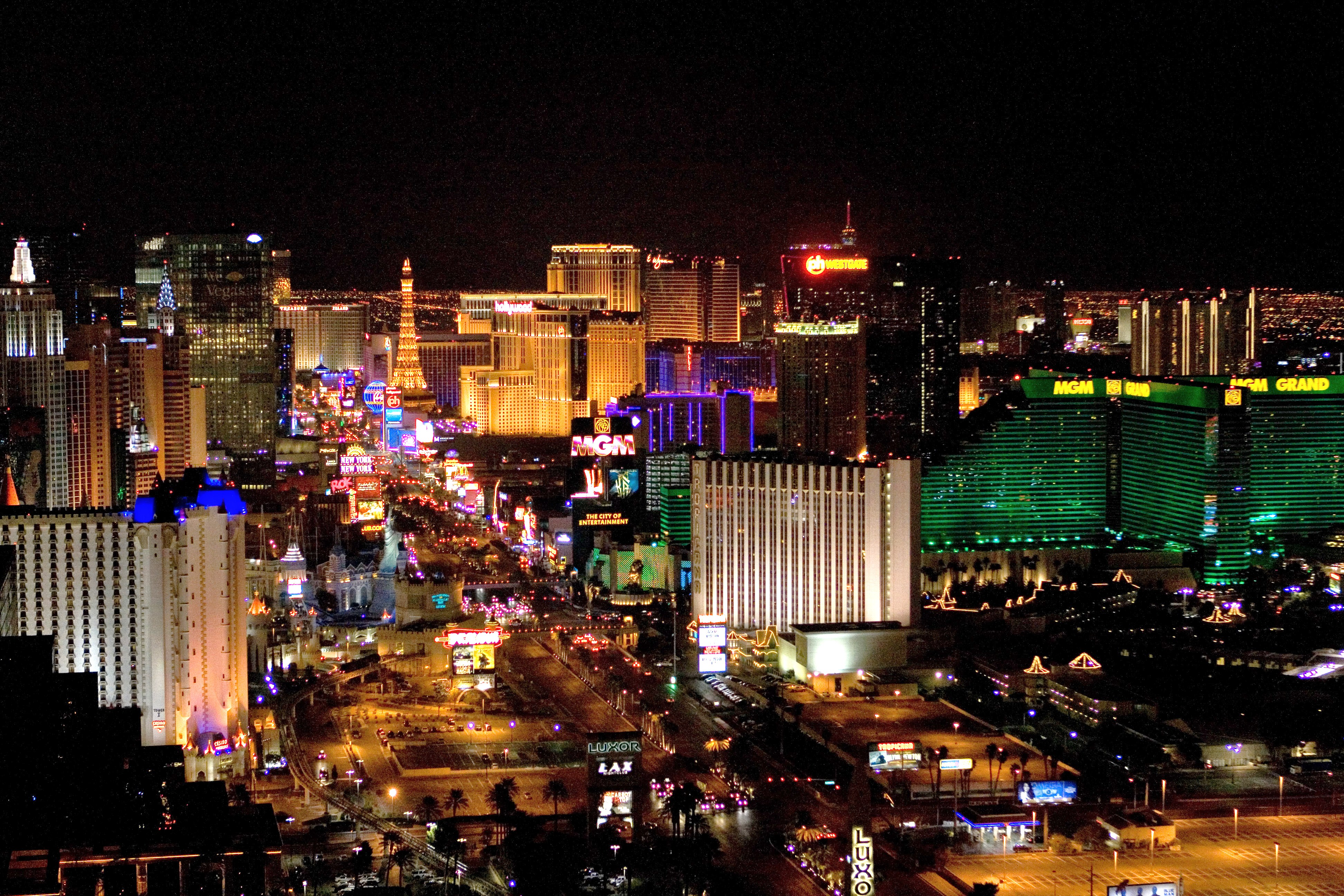

Las Vegas


Elko

|
Paradise, Sunrise Manor, and Spring Valley are unincorporated towns in the Las Vegas metropolitan area.
| Rank | County | Population within county limits |
Land Area sq. miles |
Population Density per sq mi |
Largest city |
|---|---|---|---|---|---|
| 1 | Clark | 1,715,337 | 7,910 | 174 | Las Vegas |
| 2 | Washoe | 383,453 | 6,342 | 54 | Reno |
| 3 | Carson City | 56,146 | 155.7 | 366 | Carson City |
| 4 | Douglas | 47,803 | 710 | 58 | Gardnerville Ranchos |
| 5 | Elko | 46,499 | 17,179 | 3 | Elko |
| 6 | Lyon | 44,646 | 1,994 | 17 | Fernley |
| 7 | Nye | 38,181 | 18,147 | 2 | Pahrump |
| 8 | Churchill | 26,106 | 4,929 | 5 | Fallon |
| 9 | Humboldt | 17,129 | 9,648 | 2 | Winnemucca |
| 10 | White Pine | 8,966 | 8,876 | 1 | Ely |
| 10 | Clark | 7,854 | 81 | 96 | laughlin |
Note: table was compiled using Nevada State estimates from 2004 for population and Census 2000 for area and density
10 richest places in Nevada
Ranked by per capita income
- Incline Village-Crystal Bay $52,521 Washoe County, Nevada
- Kingsbury $41,421 Douglas County, Nevada
- Mount Charleston $38,821 Clark County, Nevada
- Verdi-Mogul $38,233 Washoe County
- Zephyr Cove-Round Hill Village $37,218 Douglas County
- Summerlin South $33,017 Clark County
- Blue Diamond $30,479 Clark County
- Minden $30,405 Douglas County
- Boulder City $29,770 Clark County
- Spanish Springs $26,908 Washoe County
Education
Colleges and universities
- Nevada System of Higher Education
- University of Nevada, Las Vegas (UNLV)
- University of Nevada, Reno (UNR)
- Nevada State College
- Truckee Meadows Community College (TMCC)
- Great Basin College
- College of Southern Nevada (CSN)
- Western Nevada College (WNC)
- Sierra Nevada College
- Touro University Nevada
- University of Southern Nevada
Research institutes
- Desert Research Institute
Parks and recreation areas


Valley of Fire State Park
Recreation areas maintained by the National Park Service
Northern Nevada
Great Basin National Park
- California National Historic Trail
- Death Valley National Park
- Great Basin National Park near Baker
- Old Spanish National Historic Trail
- Pony Express National Historic Trail
Southern Nevada


Mount Charleston
- Ash Meadows National Wildlife Preserve
- Bootleg Canyon Mountain Bike Park
- Humboldt-Toiyabe National Forest
- Mount Charleston and the Mount Charleston Wilderness
- Spring Mountains and the Spring Mountains National Recreation Area
- Lake Mead National Recreation Area
Wilderness
There are 68 designated wilderness areas in Nevada, protecting some 6,579,014 acres (2,662,432.5 ha) under the jurisdiction of the National Park Service, U.S. Forest Service, and Bureau of Land Management.[49]
State parks
See: List of Nevada state parks.
Sports
Nevada is not well-known for its professional sports, but the state takes pride in college sports, most notably the Nevada Wolf Pack (representing the University of Nevada, Reno) of the Western Athletic Conference and the UNLV Rebels of the Mountain West Conference. In 2012, Nevada will join its cross-state rival in the MWC.
UNLV is most remembered for its men's basketball program, which experienced its height of supremacy in the late 1980s and early 1990s. Coached by Jerry Tarkanian, the Runnin' Rebels became one of the most elite programs in the country. In 1990, UNLV won the Men's Division I Championship by defeating Duke 103–73, which set tournament records for most points scored by a team and largest margin of victory in the national title game. In 1991, UNLV finished the regular season undefeated. Forward Larry Johnson won several awards, including the Naismith Award. UNLV reached the Final Four yet again, but lost their national semifinal against Duke 79-77, and is referred to as one of the biggest upsets in the NCAA Tournament. The Runnin' Rebels were the Associated Press pre-season #1 back to back (1989–90, 1990–91). North Carolina is the only other team to accomplish that (2007–08, 2008–09).
The state is also home to one of the most famous tennis players of all time, Andre Agassi.
Nevada sports teams
Professional
- Las Vegas Locomotives, United Football League
- Las Vegas 51s, Minor League Baseball (AAA)
- Las Vegas Wranglers, ECHL
- Reno Aces, Minor League Baseball (AAA)
- Reno Bighorns, NBA D-League
- Nevada Pumas, QuickHit Football League
College
- Nevada Wolf Pack, UNR
- UNLV Rebels
The state is also home to the Las Vegas Motor Speedway and NASCAR event and the National Rodeo.
Military
Several United States Navy ships have been named USS Nevada in honor of the state. They include:
- USS Nevada
- USS Nevada (BM-8)
- USS Nevada (BB-36)
- USS Nevada (SSBN-733)
Area 51 is located near Groom Lake, a dry salt lake bed. The much smaller Creech Air Force Base is located in Indian Springs, Nevada; Naval Air Station Fallon in Fallon; Hawthorne Army Depot in Hawthorne; and the Tonopah Test Range near Tonopah.
These bases host a number of activities including the Joint Unmanned Aerial Systems Center of Excellence, the Naval Strike and Air Warfare Center, Nevada Test and Training Range, Red Flag, the U.S. Air Force Thunderbirds, the United States Air Force Warfare Center, the United States Air Force Weapons School, and the United States Navy Fighter Weapons School.
Songs about Nevada
- "Sands of Nevada" from Mark Knopfler's 2000 release Sailing to Philadelphia
- "Sin City" from Limbeck's 2005 release Let Me Come Home
- "Home Means Nevada", the state song of Nevada, by Bertha Rafetto
- "Nevada" by Riders in the Sky from the album Best of the West
- "Night Time In Nevada" by Dulmage/Clint/Pascoe, 1931
- "Nevada's Grace" by Atreyu, twelfth track off 2004's The Curse
Future issues
Nevada enjoys many economic advantages, and the southern portion of the state enjoys mild winter weather, but rapid growth has led to some overcrowded roads and schools. Nevada has the nation's 5th largest school district in the Clark County School District (projected fall 2007 enrollment is 314,000 students grades K-12).[50] While the state was recently one of the fastest growing in the country, population growth slowed down to a halt in 2008.[51]
In 2008, the "American State Litter Scorecard," presented at the American Society for Public Administration national conference, positioned Nevada next to Mississippi and Louisiana as one of the worst states for removing litter from public roadways and properties.[52]
In August 2008, it was announced that Boyd Gaming would halt construction on a 4.2 billion dollar project called Echelon, which was to replace the old Stardust Resort & Casino. The reason cited for this is lack of funding/credit from banks.
Coyote Springs is a proposed community for 240,000 inhabitants in Clark and Lincoln counties. It would be Nevada's largest planned city. The town is being developed by Harvey Whittemore and has generated some controversy because of environmental concerns and allegations of political favoritism.[53]
State symbols

Playa areas of Nevada
- State animal: Desert Bighorn Sheep
- State artifact: Tule Duck Decoy
- State bird: Mountain Bluebird
- State colors: silver and blue
- State fish: Lahontan cutthroat trout
- State flower: Sagebrush (Artemisia tridentata)
- State fossil: Ichthyosaur
- State grass: Indian ricegrass
- State march: "Silver State Fanfare" by Gerald Willis
- State metal: Silver (Ag)
- State mottos: "Battle Born" and "All For Our Country"
- State precious gemstone: Virgin Valley black fire opal
- State semiprecious gemstone: Nevada turquoise
- State slogan: "The Battle Born State"
- State song: "Home Means Nevada" by Bertha Raffetto
- State reptile: Desert Tortoise
- State rock: Sandstone
- State soil: Orovada (soil) series
- State tartan: A particular tartan designed for Nevada by Richard Zygmunt Pawlowski
- State trees: Single-leaf Pinyon pine and Bristlecone pine (Pinus longaeva)
See also
References
- ^ The distinction of highest point in Nevada goes to the summit of Boundary Peak, so named because it is very near the Nevada-California border, at the northern terminus of the White Mountains. However, Boundary Peak can be considered a subsidiary summit of Montgomery Peak, whose summit is in California, since the topographic prominence of Boundary Peak is only 253 feet (77 m), which falls under the often used 300-foot (91 m) cutoff for an independent peak. Also, Boundary Peak is less than 1 mile (1.6 km) away from its higher neighbor. Hence Boundary Peak can be described as not being wholly within Nevada. By contrast, the prominence of Wheeler Peak, 13,063 feet (3,982 m), is quite large and in fact it is the twelfth largest in the contiguous United States. Wheeler Peak is the highest point in a radius of more than 200 square miles (520 km2) and is entirely within the state of Nevada.
- ^ a b "Elevations and Distances in the United States". U.S Geological Survey. April 29, 2005. http://erg.usgs.gov/isb/pubs/booklets/elvadist/elvadist.html#Highest. Retrieved November 6, 2006.
- ^ "Table 2. Annual Estimates of the Population of Combined Statistical Areas: April 1, 2000 to July 1, 2009 (CBSA-EST2009-02)" (CSV). 2009 Population Estimates. United States Census Bureau, Population Division. 2010-03-23. http://www.census.gov/popest/metro/tables/2009/CBSA-EST2009-02.csv. Retrieved 2010-04-19.
- ^ http://www.census.gov/popest/cities/tables/SUB-EST2009-04-32.csv
- ^ "Federal Land Acres in Nevada". US Dept. of the Interior, Bureau of Land Management. Archived from the original on 2006-09-30. http://web.archive.org/web/20060930112237/http://www.nv.blm.gov/landsales/LandFedAcresAgency.pdf. Retrieved 2009-05-07.
- ^ "Early Native Americans", "nevada-history.org", accessed Dec 27, 2010
- ^ Rocha, Guy "Myth #12 - Why Did Nevada Become a State?", "Nevada State Library and Archives", accessed Jan 9, 2011
- ^ Bible, Bill "Protect Gaming's Legacy", "Las Vegas Sun", August 11, 2000, accessed Jan 9, 2011
- ^ Jain, Priya "Betty Goes Reno", "Slate.com", July 21, 2010, accessed January 9, 2011
- ^ "Nevada Employment & Unemployment Estimates for November 2010", "Nevada Department of Employment, Training, and Rehabilitation"
- ^ "Frequently Asked Questions", Nevada Mining Association, accessed January 7, 2011
- ^ "Nevada". Wordreference.com. http://www.wordreference.com/es/en/translation.asp?spen=nevada. Retrieved 2007-02-24.
- ^ "Myth #123 - Pronouncing Nevada". Nevadaculture.org. http://nevadaculture.org/nsla/index.php?option=com_content&task=view&id=804&Itemid=95. Retrieved 2010-07-31.
- ^ "You heard it right: Bill would let them say Ne-VAH-da". http://www.rgj.com/apps/pbcs.dll/article?AID=20108220380.
- ^ a b National Climatic Data Center, Asheville, N.C., and Storm Phillips, Stormfax, Inc.
- ^ Federal Writers' Project (1940). Nevada: a guide to the Silver state. US History Publishers. p. 11. ISBN 160354027X.
- ^ Rocha Guy, Historical Myth a Month: Why Did Nevada Become A State?
- ^ http://2010.census.gov/2010census/data/apportionment-pop-text.php
- ^ By Les Christie, CNNMoney.com staff writer (2006-12-25). "CNN". Money.cnn.com. http://money.cnn.com/2006/12/22/real_estate/fastest_growing_states/index.htm. Retrieved 2010-07-31.
- ^ "www.census.gov". http://www.census.gov/geo/www/cenpop/statecenters.txt. Retrieved 2010-07-31.
- ^ doug (2008-08-08). "People keep moving to Nevada...". Employerblog.recruitingnevada.com. http://employerblog.recruitingnevada.com/2008/08/08/people-keep-moving-to-nevada/. Retrieved 2010-07-31.
- ^ Nevada – Selected Population Profile in the United States
- ^ "Language Map Data Center". Mla.org. 2007-07-17. http://www.mla.org/map_data_results&state_id=32&mode=state_tops. Retrieved 2010-07-31.
- ^ Slevin, Peter (30 April 2010). "New Arizona law puts police in 'tenuous' spot". Washington, DC: Washington Post. pp. A4. http://www.washingtonpost.com/wp-dyn/content/article/2010/04/29/AR2010042904970.html?sid=ST2010042905051.
- ^ Nevada - Selected Social Characteristics in the United States, 2008 American Community Survey 1–year Estimates, U.S. Census Bureau, 2008. Retrieved 2010-06-23.
- ^ "Pew Forum on Religion & Public Life". Religions.pewforum.org. http://religions.pewforum.org/maps. Retrieved 2010-07-31.
- ^ "The Association of Religion Data Archives | Maps & Reports". Thearda.com. http://www.thearda.com/mapsReports/reports/state/32_2000.asp. Retrieved 2010-07-31.
- ^ The Economist, August 21, 2010, p. 35
- ^ Bureau of Economic Analysis
- ^ "BEA : Gross Domestic Product by State". Bea.gov. 2009-06-02. http://www.bea.gov/regional/gsp/. Retrieved 2010-07-31.
- ^ Bls.gov; Local Area Unemployment Statistics
- ^ "Regional and State Employment and Unemployment Summary". Bls.gov. 2010-07-20. http://www.bls.gov/news.release/laus.nr0.htm. Retrieved 2010-07-31.
- ^ Nevada Mining Association, Economic Overview of the Nevada Mining Industry 2004
- ^ United States Department of Agriculture Nevada State Agriculture Overview - 2005
- ^ "Taxation Publications". Tax.state.nv.us. http://tax.state.nv.us/pubs.htm#Sales. Retrieved 2010-07-31.
- ^ "State-by-State Fact Sheets on Lodging Industry". http://www.ahla.com/content.aspx?id=27642.
- ^ S. Spacek, 2011 American State Litter Scorecard: New Rankings for An Increasingly Concerned Populace
- ^ Lawrence M. Friedman, American Law in the Twentieth Century (New Haven: Yale University Press, 2002), 596-597.
- ^ "The Tax Foundation - Tax Research Areas > Nevada". Tax Foundation. http://www.taxfoundation.org/research/topic/42.html. Retrieved 15 September 2010.
- ^ http://tax.state.nv.us/documents/Sales_Tax_Map.pdf
- ^ "State smoking ban sparks zone-change request for Gardnerville parcel Nevada Appeal serving Carson City, Nevada". Nevadaappeal.com. 2007-10-06. http://www.nevadaappeal.com/article/20071006/NEWS/110060112. Retrieved 2010-07-31.
- ^ "Have Nevada bars given up the smoking habit?". Kvbc.com. http://www.kvbc.com/Global/story.asp?S=6466938. Retrieved 2010-07-31.
- ^ "Las Vegas Now-Breaking News, Local News, Weather, Traffic, Streaming Video, Classifieds, Blogs - UPDATED: Bilbo's Smoking Lawsuit Case". Klas-tv.com. http://www.klas-tv.com/Global/story.asp?S=7293936. Retrieved 2010-07-31.
- ^ a b "Nevada Ranked Most Dangerous State". KIROTV. 2008-03-17. http://www.kirotv.com/news/15618530/detail.html. Retrieved 2009-01-04.
- ^ "The 15th Annual Most Dangerous State Award, Nevada Still Fighting the Problem". cqpress. 2009-01-04. http://os.cqpress.com/Crime%20State%202008_Most%20Dangerous.pdf. Retrieved 2009-01-04.
- ^ "Overview of Nevada's CorrectionalSystem". NICIC. 2009-01-04. http://www.nicic.org/Features/StateStats/?State=NV. Retrieved 2009-01-04.
- ^ "Voter Registration Statistics - 2010 Elections". Nevada Secretary of State. http://nvsos.gov/index.aspx?page=312. Retrieved 2010-07-07.
- ^ http://puc.state.nv.us
- ^ "Wilderness.net". Wilderness.net. http://www.wilderness.net. Retrieved 2010-07-31.
- ^ "Clark County School District: Overview". Las Vegas Sun. http://www.lasvegassun.com/guides/about/ccsd/.
- ^ http://www.bloomberg.com/news/2011-02-25/fastest-growing-nevada-now-booms-with-unemployment-stranded-homeowners.html
- ^ S. Spacek, The American State Litter Scorecard" March 2008
- ^ BREAN, HENRY (July 6, 2006). "'Lovefest' for Coyote Springs". http://www.reviewjournal.com/lvrj_home/2006/Jul-06-Thu-2006/news/8336867.html. Retrieved July 6, 2006.
External links
| Wikisource has original text related to this article: |
| Find more about Nevada on Wikipedia's sister projects: |
| Definitions from Wiktionary | |
| Textbooks from Wikibooks | |
| Quotations from Wikiquote | |
| Source texts from Wikisource | |
| Images and media from Commons | |
| News stories from Wikinews | |
| Learning resources from Wikiversity |
![]() Geographic data related to Nevada at OpenStreetMap
Geographic data related to Nevada at OpenStreetMap
- Official state website
- Nevada State Databases - Annotated list of searchable databases produced by Nevada state agencies and compiled by the Government Documents Roundtable of the American Library Association.
- State Tourism website
- Nevada state symbols
- Secretary of State of Nevada
- Nevada Classifieds
- Nevada State Library and Archives
- Energy Profile for Nevada
- USGS real-time, geographic, and other scientific resources of Nevada
- US Census Bureau
- County Maps of Nevada Full color maps. List of cities, towns and county seats
- Nevada State Facts
- Pronunciation Guide: Nevada
- Forgotten Nevada - Ghost Towns and Mining Camps of Nevada
- Nevada's Historical Markers
- Nevada at Judgepedia
- Nevada at the Open Directory Project
| Preceded by West Virginia |
List of U.S. states by date of statehood Admitted on October 31, 1864 (36th) |
Succeeded by Nebraska |

|
| |||
 Nevada: Outline • Index | ||||
| ||||||||||||||||||||||||||
| |||||||||||
| ||||||||||||||
| ||||||||||||||||||||||||||||||||||||||||||||||||||||||||
| This page uses content from the English language Wikipedia. The original content was at Nevada. The list of authors can be seen in the page history. As with this Familypedia wiki, the content of Wikipedia is available under the Creative Commons License. |