| ||||||||||||||
| Monroe County, Arkansas | |
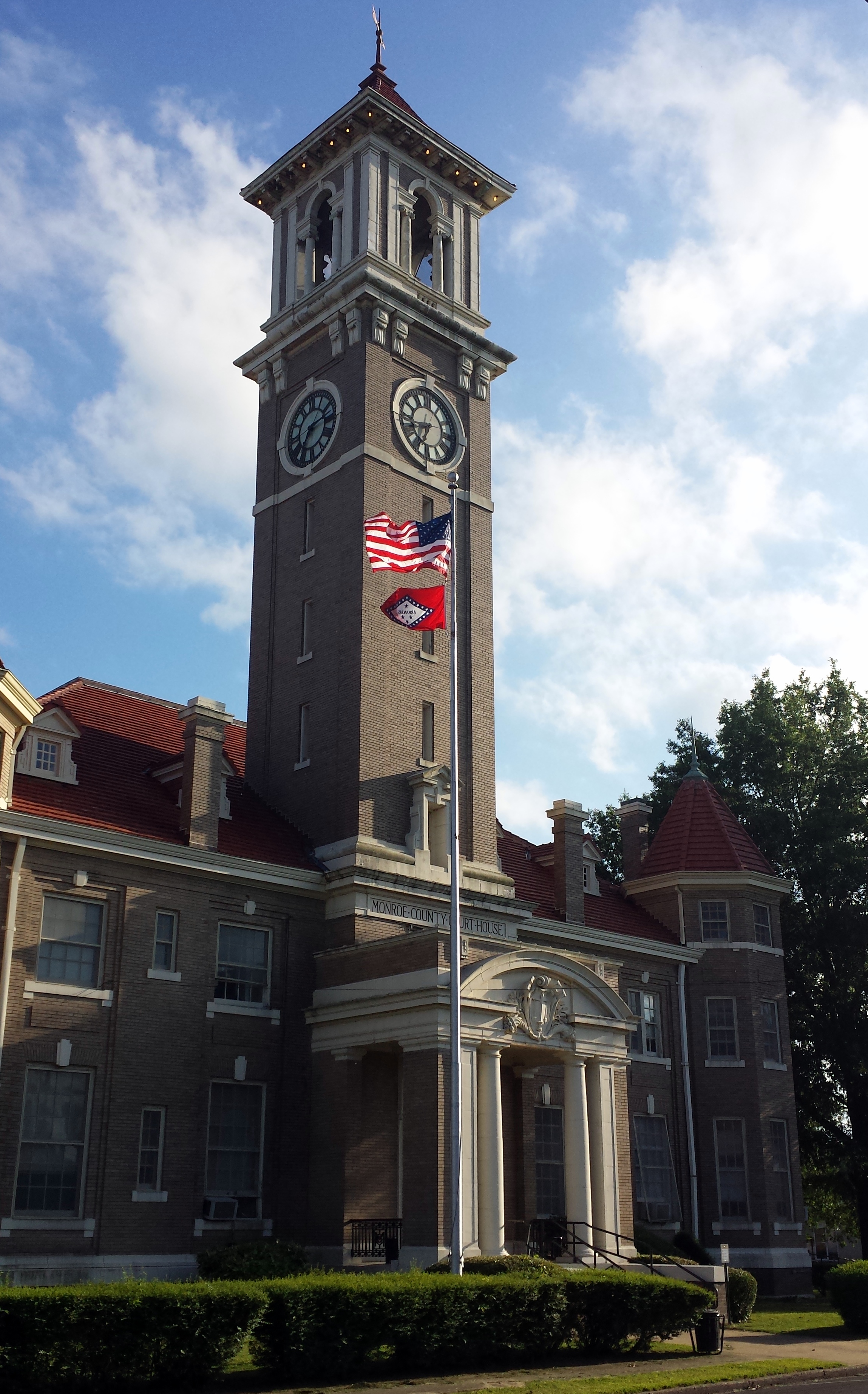 Monroe County Courthouse in Clarendon
| |
 Location in the state of Arkansas | |
 Arkansas's location in the U.S. | |
| Founded | November 2, 1829 |
|---|---|
| Named for | James Monroe[1] |
| Seat | Clarendon |
| Largest city | Brinkley |
| Area - Total - Land - Water |
621 sq mi (1,608 km²) 607 sq mi (1,572 km²) 14 sq mi (36 km²), 2.3% |
| PopulationEst. - (2015) - Density |
7,399 13/sq mi (5/km²) |
| Congressional district | 1st |
| Time zone | Central: UTC-6/-5 |
Monroe County is located in the Arkansas Delta in the U.S. state of Arkansas. The county is named for James Monroe, the fifth President of the United States. Created as Arkansas's 20th county on November 2, 1829, Monroe County is home to two incorporated town and three incorporated cities, including Clarendon, the county seat, and Brinkley, the most populous city. The county is also the site of numerous unincorporated communities and ghost towns.
Occupying only 621 square miles (161,000 ha), Monroe County is the 22nd smallest county in Arkansas. As of the 2010 Census, the county's population is 8,149 people in 4,455 households.[2] Based on population, the county is the fifth-smallest county of the 75 in Arkansas.[3] Located in the Arkansas Delta, the county is largely flat with fertile soils. Historically covered in forest, bayous, swamps, and grasslands, the area was cleared for agriculture by early settlers. It is drained by the Cache River, Bayou DeView, and the White River. Three large protected areas preserve old growth bald cypress forest, sloughs and wildlife habitat in the county: Cache River National Wildlife Refuge (NWR), Dagmar Wildlife Management Area and White River NWR.
Interstate 40 is the only Interstate highway in Monroe County, crossing the county from east to west through Brinkley. The county also has three United States highways (U.S. Route 49 [US 49], US 70, and US 79) and twelve Arkansas state highways run in the county. A Union Pacific Railroad line also crosses the county from southwest to northeast.[4]
History
Settlement in Monroe County began when Dedrick Pike settled where the Cache River enters the White River in 1816.[5] The settlement was named Mouth of the Cache, and a post office by that name was opened years later. The community renamed itself Clarendon in 1824 in honor of the Earl of Clarendon. Monroe County was established under the Arkansas territorial legislature in 1829, and the county seat was established at Lawrenceville where a jail and courthouse were erected. A ferry across the White River came in 1836, and the county seat was moved to Clarendon in 1857, with the new brick courthouse nearly finished at the outbreak of the American Civil War. The county sent five units into Confederate service, and the Union captured Clarendon in 1863 and destroyed the city. Martial law was established for four years after the war as guerrilla warfare continued and the county struggled to rebuild. The Union had completely dismandled the brick courthouse and shipped the bricks to De Valls Bluff.[6] The Monroe County Sun was established in 1876.[7]
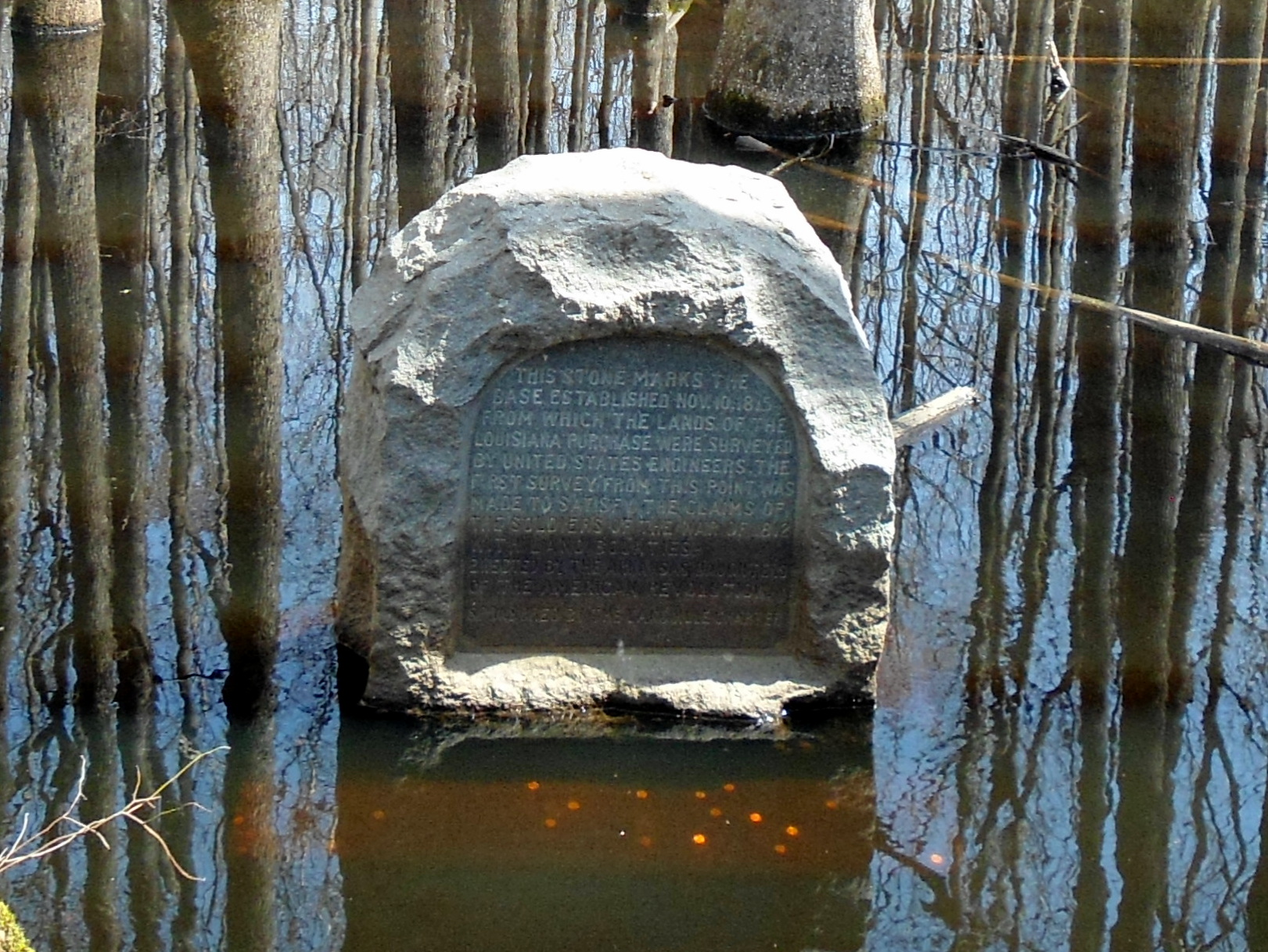

Marker at the point of beginning commemorating the start of surveying the Louisiana Purchase from the county tripoint
It was at a site near the intersection of Monroe, Phillips, and Lee counties that surveys began shortly after the United States had completed the Louisiana Purchase. From wetlands in what would become southern Monroe County, approximately 900,000 square miles (2,300,000 km2) of land would be explored after President James Madison commissioned a survey of the purchase area. The point was commemorated in 1961 by the Arkansas General Assembly as part of Louisiana Purchase State Park.
Geography
The county is located in the Arkansas Delta, one of the six primary geographic regions of Arkansas. The Arkansas Delta is a subregion of the Mississippi Alluvial Plain, which is a flat area consisting of rich, fertile sediment deposits from the Mississippi River between Louisiana and Illinois. Large portions of Monroe County are also within the Grand Prairie, a subdivision of the Arkansas Delta known today for rice farming and aquaculture. According to the U.S. Census Bureau, the county has a total area of 621 square miles (1,610 km2), of which 607 square miles (1,570 km2) is land and 14 square miles (36 km2) (2.3%) is water.[8]
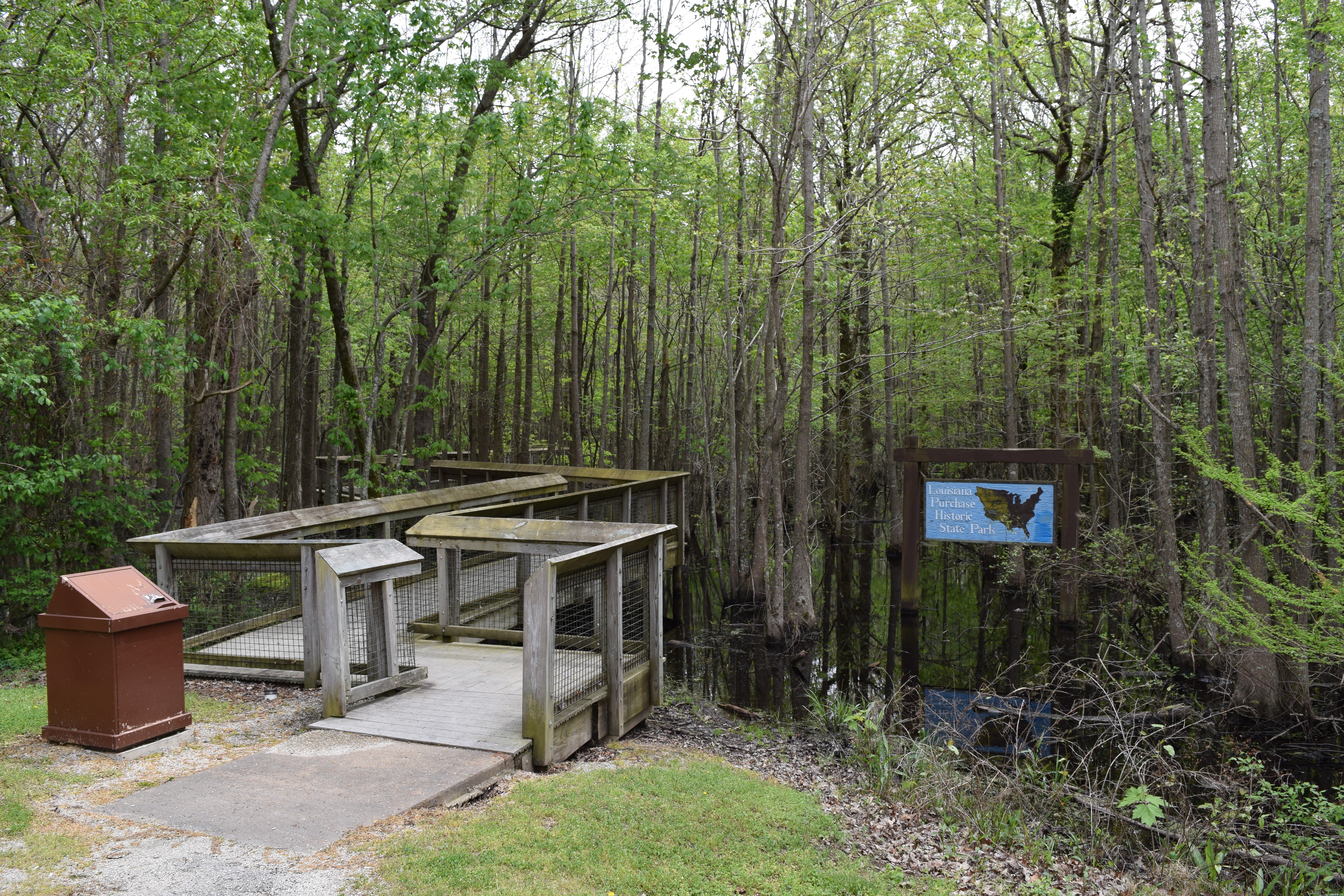

Headwater swamp at the entrance to Louisiana Purchase State Park, southern Monroe County
Prior to settlement, Monroe County was densely forested, with bayous, sloughs, and swamps crossing the land. Seeking to take advantage of the area's fertile soils, settlers cleared the land to better suit row crops.[9] Although some swampland has been preserved in the conservation areas like the Cache River NWR and White River NWR, and some former farmland has undergone reforestation, the majority (52 percent) of the county remains in cultivation.[Note 1] Another large land use in Monroe County is the Cache River NWR and White River NWR, owned by the United States Fish and Wildlife Service.
The county is located approximately 73 miles (117 km) east of Little Rock and 88 miles (142 km) west-southwest of Memphis, Tennessee.[Note 2] Monroe County is surrounded by six other Delta counties: Woodruff County to the north, St. Francis County to the northeast, Lee County and Phillips County to the east, Arkansas County to the southwest, and Prairie County to the west.
Hydrology
Water is an extremely important part of Monroe County's geography, history, economy, and culture. The many rivers, streams, ditches, sloughs and bayous crossing the county have featured prominently since prehistoric times, when Native American tribes such as the Quapaw constructed burial mounds at Indian Bay in extreme southern Monroe County (today preserved as Baytown Site).[9] The White River brought early prosperity to the county during white settlement due to its use as a navigable river. Control of the White River lead to military action in the county during the Civil War, including a gunboat battle at Clarendon in 1864. The Flood of 1927 damaged much of the county's settlements along the White, and inundated Clarendon when the levees protecting the city failed on April 20. Conservation efforts by leaders in the county lead to the creation of federal and state protected areas around the Cache and White beginning in 1935 and continuing to expand to this day.
The White River, one of Arkansas's most important rivers, is the county's major hydrologic features. The White forms the southwestern boundary of the county with Arkansas County. The Cache River runs on the west side of Monroe County, partially forming its border with Prairie County. Both the Cache River and Roc Roe Bayou empty into the White near Clarendon. Bayou De View runs through the north part of the county and meets the Cache north of Dobbs Landing.[4]
National protected areas
- Cache River National Wildlife Refuge (part)
- White River National Wildlife Refuge (part)
Demographics
| Historical populations | |||
|---|---|---|---|
| Census | Pop. | %± | |
| 1830 | 461 | ||
| 1840 | 936 | 103.0% | |
| 1850 | 2,049 | 118.9% | |
| 1860 | 5,657 | 176.1% | |
| 1870 | 8,336 | 47.4% | |
| 1880 | 9,574 | 14.9% | |
| 1890 | 15,336 | 60.2% | |
| 1900 | 16,816 | 9.7% | |
| 1910 | 19,907 | 18.4% | |
| 1920 | 21,601 | 8.5% | |
| 1930 | 20,651 | −4.4% | |
| 1940 | 21,133 | 2.3% | |
| 1950 | 19,540 | −7.5% | |
| 1960 | 17,327 | −11.3% | |
| 1970 | 15,657 | −9.6% | |
| 1980 | 14,052 | −10.3% | |
| 1990 | 11,333 | −19.3% | |
| 2000 | 10,254 | −9.5% | |
| 2010 | 8,149 | −20.5% | |
| Est. 2015 | 7,399 | [12] | −27.8% |
| U.S. Decennial Census[13] 1790–1960[14] 1900–1990[15] 1990–2000[16] 2010–2015[2] | |||


Age pyramid Monroe County[17]
As of the 2000 United States Census,[18] there were 10,254 people, 4,105 households, and 2,733 families residing in the county. The population density was 17 people per square mile (7/km²). There were 5,067 housing units at an average density of 8 per square mile (3/km²). The racial makeup of the county was 59.37% White, 38.79% Black or African American, 0.26% Native American, 0.13% Asian, 0.04% Pacific Islander, 0.26% from other races, and 1.14% from two or more races. 1.29% of the population were Hispanic or Latino of any race.
There were 4,105 households out of which 29.30% had children under the age of 18 living with them, 46.10% were married couples living together, 16.70% had a female householder with no husband present, and 33.40% were non-families. 30.10% of all households were made up of individuals and 15.10% had someone living alone who was 65 years of age or older. The average household size was 2.47 and the average family size was 3.07.
In the county the population was spread out with 27.90% under the age of 18, 7.60% from 18 to 24, 23.70% from 25 to 44, 23.40% from 45 to 64, and 17.30% who were 65 years of age or older. The median age was 38 years. For every 100 females there were 88.50 males. For every 100 females age 18 and over, there were 83.30 males.
The median income for a household in the county was $22,632, and the median income for a family was $28,915. Males had a median income of $25,299 versus $17,117 for females. The per capita income for the county was $13,096. About 21.00% of families and 27.50% of the population were below the poverty line, including 37.40% of those under age 18 and 22.40% of those age 65 or over.
Government
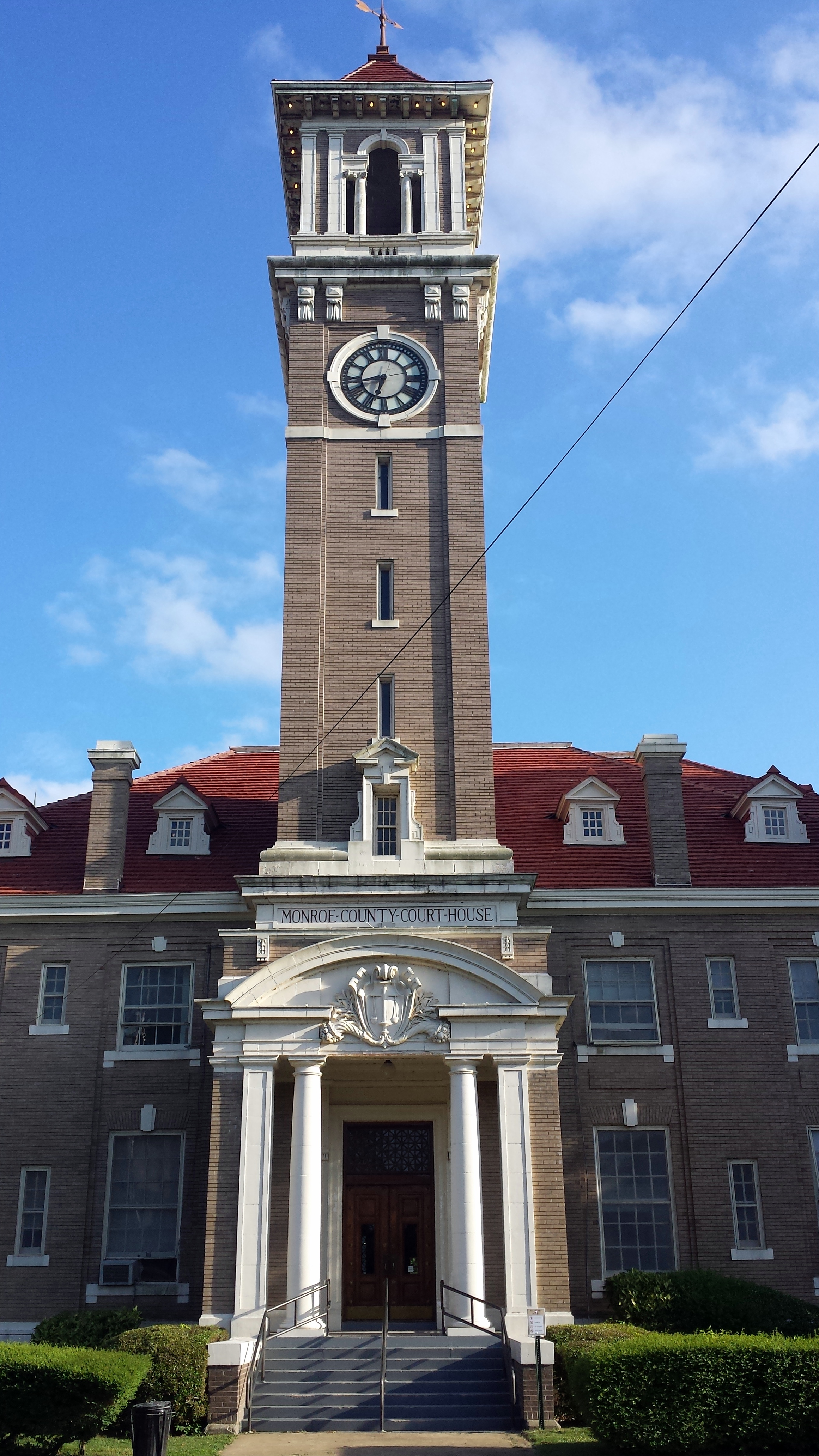

The Monroe County Courthouse in Clarendon is the seat of county government
The county government is a constitutional body granted specific powers by the Constitution of Arkansas and the Arkansas Code. The quorum court is the legislative branch of the county government and controls all spending and revenue collection. Representatives are called justices of the peace and are elected from county districts every even-numbered year. The number of districts in a county vary from nine to fifteen, and district boundaries are drawn by the county election commission. The Monroe County Quorum Court has nine members. Presiding over quorum court meetings is the county judge, who serves as the chief operating officer of the county. The county judge is elected at-large and does not vote in quorum court business, although capable of vetoing quorum court decisions.[19][20]
A portion of Monroe County is represented in the Arkansas State Senate by the Republican Ronald R. Caldwell, a real estate businessman from Wynne in Cross County. The state representative from Monroe County is a Democrat, Marshall Wright, a lawyer from Forrest City in St. Francis County.
Communities
Cities
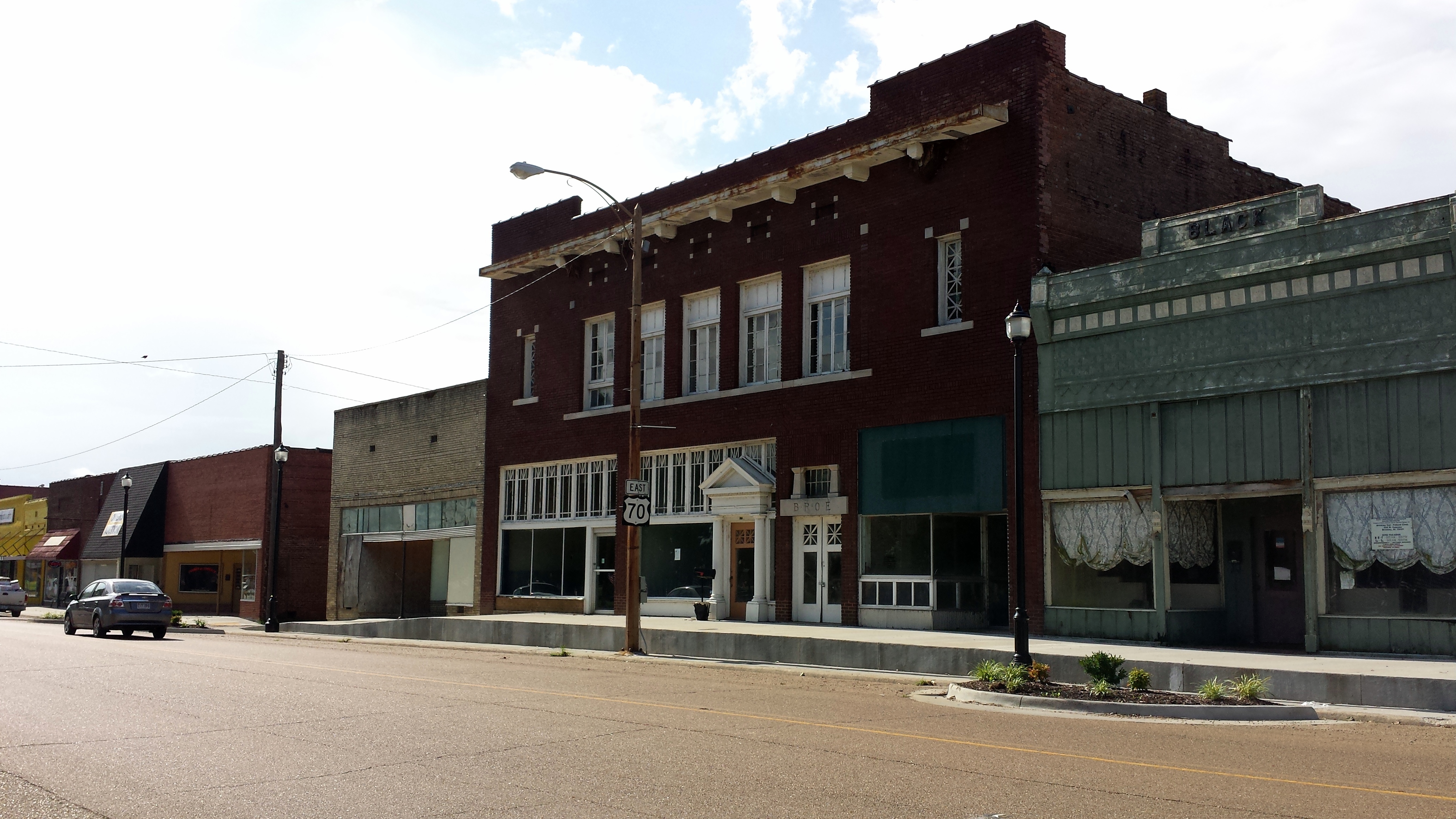

Streetside in downtown Brinkley
- Brinkley
- Clarendon (county seat)
- Holly Grove
Towns
- Fargo
- Roe
Townships
Townships in Arkansas are the divisions of a county. Each township includes unincorporated areas and some may have incorporated towns or cities within part of their space. Townships have limited purposes in modern times. However, the US Census does list Arkansas population based on townships (often referred to as "minor civil divisions"). Townships are also of value for historical purposes in terms of genealogical research. Each town or city is within one or more townships in an Arkansas county based on census maps. The townships of Monroe County are listed below with the town(s) and/or city that are fully or partially inside them listed in parentheses.
- Brinkley (most of Brinkley)
- Brown
- Cache (Clarendon)
- Cleburne
- Cypress Ridge
- Dixon (part of Brinkley)
- Duncan (Holly Grove)
- Greenfield (Fargo)
- Hindman
- Jackson
- Keevil
- Montgomery-Smalley
- Pine Ridge
- Raymond
- Richland (part of Brinkley)
- Roc Roe (Roe)
Infrastructure
Aviation


Clarendon Municipal Airport
Monroe County is home to three public own/public use general aviation (GA) airports. Each airport is used largely for agricultural spraying operations. The Clarendon Municipal Airport located southwest of Clarendon and northwest of Roe along Highway 33. For the twelve-month period ending August 31, 2015, the facility saw 26,000 general aviation operations.[23] Frank Federer Memorial Airport in southeast Brinkley had 22,000 GA operations in the twelve-month period ending August 31, 2015.[24] Holly Grove Municipal Airport located east of Holly Grove on Highway 146 is also a small rural airport. For the twelve-month period ending August 31, 2015, the facility saw 22,000 general aviation operations.[25]
Major highways


Highway 79 passes through wetlands near the White River on a historic curved concrete bridge
 Interstate 40
- U.S. Highway 49
- U.S. Highway 70
- U.S. Highway 79
- Highway 1
- Highway 17
- Highway 33
- Highway 39
- Highway 86
- Highway 146
- Highway 238
- Highway 241
- Highway 302
- Highway 316
- Highway 362
- Highway 366
Utilities
The Arkansas Department of Health is responsible for the regulation and oversight of public water systems throughout the state. Monroe County contains six community water systems: Brinkley Waterworks, Clarendon Waterworks, Holly Grove Waterworks, Roe Waterworks, United Water Association and East Monroe County Water Users. Brinkley Waterworks has the largest retail population (4,281), followed by Clarendon (1,640), and Holly Grove (1,010).[26] All community water systems in Monroe County use groundwater as their source of raw water, except East Monroe County Water Users, who purchases all water from Brinkley.[27]
Notable people
- Sheffield Nelson, the Arkansas Republican National Committeeman and his party's gubernatorial nominee in 1990 and 1994, was born in 1940 in Monroe County.
See also
- National Register of Historic Places listings in Monroe County, Arkansas
Notes and references
- Notes
- ^ In 2015, 101.1 thousand acres of soybeans, 46.2 thousand acres of rice, 22.9 thousand acres of sorghum, 16.0 thousand acres of wheat, and 15.3 thousand acres of corn were planted in Monroe County.[10] Total acreage for those two crops is 201,500. Monroe County has 607 square miles of land area, which is 388,480 acres based on 640 acres per square mile. Acreage for the total crops (201,500) divided by acreage for the county (388,480) is 51.9 percent.
- ^ Mileages from Monroe County to Little Rock and Memphis are based on highway miles using county seat Clarendon for Monroe County.[11]
- References
- ^ Gannett, Henry (1905). The Origin of Certain Place Names in the United States. U.S. Government Printing Office. p. 212. https://books.google.com/books?id=9V1IAAAAMAAJ&pg=PA212.
- ^ a b "State & County QuickFacts". United States Census Bureau. http://quickfacts.census.gov/qfd/states/05/05147.html. Retrieved August 28, 2016.
- ^ "Find a County". National Association of Counties. http://www.naco.org/Counties/Pages/FindACounty.aspx. Retrieved 2011-06-07.
- ^ a b Arkansas State Highway and Transportation Department (January 7, 2013) (PDF). General Highway Map, Monroe County, Arkansas (Map). 1:62500. Little Rock. http://www.arkansashighways.com/maps/Counties/County%20PDFs/MonroeCounty.pdf. Retrieved August 13, 2016.
- ^ Bateman p. 1.
- ^ Bateman p. 2.
- ^ Bateman p. 3.
- ^ "2010 Census Gazetteer Files". United States Census Bureau. August 22, 2012. http://www2.census.gov/geo/docs/maps-data/data/gazetteer/counties_list_05.txt. Retrieved August 27, 2015.
- ^ a b Mitchell, Louise (July 7, 2016). "Monroe County". Encyclopedia of Arkansas History and Culture. Butler Center for Arkansas Studies at the Central Arkansas Library System. http://www.encyclopediaofarkansas.net/encyclopedia/entry-detail.aspx?search=1&entryID=792. Retrieved August 28, 2016.
- ^ "National Agricultural Statistics Service County Level Data". U.S. Department of Agriculture. 2015. http://www.nass.usda.gov/Statistics_by_State/Arkansas/Publications/County_Estimates/index.php. Retrieved August 28, 2016.
- ^ "Google Maps (Search for Clarendon, AR)". Google. https://www.google.com/maps/place/Clarendon,+AR+72029/@34.6945684,-91.3249927,14z/. Retrieved August 28, 2016.
- ^ "County Totals Dataset: Population, Population Change and Estimated Components of Population Change: April 1, 2010 to July 1, 2015". http://www.census.gov/popest/data/counties/totals/2015/CO-EST2015-alldata.html. Retrieved July 2, 2016.
- ^ "U.S. Decennial Census". United States Census Bureau. http://www.census.gov/prod/www/decennial.html. Retrieved August 27, 2015.
- ^ "Historical Census Browser". University of Virginia Library. http://mapserver.lib.virginia.edu. Retrieved August 27, 2015.
- ^ Forstall, Richard L., ed (March 27, 1995). "Population of Counties by Decennial Census: 1900 to 1990". United States Census Bureau. http://www.census.gov/population/cencounts/ar190090.txt. Retrieved August 27, 2015.
- ^ "Census 2000 PHC-T-4. Ranking Tables for Counties: 1990 and 2000". United States Census Bureau. April 2, 2001. http://www.census.gov/population/www/cen2000/briefs/phc-t4/tables/tab02.pdf. Retrieved August 27, 2015.
- ^ Based on 2000 census data
- ^ "American FactFinder". United States Census Bureau. http://factfinder2.census.gov. Retrieved 2011-05-14.
- ^ Teske, Steven (March 24, 2014). "Quorum Courts". Encyclopedia of Arkansas History and Culture. Butler Center for Arkansas Studies at the Central Arkansas Library System. http://www.encyclopediaofarkansas.net/encyclopedia/entry-detail.aspx?search=1&entryID=6348. Retrieved January 23, 2016.
- ^ Goss, Kay C. (August 28, 2015). "Office of County Judge". Encyclopedia of Arkansas History and Culture. Butler Center for Arkansas Studies at the Central Arkansas Library System. http://www.encyclopediaofarkansas.net/encyclopedia/entry-detail.aspx?entryID=5720. Retrieved January 23, 2016.
- ^ U. S. Census Bureau. 2011 Boundary and Annexation Survey (BAS): Monroe County, AR (Map). http://www2.census.gov/geo/pvs/bas/bas11/st05_ar/cou/c05117_prairie/BAS11C20511700000_000.pdf. Retrieved 2011-08-24.
- ^ "Arkansas: 2010 Census Block Maps - County Subdivision". United States Census Bureau. http://www.census.gov/geo/maps-data/maps/block/2010/cousub/dc10blk_st05_cousub.html#M. Retrieved May 29, 2014.
- ^ FAA Airport Master Record for 4M8 (Form 5010 PDF). Federal Aviation Administration. Accessed August 28, 2016.
- ^ FAA Airport Master Record for M36 (Form 5010 PDF). Federal Aviation Administration. Accessed August 28, 2016.
- ^ FAA Airport Master Record for 2A6 (Form 5010 PDF). Federal Aviation Administration. Accessed August 28, 2016.
- ^ "Community Water System Data". Little Rock: Arkansas Department of Health, Engineering Section. http://www.healthy.arkansas.gov/eng/autoupdates/data.xls. Retrieved August 28, 2016.
- ^ "East Monroe County Water Users Annual Drinking Water Quality Report". Consumer Confidence Report. Little Rock: Arkansas Department of Health. 2015. http://www.healthy.arkansas.gov/eng/ccr/715.pdf.
- Bateman, Alta M.. "The History of Clarendon and Monroe County".

|
Woodruff County | St. Francis County |
| |
| Prairie County | Lee County | |||
 Monroe County, Arkansas | ||||
| Arkansas County | Phillips County |
| ||||||||||||||||||||

|
| This page uses content from the English language Wikipedia. The original content was at Monroe County, Arkansas. The list of authors can be seen in the page history. As with this Familypedia wiki, the content of Wikipedia is available under the Creative Commons License. |