(Copy from wikipedia) |
m (update from Wikipedia) |
||
| (4 intermediate revisions by 2 users not shown) | |||
| Line 1: | Line 1: | ||
| + | {{bdm}} |
||
{{Infobox settlement |
{{Infobox settlement |
||
|official_name = Milford, Connecticut |
|official_name = Milford, Connecticut |
||
|settlement_type = [[City]] |
|settlement_type = [[City]] |
||
|nickname = A Small City with a Big Heart |
|nickname = A Small City with a Big Heart |
||
| − | |image_skyline = |
+ | |image_skyline = Milford, CT Town Hall.jpg |
|imagesize = |
|imagesize = |
||
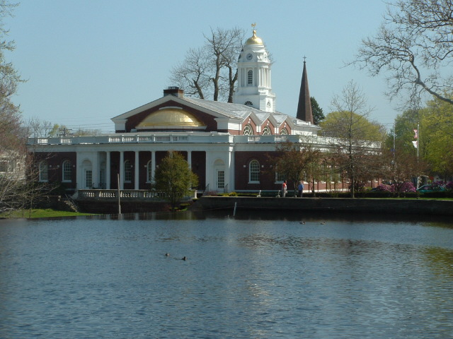
|image_caption = Milford City Hall, 110 River Street, sits along the Wepawaug River downtown. Built in 1916, it is the fifth town hall to occupy the site. |
|image_caption = Milford City Hall, 110 River Street, sits along the Wepawaug River downtown. Built in 1916, it is the fifth town hall to occupy the site. |
||
|image_seal = MilfordCTseal3.jpg |
|image_seal = MilfordCTseal3.jpg |
||
| + | |image_flag = Milford CT flag.jpg |
||
|image_map = Milford CT lg.PNG |
|image_map = Milford CT lg.PNG |
||
|mapsize = 250px |
|mapsize = 250px |
||
| Line 22: | Line 24: | ||
|subdivision_type1 = [[U.S. state|State]] |
|subdivision_type1 = [[U.S. state|State]] |
||
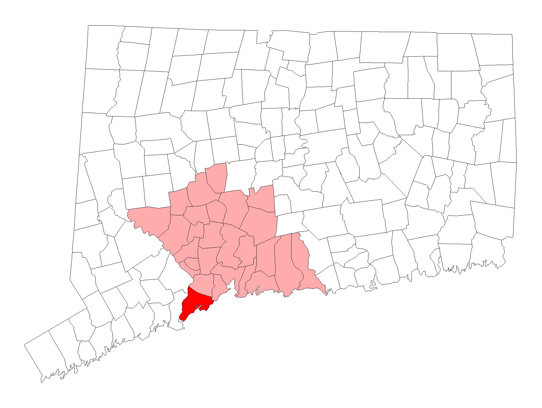
|subdivision_name1 = [[Connecticut]] |
|subdivision_name1 = [[Connecticut]] |
||
| − | |subdivision_type2 = |
+ | |subdivision_type2 = County |
| − | |subdivision_name2 = |
+ | |subdivision_name2 = [[New Haven, Connecticut|New Haven County]] |
| − | |subdivision_type3 = |
+ | |subdivision_type3 = [[NECTA]] |
| − | |subdivision_name3 = |
+ | |subdivision_name3 = Bridgeport-Stamford Region |
| − | | |
+ | |subdivision_type4 = Region |
| − | | |
+ | |subdivision_name4 = South Central Region |
| − | |government_type = [[Mayor-council#Weak-mayor, or ceremonial, form| |
+ | |government_type = [[Mayor-council#Weak-mayor, or ceremonial, form|Mayor–Board of Aldermen]] |
|leader_title = [[Mayor]] |
|leader_title = [[Mayor]] |
||
| − | |leader_name = [[ |
+ | |leader_name = [[Benjamin G. Blake]] ([[Democratic Party United States|D]]) |
|area_magnitude = 1 E9 |
|area_magnitude = 1 E9 |
||
| − | |area_total_km2 = 67. |
+ | |area_total_km2 = 67.7 |
| − | |area_land_km2 = |
+ | |area_land_km2 = 57.4 |
| − | |area_water_km2 = |
+ | |area_water_km2 = 10.2 |
| − | | |
+ | |unit_pref = Imperial |
| + | |area_total_sq_mi = |
||
| − | |unit_pref =Imperial |
||
| − | |area_land_sq_mi = |
+ | |area_land_sq_mi = |
| − | |area_water_sq_mi = |
+ | |area_water_sq_mi = |
|area_water_percent = |
|area_water_percent = |
||
| − | |population_as_of = |
+ | |population_as_of = 2010 |
| − | |population_total = |
+ | |population_total = 52759 |
| − | |population_density_km2 = |
+ | |population_density_km2 = auto |
|timezone = [[Eastern Standard Time Zone|Eastern]] |
|timezone = [[Eastern Standard Time Zone|Eastern]] |
||
|utc_offset = -5 |
|utc_offset = -5 |
||
| Line 54: | Line 56: | ||
|longd = 73 |longm = 03 |longs = 35 |longEW = W |
|longd = 73 |longm = 03 |longs = 35 |longEW = W |
||
|region = |
|region = |
||
| − | |website = |
+ | |website = {{URL|www.ci.milford.ct.us}} |
|area_code = [[Area code 203|203]] |
|area_code = [[Area code 203|203]] |
||
|blank_name = [[Federal Information Processing Standard|FIPS code]] |
|blank_name = [[Federal Information Processing Standard|FIPS code]] |
||
| Line 62: | Line 64: | ||
|footnotes = |
|footnotes = |
||
}} |
}} |
||
| − | '''Milford''' is a city in southwestern [[New Haven County, Connecticut|New Haven County]], [[Connecticut]], [[United States]], located between [[Bridgeport, Connecticut|Bridgeport]] and [[New Haven, Connecticut|New Haven]]. The population was |
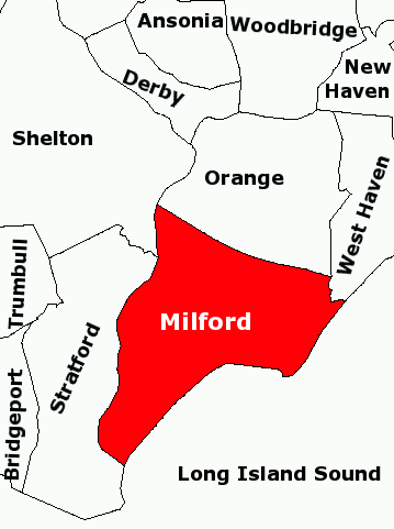
+ | '''Milford''' is a coastal city in southwestern [[New Haven County, Connecticut|New Haven County]], [[Connecticut]], [[United States]], located between [[Bridgeport, Connecticut|Bridgeport]] and [[New Haven, Connecticut|New Haven]]. The population was 52,759 at the [[2010 United States Census|2010 census]].<ref name="Census 2010">{{cite web| url=http://factfinder2.census.gov| title=Profile of General Population and Housing Characteristics: 2010 Demographic Profile Data (DP-1): Milford town, New Haven County, Connecticut| publisher=U.S. Census Bureau, American Factfinder| accessdate=September 26, 2012}}</ref> The city contains the incorporated [[borough (Connecticut)|borough]] of [[Woodmont, Connecticut|Woodmont]] and the unincorporated village of [[Devon (Milford)|Devon]]. |
| − | |||
| − | The city has grown noticeably over the years, including rapid revitalization of the downtown and retail growth along [[Route 1 (Connecticut)|Route 1]], and today Milford faces the typical modern issue of deciding how much land to develop and how much to keep natural, especially in light of the city's location at the mouth of the [[Housatonic River]]. Laws favoring the preservation and restoration of older homes have helped maintain a traditional [[New England]] town ambiance. |
||
| − | |||
| − | ''Further information: [[Economic development of Milford, Connecticut]]'' |
||
==History== |
==History== |
||
| + | |||
===Early history=== |
===Early history=== |
||
| − | [[Image:BarberJohnWarnerOysterHutsMilfordPoint.jpg|thumb|left|250px| |
+ | [[Image:BarberJohnWarnerOysterHutsMilfordPoint.jpg|thumb|left|250px|''Oyster Huts on Milford Point'', a sketch by [[John Warner Barber]] for his ''Historical Collections of Connecticut'' (1836). Barber wrote that he found 15 or 20 of these seaweed-covered huts along the shore when he visited the town in 1836. Oystermen used the huts in the winter.]] |
| − | The land which today comprises Milford, [[Orange, Connecticut|Orange]] and [[West Haven, Connecticut|West Haven]] |
+ | The land which today comprises Milford, [[Orange, Connecticut|Orange]] and [[West Haven, Connecticut|West Haven]] was purchased on February 1, 1639 from Ansantawae, chief of the local [[Paugusset]]s (an [[Algonquian peoples|Algonquian]] tribe) by English settlers affiliated with the contemporary [[New Haven Colony]]. Originally, the area was known as "Wepawaug", after the small river which runs through the town, and which has given its name to several streets in both Milford and Orange. |
| − | During the Revolutionary War the Milford section of the [[Boston Post Road]], a vital route connecting Boston, New York and other major coastal cities, was blockaded by [[Continental Army|Continental forces]] and Fort Trumbull was constructed to protect the town. The site of the blockade is commemorated by the Liberty Rock monument. |
+ | During the [[Revolutionary War]] the Milford section of the [[Boston Post Road]], a vital route connecting [[Boston]], [[New York City|New York]] and other major coastal cities, was blockaded by [[Continental Army|Continental forces]], and Fort Trumbull was constructed to protect the town. The site of the blockade is commemorated by the Liberty Rock monument. |
By 1822, the [[New England town|town]] had grown large enough that residents in the northern and eastern sections of Milford chartered their own independent course as the town of Orange. During the next century and a half, the remaining section of Milford was known for shipbuilding, farming and oystering, although a small subset of industrial facilities also developed in town. During this time, Milford also became known as a [[beach resort]] for residents of New Haven and [[Bridgeport, Connecticut|Bridgeport]]. |
By 1822, the [[New England town|town]] had grown large enough that residents in the northern and eastern sections of Milford chartered their own independent course as the town of Orange. During the next century and a half, the remaining section of Milford was known for shipbuilding, farming and oystering, although a small subset of industrial facilities also developed in town. During this time, Milford also became known as a [[beach resort]] for residents of New Haven and [[Bridgeport, Connecticut|Bridgeport]]. |
||
Interestingly, the boundaries of the final town charter granted by the State of Connecticut in 1899 to Laurel Beach are contained entirely within Milford. Residents of Laurel Beach must therefore pay taxes to both Laurel Beach as well as Milford, and all mail to Laurel Beach residents is mailed to Milford. |
Interestingly, the boundaries of the final town charter granted by the State of Connecticut in 1899 to Laurel Beach are contained entirely within Milford. Residents of Laurel Beach must therefore pay taxes to both Laurel Beach as well as Milford, and all mail to Laurel Beach residents is mailed to Milford. |
||
| + | |||
| − | ''' |
||
| − | In 1903 the southeastern portion of the town was incorporated as the Borough of Woodmont. In 1959, |
+ | In 1903, the southeastern portion of the town was incorporated as the Borough of [[Woodmont, Connecticut|Woodmont]]. In 1959, the town of Milford including the Borough of Woodmont was incorporated as the City of Milford. |
===Towns created from Milford=== |
===Towns created from Milford=== |
||
| + | [[File:Milford Connecticut old bridge.jpg|thumb|left|landscape|View of Milford's greens on a 19th-century naïve landscape painting]] |
||
| − | [[Image:MilfordCtAreaOutlineMap.png|thumb|200px|right|<small>Map showing Milford and neighboring towns</small>]] |
||
| + | [[Image:MilfordCtAreaOutlineMap.png|thumb|200px|right|Map showing Milford and neighboring towns]] |
||
Milford was one of the early settlements in south central Connecticut and, over time, gave rise to several new [[New England town|towns]] that broke off and incorporated separately. The following is a list of towns created from parts of Milford. |
Milford was one of the early settlements in south central Connecticut and, over time, gave rise to several new [[New England town|towns]] that broke off and incorporated separately. The following is a list of towns created from parts of Milford. |
||
* [[Woodbridge, Connecticut|Woodbridge]] in 1784 (also partly from [[New Haven, Connecticut|New Haven]]) |
* [[Woodbridge, Connecticut|Woodbridge]] in 1784 (also partly from [[New Haven, Connecticut|New Haven]]) |
||
| − | ** [[Bethany, Connecticut|Bethany]] created from Woodbridge in 1832 |
+ | ** [[Bethany, Connecticut|Bethany]], created from Woodbridge in 1832 |
| − | * [[Orange, Connecticut|Orange]] (originally North Milford) in 1822 (also partly from |
+ | * [[Orange, Connecticut|Orange]] (originally North Milford) in 1822 (also partly from New Haven) |
| − | ** [[West Haven, Connecticut|West Haven]] created from Orange in 1921 |
+ | ** [[West Haven, Connecticut|West Haven]], created from Orange in 1921 |
| + | |||
| + | ===The "oatmeal lots" of Liberty Park=== |
||
| + | Starting in 1902, [[Quaker Oats]] oatmeal boxes came with a coupon redeemable for the legal deed to a tiny lot in Milford. The lots, sometimes as small as {{convert|10|ft|0}} by 10 feet, were carved out of a {{convert|15|acre|adj=on}} tract in a never-built subdivision called "Liberty Park". A small number of children (or their parents), often residents living near Milford, collected the deeds and started paying the extremely small property taxes on the "oatmeal lots". The developer of the prospective subdivision hoped the landowners would hire him to build homes on the lots, although several lots would need to be combined before building could start. Since the subdivision into small lots predated Milford's planning and zoning regulations, the deeds were entirely legal, although they created a large amount of paperwork for town tax collectors, who frequently couldn't find the property owners and received almost no tax revenue from the lots.<ref name=fnolg>{{Cite news|last=Juliano |first=Frank |url=http://www.ctpost.com/local/article/Oatmeal-lots-gave-officials-indigestion-687006.php |title='Oatmeal lots' gave officials indigestion |pages=A1, A12 |date=October 3, 2010 |accessdate=October 23, 2010 |newspaper=[[Connecticut Post]]}}</ref> |
||
| + | |||
| + | In the mid-1970s, when the town wanted to develop the area, town officials put an end to the oatmeal lots in a "general foreclosure" that avoided the enormous expense of individual foreclosures by condemning nearly all of the property in one legal filing. One of the streets in the Liberty Park subdivision plans, Shelland Street, was later built in the late 1990s as an access road to the Milford Power Company. The site is currently home to the [[BIC Corporation]]'s [[lighter]] factory at 565 Bic Drive. (In a separate land giveaway in 1955 tied to the ''[[Sergeant Preston of the Yukon]]'' television show, Quaker Oats offered in its [[Puffed Wheat]] and [[Puffed Rice]] cereal boxes genuine deeds to land in the [[Klondike, Yukon|Klondike]].)<ref name=fnolg/> |
||
===Post-World War II development=== |
===Post-World War II development=== |
||
| − | In the post-[[World War II]] period, Milford—like many other New England towns—underwent significant suburbanization. [[Interstate 95 in Connecticut|Interstate 95]] was routed through town and the Milford section was completed in 1958. |
+ | In the post-[[World War II]] period, Milford—like many other New England towns—underwent significant suburbanization. [[Interstate 95 in Connecticut|Interstate 95]] was routed through town, and the Milford section was completed in 1958. |
| − | The 1960s and |
+ | The 1960s and 1970s witnessed the construction of the [[Westfield Connecticut Post|Connecticut Post Mall]], one of the state's largest shopping malls, and the extensive commercial development of the town's stretch of the [[Boston Post Road]]. One notable small business located on the Boston Post Road during the 1970s was [[SCELBI]] Computer Consulting, credited by many as being the world's first personal-computer manufacturer. Starting in 1975, the city began hosting the [[Milford Oyster Festival]], which has since become firmly established as an annual Milford tradition that is held "rain or shine".<ref>"[http://dailypostal.com/2010/08/21/milford-oyster-festival-2010/ Milford Oyster Festival 2010]." ''Daily Postal''. August 21, 2010</ref><ref name=misur2010>Misur, Susan. "[http://www.newhavenregister.com/articles/2010/08/22/news/milford/doc4c70a51c00ba8527828365.txt Annual Oyster Festival draws thousands in Milford]." ''New Haven Register''. Sunday, August 22, 2010</ref> |
| − | The city became host to several headquarters of multinational corporations, including the Schick Shaving company |
+ | The city became host to several headquarters of multinational corporations, including the [[Schick (razors)|Schick]] Shaving company,<ref>{{cite web|url=http://www.schick.com/us/shaving-history.shtml |title=Schick® | Shaving History |publisher=Schick.com |date= |accessdate=2013-05-19}}</ref> and Doctor's Associates, Inc., owners of the [[Subway (restaurant)|Subway]] chain of fast-food restaurants. The US operations of [[Société Bic|BIC]] were headquartered in Milford, but in March 2008 moved most of its operations to [[Shelton, Connecticut|Shelton]]. [[Milford Hospital (Connecticut)|Milford Hospital]] has also developed into an important health care resource for the area. It has also become home of smaller national corporations such as [[Total Mortgage Services]]<ref>{{cite web|title=Total Mortgage Services|url=http://www.totalmortgage.com/|publisher=Total Mortgage Services|accessdate=29 January 2013}}</ref> and Orchid Medical. |
| + | |||
| + | {{further2|[[Economic development of Milford, Connecticut]]}} |
||
| + | |||
| + | {{Gallery |
||
| + | | title = Milford, Connecticut |
||
| + | | lines = 3 |
||
| + | | width = 180 |
||
| + | | height = 180 |
||
| + | |File:River_Street_Milford.jpg|alt1=|River Street in Downtown Milford |
||
| + | |File:Milford_Harbor.jpg|alt2=|Milford Harbor seen from Pond Street |
||
| + | |File:Trumbull_and_Gulf_Beaches.jpg|alt3=|View of coastline from Fort Trumbull Beach with Gulf Beach in distance |
||
| + | |File:Milford_Green.jpg|alt4=|Milford Green, the second-longest green in [[New England]] |
||
| + | |File:Milford_Beach.jpg|alt5=|View of [[Long Island Sound]] from a Milford beach |
||
| + | |File:Milford_Metro_North_Station.jpg|alt6=|The [[Milford (Metro-North station)|Milford Metro North Rail Station]] |
||
| + | }} |
||
==Government== |
==Government== |
||
| − | Government in the city is set up with the mayor as chief executive and the Board of Aldermen as a legislative body. The mayor is permitted to propose legislation to the Board of Aldermen and introduces the city budget, but possesses no [[veto]] power over what the Aldermen |
+ | Government in the city is set up with the mayor as chief executive and the Board of Aldermen as a legislative body. The mayor is permitted to propose legislation to the Board of Aldermen and introduces the city budget, but possesses no [[veto]] power over what the Aldermen chooses to pass. |
| + | |||
| + | === Taxes === |
||
| + | In 2005, the [[mill rate]] for Milford was 34.36<ref>http://www.courant.com/classified/realestate/hc-class-real-millrates0501,0,4623522.htmlstory</ref> and is reportedly 26.28 mills for fiscal year 2013-2014.<ref>http://www.ci.milford.ct.us/public_documents/MilfordCT_Tax/index</ref> |
||
===Elected positions=== |
===Elected positions=== |
||
| + | The following is a list of city government positions elected by city residents and the terms thereof:<ref>''An Act Concerning a Charter for the City of Milford'', Articles II-III. City of Milford, Connecticut. Effective November 9, 1959. Revised November 8, 1983.</ref> |
||
| − | {{See also|List of mayors of Milford, Connecticut}} |
||
| − | The following is a list of city government positions elected by city residents and the terms thereof: |
||
| − | * |
+ | *Mayor: The mayor is the city's chief executive and is elected in odd-numbered years. The mayor receives compensation for his or her services. |
| + | *Board of Aldermen: The Board of Aldermen consists of 15 members elected in odd-numbered years, three from each of the city's five political districts. Per City Charter requirements, only two of the three aldermen elected from each district may be from one political party to allow for minority representation on the board; voters are permitted to vote for any three aldermen in their district. Members of the Board of Aldermen receive no compensation for their services. |
||
| + | *Board of Education: The Board of Education deals with educational matters in the city and consists of 10 members elected in odd-numbered years, two from each of the city's five political districts. Members receive no compensation for their services. |
||
| + | *Planning & Zoning Board: The Planning & Zoning Board deals with development and land use issues and consists of 10 members, two from each of the city's five political districts. Members serve a four-year term, with one of the two members of each political district up for election during each odd-numbered year's election cycle, ensuring that no more than half of the board is made up of new members at the start of a new session. Members of the Planning & Zoning Board receive no compensation for their services. |
||
| + | *City Clerk: The city clerk is elected in odd-numbered years and receives a compensation for services provided. |
||
| + | *Constables: Seven constables are elected in odd-numbered years, though individual voters are only permitted to vote for any four of their choosing on the ballot. They are compensated on a case-by-case basis. |
||
| + | *Registrars of Voters: Pursuant to Connecticut state law, each town must have a [[Republican Party United States|Republican]] and [[Democratic Party United States|Democratic]] registrar of voters to serve as election administrators, though an additional third party registrar is permitted if they receive more votes than either of the major parties' registrar. Registrars in Milford are elected to two-year terms, their election taking place during each even-year state election cycle. Registrars are compensated for their services. Voters may only vote for one choice for registrar. |
||
| + | ===List of mayors=== |
||
| − | * Board of Aldermen: The Board of Aldermen consists of 15 members elected in odd-numbered years, three from each of the city’s five political districts. Per City Charter requirements, only two of the three aldermen elected from each district may be from one political party to allow for minority representation on the board; voters are permitted to vote for any three aldermen in their district. Members of the Board of Aldermen receive no compensation for their services. |
||
| + | After becoming incorporated as a city in 1959, the city reformed its system of government by establishing a [[mayor-council|mayor–board of aldermen]] format. It elected its first mayor, Charles Iovino,<ref>{{cite news| url=http://select.nytimes.com/gst/abstract.html?res=F10811FB345F1A7B93CAA9178AD95F4D8585F9 | work=The New York Times | title=EX-CITY MANAGER BECOMING MAYOR; Iovino Takes Post Tomorrow in Milford, Conn., After Old Job Is Abolished | date=November 8, 1959 | accessdate=May 8, 2010}}</ref> the incumbent city manager under Milford's previous form of government, on November 3, 1959. |
||
| + | Since 1959, 10 people have held the office of mayor in the city.<ref name=MilfordSunRepub>{{cite web|url=http://www.facebook.com/note.php?note_id=171411638215|title=Historic City Election Ahead|author=John H. O'Connell|publisher=Milford Republican Town Committee|date=November 1, 2009|accessdate=March 2, 2010}}</ref> |
||
| − | * Board of Education: The Board of Education deals with educational matters in the city and consists of 10 members elected in odd-numbered years, two from each of the city’s five political districts. Members receive no compensation for their services. |
||
| + | {| class="wikitable" |
||
| − | * Planning & Zoning Board: The Planning & Zoning Board deals with development and land use issues and consists of 10 members, two from each of the city’s five political districts. Members serve a four-year term, with one of the two members of each political district up for election during each odd-numbered year’s election cycle, ensuring that no more than half of the board is made up of new members at the start of a new session. Members of the Planning & Zoning Board receive no compensation for their services. |
||
| + | |- |
||
| + | ! # |
||
| + | ! Name |
||
| + | ! In office |
||
| + | ! Political party |
||
| + | |-{{party shading/Independent}} |
||
| + | |1 |
||
| + | |Charles Iovino |
||
| + | |1959–1963 |
||
| + | |[[Independent Party of Connecticut|Independent]] |
||
| + | |-{{party shading/Democratic}} |
||
| + | |2 |
||
| + | |Alan Jepson |
||
| + | |1963–1969 |
||
| + | |[[Democratic Party (United States)|Democratic]] |
||
| + | |-{{party shading/Republican}} |
||
| + | |3 |
||
| + | |Edward Kozlowski |
||
| + | |1969–1971 |
||
| + | |[[Republican Party (United States)|Republican]] |
||
| + | |-{{party shading/Republican}} |
||
| + | |4 |
||
| + | |Clifton Moore |
||
| + | |1971–1973 |
||
| + | |Republican |
||
| + | |-{{party shading/Democratic}} |
||
| + | |5 |
||
| + | |Joel Baldwin |
||
| + | |1973–1977 |
||
| + | |Democratic |
||
| + | |-{{party shading/Republican}} |
||
| + | |6 |
||
| + | |Henry Povinelli |
||
| + | |1977–1981 |
||
| + | |Republican |
||
| + | |-{{party shading/Democratic}} |
||
| + | |7 |
||
| + | |Alberta Jagoe |
||
| + | |1981–1989 |
||
| + | |Democratic |
||
| + | |-{{party shading/Republican}} |
||
| + | |8 |
||
| + | |Frederick L. Lisman |
||
| + | |1989–2001 |
||
| + | |Republican |
||
| + | |-{{party shading/Republican}} |
||
| + | |9 |
||
| + | |[[James L. Richetelli, Jr.]] |
||
| + | |2001–2011 |
||
| + | |Republican |
||
| + | |-{{party shading/Democratic}} |
||
| + | |10 |
||
| + | |[[Benjamin G. Blake]] |
||
| + | |2011–present |
||
| + | |Democratic |
||
| + | |-{{party shading/Democratic}} |
||
| + | |} |
||
| + | ==Emergency services== |
||
| − | * City Clerk: The city clerk is elected in odd-numbered years and receives a compensation for services provided. |
||
| + | ===Fire Department=== |
||
| − | * Constables: Seven constables are elected in odd-numbered years, though individual voters are only permitted to vote for any four of their choosing on the ballot. They are compensated on a case-by-case basis. |
||
| + | The city of Milford is protected 24/7, 365 by the 114 paid, full-time firefighters of the city of Milford Fire Department - ISO Class 1. The Milford Fire Department currently operates out of five fire stations, located throughout the city, under the command of a Battalion Chief and a Shift Commander. The Milford Fire Department also maintains and operates a fire apparatus fleet of seven engines (including one [[quint (fire apparatus)|Quint]]), one tower ladder, two rescue ambulances, two [[dangerous goods|HazMat]] units, one dive rescue unit, one collapse rescue unit, two fireboats, a canteen unit, and numerous other special, support, and reserve units. The Milford Fire Department is one of only two fire departments in the state of Connecticut to maintain an ISO Class 1 rating. The current{{when|date=June 2012}} Fire Chief is Douglas Edo.<ref>{{cite web|author=City of Milford, CT |url=http://www.ci.milford.ct.us/public_documents/milfordct_fire/fire |title=City of Milford, CT - Milford Fire Department |publisher=Ci.milford.ct.us |date=2013-05-08 |accessdate=2013-05-19}}</ref> |
||
| + | |||
| + | ====Fire station locations and apparatus==== |
||
| + | Below is a complete listing of all fire station locations and apparatus in the city of Milford.<ref>{{cite web|author=City of Milford, CT |url=http://www.ci.milford.ct.us/public_documents/milfordct_fire/FireStations |title=City of Milford, CT - Fire Stations |publisher=Ci.milford.ct.us |date=2013-02-28 |accessdate=2013-05-19}}</ref> |
||
| + | {| class=wikitable |
||
| + | |- valign=bottom |
||
| + | ! Engine company |
||
| + | ! Truck company |
||
| + | ! Rescue ambulance |
||
| + | ! Special unit |
||
| + | ! Command unit |
||
| + | ! Address |
||
| + | |- |
||
| + | | Engine 1 || Tower 1 || Rescue 1, Rescue 3 || || Car 4 (Shift Commander), Car 5 (Battalion Chief) || 72 New Haven Ave. |
||
| + | |- |
||
| + | | Engine 3, Engine 4 || || || Haz-Mat. 1, Haz-Mat. 2, Dive Rescue Unit || || 349 Naugatuck Ave. |
||
| + | |- |
||
| + | | Engine 5, Engine 6 || || Rescue 234 (Collapse Unit) || || || 980 New Haven Ave. |
||
| + | |- |
||
| + | | Engine 7 || || Rescue 2 || Decon. Trailer || || 55 Wheelers Farms Rd. |
||
| + | |} |
||
| + | The Milford Fire Department also operates four reserve engines. Engine 2 (Reserve) is located at the quarters of Engine 1 and Tower 1. Engines 8 and 10 (Reserve) are located at the quarters of Engine 3 (Quint) and Engine 4, while Engine 9 (Reserve) is located at the quarters of Engine's 5 and 6. The Canteen Unit is operated out of a garage at 3 Charles Street. As of 2012, the city has begun construction of a new fire station to be located on New Haven Avenue and to serve as the new quarters of Engine 5, Engine 6, and the Collapse Unit. |
||
| + | ===Police department=== |
||
| − | * Registrar of Voters: Pursuant to Connecticut state law, each town must have a [[Republican Party United States|Republican]] and [[Democratic Party United States|Democratic]] registrar of voters to serve as election administrators, though an additional third party registrar is permitted if they receive more votes than either of the major parties’ registrar. Registrars in Milford are elected to two-year terms, their election taking place during each even-year state election cycle. Registrars are compensated for their services. Voters may only vote for one choice for registrar. |
||
| + | The Milford Police Department is led by Chief Keith L. Mello, a 1981 graduate of the town's police academy.<ref>{{cite web|author=City of Milford, CT |url=http://www.ci.milford.ct.us/public_documents/FOV1-0001066B/Chief%20Of%20Police |title=City of Milford, CT - Chief Of Police |publisher=Ci.milford.ct.us |date= |accessdate=2013-05-19}}</ref> On May 12, 2011, the Police Officer Standards & Training Council re-accredited the department's Tier I & II State Accreditation.<ref>{{cite web|author=City of Milford, CT |url=http://www.ci.milford.ct.us/Public_Documents/MilfordCT_Police/Public%20Announcements |title=City of Milford, CT - Public Announcements |publisher=Ci.milford.ct.us |date= |accessdate=2013-05-19}}</ref> |
||
==Principal communities of Milford== |
==Principal communities of Milford== |
||
[[Image:PostcardSeasideAveMilfordCT1907.jpg|thumb|250px|right|Seaside Avenue, 1911 postcard]] |
[[Image:PostcardSeasideAveMilfordCT1907.jpg|thumb|250px|right|Seaside Avenue, 1911 postcard]] |
||
| + | *Downtown Milford |
||
| − | *Milford center ([http://www.downtownmilfordct.com downtown website]) |
||
| − | *[[Devon (Milford)|Devon]] |
+ | *[[Devon (Milford)|Devon]] |
**Rivercliff |
**Rivercliff |
||
*Morningside |
*Morningside |
||
*Walnut Beach |
*Walnut Beach |
||
*Wildermere Beach |
*Wildermere Beach |
||
| − | *[[Woodmont, Connecticut|Woodmont borough]] |
+ | *[[Woodmont, Connecticut|Woodmont borough]], also known as "Woodmont On the Sound" |
| − | Other minor communities and geographic features are |
+ | Other minor communities and geographic features are Anchor Beach, Bayview, Bayview Heights, Burwells Beach, Cedar Beach, Downtown Historic District, Ettadore Park, Far View Beach, Forest Heights, Fort Trumbull, Great River, Gulf Beach, Laurel Beach, Lexington Green, Merwin's Beach, Merwin's Point, Milford Lawns, Milford Point, Myrtle Beach, Naugatuck Gardens, Point Lookout, Pond Point Beach, Silver Sands Beach, South of the Green, Walnut Beach, Wheelers Farms. |
==Culture== |
==Culture== |
||
| + | {{See also|Milford Oyster Festival}} |
||
| + | {{Unreferenced section|date=April 2011}} |
||
[[Image:Oyster Festival1.JPG|thumb|right|300px|2006 Milford Oyster Festival Banner]] |
[[Image:Oyster Festival1.JPG|thumb|right|300px|2006 Milford Oyster Festival Banner]] |
||
| − | Every year in August, Milford celebrates its annual Oyster Festival, which serves as a combination of a typical town fair with a culinary celebration of the town's location on historically shellfish-rich [[Long Island Sound]]. This festival |
+ | Every year on the third Saturday in August, Milford celebrates its annual [[Oyster]] Festival, which serves as a combination of a typical town fair with a culinary celebration of the town's location on historically shellfish-rich [[Long Island Sound]]. This festival takes place in and around the Milford [[Village green|Green]], near the center of town, as well as in various locations throughout the downtown area, and features a wide variety of events including [[canoe]] and [[kayak]] races, musical performances, and [[classic car]] shows. |
| + | The Milford Oyster Festival has drawn large musical acts over the years including [[Joan Jett]], [[The Marshall Tucker Band]], [[John Cafferty & The Beaver Brown Band]], [[Soul Asylum]], and many more. |
||
| − | Milford is home to a substantial art community. The Milford Cultural Center, operated by the Milford Council for the Arts, offers various events throughout the year. The Firehouse Art Gallery was recently opened in Devon . The beach resort quality of the town lives on, with several beaches, [[Silver Sands State Park]], the [[Connecticut Audubon Society Coastal Center at Milford Point]], [[Charles Island]], two [[golf course]]s, and numerous other recreational facilities available for residents and tourists, while the proximity to New Haven, rail transport to [[New York City]], a good school system, and a shuttle bus service that traverses the town supply some urban conveniences. |
||
| + | There are also other features such as carnival rides, food stands, crafts, face painting, and even opening your own oyster for a pearl. |
||
| − | [[Image:Milfordluft 2.jpg|thumb|left|300px|Aerial view of Milford including Charles Island]] |
||
| − | |||
| − | ==Geography and environment== |
||
| − | According to the [[United States Census Bureau]], Milford has a total area of 23.7 [[square mile]]s (61.5 [[km²]]), of which, 22.3 square miles (57.7 km²) of it is land and 1.5 square miles (3.8 km²) of it (6.15%) is water. |
||
| − | |||
| − | Milford's [[Devon (Milford)|Devon]] neighborhood<ref>[http://www.villageofdevon.com/ Village of Devon Official Web Site]</ref> is located at the mouth of the [[Housatonic River]] near [[Stratford, Connecticut|Stratford]], and features an [[Audubon|Audubon Center]] overlooking the [[estuary]]. |
||
| − | |||
| − | ===Islands and coastline=== |
||
| − | A large portion of Milford's shoreline forms the [[Silver Sands State Park]]. [[Charles Island]] is also a part of the park and is a protected bird nesting ground. There is a sand bar (more correctly called a [[tombolo]] since it is perpendicular, not parallel to the coast) accessible during low tide that people can walk on from Silver Sands Beach to Charles Island. |
||
| + | The Milford Cultural Center, operated by the Milford Council for the Arts, offers various events throughout the year. The Firehouse Art Gallery was recently opened in Devon. The beach resort quality of the town lives on, with several rocky beaches, [[Silver Sands State Park]], the [[Connecticut Audubon Society Coastal Center at Milford Point]], [[Charles Island]], two [[golf course]]s, and numerous other recreational facilities available for residents and tourists. |
||
| − | The island is a part of the Hamonasset-Ledyard [[Moraine]] and was formed as glaciers retreated at the end of the last ice age. The [[Wisconsin Continental Ice Shelf|Wisconsin glaciation]] formed [[drumlin]]s in Milford: Clark, Burwell, Eels, Bryan and Merwin hills.<ref name=jwsrgcri>Skehan, James W., ''Roadside Geology of Connecticut and Rhode Island'', p 218, Missoula, Montana: Mountain Press Publishing Co., 2008, ISBN 9780828425471</ref> |
||
| + | ==Economy== |
||
| − | Milford also owns three islands in the [[Housatonic River]]: [[Fowler Island]], just to the south of the [[Igor I. Sikorsky Memorial Bridge]], [[Duck Island (Connecticut)|Duck Island]] and [[Nells Island]], both near the mouth of the river. |
||
| − | == |
+ | ===Top employers=== |
| + | According to the City's 2011 Comprehensive Annual Financial Report,<ref>[http://www.ci.milford.ct.us/Public_Documents/MilfordCT_Finance/statement/City%20of%20Milford%20Financial%20Statements%206-30-11.pdf City of Milford CAFR]</ref> the top employers in the city are: |
||
| − | {| class="wikitable" style="float:right;" |
||
| + | {| class="wikitable" |
||
| − | | colspan="2" align="center" |'''Historical<br /> population of<br />Milford''' [http://www.sots.state.ct.us/RegisterManual/regman.htm] |
||
| − | |- |
||
| − | |1756 |
||
| − | |1,633 |
||
| − | |- |
||
| − | |1774 |
||
| − | |2,127 |
||
| − | |- |
||
| − | |1782 |
||
| − | |2,195 |
||
| − | |- |
||
| − | |1790 |
||
| − | |2,098 |
||
|- |
|- |
||
| + | ! # |
||
| − | |1800 |
||
| + | ! Employer |
||
| − | |2,417 |
||
| + | ! Employees |
||
|- |
|- |
||
| + | | 1 |
||
| − | |1810 |
||
| + | |City of Milford, Board of Education |
||
| − | |2,674 |
||
| + | |1,238 |
||
|- |
|- |
||
| + | |2 |
||
| − | |1820 |
||
| + | |[[Milford Hospital (Connecticut)|Milford Hospital]] |
||
| − | |2,785 |
||
| + | |811 |
||
|- |
|- |
||
| + | |3 |
||
| − | |1830 |
||
| + | |[[Subway (restaurant)|Subway]] |
||
| − | |2,256 |
||
| + | |719 |
||
|- |
|- |
||
| + | |4 |
||
| − | |1840 |
||
| + | |[[Schick (razors)|Schick]] |
||
| − | |2,455 |
||
| + | |705 |
||
|- |
|- |
||
| + | |5 |
||
| − | |1850 |
||
| + | |City of Milford |
||
| − | |2,465 |
||
| + | |556 |
||
|- |
|- |
||
| + | |6 |
||
| − | |1860 |
||
| + | |[[Neopost|Hasler Neopost]] |
||
| − | |2,828 |
||
| + | |325 |
||
|- |
|- |
||
| + | |7 |
||
| − | |1870 |
||
| + | |[[Stop & Shop]] |
||
| − | |3,405 |
||
| + | |325 |
||
|- |
|- |
||
| + | |8 |
||
| − | |1880 |
||
| + | |[[Macy's]] |
||
| − | |3,347 |
||
| + | |277 |
||
|- |
|- |
||
| + | |9 |
||
| − | |1890 |
||
| + | |[[ShopRite (United States)|ShopRite]] of Milford |
||
| − | |3,811 |
||
| + | |241 |
||
|- |
|- |
||
| + | |10 |
||
| − | |1900 |
||
| + | |Alinabal |
||
| − | |3,783 |
||
| − | | |
+ | |234 |
| − | |1910 |
||
| − | |4,366 |
||
| − | |- |
||
| − | |1920 |
||
| − | |10,193 |
||
| − | |- |
||
| − | |1930 |
||
| − | |12,660 |
||
| − | |- |
||
| − | |1940 |
||
| − | |16,439 |
||
| − | |- |
||
| − | |1950 |
||
| − | |26,870 |
||
| − | |- |
||
| − | |1960 |
||
| − | |41,662 |
||
| − | |- |
||
| − | |1970 |
||
| − | |50,858 |
||
| − | |- |
||
| − | |1980 |
||
| − | |50,898 |
||
| − | |- |
||
| − | |1990 |
||
| − | |49,938 |
||
| − | |- |
||
| − | |2000 |
||
| − | |52,212 |
||
| − | |- |
||
| − | |2002 |
||
| − | |53,472<br /> (est.)[http://eire.census.gov/popest/data/cities.php] |
||
|} |
|} |
||
| + | |||
| − | As of the [[census]]{{GR|2}} of 2000, there were 52,212 people, 20,138 households, and 13,613 families residing in Milford. The [[population density]] was 2,270.7 people per square mile (876.8/km²). There were 21,145 housing units at an average density of 949.0/sq mi (366.4/km²). The racial makeup of Milford was 93.55% [[White (U.S. Census)|White]], 1.91% [[African American (U.S. Census)|African American]], 0.13% [[Native American (U.S. Census)|Native American]], 2.36% [[Asian (U.S. Census)|Asian]], 0.03% [[Pacific Islander (U.S. Census)|Pacific Islander]], 0.88% from [[Race (United States Census)|other races]], and 1.14% from two or more races. [[Hispanic (U.S. Census)|Hispanic]] or [[Latino (U.S. Census)|Latino]] of any race were 3.34% of the population. |
||
| + | ==Geography and environment== |
||
| + | [[Image:Milfordluft 2.jpg|thumb|left|300px|Aerial view of Milford including Charles Island]] |
||
| + | According to the [[United States Census Bureau]], Milford, including the borough of Woodmont, has a total area of {{convert|67.7|sqkm|disp=flip}}, of which {{convert|57.4|sqkm|disp=flip}} is land and {{convert|10.2|sqkm|disp=flip}}, or 15.11%, is water.<ref>{{cite web| url=http://factfinder2.census.gov| title=Geographic Identifiers: 2010 Demographic Profile Data (G001): Milford town, New Haven County, Connecticut| publisher=U.S. Census Bureau, American Factfinder| accessdate=September 26, 2012}}</ref> |
||
| + | |||
| + | Milford's [[Devon (Milford)|Devon]] neighborhood<ref>[http://www.villageofdevon.com/ Village of Devon official website]</ref> is located at the mouth of the [[Housatonic River]] near [[Stratford, Connecticut|Stratford]], and features the Connecticut Audubon Coastal Center overlooking the [[estuary]]. |
||
| + | |||
| + | ===Islands and coastline=== |
||
| + | Milford has over {{convert|14|mi}} of shoreline facing [[Long Island Sound]], the most of any town in Connecticut.<ref>Charles, Eleanor [http://www.nytimes.com/2002/04/07/realestate/if-you-re-thinking-living-milford-conn-long-shoreline-wealth-activities.html "If You're Thinking of Living In/Milford, Conn.; Long Shoreline and a Wealth of Activities"], ''The New York Times'', April 7, 2002, accessed July 3, 2011.</ref> A large portion of Milford's shoreline forms the [[Silver Sands State Park]]. A newly built mile-long [[boardwalk]] was opened in 2011 that connects Silver Sands to Walnut Beach in Devon. [[Charles Island]] is also a part of the park and is a protected bird nesting ground. There is a sand bar (called a [[tombolo]] since it is perpendicular, not parallel to the coast) accessible during low tide that people can walk on from Silver Sands Beach to Charles Island. |
||
| + | |||
| + | The island is a part of the Hamonasset-Ledyard [[Moraine]] and was formed as glaciers retreated at the end of the last ice age. The [[Wisconsin Continental Ice Shelf|Wisconsin glaciation]] formed [[drumlin]]s in Milford: Clark, Burwell, Eels, Bryan and Merwin hills.<ref name=jwsrgcri>Skehan, James W., ''Roadside Geology of Connecticut and Rhode Island'', p 218, Missoula, Montana: Mountain Press Publishing Co., 2008, ISBN 978-0-8784-2547-1</ref> |
||
| + | |||
| + | Milford owns three islands in the [[Housatonic River]]: [[Fowler Island]], just to the south of the [[Igor I. Sikorsky Memorial Bridge]], [[Duck Island (Connecticut)|Duck Island]], and [[Nells Island]], both near the mouth of the river. In addition to [[Silver Sands State Park]], Milford has five public beaches with lifeguard services for its residents - Gulf Beach, Anchor Beach, Hawley Avenue Beach, Walnut Beach, and Middle Beach - as well as seven private beaches. |
||
| + | |||
| + | ==Transportation== |
||
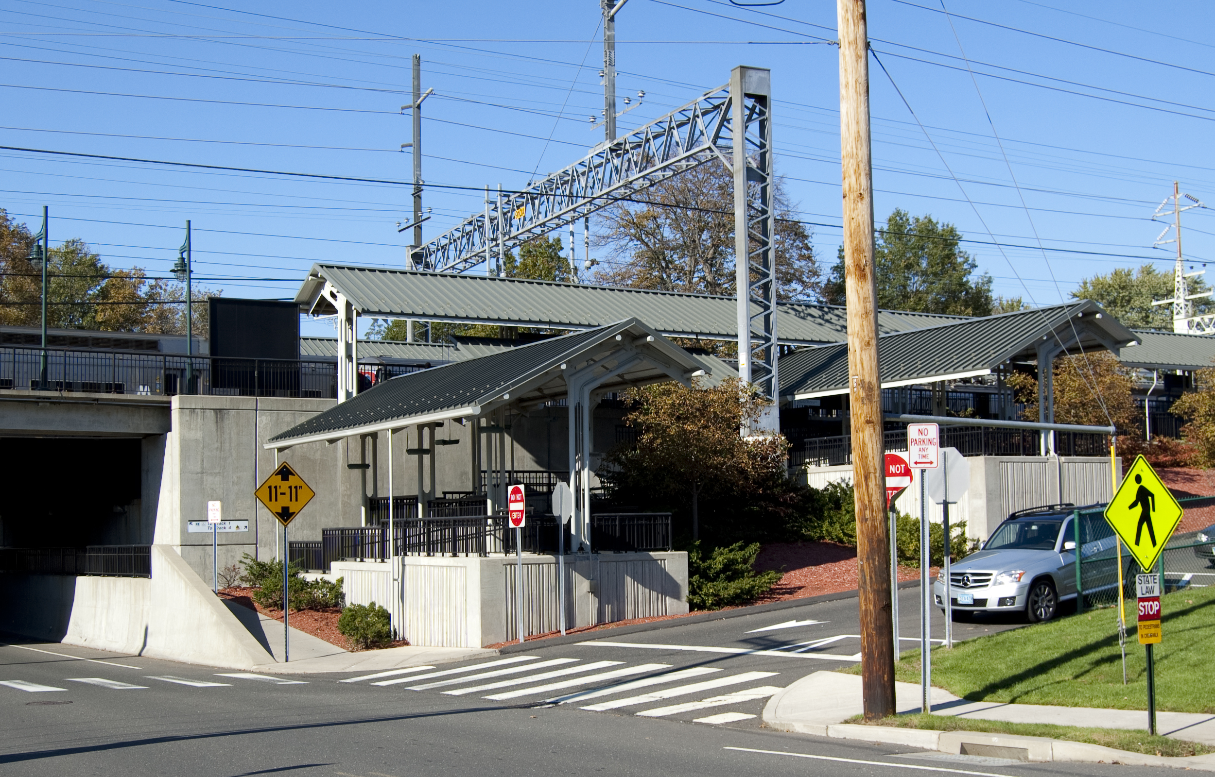
| + | [[Interstate 95 in Connecticut|Interstate 95]] and [[U.S. Route 1 in Connecticut|U.S. Route 1]] pass through the southern part of Milford. The [[Wilbur Cross Parkway]] cuts across the northern part of the city and is connected to I-95 and Route 1 via the [[Milford Parkway (Connecticut)|Milford Parkway]], also known as the Daniel S. Wasson connector, named for the first police officer to die in the line of duty in the city of Milford. He was killed on April 12, 1987, when he was shot by a motorist he had pulled over. The [[Metro-North]] [[New Haven Line]] has a station stop in downtown Milford ([[Milford (Metro-North station)|Milford station]]). The [[Milford Transit District]] provides in-town service to major attractions. Connections with the [[Greater Bridgeport Transit Authority]] and [[Connecticut Transit New Haven]] are also available. |
||
| + | |||
| + | ==Demographics== |
||
| + | {{See also|List of Connecticut locations by per capita income}} |
||
| + | {{historical populations |
||
| + | |source = <ref>{{cite web|author=Enter your Company or Top-Level Office |url=http://www.sots.state.ct.us/RegisterManual/regman.htm |title=Office of the Secretary of the State |publisher=Sots.state.ct.us |date= |accessdate=2013-05-19}}</ref> |
||
| + | |1756|1633 |
||
| + | |1774|2127 |
||
| + | |1782|2195 |
||
| + | |1790|2098 |
||
| + | |1800|2417 |
||
| + | |1810|2674 |
||
| + | |1820|2785 |
||
| + | |1830|2256 |
||
| + | |1840|2455 |
||
| + | |1850|2465 |
||
| + | |1860|2828 |
||
| + | |1870|3405 |
||
| + | |1880|3347 |
||
| + | |1890|3811 |
||
| + | |1900|3783 |
||
| + | |1910|4366 |
||
| + | |1920|10193 |
||
| + | |1930|12660 |
||
| + | |1940|16439 |
||
| + | |1950|26870 |
||
| + | |1960|41662 |
||
| + | |1970|50858 |
||
| + | |1980|50898 |
||
| + | |1990|49938 |
||
| + | |2000|52212 |
||
| + | |2010|52759 |
||
| + | }} |
||
| + | |||
| + | As of the [[census]]{{GR|2}} of 2000, there were 52,212 people, 20,138 households, and 13,613 families residing in Milford. The [[population density]] was 2,270.7 people per square mile (876.8/km²). There were 21,145 housing units at an average density of 949.0 per square mile (366.4/km²). The racial makeup of Milford was 93.55% [[White (U.S. Census)|White]], 1.91% [[African American (U.S. Census)|African American]], 0.13% [[Native American (U.S. Census)|Native American]], 2.36% [[Asian (U.S. Census)|Asian]], 0.03% [[Pacific Islander (U.S. Census)|Pacific Islander]], 0.88% from [[Race (United States Census)|other races]], and 1.14% from two or more races. [[Hispanic (U.S. Census)|Hispanic]] or [[Latino (U.S. Census)|Latino]] of any race were 3.34% of the population. |
||
There were 20,138 households out of which 29.3% had children under the age of 18 living with them, 54.7% were [[Marriage|married couples]] living together, 9.7% had a female householder with no husband present, and 32.4% were non-families. 26.3% of all households were made up of individuals and 10.3% had someone living alone who was 65 years of age or older. The average household size was 2.49 and the average family size was 3.04. |
There were 20,138 households out of which 29.3% had children under the age of 18 living with them, 54.7% were [[Marriage|married couples]] living together, 9.7% had a female householder with no husband present, and 32.4% were non-families. 26.3% of all households were made up of individuals and 10.3% had someone living alone who was 65 years of age or older. The average household size was 2.49 and the average family size was 3.04. |
||
| Line 238: | Line 356: | ||
In Milford the population was spread out with 22.4% under the age of 18, 5.9% from 18 to 24, 31.7% from 25 to 44, 25.0% from 45 to 64, and 14.9% who were 65 years of age or older. The median age was 39 years. For every 100 females there were 93.6 males. For every 100 females age 18 and over, there were 90.0 males. |
In Milford the population was spread out with 22.4% under the age of 18, 5.9% from 18 to 24, 31.7% from 25 to 44, 25.0% from 45 to 64, and 14.9% who were 65 years of age or older. The median age was 39 years. For every 100 females there were 93.6 males. For every 100 females age 18 and over, there were 90.0 males. |
||
| − | + | As of the 2000 census, the median income for a household was $61,183. The [[per capita income]] was $28,773. About 2.4% of families and 3.8% of the population were below the [[poverty line]], including 4.1% of those under age 18 and 5.4% of those age 65 or over. |
|
| + | The Census Bureau's 2010-2012 [[American Community Survey]] showed that (in 2012 [[inflation adjustment|inflation-adjusted]] dollars) [[median household income]] was $77,925 and the median family income was $93,697. Year-round male workers had a median income of $67,631 versus $59,992 for females. The [[per capita income]] for the city was $38,560.<ref>[http://factfinder2.census.gov/faces/tableservices/jsf/pages/productview.xhtml?pid=ACS_12_3YR_DP03&prodType=table: SELECTED ECONOMIC CHARACTERISTICS more information 2010-2012 American Community Survey 3-Year Estimates], [[United States Census Bureau]]. Accessed December 1, 2013.</ref> |
||
{| class=wikitable |
{| class=wikitable |
||
! colspan = 6 | Voter registration and party enrollment as of October 28, 2008<ref>{{cite web|title = Registration and Party Enrollment Statistics as of October 28, 2008 | publisher = Connecticut Secretary of State | format = PDF | accessdate = 2009-04-13 | url = http://www.sots.ct.gov/sots/lib/sots/electionservices/registration_and_enrollment_stats/2008_registration_and_enrollment_statistics.pdf}}</ref> |
! colspan = 6 | Voter registration and party enrollment as of October 28, 2008<ref>{{cite web|title = Registration and Party Enrollment Statistics as of October 28, 2008 | publisher = Connecticut Secretary of State | format = PDF | accessdate = 2009-04-13 | url = http://www.sots.ct.gov/sots/lib/sots/electionservices/registration_and_enrollment_stats/2008_registration_and_enrollment_statistics.pdf}}</ref> |
||
| Line 250: | Line 369: | ||
{{American politics/party colors/Democratic/row}} |
{{American politics/party colors/Democratic/row}} |
||
| [[Democratic Party (United States)|Democratic]] |
| [[Democratic Party (United States)|Democratic]] |
||
| − | | |
+ | | style="text-align:center;"| 9,421 |
| − | | |
+ | | style="text-align:center;"| 276 |
| − | | |
+ | | style="text-align:center;"| 9,697 |
| − | | |
+ | | style="text-align:center;"| 27.98% |
{{American politics/party colors/Republican/row}} |
{{American politics/party colors/Republican/row}} |
||
| [[Republican Party (United States)|Republican]] |
| [[Republican Party (United States)|Republican]] |
||
| − | | |
+ | | style="text-align:center;"| 7,223 |
| − | | |
+ | | style="text-align:center;"| 236 |
| − | | |
+ | | style="text-align:center;"| 7,459 |
| − | | |
+ | | style="text-align:center;"| 21.52% |
{{American politics/party colors/Independent/row}} |
{{American politics/party colors/Independent/row}} |
||
| Unaffiliated |
| Unaffiliated |
||
| − | | |
+ | | style="text-align:center;"| 16,788 |
| − | | |
+ | | style="text-align:center;"| 638 |
| − | | |
+ | | style="text-align:center;"| 17,426 |
| − | | |
+ | | style="text-align:center;"| 50.28% |
{{American politics/party colors/Libertarian/row}} |
{{American politics/party colors/Libertarian/row}} |
||
| Minor parties |
| Minor parties |
||
| − | | |
+ | | style="text-align:center;"| 62 |
| − | | |
+ | | style="text-align:center;"| 6 |
| − | | |
+ | | style="text-align:center;"| 68 |
| − | | |
+ | | style="text-align:center;"| 0.20% |
|- |
|- |
||
! colspan = 2 | Total |
! colspan = 2 | Total |
||
| − | ! |
+ | ! style="text-align:center;"| 33,494 |
| − | ! |
+ | ! style="text-align:center;"| 1,156 |
| − | ! |
+ | ! style="text-align:center;"| 34,650 |
| − | ! |
+ | ! style="text-align:center;"| 100% |
|} |
|} |
||
==On the National Register of Historic Places== |
==On the National Register of Historic Places== |
||
| − | * |
+ | *[[Academy of Our Lady of Mercy Lauralton Hall]] — 200 High St. (added in 2011) |
| − | * |
+ | *[[Buckingham House (Milford, Connecticut)|Buckingham House]] — 61 North St. (added in 1977) |
| − | * |
+ | *[[Eells-Stow House]] — 34 High St. (added in 1977) |
| − | * |
+ | *[[Hebrew Congregation of Woodmont]] — 15 and 17 Edgefield Ave. (added in 1995) |
| − | * |
+ | *[[Housatonic River Railroad Bridge]] — Amtrak right-of-way at [[Housatonic River]] (added in 1987) |
| − | * |
+ | *[[Milford Point Hotel]] — Milford Point Road (added in 1988) |
| + | *[[River Park Historic District]] — Roughly bounded by Boston Post Road, Cherry St. and Amtrak, and High St. (added in 1986) |
||
| − | *'''[[St. Peter's Episcopal Church (Milford, Connecticut)|St. Peter's Episcopal Church]]''' — 61, 71, 81 River St. (added in 1979) |
||
| − | * |
+ | *[[St. Peter's Episcopal Church (Milford, Connecticut)|St. Peter's Episcopal Church]] — 61, 71, 81 River St. (added in 1979) |
| − | * |
+ | *[[Taylor Memorial Library]] — 5 Broad St. (added in 1979) |
| − | * |
+ | *[[US Post Office-Milford Main]] — 6 W. River St. (added in 1986) |
| + | *[[Washington Bridge (Connecticut)|Washington Bridge]] — Spans the [[Housatonic River]] to [[Stratford, Connecticut|Stratford]] (added in 2004) |
||
==Notable residents== |
==Notable residents== |
||
| − | * [[ |
+ | * [[Nick Art]], actor<ref>http://www.imdb.com/name/nm1357069/</ref> |
| − | * [[ |
+ | * [[Dylan Bruno]], actor<ref>http://www.imdb.com/name/nm0116465/</ref> |
| − | * [[ |
+ | * [[Anne Griffin]], actress<ref>http://www.imdb.com/name/nm1662443/</ref> |
| + | * [[Doug Henry (motocross)|Doug Henry]], National Champion motocross & snowmobile racer<ref>[http://www.motorcyclemuseum.org/halloffame/hofbiopage.asp?id=377 ]{{dead link|date=May 2013}}</ref> |
||
| − | * [[Simon Lake]] (1866–1945), inventor and naval engineer.<ref>http://www.simonlake.com/html/inventor___engineer.html</ref> |
||
| + | * [[Simon Lake]] (1866–1945), inventor and naval engineer<ref>{{cite web|url=http://www.simonlake.com/html/inventor___engineer.html |title=Inventor & Engineer |publisher=Simonlake.com |date= |accessdate=2013-05-19}}</ref> |
||
| − | * [[Jonathan Law]] (1674–1750), colonial era judge, Governor of the [[Colony of Connecticut]] between 1741-1750.<ref>http://www.cslib.org/gov/lawj.htm</ref> |
||
| + | * [[Jonathan Law]] (1674–1750), colonial era judge, Governor of the [[Colony of Connecticut]] between 1741 and 1750<ref>{{cite web|url=http://www.cslib.org/gov/lawj.htm |title=Jonathan Law |publisher=Cslib.org |date= |accessdate=2013-05-19}}</ref> |
||
| − | * [[Brad Lockerman]], actor.<ref>http://www.imdb.com/name/nm0516830/bio</ref> |
||
| − | * [[Joseph Plumb Martin]] (1760–1850), |
+ | * [[Joseph Plumb Martin]] (1760–1850), Revolutionary War soldier, raised by his grandparents in Milford<ref>[http://www.ci.milford.ct.us/Public_Documents/FOV1-0000F6DA/aldermenmeetings/BOAMinutes080607.pdf ]{{dead link|date=May 2013}}</ref> |
| − | * [[Abigail Merwin]] (1759–1786), a Colonial-era wife and mother who alerted the local militia of a raid by British forces arriving from the warship [[HMS Swan (1767)]] |
+ | * [[Abigail Merwin]] (1759–1786), a Colonial-era wife and mother who alerted the local militia of a raid by British forces arriving from the warship [[HMS Swan (1767)|HMS ''Swan'']]<ref>{{cite web|url=http://oceanvoyaging.com/SnippetPages/Snippets2009/SnippetsOctober2009.html |title=NavigatorHomeSubpage |publisher=Oceanvoyaging.com |date= |accessdate=2013-05-19}}</ref> |
| − | * [[ |
+ | * [[Ellen Muth]], actress<ref>http://www.imdb.com/name/nm0616091/bio</ref> |
| + | * [[Erin Pac]], [[Bobsleigh at the 2010 Winter Olympics|2010 women’s bobsled]] Olympic bronze medalist<ref>[http://www.acorn-online.com/joomla15/milfordmirror/news/localnews/50528-olympic-bobsledder-from-milford-in-second-place-so-far.html ]{{dead link|date=May 2013}}</ref> |
||
| − | * [[Ellen Muth]], actress.<ref>http://www.imdb.com/name/nm0616091/bio</ref> |
||
| + | * [[Dan Patrick]] (Pugh), NBC's ''[[Football Night in America]]'' co-host, senior writer for ''[[Sports Illustrated]]'', and former [[SportsCenter|ESPN ''SportsCenter'']] anchor<ref>[http://www.nhregister.com/articles/2009/06/10/news/milford/a1_--_man_caves.txt]{{Dead link|date=December 2010}}</ref> |
||
| − | *[[Erin Pac]], [[Bobsleigh at the 2010 Winter Olympics|2010 women’s bobsled]] Olympic bronze medalist<ref>http://www.acorn-online.com/joomla15/milfordmirror/news/localnews/50528-olympic-bobsledder-from-milford-in-second-place-so-far.html</ref> |
||
| + | * [[Jason Peter]], Collegiate All-American defensive tackle (1997) & defensive end for the [[Carolina Panthers]], attended Milford Academy<ref>{{cite news| url=http://query.nytimes.com/gst/fullpage.html?res=9B01E1D6143EF931A25751C0A9609C8B63&sec=&spon=&pagewanted=all | work=The New York Times | title=IN PERSON; When the Cheers Aren't Enough | first=Bill | last=Finley | date=February 12, 2006 | accessdate=May 12, 2010}}</ref> |
||
| − | * [[Dan Patrick]] (Pugh), NBC's Football Night in America co-host, [[SportsCenter|ESPN SportsCenter]] anchor, and senior writer for [[Sports Illustrated]].<ref>http://www.nhregister.com/articles/2009/06/10/news/milford/a1_--_man_caves.txt</ref> |
||
| − | * [[Jason Peter]], Collegiate All-American defensive tackle (1997) & defensive end for the [[Carolina Panthers]] attended Milford Academy.<ref>{{cite news| url=http://query.nytimes.com/gst/fullpage.html?res=9B01E1D6143EF931A25751C0A9609C8B63&sec=&spon=&pagewanted=all | work=The New York Times | title=IN PERSON; When the Cheers Aren't Enough | first=Bill | last=Finley | date=February 12, 2006 | accessdate=May 12, 2010}}</ref> |
||
* [[Catherine Pollard (Scouting)|Catherine Pollard]] (c. 1918 - 2006), first female Scoutmaster in the [[Boy Scouts of America]] |
* [[Catherine Pollard (Scouting)|Catherine Pollard]] (c. 1918 - 2006), first female Scoutmaster in the [[Boy Scouts of America]] |
||
| + | * [[Charles H. Pond]] (1781–1861), judge of the New Haven County Court, sheriff of New Haven, Lieutenant Governor & 37th Governor of Connecticut<ref>{{cite web|url=http://www.cslib.org/gov/ |title=Governors of Connecticut |publisher=Cslib.org |date= |accessdate=2013-05-19}}</ref> |
||
| − | * [[Peter Pond]] (1739/40?–1807), the first explorer of the [[Athabasca]] region of [[North America]] in the 1780s & founding member of the [[North West Company]].<ref>http://www.biographi.ca/009004-119.01-e.php?&id_nbr=2615</ref> |
||
| + | * [[Peter Pond]] (1739/40?–1807), first explorer of the [[Lake Athabasca|Athabasca]] region of [[North America]] in the 1780s & founding member of the [[North West Company]]<ref>{{cite web|url=http://www.biographi.ca/009004-119.01-e.php?&id_nbr=2615 |title=POND, PETER - Dictionary of Canadian Biography Online |publisher=Biographi.ca |date=2007-10-18 |accessdate=2013-05-19}}</ref> |
||
| − | * [[Peter L. Pond]] (1933–2000), human rights activist and philanthropist who adopted 16 Cambodian orphans<ref>Mooney, Tom, "Peter Pond's War," Providence Journal, Oct 15, 1989 p. M-06.</ref>. |
||
| + | * [[Peter L. Pond]] (1933–2000), human rights activist and philanthropist who adopted 16 Cambodian orphans<ref>Mooney, Tom, "Peter Pond's War," Providence Journal, Oct 15, 1989 p. M-06.</ref> |
||
| − | * [[Charles H. Pond]] (1781–1861), judge of the New Haven County Court, sheriff of New Haven, Lieutenant Governor & 37th Governor of Connecticut.<ref>http://www.cslib.org/gov/</ref> |
||
| + | * [[Jonathan Quick]], NHL goaltender for the [[Los Angeles Kings]]<ref>{{cite web|url=http://kings.nhl.com/club/player.htm?id=8471734#&navid=lak-keymatch |title=Jonathan Quick Los Angeles Kings - 2012-2013 Stats - Los Angeles Kings - Team |publisher=Kings.nhl.com |date=1986-01-21 |accessdate=2013-05-19}}</ref> |
||
| − | * [[Christy Carlson Romano]], actress.<ref>http://www.imdb.com/name/nm0005579/</ref> |
||
| + | * [[John Ratzenberger]], actor, owns a home in town |
||
| − | * [[Dan Rusanowsky]], NHL radio broadcaster for the [[San Jose Sharks]].<ref>http://sharks.nhl.com/club/page.htm?bcid=29683</ref> |
||
| − | * [[ |
+ | * [[Christy Carlson Romano]], actress<ref>http://www.imdb.com/name/nm0005579/</ref> |
| + | * [[Dan Rusanowsky]], NHL radio broadcaster for the [[San Jose Sharks]]<ref>{{cite web|url=http://sharks.nhl.com/club/page.htm?bcid=29683 |title=Dan Rusanowsky, Radio Play-By-Play Broadcaster - San Jose Sharks - Front Office Staff |publisher=Sharks.nhl.com |date= |accessdate=2013-05-19}}</ref> |
||
| − | * [[Al Scaduto]] (1928–2007), cartoonist ''[[They'll Do It Every Time]]''<ref>http://www.edwardsanddowdle.com/_mgxroot/page_10780.php?id=483319</ref> |
||
| + | * [[Al Scaduto]] (1928–2007), cartoonist (''[[They'll Do It Every Time]]'')<ref>{{cite web|url=http://www.edwardsanddowdle.com/_mgxroot/page_10780.php?id=483319 |title=Edwards and Dowdle, New York | Obituaries |publisher=Edwardsanddowdle.com |date= |accessdate=2013-05-19}}</ref> |
||
| − | * [[Frank J. Sprague]] (1857–1934), inventor who helped develop the electric motor, electric railways, and electric elevators.<ref>http://www.theelevatormuseum.org/e/e-1.htm</ref> |
||
| + | * [[Frank J. Sprague]] (1857–1934), inventor who helped develop the electric motor, electric railways, and electric elevators<ref>{{cite web|url=http://www.theelevatormuseum.org/e/e-1.htm |title=The Inventors (E) |publisher=Theelevatormuseum.org |date=1934-10-25 |accessdate=2013-05-19}}</ref> |
||
| − | * [[Robert Treat]] (1624?-1710), colonial era deputy & military officer, Governor of the [[Colony of Connecticut]] between 1683-1698.<ref>http://www.cslib.org/gov/treatr.htm</ref> |
||
| + | * [[Robert Treat]] (1624?-1710), colonial era deputy & military officer, Governor of the [[Colony of Connecticut]] between 1683-1698<ref>{{cite web|url=http://www.cslib.org/gov/treatr.htm |title=Robert Treat |publisher=Cslib.org |date= |accessdate=2013-05-19}}</ref> |
||
| − | * [[Jonathan Quick]], NHL goaltender for the [[Los Angeles Kings]].<ref>http://kings.nhl.com/club/player.htm?id=8471734#&navid=lak-keymatch</ref> |
||
| − | * [[Heidi |
+ | * [[Heidi Voight]], [[Miss Connecticut]] 2006<ref>{{cite web|url=http://www.miap.us/media.htm |title=MIAP - About Us |publisher=Miap.us |date= |accessdate=2013-05-19}}</ref> |
==Movies filmed in Milford== |
==Movies filmed in Milford== |
||
Movies filmed at least in part in Milford include:<ref>[http://imdb.com/List?locations=Milford,+Connecticut,+USA&&tv=on Internet Movie DataBase Web site's page for Milford, Connecticut]</ref> |
Movies filmed at least in part in Milford include:<ref>[http://imdb.com/List?locations=Milford,+Connecticut,+USA&&tv=on Internet Movie DataBase Web site's page for Milford, Connecticut]</ref> |
||
| + | <!--Note: IMDB's list includes New Milford, Connecticut, so be careful when adding to check each entry individually--> |
||
| − | *''[[A Dance for Grace]]'' (2010) |
||
| + | *''[[The Light That Failed]]'' (1916) - Smith's Point was used in a desert battle scene using camels from Barnum's circus in Bridgeport.<ref>Dooling, Michael C. Milford Lost & Found, The Carrollton Press, 2009</ref> |
||
| − | *''[[This Wretched Life]]'' (2010) |
||
| − | *''[[ |
+ | *''[[Man on a Swing]]'' (1974) |
| − | *''[[ |
+ | *''[[Daylight (film)|Daylight]]'' (1996) |
| − | *''[[December Plans]]'' (2007) |
||
*''[[Furious Fish]]'' (2005) |
*''[[Furious Fish]]'' (2005) |
||
*''[[Save the Forest]]'' (2005) |
*''[[Save the Forest]]'' (2005) |
||
| − | *''[[ |
+ | *''[[December Plans]]'' (2007) |
| − | *''[[ |
+ | *''[[Righteous Kill]]'' (2008) |
| − | *''[[ |
+ | *''[[Sad Sack Sally]]'' (2009) |
| + | *''[[A Dance for Grace]]'' (2010) |
||
| + | *''[[This Wretched Life]]'' (2010) |
||
| + | *''[[After the Fall (2013 film)|After The Fall]]'' (2013) |
||
==References== |
==References== |
||
| + | {{reflist|colwidth=30em}} |
||
| − | {{Reflist}} |
||
==External links== |
==External links== |
||
| + | |||
| + | {{Geographic Location |
||
| + | | Centre = Milford |
||
| + | | North = [[Orange, Connecticut|Orange]] |
||
| + | | Northeast = [[West Haven, Connecticut|West Haven]] |
||
| + | | East = [[Long Island Sound]] |
||
| + | | South = [[Long Island Sound]] |
||
| + | | West = [[Stratford, Connecticut|Stratford]] / [[Housatonic River]]}} |
||
| + | |||
{{Portal|Connecticut}} |
{{Portal|Connecticut}} |
||
[[File:PostcardLaurelBeachMilfordCT1910.jpg|thumb|right|250px|Laurel Beach, 1910]] |
[[File:PostcardLaurelBeachMilfordCT1910.jpg|thumb|right|250px|Laurel Beach, 1910]] |
||
| − | *[http://www.ci.milford.ct.us/ City of Milford] |
+ | *[http://www.ci.milford.ct.us/ City of Milford official website] |
| − | *[http://www. |
+ | *[http://www.downtownmilfordct.com/ Downtown Milford Business Association] |
| + | *[http://news.hamlethub.com/milford/ Milford's HamletHub], Milford's Local Stories |
||
*[http://www.villageofdevon.com/ Village of Devon] |
*[http://www.villageofdevon.com/ Village of Devon] |
||
*{{dmoz|Regional/North_America/United_States/Connecticut/Localities/M/Milford}} |
*{{dmoz|Regional/North_America/United_States/Connecticut/Localities/M/Milford}} |
||
| − | *[http://history.rays-place.com/ct/early-milford-ct.htm |
+ | *[http://history.rays-place.com/ct/early-milford-ct.htm "Early Milford"], history of Milford |
| − | *[http://www.milfordlivingmagazine.com/ Milford Living |
+ | *[http://www.milfordlivingmagazine.com/ ''Milford Living'' magazine] |
| − | *[http://homepages.rootsweb.com/~riggs/Maps/MilfordCT.gif 1646 |
+ | *[http://homepages.rootsweb.com/~riggs/Maps/MilfordCT.gif 1646 map of Milford] |
| − | *[http://www. |
+ | *[http://www.milfordradio.com/ MilfordRadio.com], community information |
| − | {{Coord|41.22623|-73.06263|region:US_type:city|display=title}} |
||
| − | |||
| − | {{Connecticut}} |
||
{{New Haven County, Connecticut}} |
{{New Haven County, Connecticut}} |
||
| + | {{Connecticut}} |
||
| + | {{New York metropolitan area}} |
||
| + | {{New England}} |
||
[[Category:Milford, Connecticut| ]] |
[[Category:Milford, Connecticut| ]] |
||
[[Category:Cities in Connecticut]] |
[[Category:Cities in Connecticut]] |
||
| − | [[Category: |
+ | [[Category:Cities in New Haven County, Connecticut]] |
[[Category:Census balances in the United States]] |
[[Category:Census balances in the United States]] |
||
| + | [[Category:Cities in the New York metropolitan area]] |
||
{{usedwp|Milford, Connecticut}} |
{{usedwp|Milford, Connecticut}} |
||
Latest revision as of 09:43, 16 February 2014
| Main | Births etc |
|---|
| Milford, Connecticut | |||
|---|---|---|---|
| — City — | |||
 |
|||
|
|||
| Nickname(s): A Small City with a Big Heart | |||
 |
|||
| Coordinates: | |||
| Country | United States | ||
| State | Connecticut | ||
| County | New Haven County | ||
| NECTA | Bridgeport-Stamford Region | ||
| Region | South Central Region | ||
| Settled | 1639 | ||
| Incorporated (city) | 1959 | ||
| Government | |||
| • Type | Mayor–Board of Aldermen | ||
| • Mayor | Benjamin G. Blake (D) | ||
| Area | |||
| • Total | 26.1 sq mi (67.7 km2) | ||
| • Land | 22.2 sq mi (57.4 km2) | ||
| • Water | 3.9 sq mi (10.2 km2) | ||
| Population (2010) | |||
| • Total | 52,759 | ||
| • Density | 2,000/sq mi (780/km2) | ||
| Time zone | Eastern (UTC-5) | ||
| • Summer (DST) | Eastern (UTC-4) | ||
| ZIP code | 06460, 06461 | ||
| Area code(s) | 203 | ||
| FIPS code | 09-47515 | ||
| Website | ci.milford.ct.us | ||
Milford is a coastal city in southwestern New Haven County, Connecticut, United States, located between Bridgeport and New Haven. The population was 52,759 at the 2010 census.[1] The city contains the incorporated borough of Woodmont and the unincorporated village of Devon.
History[]
Early history[]
Oyster Huts on Milford Point, a sketch by John Warner Barber for his Historical Collections of Connecticut (1836). Barber wrote that he found 15 or 20 of these seaweed-covered huts along the shore when he visited the town in 1836. Oystermen used the huts in the winter.
The land which today comprises Milford, Orange and West Haven was purchased on February 1, 1639 from Ansantawae, chief of the local Paugussets (an Algonquian tribe) by English settlers affiliated with the contemporary New Haven Colony. Originally, the area was known as "Wepawaug", after the small river which runs through the town, and which has given its name to several streets in both Milford and Orange.
During the Revolutionary War the Milford section of the Boston Post Road, a vital route connecting Boston, New York and other major coastal cities, was blockaded by Continental forces, and Fort Trumbull was constructed to protect the town. The site of the blockade is commemorated by the Liberty Rock monument.
By 1822, the town had grown large enough that residents in the northern and eastern sections of Milford chartered their own independent course as the town of Orange. During the next century and a half, the remaining section of Milford was known for shipbuilding, farming and oystering, although a small subset of industrial facilities also developed in town. During this time, Milford also became known as a beach resort for residents of New Haven and Bridgeport.
Interestingly, the boundaries of the final town charter granted by the State of Connecticut in 1899 to Laurel Beach are contained entirely within Milford. Residents of Laurel Beach must therefore pay taxes to both Laurel Beach as well as Milford, and all mail to Laurel Beach residents is mailed to Milford.
In 1903, the southeastern portion of the town was incorporated as the Borough of Woodmont. In 1959, the town of Milford including the Borough of Woodmont was incorporated as the City of Milford.
Towns created from Milford[]

View of Milford's greens on a 19th-century naïve landscape painting

Map showing Milford and neighboring towns
Milford was one of the early settlements in south central Connecticut and, over time, gave rise to several new towns that broke off and incorporated separately. The following is a list of towns created from parts of Milford.
- Woodbridge in 1784 (also partly from New Haven)
- Bethany, created from Woodbridge in 1832
- Orange (originally North Milford) in 1822 (also partly from New Haven)
- West Haven, created from Orange in 1921
The "oatmeal lots" of Liberty Park[]
Starting in 1902, Quaker Oats oatmeal boxes came with a coupon redeemable for the legal deed to a tiny lot in Milford. The lots, sometimes as small as 10 feet (3 m) by 10 feet, were carved out of a 15-acre (6.1 ha) tract in a never-built subdivision called "Liberty Park". A small number of children (or their parents), often residents living near Milford, collected the deeds and started paying the extremely small property taxes on the "oatmeal lots". The developer of the prospective subdivision hoped the landowners would hire him to build homes on the lots, although several lots would need to be combined before building could start. Since the subdivision into small lots predated Milford's planning and zoning regulations, the deeds were entirely legal, although they created a large amount of paperwork for town tax collectors, who frequently couldn't find the property owners and received almost no tax revenue from the lots.[2]
In the mid-1970s, when the town wanted to develop the area, town officials put an end to the oatmeal lots in a "general foreclosure" that avoided the enormous expense of individual foreclosures by condemning nearly all of the property in one legal filing. One of the streets in the Liberty Park subdivision plans, Shelland Street, was later built in the late 1990s as an access road to the Milford Power Company. The site is currently home to the BIC Corporation's lighter factory at 565 Bic Drive. (In a separate land giveaway in 1955 tied to the Sergeant Preston of the Yukon television show, Quaker Oats offered in its Puffed Wheat and Puffed Rice cereal boxes genuine deeds to land in the Klondike.)[2]
Post-World War II development[]
In the post-World War II period, Milford—like many other New England towns—underwent significant suburbanization. Interstate 95 was routed through town, and the Milford section was completed in 1958.
The 1960s and 1970s witnessed the construction of the Connecticut Post Mall, one of the state's largest shopping malls, and the extensive commercial development of the town's stretch of the Boston Post Road. One notable small business located on the Boston Post Road during the 1970s was SCELBI Computer Consulting, credited by many as being the world's first personal-computer manufacturer. Starting in 1975, the city began hosting the Milford Oyster Festival, which has since become firmly established as an annual Milford tradition that is held "rain or shine".[3][4]
The city became host to several headquarters of multinational corporations, including the Schick Shaving company,[5] and Doctor's Associates, Inc., owners of the Subway chain of fast-food restaurants. The US operations of BIC were headquartered in Milford, but in March 2008 moved most of its operations to Shelton. Milford Hospital has also developed into an important health care resource for the area. It has also become home of smaller national corporations such as Total Mortgage Services[6] and Orchid Medical.
| Milford, Connecticut | ||||||||||||
| ||||||||||||


Government[]
Government in the city is set up with the mayor as chief executive and the Board of Aldermen as a legislative body. The mayor is permitted to propose legislation to the Board of Aldermen and introduces the city budget, but possesses no veto power over what the Aldermen chooses to pass.
Taxes[]
In 2005, the mill rate for Milford was 34.36[7] and is reportedly 26.28 mills for fiscal year 2013-2014.[8]
Elected positions[]
The following is a list of city government positions elected by city residents and the terms thereof:[9]
- Mayor: The mayor is the city's chief executive and is elected in odd-numbered years. The mayor receives compensation for his or her services.
- Board of Aldermen: The Board of Aldermen consists of 15 members elected in odd-numbered years, three from each of the city's five political districts. Per City Charter requirements, only two of the three aldermen elected from each district may be from one political party to allow for minority representation on the board; voters are permitted to vote for any three aldermen in their district. Members of the Board of Aldermen receive no compensation for their services.
- Board of Education: The Board of Education deals with educational matters in the city and consists of 10 members elected in odd-numbered years, two from each of the city's five political districts. Members receive no compensation for their services.
- Planning & Zoning Board: The Planning & Zoning Board deals with development and land use issues and consists of 10 members, two from each of the city's five political districts. Members serve a four-year term, with one of the two members of each political district up for election during each odd-numbered year's election cycle, ensuring that no more than half of the board is made up of new members at the start of a new session. Members of the Planning & Zoning Board receive no compensation for their services.
- City Clerk: The city clerk is elected in odd-numbered years and receives a compensation for services provided.
- Constables: Seven constables are elected in odd-numbered years, though individual voters are only permitted to vote for any four of their choosing on the ballot. They are compensated on a case-by-case basis.
- Registrars of Voters: Pursuant to Connecticut state law, each town must have a Republican and Democratic registrar of voters to serve as election administrators, though an additional third party registrar is permitted if they receive more votes than either of the major parties' registrar. Registrars in Milford are elected to two-year terms, their election taking place during each even-year state election cycle. Registrars are compensated for their services. Voters may only vote for one choice for registrar.
List of mayors[]
After becoming incorporated as a city in 1959, the city reformed its system of government by establishing a mayor–board of aldermen format. It elected its first mayor, Charles Iovino,[10] the incumbent city manager under Milford's previous form of government, on November 3, 1959.
Since 1959, 10 people have held the office of mayor in the city.[11]
| # | Name | In office | Political party |
|---|---|---|---|
| 1 | Charles Iovino | 1959–1963 | Independent |
| 2 | Alan Jepson | 1963–1969 | Democratic |
| 3 | Edward Kozlowski | 1969–1971 | Republican |
| 4 | Clifton Moore | 1971–1973 | Republican |
| 5 | Joel Baldwin | 1973–1977 | Democratic |
| 6 | Henry Povinelli | 1977–1981 | Republican |
| 7 | Alberta Jagoe | 1981–1989 | Democratic |
| 8 | Frederick L. Lisman | 1989–2001 | Republican |
| 9 | James L. Richetelli, Jr. | 2001–2011 | Republican |
| 10 | Benjamin G. Blake | 2011–present | Democratic |
Emergency services[]
Fire Department[]
The city of Milford is protected 24/7, 365 by the 114 paid, full-time firefighters of the city of Milford Fire Department - ISO Class 1. The Milford Fire Department currently operates out of five fire stations, located throughout the city, under the command of a Battalion Chief and a Shift Commander. The Milford Fire Department also maintains and operates a fire apparatus fleet of seven engines (including one Quint), one tower ladder, two rescue ambulances, two HazMat units, one dive rescue unit, one collapse rescue unit, two fireboats, a canteen unit, and numerous other special, support, and reserve units. The Milford Fire Department is one of only two fire departments in the state of Connecticut to maintain an ISO Class 1 rating. The current Fire Chief is Douglas Edo.[12]
Fire station locations and apparatus[]
Below is a complete listing of all fire station locations and apparatus in the city of Milford.[13]
| Engine company | Truck company | Rescue ambulance | Special unit | Command unit | Address |
|---|---|---|---|---|---|
| Engine 1 | Tower 1 | Rescue 1, Rescue 3 | Car 4 (Shift Commander), Car 5 (Battalion Chief) | 72 New Haven Ave. | |
| Engine 3, Engine 4 | Haz-Mat. 1, Haz-Mat. 2, Dive Rescue Unit | 349 Naugatuck Ave. | |||
| Engine 5, Engine 6 | Rescue 234 (Collapse Unit) | 980 New Haven Ave. | |||
| Engine 7 | Rescue 2 | Decon. Trailer | 55 Wheelers Farms Rd. |
The Milford Fire Department also operates four reserve engines. Engine 2 (Reserve) is located at the quarters of Engine 1 and Tower 1. Engines 8 and 10 (Reserve) are located at the quarters of Engine 3 (Quint) and Engine 4, while Engine 9 (Reserve) is located at the quarters of Engine's 5 and 6. The Canteen Unit is operated out of a garage at 3 Charles Street. As of 2012, the city has begun construction of a new fire station to be located on New Haven Avenue and to serve as the new quarters of Engine 5, Engine 6, and the Collapse Unit.
Police department[]
The Milford Police Department is led by Chief Keith L. Mello, a 1981 graduate of the town's police academy.[14] On May 12, 2011, the Police Officer Standards & Training Council re-accredited the department's Tier I & II State Accreditation.[15]
Principal communities of Milford[]


Seaside Avenue, 1911 postcard
- Downtown Milford
- Devon
- Rivercliff
- Morningside
- Walnut Beach
- Wildermere Beach
- Woodmont borough, also known as "Woodmont On the Sound"
Other minor communities and geographic features are Anchor Beach, Bayview, Bayview Heights, Burwells Beach, Cedar Beach, Downtown Historic District, Ettadore Park, Far View Beach, Forest Heights, Fort Trumbull, Great River, Gulf Beach, Laurel Beach, Lexington Green, Merwin's Beach, Merwin's Point, Milford Lawns, Milford Point, Myrtle Beach, Naugatuck Gardens, Point Lookout, Pond Point Beach, Silver Sands Beach, South of the Green, Walnut Beach, Wheelers Farms.
Culture[]


2006 Milford Oyster Festival Banner
Every year on the third Saturday in August, Milford celebrates its annual Oyster Festival, which serves as a combination of a typical town fair with a culinary celebration of the town's location on historically shellfish-rich Long Island Sound. This festival takes place in and around the Milford Green, near the center of town, as well as in various locations throughout the downtown area, and features a wide variety of events including canoe and kayak races, musical performances, and classic car shows.
The Milford Oyster Festival has drawn large musical acts over the years including Joan Jett, The Marshall Tucker Band, John Cafferty & The Beaver Brown Band, Soul Asylum, and many more.
There are also other features such as carnival rides, food stands, crafts, face painting, and even opening your own oyster for a pearl.
The Milford Cultural Center, operated by the Milford Council for the Arts, offers various events throughout the year. The Firehouse Art Gallery was recently opened in Devon. The beach resort quality of the town lives on, with several rocky beaches, Silver Sands State Park, the Connecticut Audubon Society Coastal Center at Milford Point, Charles Island, two golf courses, and numerous other recreational facilities available for residents and tourists.
Economy[]
Top employers[]
According to the City's 2011 Comprehensive Annual Financial Report,[16] the top employers in the city are:
| # | Employer | Employees |
|---|---|---|
| 1 | City of Milford, Board of Education | 1,238 |
| 2 | Milford Hospital | 811 |
| 3 | Subway | 719 |
| 4 | Schick | 705 |
| 5 | City of Milford | 556 |
| 6 | Hasler Neopost | 325 |
| 7 | Stop & Shop | 325 |
| 8 | Macy's | 277 |
| 9 | ShopRite of Milford | 241 |
| 10 | Alinabal | 234 |
Geography and environment[]


Aerial view of Milford including Charles Island
According to the United States Census Bureau, Milford, including the borough of Woodmont, has a total area of 26.1 square miles (67.7 km2), of which 22.2 square miles (57.4 km2) is land and 3.9 square miles (10.2 km2), or 15.11%, is water.[17]
Milford's Devon neighborhood[18] is located at the mouth of the Housatonic River near Stratford, and features the Connecticut Audubon Coastal Center overlooking the estuary.
Islands and coastline[]
Milford has over 14 miles (23 km) of shoreline facing Long Island Sound, the most of any town in Connecticut.[19] A large portion of Milford's shoreline forms the Silver Sands State Park. A newly built mile-long boardwalk was opened in 2011 that connects Silver Sands to Walnut Beach in Devon. Charles Island is also a part of the park and is a protected bird nesting ground. There is a sand bar (called a tombolo since it is perpendicular, not parallel to the coast) accessible during low tide that people can walk on from Silver Sands Beach to Charles Island.
The island is a part of the Hamonasset-Ledyard Moraine and was formed as glaciers retreated at the end of the last ice age. The Wisconsin glaciation formed drumlins in Milford: Clark, Burwell, Eels, Bryan and Merwin hills.[20]
Milford owns three islands in the Housatonic River: Fowler Island, just to the south of the Igor I. Sikorsky Memorial Bridge, Duck Island, and Nells Island, both near the mouth of the river. In addition to Silver Sands State Park, Milford has five public beaches with lifeguard services for its residents - Gulf Beach, Anchor Beach, Hawley Avenue Beach, Walnut Beach, and Middle Beach - as well as seven private beaches.
Transportation[]
Interstate 95 and U.S. Route 1 pass through the southern part of Milford. The Wilbur Cross Parkway cuts across the northern part of the city and is connected to I-95 and Route 1 via the Milford Parkway, also known as the Daniel S. Wasson connector, named for the first police officer to die in the line of duty in the city of Milford. He was killed on April 12, 1987, when he was shot by a motorist he had pulled over. The Metro-North New Haven Line has a station stop in downtown Milford (Milford station). The Milford Transit District provides in-town service to major attractions. Connections with the Greater Bridgeport Transit Authority and Connecticut Transit New Haven are also available.
Demographics[]
| Historical population | ||
|---|---|---|
| Year | Pop. | ±% |
| 1756 | 1,633 | — |
| 1774 | 2,127 | +30.3% |
| 1782 | 2,195 | +3.2% |
| 1790 | 2,098 | −4.4% |
| 1800 | 2,417 | +15.2% |
| 1810 | 2,674 | +10.6% |
| 1820 | 2,785 | +4.2% |
| 1830 | 2,256 | −19.0% |
| 1840 | 2,455 | +8.8% |
| 1850 | 2,465 | +0.4% |
| 1860 | 2,828 | +14.7% |
| 1870 | 3,405 | +20.4% |
| 1880 | 3,347 | −1.7% |
| 1890 | 3,811 | +13.9% |
| 1900 | 3,783 | −0.7% |
| 1910 | 4,366 | +15.4% |
| 1920 | 10,193 | +133.5% |
| 1930 | 12,660 | +24.2% |
| 1940 | 16,439 | +29.8% |
| 1950 | 26,870 | +63.5% |
| 1960 | 41,662 | +55.1% |
| 1970 | 50,858 | +22.1% |
| 1980 | 50,898 | +0.1% |
| 1990 | 49,938 | −1.9% |
| 2000 | 52,212 | +4.6% |
| 2010 | 52,759 | +1.0% |
| Source: [21] | ||
As of the census[22] of 2000, there were 52,212 people, 20,138 households, and 13,613 families residing in Milford. The population density was 2,270.7 people per square mile (876.8/km²). There were 21,145 housing units at an average density of 949.0 per square mile (366.4/km²). The racial makeup of Milford was 93.55% White, 1.91% African American, 0.13% Native American, 2.36% Asian, 0.03% Pacific Islander, 0.88% from other races, and 1.14% from two or more races. Hispanic or Latino of any race were 3.34% of the population.
There were 20,138 households out of which 29.3% had children under the age of 18 living with them, 54.7% were married couples living together, 9.7% had a female householder with no husband present, and 32.4% were non-families. 26.3% of all households were made up of individuals and 10.3% had someone living alone who was 65 years of age or older. The average household size was 2.49 and the average family size was 3.04.
In Milford the population was spread out with 22.4% under the age of 18, 5.9% from 18 to 24, 31.7% from 25 to 44, 25.0% from 45 to 64, and 14.9% who were 65 years of age or older. The median age was 39 years. For every 100 females there were 93.6 males. For every 100 females age 18 and over, there were 90.0 males.
As of the 2000 census, the median income for a household was $61,183. The per capita income was $28,773. About 2.4% of families and 3.8% of the population were below the poverty line, including 4.1% of those under age 18 and 5.4% of those age 65 or over.
The Census Bureau's 2010-2012 American Community Survey showed that (in 2012 inflation-adjusted dollars) median household income was $77,925 and the median family income was $93,697. Year-round male workers had a median income of $67,631 versus $59,992 for females. The per capita income for the city was $38,560.[23]
| Voter registration and party enrollment as of October 28, 2008[24] | |||||
|---|---|---|---|---|---|
| Party | Active voters | Inactive voters | Total voters | Percentage | |
| Democratic | 9,421 | 276 | 9,697 | 27.98% | |
| Republican | 7,223 | 236 | 7,459 | 21.52% | |
| Unaffiliated | 16,788 | 638 | 17,426 | 50.28% | |
| Minor parties | 62 | 6 | 68 | 0.20% | |
| Total | 33,494 | 1,156 | 34,650 | 100% | |
On the National Register of Historic Places[]
- Academy of Our Lady of Mercy Lauralton Hall — 200 High St. (added in 2011)
- Buckingham House — 61 North St. (added in 1977)
- Eells-Stow House — 34 High St. (added in 1977)
- Hebrew Congregation of Woodmont — 15 and 17 Edgefield Ave. (added in 1995)
- Housatonic River Railroad Bridge — Amtrak right-of-way at Housatonic River (added in 1987)
- Milford Point Hotel — Milford Point Road (added in 1988)
- River Park Historic District — Roughly bounded by Boston Post Road, Cherry St. and Amtrak, and High St. (added in 1986)
- St. Peter's Episcopal Church — 61, 71, 81 River St. (added in 1979)
- Taylor Memorial Library — 5 Broad St. (added in 1979)
- US Post Office-Milford Main — 6 W. River St. (added in 1986)
- Washington Bridge — Spans the Housatonic River to Stratford (added in 2004)
Notable residents[]
- Nick Art, actor[25]
- Dylan Bruno, actor[26]
- Anne Griffin, actress[27]
- Doug Henry, National Champion motocross & snowmobile racer[28]
- Simon Lake (1866–1945), inventor and naval engineer[29]
- Jonathan Law (1674–1750), colonial era judge, Governor of the Colony of Connecticut between 1741 and 1750[30]
- Joseph Plumb Martin (1760–1850), Revolutionary War soldier, raised by his grandparents in Milford[31]
- Abigail Merwin (1759–1786), a Colonial-era wife and mother who alerted the local militia of a raid by British forces arriving from the warship HMS Swan[32]
- Ellen Muth, actress[33]
- Erin Pac, 2010 women’s bobsled Olympic bronze medalist[34]
- Dan Patrick (Pugh), NBC's Football Night in America co-host, senior writer for Sports Illustrated, and former ESPN SportsCenter anchor[35]
- Jason Peter, Collegiate All-American defensive tackle (1997) & defensive end for the Carolina Panthers, attended Milford Academy[36]
- Catherine Pollard (c. 1918 - 2006), first female Scoutmaster in the Boy Scouts of America
- Charles H. Pond (1781–1861), judge of the New Haven County Court, sheriff of New Haven, Lieutenant Governor & 37th Governor of Connecticut[37]
- Peter Pond (1739/40?–1807), first explorer of the Athabasca region of North America in the 1780s & founding member of the North West Company[38]
- Peter L. Pond (1933–2000), human rights activist and philanthropist who adopted 16 Cambodian orphans[39]
- Jonathan Quick, NHL goaltender for the Los Angeles Kings[40]
- John Ratzenberger, actor, owns a home in town
- Christy Carlson Romano, actress[41]
- Dan Rusanowsky, NHL radio broadcaster for the San Jose Sharks[42]
- Al Scaduto (1928–2007), cartoonist (They'll Do It Every Time)[43]
- Frank J. Sprague (1857–1934), inventor who helped develop the electric motor, electric railways, and electric elevators[44]
- Robert Treat (1624?-1710), colonial era deputy & military officer, Governor of the Colony of Connecticut between 1683-1698[45]
- Heidi Voight, Miss Connecticut 2006[46]
Movies filmed in Milford[]
Movies filmed at least in part in Milford include:[47]
- The Light That Failed (1916) - Smith's Point was used in a desert battle scene using camels from Barnum's circus in Bridgeport.[48]
- Man on a Swing (1974)
- Daylight (1996)
- Furious Fish (2005)
- Save the Forest (2005)
- December Plans (2007)
- Righteous Kill (2008)
- Sad Sack Sally (2009)
- A Dance for Grace (2010)
- This Wretched Life (2010)
- After The Fall (2013)
References[]
- ^ "Profile of General Population and Housing Characteristics: 2010 Demographic Profile Data (DP-1): Milford town, New Haven County, Connecticut". U.S. Census Bureau, American Factfinder. http://factfinder2.census.gov. Retrieved September 26, 2012.
- ^ a b Juliano, Frank (October 3, 2010). "'Oatmeal lots' gave officials indigestion". Connecticut Post: pp. A1, A12. http://www.ctpost.com/local/article/Oatmeal-lots-gave-officials-indigestion-687006.php. Retrieved October 23, 2010.
- ^ "Milford Oyster Festival 2010." Daily Postal. August 21, 2010
- ^ Misur, Susan. "Annual Oyster Festival draws thousands in Milford." New Haven Register. Sunday, August 22, 2010
- ^ "Schick® | Shaving History". Schick.com. http://www.schick.com/us/shaving-history.shtml. Retrieved 2013-05-19.
- ^ "Total Mortgage Services". Total Mortgage Services. http://www.totalmortgage.com/. Retrieved 29 January 2013.
- ^ http://www.courant.com/classified/realestate/hc-class-real-millrates0501,0,4623522.htmlstory
- ^ http://www.ci.milford.ct.us/public_documents/MilfordCT_Tax/index
- ^ An Act Concerning a Charter for the City of Milford, Articles II-III. City of Milford, Connecticut. Effective November 9, 1959. Revised November 8, 1983.
- ^ "EX-CITY MANAGER BECOMING MAYOR; Iovino Takes Post Tomorrow in Milford, Conn., After Old Job Is Abolished". The New York Times. November 8, 1959. http://select.nytimes.com/gst/abstract.html?res=F10811FB345F1A7B93CAA9178AD95F4D8585F9. Retrieved May 8, 2010.
- ^ John H. O'Connell (November 1, 2009). "Historic City Election Ahead". Milford Republican Town Committee. http://www.facebook.com/note.php?note_id=171411638215. Retrieved March 2, 2010.
- ^ City of Milford, CT (2013-05-08). "City of Milford, CT - Milford Fire Department". Ci.milford.ct.us. http://www.ci.milford.ct.us/public_documents/milfordct_fire/fire. Retrieved 2013-05-19.
- ^ City of Milford, CT (2013-02-28). "City of Milford, CT - Fire Stations". Ci.milford.ct.us. http://www.ci.milford.ct.us/public_documents/milfordct_fire/FireStations. Retrieved 2013-05-19.
- ^ City of Milford, CT. "City of Milford, CT - Chief Of Police". Ci.milford.ct.us. http://www.ci.milford.ct.us/public_documents/FOV1-0001066B/Chief%20Of%20Police. Retrieved 2013-05-19.
- ^ City of Milford, CT. "City of Milford, CT - Public Announcements". Ci.milford.ct.us. http://www.ci.milford.ct.us/Public_Documents/MilfordCT_Police/Public%20Announcements. Retrieved 2013-05-19.
- ^ City of Milford CAFR
- ^ "Geographic Identifiers: 2010 Demographic Profile Data (G001): Milford town, New Haven County, Connecticut". U.S. Census Bureau, American Factfinder. http://factfinder2.census.gov. Retrieved September 26, 2012.
- ^ Village of Devon official website
- ^ Charles, Eleanor "If You're Thinking of Living In/Milford, Conn.; Long Shoreline and a Wealth of Activities", The New York Times, April 7, 2002, accessed July 3, 2011.
- ^ Skehan, James W., Roadside Geology of Connecticut and Rhode Island, p 218, Missoula, Montana: Mountain Press Publishing Co., 2008, ISBN 978-0-8784-2547-1
- ^ Enter your Company or Top-Level Office. "Office of the Secretary of the State". Sots.state.ct.us. http://www.sots.state.ct.us/RegisterManual/regman.htm. Retrieved 2013-05-19.
- ^ "American FactFinder". United States Census Bureau. http://factfinder.census.gov. Retrieved 2008-01-31.
- ^ SELECTED ECONOMIC CHARACTERISTICS more information 2010-2012 American Community Survey 3-Year Estimates, United States Census Bureau. Accessed December 1, 2013.
- ^ "Registration and Party Enrollment Statistics as of October 28, 2008" (PDF). Connecticut Secretary of State. http://www.sots.ct.gov/sots/lib/sots/electionservices/registration_and_enrollment_stats/2008_registration_and_enrollment_statistics.pdf. Retrieved 2009-04-13.
- ^ http://www.imdb.com/name/nm1357069/
- ^ http://www.imdb.com/name/nm0116465/
- ^ http://www.imdb.com/name/nm1662443/
- ^ [1]
- ^ "Inventor & Engineer". Simonlake.com. http://www.simonlake.com/html/inventor___engineer.html. Retrieved 2013-05-19.
- ^ "Jonathan Law". Cslib.org. http://www.cslib.org/gov/lawj.htm. Retrieved 2013-05-19.
- ^ [2]
- ^ "NavigatorHomeSubpage". Oceanvoyaging.com. http://oceanvoyaging.com/SnippetPages/Snippets2009/SnippetsOctober2009.html. Retrieved 2013-05-19.
- ^ http://www.imdb.com/name/nm0616091/bio
- ^ [3]
- ^ [4]
- ^ Finley, Bill (February 12, 2006). "IN PERSON; When the Cheers Aren't Enough". The New York Times. http://query.nytimes.com/gst/fullpage.html?res=9B01E1D6143EF931A25751C0A9609C8B63&sec=&spon=&pagewanted=all. Retrieved May 12, 2010.
- ^ "Governors of Connecticut". Cslib.org. http://www.cslib.org/gov/. Retrieved 2013-05-19.
- ^ "POND, PETER - Dictionary of Canadian Biography Online". Biographi.ca. 2007-10-18. http://www.biographi.ca/009004-119.01-e.php?&id_nbr=2615. Retrieved 2013-05-19.
- ^ Mooney, Tom, "Peter Pond's War," Providence Journal, Oct 15, 1989 p. M-06.
- ^ "Jonathan Quick Los Angeles Kings - 2012-2013 Stats - Los Angeles Kings - Team". Kings.nhl.com. 1986-01-21. http://kings.nhl.com/club/player.htm?id=8471734#&navid=lak-keymatch. Retrieved 2013-05-19.
- ^ http://www.imdb.com/name/nm0005579/
- ^ "Dan Rusanowsky, Radio Play-By-Play Broadcaster - San Jose Sharks - Front Office Staff". Sharks.nhl.com. http://sharks.nhl.com/club/page.htm?bcid=29683. Retrieved 2013-05-19.
- ^ "Edwards and Dowdle, New York | Obituaries". Edwardsanddowdle.com. http://www.edwardsanddowdle.com/_mgxroot/page_10780.php?id=483319. Retrieved 2013-05-19.
- ^ "The Inventors (E)". Theelevatormuseum.org. 1934-10-25. http://www.theelevatormuseum.org/e/e-1.htm. Retrieved 2013-05-19.
- ^ "Robert Treat". Cslib.org. http://www.cslib.org/gov/treatr.htm. Retrieved 2013-05-19.
- ^ "MIAP - About Us". Miap.us. http://www.miap.us/media.htm. Retrieved 2013-05-19.
- ^ Internet Movie DataBase Web site's page for Milford, Connecticut
- ^ Dooling, Michael C. Milford Lost & Found, The Carrollton Press, 2009
External links[]

|
Orange | West Haven |
| |
| Stratford / Housatonic River | Long Island Sound | |||
 Milford | ||||
| Long Island Sound |
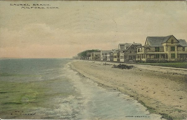

Laurel Beach, 1910
- City of Milford official website
- Downtown Milford Business Association
- Milford's HamletHub, Milford's Local Stories
- Village of Devon
- Milford, Connecticut at the Open Directory Project
- "Early Milford", history of Milford
- Milford Living magazine
- 1646 map of Milford
- MilfordRadio.com, community information
| ||||||||||||||||

| ||||||||||||||||||||
| ||||||||||||||||||||||
| |||||||||||||||||||||||
| This page uses content from the English language Wikipedia. The original content was at Milford, Connecticut. The list of authors can be seen in the page history. As with this Familypedia wiki, the content of Wikipedia is available under the Creative Commons License. |