| Main | Births etc |
|---|
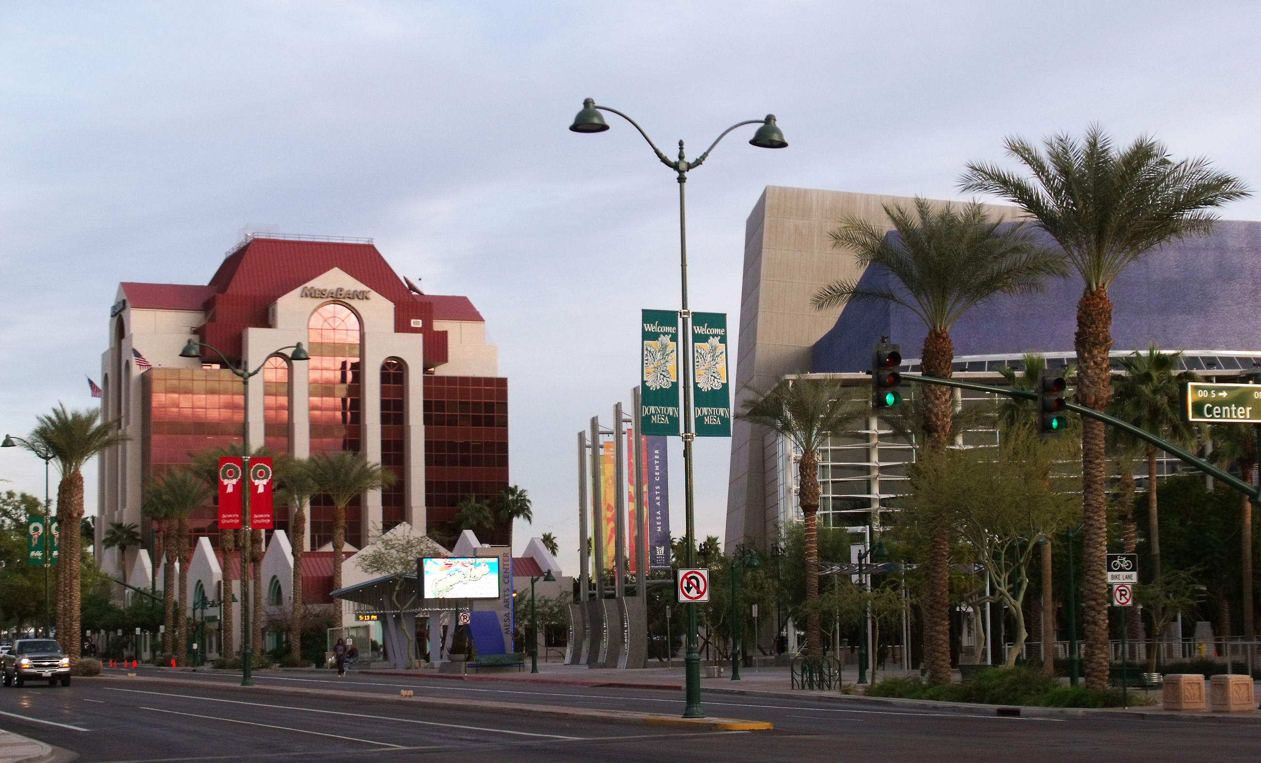
| Mesa, Arizona | |||
|---|---|---|---|
| — City — | |||
| City of Mesa | |||
 |
|||
|
|||
 |
|||

Mesa, Arizona |
|||
| Coordinates: Coordinates: | |||
| Country | United States | ||
| State | Arizona | ||
| County | Maricopa | ||
| Founded | 1878 | ||
| Government | |||
| • Mayor | Scott Smith (R) | ||
| Area | |||
| • City | 133.13 sq mi (324.2 km2) | ||
| • Land | 132.93 sq mi (323.7 km2) | ||
| • Water | 0.2 sq mi (0.6 km2) | ||
| Elevation | 1,243 ft (378 m) | ||
| Population (2012)[1][2] | |||
| • City | 452,084 (US: 38th) | ||
| • Density | 3,536.6/sq mi (1,365.6/km2) | ||
| • Metro | 4,329,534 (US: 13th) | ||
| Time zone | MST (no DST) (UTC-7) | ||
| ZIP codes | 85200-85299 | ||
| Area code(s) | 480 | ||
| FIPS code | 04-46000 | ||
| Website | http://www.mesaaz.gov/ | ||

Mesa ( /ˈmɛsə/ MES-ə) is a city in Maricopa County, in the State of Arizona and is a suburb located about 20 miles (32 km) east of Phoenix. Mesa is in the East Valley section of the Phoenix Metropolitan Area. It is bordered by Tempe on the west, the Salt River Pima-Maricopa Indian Community on the north, Chandler and Gilbert on the south, and Apache Junction on the east. As of the 2010 Census Mesa became Arizona's center of population.
Mesa is the third-largest city in Arizona, after Phoenix and Tucson, the 38th-largest city in the US. The city is home to 439,041 as of 2010, reported by the Census Bureau, making its population larger than more recognizable cities such as Atlanta, Miami, Minneapolis, Cincinnati, Greensboro, Pittsburgh, Ft. Wayne, St. Louis, Tulsa, Wichita, and Cleveland.[3] Mesa is home to numerous higher education facilities including Polytechnic campus of Arizona State University.
History[]
The history of Mesa dates back at least 2,000 years to the arrival of the Hohokam people. The Hohokam, whose name means "All Used Up" or "The Departed Ones", built the original canal system. The canals were the largest and most sophisticated in the prehistoric New World. Some were up to 90 feet (27 m) wide and ten feet deep at their head gates, extending for as far as 16 miles (26 km) across the desert. By A.D. 1100 water could be delivered to an area over 110,000 acres (450 km2), transforming the Sonoran Desert into an agricultural oasis. By A.D. 1450, the Hohokam had constructed hundreds of miles of canals many of which are still in use today.[4]
After the disappearance of the Hohokam and before the arrival of the early settlers little is known, as explorers did not venture into this area. By the late 19th century near present-day Mesa, U.S. Army troops subdued the Apache opening the way for settlement.
Mormon pioneer Daniel Webster Jones led an expedition to found a Mormon settlement in Arizona. Leaving St. George, Utah in March 1877, Jones and others arrived at Lehi, an area within the northern edge of present-day Mesa. Jones had been asked by Mormon officials to direct a party of people in establishing a settlement in Arizona. This settlement was initially known as Jonesville and Fort Utah and did not receive the name of Lehi until 1883, when it was adopted on the suggestion of Brigham Young, Jr.[5]
At the same time, another group dubbed the First Mesa Company arrived from Utah and Idaho. Their leaders were named Francis Martin Pomeroy, Charles Crismon, George M. Sirrine and Charles I. Robson. Rather than accepting an invitation to settle at Jones' Lehi settlement, they moved to the top of the mesa that serves as the city's namesake. They dug irrigation canals, some of which were over the original Hohokam canals, and by April 1878, water was flowing through them.[6] The Second Mesa Company arrived in 1879 and settled to the west of where the First Mesa Company settled in 1880, due to lack of available farmland. This settlement was called Stringtown.[7]
On July 17, 1878, Mesa City was registered as a 1-square-mile (2.6 km2) townsite. The first school was built in 1879. In 1883, Mesa City was incorporated with a population of 300 people. Dr. A. J. Chandler, who would later go on to found the city of Chandler, worked on widening the Mesa Canal in 1895 to allow for enough flow to build a power plant. In 1917, the city of Mesa purchased the utility company. The revenues from the company provided enough for capital expenditures until the 1960s. During the Great Depression, WPA funds provided paved streets, a new hospital, a new town hall and a library.[8]
With the opening of Falcon Field and Williams Field in the early 1940s, more military personnel began to move into the Mesa area. With the advent of air conditioning and the rise of tourism, population growth exploded in Mesa as well as the rest of the Phoenix area. Industry—especially early aerospace companies—grew in the 1950s and 1960s. As late as 1960, half of the residents of Mesa made a living with agriculture, but this has declined substantially as Mesa's suburban growth continued on track with the rest of the Phoenix metro area.[9]
Demographics[]
| Historical populations | |||
|---|---|---|---|
| Census | Pop. | %± | |
| 1900 | 722 | ||
| 1910 | 1,692 | 134.3% | |
| 1920 | 3,036 | 79.4% | |
| 1930 | 3,711 | 22.2% | |
| 1940 | 7,224 | 94.7% | |
| 1950 | 16,790 | 132.4% | |
| 1960 | 33,772 | 101.1% | |
| 1970 | 63,049 | 86.7% | |
| 1980 | 152,404 | 141.7% | |
| 1990 | 288,104 | 89.0% | |
| 2000 | 396,375 | 37.6% | |
| 2010 | 439,041 | 10.8% | |
| Est. 2012 | 452,084 | 14.1% | |
2012 Estimate[11] | |||
According to the 2010 Census, the racial composition of Mesa was as follows:[12]
- White: 77.1% (Non-Hispanic Whites: 64.3%)
- Hispanic or Latino (of any race): 26.5%
- Black or African American: 3.5%
- Two or more races: 3.4%
- Native American: 2.4%
- Asian: 1.9% (0.5% Filipino, 0.3% Chinese, 0.3% Vietnamese, 0.3% Indian, 0.1% Korean, 0.1% Japanese)
- Native Hawaiian and Other Pacific Islander: 0.4%
- Some other race: 5.8%
As of the census of 2010, there were 439,041 people, 146,643 households, and 99,863 families residing in the city. The population density was 3,171.3 people per square mile (1,224.4/km²). There were 175,701 housing units at an average density of 1,405.7 per square mile (542.8/km²).
The racial make-up of the city was 81.6% White, 2.4% Black or African American, 2.2% Native American, 2.00% Asian, 0.10% Pacific Islander, 9.3% from other races, and 1.30% from two or more races. 24.0% of the population were Hispanic or Latino of any race.
There were 146,643 households out of which 33.4% had children under the age of 18 living with them, 52.7% were married couples living together, 10.6% had a female householder with no husband present, and 31.9% were non-families. 24.2% of all households were made up of individuals and 9.1% had someone living alone who was 65 years of age or older. The average household size was 2.68 and the average family size was 3.20.
The age distribution was 27.3% under 18, 11.2% from 18 to 24, 29.7% from 25 to 44, 18.4% from 45 to 64, and 13.3% who were 65 or older. The median age was 32 years. For every 100 females there were 98.2 males. For every 100 females age 18 and over, there were 95.6 males.
The median income for a household in the city was $42,817, and the median income for a family was $49,232. Males had a median income of $35,960 versus $27,005 for females. The per capita income for the city was $19,601. About 6.2% of families and 8.9% of the population were below the poverty line, including 10.7% of those under age 18 and 7.1% of those age 65 or over. Mesa's residents exhibit a great deal of economic diversity, with low-income areas constructed somewhat close to high-scale neighborhoods with expensive custom homes. The neighborhood "Marlborough Mesa" has won a community award.
Defining East and West Mesa[]
Due to Mesa's extremely long east to west travel distance, in excess of 18 miles (29 km)[13] and large land area 133.13 square miles (344.8 km2), locations in Mesa are often referred to as residing within either East Mesa or West Mesa.[14][15][16]
Commonly accepted boundaries[]
Center St[]
Mesa employs a grid system for street numbering that is different from that used in Phoenix and other portions of the metropolitan area. Center Street, running north to south bisects Mesa into eastern and western halves and serves as the east and west numbering point of origin within Mesa. Streets west of Center St., such as W. University Drive or W. Main St. are considered to be in West Mesa; whereas, streets east of Center St., such as E. University or E. Main St. are considered to be in East Mesa.[17]
Mesa Drive 1/2 Mile East of Center St. (By Zip code)[]
Mesa Drive, running north to south and bisecting Mesa into east and west sections, is located 0.5 miles (800 m) east of Center Street, and serves as the zip code boundary between the 85281, 85201, 85202, and 85210 zip codes of Western Mesa and the 85203, 85204, 85205, 85206, 85207, 85208, 85209, 85212, 85213, 85215, 85220, and 85242 zip codes of Eastern Mesa.[18]
Country Club Drive 1/2 Mile West of Center St. (By US Congressional district)[]
Country Club Drive, running north to south and bisecting Mesa into east and west sections, is located 0.5 miles (800 m) west of Center St, and serves as the jurisdictional boundary between Arizona's 5th and 6th congressional districts.[19] Note that that this same road (as Arizona Avenue) serves as the official east and west numbering point of origin within the city of Chandler, located south of Mesa.
Economy[]
Top employers[]
According to the City's 2011 Comprehensive Annual Financial Report,[20] the top employers in the city are:
| # | Employer | # of Employees |
|---|---|---|
| 1 | Mesa Public Schools | 9,500 |
| 2 | Banner Health | 8,650 |
| 3 | Boeing | 4,260 |
| 4 | City of Mesa | 3,442 |
| 5 | Wal-Mart | 2,503 |
| 6 | Mesa Community College | 2,201 |
| 7 | Fry's Food and Drug | 1,276 |
| 8 | The Home Depot | 826 |
| 9 | County of Maricopa | 720 |
| 10 | Mountain Vista Medical Center | 627 |
Climate[]
Mesa, located in the Sonoran Desert, has mild winters and hot summers, with the July average high/low at 106/77. The January high/low is 67/41.
| Climate data for Mesa, Arizona | |||||||||||||
|---|---|---|---|---|---|---|---|---|---|---|---|---|---|
| Month | Jan | Feb | Mar | Apr | May | Jun | Jul | Aug | Sep | Oct | Nov | Dec | Year |
| Record high °F (°C) | 89 (32) |
95 (35) |
99 (37) |
106 (41) |
118 (48) |
116 (47) |
119 (48) |
115 (46) |
113 (45) |
107 (42) |
97 (36) |
86 (30) |
119 (48) |
| Average high °F (°C) | 67 (19) |
71 (22) |
77 (25) |
85 (29) |
94 (34) |
104 (40) |
106 (41) |
104 (40) |
99 (37) |
89 (32) |
75 (24) |
67 (19) |
86.5 (30.3) |
| Average low °F (°C) | 41 (5) |
45 (7) |
49 (9) |
54 (12) |
61 (16) |
70 (21) |
77 (25) |
76 (24) |
70 (21) |
59 (15) |
47 (8) |
40 (4) |
57.4 (14.1) |
| Record low °F (°C) | 15 (−9) |
19 (−7) |
24 (−4) |
30 (−1) |
37 (3) |
43 (6) |
54 (12) |
51 (11) |
40 (4) |
30 (−1) |
22 (−6) |
17 (−8) |
15 (−9) |
| Precipitation inches (mm) | 1.01 (25.7) |
1.03 (26.2) |
1.19 (30.2) |
0.33 (8.4) |
0.17 (4.3) |
0.06 (1.5) |
0.89 (22.6) |
1.14 (29) |
0.89 (22.6) |
0.81 (20.6) |
0.77 (19.6) |
0.98 (24.9) |
9.27 (235.5) |
| Source: The Weather Channel[21] | |||||||||||||
Cultural attractions[]
LDS Mesa Arizona Temple

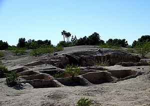
Mesa Grande Ruins
- HoHoKam Park of the Cactus League home of the Chicago Cubs during spring training, the WAC Baseball Tournament and former summer home to the now defunct Mesa Miners professional baseball team of the Golden Baseball League.
- Mesa Arts Center
- Mesa Amphitheatre
- Mesa Arizona Temple, a large LDS temple, where an Easter Pageant is held every spring.
- Museums
- Arizona Museum for Youth
- Commemorative Air Force Arizona Wing Aircraft Museum, located at Falcon Field – B-17 Sentimental Journey
- Mesa Historical Museum
- Arizona Museum of Natural History
- Archeological Sites
- Mesa Grande Ruins
- Park of the Canals
- Public Libraries
- Main Library (MN)
- Dobson Ranch Branch (DR)
- Red Mountain Branch (RM)
- Water Parks
- Golfland Sunsplash waterpark on U.S. 60.
- The only highrise in Mesa is the Bank of America (formerly Western Savings) building near Fiesta Mall
Amenities[]
West Mesa[]
The Fiesta Mall is located in West Mesa, and owned by Westcor. The mall's anchors are Dillard's, Macy's, Sears, Best Buy, and Dick's Sporting Goods. It is located near several shopping centers, Mesa's Bank of America,[22] and other retail stores, banks, and restaurants. An expansion of Fiesta Mall has been planned.[23]
Mesa Riverview is a new outdoor destination retail center in the northwestern corner of the city, near Loop 202 and Dobson Road. At build-out the center will include of 1,300,000 square feet (120,000 m2) of retail space.[24] The anchors include Bass Pro Shops, Cinemark Theaters, Wal-Mart, and Home Depot. Mesa Riverview also includes restaurants and specialty stores, such as Toby Keith's I Love This Bar & Grill.
East Mesa[]
The Superstition Springs Center is a shopping mall in East Mesa also owned by Westcor. It features an outdoor amphitheatre and fountain which convert to a stage. Anchor stores at the mall are Dillard's, JCPenney, Macy's, and Sears.
Parks and Recreation[]
Mesa has over 2,280 acres of parkland in the city limits. Mesa's largest park is Red Mountain Park which spans 1,146 acres. It includes a lake, playgrounds, a basketball court and a cement volleyball court.[25]
Transportation[]


Mesa City Hall in downtown Mesa
Several area freeways serve the Mesa area, such as U.S. Route 60, locally known as the Superstition Freeway, which runs between Apache Junction and Phoenix. It is also served by SR 87 and bypass loops Loop 101, which skirts the western city limits as the Price Freeway, and Loop 202, which bypasses the city on the north and east. Public transportation is provided by Valley Metro with most buses running Monday through Saturday only; until July 2008, Mesa was the largest U.S. city with no public transit service on Sundays. West Mesa is connected to the METRO Light Rail line at the Dobson Road station incongruously called Main and Sycamore (Sycamore being a minor one-block-long street).
Air service in the city is provided by two airports. Falcon Field, located in the northeastern part of the area, was established as a training field for British RAF pilots during World War II and was transferred to the city at the end of the war. Falcon Field has 605 aircraft based there.[26] Boeing builds the AH-64 Apache attack helicopter at a facility adjoining Falcon Field. Phoenix-Mesa Gateway Airport is located in the far southeastern area of the city, and provides alternate but limited air service to Sky Harbor International Airport. Phoenix-Mesa Gateway was formerly Williams Gateway Airport, and before that, Williams Air Force Base, which closed in 1993. Williams Gateway was announced as a new Focus City for Allegiant Air. Service started October 25, 2007.
Walkability[]
A 2011 study by Walk Score ranked Mesa 35th most walkable of fifty largest U.S. cities.[27] However, very few people choose to walk during the summer months of June, July, and August due to the extreme heat in Arizona.
Education[]
Almost all of the city of Mesa is served by public schools operated by Mesa Public Schools; however, a small southern portion is served by the Gilbert Public Schools, and a small western portion is served by the Tempe Elementary School District and the Tempe Union High School District.
Mesa is also home to Mesa Community College, the largest of the Maricopa Community Colleges, which enrolls over 24,000 full and part-time students. In addition, the Polytechnic campus of Arizona State University lies in southeast Mesa. This satellite campus enrolls over 6,000 undergraduate and graduate students in scientific and engineering fields. In addition, A. T. Still University operates an Osteopathic Medical School in Mesa. The aviation school CAE Global Academy Phoenix is also located in Mesa.
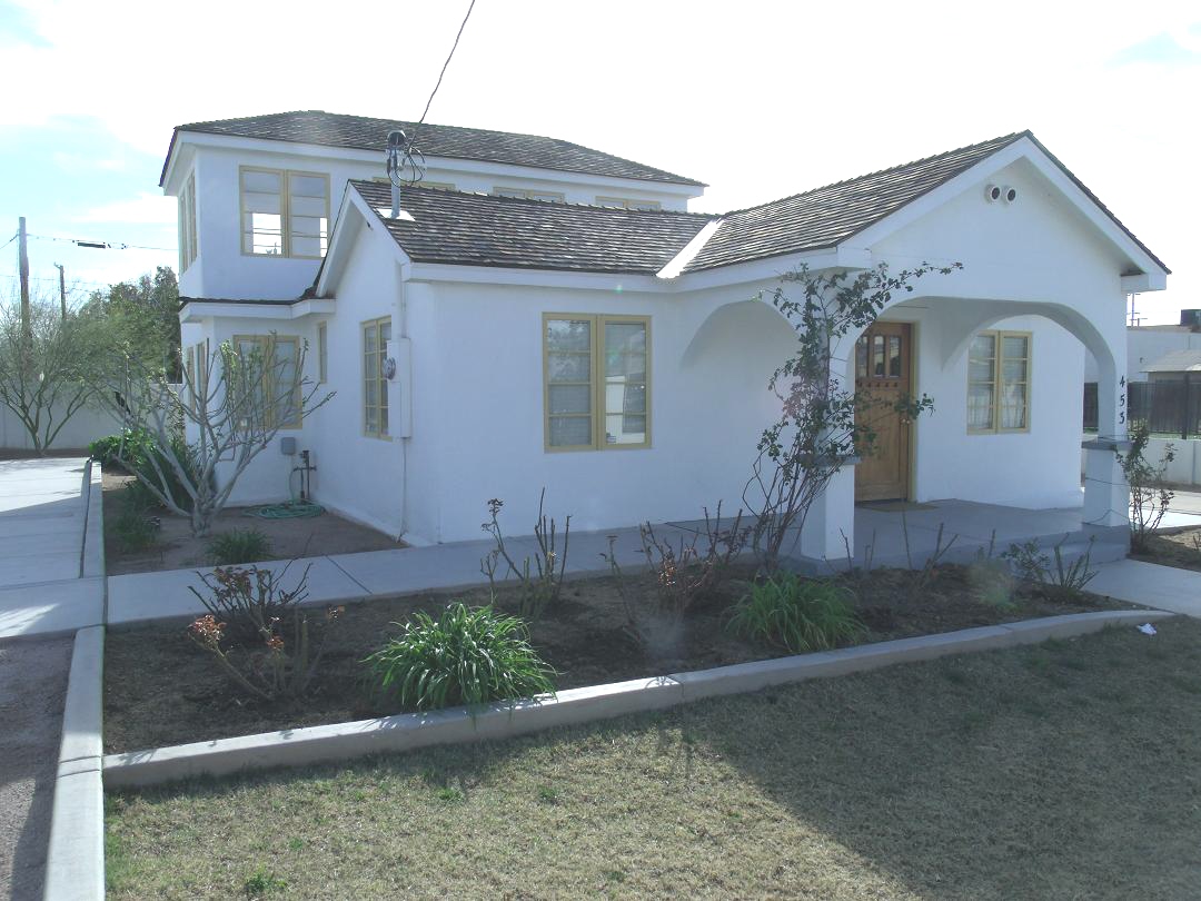
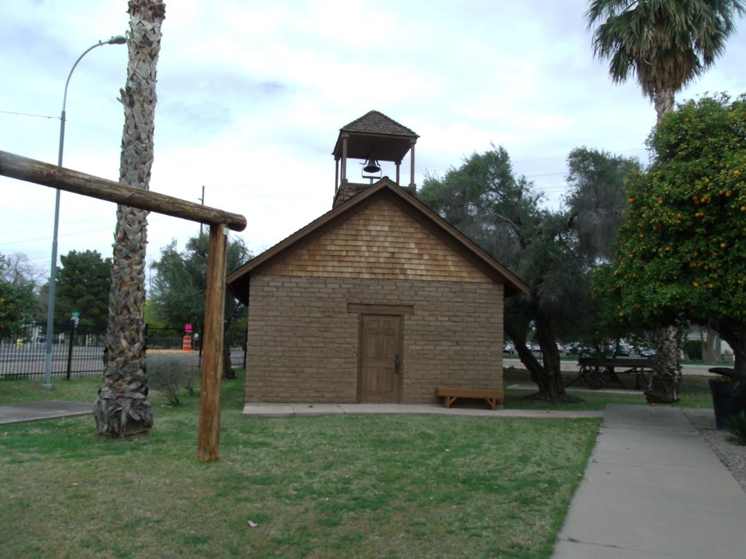
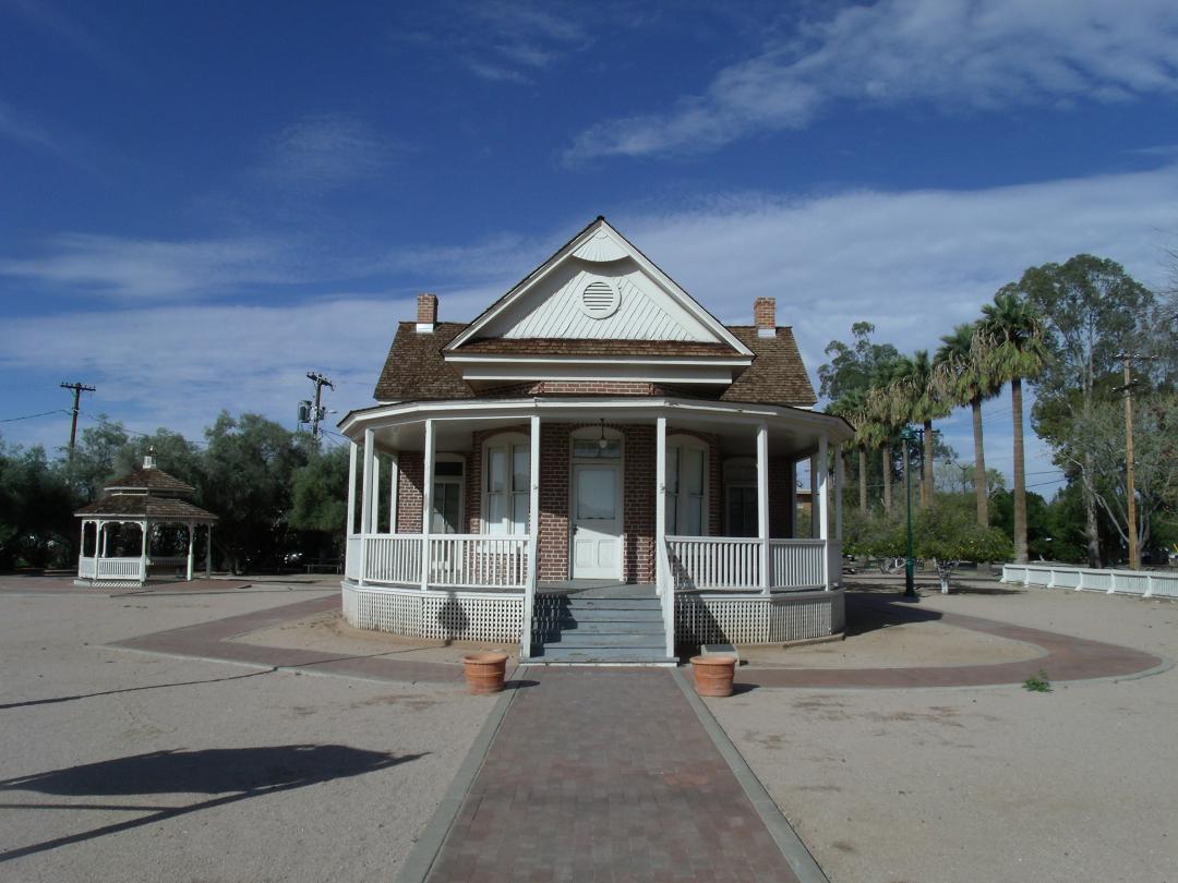
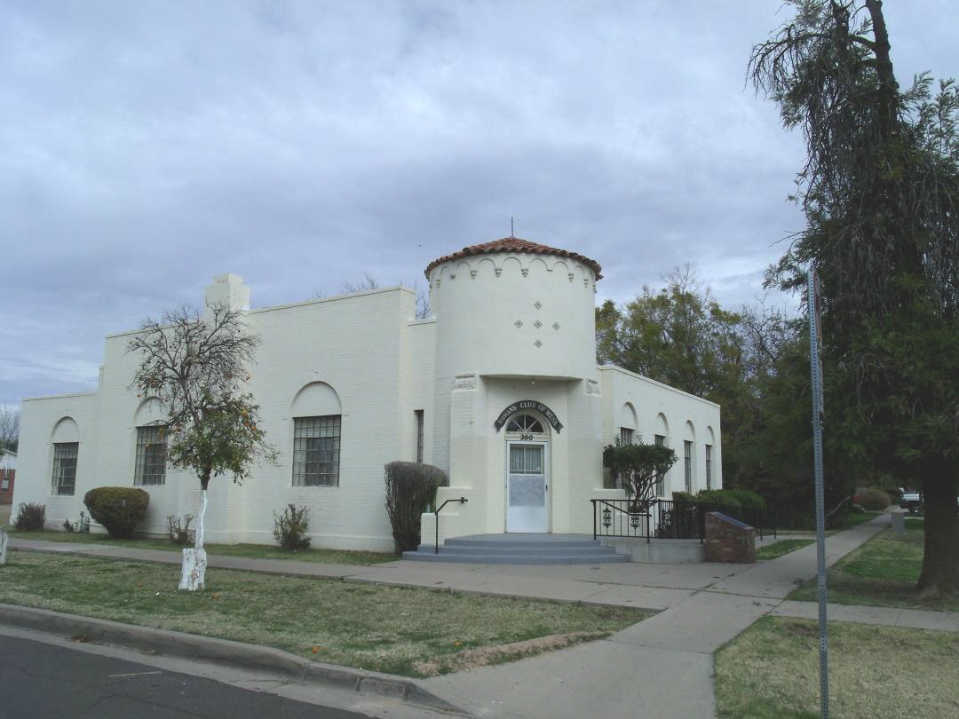
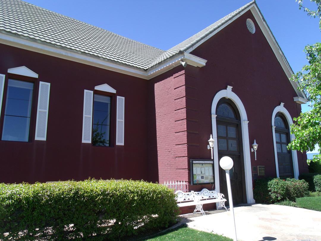
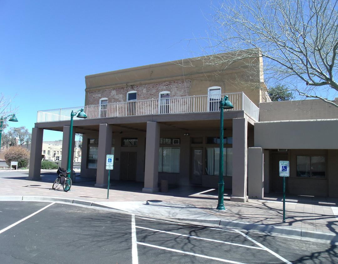
Historic properties in Mesa[]
There are numerous properties in the city of Mesa which are considered to be historical and have been included either in the National Register of Historic Places[28] or the listings of the Mesa Historic Properties. The following are images of some of these properties with a short description of the same.
| Historic Mesa, Arizona (NRHP = National Register of Historic Places) (MHP = Mesa Historic Properties)[29] | ||||||||||||||||||||||||||||||
| ||||||||||||||||||||||||||||||


Sister cities[]
Mesa has five sister cities, as designated by Sister Cities International:
|
See also[]
- Life Teen
- Mesa Distance Learning Program
- The Church of Jesus Christ of Latter-day Saints in Arizona
- Tri City Mall
- Falcon Field (Arizona)
References[]
- ^ "Annual Estimates of the Resident Population for Incorporated Places Over 50,000" (HTML). 2012 Population Estimates. United States Census Bureau, Population Division. 2013-09-28. http://www.census.gov/popest/data/cities/totals/2012/index.html. Retrieved 2013-09-28.
- ^ "Annual Estimates of the Resident Population for Incorporated Places: April 1, 2010 to July 1, 2012" (HTML). United States Census Bureau. 2013-09-28. http://www.census.gov/popest/data/cities/totals/2012/SUB-EST2012-3.html. Retrieved 2013-09-28.
- ^ Demographics, Mesaaz.gov, archived from the original on 2010-09-26, http://web.archive.org/web/20100926114753/http://mesaaz.gov/Residents/demographics/default.aspx, retrieved 2010-07-02
- ^ Hohokam, "A Brief History of Mesa, Arizona", Mesalibrary.org (City of Mesa Library), July 2003, http://www.mesalibrary.org/about_mesa/mesahistory/hohokam.aspx, retrieved 2012-03-13
- ^ Jenson, Andrew (1941), Encyclopedic History of the Church of Jesus Christ of Latter-day Saints, Salt Lake City: Deseret News Publishing Company, p. 426, http://contentdm.lib.byu.edu/cdm/ref/collection/BYUIBooks/id/2694/show/2249
- ^ First Mesa Company, "A Brief History of Mesa, Arizona", Mesalibrary.org (City of Mesa Library), July 2003, http://www.mesalibrary.org/about_mesa/mesahistory/firstmesa.aspx, retrieved 2012-03-13
- ^ Second Mesa Company, "A Brief History of Mesa, Arizona", Mesalibrary.org (City of Mesa Library), July 2003, http://www.mesalibrary.org/about_mesa/mesahistory/secondmesa.aspx, retrieved 2012-03-13
- ^ Mesa City - 1878 to Depression, "A Brief History of Mesa, Arizona", Mesalibrary.org (City of Mesa Library), July 2003, http://www.mesalibrary.org/about_mesa/mesahistory/mesacity.aspx, retrieved 2012-03-13
- ^ World War II to Present, "A Brief History of Mesa, Arizona", Mesalibrary.org (City of Mesa Library), July 2003, http://www.mesalibrary.org/about_mesa/mesahistory/wwii.aspx, retrieved 2012-03-13
- ^ United States Census Bureau. "Census of Population and Housing". http://www.census.gov/prod/www/decennial.html. Retrieved September 28, 2013.
- ^ "Annual Estimates of the Resident Population: April 1, 2010 to July 1, 2012". http://www.census.gov/popest/data/cities/totals/2012/SUB-EST2012-3.html. Retrieved September 28, 2013.
- ^ Factfinder2.census.gov, United States Census Bureau, http://factfinder2.census.gov/faces/tableservices/jsf/pages/productview.xhtml?pid=DEC_10_PL_QTPL&prodType=table
- ^ Yahoo maps
- ^ "Search: west mesa", City of Mesa – Search Page, Mesaaz.gov, http://mesaaz.gov/search/default.aspx?cx=015015829240626729465%3Az3vghkx_ztm&cof=FORID%3A11%3B&ie=UTF-8&q=west+mesa&sa=Search#941, retrieved 2010-07-02
- ^ "West Mesa Park-and-ride Project No. 06-045-001", Transportation Advisory Board Report, City of Mesa, April 21, 2009, http://www.mesaaz.gov/transportation/tabdocs/4-09/Item4.pdf
- ^ "West Mesa crime spree ends in arrest", Mesaaz.gov (City of Mesa), archived from the original on 2010-05-28, http://web.archive.org/web/20100528023917/http://www.mesaaz.gov/police/media_releases/2008/barnes-rico_032508.aspx, retrieved 2010-07-02
- ^ http://maps.yahoo.com/#mvt=m&lat=33.414824&lon=-111.831545&zoom=15&q1=mesa%2C%20az
- ^ "Mesa ZIP codes" (PDF), mesaaz.gov (City of Mesa), 2009-10-15, http://www.mesaaz.gov/maps/pdf/zip_code_map.pdf, retrieved 2012-03-13
- ^ "Arizona’s 5th Congressional District & Map", govtrack.us (GovTrack), 2011-01-03, http://www.govtrack.us/congress/findyourreps.xpd?state=AZ&district=5, retrieved 2012-03-13
- ^ "Statistical Section" (PDF), 2011 City of Mesa Comprehensive Annual Financial Report, City of Mesa, http://www.ci.mesa.az.us/accounting/pdf/2011/statistical.pdf, retrieved 2012-11-17
- ^ Monthly Averages for Mesa, AZ (85202), Weather.com, http://www.weather.com/outlook/travel/businesstraveler/wxclimatology/monthly/85202, retrieved 2012-03-13
- ^ Boyle, Tim (April 2001), A Big Bang in Downtown, or The History of the Financial Plaza, http://timboyle.com/writing/westernsavings.html, retrieved 2012-03-13
- ^ Fiesta Mall – Center Redevelopment, archived from the original on 2008-12-20, http://web.archive.org/web/20081220205608/http://www.shopfiesta.com/redirect.asp?p=centerredevelopment, retrieved 2008-04-06
- ^ Mesa Riverview – Center Information, archived from the original on 2008-03-12, http://web.archive.org/web/20080312020800/http://mesariverview.com/index.php?page=center-information, retrieved 2008-04-06
- ^ "Red Mountain Park" City of Mesa, Arizona. Retrieved on 9 July 2013.
- ^ KFFZ: Falcon Field Airport, Mesa, Arizona, USA, "Airport Information", airnav.com (AirNav, LLC), http://www.airnav.com/airport/KFFZ
- ^ "Mesa, AZ", City and Neighborhood Walkability Rankings: Cities in the United States, Walk Score, 2011, http://www.walkscore.com/AZ/Mesa, retrieved 2012-03-13
- ^ National Register of Historic Places
- ^ Mesa Historic Properties
External links[]
| Find more about Mesa, Arizona on Wikipedia's sister projects: |
| Definitions from Wiktionary | |
| Textbooks from Wikibooks | |
| Quotations from Wikiquote | |
| Source texts from Wikisource | |
| Images and media from Commons | |
| News stories from Wikinews | |
| Learning resources from Wikiversity |
- Mesa city government.
- Mesa Arizona Convention and Visitors Bureau – Tourism
- Mesa news, sports and things to do from The Mesa Republic newspaper
- City of Mesa Library on the Web
- Mesa Chamber of Commerce
| ||||||||||||||||||||

| ||||||||||||||
| ||||||||||||||||||||
| |||||||
| This page uses content from the English language Wikipedia. The original content was at Mesa, Arizona. The list of authors can be seen in the page history. As with this Familypedia wiki, the content of Wikipedia is available under the Creative Commons License. |