| Melrose, Massachusetts | |||
|---|---|---|---|
| — City — | |||
| Historical image of Melrose City Hall, located in Downtown Melrose. | |||
|
|||
| Motto: One Community Open to All | |||
 |
|||
 <div style="position: absolute; top: Expression error: Missing operand for *.%; left: 212.7%; height: 0; width: 0; margin: 0; padding: 0;">
Melrose, Massachusetts |
|||
| Country | United States | ||
| State | Massachusetts | ||
| County | Middlesex | ||
| Settled | 1629 | ||
| Incorporated | 1850 | ||
| City | 1900 | ||
| Government | |||
| • Type | Mayor-council city | ||
| • Mayor | Gail Infurna | ||
| • Board of Selectmen | |||
| Area | |||
| • Total | 4.8 sq mi (12.3 km2) | ||
| • Land | 4.7 sq mi (12.1 km2) | ||
| • Water | 0.1 sq mi (0.2 km2) | ||
| Elevation | 133 ft (41 m) | ||
| Population (2010) | |||
| • Total | 26,983 | ||
| • Estimate (2018)[1] | 28,193 | ||
| • Density | 5,600/sq mi (2,200/km2) | ||
| Time zone | Eastern (UTC−5) | ||
| • Summer (DST) | Eastern (UTC−4) | ||
| ZIP Code | 02176 | ||
| Area code(s) | 339/781 | ||
| FIPS code | 25-40115 | ||
| GNIS feature ID | 0612780 | ||
| Website | cityofmelrose.org | ||


Melrose is a city located in the Greater Boston metropolitan area in Middlesex County, Massachusetts, United States. Its population as per the 2010 United States Census is 26,983. It is a suburb located approximately seven miles north of Boston and is situated in the center of the triangle created by Interstates 93, 95 and U.S. Route 1.
The land that comprises Melrose was first settled in 1628 and was once part of Charlestown and then Malden. It became the Town of Melrose in 1850 and then the City of Melrose in 1900.[2]
History[]


1852 map of Boston area showing Melrose and rail lines
Melrose was originally called "Ponde Fielde" for its abundance of ponds and streams or "Mystic Side" because of its location in a valley north of the Mystic River. The area was first explored by Richard and Ralph Sprague in 1628, and became part of Charlestown in 1633 along with a large area of land encompassing most of the surrounding communities.[3][4] In 1649, the neighborhood of Charlestown known as Malden was incorporated as a separate town; the new town of Malden included most of present-day Melrose (then called North Malden) within its borders. North Malden largely remained a lightly populated farming community.[3][4]
In 1845, the Boston and Maine Railroad built three stops (now the commuter rail stations of Wyoming Hill, Melrose/Cedar Park, and Melrose Highlands). Boston workers in search of a country atmosphere moved to the area and began commuting to work.[3] The population of North Malden began growing, and in 1850 North Malden split from Malden proper and was incorporated as the town of Melrose. Melrose annexed the highlands from neighboring Stoneham in 1853, creating the city's current borders.[3]
The population of Melrose continued to grow throughout the second half of the nineteenth century. Farmland was increasingly partitioned into smaller parcels for residences and businesses. The fire department and the town's school district were founded and town hall was built in 1873. In 1899, the City of Melrose became the 33rd incorporated city in Massachusetts. Levi S. Gould became the city’s first mayor on January 1, 1900.[3]
Melrose reached a peak in population of 33,180 residents in 1970, before beginning a slow decline continuing through 2010. On April 1, 1982, Downtown Melrose was added to the National Register of Historic Places; the public library was similarly added to the register in 1988.[3]
Name[]
The name "Melrose" comes from the burgh of Melrose, Scotland. It was a reference to the hills of Melrose, Scotland which the new town resembled. The name was suggested and advocated for by William Bogle, a Scotland native and longtime resident of North Malden.[3][4]
Geography[]
Melrose is located at (42.459045, −71.062339).[5]
According to the United States Census Bureau, the city has a total area of 4.8 square miles (12 km2), of which 4.7 square miles (12 km2) is land and 0.1 square miles (0.26 km2), or 1.26%, is water. The city's largest body of water is Ell Pond, situated near the center of the city, while other major bodies are Swains Pond and Towners Pond, located on the east side near Mount Hood Golf Club.
Melrose is approximately 7 miles (11 km) north of Boston, Massachusetts. It borders four cities and towns: Malden, Saugus, Stoneham, and Wakefield. Major geographic features include Ell Pond, Swains Pond, Sewall Woods, Mount Hood, Boston Rock, Pine Banks Park, and the eastern reaches of the Middlesex Fells Reservation.
The writer Elizabeth George Speare, who was born in Melrose, wrote of her hometown: "Melrose was an ideal place in which to have grown up, close to fields and woods where we hiked and picnicked, and near to Boston where we frequently had family treats of theaters and concerts."
Neighborhoods[]
- Cedar Park
- Downtown Melrose
- East Side
- Horace Mann
- Melrose Highlands
- Mount Hood
- Oak Grove/Pine Banks
- Wyoming
")
")
Government[]
Gail Infurna is the Mayor of Melrose as of February 2018. A member of the Board of Alderman since 1998, she was selected by her peers to replace Mayor Robert J. Dolan, who resigned to take a position as Town Administrator in nearby Lynnfield.[6] Melrose is represented in the Massachusetts House of Representatives by Paul Brodeur (D),[7] and by Jason Lewis (D) in the Massachusetts Senate.[8] Melrose is part of the fifth Congressional district of Massachusetts, and is represented by Katherine Clark (D). The current U.S. senators from Massachusetts are Edward J. Markey (D) and Elizabeth Warren (D).[9]
Melrose is served by an eleven-member Board of Aldermen. Four At-Large Aldermen (currently Manisha Bewtra, Kate Lipper-Garabedian, Monica Medeiros, and Michael Zwirko) are elected by the entire city, while the seven Ward Aldermen, elected by voters in their individual wards, are John N. Tramontozzi (Ward 1), Jennifer Lemmerman (Ward 2), Francis X. Wright, Jr. (Ward 3), Robert A. Boisselle (Ward 4), Shawn M. MacMaster (Ward 5), Peter D. Mortimer (Ward 6) and Scott Forbes. (Ward 7). Beginning in the 2007 election, the mayor's position became a four-year term (from two) and was given a seat on the School Committee. All aldermen are elected to two-year terms. City elections are held in odd-numbered years.
| Voter Registration and Party Enrollment as of February 1, 2019[10] | |||||
|---|---|---|---|---|---|
| Party | Number of Voters | Percentage | |||
| Democratic | 6,826 | 34.06% | |||
| Republican | 1,905 | 9.51% | |||
| Unaffiliated | 11,113 | 55.45% | |||
| style="background-color:Template:Green-Rainbow Party/meta/color;" width=10px | | Green-Rainbow | 12 | 0.06% | ||
| Libertarian | 56 | 0.28% | |||
| Total | 20,041 | 100% | |||
Demographics[]
| Historical population | ||
|---|---|---|
| Year | Pop. | ±% |
| 1850 | 1,260 | — |
| 1860 | 2,532 | +101.0% |
| 1870 | 3,414 | +34.8% |
| 1880 | 4,560 | +33.6% |
| 1890 | 8,519 | +86.8% |
| 1900 | 12,962 | +52.2% |
| 1910 | 15,715 | +21.2% |
| 1920 | 18,204 | +15.8% |
| 1930 | 23,170 | +27.3% |
| 1940 | 25,333 | +9.3% |
| 1950 | 26,988 | +6.5% |
| 1960 | 29,619 | +9.7% |
| 1970 | 33,180 | +12.0% |
| 1980 | 30,055 | −9.4% |
| 1990 | 28,150 | −6.3% |
| 2000 | 27,134 | −3.6% |
| 2010 | 26,983 | −0.6% |
| 2018 | 28,193 | +4.5% |
As of the census[22] of 2010, there were 26,983 people, 11,213 households, and 7,076 families residing in the city. The racial makeup of the city was 91.1% White, 2.4% African American, 0.1% Native American, 3.8% Asian, 0.9% from other races, and 1.7% from two or more races. Hispanic or Latino of any race were 2.5% of the population.
There were 11,213 households out of which 28.4% had children under the age of 18 living with them, 51.4% were married couples living together, 9.1% had a female householder with no husband present, and 36.9% were non-families. Of all households 31.3% were individuals living alone and 13.5% were composed of an individual 65 years or older living alone. The average household size was 2.38 and the average family size was 3.05.
In the city, the population was spread out with 23.5% under the age of 20, 4.0% from 20 to 24, 27.4% from 25 to 44, 29.2% from 45 to 64, and 15.9% who were 65 years of age or older. The median age was 41.9 years. For every 100 females, there were 88.8 males. For every 100 females age 18 and over, there were 85.4 males.
Education[]


Melrose High School as seen from Lynn Fells Parkway
The Melrose School district runs several schools including The Franklin Early Childhood Center, five elementary schools (Roosevelt, Lincoln, Winthrop, Hoover, and Horace Mann), Melrose Veterans Memorial Middle School (MVMMS), and Melrose High School. The city also has a private elementary school, St. Mary's, run by one of the city's Catholic churches of the same name. The Winthrop School is among the average-sized schools in Melrose, with an average three classes per grade, while the Lincoln School has the largest student population of the elementary schools. The Hoover School is second smallest to the Horace Mann School which educates about 270 children per year. The Franklin Early Childhood Center houses preschool, pre-k and multiage programs enrolling about 240 three- to five-year-old learners. MVMMS is school to about one thousand eleven- through fourteen-year-olds and is the winner of the 2002 Massachusetts Department of Education's Compass School Award, the 2007 Massachusetts Technology Collaborative's Green School Award (for its use of solar energy), and the 2008 New England League of Middle Schools' Spotlight School Award.
Health care[]
There are many health care facilities located in Melrose. MelroseWakefield Hospital, a 234-bed non-profit hospital, was home to the world's first cochlear implant and laser surgery and it was among the first hospitals in the country to offer same day surgery.[23][24] In addition to the hospital, there are many pediatricians, specialists, dentists and dermatologists. Also, the city's Milano Senior Center provides social, recreational, health, and educational programs for Melrose’s senior citizens.[23]
Transportation[]
The city of Melrose is located seven miles north of Boston. Although the only highway in Melrose is a tiny part of Route 99, the city has access to many nearby highways including Route 1 in Saugus, Interstate 93 in Stoneham, Massachusetts Route 16 In Everett and Route 128/Interstate 95 in Wakefield. The city is also served by the MBTA. Service includes five bus routes: 106, 131, 132, 136 and 137. There are three commuter rail stations: Wyoming Hill, Melrose/Cedar Park, and Melrose Highlands. Oak Grove, the northern terminus of the MBTA's Orange Line subway system, is located in Malden on the Melrose city line. Oak Grove is primarily a park-and-ride station with 788 parking spaces.
Media[]
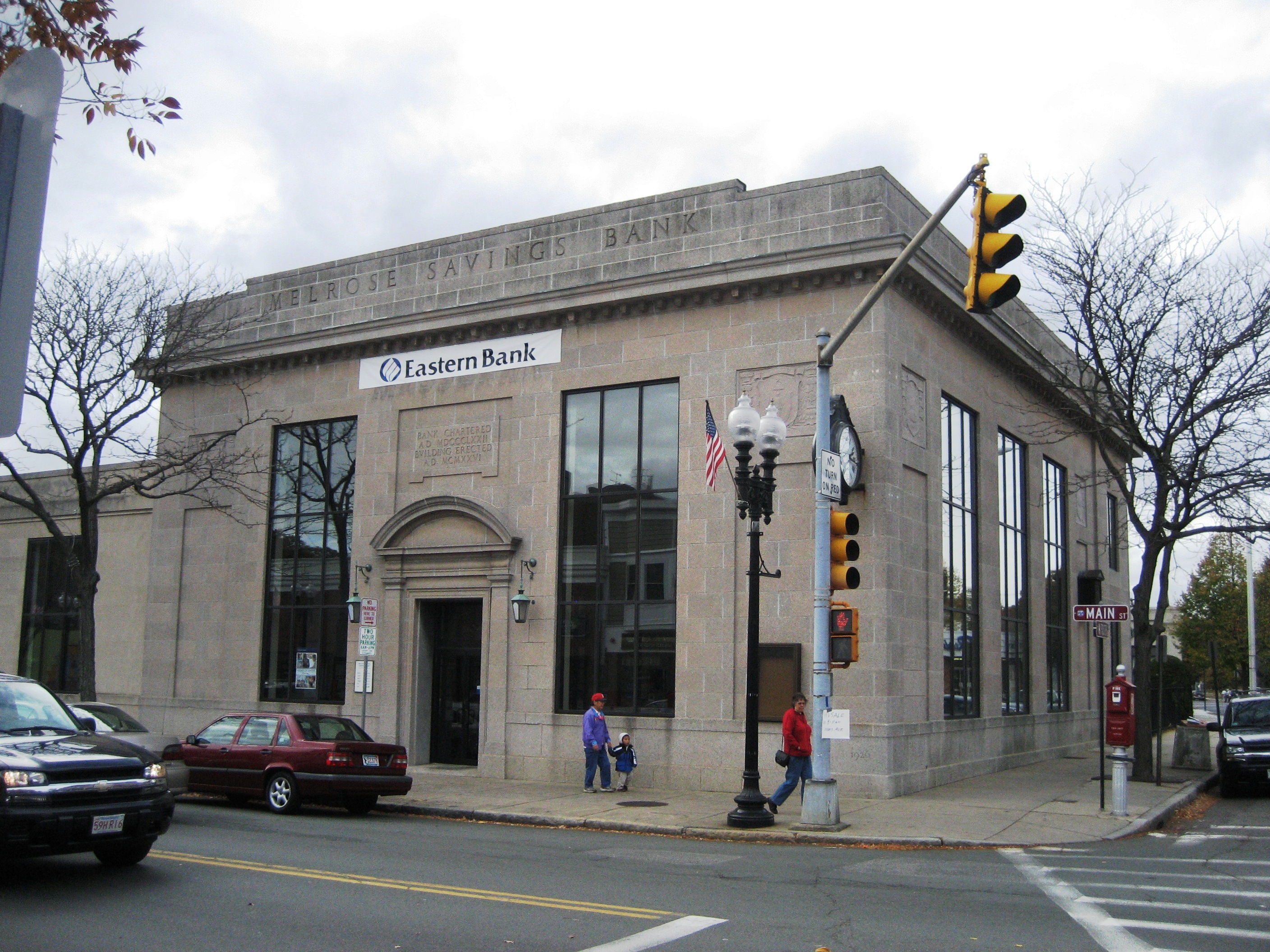

Former MassBank building downtown which was used for a bank scene in the movie The Town (2010)
Melrose has two weekly newspapers: the Melrose Free Press and the Melrose Weekly News. There is also a daily online news site, Melrose Patch (published by AOL Inc.). Melrose Massachusetts Television (MMTV) is a Public-access television cable TV station available to all customers and broadcasts Government-access television (GATV) community notices as well as resident produced Public-access television cable TV content.
Starting with Governor Deval Patrick's tax initiative program, Melrose has become a popular place to shoot films. In the fall of 2009, the Ben Affleck movie The Town captured many key scenes in a historic bank on Main Street downtown,[25] while around the same time, Cameron Diaz and Tom Cruise's movie Knight & Day shot scenes on the Fellsway.[26] The same month, a documentary for PBS about the Scopes Trial was also shot in the Aldermanic Chamber of Melrose City Hall.[26]
On September 22, 2016, Melrose was again named one of the "hottest zip codes" in the nation by Realtor.com. It had been number one in the nation in 2015 before falling to number seven in 2016.[27]
Notable people[]
- Eric Aho, born in Melrose, painter[28]
- Brooks Atkinson, born in Melrose, Pulitzer Prize-winning journalist, author, theater critic
- Shawn Bates, professional hockey player
- Andy Brickley, professional hockey player, current game analyst on NESN's Bruins telecasts
- Gary Cherone, rock singer
- Will Cotton, painter
- Clarence DeMar, runner (one of only two Americans to win three consecutive Boston marathons)
- Geraldine Farrar, born in Melrose, Metropolitan Opera soprano, silent film star
- Martin Fowler, author of Refactoring
- Michael Gandolfi, composer
- Jeff Gorton, general manager of the New York Rangers
- Hago Harrington, professional hockey player
- Ryan Johnson, professional soccer player
- Myles J. Lane, NHL hockey player
- Steven Langton, world champion bobsledder
- Marcia Lewis, born in Melrose, Tony Award-nominated stage and TV actor
- Mary Livermore, reformer
- Andy Macdonald, professional skateboarder
- Walter C. Monegan Jr., Medal of Honor recipient
- Guy Murray, journalist, children's author
- Don Orsillo, born in Melrose, former Red Sox NESN announcer; currently San Diego Padres announcer
- Frantzdy Pierrot, Professional soccer player for Royal Excel Mouscron in Belgium
- Richard Evans Schultes, ethnobotanist
- David Souter, born in Melrose, Associate Justice of the United States Supreme Court
- Elizabeth George Speare, children's author
- Frank Stella, contemporary painter, sculptor; studio formerly located in Melrose
- Garrett Swasey, former ice dancer turned police officer killed in Colorado Springs Planned Parenthood Shooting
- Keith Tkachuk, professional hockey player
- Dick Umile, UNH hockey coach
- Nancy Werlin, novelist
- Royal Barry Wills, architect
- Thomas Woods, historian, political analyst, and author
- Sewall Wright, geneticist known for his work on the evolution theory
- Bill Rodgers, four time Boston Marathon winner
See also[]
- Melrose Symphony Orchestra
- National Register of Historic Places listings in Middlesex County, Massachusetts
- Pine Banks
- Middlesex Fells Reservation
- Mount Hood Golf Club
References[]
- ^ "Population and Housing Unit Estimates". https://www.census.gov/programs-surveys/popest/data/tables.2018.html. Retrieved July 24, 2019.
- ^ Goss, Elbridge Henry (1876). The Centennial Fourth: Historical Address Delivered in Town Hall, Melrose, Mass., July 4, 1876. p. 35. https://books.google.com/books?id=eyQWAAAAYAAJ&pg=PA35.
- ^ a b c d e f g "A Condensed History of Melrose". Archived from the original on 2009-06-15. https://web.archive.org/web/20090615120514/http://www.cityofmelrose.org/Interns%2007/a_condensed_history_of.htm. City of Melrose. Retrieved on January 26, 2008
- ^ a b c Goss, Eldbridge Henry (1902). The history of Melrose, County of Middlesex, Massachusetts. City of Melrose. https://archive.org/stream/historyofmelrose02goss. Retrieved 24 April 2015.
- ^ "US Gazetteer files: 2010, 2000, and 1990". United States Census Bureau. 2011-02-12. https://www.census.gov/geo/www/gazetteer/gazette.html. Retrieved 2011-04-23.
- ^ "The Mayor's Office". City of Melrose. https://www.cityofmelrose.org/mayor. Retrieved 9 February 2018.
- ^ "Member Profile-Paul Brodeur". https://malegislature.gov/People/Profile/P_B1. Retrieved 3 May 2015.
- ^ "Member Profile-Jason M. Lewis". https://malegislature.gov/People/Profile/JML0. Retrieved 3 May 2015.
- ^ "Massachusetts Senators, Representatives and Congressional District Maps". https://www.govtrack.us/congress/members/MA. Retrieved 3 May 2015.
- ^ "Registered Voter and Party Enrollment as of February 1, 2019" (PDF). Commonwealth of Massachusetts - Elections Division. https://www.sec.state.ma.us/ele/elepdf/enrollment_count_20190201.pdf. Retrieved May 12, 2019.
- ^ "TOTAL POPULATION (P1), 2010 Census Summary File 1". American FactFinder, All County Subdivisions within Massachusetts. United States Census Bureau. 2010. http://factfinder2.census.gov/faces/tableservices/jsf/pages/productview.xhtml?src=bkmk.
- ^ "Massachusetts by Place and County Subdivision - GCT-T1. Population Estimates". United States Census Bureau. http://factfinder.census.gov/servlet/GCTTable?_bm=y&-geo_id=04000US25&-_box_head_nbr=GCT-T1&-ds_name=PEP_2009_EST&-_lang=en&-format=ST-9&-_sse=on. Retrieved July 12, 2011.
- ^ "1990 Census of Population, General Population Characteristics: Massachusetts". US Census Bureau. December 1990. Table 76: General Characteristics of Persons, Households, and Families: 1990. 1990 CP-1-23. http://www.census.gov/prod/cen1990/cp1/cp-1-23.pdf. Retrieved July 12, 2011.
- ^ "1980 Census of the Population, Number of Inhabitants: Massachusetts". US Census Bureau. December 1981. Table 4. Populations of County Subdivisions: 1960 to 1980. PC80-1-A23. http://www2.census.gov/prod2/decennial/documents/1980a_maABC-01.pdf. Retrieved July 12, 2011.
- ^ "1950 Census of Population". Bureau of the Census. 1952. Section 6, Pages 21-10 and 21-11, Massachusetts Table 6. Population of Counties by Minor Civil Divisions: 1930 to 1950. http://www2.census.gov/prod2/decennial/documents/23761117v1ch06.pdf. Retrieved July 12, 2011.
- ^ "1920 Census of Population". Bureau of the Census. Number of Inhabitants, by Counties and Minor Civil Divisions. Pages 21-5 through 21-7. Massachusetts Table 2. Population of Counties by Minor Civil Divisions: 1920, 1910, and 1920. http://www2.census.gov/prod2/decennial/documents/41084506no553ch2.pdf. Retrieved July 12, 2011.
- ^ "1890 Census of the Population". Department of the Interior, Census Office. Pages 179 through 182. Massachusetts Table 5. Population of States and Territories by Minor Civil Divisions: 1880 and 1890. http://www2.census.gov/prod2/decennial/documents/41084506no553ch2.pdf. Retrieved July 12, 2011.
- ^ "1870 Census of the Population". Department of the Interior, Census Office. 1872. Pages 217 through 220. Table IX. Population of Minor Civil Divisions, &c. Massachusetts. http://www2.census.gov/prod2/decennial/documents/1870e-05.pdf. Retrieved July 12, 2011.
- ^ "1860 Census". Department of the Interior, Census Office. 1864. Pages 220 through 226. State of Massachusetts Table No. 3. Populations of Cities, Towns, &c.. http://www2.census.gov/prod2/decennial/documents/1860a-08.pdf. Retrieved July 12, 2011.
- ^ "1850 Census". Department of the Interior, Census Office. 1854. Pages 338 through 393. Populations of Cities, Towns, &c.. http://www2.census.gov/prod2/decennial/documents/1850c-11.pdf. Retrieved July 12, 2011.
- ^ "Census of Population and Housing". Census.gov. https://www.census.gov/prod/www/decennial.html. Retrieved June 4, 2015.
- ^ "American FactFinder". United States Census Bureau. http://factfinder2.census.gov. Retrieved 2008-01-31.
- ^ a b "Healthcare Services & Elder Care". City of Melrose. Archived from the original on May 17, 2008. https://web.archive.org/web/20080517171845/http://www.cityofmelrose.org/Why%20Melrose/healthcare_services.htm. Retrieved 2008-07-19.
- ^ "Melrose-Wakefield Hospital". Hallmark Health. Archived from the original on January 4, 2008. https://web.archive.org/web/20080104133212/http://www.hallmarkhealth.org/melrose.php. Retrieved 2008-07-19.
- ^ DeMaina, Daniel (October 9, 2009). "Melrose: 'Lights, cameras, action' in city as Ben Affleck movie shoots locally this month". Melrose Free Press. GateHouse Media. Archived from the original on January 31, 2012. https://web.archive.org/web/20120131231417/http://www.wickedlocal.com/melrose/fun/entertainment/arts/x366050607/Melrose-Lights-cameras-action-in-city-as-Ben-Affleck-movie-shoots-locally-this-month. Retrieved 2009-10-10.
- ^ a b Staff reports (October 28, 2009). "Melrose’s Hollywood streak continues with Tom Cruise filming on Friday". Melrose Free Press. GateHouse Media. Archived from the original on June 10, 2010. https://web.archive.org/web/20100610220225/http://www.wickedlocal.com/melrose/fun/entertainment/arts/x665153617/Melrose-s-Hollywood-streak-continues-with-Tom-Cruise-filming-on-Friday. Retrieved October 28, 2009.
- ^ Bilis, Madeline (September 22, 2016). "Melrose was named one of the nation's hottest zip codes". Boston Magazine. Metro Corp.. http://www.bostonmagazine.com/property/blog/2016/09/22/melrose-hottest-zip-code. Retrieved 2016-12-12.
- ^ "DC Moore Gallery, artist page". http://www.dcmooregallery.com/artists/eric-aho. Retrieved 1 February 2013.
External links[]
| Wikivoyage has a travel guide for Melrose (Massachusetts). |
- City of Melrose official website
- MMTV Melrose Massachusetts Television
- Melrose Public Library
- Melrose Public Schools
- City-Data.com Melrose Profile
- Melrose Free Press
- Mass Online Melrose Profile
- Melrose Mirror Senior Journal
- Melrose Symphony Orchestra
- Definitive biography The Indescribable Phenomenon: The Life and Mysteries of Anna Eva Fay by Barry H. Wiley (2005)
- 1871 Atlas of Massachusetts by Wall & Gray
- The History of Melrose, County of Middlesex, Massachusetts by Elbridge Henry Goss, published 1903, 508 pp.

|
Wakefield |
| ||
| Stoneham | Saugus | |||
 Melrose | ||||
| Malden |
Template:MelroseMA
| ||||||||||||||||||||

_map.jpg)
.jpg)
| |||||||||||||||||