| Manipur মণিপুর |
|||
|---|---|---|---|
| — State — | |||
|
|||
 |
|||
 |
|||
| Coordinates (Imphal): Coordinates: | |||
| Country | |||
| Established | 21 January 1972 | ||
| Capital | Imphal | ||
| Largest city | Imphal | ||
| Districts | 9 | ||
| Government | |||
| • Governor | Gurbachan Jagat | ||
| • Chief Minister | Okram Ibobi Singh (INC) | ||
| • Legislature | Unicameral (60 seats) | ||
| Area | |||
| • Total | 22,347 km2 (8,628 sq mi) | ||
| Area rank | 23rd | ||
| Population (2011) | |||
| • Total | 2,721,756 | ||
| • Rank | 22nd | ||
| • Density | 120/km2 (320/sq mi) | ||
| Time zone | IST (UTC+05:30) | ||
| ISO 3166 code | IN-MN | ||
| HDI | |||
| HDI rank | 5th (2005) | ||
| Literacy | 79.85% (2011 Census) | ||
| Official languages | Meiteilon | ||
| Website | Manipur Official Website | ||
Manipur (Pron: /məɳɪpʊr/) ![]() pronunciation (help·info) (Meitei: Maneepoor maṇipur) is a state in northeastern India, with the city of Imphal as its capital. Manipur consist of Meitei, Pangal, Naga, Zomi, Kuki,Mizo and Meitei people, and is bounded by the Indian states of Nagaland to the north, Mizoram to the south, and Assam to the west; it also borders Burma to the east. It covers an area of 22,347 square kilometres (8,628 sq mi).
pronunciation (help·info) (Meitei: Maneepoor maṇipur) is a state in northeastern India, with the city of Imphal as its capital. Manipur consist of Meitei, Pangal, Naga, Zomi, Kuki,Mizo and Meitei people, and is bounded by the Indian states of Nagaland to the north, Mizoram to the south, and Assam to the west; it also borders Burma to the east. It covers an area of 22,347 square kilometres (8,628 sq mi).
Manipur, as the name suggests, is a land of jewels. Its rich culture excels in every aspects as in martial arts, dance, theater and sculpture. The charm of the place is the greenery with the moderate climate making it a tourists' heaven.
Taking into account the state's geographical location, Manipur can serve as the India's Gateway to the South-East Asia. The proposed Trans-Asian Railway Network (TARN) if constructed, will pass on from Manipur, connecting India to Burma, Thailand, Malaysia and Singapore. As such, economists suggests that Manipur could transform into a bustling economic powerhouse state in the next couple of decades.
The Meiteis (Meeteis), who live primarily in the state's valley region, form the primary ethnic group (60% of the total population) but occupy only 10% of the total land area. Their language, Meiteilon (Meeteilon), (also known as Manipuri), is also the lingua franca in the state, and was recognized as one of the national languages of India in 1992. The Muslims (Meitei-Pangal) also live in the valley; the Kukis, Nagas, Zomis and other smaller groups form about 40% of the population but occupy the remaining 90% of the total land area of Manipur. Manipur is considered a sensitive border state.
Foreigners entering Manipur prior to January 1, 2011 (including foreign citizens born in Manipur) were required to possess a Restricted Area Permit. As of January 1, 2011 foreign citizens are no longer required to have a Protected Areas Permit (PAP).
Etymology[]
Manipur had been known throughout the ages as Meitrabak, Kangleipak or Meiteileipak[1] as well as by more than twenty other names.[2] Sanamahi Laikan wrote that Manipur's new nomenclature was adopted in the eighteenth century during the reign of Meidingu Pamheiba. According to Sakok Lamlen, the area had different names according to the era. During the Hayachak period it was known as Mayai Koiren poirei namthak saronpung or Tilli Koktong Ahanba, then in the Khunungchak period as Meera Pongthoklam. Thereafter during the Langbachak era, it became Tilli Koktong Leikoiren and finally Muwapalli in the Konnachak epoch.[3] During the latter part of its history, Manipur and its people were known by different names to their neighbours. The Shans or Pongs called the area Cassay, the Burmese Kathe, and the Assamese Meklee. In the first treaty between the British East India Company and Meidingu Chingthangkhomba (Bhagyachandra) signed in 1762, the kingdom was recorded as Meckley. Bhagyachandra and his successors issued coins engraved with the title of Manipureshwar, or lord of Manipur and the name Meckley was discarded. Later on, the Sanskritisation work, Dharani Samhita (1825–34) popularized the legends of the derivation of Manipur's name.[4]
History[]


,_installed_on_the_top_of_a_monumental_pillar,_dedicated_to_the_Meitei_martyrs_of_Kangleipak_(Manipur),_standing_inside_the_historic_Bir_Tikendrajit_Park,_Imphal.jpg)
The Kangla Sha, the state emblem


The Kangla Gate (west entrance to the Kangla Fort
Manipur came under British rule as a princely state (kangleipak) in 1891 and existed until 1947, when it acceded to the newly independent Union of India. During the World War II, Manipur was the scene of many fierce battles between the Japanese and the Allied forces. The Japanese were beaten back before they could enter Imphal, and this proved to be one of the turning points of the war. After the War, the Manipur Constitution Act of 1947 established a democratic form of government with the Maharaja as the Executive Head and an elected legislature. In 1949, Maharaja Budhachandra was summoned to Shillong, capital of the then Indian province of Assam. The legislative assembly was dissolved on the controversial annexation of the state with the republic of India in October 1949. Manipur was a union territory from 1956 and later became a full-fledged state in 1972.
Manipur became a Union Territory in 1956 and later, in 1972, a full-fledged state of India with Muhammad Alimuddin becoming the first statehood Chief Minister (1972–74).
There has been a separatist movement in Manipur since 1964 with the establishment of United National Liberation Front, with several violent groups desirous of a sovereign Manipur.[5] Special permission must also be obtained for those who wish to enter Manipur, as it is considered a "sensitive area" on account of its political troubles and geographical location.[6]
Geography, vegetation and climate[]
Geography[]


Singda-The place where the Highest Mud Dam in India is located


Barak River in its upper course in Manipur
Manipur is one of the seven states of Northeast India. The state is bound by Nagaland in the north, by Mizoram in the south, by Assam in the west, and by the borders of the country Burma in the east as well as in the south. The state capital of Manipur is Imphal. The state lies at latitude of 23°83’N – 25°68’N and longitude of 93°03’E – 94°78’E. The total area covered by the state is 22,347 km². The capital lies in an oval-shaped valley of approximately 700 square miles (2,000 km2) surrounded by blue mountains and is at an elevation of 790 metres above the sea level.[7] The slope of the valley is from north to south. The presence of the mountain ranges not only prevents the cold winds from the north from reaching the valley but also acts as a barrier to the cyclonic storms originating from the Bay of Bengal.
There are four major river basins in Manipur State, the Barak River Basin (Barak Valley) to the west, the Manipur River Basin in central Manipur, the Yu River Basin in the east, and a portion of the Lanye River Basin in the north.[8] The total water resources of Barak and Manipur river basins are about 1.8487 Mham. The overall water balance of the state amounts to 0.7236 Mham in the annual water budget.[9] (By way of comparison, India receives 400 Mham (million hectare meters) of rain annually[10]) The Barak river, the largest river of Manipur, originates in the Manipur Hills and is joined by a number of tributaries such as the Irang, Maku, and Tuivai. After its junction with the Tuivai, the Barak River turns north and forms the border with Assam State, and then enters the Cachar Assam just above Lakhipur. The Manipur river basin has eight major rivers: the Manipur, Imphal, Iril, Nambul, Sekmai, Chakpi, Thoubal and Khuga. All these rivers originate from the surrounding hills.
Almost all the rivers in the valley area are in the mature stage and, therefore, deposit their sediment load in the Loktak lake.[7] The rivers draining the Manipur Hills are comparatively young, due to the hilly terrain through which they flow. These rivers are corrosive in nature and assume turbulent form in the rainy season. Important rivers draining the western area include the Maku, Barak, Jiri, Irang and Leimatak. Rivers draining the eastern part of the state, the Yu River Basin, include the Chamu, Khunou and other short streams.
Physiographically, Manipur may be characterised in two distinct physical regions – an outlying area of rugged hills and narrow valleys, and the inner area of flat plain, with all associated land forms. These two areas are not only distinct in respect of physical features but are also conspicuous with regard to various flora and fauna. The valley region would have been a monotonous, featureless plain but for a number of hills and mounds rising above the flat surface. The Loktak lake is an important feature of the central plain. The total area occupied by all the lakes is about 600 km². The altitude ranges from 40 m at Jiribam to 2,994 m at Mt. Iso Peak near Mao Songsong.
The soil cover can be divided into two broad types, viz. the red ferruginous soil in the hill area and the alluvium in the valley. The valley soils generally contain loam, small rock fragments, sand and sandy clay, and are quite varied. On the plains, especially flood plains and deltas, the soil is quite thick. The top soil on the steep slopes is very thin. Soil on the steep hill slopes is subject to high erosion, resulting in gullies and barren rock slopes. The normal pH value ranges from 5.4 to 6.8.[11] The climate of the State is salubrious with approximate average annual rainfall varying from 933 mm at Imphal to 2593 mm at Tamenglong. The temperature ranges from sub-zero to 36°C.and
Districts[]
Manipur has currently nine administrative districts.
| District | Area | Population | Headquarters |
|---|---|---|---|
| Bishnupur | 496 | 208,368 | Bishnupur |
| Churachandpur | 4570 | 227,905 | Churachandpur |
| Chandel | 3313 | 118,327 | Chandel |
| Imphal East | 709 | 394,876 | Porompat |
| Imphal West | 519 | 444,382 | Lamphelpat |
| Senapati | 3271 | 283,621 | Senapati |
| Tamenglong | 4391 | 111,499 | Tamenglong |
| Thoubal | 514 | 364,140 | Thoubal |
| Ukhrul | 4544 | 140,778 | Ukhrul |
Vegetation[]


Flowers lining up the Foothills


A tree standing alone amidst the wilderness
The natural vegetation occupies an area of about 14,365 km² which is nearly 64% of the total geographical area of the state. The vegetation consists of a large variety of plants ranging from short and tall grasses, reeds and bamboos to trees of various species. Broadly, there are four types of forests:
- Tropical Semi-evergreen.
- Dry Temperate Forest
- Sub-Tropical Pine
- Tropical Moist Deciduous
Teak, pine, oak, uningthou, leihao, bamboo, cane, etc. are important forest resources growing in plenty. In addition, rubber, tea, coffee, orange, and cardamom are grown in hill areas. Rice is a staple food for Manipuris. Rice and cash crops make up the main vegetation cover in the valley.
Climate[]


The Dzuko Valley lying on the border of Manipur and Nagaland has a temperate climate

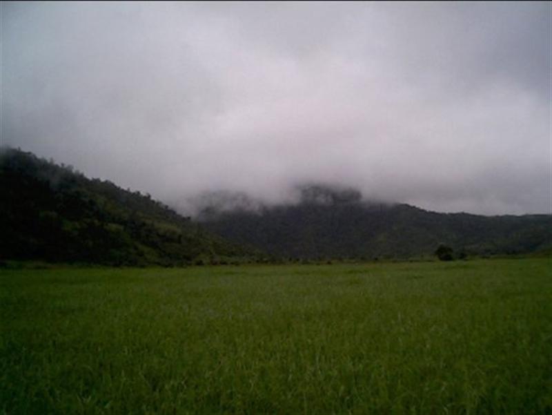
Monsoon clouds in Manipur
The climate of Manipur is largely influenced by the topography of this hilly region which defines the geography of Manipur. Lying 790 meters above sea level, Manipur is wedged between hills on all sides. This northeastern corner of India enjoys a generally amiable climate, though the winters can be a little chilly. The maximum temperature in the summer months is 32 degree C. In winter the temperature often falls below zero, bringing frost. Snow sometimes falls in some hilly regions due to the Western Disturbance. The coldest month is January, and the warmest July. The ideal time for tourism in the state, in terms of climate, is from October to February, when the weather remains bright and sunny without the sun being too hot.
The state is drenched in rains from May until mid-October. It receives an average annual rainfall of 1467.5 mm. However, the rain distribution varies from 933 mm in Imphal to 2593 mm in Tamenglong. The precipitation ranges from light drizzles to heavy downpour. The normal rainfall of Manipur enriches the soil and helps in agricultural processes and irrigation. The South Westerly Monsoon picks up moisture from the Bay of Bengal and heads toward Manipur, hits the eastern Himalaya ranges and produces a massive amount of rain in the state.
Population[]
| Population Growth | |||
|---|---|---|---|
| Census | Pop. | %± | |
| 1951 | 578,000 | ||
| 1961 | 780,000 | 34.9% | |
| 1971 | 1,073,000 | 37.6% | |
| 1981 | 1,421,000 | 32.4% | |
| 1991 | 1,837,000 | 29.3% | |
| 2001 | 2,294,000 | 24.9% | |
| Source:Census of India[12] | |||
Manipur has a population of 2,388,634. Of this total, 58.9% live in the valley and the remaining 41.1% in the hilly region. The hills are inhabited mainly by the Nagas, Kukis, Paite(Zomi) and smaller tribal communities and the valley mainly by the Meiteis, Pangal, and "Bhamons" who are literally non-Meiteis). Some Naga, Kuki, Paite and Hmar settlements are also found in the valley region. Racially, Manipuri people are unique and special as they have features similar to South east Asian except for Brahmins in the state who were believed to be more Indian as they have Indian features. .[13] The distribution of area, population and density, literacy rate, etc. as per the 2001 Census provisional figures are as below:
| Demographics of Manipur | |
|---|---|
| Total Population | 2,388,634 |
| Male Population | 1,207,338 |
| Female Population | 1,181,296 |
| Rural Population | 1,818,224 |
| Urban Population | 570,410 |
| Sex Ratio | 978 female to 1000 male |
| Density (per km²) | 107 |
| Literacy | 1,429,656 (68.87%) |
| Towns | 33 |
Language[]
The official languages of the state are Manipuri (Meitei) and English.
Manipuri language[]
Meiteilon, the official language of Manipur, has a long history. Courses on Manipuri Language and Literature are offered as a subject up to M.A. level in both Central and State Universities. It is the main language of communication among all different tribes and people inhabiting Manipur. English is also slowly gaining ground as a common language of communication. Hindi is also in use by the migrants from northern India. Meiteilon has been recognized as the Manipuri language by the Indian Union and has been included in the list of scheduled languages (included in the 8th schedule by the 71st amendment of the constitution in 1992). Meitei is taught as a subject up to postgraduate level (Ph.D.) in Indian universities, apart from being a medium of instruction up to the undergraduate level in Manipur.
Manipuri script[]
Meitei Mayek is a script, commonly referred as Mayek, which has been used since ancient times. The origins of the Manipuri alphabet, or Meetei Mayek as it is know in Manipuri, are shrouded in mystery as many historical documents were destroyed at the beginning of the 18th century during the reign of King Pamheiba. Some believe the alphabet has been used for almost 4,000 years.
Between 1709 and the middle of the 20th century, the Manipuri language was written with the Bengali alphabet. During the 1940's and 50's, Manipuri scholars began campaigning to bring back the old Manipuri alphabet. In 1976 at a writers conference all the scholars finally agreed on a new version of the alphabet containing a number of additional letters to represent sounds not present in the language when the script was first developed. The current Manipuri script is a reconstruction of the ancient Manipuri script. Since the early 1980's the Manipuri alphabet has been taught in schools in Manipur.
Languages of hill people[]
There are 29 different dialects spoken in Manipur. Six main hill dialects recognised by Government of Manipur for medium of instruction & examination up to class XII are:
- Thadou-Kuki, dialect of Thadou people, the second language in the state after Meiteilon during Colonial Period.
- Tangkhul, dialect of Tangkhul people
- Paite, dialect of Paite people
- Hmar, dialect of Hmar people
- Mao, dialect of Mao People
- Rongmei dialect of Rongmei people
- Maring dialect of Maring Naga/Maring,Maring Khoibu,Maring Narum-saibol people
Transportation[]
Tulihal Airport, Changangei, Imphal, the only airport of Manipur, connects directly with Delhi, Kolkata Guwahati, Silcher and Agartala. National Highway NH-39 links Manipur with the rest of the country through the railway stations at Dimapur in Nagaland at a distance of 215 km (134 mi) from Imphal. National Highway 53 (India) connects Manipur with another railway station at Silchar in Assam, which is 269 km (167 mi) away from Imphal. The road network of Manipur, with a length of 7,170 km (4,460 mi) connects all the important towns and distant villages.
On April 9, 2010, Union Minister of India, Shashi Tharoor announced that the central government is considering a rail link from Manipur to Vietnam.[14]
Religion[]

Sanamahi temple at Kangla


Pakhangba
| Religion in Manipur[15] | ||||
|---|---|---|---|---|
| Religion | Percent | |||
| Hinduism | 46.01% | |||
| Islam | 8.81% | |||
| Christianity | 34.04% | |||
| Others | 10.86% | |||
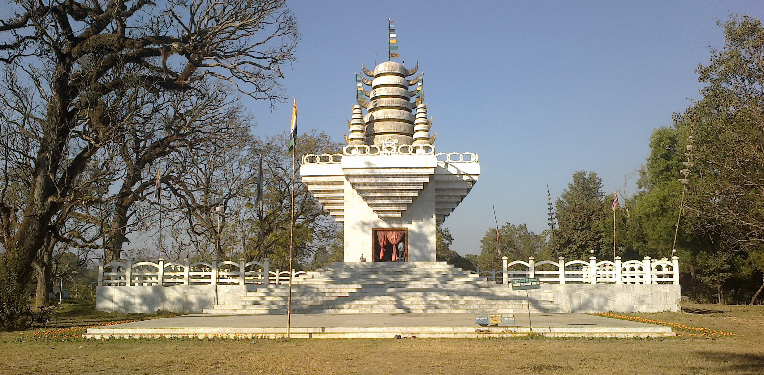
Meiteism (Meeteism) and Sanamahi[]

.jpg)
Ningthoukhong Gopinath Mandir
The people of Manipur follow several faiths and religions which can be traced down to its unique historical past. Sanamahism is an ancient indigenous religion, rich in mythology and colorful in ritual. The Sanamahi worship is concentrated around the Sun God/Sanamahi. Early Manipuris were the devotees of a Supreme deity "Lainingthou Soralel" following the footprint of their Godly ancestors. That particular kind of ancestor worship and animism, with the central focus of worship on Umang Lai – that is, ethnic governing deities worshipped in sacred groves. Some of the gods(Lais) Manipuris worship are Atiya Sidaba, Pakhangba, Sanamahi, Leimaren, Oknarel, Panganba, Thangjing, Marjing, Wangbaren, Koubru. The religious life of the people, even when they adopted non-mainstream Hinduism, retained many characteristics inherited from their prehistoric ancestors. The essentials of this religion remain recognizable to the present day.[16] but did not win widespread adoption until relative recent history.
Christianity[]
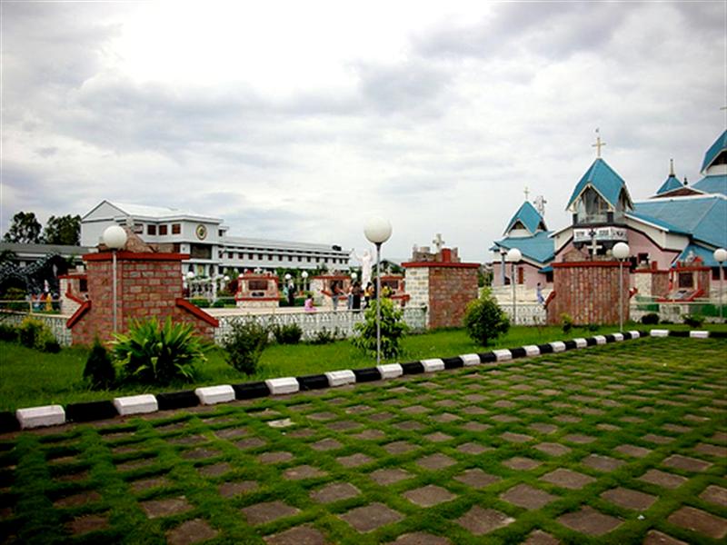

St.Joseph's Cathedral at Imphal
Christianity in Manipur started to spread in the 19th century onwards by missionaries. The 20th century saw the establishment of a few Christian schools which then introduced Western-type education in this remote part of the world. Some of the finest schools in Manipur are Little Flower School in Imphal, Don Bosco High School in Imphal, St. Joseph's Convent, Nirmalabas High School. These schools have produced achievers in various professions such as medicine, engineering, and other branches of science. A sizeable Meitei population have joined Christianity. Christianity constitutes 34% of the population.
Hinduism[]
It was in the 15th century that a particular form of Vaisnavism was adopted and spread under the reign of King Kyamba through to King Khagemba in the 19th century. Towards the end of the 19th century and at the advent of the 20th century, a great force of Gaudiya Vaishnavism came and spread in Manipur. Over the last couple of decades there has been a revival of Sanamahi religion and this was evident in the significant growth of the "non-mainstream" religion category in the 2001 census which amounted to 17% of the population. Due to the revival of demographic profile of the state, Sanamahism will now be included in the next Government of India population census in 2011.[17] According to the 2011 census Hinduism is identified with 46% of the population.[18]
Islam[]
Muslims numbering 190,939 form about 8.32% of the state population as per 2001 census. Influence of religious preceptors- Shaikh Shah Jalal Yemeni who came to Sylhet in 1303 AD and Azan Fakir Baghdadi in 1690 AD in Assam is also felt among Manipuri Muslims. There are Arab, Turani, Bengali and Mughal or Chaghtai Turk sections among Manipuri Muslims.
Culture[]
Culture of Manipur[]


The Chorus Repertory Theatre, Imphal, founded by Ratan Thiyam
Theatre and society in Manipur are intimately linked, as in many parts of the world. Manipuris are a culturally enthusiastic people. Cultural spirit has never been allowed to be blown out despite the area's remoteness from the outside world. This is why it still thrives in the Manipur valley.
Theatre has always been part of the Laiharaoba festivals since time immemorial. Theatre in Manipur today can be broadly divided, based on the texts, into religious and secular. The former is the adaptation of religious epics or some episodes from them, performed mainly in the sacred sphere such as temples. Within this Gauralila (the story of the childhood days of Caitanya Mahaprabhu), Sanjenba (an episode from the play between Krishna and his cows and his Gopis), and Udukhol (an episode from Krishna's childhood days) can be incorporated. They are seasonal performances commanding spiritual devotions among the audience.
Secular theatre is mostly confined to themes that are not religious and is performed in the secular or profane spheres. Within these are Shumang lila and Phampak lila (stage drama). Though the religious genre is loved profoundly by the audience, the torch of theatre is being held aloft by the secular ones. Among the latter also Shumang lila commands a very wide rustic popularity among the audience though the stage drama still does not lack its serene and dignified position mostly because of its community-based themes and styles. Etymologically Shumang lila is the combination of "Shumang" (courtyard) and "Lila" (play or performance). It is performed in an area of 13/13 ft in the centre of any open space, in a very simple style without a raised stage or any set design or heavy props such as curtains, background scenery, visual effects, etc. It uses only one table and two chairs, kept on one side of the performance space. Its claim to be the theatre of the masses is underlined by the way it is performed in the middle of an audience that surrounds it, leaving only one passage as both entrance and exit.
Shumang lila is performed by a touring band of 12-13 professional artists on invitation basis. These troupes may be exclusively female (Nupi Shumang Lila) or exclusively male (Nupa Shumang lila). Though the male characters are played by the female artists in the case of the former, what is most intriguing is the acting of the female roles by the male artists or nupishabis (male actresses). They are feminine in their looks, bodily gestures and facial expressions guised in masculine souls.
Historically the seed of Shumang lila was sown in Phagee lila (farce), performed during the reign of Ningthourel Chandrakirti (1850–1886), though traces of it were already present in the episode of Tangkhul-Nurabi Loutaba of Laiharaoba festival. Then it was succeeded by such plays as Ramlila, Sabha parba, Kabul lila, etc. But the real Shumang lila with various rasas (sentiments) was ushered in with the epic play Harishchandra (1918). Then it was followed by others such as Meiraba charan, Thok lila, etc. One of the most successful of this era was Moirang parba, an epic play based on the legendary lovers Khamba and Thoibi of Moirang.
On the other hand, the world of Phampak lila (stage drama) performed in the proscenium theatre is similar, in form, to the Western theatrical model and Indian Natyasastra model though its contents are indigenous. The so-called modern theatre descended on Manipuri theatre culture with the performance of Pravas Milan (1902) under the enthusiastic patronage of Sir Churchand Maharaj (1891–1941). The pace of theatrical movement was geared up with the institution of various groups such as Manipur Dramatic Union (MDU) (1930), Arian Theatre (1935), Chitrangada Natya Mandir (1936), Society Theatre (1937), Rupmahal (1942), Cosmopolitan Dramatic Union (1968), and the Chorus Repertory Theatre of Ratan Thiyam (1976). These groups started experimenting with various types of plays apart from historical and pauranic ones. Today Manipuri theatre is well respected because of various excellent productions shown in various parts of the country and abroad. Manipuri plays, both Shumang lila and stage lila, have been a regular feature in the annual festival of the National School of Drama, New Delhi.
Manipuri dance (Ras Lila)[]


Ras Lila
A classical form of Manipuri dance based and inspired by the theme of Lord Krishna and his beloved Radha's love story and the devotion of the Gopis (companions) toward Lord Krishna. This graceful and slow movement of the dance makes it one of the most acclaimed classical dances of India. The costume is elegant, as there are nicely embroidered clothes that give luster to the beauty of the art. This dance is very exciting dance.
Chorus Repertory Theater[]

The Shrine – the main theater
The auditorium of the theater is situated on the outskirts of Imphal and the campus stretches for about 2 acres (8,100 m2). It has housing and working quarters to accommodate a self-sufficiency of life. The theater association has churned out internationally acclaimed plays like Chakravyuha and Uttarpriyadashi. Its 25 years of existence in theater had disciplined its performers to a world of excellence. Chakravyuha taken from the Mahabharat epic had won Fringe Firsts Award, 1987 at the Edinburgh International Theater Festival. Chakravyuha deals with the story of Abhimanyu (son of Arjun) of his last battle and approaching death whereas Uttarpriyadashi is an 80-minute exposition of Emperor Ashoka's redemption.
Indigenous games[]
The indigenous games of Manipur can be classified as Outdoor and Indoor.
Outdoor[]
- Mukna
- Mukna Kangjei (Khong kangjei)
- Sagol Kangjei (Polo)
- Yubi lakpi (Coconut Rugby)
- Oo-Laobi
- Hiyang-Tannaba
- Arambai Hunba
Mukna (wrestling)[]
Mukna is a popular sport in Manipur
Mukna is a popular form of wrestling. It has fundamental rules agreed by all Mukna organizations and with Royal Consent. Traditionally the game is controlled and organised by Pana Loisang of the Ruler of the state and village organizations. There are four, Panas-Ahallup, Naharup, Khabam and Laipham, who control all fixtures and times for the games and the State Meet in which the Final is invariably graced by the ruler, who presents the title of Jatra (Champion) for the year along with reward of Thum Nama (A full bag of salt) and Ngabong Phi (hand made cloth of cotton yarn), exemption of all state duties and Ningham Samjin dress (traditional). The game has two categories (1) Takhatnabi (League), (2) Naitom (Knockout). The young talents work and play all the year round with dedication for the title of 'Jatra' (Champion) of Mukna of Manipur.
Mukna Kangjei (Khong Kangjei)[]
Mukna Kangjei is a game which combines the arts of mukna (wrestling) and Kangjei (Cane Stick) to play the ball made of seasoned bamboo roots. The origin of the game goes back well to Aniconic worship. People celebrate Lai Haraoba (festival to please traditional deities) and include this item to mark the end of the festival. It was believed that Khagemba Ningthou (King, 1597–1652) patronised this game. In later generations, the game is organised in the villages. Presently, associations are formed in Panas with rules and regulations of Mukna Kangjei. The game is played by two teams of seven players each. All players hold a natural cane stick with root, gradually increasing the size of the root, to the length of about seven inches to play the ball made out of seasoned bamboo roots of approximately a diameter of four inches (102 mm). The players put on Mukna Kisi Phijet (dress of cloth knot) to secure protection and holding each other. At present a short pant is added below Kisi (like cloth belt with knots). The game starts by throwing the ball in front of the panjenbas (leaders) of the two teams standing face to face to each other on the line. If possible they can pick up the ball and run. The process of running and obstructing each other to put the ball on the goal line of the ground is allowed, Pun onba (change of side) and end of the game is given by the command of the umpire. The rules for the game are known as Kangjei lon. It has improved a lot and was demonstrated during the Fifth National Games 1999 at Imphal.
Sagol Kangjei (Polo)[]
To Manipuris according to Chaitharol-Kumbaba, a Royal Chronicle of Manipur King Kangba who ruled Manipur much earlier than Nongda Lairen Pakhangba (33 AD) introduced Sagol Kangjei (Kangjei on horse back). Further regular playing of this game commenced in 1605 during the reign of King Khagemba under newly framed rules of the game. The game requires perfect control of the pony, the stick and the ball with proficiency of riding. The sense of 'fair Play' was the main guided factor of this game. This is played between two teams of Seven players a side. During the time of the late Sir Chandrakirti Singh, K.C.S.I Maharaja of Manipur introduced regular game at Mapal Kangjeibung (now near Tikendrajit Park) on the ground of Sana-Lamjei (length 160 and 80 width in dimension) being one Lamjei equal to 6 ft (1.8 m) The game can be played in smaller ground also if occasion demands. Earlier, there was no definite rules for foul in traditional Sagol Kangjei. Manipur has produced players of outstanding calibres like Jubaraj Bir Tikendraji (Senapati of Manipur Army) as legendary player described by Mrs. Grimwood (1887–90). After 1891, Manipur produced outstanding players like (L) Ojha Tombi and Shyamjai Sharma who never had the chance to play in international tournament. From the history it is an established fact and accepted that Manipur is the birthplace of Polo of the World.
Yubi lakpi[]
Yubi lakpi is a traditional football game played in Manipur, India, using a coconut, which has some notable similarities to rugby. Despite these similarities, the name is not related to the game of rugby or Rugby School in England, it is in fact of Manipuri origin, and means literally "coconut snatching".
Oolaobi[]
Oolaobi (Woo-Laobi) is an outdoor game mainly played by females. Meitei mythology believes that UmangLai Heloi-Taret (seven deities–seven fairies) played this game on the Courtyard of the temple of Umang Lai Lairembi. The number of participants is not fixed but are divided into two groups (size as per agreement). Players are divided as into Raiders (Attackers) or Defenders (Avoiders).
The Raiders say "oo" without stopping as long as they can continue and try to touch the Avoiders. If a Raider touches an Avoider is out, the Avoider is out. This process goes on till Avoiders are out or surrender. If a raider fails to say "oo" or is out of breath, the Raider is out. Points are counted on the elimination of Raiders/Defenders.
If Raiders are tired they declare for change and a time limit is decided on. The principles of Oolaobi are very similar to Kabaddi in India. The ground (court) is not marked; normally the open space in the premises of the house or temple is used for the game. Oolaobi is very popular with girls and a source of talent in Kabaddi.
Hiyang Tannaba[]


Hiyang Tannaba in progress
Hiyang Tannaba (Boat Race) : Hiyang tannaba (Hi Yangba Tannaba) is a traditional function of the Panas. This is held during the month of November. This was introduced during the time of Ningthourel Khunjaoba, the second son of King Khagemba, who dug the Kangla Moat around the Palace to make it impregnable in the year of 1660 after he ascended the throne in 1652.In the traditional function two boats "Tanahi" (Race Boat) are detailed for leaders known as "Tengmai Lappa". In each boat forty Hiroys (Boatsman) operate the boat. The boat which reaches the finishing line is the winner and all boatsman raise their (Now) oars high in the air as a sign of reaching the finishing line first and thus the winner of the race is declared. The leader pays his respect to the deity and the King of Manipur.
Arambai Hunba[]
People of Manipur are very fond of riding horses specially those who are in the village near the breeding areas. Since the ponies are easily available, the young boys get the chance of riding ponies without saddle on horse back. Sometimes they ride horse using a rope in place of regular bridle throwing branches of small trees in place of Arambai. This practice helped the Manipur Arambai force as a martial art which was very much required during the advance and withdrawal of forces. This art was very popular as an indigenous game of the youth of Manipur. This game is displayed even now, during the festival "Kwak Jatra" after Durga Puja.
Apart from these games, some outdoor games, which are played by children, are in a position of extinction. The games like Khutlokpi, Phibul Thomba, Chaphu Thugaibi etc. are very popular game in Cambodia. Such games are played especially during the Khmer New Year.[19]
Indoor Indigenous Games[]
Kang[]


Kang game
Kang is played by both male and female Meities of Manipur. Manipuris believe Kang is a game played by deity " Panthoibi". It is also believed that Manipuris began to play this game well before Vaishnavism came to Manipur. It is culturally a fine game of Manipur specially of Meiteis. It is played under a shed of building on an earth ground (court) smoothly levelled to suit the course of the 'Kang' the target on the court. It is well marked for the respective positions of the players of both to hit the target on the court. It has rules and regulations formed by the associations to suit the occasions of the games either for tournaments or Friendly. The dignitaries of the Palace, even Queen and King also participated on social functions. In olden days 'Kang' was played during summer, starting from Cheiraoba (Manipur New Year) to Kang Chingba. Presently the game is played in several tournaments throughout the year, organised by the Associations. Rules and regulations have been modified to suit the improved process of the game.
Festivals[]
The various festivals of Manipur are Lui-ngai-niNingol Chakouba, Yaoshang, Ramjan ID, Kut, Gan-ngai, Chumpha, Christmas, Cheiraoba, Kang and Heikru Hidongba. Most of these festivals are usually celebrated on the basis of lunar calendar. Almost every festival celebrated in other states is observed here and it makes Manipur a mini metropolis.
Ningol Chakouba (November)[]
A social festival of the Meiteis and many communities of Manipur where the married women (Ningol) are invited (Chakouba-literally calling to a meal; for dinner or lunch) to a feast at their parental house along with their children. Besides the feast, gifts are given to the women/invitees and to their children. It is the festival that binds and revives the family relations between the girls married away and the parental family. Nowadays, other communities have also started celebrating this kind of a family-bonding festival. It is held every year on the 2nd lunar day of Heyangei (mostly during the month of November. Sometimes it falls in October).
"Ningol" can mean a family's woman or a girl child and is not necessarily married.
Yaoshang (February/March)[]
Yaoshang is one of the colourful and biggest festival of Manipur now it is mixed up with holi festival. The actual name of Yaoshang is "Yawol Shang" in remembrance of Manipuri god "Pakhangba" play often in a small hut. It is celebrated for five days starting from the full moon of "Lamta tha" the last month of Manipuri month (February/March). At the first day of Yaoshang "Yawol Shang" will make and burn just after the sunset with a spiritual function in every "Leikai" that is village or sub villages that have their names that is called "Yawol Shang Mei Thaaba", and just after burned "Yawol Shang" the children beg for some moneys in every house that is called "Nakatheng". In the second and third days girls goes to their relatives for their "nakatheng" and block roads with ropes for some moneys. In the fourth and fifth days boys starting to pour or splash water one another etc.. Another feature of this premiere festival is the Thabal Chongba (Dancing in the Moonlight). The boys from various places will come to the site of the festival and dance with the girls by holding on to their hands and moving in circles.
Christmas (December)[]
The Hill dwellers consisting of various tribes (Kuki, Naga, Hmar etc.)in Manipur are Christians and celebrate Christmas for two days with prayers, reading of gospels, eating, singing of hymns, lectures on Christ, sports etc. It is usually observed on 24 December and 25. The Kuki are the second largest people in terms of population, next to the Meitei people. Few of them living in the plain area but most of them living in the hill area from generation to generation. Nowadays, one can find a small but rapidly expanding Meitei Christian population both in the urban and rural areas.
Kut (Post Harvest festival) (November)[]
A post harvest festival predominantly celebrated by Kuki-Chin tribes in Manipur has become one of the leading festivals of the state. Kut is not restricted to a particular community or tribe but the whole state populace participates in merriment. On 1 November of every year the state declared holiday for Kut celebration. The festival is marked by various cultural events such as traditional dances, folk dances, songs, sports and the most popular Miss Kut contest. It is a festival of peace and thanksgiving to the Almighty for the harvests.
Gaan-Ngai[]
Gaan-Ngai is the greatest festival of the Zeliangrong people. Its a 5 day long festival and is usually performed on the 13th day of the Meitei month of Wakching as per the Meitei Calendar of the lunar year.
Ramjan Id[]
The Manipuri Muslims observed this festival in the very spirits of joy and festivities as in other Muslim world. During this month the Muslims practice denial by taking a fast, abstaining from eating and drinking, from pre-dawn till sunset. After the second day of shawwal, when the new moon is visible they break fast which is also popularly known as Id-Ul-Fitre. They offer prayers at the mosques, have delicious dishes, exchange greetings and call on the friends and relatives. Ramjan is the ninth month of the Hijri year.
Cheiraoba (Sajibugi Nongma Panba), March/April)[]

,_in_the_Cheirao_Ching_summit_in_Kangleipak_(Manipur).jpg)
Cheiraoching Kaba
Cheiraoba (Chei=stick;raoba (derived from laoba= announce)) is the new year of Manipur. It is observed on the first lunar day of the lunar month Sajibu (March/April) and so it is also popularly known as Sajibu Cheiraoba. In olden days, where proper knowledge of time keeping was not there in every houses of Manipur, a King's horse-man announced the beginning of the new year with a stick on hand. And hence the name "Cheiraoba".
People of Manipur clean and decorate their houses and make a sumptuous variety of dishes to feast upon after offering food to the deity on this day. After the feast, as a part of the rituals, people climb the "CHEIRAOCHING" located in Chingmeirong or the nearest hill tops; in the belief that it would excel them to greater heights in their worldly life.
Separatist insurgency[]
A separatist insurgency began in 1964, although momentum to a more violent phase did not occur until 1978.[20] The Separatists demand a sovereign state separate from the Union of India, a claimed lack of development, plundering of local resources, and a general discontent is part of their argument.[20][21][21] The international Human Rights Watch, argues that human rights violations by Indian Security Forces have only fuelled the insurgency.[22][22] It adds that the Indian Army have at times acted with impunity as anti-terrorism laws in the state make prosecution of human rights violators difficult.[13][23][24][25]
There are currently 34 groups, including non-violent ones, that demand independence from India.[20] In 1999, some of these groups coalesced into an alliance organization called the "Manipur People's Liberation Front." Of these, the three most prominent are the United National Liberation Front (UNLF), Peoples Revolutionary Party of Kangleipak (PREPAK), and PLA of Manipur. The UNLF is estimated to have 2500 active militants, the PREPAK with 1500, and PLA with 3000.[20] The Indian news organization, Rediff, contends:
As of today, Manipur is the worst case scenario in the north-east as far as militancy is concerned. Apart from the fact that there are more militant groups in the state than anywhere else -- at least seven prominent groups operate in Manipur -- the rivalries between these outfits often leads to greater violence.[26]
The Kuki insurgent groups want a separate state for the Kukis to be carved out from the present state of Manipur. The Kuki insurgent groups are under two umbrella organisation, Kuki National Organisation (KNO) and United Peoples Forum.[27]
The situation is further complicated because insurgent groups are not united in the same cause. The Nagas wish to annex part of Manipur and merge with a greater Nagaland or Nagalim, which is in conflict with Meitei insurgent demands for the integrity of their vision of an independent state.[20] There were many tensions between the different tribes and have witnessed numerous clashes between Naga and Kukis, Meiteis and Muslims.
Tourism[]
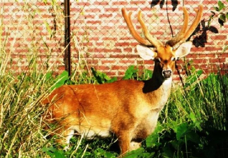
Manipur, as the name suggests, is a land of jewels. Its rich culture excels in every aspects as in martial arts, dance, theater and sculpture. The charm of the place is the greenery with the moderate climate making it a tourists' heaven. The beautiful and seasonal Shirui Lily at Ukhrul (district), Sangai (Brow antlered deer) and the floating islands at Loktak Lake are few of the rare things found in Manipur. Polo, which can be called a royal game, also originated from Manipur. Some of the main tourist attractions are:
Imphal (Capital)[]
The city is mainly inhabited by the Meitei with a large migrant population from Bihar, UP, Rajasthan, West Bengal, Punjab, Tamil Nadu, Kerala, etc. and it is just 7 km (4.3 mi) from the airport of Manipur (Tulihal Airport). The district is divided into East and West and the recently constructed sports complex (Khuman Lampak Sports Complex) for the 1997 National Games is also one of the attractions consisting of every thing from a cyclists velodrome to the main stadium. Most of the imported goods are sold here at its Paona Bazar, Gam-bir Sing Shopping Complex, Ningthibi Collections and Leima Plaza.
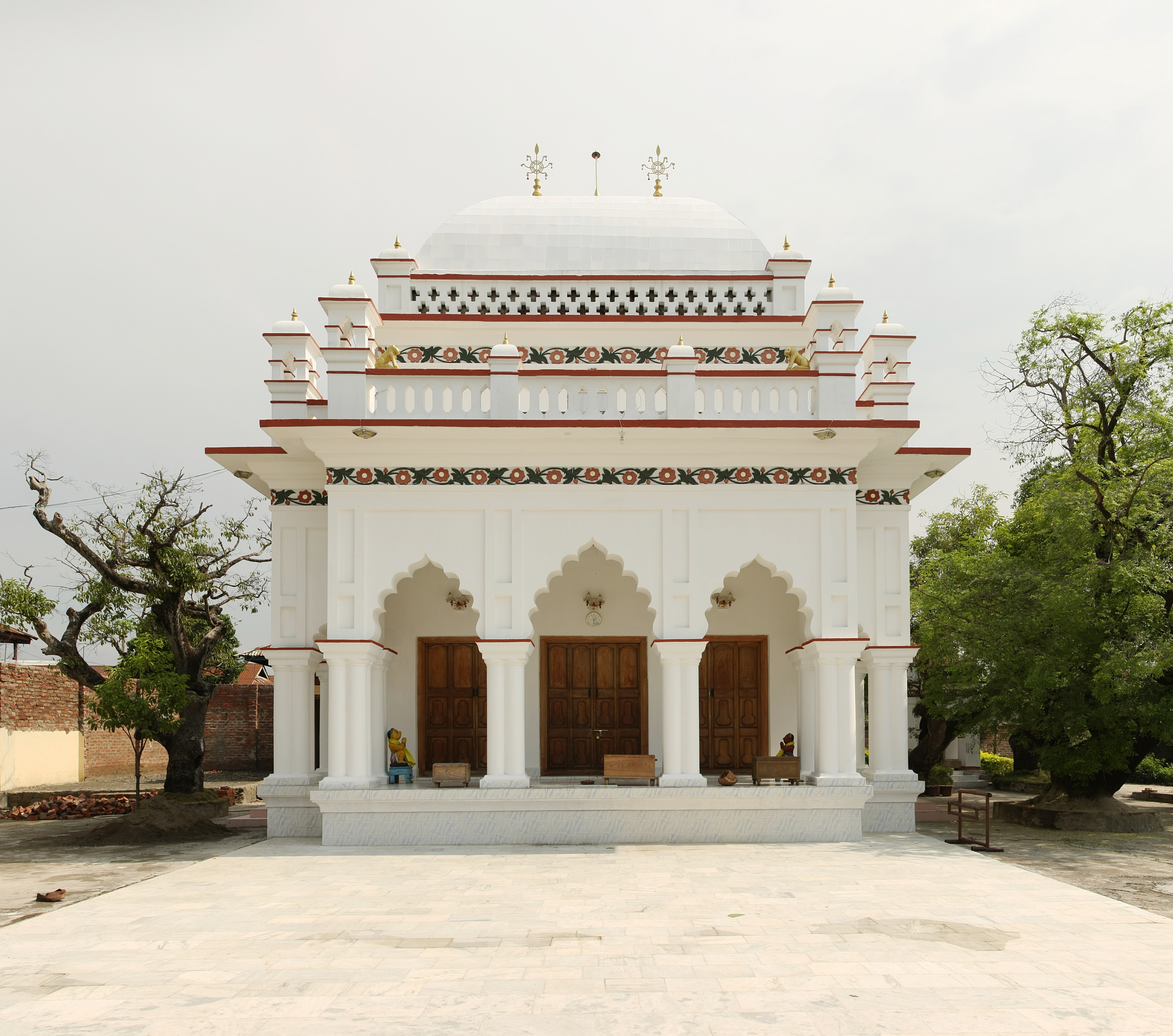
Shree Govindajee Temple[]
Shree Shree Govindajee Temple
This temple in Manipur diplomatically adjoins the palaces of the former rulers of the then kingdom, dull in design with gold domes, a paved court and a large, raised congregation hall. The deity in the center has other idols of Radha Govinda, Balaram and Krishna and Jagannath, Balabhadra and Subhadra on either side of it.
Keibul Lamjao National Park[]
Sangai at Keibul Lamjao National Park
Keibul Lamjao National Park, 48 km (30 mi) away from Imphal is an abode of, rare and endangered species of Brow Antlered deer (Scientific name: Rucervus eldii eldii). This ecosystem is home to 17 rare species of mammals. The greenery of the place and the moderate temperature makes a pleasant experience to visit.[7] It is the only floating national park of the world.
Loktak Lake[]
Loktak Lake is a freshwater lake where most of the people of Manipur get their share of fish. The special treat to watch are the floating islands popularly known as Phumdi which is made out of the tangle of watery weeds and other plants. With a nominal fee, people can hire small boats and see the fascinating way of life on these floating islands. The wetland is swampy and is favourable for a number of species to thrive on. It is in the district of Bishnupur. Etymology of Loktak is "Lok = stream and tak= the end" (End of the Streams).[7]
Lamka[]
Lamka is the second largest town in Manipur. The town is thriving business centre. The main attraction of the district is the Khuga Dam, which is some 7 km south of the proper town.
Moreh[]
Moreh is a booming border town in the Indo-Burmese border. It is inhabited mainly by the Kukis and some other ethnic communities like the Meiteis, Nepalis, Sikhs, Bengalis, Biharis, Rajasthanis, Tamils, etc. There is a thriving trade between India and Burma through this town. With the legal trade there also exist thrives illegal trade, mostly opium, going on through this town. To control this town there was a huge tussle between the militant groups, KNA of the Kukis and NSCN(IM) of the Nagas, which resulted in ethnic conflict between the two resulting in the loss of thousands of lives in the early 1990s. Of late, the Kukis went to benefit largely from this thriving border trade and increasing their livelihood. The town of Moreh in particular has an estimated 17,000 Tamils.[28] Tamils in Manipur have relatives and business contacts in Myanmar, which is a valuable network facilitating cross-border trade.[29]
Other places of interest[]
War cemeteries[]
Commemorating the memories of the British and Indian soldiers who died during the Second World War, these cemeteries are managed by the Commonwealth War Graves Commission. Serene and well maintained, the graves carry small stone markers and bronze plaques.
Khonghampat Orchidarium[]
7 km (4.3 mi) from Imphal, on National Highway 39 (India) is the Central Orchidarium, which covers 200 acres (0.81 km2) and houses over 110 rare varieties of orchids, which include almost a dozen endemic species. The peak blooming season is March – April.
Manipur Zoological Gardens[]
6 km (3.7 mi) to the west of Imphal, at the foot of the pine growing hillocks at Iroisemba on the Imphal-Kangchup Road are the Zoological Gardens. Not to be missed is an opportunity to see the graceful brow antlered deer (Sangai) one of the rarest species in the world, in sylvan surroundings.
Moirang[]
45 km (28 mi) from Imphal, the town is one of the main centres of early Meitei folk culture with the ancient temple of the pre-Hindu deity Lord Thangjing, situated here. In the month of May, men and women, dressed in colourful traditional costumes, sing and dance in honour of the Lord at the Moirang "Lai Haraoba" which is a ritual dance festival held each year. The town also has a special place in the history of the Indian freedom struggle. It was at Moirang that the flag of the Indian National Army was first unfurled on 14 April 1944.
Loktak Lake and Sendra Island[]


Bird's eye view of Floating Cafe' on Loktak Lake from Sendra Hill
48 km (30 mi) from Imphal, lies the largest fresh water lake in the North East India, the Loktak Lake, a veritable miniature inland sea. From the Tourist Bungalow set atop Sendra Island, visitors get a bird's eye view of life on the Lake-small islands that are actually floating weed on which live the Lake people, the shimmering blue waters of the Lake, labyrinthine boat routes and colourful water plants. The Sendra Tourist Home with an attached cafeteria in the middle of the lake is an ideal tourist spot.
Kaina[]
It is a hillock about 921 metres above sea level and a sacred place of the Manipuri Hindus. So goes the story that one night, Shri Govindajee appeared in the dream of his devotee, Shri Jai Singh Maharaja and asked the saintly king to install in a temple, an image of Shri Govindajee. It was to be carved out of a jack fruit tree, which was then growing at Kaina. The scenery in this place is charming and the hill shrubs and natural surroundings give the place a religious atmosphere. It is only 29 km (18 mi) from Imphal.
Khongjom[]
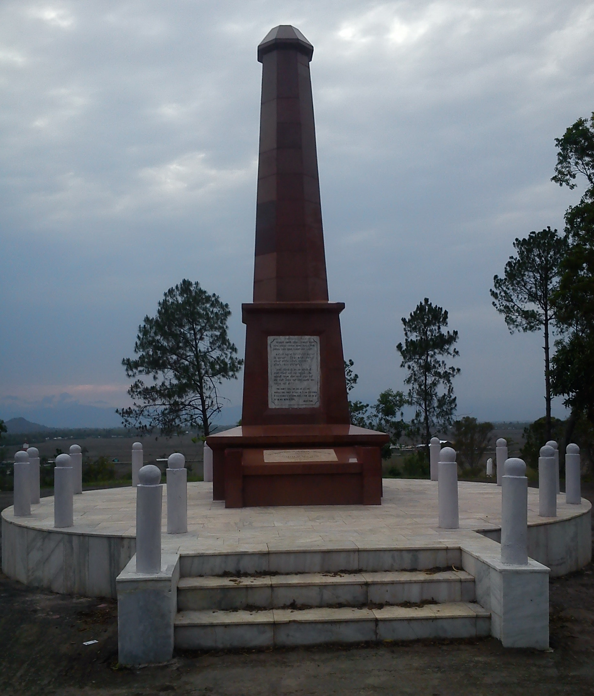

Khongjom war memorial
36 km (22 mi) on the Indo-Burmese road, a war broke out between Manipur and British India in 1891. It is here that Major General Paona Brajabashi, one of the great warriors of Manipur proved his valor against the superior force of the invading British Army in 1891. A War Memorial has been constructed on the top of the Kheba Hill. 23 April is celebrated as Khongjom Day every year and is a state holiday.
Tengnoupal[]
69 km (43 mi) from Imphal. The highest point on the Indo-Burmese Road, from here, you can have a full view of the valley of Burma.
Ukhrul[]
83 km (52 mi) to the east of Imphal, this district headquarters of Manipur East is the highest hill station of the state. A centre of the colourful warrior tribe Tangkhul Nagas, it is well developed and famous for its peculiar type of land-lily, the Shirui, grown in the Shirui hills. Shirui Hills and Khangkhui Lime Caves are interesting places for excursions.
Manipur State Museum[]
The interesting museum near the Polo Ground in the heart of Imphal has a fairly good display of Manipur's Tribal heritage and a collection of portraits of Manipur's former rulers.
Maibam Lotpa Ching[]
It is a hillock about 16 km (9.9 mi) from Imphal on Tiddim Road. It is a thrilling spot where a fierce battle took place between the British and the Japanese force in World War II and regarded as a holy place. There is also a monument in memory of the Japanese Martyrs who sacrificed their lives in this fierce battle.
Willong Khullen & Yangkhullen[]
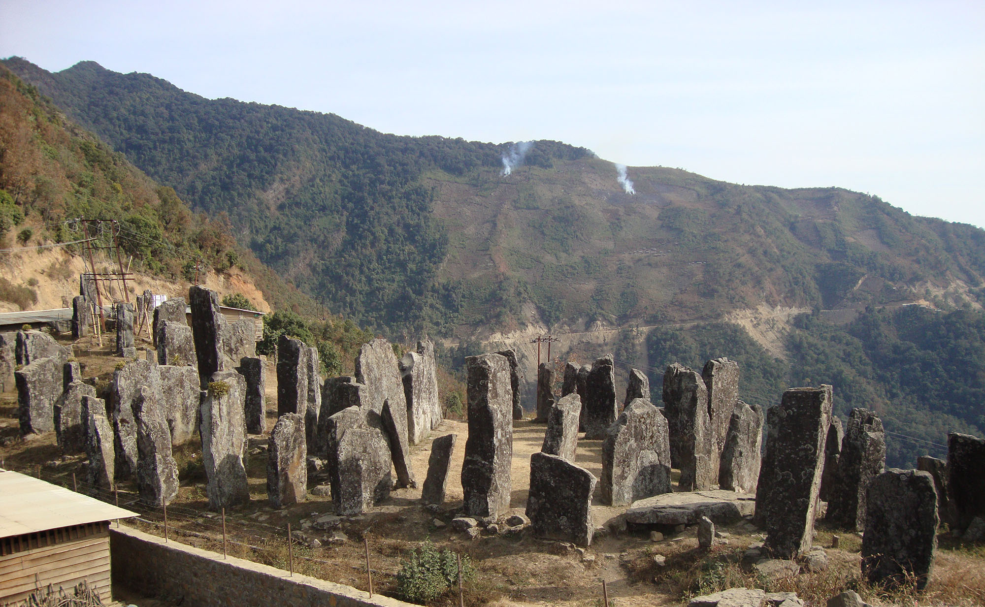

Stone Erections of Willong Khullen
Willong Khullen is a village located some 37 km (23 mi) from National Highway 39 (India) (Maram) on the Maram-Peren Road. It is home to a stone erection very similar to Stonehenge. Some of the tallest stones are seven meters tall and one meter thick.
The village of Yangkhullen is built on a steep slope on the hills.
Leimram Waterfall[]


Leimaram waterfall
A popular tourist and picnic spot in Sadu Chiru known as Leimram waterfall(near Ichum Keirap village) 27 km (17 mi) from Imphal, in the Sadar hill area, Senapati district. Hundreds of tourist flocks to this place to enjoy the view of this waterfall and the natural beauty surrounding it. Consisting of three falls with the first fall about thirty meters high. On the side of it, a newly park or garden-'Agape park' is situated. It is owned and managed by Kamlun Telien of Ichum Keirap.
Entry to Manipur[]
Until recently, entry to Manipur was controlled by the central government, for both foreigners and citizens of India. The state government as per directives from the Ministry of Home Affairs (MHA), Government of India on 9 November, relaxed existing guidelines of the ministry's circular No. 249 under letter no. 15011/7/95-F.I dated 29/6/1998 and delegated powers to issue Protected Area Permits (PAP):
- To visiting foreign tourists in a group of two or more persons with a recognized travel agent who would act as an escort of the group up to a maximum period of 30 days.
- Foreigners married to Indian nationals belonging to Manipur can visit the state on tourist visa for a maximum period of 90 days.
- IO/OCI card holder hailing from Manipur, visiting foreign nationals engaged in development/welfare project would continue to require prior permission of MHA after examining proposal in consultation with security agencies, MHA may consider issue of PAP to such visits of foreign nationals initially for a period up to 180 days.
The official order of state Home department also mentioned the permitted areas of foreigners to be visit in the state including, Loktak Lake, Imphal, INA Memorial Moirang, Keibul Lamjao Deer Sanctuary, Waithou Lake, Imphal-Bishnupur-Phubala-Moirang-sendra-Keibul Lamjao-Imphal, Imphal _Moirang Lake-Keibul Lamjao-Churachandpur-Khuga River-Imphal, Imphal-Litan-Ukhrul-Shiroy-Sangshak-Imphal, Imphal-Thoubal- Waithou Lake- Khongjom-Kakching- Thongjao-Waikhong-Sugunu-Imphal, Imphal-Khonghampat-Kanglatombi-Kangpokpi-Senapati-Karong-Mao gate-Imphal and Imphal Noneh-Khongsang-Nungba-Jiribam-Imphal.
The official order further mentioned whereas until now foreigners were required to travel by air from Kolkata to Imphal, henceforth, foreign tourists will also be allowed to enter by road along with NH-39 and NH-53. This circuit would be Dimapur-Kohima-Imphal-Jiribam-Silchar, the official order mentioned.
Media[]
Radio[]
1. All India Radio, Akashvani Imphal (On AM). 2. All India Radio, Akashvani Imphal (On FM). 3. All India Radio, Akashvani Churachandpur(On FM)
Telecommunications[]
- Airtel, Aircel, BSNL, Reliance Mobile, Tata Docomo, Vodafone etc.
Television[]
1. Doordarshan, DD Imphal.
Cable Tv Network[]
- Airtel digital TV, Dish TV, Reliance Digital TV, TATA Sky.
- ISTV Imphal.
News websites and Manipuri Vernaculars[]
- Poknapham Daily (Manipuri Daily).[30]
- The Sangai Express (English Daily).[31]
- Hueiyen Lanpao (English Daily).[32]
- Ireibak (Manipuri Daily).[33]
- Naharolgi Thoudang (Manipuri Daily).[34]
- The Peoples Chronicle(English Daily).
- E-Pao (English web).[35]
- Kanglaonline (English web).[36]
- Imphal Free Press (English Daily).[37]
- The Gosem (Thadou Daily)
- Zalen Banner (Thadou Weekly News)
- AJA (Tangkhul Daily).[38]
- Manipur Express (Paite Language Daily)
- Lamka Post (Paite Language Daily)
- ZOGAM.COM (Bilingual Website).[39]
- Hmasawnna Thar(Hmar language daily)[40]
Economy[]


Market in Imphal
Macro-economic trends[]
This is a chart of trends of gross state domestic product of Manipur at market prices estimated by Ministry of Statistics and Programme Implementation with figures in ten millions of Indian Rupees.[41]
| Period | Gross State Domestic Product (in Rupees, Crores***) |
|---|---|
| 1999–2000 | 3260 |
| 2000–2001 | 3112 |
| 2001–2002 | 3369 |
| 2002–2003 | 3506 |
| 2003–2004 | 3979 |
| 2004–2005 | 4568 |
| 2005–2006 | 5066 |
| 2006–2007 | 5403 |
| 2007–2008 | 5848 |
| 2008–2009 | 6344 |
See also[]
- Manipuri dance
- Manipuri cuisine
- Irom Sharmila Chanu
- AFSPA
References[]
- ^ Laininghan Naoria Phulo, Meitei Haubham Wari (The Origin History of Meiteis), 1934.
- ^ Naorem Sanajaoba, Maipur Past and Present, Mittal Publication, Delhi, 2005
- ^ Ningthoujongjam Khelchandra, History of Ancient Manipuri Literature, Manipuri Sahitya Parishad, 1969
- ^ Gangmuei Kabui, History of Manipur, National Publishing House, Delhi, 1991.
- ^ Prabhakara, M.S. (September 9, 2006). "Degrees of separatism". The Hindu. http://www.hinduonnet.com/fline/fl2318/stories/20060922002604200.htm. Retrieved November 4, 2010.
- ^ http://www.manipur.we.bs/
- ^ a b c d Fate of Loktak Lake
- ^ Haokip, Shri Ngamthang (2007) "Basine Delineation Map of Manipur" Profile on State of Environment Report of Manipur, 2006-07 Ministry of Environment and Forests, Manipur, p. 4
- ^ Government of Manipur. "Irrigation And Water Management". http://www.manipur.nic.in/planning/DraftMSDR/Draft_SDR_pdf/Chapter%207_irrigation.pdf. Retrieved October 31, 2010.
- ^ Centre for Science and Environment (India). "The Arithmetic of Water in India". http://www.rainwaterharvesting.org/Solution/Water-Arithmetic.htm. Retrieved October 31, 2010.
- ^ Director of Commerce and Industries, Manipur. ""Soil and Climate of Manipur"". http://investinmanipur.nic.in/gp_soil.htm. Retrieved October 31, 2010.
- ^ "Census Population" (PDF). Census of India. Ministry of Finance India. http://indiabudget.nic.in/es2006-07/chapt2007/tab97.pdf. Retrieved 2008-12-18.
- ^ a b Datta, Tanya (8 August 2007). "India's 'forgotten' war". BBC News. http://news.bbc.co.uk/2/hi/programmes/crossing_continents/6935673.stm. Retrieved 12 May 2010.
- ^ "Rail link from Manipur to Vietnam on cards: Tharoor - Times Of India". The Times Of India. http://timesofindia.indiatimes.com/india/Rail-link-from-Manipur-to-Vietnam-on-cards-Tharoor/articleshow/5778641.cms.
- ^ "Census of India - Religious Composition". Government of India, Ministry of Home Affairs. http://censusindia.gov.in/Census_Data_2001/Census_data_finder/C_Series/Population_by_religious_communities.htm. Retrieved 8 August 2012.
- ^ macks nigombam. "A Brief history of the Meiteis of Manipur". Themanipurpage.tripod.com. http://themanipurpage.tripod.com/history/puwarimeitei.html. Retrieved 2010-07-18.
- ^ Indian Census
- ^ Religious Composition
- ^ Singh, Atom Sunil; Borderless Connectivity on Indigenous Games between Cambodia and Manipur, The Sangai Express, 4 June 2008.
- ^ a b c d e chandru. "MANIPUR- in a strange whirlpool of Cross-Current Insurgency". Southasiaanalysis.org. http://www.southasiaanalysis.org/papers13/paper1210.html. Retrieved 2010-07-18.
- ^ a b "Insurgency In Manipur :: KanglaOnline ~ Your Gateway". Kanglaonline.com. http://classic.kanglaonline.com/index.php?template=kshow&kid=834. Retrieved 2010-07-18.
- ^ a b "India: Army Killings Fuel Insurgency in Manipur | Human Rights Watch". Hrw.org. 2008-09-15. http://www.hrw.org/en/news/2008/09/14/india-army-killings-fuel-insurgency-manipur. Retrieved 2010-07-18.
- ^ ibid
- ^ Manipur, The Hindu, 30 August 2009
- ^ "India's Independent Weekly News Magazine". Tehelka. http://www.tehelka.com/story_main42.asp?filename=Ne080809murder_in.asp. Retrieved 2010-07-18.
- ^ "'Insurgency is biggest business in northeast'". Rediff.com. 1986-10-03. http://www.rediff.com/news/2004/oct/04spec1.htm. Retrieved 2010-07-18.
- ^ www.kukination.net
- ^ http://manipur.nic.in/planning/DraftMSDR/Draft_SDR_pdf/Chapter%2011_Border%20Trade.pdf
- ^ Thongkholal Haokip, Looking East via Moreh: Prospects and Challenges for the Kukis, in The Kuki Society: Past, Present and Future New Delhi: Maxford Publishers, 2011, pp. 190-202
- ^ Manipur News | Manipur Daily | Poknapham - Manipuri News!
- ^ # The Sangai Express (English) The Sangai Express - Largest Circulated News Paper In Manipur
- ^ Hueiyen Lanpao - Breaking News, Current News, North East India, Manipur News, News Online
- ^ : IREIBAK - Daily Manipuri Newspaper :
- ^ Naharolgi Thoudang - Sunday, March 27, 2011 Naharolgi Thoudang celebrates 15th Anniversary. We are very thankful to all our esteem readers for being with us
- ^ Manipur - E-Pao! :: Complete e-platform for Manipuris
- ^ Kanglaonline | Your Gateway to Manipur, Nagaland, Arunachal Pradesh, Assam, Mizoram, Tripura, Meghalaya
- ^ Imphal Free Press - Leading Newspaper in Manipur
- ^ Reclaiming our past - Tangkhul.com
- ^ # ZOGAM.COM (Bilingual) Zogam.com - Bridging the Zomis
- ^ Hmasawnna Thar
- ^ Statement: Gross State Domestic Product at current prices – Government of India, Ministry of Statistics retrieved: 16 December 2009
External links[]

|
Nagaland |
| ||
| Assam | ||||
 Manipur | ||||
| Mizoram |
| ||||||||||||||
| |||||
Template:Princely states of India
| This page uses content from the English language Wikipedia. The original content was at Manipur. The list of authors can be seen in the page history. As with this Familypedia wiki, the content of Wikipedia is available under the Creative Commons License. |