| Main | Births etc |
|---|
| Măgurele | |||
|---|---|---|---|
| — Town — | |||
 |
|||
|
|||
 |
|||

Măgurele |
|||
| Coordinates: Coordinates: | |||
| Country | |||
| County | |||
| Subordinated villages | |||
| Area | |||
| • Total | 45.00 km2 (17.37 sq mi) | ||
| Elevation | 85 m (279 ft) | ||
| Population (2011) | |||
| • Total | 11 041 | ||
| • Density | 245.35/km2 (635.5/sq mi) | ||
| Time zone | EET (UTC+2) | ||
| • Summer (DST) | EEST (UTC+3) | ||
| Website | http://primariamagurele.ro/ | ||
Măgurele is a town situated in the southwestern part of Ilfov County, Romania. Its population is 11,041. Four villages are administered by the town: Alunișu, Dumitrana, Pruni and Vârteju.
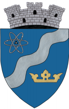
The town hosts a nuclear research lab, the Institute of Atomic Physics (Romanian: Institutul de Fizicǎ Atomicǎ (IFA)) and its National Institute for Physics and Nuclear Engineering. Between 1957 and 1998, it had a Soviet VVRS research reactor, now closed down. The Faculty of Physics of the University of Bucharest is also located in Măgurele.
Its name is derived from a Romanian word possibly of Dacian origin, măgură, meaning "hill".
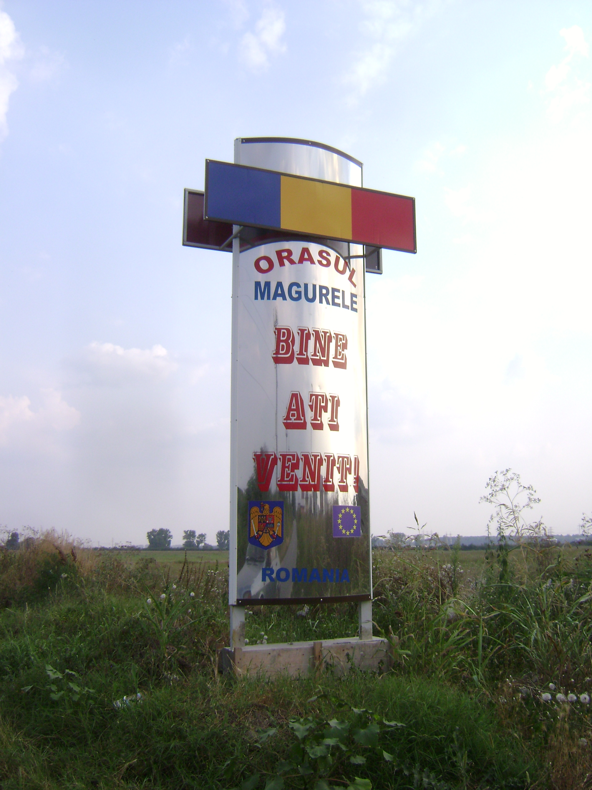

Welcome sign at the town's southern entry
References[]
External links[]
- Horia Hulubei National Institute of Physics and Nuclear Engineering
- National Institute of Materials Physics
| ||||||||

|
Bragadiru | București |
| |
| Cornetu | Jilava | |||
 Măgurele | ||||
| Mihăilești |
| |||||||||||||