| ||||||||||||||
| Kurukshetra district कुरुक्षेत्र जिला |
|
|---|---|
| — District of Haryana — | |
 |
|
| Country | India |
| State | Haryana |
| Established | |
| Headquarters | Kurukshetra |
| Tehsils | 1. Thanesar, 2. Shahabad 3. Pehowa |
| Government | |
| • Lok Sabha constituencies | Kurukshetra (shared with Yamuna Nagar and Kaithal districts) |
| • Assembly seats | 4 |
| Area | |
| • Total | 1,683 km2 (650 sq mi) |
| Population (2001) | |
| • Total | 825,454 |
| • Density | 490/km2 (1,300/sq mi) |
| • Urban | 26.10 |
| Demographics | |
| • Literacy | 69.88 |
| • Sex ratio | 866 |
| Website | Official website |
Kurukshetra district (Hindi: कुरुक्षेत्र जिला) is one of the 21 districts of Haryana state in northern India. The town of Kurukshetra, a sacred place for the Hindus, is the administrative headquarters of this district. The district occupies an area of 1682.53 km². The district has a population of 825,454 (2001 census). This district is part of Ambala division.
Origin of name[]
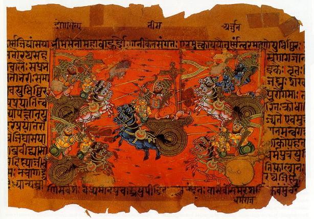
The Kurukshetra war depicted in a manuscript of the Mahabharata
The district derived its name from the ancient region of Kurukshetra, which literally means the land of the Kurus. It is believed that the Kurukshetra war described in the Mahabharata and the Puranas was fought here and Krishna recited the Bhagavat Gita to Arjuna on the battlefield before the war.
History[]
The district was carved out from the erstwhile Karnal district in 1973. Later some parts of this district were transferred to Kaithal and Yamuna Nagar districts at the time of their creation.
Divisions[]
Kurukshetra district comprises two sub-division: Thanesar and Pehowa. Thanesar sub-division comprises two tehsils, Thanesar and Shahabad and two sub-tehsils, Ladwa and Babain. Pehowa sub-division consists of Pehowa tehsil and Ismailabad sub-tehsil. The significant towns in this district are Kurukushetra, Thanesar and Pehowa. Due to its location at punjab border it has a substantial sikh population also
Demographics[]
According to the 2011 census Kurukshetra district has a population of 964,231,[1] roughly equal to the nation of Fiji[2] or the US state of Montana.[3] This gives it a ranking of 452nd in India (out of a total of 640).[1] The district has a population density of 630 inhabitants per square kilometre (1,600 /sq mi) .[1] Its population growth rate over the decade 2001-2011 was 16.81 %.[1] Kurukshetra has a sex ratio of 889 females for every 1000 males,[1] and a literacy rate of 76.7 %.[1]
Education[]
Kurukshetra University was established as a unitary residential university at Kurukshetra in 1956. The Regional Engineering College at Kurukshetra was established in 1963, which was later renamed as National Institute of Technology.
References[]
- ^ a b c d e f "District Census 2011". Census2011.co.in. 2011. http://www.census2011.co.in/district.php. Retrieved 2011-09-30.
- ^ US Directorate of Intelligence. "Country Comparison:Population". https://www.cia.gov/library/publications/the-world-factbook/rankorder/2119rank.html. Retrieved 2011-10-01. "Fiji 883,125 July 2011 est."
- ^ "2010 Resident Population Data". U. S. Census Bureau. http://2010.census.gov/2010census/data/apportionment-pop-text.php. Retrieved 2011-09-30. "Montana 989,415"
External links[]

|
Patiala district, Punjab | Ambala district |
| |
| Yamuna Nagar district | ||||
 Kurukshetra district | ||||
| Kaithal district | Karnal district |
| ||||||||||||||||||||||||||
| ||||||||||||||||||||
| This page uses content from the English language Wikipedia. The original content was at Kurukshetra district. The list of authors can be seen in the page history. As with this Familypedia wiki, the content of Wikipedia is available under the Creative Commons License. |