| ||||||||||||||
| Kurnool district కర్నూల్ జిల్లా |
|
|---|---|
| — district — | |
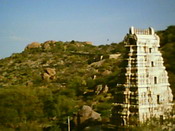
| A Pillar at Ahobilam Temple | |
| Coordinates: Coordinates: | |
| Country | |
| State | Andhra Pradesh |
| Region | Rayalaseema |
| Headquarters | Kurnool |
| Time zone | IST (UTC+5:30) |
| Website | kurnool.nic.in |
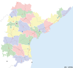
Kurnool District is a district in the state of Andhra Pradesh, India, located in the west-central part of the state on the southern banks of the Tungabhadra and Handri rivers. The town of Kurnool is currently the headquarters of the district. It had a population of 3,529,494 of which 23.16% were urban as of 2001.[1]

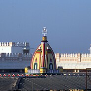
Hall of The Nawab at Adoni fort in Kurnool District

Veerabrahmendra Swamy Temple in Banaganapalle
Telugu, Urdu[2] and Kannada are the most widely spoken languages.
History[]
Palaeolothic era[]
The Ketavaram[3] rock painting's are dated back to the Paleolithic era (located at a distance of 18 Kilometer from Kurnool). Also the Jurreru Valley, Katavani Kunta[4] and Yaganti in Kurnool District have some important rock art's and painting's in their vicinity, may be dated back to 35,000 to 40,000 years ago.
Buddhism and Jainism[]
Belum Caves are geologically and historically important caves in the district. There are indications that Jain's and Buddhist monks were occupying these caves centuries ago. Many Buddhists relics were found inside the caves. These relics are now housed in Museum at Ananthapur.
Archaeological survey of India (ASI) also found remnants of vessels, etc. of pre-Buddhist era and has dated the remnants of vessels found in the caves to 4500 BC.[5]
Medieval era[]
In 12th century AD, the Odders, who carted stones for the construction of the temple at Alampur, Mahaboobnagar District, on the left bank of the River Thungabhadra, used the site where the town now stands as a stopping place before crossing the Tungabhadra. They greased their cart wheels with grease supplied by local grease merchants and called the place 'Kandanavolu' which in course of time came to be known as Kurnool.
Of historical interest are the ruins of a royal fort dating back to the medieval kingdom of Vijayanagar, which flourished from the 14th to the 16th century. Several Hindu Temple's as Ahobilam, Mahanandi, Yaganti, Srisailam, Kolimigundla, Omkaram were developed during the era of Vijayanagar Dynasty.
Several Persian and Arabic inscriptions which throw light on various aspects of historical interests are found here. In Kurnool there are 52 dargahs (shrines) located around the Thungabhadra and Hundari rivers. A very famous and lengthy K.C. Canal starts in Kurnool and ends in Cuddapah. It is around 300 kilometers long. In Kurnool city there are a number of ancient temples, churches and mosques. Kurnool city, known as the gateway to the Rayalaseema, on N.H.7 (Kanyakumari to Varanasi) on the banks of the Rivers Thungabhadra and the Hundri was the capital of the first linguistic state in free India, Andhra State from 1 Oct. 1953 to 31 Oct. 1956. As such it has some historical buildings.
Kurnool has freedom fighters like Vuyyalawada Narsimha Reddy, Gadicharla Harisarvothama Rao. Zilla Grandhalaya Samstha (ZGS ) and the District Central Libray (DCL), Kurnool, building near the old Bus stand is named 'GADICHARLA HARISARVOTHAMA RAO SMARAKA BHAVANAMU". It is the second district, apart from Nellore (Bejawada Gopal Reddy 'Andhra state' & Nedurumalli Janardhan Reddy), which has contributed two Chief Ministers to Andhra Pradesh:
- Damodaram Sanjeevaiah (1st dalit Chief Minister of India and A.P),
- Kotla Vijaya Bhaskar Reddy
- 10th Indian Prime Minister P.V. Narasimha rao was elected as member of parliament from Nandyal constituency with over 6 lakh (600,000) majority, a world record.
Neelam Sanjeeva Reddy (Ananthapur District) was elected from the Dhone assembly constituency in 1962 general elections and became the Chief Minister of AP. Again in 1977 general elections to the Lok Sabha, he won from the Nandyal Parliamentary constituency and became the speaker of the Lok Sabha. However he resigned and became the 6th President of the Republic of India. In 1970, part of Kurnool district was split off to become part of Prakasam district.[6]
Kurnool District is currently a part of the Red Corridor.[7]
Geography[]
Kurnool district occupies an area of approximately 17,658 square kilometres (6,818 sq mi),[8] comparatively equivalent to New Caledonia.[9]
Kurnool is surrounded by districts of both Andhra Pradesh and Karnataka:
- North - Mahabub Nagar
- South - Anantapur, Kadapa (Cuddapah)
- East - Praksam (Ongole)
- West - Bellary (A district in Karnataka State)
The Nallamalas and Erramalas mountain ranges in the district run parallel from the North to South. The ranges divide the district into two tracts crossed by the Krishna and Pennar rivers. The North Pagidyala mandal is about 1000 above sea level. From this height the ground slopes to the South along the river Kundu until it traverses into the Pennar valley. Major part of its tract is black soil. Between the Erramalas and Nallamalas lies the Eastern part of the district comprising
- Kodumur
- Nandikotkur
- Pagidyala
- Kothapalli
- Pamulapadu
- Atmakur
- Velgode
- Jupadu Bungalow
- Miduthur
- Bandi Atmakur
- Gadivemula
- Nandyal
- Mahanandi
- Panyam
- Cementnagar
- Banaganapalle
- Srisailam
- Owk
- Allagadda
- Koilkuntla
- Rudravaram
- Chagalamarri
- Yemmiganur
- Adoni
- Devanakonda
- Pathhikonda
- Dhone
- Betamcherla
- Srisailam Project (RFC) Township
Gallery[]
Economy[]
Household indicators[]
In 2007–2008 the International Institute for Population Sciences interviewed 1247 households in 38 villages across the district.[10] They found that 94% had access to electricity, 89.7% had drinking water, 34.6% toilet facilities, and 51.6% lived in a pucca (permanent) home.[10] 30.6% of girls wed before the legal age of 18[11] and 85.1% of interviewees carried a BPL card.[10]
Divisions[]
Kurnool District comprises 3 Revenue Divisions, 54 Revenue Mandals, 53 Mandal Parishads, One Municipal Corporation, 3 Municipalities, 899 Gram Panchayats (Notified – 7, Non notified – 862 ), 920 Revenue Villages and 615 Hamlet Villages.
Mandals[]
There are 3 revenue divisions and 54 mandals in Kurnool District. The revenue divisions are Adoni, Nandyal and Kurnool.[12]
- Adoni
- Allagadda
- Alur
- Aspari
- Atmakur
- Banaganapalle
- Bandi Atmakur
- Bethamcherla
- C.Belagl
- Chagalamarri
- Chippagiri
- Devanakonda
- Dhone alias Dronachalam
- Dornipadu
- Gadi Vemula
- Gonegandla
- Gospadu
- Gudur
- Halaharvi
- Holagunda
- Jupadu Bungalow
- Kallur
- Kodumuru
- Koilkuntla
- Kolimigundla
- Kosigi
- Kothapalle
- Kowthalam
- Krishnagiri
- Kurnool
- Maddikera (East)
- Mahanandi
- Mantralayam
- Miduthur
- Nandavaram
- Nandikotkur
- Nandyal
- Orvakal
- Owk
- Pagidyala
- Pamulapadu
- Panyam
- Pattikonda
- Peapally
- Pedda Kadubur
- Rudravaram
- Sanjamala
- Sirvel
- Srisailam
- Tuggali
- Uyyalawada
- Veldurthi
- Velgodu
- Yemmiganur.
Transport[]
The district is connected by highways and railways.
But people most often use the highways than the railways due to the less frequency of trains .
Demographics[]
According to the 2011 census Kurnool district has a population of 4,046,601,[13] roughly equal to the nation of Liberia[14] or the US state of Oregon.[15] This gives it a ranking of 54th in India (out of a total of 640).[13] The district has a population density of 229 inhabitants per square kilometre (590 /sq mi) .[13] Its population growth rate over the decade 2001-2011 was 14.65%.[13] Kurnool has a sex ratio of 984 females for every 1000 males,[13] and a literacy rate of 61.13%.[13]
From the years the people can be divided broadly divided into landlords and agricultural labors. The communities are affectionate to one another and loyal to their land lord.Even today the rural population are agricultural labors without any sizeable land holdings.That's why Kurnool District is known for the effective implementation of The Mahatma Gandhi National Rural Employment Guarantee Act (NREGS) among all districts of Andhra Pradesh and even India. In recent times there has been massive migration of rural population to cities like Guntur, Bellary and Bangalore.
Today one can find hundreds of villages in the western part of the district going empty. Longterm steps need to be implemented to provide rural employment by setting up rural industries. What is needed is good and sustained school education for the children.
Visitor attractions[]
- Gundla Brahmeswaram Temple, Nallamala Forest
- Ahobilam
- Belum Caves
- Dhone
- Kalva Bugga
- Kolimigundla
- Mahanandi
- Mantralayam
- Omkaram
- Angameshwaram
- Srisailam
- Yaganti
References[]
- ^ Census GIS India
- ^ http://www.languageinindia.com/april2003/urduinap.html
- ^ http://www.aparchaeologymuseum.com/wp-content/uploads/2012/06/Kurnool.pdf
- ^ http://www.academia.edu/483477/New_rock_art_discoveries_in_the_Kurnool_District_Andhra_Pradesh_India
- ^ [1] Show Caves of India: Belum Caves
- ^ Law, Gwillim (2011-09-25). "Districts of India". Statoids. http://www.statoids.com/yin.html. Retrieved 2011-10-11.
- ^ "83 districts under the Security Related Expenditure Scheme". IntelliBriefs. 2009-12-11. http://intellibriefs.blogspot.com/2009/12/naxal-menace-83-districts-under.html. Retrieved 2011-09-17.
- ^ Srivastava, Dayawanti et al. (ed.) (2010). "States and Union Territories: Andhra Pradesh: Government". India 2010: A Reference Annual (54th ed.). New Delhi, India: Additional Director General, Publications Division, Ministry of Information and Broadcasting (India), Government of India. pp. 1111–1112. ISBN 978-81-230-1617-7.
- ^ "Island Directory Tables: Islands by Land Area". United Nations Environment Program. 1998-02-18. http://islands.unep.ch/Tiarea.htm. Retrieved 2011-10-11. "New Caledonia (main island) 16,648km2"
- ^ a b c "District Level Household and Facility Survey (DLHS-3), 2007-08: India. Andhra Prades" (PDF). International Institute for Population Sciences and Ministry of Health and Family Welfare. 2010. http://www.rchiips.org/pdf/rch3/report/AP.pdf. Retrieved 2011-10-03.
- ^ "How Do I? : Obtain Marriage Certificate". National Portal Content Management Team, National Informatics Centre. 2005. http://india.gov.in/howdo/howdoi.php?service=3. Retrieved 2011-10-03. "To be eligible for marriage, the minimum age limit is 21 for males and 18 for females."
- ^ Details of Andhra Pradesh till Intermediate Panchayat Tier
- ^ a b c d e f "District Census 2011". Census2011.co.in. 2011. http://www.census2011.co.in/district.php. Retrieved 2011-09-30.
- ^ US Directorate of Intelligence. "Country Comparison:Population". https://www.cia.gov/library/publications/the-world-factbook/rankorder/2119rank.html. Retrieved 2011-10-01. "Liberia 3,786,764 July 2011 est."
- ^ "2010 Resident Population Data". U. S. Census Bureau. http://2010.census.gov/2010census/data/apportionment-pop-text.php. Retrieved 2011-09-30. "Oregon 3,831,074"
External links[]
- Official Website
- Kurnool Website
Kurnool (district) travel guide from Wikivoyage

|
Raichur district, Karnataka | Mahbubnagar district | 
| |
| Bellary district, Karnataka | Prakasam district | |||
 Kurnool district | ||||
| Anantapur district | YSR district |
| |||||||||||||||||
Template:Cities and towns in Kurnool district
| This page uses content from the English language Wikipedia. The original content was at Kurnool district. The list of authors can be seen in the page history. As with this Familypedia wiki, the content of Wikipedia is available under the Creative Commons License. |


