| ||||||||||||||
| Krishnagiri district | |
|---|---|
| — District — | |
 |
|
 |
|
| Coordinates: Coordinates: | |
| Country | |
| State | Tamil Nadu |
| Division | Krishnagiri & Hosur |
| Metro | |
| Municipal Corporations | Krishnagiri |
| Municipalities | |
| Town Panchayats | |
| Headquarters | Krishnagiri |
| Talukas | Krishnagiri, Hosur, Denkanikottai, Pochampalli, Uthangarai. |
| Government | |
| • Collector | Dr C.N Maheswaran, IAS |
| Time zone | IST (UTC+5:30) |
| PIN | 635xxx |
| Telephone code | 04343 |
| ISO 3166 code | [[ISO 3166-2:IN|]] |
| Vehicle registration | TN-24[1] |
| Largest city | Krishnagiri |
| Largest metro | Krishnagiri |
| IUCN category | |
| Central location: | |
| Website | krishnagiri.nic.in/ |
Krishnagiri is a district in the state of Tamil Nadu, India. The municipal town of Krishnagiri is the district headquarters. In Tamil Nadu, E-Governance was first introduced at Krishnagiri district under the National e-Governance Project (NEGP) in Revenue, Social Welfare departments on a pilot basis.[2][3] The district is one of the two largest producers of Mangoes not only in Tamil Nadu but throughout India.[4]
Etymology[]
'Krishna' refers to 'black' and 'giri' refers to 'hill'. Thus, 'Krishnagiri' refers to 'Black Hill'. This district is gifted with black granite hillocks and named as 'Krishnagiri'. Also, the region came under the rule of Krishna Deva Raya and hence it might also have been named after him.[5]
History[]
Krishnagiri District has a prehistoric importance. Till the year 2004 Krishnagiri was a part of the Dharmapuri district. Considering the expanding population and significant features of the Krishnagiri division, Krishnagiri District was formed as the 30th district separate district of Tamil Nadu on February 9, 2004. Thiru. Mangat Ram Sharma, I.A.S has administered the office as first Collector of Krishnagiri District.
District Administration[]
District Collector is the head of the Krishnagiri District Administration. Krishnagiri district is divided into 2 divisions and 5 Taluks for the purpose of Revenue Administration. Revenue Divisional Officer heads the divisions and Tahsildar is the head of taluk level administration.
Development administration in this district is coordinated by the Panchayat Unions (also called as Blocks) for the rural areas. There are about 10 Panchayat Unions, 7 Town Panchayats, 352 Village Panchayats and 636 Revenue Villages in this district.
Krishnagiri district comprises two revenue divisions Krishnagiri and Hosur. There are five taluks namely Krishnagiri, Hosur, Pochampalli, Uthangarai and Denkanikottai. There are ten Panchayat Unions as follows: Kelamangalam, Thalli, Krishnagiri, Shoolagiri, Vepanapalli, Hosur, Kaveripattinam, Bargur, Mathur and Uthangarai.
Geography & Climate[]
Krishnagiri district covers an area of 5143 km². Krishnagiri district is bound by Vellore and Thiruvannamalai districts to the East, State of Karnataka to the west, State of Andhra Pradesh to the North and Dharmapuri District to the south. This district is elevated from 300m to 1400m above the mean sea level. It is located between 11° 12' N and 12° 49' N latitude, 77° 27' E to 78° 38' E longitude.
| Taluk H.Q | Latitude (N) | Longitude (E) |
|---|---|---|
| Krishnagiri Taluk | 12o32’44” | 78o13’36” |
| Pochampalli Taluk | 12o20’ | 78o22’ |
| Uthangarai Taluk | 12o15’ | 78o33’ |
| Hosur Taluk | 12o48’ | 77o50’23” |
| Denkanikottai Taluk | 12o02’ | 77o47’ |
It basically has a mountainous terrain. The flatlands are irrigated by the South Pennar River. The eastern part of the district experiences hot climate and the western part contrastingly has a pleasant climate. The average rainfall is 830 mm per annum. March - June is the summer season. July - November is the Rainy Season and during December - February winter prevails.
| Year | Rain fall (in mm) |
|---|---|
| 2001–2002 | 825.700 |
| 2002–2003 | 521.600 |
| 2003–2004 | 1075.600 |
| 2004–2005 | 230.620 |
| 2005–2006 | 1262.800 |
Net Cultivated, Irrigated, Double, Multiple Cropped, Cultivable Wasteland, Water land and Forest
| Classification | Geo. | Extent (Ha) |
|---|---|---|
| Forest | 202409 | 39% |
| Banner and uncultivable waste | 24194 | 5% |
| Land put to non agricultural uses | 21466 | 4% |
| Cultivable waste | 6341 | 1% |
| Permanent pastures and other grassing lands | 7378 | 1% |
Transportation[]


The following major roads pass through Krishnagiri
Highways[]
| Start/End Point | NH No. | Kilometers |
|---|---|---|
| Kanniyakumari–Varanasi | 7 | 2460 |
| Krishnagiri–Ranipet | 46 | 144 |
| Pondicherry–Krishnagiri | 66 | 214 |
| Krishnagiri–Madanapalli | 219 | 175 |
| Sarjapur–Bagalur–Hosur | 207 | 40 |
Railways[]
Salem, Bangalore Broad gauge line run through Hosur. A railway line between Jolarpet and Hosur (Via) Krishnagiri will pave way for further improvement of industrial growth in Hosur. This will link Chennai city and its port facilities with the growing town of Hosur, which is also a hub for horticulture crops. However this will take some time for realization. As per new budget report, the proposed new line would take off from Jolarpet Junction, Tirupattur and pass through Kandili, Bargur, Krishnagiri and Shoolagiri a length of 104 km to join at Rayakottai. Another survey was conducted for a new rail link between Krishnagiri and Dharmapuri in 2004-05.
Public Amenities[]
Irrigation (Canal, Tube Wells, Wells, Tanks) etc[]
The Public Works Department and Panchayat union tanks, ponds and supply channels plays an important role in the irrigation of Krishnagiri district. But they have to be desilted and strengthened. New Check Dams and flood protection walls have to be constructed for water conservation.
Electricity[]
Street lighting in rural areas is vested with the Panchayat Administration. The panchayats looks after the erection of new streetlights in the hamlets, payment of current consumption charges from the panchayat funds. Also the procurement of tube lights, sodium vapor lights and other electrical appliances are done by the connected panchayats itself. Now solar lights are also being utilized to cut down on consumption cost. Overall, 95% of the hamlets are covered under Rural Electrification.
Generally the power supply position in Krishnagiri District is normal. But in some areas low voltage problem is felt, especially in the hamlets in ghat section. To minimize the current consumption charges in the panchayats, efforts were taken to utilize solar power lights as an alternate and renewable source in Krishnagiri District.
Educational and Vocational Training Institutes etc[]
There is a Community Polytechnic run by the Government in Krishnagiri District. Also, the TAHDCO (Tamil Nadu Adi Dravidar Housng Development Corporation) offers Nursing and Catering Training under Vocational Training courses through private training institutions to people belonging to SC / ST communities. Also skill training is given to scavengers under NSLRS scheme by TAHDCO. The Government as well as private organizations in Krishnagiri District run the following schools and training institutions.
| Education centers | no. |
|---|---|
| Primary Schools | 988 |
| Middle schools | 107 |
| High schools | 113 |
| Hr. Sec. Schools | 72 |
| Industrial Training Institutions | 5 |
| Music school | 1 |
| Teachers Training School | 2 |
| Polytechnic | 4 |
| Engineering College | 5 |
| Arts & Science College | 8 |
Demographics[]
According to the 2011 census Krishnagiri district has a population of 1,883,731,[6] roughly equal to the nation of Lesotho[7] or the US state of West Virginia.[8] This gives it a ranking of 251st in India (out of a total of 640).[6] The district has a population density of 370 inhabitants per square kilometre (960 /sq mi) .[6] Its population growth rate over the decade 2001-2011 was 20.67%.[6] Krishnagiri has a sex ratio of 956 females for every 1000 males,[6] and a literacy rate of 72.41%.[6]
The district exhibits the confluence of different languages and religions. Three languages namely Tamil, Telugu and Kannada are predominantly spoken in this district. Major religions are Hinduism, Islam and Christianity.
Economy[]
- Krishnagiri district is famous for Mangoes. Krishangiri district is also famous for the Granite Industry with quarries and processing units spread around the district. Hosur, one of the most industrialized places in the state is located in this district.
- With 40% share, the district is the top producer of Ragi in Tamil Nadu.[9]
Agriculture[]
The important crops of Krishnagiri District are Paddy, Maize, Ragi, Banana, Sugarcane, Cotton, Tamarind, Coconut, Mango, Groundnut, Vegetables and Flowers. The district has an excellent scope for agri business. Regional Agricultural Research Center of Tamil Nadu Agricultural University is functioning efficiently at Paiyur in Kaveripattinam union since 1973. This center is functioning in 18.5 hec. of land. It helps the peasants to develop and adopt the modern technique of cultivation. It has developed hybrid seeds by research which yields more tonnage and good quality.
| production | area(hectares) |
|---|---|
| paddy | 20,687 |
| ragii | 48,944 |
| other minor crops | 11,937 |
| pulses | 48,749 |
| sugarcane | 4,078 |
| Mangos | 30,017 |
| Coconut | 13,192 |
| Tamarind | 1,362 |
| Other Crops | 43,199 |
Mining and Forestry based activities[]
Mining In Krishnagiri District, quarry leases are being granted for granite in Patta lands and rough stone and earth quarry leases are being granted in Government and patta lands under Tamil Nadu Minor Mineral Concession Rules 1959. Public works Department (WRO wing) is operating sand quarry in riverbeds. A state owned corporation called Tamil Nadu Metals and Mineral Ltd is also earning quarry / Mining grants etc. in Government lands. The total mineral revenue realized during the year 2006-07 is Rs. 7.45 crores. It is ascertained that nearly 7,000 workers are being engaged in quarry activities.
Forestry based activities As Krishnagiri District has 2,02,409 hectares of forest land which constitutes 39% of the total geographical area, there are abundant produce from the forest areas. Bamboo products, honey collection and tamarind production are the forestry land activities found in Anchetty, Denkanikotta, Thally and Berigai areas. This has generated employment opportunities to thousands of rural people in these areas.
Animal Husbandry and Fisheries[]
Fisheries
Details about the revenue in Fisheries up to 15.07.2007
| Name of the Reservoir | Target(MT) | Achievement | Revenue Collection (Rs) | Fishermen benefited / Amount |
|---|---|---|---|---|
| Krishnagiri Dam | 51.0 | 6.810 | 4844 | 23/4844 |
| Pambaru Dam | 30 | 2.018 | 13570 | 16/13570 |
| Kelavarppalli Dam | 29.0 | 15.110 | 95387 | 30/95387 |
| Barur Lake | 284.0 | 17.600 | 124600 | 37/124600 |
| Chinnaru Dam | 6.8 | 0.931 | 10410 | 5/10410 |
| Mayil Ravanan Lake | 3.0 | 0.164 | 820 | 1/820 |
| Ramanayakan Lake | 4.0 | 0.273 | 2305 | 1/2305 |
Animal Husbandry
In Krishnagiri District the annual income in the Animal Husbandry Sector as follows for the year 2006-07.
| Classification | Income received |
|---|---|
| Milk | 24,94,926 |
| Egg | 3,88,192 |
| Pork | 1,54,496 |
| Sale of livestocks | 4,21,578 |
| Miscellaneous | 13,55,244 |
| Artificial Insemination | 5,79,898 |
| LN 2 (Liquid Nitrogen) | 1,27,819 |
| Total income | 55,22,153 |
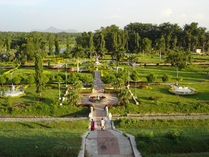
Gallery[]
")
")
._Between_1790_and_1792.jpg "View of Anchittidrug (Mysore). Between 1790 and 1792.jpg (188 KB)")
See also[]
- Transport in Krishnagiri
- Krishnagiri
References[]
- ^ www.tn.gov.in
- ^ "e-Governance in Pilot Basis". TNeGA. http://www.tnega.in/edistrict.html.
- ^ "CM to inaugurate e-Governance scheme in Krishnagiri". The Hindu. Sep 23, 2010. http://hindu.com/2010/09/23/stories/2010092351070300.htm.
- ^ "Arab political world's uncertainty shakes Mango export of India". BBC. http://www.bbc.co.uk/tamil/india/2011/11/111113_mangopulpexportwoes.shtml. Retrieved November 14, 2011.
- ^ "Krishnagiri Etymology". District Admin., Krishnagiri. http://www.krishnagiri.tn.nic.in/profile.htm.
- ^ a b c d e f "District Census 2011". Census2011.co.in. 2011. http://www.census2011.co.in/district.php. Retrieved 2011-09-30.
- ^ US Directorate of Intelligence. "Country Comparison:Population". https://www.cia.gov/library/publications/the-world-factbook/rankorder/2119rank.html. Retrieved 2011-10-01. "Lesotho 1,924,886"
- ^ "2010 Resident Population Data". U. S. Census Bureau. http://2010.census.gov/2010census/data/apportionment-pop-text.php. Retrieved 2011-09-30. "West Virginia 1,852,994"
- ^ http://www.tn.gov.in/deptst/agriculture.pdf
External links[]

|
Bangalore Rural district, Karnataka Bangalore district, Karnataka |
Kolar district, Karnataka | Chittoor district, Andhra Pradesh |
|
| Ramanagara district, Karnataka | Vellore district | |||
 Krishnagiri district | ||||
| Chamarajanagar district, Karnataka | Dharmapuri district | Tiruvannamalai district |
Template:Krishnagiri district
| ||||||||||||||||||||||||||||||||||||||||
| This page uses content from the English language Wikipedia. The original content was at Krishnagiri district. The list of authors can be seen in the page history. As with this Familypedia wiki, the content of Wikipedia is available under the Creative Commons License. |