| Main | Births etc |
|---|
| Krížová Ves | |||
|---|---|---|---|
| — Commune and village — | |||
 |
|||
|
|||
 |
|||

Krížová Ves |
|||

Krížová Ves |
|||
| Coordinates: | |||
| Country | |||
| Region | Prešov | ||
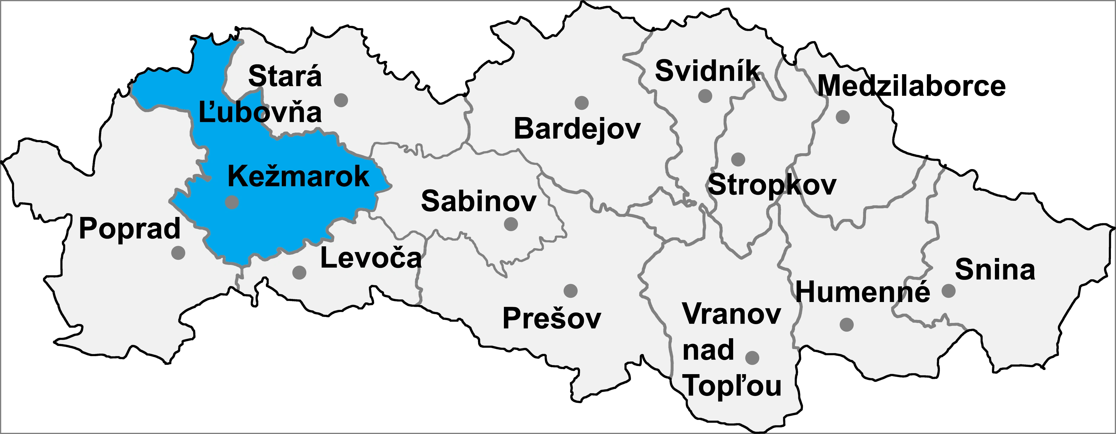
| District | Kežmarok | ||
| First mentioned | 1290 | ||
| Government | |||
| • Mayor | Jozef Grivalsky | ||
| Area | |||
| • Total | 11.93 km2 (4.61 sq mi) | ||
| Elevation | 594 m (1,949 ft) | ||
| Population (31.12.2014) | |||
| • Total | 2,121 | ||
| • Density | 177.79/km2 (460.5/sq mi) | ||
| Time zone | CET (UTC+1) | ||
| • Summer (DST) | CEST (UTC+2) | ||
| Postal code | 059 01 | ||
| Phone prefix | 421-53 | ||
| Website | [1] | ||

Krížová Ves (Hungarian: Keresztfalu - older name Keresztfalva, German: Kreuz) is a village and commune in Kežmarok District in the Prešov Region of north Slovakia.[1]
History[]
In historical records the village was first mentioned in 1290. Krížová Ves had been known also by its German name Kreuz.
Geography[]
The municipality lies at an altitude of 624 metres and covers an area of 11.928 km². It has a population of about 2000 people.
Demographics[]
According to 2010 census total population was 2008. In the village is sizeable Gypsy population, which had been claimed by 1249 inhabitants, which is ca. 62% of the total population. In 2010 there had been 1008 males and 1000 females.
Economy and infrastructure[]
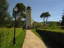
In Krížová Ves are a football pitch, public library, elementary school, kindergarten, cable TV, foodstuff store and a general store. Cultural sightseeings are gothic Roman Catholic and evangelical churches and a Renaissance manor house.
References[]
- ^ "Statistical Office of the Slovak Republic". Výsledky SODB 2011. Štatistický úrad SR. http://portal.statistics.sk/files/obce-pohl-vek.pdf. Retrieved 9.8.2012.
External links[]
| |||||||