| ||||||||||||||
| Kanyakumari district | |
|---|---|
| — district — | |
 |
|
 |
|
| Country | India |
| State | Tamil Nadu |
| District | Kanniyakumari |
| Established | 1 November 1956 |
| Headquarters | Nagercoil |
| Talukas | Agastheeswaram, Kallkkulam, Thovalai, Vilavancode |
| Government | |
| • Collector & District Magistrate | S. Nagarajan |
| Area | |
| • Total | 1,684 km2 (650 sq mi) |
| Population (2011)[1] | |
| • Total | 1,863,174 |
| • Density | 1,005.7/km2 (2,605/sq mi) |
| Languages | |
| • Official | Tamil, |
| Time zone | IST (UTC+5:30) |
| PIN | 629000 |
| Telephone code | 04652 & 04651 |
| Vehicle registration | TN-74 & TN-75 |
| Coastline | 72 kilometres (45 mi) |
| Sex ratio | M-1000/F-1014 ♂/♀ |
| Literacy | 97.6% |
| Legislature type | Elected |
| Legislature Strength | 6 |
| Lok Sabha constituency | Kanyakumari |
| Vidhan Sabha constituency | 6 |
| Precipitation | 1,865 millimetres (73.4 in) |
| Avg. summer temperature | 23 °C (73 °F) |
| Avg. winter temperature | 11 °C (52 °F) |
| Website | kanyakumari.tn.nic.in |
Kanyakumari District (also spelled Kanniyakumari or Kanniakumari District) is a district of Tamil Nadu state, India, and is the southernmost land area of mainland India.
The district is the second most urbanised district in Tamil Nadu — next only to Chennai and ahead of Coimbatore[2] — and is the second smallest of the 32 districts of Tamil Nadu. Kanyakumari shares it names with the town of Kanyakumari, which is at the tip of the Indian Peninsula and faces the Indian Ocean, but the administrative capital is Nagercoil. The district is also known as "The District of Ponds" or "The Lands End."
It was part of the princely state of Travancore until India's independence; it later formed a part of Travancore Cochin Presidency before the state of Kerala was formed. Subsequently, four of the eight taluks of Thiruvananthapuram district were separated to form the new district of Kanyakumari, and they were made a part of the Madras Presidency under recommendations from the States' Reorganisation Commission in 1956. The Presidency was later renamed as Tamil Nadu.
The district has a varied topography with sea on three sides and the mountains of the Western Ghats bordering the northern side.[3] The District was rated as one of India's Six Hidden Gems by National Geography.[4]
Location[]
Kanyakumari district is at the southern tip of peninsular India. It is bordered on the west by Thiruvananthapuram district of Kerala state and by Tirunelveli district of Tamil Nadu to the north and east. It is sometimes referred to as "Land's End".[5] The southeastern boundary is coastal and comprises the Gulf of Mannar (Bay of Bengal), while on the south and the southwest, the boundaries are the Indian Ocean and the Arabian Sea.
The district lies at geographical co-ordinates between 77° 15' and 77° 36' east and 8° 03' and 8° 35' north.
Administrative divisions[]

Padmanabhapuram Palace
For administrative purposes, the district comprises four taluks: Thovalai, Agastheeswaram, Kalkulam, and Vilavancode. It has nine blocks — Agastheeswaram, Rajakkamangalam, Thovalai, Kurunthancode, Thuckalay, Thiruvattar, Killiyur, Munchirai and Melpuram — and four municipalities: Nagercoil, Padmanabhapuram, Colachel and Kuzhithurai.
At the lower levels of administration, there are 99 village panchayats and a further 56 special category village panchayats.
The major towns of the district include:
- Agastheeswaram taluk: Nagercoil, Kanyakumari, Agastheeswaram, Suchindram and Rajakkamangalam.
- Thovalai taluk: Thovalai and Boothapandi.
- Kalkulam taluk: Padmanabhapuram-Thuckalay, Colachel, Kalkulam, Thiruvithamcode, Kurunthancode, Thiruvattar and Kulasekaram.
- Vilavancode Taluk: Karungal, Kuzhithurai-Marthandam, Vilavancode, Killiyur, Munchirai, Arumanai and Melpuram.
Demography[]
According to the provisional figures for the 2011 census, Kanyakumari district has a population of 1,863,174 and 82.47 percent of the district is urbanised. After Chennai, it has the highest population density in Tamil Nadu, with 1106 persons per km2. The literacy rate of 90.25 percent is the highest in Tamil Nadu. The district also has a high female sex ratio, as 1010 females are born for every 1000 males.[6]
Religion[]
As of 2001, the distribution of population based on religion was 51.27 percent Hindu, 44.47 percent Christian, 4.20 percent Muslim and 0.057 percent professing other beliefs.[7]
Festivals[]

An octo-circular Ayyavazhi Nizhal Thangal near Thiruvattar on the Martandam-Kulasekaram road.
The Mandaikadu festival is celebrated by people of the district and by those in Kerala. Traditionally, participants would chant while walking and other people would provide them with butter, milk, water, jaggery, and coffee. The festival, which is celebrated for ten days, later became a social function, especially on Sunday. In 1982 there were police shootings to quell a disturbance by anti-social religious radicals. Today, Mandaikadu is more of a departmental festival.
The Ayyavazhi festival, Ayya vaikunda Avataram, is widely celebrated throughout the district.[8][9] The Kodiyettru Thirunal is celebrated in the religious headquarters of Swamithope pathi and attracts large crowds[10] from Tamil Nadu and across India.[11][12][13]
New Year is celebrated with Vana Vediakkai (fireworks) and local games such as Valukku Panai (slippery palm), a game in which a person has to climb a bamboo stick that is flooded with oil.
Food[]


Munthiri Kothu, unique sweet of Kanyakumari District and neighboring Kerala
Rice is the staple food of the people, although for some people in the hilly areas, tapioca is the main food. Though there are some vegetarians among the populace, a majority of the people use agro, meat and fish products. Fish caught in the seas around the district during the night or early morning hours reach the markets in the interior towns and villages in the early morning. The food (for example, Chakkoli) is spicy, and the people in the district tend to use more grated coconut in their curries and food-preparations, like neighbouring Kerala.
Transport and highways[]
There are two major National Highways (NH) roads emanating from Kanyakumari town. One is the NH 7 that starts from the town and runs through Madurai and the other is the NH 47 that runs to Salem through Kerala, touching some important cities like Trivandrum, Kochi and Coimbatore.
The state-owned Tamil Nadu State Transport Corporation is the major operator of bus services in the district, though licences are issued for specific routes to private operators.
Today, there are 3495.80 km of surfaced roads in the district.
The Airport Authority of India have proposed for an airport in Nagercoil to tap the tourism potential of the southern districts of Tamil Nadu.[14] The nearest airports are Trivandrum International Airport and Tuticorin Domestic Airport, which are 70 kilometres (43 mi) and 110 kilometres (68 mi) from Nagercoil, respectively.
Railways[]
Nagercoil is a major railway junction, connecting the eastern and western rail lines and all the major cities in India. The busier western coast line runs through Kerala and the eastern runs into the Tirunelveli district of Tamil Nadu, towards Chennai. The rail link to Kanyakumari was established in 1978 and was technically a difficult feat due to the nature of the land. This was especially the case for the western route, which passes over substantial embankments and also hill tunnels. The railways are under the jurisdiction of the Thiruvananthapuram Division of the Southern Railway Zone.[15]
Nagercoil Railway Station which is one of the few A+ Grade Station's in South India is being Upgraded to become an Zone with its Headquarters being in Nagercoil. This will be created by carving Tirunelveli District and Thoothukudi District into this Region and Kanyakumari District from Thiruvananthapuram Railway division.[16]
Kanyakumari District is connected through direct train services with all the metropolitan cities in India, like New Delhi, Mumbai, Chennai, Bangalore and Kolkata. These Express trains originate either from Kanyakumari or Nagercoil.
Passenger (local) train services and other express trains run between Trivandrum Central and either Nagercoil or Kanyakumari. The journey by train from Trivandrum Central to Nagercoil usually takes two hours.
The Vivek Express, which is India's longest-running train, both in time and distance, runs between Kanyakumari town and Dibrugarh in Assam. The train covers 4,286 kilometres (2,663 mi) in 82 hours and 30 minutes.
Electricity generation[]


Kanyakumari district is a major center of windmill electricity generation.
There are two hydroelectric power stations at Kodayar, generating a combined 100 MW of power.[17]
Aralvaimozhi is a major centre for generation of windmill power and the largest in the world,[18][19] led by major corporations like Suzlon Energy and Micon.
Colachel Port[]
Colachel Port is a small natural harbour in the western side of the district near the town of Colachel.[20]
Education[]
Colleges of higher education are found throughout the district, mainly art, science and engineering colleges. The Scott Christian College, founded by William Tobias Ringeltaube in Nagercoil, is more than 100 years old.[21]
The state runs the Kanyakumari Government Medical College at Asaripallam, a Government Engineering College and a Government Polytechnic at Konam, near Nagercoil. Many private Engineering Colleges including a private university were started-functioning in the recent past. No fewer than 30 engineering colleges are functioning in the district which are currently affiliated to the Anna University; arts and science colleges are affiliated to Manonmaniam Sundaranar University, Tirunelveli. The Manonmaniam Sundaranar University runs a research unit — Centre for Marine Sciences and Technology — at Rajakamangalam, Kanyakumari District. Noorul Islam University is the only private university functioning at Thuckalay.
Rivers[]


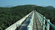
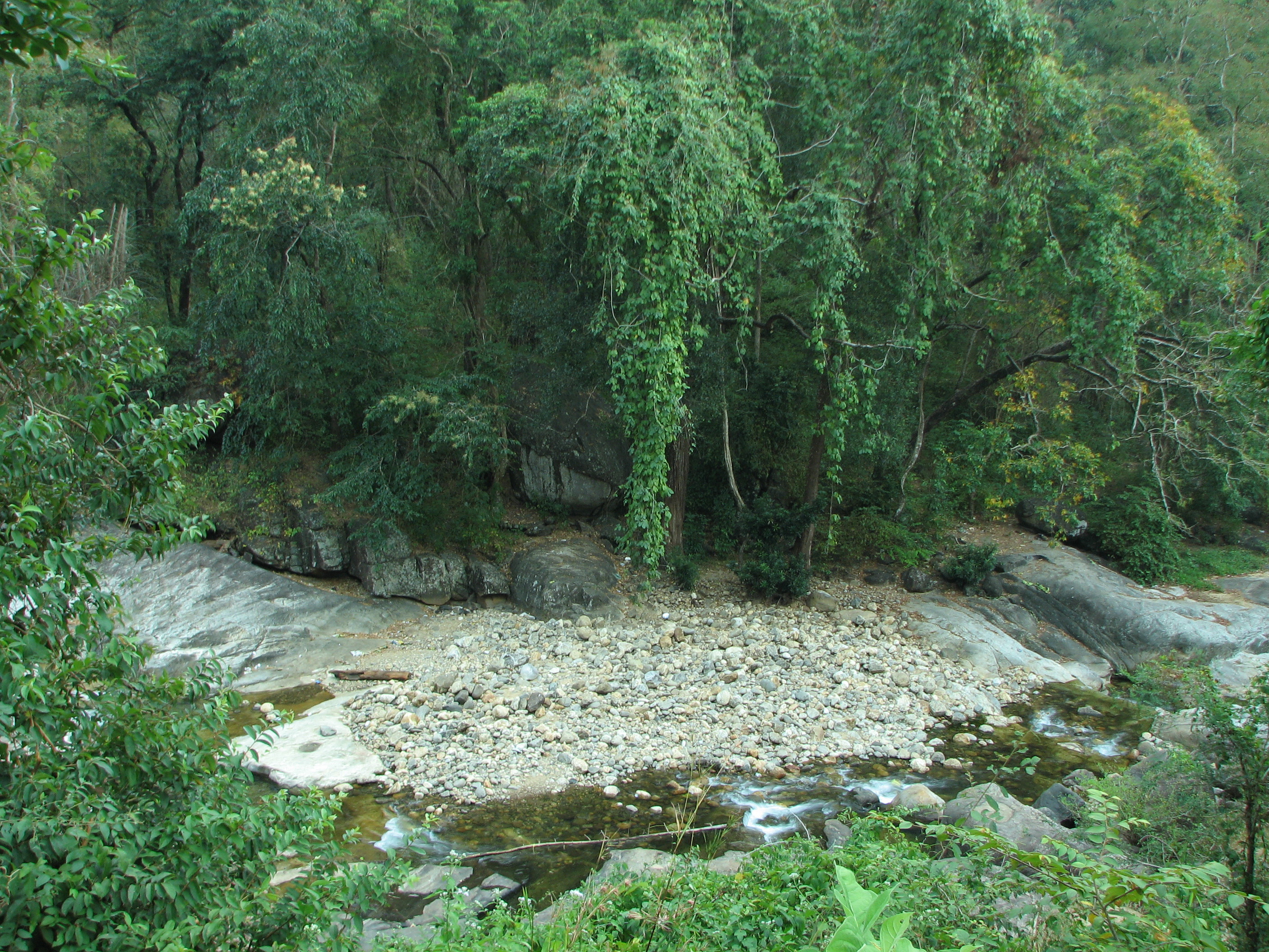
View from the Mathur Hanging Trough bridge with the Pahrali river flowing below.
The major river in the district is Thamirabarani locally known as Kuzhithuraiar. This river has two major tributaries, Kodayar and Paralayar, with the Pechiparai Dam and Perunchani Dam, respectively, built across them. There are many tributaries for the Kodayar River of which Chittar I and Chittar II, with their dams, are the major ones. The origin of Tambaraparani River is in the Western Ghats and the river confluences with Arabian sea near Thengapattanam, about 56 kilometres (35 mi) west of Kanyakumari town.
Valliar, another small river, along with its tributary Thoovalar, originates from the Velimalai Hills, collects drainage from P.P. Channel and its branches, ayacuts (irrigated area under a tank) and confluences with the Arabian Sea in Kadiapattinam.
The Pazhayar River, another small river, starts at Shorlacode, about 18 kilometres (11 mi) north-west of Nagercoil. This is polluted as it collects drainage of Thovalai, Ananthanar and N.P. Channels on its course.
The Pahrali River also flows through the district. The Mathur Hanging Trough, the highest and longest aqueduct in Asia, was built over it near Mathur.
Forests[]

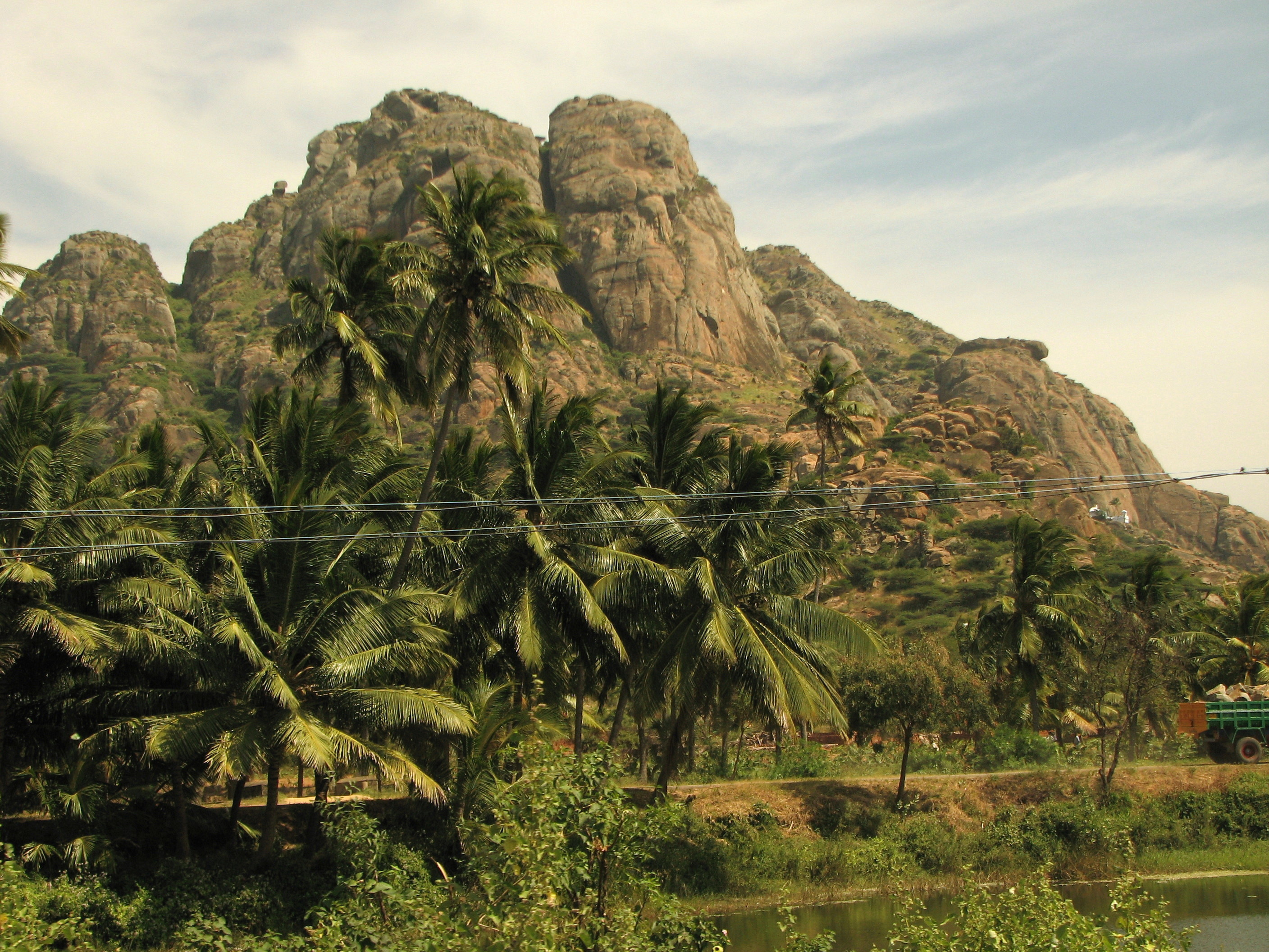
Keeriparai, the district comprises a sizeable area of lush forests
The forests in Kanyakumari District are about 75 million years old. Of the total district area of 1671.3 km², government forests occupy an area of 504.86 km² which comes to about 30.2 percent of the geographical area of the district. The forests of the district are administered through the Kanyakumari Forest Division, with headquarters at Nagercoil, the capital of Kanyakumari District.
There are 14 types of forests from luxuriant tropical wet evergreen to tropical thorn forests. This variety occurs in the district because of diverse locality factors.[22] Rainfall varies from 103 cm to 310 cm elevation from sea level to 1829 m. The forest area is 30.2% of the total district geographical area which is next to Nilgiris district with 59% and Dharmapuri District with 38% in Tamil Nadu State. 52% of the district's forests are classified as dense forests, which is second only to Dharmapuri District with 58%.
The forests contain species such as Mesua ferrea, Bischofia Javanica, Vitex altissima to smaller trees of Dillini a species festooning climber, shrubs, valuable herbs, variety of orchids, two types of canes, many indigenous palms and cycas. The important timbers are teak, rosewood, vengai and aini. Various types of forest products like bamboos, reeds, canes, soft wood, tamarind, lemon grass, rubber, coconut, arecanut, terminalia chebula, cinnamon bark nelli, cardamom, mango and many medicinal plants are harvested in this district. The Maruthuvalmalai, a hill located among green paddy fields and coconut palms, is famous for valuable medicinal plants. This is the only district in Tamil Nadu where rubber and clove plantations have been raised in reserve forests in an area of 47.857 km² and 1.1 km² respectively. The district is rich in wildlife with at least 25 types of mammals, about 60 species of birds including 14 species of migratory birds and many species of fishes, reptiles and amphibians listed.
The following are the reserve forests in Kanyakumari Forest Division:
- Therkumalai East and West - 17.4 km²
- Thadagaimalai - 7.9 km²
- Poigaimalai - 12.4 km²
- Mahendragiri - 43.6 km²
- Veerapuli - 281.9 km²
- Velimalai - 11.2 km²
- Old Kulasekaram - 6.9 km²
- Kilamalai - 81.06 km²
- Asambu - 43.10 km²
Flora and fauna[]
Fauna[]
The flora and fauna of Kanyakumari District are vast and diverse.
Animals on the hills of the district include Bengal Tiger, Elephant, Sambar Deer, Porcupines, Hedgehogs and wild boar, while pied kingfisher, Painted Stork and cranes are commonly found in the water bodies and wetlands. Reptiles include Monitor Lizards, Pythons,Blood Viper and other snakes.
In Mahendragiri hills (about 4,000 ft (1,200 m) above sea level), one can find Elephant, Tiger, Leopards and deer. Leopard cubs often stray onto the highway near the hills and are sometimes run over by motorists.
The Keeriparai and Maramalai hills are habitats for wild Elephants and Indian Bison. The Kodayar hills are the breeding centers for the Indian rock pythons and Indian Bison. In the Theroor wetlands, one can see several varieties of storks and migratory birds during specific seasons. Trout and other varieties of freshwater fish are found in the Pechiparai reservoir.
The district also has a wildlife sanctuary and a bird sanctuary[23]
Flora[]
Kanyakumari district is noted for its medicinal plants and herbs. The district also has a huge forest cover, accommodating a wide variety of plants, trees, and shrubs.
Commercial varieties include various kinds of Plantain (like Nenthiram, Palayamkotan, Thuluvam, Matti), jackfruit (like Varikila and Koolan), mango (varieties like Alphonsa, Bangalora, Neelam and Ottu) and coconut. In addition to fruits, a variety of flowers like roses and jasmine are also produced. Common garden varieties in the district include crotons, lillies, and dahlias.
Areas like Keeriparai are home to varieties of ferns, bamboos and other tropical plants. Flame of the Forest (Butea monosperma), a tree with reddish and orange leaves and flowers, is found in the Pechiparai Reservoir. Rubber estates are found in the hilly areas surrounding Arumanai, Kaliyal, and Kadayal.

Maruthuvazhmalai (or medicinal) Hill, near Kanyakumari.
Tourist attractions[]


Thiruparappu falls (top view)

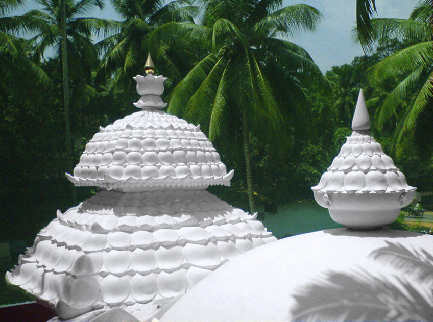
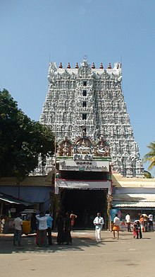
Suchindram temple


St. Xavier's Church, Kottar, Nagercoil


Map showing near-by areas and Pancha pathi


Thirparappu Temple, near Thirparappu Waterfalls


Vellimalai Hill

Mathur Aqueduct (Mathur Hanging Trough Bridge) – one of the largest Aqueducts in Asia
Kanyakumari district has various eco-systems, including beaches, mountain valleys and evergreen forests, as well as rubber and clove plantations
- The Padmanabhapuram Palace complex is located in the granite Padmanabhapuram Fort, close to Thuckalay and at the foot of the Veli Hills, which form a part of the Western Ghats. The river Valli flows nearby.[24]


Chothavilai Beach, near Nagercoil
- Vattakottai Fort (literally, "circular fort") is an 18th-century fort overlooking the sea, located six kilometres from Kanyakumari.
- St. Xavier's Church, Kottar, Cathedral of the Roman Catholic diocese of Kottar, where St. Francis Xavier celebrated Mass in the 16th century.
- Suchindram has the Sthanumalayan temple with a repository of art treasures belonging to several kingdoms. The temple is famous for its ninth-century inscriptions, musical columns, and 6-meter-tall statue of the monkey god Hanuman. The main deity in the form of a shivlinga represents Shiva, Vishnu, and Brahma, the trinity of the Hindu pantheon.
- The Panchappathi, five primary sacred places of Ayyavazhi are all situated within a fifteen-kilometre radius of Kanyakumari. It also includes the Swamithope Pathi (headquarters of Ayyavazhi), a famous temple in Tamil Nadu, situated ten kilometres to the northwest. It is not structurally massive temple, but is known for its non-idolatry system of worship.
- Udayagiri Fort, built by King Marthanda Varma, has a foundry for casting guns. It is also the tomb-site of the king's trusted European general Captain De Lennoy. Udayagiri Fort is now a bio-diversity park, administered by the Department of Forests, Kanyakumari Division.
- Mathur Hanging Trough, near Thiruvattar in the District, is an aqueduct that carries irrigation water through a canal between two hills. The canal itself goes above a small river. Built on very high pillars, is one of the biggest aqueducts, both in height and length, in Asia. The view from the middle of the aqueduct of the surrounding hills and vegetation, and the small river flowing down below, is breathtaking.
- The Chitharal Jain Monuments, situated about 35 km (22 mi) from Marthandam, are rock shelters and idols dating from the 9th- to 11th-centuries.
- Olakaruvi waterfalls, about 20 km (12 mi) from Nagercoil is on the middle of a hill and requires an hour's trek by foot from the base of the hill (better to go in a group, as it is a forested area)
- Pechiparai Reservoir, about 30 km (19 mi) from the town, and also Perunchani and Chittar dams).
- Thiruparrapu Falls, is a waterfall near Thiruparrapu. There is an ancient temple near the falls, which is popular among the locals and Keralites.
- Sanguthurai Beach, about 8 km (5.0 mi) from Nagercoil is a palm-fringed and sandy beach. Sothavilai Beach is another good beach, about 7 km (4.3 mi)from the heart of town. Both beaches were hit by the Indian Ocean Tsunami, but authorities have taken steps to improve facilities again. There is a lagoon at Manakudy – 10 km (6 mi) from the town.
- Mukkudal reservoir : Fresh water supply to Nagercoil is from the Mukkadal Reservoir, about 8 km (5.0 mi) from the town, in the interior – itself a scenic place, with a small bushy island in the middle of the dam. The dam is surrounded by hills of the Western Ghats.
- Kalikesam,- is a scenic picnic spot. The Kali temple situated here attracts many pilgrims.
Indian Ocean tsunami[]

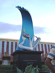
Tsunami memorial in Kanyakumari beach
Kanyakumari district was one of the worst affected districts in India in the tsunami that ravaged the coasts of various countries in South and South East Asia, on 26 December 2004. There were nearly 900 deaths and several hundreds missing and injured. Social organizations from several countries and the Government have since been working on rehabilitating the affected people and property.
Notable people[]
Notable people from the district include:
- Martyr Devasahayam Pillai (23 April 1712—14 January 1752), an affluent 18th century Nair-convert to Christianity who was executed and attained martyrdom at Kattadimalai but was buried inside St. Xavier`s Cathedral Church, Kottar. Now recommended for beatification in the Catholic religion.
- `Kalaivanar` N. S. Krishnan [2]- Tamil film comedian and drama Actor
- Marshal Nesamony - leader of the movement for the merger of Kanyakumari district with Tamil Nadu (then Madras State) from Kerala (then Travancore-Cochin state) and three times Lok Sabha MP
- A. Chidambaranatha Nadar, Minister of Travancore-Cochin
- Kunjan Nadar, Vattiyoorkavu Veeran, leader of Congress, legislator
- Lourdammal Simon,Ex-MLA and Minister of Tamil Nadu Govt. for Local Administration in K. Kamaraj(C.M.)`s Second Cabinet(1957-1962)
- Jegath Gaspar Raj - founder & Managing Trustee of Tamil Maiyam and he hails from Kanjampuram in Kanyakumari Dist.
- Sathyaneshan Nadar - actor in Malayalam films
- N. Dennis - former MP Six Terms - 7,8,9,10,11,12 Lok Sabha
- S. Venkitaramanan - former Governor of Reserve Bank of India
- Admiral Sushil Kumar - 18th Chief of Naval Staff of India
- David Davidar - English writer and ex-CEO of Penguin India (publishers).
- Bala Prajapathi Adikalar, present Pattathu Ayya of Swamithope pathi and a leader of the Ayyavazhi.
- Jeyamohan, literary writer and novelist in Tamil and Malayalam
- Menaka (actress),actress in Tamil and Malayalam films
- Velu Thampi Dalawai (1765–1809) - the Diwan of Travancore under the Maharaja Balaramavarma. Led the rebellion against the English East India Company, and started Nair Pattalam
- Thikkurissi Sukumaran Nair - Malayalam actor and poet
- Kumari Anandan, Tamil scholar, writer and orator; ex-MLA four times,ex-MP and former president of TNCC.
- H. Vasanthakumar, businessman. owner of Vasanth & Co retail chain and Vasanth TV
- Kavimani Desika Vinayagam Pillai - Tamil poet and scholar
- Sathavathani Sheikh Thambi Pavalar[25] - amil poet, scholar and freedom fighter
- Most Rev.Francis Kalist, Roman Catholic Bishop of Meerut diocese in Uttar Pradesh,
- K. V. Mahadevan (1918–2001) - film music director and National Award winner.
- C. Boaz - social activist
- His Grace Most Rev.Dr.Soosa Pakiam M, Arch Bishop, Latin Arch Diocese Of Thiruvananthapuram
- Mullanchery M Velaian - Organizer Kumari Arivial Peravai(KAP)
- {[R. Ponnappa Nadar]} - Leader of the Opposition Tamilnadu Assembly
See also[]
- List of Colleges in Kanyakumari District
- Bhoothapandi Temple
References[]
- ^ "2011 Census of India" (Excel). Indian government. 16 April 2011. http://www.censusindia.gov.in/2011-prov-results/prov_data_products_tamilnadu.html.
- ^ Kumari second most urbanised TN district - South India - Tamil Nadu - ibnlive
- ^ Kanyakumari District Website
- ^ " India: six great hidden gems by train"
- ^ "Tourism fete to be held in Kanyakumari". The Hindu (Chennai, India). 24 January 2009. http://www.hindu.com/2009/01/04/stories/2009010450550200.htm. Retrieved 2009-05-24.
- ^ 2011 census
- ^ "Religion wise Population — Census 2001". Ministry of Home Affairs (Directorate of Census Operations — Tamil Nadu). http://census2001.tn.nic.in/religion.aspx. Retrieved 2011-01-03.
- ^ The Daily Thanthi, Nagercoil Edition, 5/4/2006.
- ^ Report on declaration of holiday for the festival "Dina Malar". http://www.dinamalar.com/2006mar03/general_tn3.asp Report on declaration of holiday for the festival. Retrieved 2007-02-03.
- ^ Report on the festival "The Hindu" ("Thousands of people witnessed the Vaikasi car festival at Vaikundar temple at Swamithoppu..."). http://www.hindu.com/2008/06/03/stories/2008060351640300.htm Report on the festival. Retrieved 2008-06-03.
- ^ The Daily Thanthi (Nagercoil Edition), 29-1-2007, Page 12, "Devotees from the districts of Kanyakumari, Tirunelveli, Thoothukkudi, Theni, Chennai, Coimbatore and also from the State of Kerala participated in the Car festival."
- ^ The Daily Thanthi (Coimbatore Edition), 3-6-2008, Page 4, "Thousands of devotees from the districts of Madurai, Tirunelveli, Thoothukkudi, Theni, Coimbatore and also from the State of Kerala participated in the Car festival."
- ^ Dinakaran (Tirunelveli Edition), 3-6-2008, Page 6, "Thousands of devotees from the districts of Kanyakumari, Tirunelveli, Thoothukkudi, Theni, and also from the State of Kerala participated in the Car festival."
- ^ Airport for Nagercoil
- ^ .“Expedite railway station work at Parvathipuram”
- ^ "Nagercoil Division to Be Formed in 'Next Parliament Budget':Railway Officials"
- ^ "Kodayar I Hydroelectric Power Plant India - GEO". Globalenergyobservatory.org. http://globalenergyobservatory.org/geoid/3878. Retrieved 2012-10-17.
- ^ "Tapping the Wind - India". February 2005. http://www.tve.org/ho/doc.cfm?aid=1678&lang=English. Retrieved 2006-10-28.
- ^ Watts, Himangshu (November 11 2003). "Clean Energy Brings Windfall to Indian Village". Reuters News Service. http://www.planetark.com/dailynewsstory.cfm/newsid/22758/story.htm. Retrieved 2006-10-28.
- ^ New project to promote tourism in lighthouses
- ^ "SCC Nagercoil". http://www.scottchristian.org/aboutus.php. Retrieved 10 October 2012.
- ^ (according to Champion and Seth's classification)
- ^ GRUBH, SHAILAJA ROBERT (2003-02-01). "Sanctuary in the lowland plains". The Hindu (Chennai, India). http://www.hindu.com/thehindu/yw/2003/02/01/stories/2003020101320300.htm. Retrieved 2009-01-08.
- ^ Padmanabhapuram Palace - Padmanabhapuram Palace Trivandrum Kerala, Padamanabha Puram Palace Thiruvananthapuram India
- ^ [1] Sathavathani Sheikh Thambi Pavalar
External links[]

|
Thiruvananthapuram district, Kerala | Tirunelveli district |
| |
 Kanyakumari district | ||||
| Lakshadweep Sea | Indian Ocean | Gulf of Mannar |
Template:District of Kanyakumari
| ||||||||||||||||||||||||||||||||||||||||
| This page uses content from the English language Wikipedia. The original content was at Kanyakumari district. The list of authors can be seen in the page history. As with this Familypedia wiki, the content of Wikipedia is available under the Creative Commons License. |