| Main | Births etc |
|---|
| Kaliningrad Oblast | |||
|---|---|---|---|
| Калининградская область (Russian) | |||
| — Oblast — | |||
|
|||
 |
|||
| Coordinates: Coordinates: | |||
| Political status | |||
| Country | Russia | ||
| Federal district | Northwestern[2] | ||
| Economic region | Kaliningrad[3] | ||
| Established | April 7, 1946[4] | ||
| Administrative center | Kaliningrad | ||
| Government (as of October 2016) | |||
| - Governor[5] | Anton Alikhanov | ||
| - Legislature | Oblast Duma[6] | ||
| Statistics | |||
| Area (as of the 2002 Census)[7] | |||
| - Total | 15,100 km2 (5,830.1 sq mi) | ||
| Area rank | 76th | ||
| Population (2010 Census)[8] | |||
| - Total | 941,873 | ||
| - Rank | 56th | ||
| - Density[9] | 62.38 /km2 (161.6 /sq mi) | ||
| - Urban | 77.6% | ||
| - Rural | 22.4% | ||
| Population (January 2020 est.) | 1,012,253 inhabitants[10] | ||
| Time zone(s) | USZ1 (UTC+03:00)[11] | ||
| ISO 3166-2 | RU-KGD | ||
| License plates | 39, 91 | ||
| Official languages | Russian[12] | ||
| Official website | |||


Kaliningrad Oblast (dark green) of Russia (light green) within Europe
Kaliningrad Oblast (Russian: Калинингра́дская о́бласть, Kaliningradskaya Oblast), often referred to as the Kaliningrad Region in English,[13][14] or simply Kaliningrad, is a federal subject and semi-exclave of Russia located in Central Europe, on the coast of the Baltic Sea. Its constitutional status is equal to each of the other 85 federal subjects. Its administrative centre is the city of Kaliningrad, formerly known as Königsberg. The port of Baltiysk, in the oblast, is the only Baltic port in the Russian Federation that remains ice-free in winter. According to the 2010 census, it had a population of 941,873.[8]
The oblast is bordered by Poland to the south, Lithuania to the north and east, and the Baltic Sea to the west. It is impossible to travel overland between the oblast and Russia without passing through at least two other countries. The territory was formerly the northern part of the Prussian province of East Prussia, the southern part of which is today part of the Warmian-Masurian Voivodeship in Poland. With the defeat of Nazi Germany in 1945 in the Second World War, the territory was annexed as part of the Russian SSR by the Soviet Union. Following the post-war migration and flight and expulsion of Germans, the territory was populated with citizens from the Soviet Union. As of the 2010 census, only a small number of ethnic Germans remain;[15] most of the several thousand who live in the oblast are recent immigrants from other parts of the former Soviet Union.
Early in the 21st century, the economy of Kaliningrad Oblast became one of the best performing economies in Russia. This was helped by a low manufacturing tax rate related to the Yantar "Special Economic Zone" (SEZ), which is located inside the oblast. As of 2006, one in three television sets manufactured in Russia came from Kaliningrad. The territory's population was one of the few in Russia that was expected to show strong growth after the collapse of the USSR.[16]
History[]
Middle Ages[]

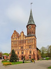
Königsberg Cathedral
During the Middle Ages, the territory of what is now the Kaliningrad Oblast was inhabited by tribes of Old Prussians (Sambians) in the western part and by Lithuanians in the eastern part. The tribes were divided by the rivers Pregolya and Łyna. The Teutonic Knights conquered the region and established a monastic state. On the foundations of a destroyed Prussian settlement known as Tvanksta, the Order founded the city of Königsberg (modern Kaliningrad). Germans resettled the territory and assimilated the indigenous Old Prussians. The Lithuanian-inhabited areas became known as Lithuania Minor. Speakers of the old Baltic languages became extinct around the 17th century, having been assimilated and Germanised.
Pre-Modern Period[]
  History of Brandenburg and Prussia | |||
| Northern March pre-12th century |
Old Prussians pre-13th century | ||
| Margraviate of Brandenburg 1157–1618 (1806) |
Ordensstaat 1224–1525 | ||
| Duchy of Prussia 1525–1618 |
Royal (Polish) Prussia 1466–1772 | ||
| Brandenburg-Prussia 1618–1701 | |||
| Kingdom in Prussia 1701–1772 | |||
| Kingdom of Prussia 1772–1918 | |||
| Free State of Prussia 1918–1933 |
Klaipėda Region (Lithuania) 1920-39 / 1945-present | ||
| Free State of Prussia 1933–1947 | |||
| Brandenburg (Germany) 1947–1952 / 1990–present |
Recovered Territories (Poland) 1918/45-present |
Kaliningrad Oblast (Russia) 1945-present | |
In 1525, Grand Master Albert of Brandenburg secularized the Prussian branch of the Teutonic Order and established himself as the sovereign of the Duchy of Prussia. The duchy was nominally a fief of the Polish crown. It later merged with the Margraviate of Brandenburg. Königsberg was the duchy's capital from 1525 until 1701. As the centre of Prussia moved westward, the position of the capital became too peripheral and Berlin became the new Prussian capital city. During the Seven Years' War it was occupied by the Russian Empire. The region was reorganized into the Province of East Prussia within the Kingdom of Prussia in 1773. The territory of the Kaliningrad Oblast lies in the northern part of East Prussia.
Modern period[]
Historical ethnic and religious structure[]
In 1817, East Prussia had 796,204 Protestants, 120,123 Roman Catholics, 2,389 Jews, and 864 Mennonites.[17]
In 1824, shortly before its merger with West Prussia, the population of East Prussia was 1,080,000 people.[18] Of that number, according to Karl Andree, Germans were slightly more than half, while 280,000 (~26%) were ethnically Polish and 200,000 (~19%) were ethnically Lithuanian.[19] As of 1819 there were also 20,000 strong ethnic Curonian and Latvian minorities as well as 2,400 Jews, according to Georg Hassel.[20] Similar numbers are given by August von Haxthausen in his 1839 book, with a breakdown by county.[21] However, the majority of East Prussian Polish and Lithuanian inhabitants were Lutherans, not Roman Catholics like their ethnic kinsmen across the border in the Russian Empire. Only in Southern Warmia (German: Ermland) Catholic Poles – so called Warmiaks (not to be confused with predominantly Protestant Masurians) – comprised the majority of population, numbering 26,067 people (~81%) in county Allenstein (Polish: Olsztyn) in 1837.[21] Another minority in 19th century East Prussia, were ethnically Russian Old Believers, also known as Philipponnen – their main town was Eckersdorf (Wojnowo).[22][23][24]
German culture and Germanization[]
East Prussia was an important centre of German culture. Many important figures, such as Immanuel Kant and E. T. A. Hoffmann, came from this region. Despite being heavily damaged during World War II and thereafter, the cities of the oblast still contain examples of German architecture. The Jugendstil style showcases the rich German history and cultural importance of the area.
By the early 20th century, Lithuanians formed a majority only in rural parts of the north-eastern corner of East Prussia (Memelland and Lithuania Minor). The same was true of the Latvian-speaking Kursenieki who had settled the coast of East Prussia between Gdańsk and Klaipėda. The rest of the area, with the exception of the Polish Masurians in Mazury (southern Prussia), was overwhelmingly German-speaking.
The Memel Territory (Klaipėda region), formerly part of north-eastern East Prussia as well as Lithuania Minor, was annexed by Lithuania in 1923. In 1938, Nazi Germany radically renamed about a third of the place names of this area, replacing Old Prussian and Lithuanian names with newly invented German names.
")
")
")
Takeover by the Soviet Union[]
On August 29, 1944, Soviet troops reached the border of East Prussia. By January 1945, they had taken all of East Prussia except for the area around Königsberg. Many inhabitants fled west at this time. During the last days of the war, over two million people fled before the Red Army and were evacuated by sea. Under the terms of the Potsdam Agreement, the city became part of the Soviet Union pending the final determination of territorial questions at a peace settlement. This final determination took place on September 12, 1990 with the signing of the Treaty on the Final Settlement with Respect to Germany. The excerpt pertaining to the partition of East Prussia including the area surrounding Königsberg is as follows (note that Königsberg is spelt "Koenigsberg" in the original document):
VI. CITY OF KOENIGSBERG AND THE ADJACENT AREA
The Conference examined a proposal by the Soviet Government that pending the final determination of territorial questions at the peace settlement, the section of the western frontier of the Union of Soviet Socialist Republics which is adjacent to the Baltic Sea should pass from a point on the eastern shore of the Bay of Danzig to the east, north of Braunsberg – Goldep, to the meeting point of the frontiers of Lithuania, the Polish Republic and East Prussia.The Conference has agreed in principle to the proposal of the Soviet Government concerning the ultimate transfer to the Soviet Union of the city of Koenigsberg and the area adjacent to it as described above, subject to expert examination of the actual frontier.
The President of the United States and the British Prime Minister have declared that they will support the proposal of the Conference at the forthcoming peace settlement.[25]
Königsberg was renamed Kaliningrad in 1946 in memory of Chairman of the Presidium of the Supreme Soviet of the USSR Mikhail Kalinin. The remaining German population was forcibly expelled between 1947 and 1948. The conquered territory was populated with citizens of the Soviet Union, mostly ethnic Russians but to a lesser extent also Ukrainians and Belarusians.[26]
The German language was replaced with the Russian language. In 1950, there were 1,165,000 inhabitants, which was only half the number of the pre-war population.
Cold War period[]
The city was rebuilt during the Cold War. The territory became strategically important as the headquarters of the Soviet Baltic Fleet, as the port is ice-free in winter unlike Saint Petersburg (then Leningrad). Consequently, the city was closed to foreign visitors.
In 1957, an agreement was signed and later came into force which delimited the border between Poland and the Soviet Union.[27][28]
The region was added as a semi-exclave to the Russian SFSR; since 1946 it has been known as the Kaliningrad Oblast. According to some historians, Stalin created it as an oblast separate from the Lithuanian SSR because it further separated the Baltic states from the West.[29] The names of the cities, towns, rivers and other geographical features were changed to Russian names.
The area was administered by the planning committee of the Lithuanian SSR, although it had its own Communist Party committee. However, the leadership of the Lithuanian SSR (especially Antanas Sniečkus) refused to annex the territory.[26] In 2010, the German magazine Der Spiegel published a report claiming that Kaliningrad had been offered to Germany in 1990 (against payment), but this was denied by Mikhail Gorbachev.[30]
Today[]

Kaliningrad's isolation was exacerbated by the collapse of the Soviet Union in 1991 when Lithuania became an independent country and even more when both Poland and Lithuania became members of NATO and subsequently the European Union in 2004. Since the dissolution of the Soviet Union and the independence of the Baltic states, Kaliningrad Oblast has been separated from the rest of Russia by other countries instead of by other Soviet republics. Neighboring nations imposed strict border controls when they joined the European Union. All military and civilian land links between the region and the rest of Russia have to pass through members of NATO and the EU. Russian proposals for visa-free travel between the EU and Kaliningrad have so far been rejected by the EU. Travel arrangements, based on the Facilitated Transit Document (FTD) and Facilitated Rail Transit Document (FRTD)[31][32] have been made.[31][32] On January 12, 1996, Kaliningrad Oblast, alongside Sverdlovsk, became the first oblasts of Russia to sign a power-sharing treaty with the federal government, granting it autonomy.[33] However this agreement was abolished on May 31, 2002.[34]
The territory's economic situation was badly affected by its geographic isolation and the significant reduction in the size of the Russian military garrison, which had previously been one of the major employers and helped the local economy.
After 1991, some ethnic Germans immigrated to the area, such as Volga Germans from other parts of Russia and Kazakhstan, especially after Germany raised the requirements for people from the former Soviet Union to be accepted as ethnic Germans and have a "right of return".

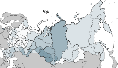
Distribution of Germans in Russia, 2010, demonstrating the higher German presence in the Kaliningrad Oblast compared to other areas in European Russia
These Germans are overwhelmingly Russian-speaking and as such were rejected for resettlement within Germany under Germany's new rules. A similar migration by Poles from the lands of the former Soviet Union to the Kaliningrad Oblast occurred at this time as well. The situation has begun to change, albeit slowly. Germany, Lithuania, and Poland have renewed contact with Kaliningrad Oblast, through town twinning and other projects. This has helped to promote interest in the history and culture of the East Prussian and Lietuvininkai communities.
In July 2005, the 750-year jubilee of the city was widely celebrated.
In July 2007, Russian First Deputy Prime Minister Sergei Ivanov declared that if US-controlled missile defense systems were deployed in Poland, then nuclear weapons might be deployed in Kaliningrad. On November 5, 2008, Russian leader Dmitry Medvedev said that installing missiles in Kaliningrad was almost a certainty.[35] These plans were suspended in January 2009,[36] but implemented in October 2016.[37] In 2011, a long range Voronezh radar was commissioned to monitor missile launches within about 6,000 km. It is situated in the settlement of Pionersky (formerly German Neukuhren) in Kaliningrad Oblast.[38]
Geography[]


Map of Kaliningrad Oblast

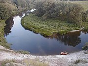
Angrapa River, Kaliningrad Oblast
Kaliningrad is the only Russian Baltic Sea port that is ice-free all year round and hence plays an important role in maintenance of the Baltic Fleet. As a semi-exclave of Russia, it is surrounded by Poland (Pomeranian and Warmian-Masurian Voivodeships), Lithuania (Klaipėda, Marijampolė and Tauragė Counties) and the Baltic Sea. Its largest river is the Pregolya. It starts as a confluence of the Instruch and the Angrapa and drains into the Baltic Sea through the Vistula Lagoon. Its length under the name of Pregolya is 123 km (76 mi), 292 km (181 mi), including the Angrapa.
Notable geographical features include:
- Curonian Lagoon (shared with Lithuania)
- Vistula Lagoon (shared with Poland)
Major cities and towns:
| Russian | German † | Lithuanian † | Polish † | |
|---|---|---|---|---|
| Baltiysk | Балтийск | Pillau | Piliava | Piława |
| Chernyakhovsk | Черняховск | Insterburg | Įsrutis | Wystruć |
| Gusev | Гусев | Gumbinnen | Gumbinė | Gąbin |
| Kaliningrad | Калининград | Königsberg | Karaliaučius | Królewiec |
| Sovetsk | Советск | Tilsit | Tilžė | Tylża |
† Pre-1946 (the German-language names were also used in English in this period)
Politics[]
The current governor (since 2017) of Kaliningrad Oblast is Anton Alikhanov. The latest elections to the region's legislative body, the 40-seat Kaliningrad Oblast Duma, were held in September 2016.
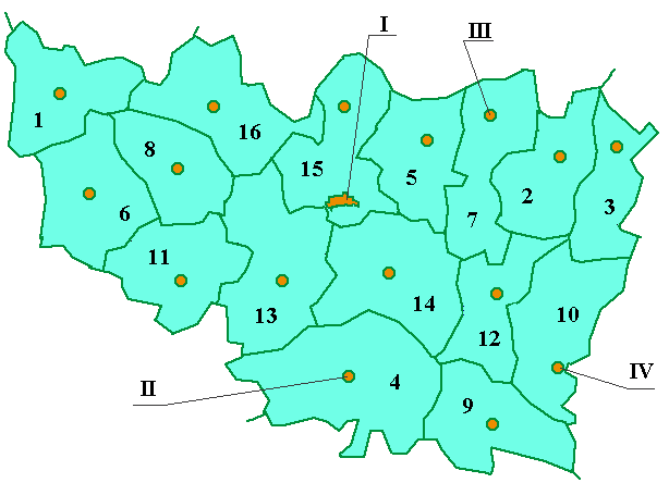
Administrative divisions[]
The oblast includes 16 rayons (districts) and 8 cities of regional importance and urban type settlement.

Administrative divisions (raions) of Vladimir Oblast
Urban Okrugs (Circles)
| № | Coat of Arms | Name of Urban okrug |
Area (km²) |
Population (2010). |
Population Rank | |||||||
|---|---|---|---|---|---|---|---|---|---|---|---|---|
| I | Kaliningrad | 308,0 | 340 188 | 1 | ||||||||
| II | Baltiysk | 43,0 | 63 432 | 4 | ||||||||
| III | Ladushkin | 57,4 | 148 355 | 2 | ||||||||
| IV | Mamonovo | 43,8 | 116 991 | 3 | ||||||||
| V | Pionersky | 113,2 | 17 899 | 5 | - | VI | Svatly | 57,4 | 148 355 | 2 | ||
| IV | Murom | 43,8 | 116 991 | 3 | ||||||||
| V | Raduzhny (ZATO) | 113,2 | 17 899 | 5 |
Template:Kaliningrad Oblast Map
Rayons (Districts)
| № | Coat of Arms | Name of rayon | Area (km²) |
Area rank |
Population '000 (2010) |
Population rank |
Аdministrative center |
Population '000 (2010) | ||
|---|---|---|---|---|---|---|---|---|---|---|
| 1 | Bagrationovsk Rayon | 1 834 | 6 | 114 613 | 1 | Bagrationovsk | 62 713 | |||
| 2 | Chernyakovsk Rayon | 2 252 | 3 | 81 011 | 2 | Chernyakovsk | 40 479 | |||
| 3 | Gvardeisky Rayon | 1 487 | 10 | 22 696 | 15 | Gvardeisky | 13 099 | |||
| 4 | Guryevsk | 4 370 | 1 | 44 032 | 7 | Guryevs | ||||
| 5 | Gusev | 1 090 | 15 | 31 797 | 12 | Gusev | 13 494 | |||
| 6 | File:Coat of Arms of Krasnoznamensk (Kaliningrad oblast).png.gif | Krasnoznamensk Rayon | 1 135 | 14 | 40 042 | 9 | Krasnoznamensk | 29639 | ||
| 7 | Neman Rayon | 1 817 | 7 | 29 659 | 13 | Neman | ||||
| 8 | Nesterov Rayon | 1 148 | 13 | 55 534 | 5 | Nesterov | 45 379 | |||
| 9 | Ozyorsk Raypn | 2 221 | 4 | 36 945 | 11 | Ozyorsk | 15 097 | |||
| 10 | Polessk Rayon | 1 050 | 16 | 24 683 | 14 | Polessk | ||||
| 11 | Pravdinsk Rayon | 1 692 | 8 | 63 279 | 3 | Pravdinsk | 14 523 | |||
| 12 | Slavsk | 1 388 | 12 | 18 863 | 16 | Krasnaya Gorbatka | 8 478 | |||
| 13 | Zeleznograd | 1 524 | 9 | 57 854 | 4 | Sobinka | 19 328 |
.png.gif)
Demographics[]
Settlements[]
Largest cities or towns in Kaliningrad Oblast
2010 Russian Census | |||||||||
|---|---|---|---|---|---|---|---|---|---|
| Rank | Administrative Division | Pop. | |||||||
 Kaliningrad  Sovetsk |
1 | Kaliningrad | City of oblast significance of Kaliningrad | 431,902 |  Chernyakhovsk  Baltiysk | ||||
| 2 | Sovetsk | Town of oblast significance of Sovetsk | 41,705 | ||||||
| 3 | Chernyakhovsk | Chernyakhovsk Rayon | 40,449 | ||||||
| 4 | Baltiysk | Baltiysk Rayon | 32,697 | ||||||
| 5 | Gusev | Gusev | 28,260 | ||||||
| 6 | Svetly | Town of oblast significance of Svetly | 21,375 | ||||||
| 7 | Gvardeysk | Gvardeysk Rayon | 13,899 | ||||||
| 8 | Zelenogradsk | Zelenogradsk Rayon | 13,026 | ||||||
| 9 | Guryevsk | Guryevsk Rayon | 12,431 | ||||||
| 10 | Neman | Neman Rayon | 11,798 | ||||||
Population[]


Local residents in Kaliningrad taking part in the "Immortal Regiment," carrying portraits of their ancestors who fought in World War II


.jpg)
Epiphany bathing in Kaliningrad
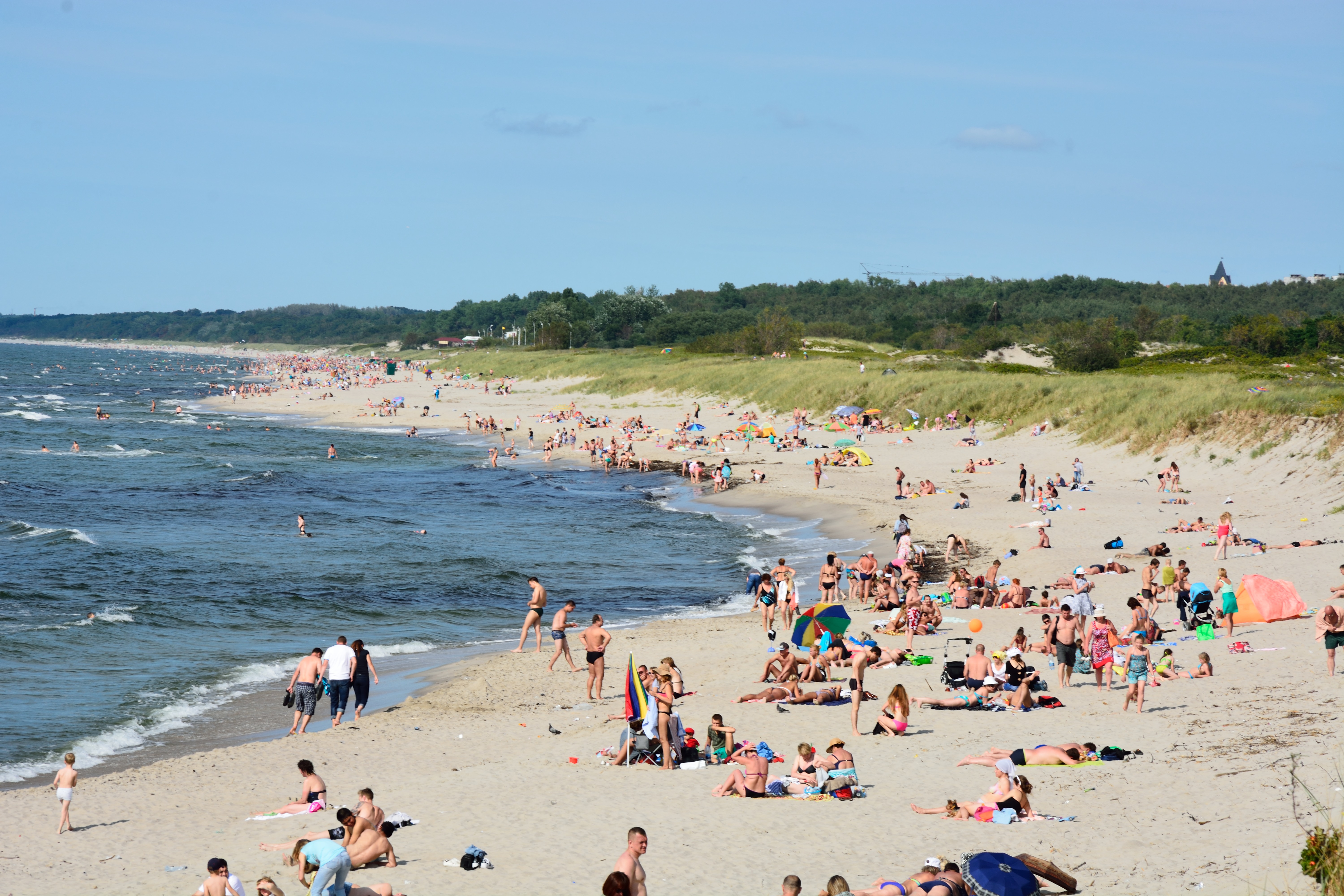

.jpg)
People on the beach near Baltiysk
According to the 2010 Census, the population of the oblast was 941,873;[8] down from 955,281 recorded in the 2002 Census.[39] The 1989 Census recorded 871,283 inhabitants.[40] Kaliningrad Oblast was the fourth most densely populated federal subject in Russia, with 62.5 persons/km2 (162 persons/sq mi).
Population-wise, the oblast is thoroughly Russian and Russophone in character, with almost none of the pre–World War II German, Lithuanian (Lietuvininks), Latvian-speaking Kursenieki, or Polish population remaining in today's Kaliningrad Oblast. However, after 1991, some ethnic Germans and Poles immigrated to the area, from Kazakhstan, Russia, and other sites in the former Soviet Union.
Ethnic groups[]
According to the 2010 Census, the ethnic composition of the oblast was as follows:[8]
- 772,534 Russians (86.4%)
- 32,771 Ukrainians (3.7%)
- 32,497 Belarusians (3.6%)
- 9,769 Lithuanians (1.1%)
- 9,226 Armenians (1%)
- 7,349 Germans (0.8%)
- 4,534 Tatars (0.5%)
- 3,282 Azeris (0.4%)
- 2,788 Poles (0.3%)
- 2,245 Uzbeks (0.3%)
- 16,857 others (1.9%)
- 48,021 people were registered from administrative databases and could not declare an ethnicity. It is estimated that the proportion of ethnicities in this group is the same as that of the declared group.[41]
| Census[42] | 1959 | 1970 | 1979 | 1989 | 2002 | 2010 |
|---|---|---|---|---|---|---|
| Russians | 473,861 (77.6%) | 564,469 (77.1%) | 632,717 (78.3%) | 683,563 (78.5%) | 786,885 (82.4%) | 772,534 (86.4%) |
| Ukrainians | 35,717 (5.8%) | 48 044 (6.6%) | 54,656 (6.8%) | 62,750 (7.2%) | 47,229 (4.9%) | 32,771 (3.7%) |
| Belarusians | 57,178 (9.4%) | 68,808 (9.4%) | 72,465 (9.0%) | 73,926 (8.5%) | 50,748 (5.3%) | 32,497 (3.6%) |
| Lithuanians | 21,262 (3.5%) | 23,376 (3.2%) | 19,647 (2.4%) | 18,116 (2.1%) | 13,937 (1.5%) | 9,769 (1.1%) |
Total fertility rate [43]
| Year | Rate |
|---|---|
| 2000 | 1.11 |
| 2005 | 1.16 |
| 2010 | 1.46 |
| 2013 | 1.64 |
| 2014 | 1.70 |
| 2015 | 1.75 |
| 2016 | 1.73 |
| 2017 | 1.57 |
Religion[]
| Religion in Kaliningrad Oblast as of 2012 (Sreda Arena Atlas)[44][45] | ||||
|---|---|---|---|---|
| Russian Orthodoxy | 30.9% | |||
| Other Orthodox | 0.5% | |||
| Roman Catholic | 1% | |||
| Other Christians | 1.7% | |||
| Spiritual but not religious | 34% | |||
| Atheism and irreligion | 21.6% | |||
| Other and undeclared | 10.3% | |||
According to a 2012 survey[44] 34 per cent of the population of Kaliningrad Oblast declare themselves to be "spiritual but not religious", 30.9 per cent adhere to the Russian Orthodox Church, 22 per cent are atheist and 11.1 per cent follow other religions or did not give an answer to the question, 1 per cent are unaffiliated generic Christians and 1 per cent adhere to the Catholic Church.[44]
Until 1945, the region was overwhelmingly Lutheran, with a small number of Catholics and Jews. The state church of Prussia was dominant in the region. Although it was both Reformed and Lutheran since 1817, there was an overwhelming Lutheran majority and very few Reformed adherents in East Prussia.
Military[]


Victory Day in Kaliningrad
For some years after the fall of the Soviet Union, Kaliningrad Oblast was one of the most militarized areas of the Russian Federation and the density of military installations was the highest in Europe, as much of the Soviet equipment pulled out of Eastern Europe was left there. As of 2009, there were 11,600 Russian ground troops based in the oblast, plus additional naval and air force personnel.[46] Thus military troops amount to less than 2% of the oblast's population. Kaliningrad is the headquarters of the Russian Baltic Fleet together with Chernyakhovsk (air base), Donskoye (air base) and Kaliningrad Chkalovsk (naval air base).
The Washington Times wrote on January 3, 2001, citing anonymous intelligence reports, that Russia had transferred tactical nuclear weapons into a military base in Kaliningrad for the first time since the end of the Cold War. Russian top-level military leaders denied those claims.[47] A Pentagon spokesperson said that such deployment would violate the Russian pledge to remove nuclear weapons from the Baltics. Russia and the United States announced in 1991 and 1992 a non-binding agreement to reduce arsenals of tactical nuclear weapons.
On November 5, 2008, Russian President Dimitry Medvedev said that Russia would deploy Iskander missiles in the oblast "as a response to U.S. plans for basing missile defense missiles in Poland," adding that the country also deployed equipment to electronically hamper the operation of future U.S. missile facilities in Poland and the Czech Republic.[48]
However, on January 28, 2009, a Russian defense official stated that the deployment of short-range missiles in Kaliningrad Oblast would cease, due to "perceived changes in the attitude of the United States government towards the Russian Federation," following the election of United States President Barack Obama.[49] In September 2009, Russia fully scrapped plans to send short-range missiles into the Kaliningrad Oblast in response to Obama's decision to cancel the missile defense system.
In November 2011, Dmitry Medvedev issued another stern warning that Russia would deploy new missiles aimed at U.S. missile defense sites in Europe if the U.S. went ahead with the planned shield.[50] Then in 2012, Russia chose Kaliningrad as the second region (after Moscow) to deploy the S-400 (SAM) missile system.[51] Subsequently, the Russian newspaper Izvestia reported in December 2013 that the short-range Iskander-M 9K720 operational-tactical missile systems had been commissioned by the Western Military District's missile and artillery forces at about the same time. Encounters between Russian forces and NATO have been on the rise since 2014.[52][53]
Economy[]


Curonian Spit in Kaliningrad Oblast

Kaliningrad
In 2017, the nominal GDP of Kaliningrad Oblast was US$7 billion, equivalent to US$7,000 per capita.[54]
The oblast derives an economic advantage from its geographic position as an ice-free port and its proximity to the European Union. It also has the world's largest deposits of amber. The region has developed its tourism infrastructure and promotes attractions such as the Curonian Spit.[55]
To address the oblast's high rate of unemployment, in 1996 the Russian authorities granted the oblast a special economic status with tax incentives that were intended to attract investors. The oblast's economy has since benefited substantially and in recent years experienced a boom. A US$45 million airport terminal has been opened and the European Commission provides funds for business projects under its special program for the region. Trade with the countries of the EU has increased. Economic output has increased.[56]
According to official statistics, the Gross Regional Product in 2006 was 115 billion roubles.[57] GRP per capita in 2007 was 155 669 roubles.[58]
Industry[]
Car and truck assembly (GM, BMW, Kia, Yuejin), and production of auto parts, are major industries in Kaliningrad Oblast. There are shipbuilding facilities in Kaliningrad and Sovetsk. Food processing is a mature industry in the region. OKB Fakel, a world leader in the field of Hall thruster development, as well as a leading Russian developer and manufacturer of electric propulsion systems, is based in Neman. The company employs 960 people.[59][60] General Satellite (GS) is the biggest employer in Gusev city producing satellite receivers, cardboard packaging, nanomaterials etc.
Natural resources[]
Kaliningrad Oblast possesses more than 90 per cent of the world's amber deposits.[61] Until recently raw amber was exported for processing to other countries, but in 2013 the Russian government banned the export of raw amber in order to boost the amber processing industry in Russia.[62]
There are small oil reservoirs beneath the Baltic Sea not far from Kaliningrad's shore. Small-scale offshore exploration started in 2004. Poland, Lithuania, and some local NGOs, voiced concerns about possible environmental effects.
Fishing[]
Fishing is an important regional industry, with big fishing ports in Kaliningrad and Pionersky (formerly Neukuhren) and smaller ones in Svetly and Rybachy.
Power generation[]
Average yearly power consumption in the Kaliningrad Oblast was 3.5 terawatt-hours in 2004 with local power generation providing just 0.235 terawatt-hours. The balance of energy needs was imported from neighboring countries. A new Kaliningrad power station was built in 2005, covering 50% of the oblast's energy needs. A second part of this station was built in 2010, making the oblast independent from electricity imports.
As of 2018, two nuclear power reactors were under construction in the eastern part of the region. The project is now abandoned.
See also[]
- Kaliningrad Oblast election, 2011
- Baltic Republican Party
- List of rural localities in Kaliningrad Oblast
- Kaliningrad Special Region
- Kaliningrad (Königsberg) dispute
References[]
- ^ Article 5 of the Charter of Kaliningrad Oblast states that the oblast may have an anthem, providing a law is adopted to that effect. As of 2015, no such law is in place.
- ^ Президент Российской Федерации. Указ №849 от 13 мая 2000 г. «О полномочном представителе Президента Российской Федерации в федеральном округе». Вступил в силу 13 мая 2000 г. Опубликован: "Собрание законодательства РФ", №20, ст. 2112, 15 мая 2000 г. (President of the Russian Federation. Decree #849 of May 13, 2000 On the Plenipotentiary Representative of the President of the Russian Federation in a Federal District. Effective as of May 13, 2000.).
- ^ Госстандарт Российской Федерации. №ОК 024-95 27 декабря 1995 г. «Общероссийский классификатор экономических регионов. 2. Экономические районы», в ред. Изменения №5/2001 ОКЭР. (Gosstandart of the Russian Federation. #OK 024-95 December 27, 1995 Russian Classification of Economic Regions. 2. Economic Regions, as amended by the Amendment #5/2001 OKER. ).
- ^ Charter of Kaliningrad Oblast, Article 3
- ^ Charter of Kaliningrad Oblast, Article 28
- ^ Charter of Kaliningrad Oblast, Article 17
- ^ Федеральная служба государственной статистики (Federal State Statistics Service) (2004-05-21). "Территория, число районов, населённых пунктов и сельских администраций по субъектам Российской Федерации (Territory, Number of Districts, Inhabited Localities, and Rural Administration by Federal Subjects of the Russian Federation)" (in Russian). Всероссийская перепись населения 2002 года (All-Russia Population Census of 2002). Federal State Statistics Service. http://perepis2002.ru/ct/html/TOM_01_03.htm. Retrieved 2011-11-01.
- ^ a b c d "Всероссийская перепись населения 2010 года. Том 1 [2010 All-Russian Population Census, vol. 1)]" (in Russian). Всероссийская перепись населения 2010 года (2010 All-Russia Population Census). Federal State Statistics Service. 2011. http://www.gks.ru/free_doc/new_site/perepis2010/croc/perepis_itogi1612.htm. Retrieved June 29, 2012.
- ^ The density value was calculated by dividing the population reported by the 2010 Census by the area shown in the "Area" field. Please note that this value may not be accurate as the area specified in the infobox is not necessarily reported for the same year as the population.
- ^ https://www.gks.ru/storage/mediabank/PrPopul2020.xls
- ^ Правительство Российской Федерации. Постановление №725 от 31 августа 2011 г. «О составе территорий, образующих каждую часовую зону, и порядке исчисления времени в часовых зонах, а также о признании утратившими силу отдельных Постановлений Правительства Российской Федерации». Вступил в силу по истечении 7 дней после дня официального опубликования. Опубликован: "Российская Газета", №197, 6 сентября 2011 г. (Government of the Russian Federation. Resolution #725 of August 31, 2011 On the Composition of the Territories Included into Each Time Zone and on the Procedures of Timekeeping in the Time Zones, as Well as on Abrogation of Several Resolutions of the Government of the Russian Federation. Effective as of after 7 days following the day of the official publication.).
- ^ Official the whole territory of Russia according to Article 68.1 of the Constitution of Russia.
- ^ "Kaliningrad profile". BBC News. March 12, 2015. https://www.bbc.co.uk/news/world-europe-18284828.
- ^ "Kaliningrad Region". http://tpprf.ru/en/tertpp/north_west/kening/.
- ^ https://worldpopulationreview.com/world-cities/kaliningrad-population
- ^ Sheeter, Laura (October 16, 2006). "Kaliningrad erases stains of past". BBC News. http://news.bbc.co.uk/2/low/europe/6048708.stm.
- ^ Hoffmann, Johann Gottfried (1818). Übersicht der Bodenfläche und Bevölkerung des Preußischen Staates : aus den für das Jahr 1817 mtlich eingezogenen Nachrichten. Berlin: Decker. pp. 51. https://reader.digitale-sammlungen.de/en/fs1/object/display/bsb10001094_00057.html.
- ^ Plater, Stanisław (1825) (in pl). Jeografia wschodniéy części Europy czyli Opis krajów przez wielorakie narody słowiańskie zamieszkanych: obejmujący Prussy, Xsięztwo Poznańskie, Szląsk Pruski, Gallicyą, Rzeczpospolitę Krakowską, Krolestwo Polskie i Litwę. Wrocław: u Wilhelma Bogumiła Korna. pp. 17. http://obc.opole.pl/dlibra/doccontent?id=8541.
- ^ Andree, Karl (1831) (in de). Polen: in geographischer, geschichtlicher und culturhistorischer Hinsicht. Verlag von Ludwig Schumann. p. 218. https://archive.org/details/bub_gb_xgUEAAAAYAAJ.
- ^ Hassel, Georg (1823) (in de). Statistischer Umriß der sämmtlichen europäischen und der vornehmsten außereuropäischen Staaten, in Hinsicht ihrer Entwickelung, Größe, Volksmenge, Finanz- und Militärverfassung, tabellarisch dargestellt; Erster Heft: Welcher die beiden großen Mächte Österreich und Preußen und den Deutschen Staatenbund darstellt. Verlag des Geographischen Instituts Weimar. pp. 41.
- ^ a b Haxthausen, August (1839) (in de). Die Ländliche Verfassung in den Einzelnen Provinzen der Preussischen Monarchie. pp. 75–91. https://books.google.com/books?id=Gsj1FBg0gvUC&pg=PA75.
- ^ "Monastery of the Dormition of the Mother of God in Wojnowo (Eckersdorf)". http://www.wojnowo.net/wojnowo-history.
- ^ Tetzner, Franz (1902). Die Slawen in Deutschland: beiträge zur volkskunde der Preussen, Litauer und Letten, der Masuren und Philipponen, der Tschechen, Mährer und Sorben, Polaben und Slowinzen, Kaschuben und Polen. Braunschweig: Verlag von F. Vieweg. pp. 212–248.
- ^ "Old Believers in Poland - historical and cultural information". http://www.inne-jezyki.amu.edu.pl/Frontend/Language/Details/28.
- ^ "The Potsdam Declaration". http://www.ibiblio.org/pha/policy/1945/450802a.html.
- ^ a b Milan Bufon (April 11, 2014). The New European Frontiers: Social and Spatial (Re)Integration Issues in Multicultural and Border Regions. Cambridge Scholars Publishing. p. 98. ISBN 978-1443859363. https://books.google.com/books?id=GpoxBwAAQBAJ&q=kaliningrad&pg=PA97.
- ^ "Russia (USSR) / Poland Treaty (with annexed maps) concerning the Demarcation of the Existing Soviet–Polish State Frontier in the Sector Adjoining the Baltic Sea 5 March 1957". https://www.un.org/Depts/los/LEGISLATIONANDTREATIES/PDFFILES/TREATIES/RUS-POL1957SF.PDF.
- ^ For other issues of the frontier delimitation see "Maritime boundary delimitation agreements and other material". https://www.un.org/Depts/los/LEGISLATIONANDTREATIES/STATEFILES/POL.htm.
- ^ Weinberg, Gerhard L. (2005). Visions of Victory: The hopes of eight World War II leaders. Cambridge University Press. p. 114. ISBN 978-0-521-85254-8. https://archive.org/details/visionsofvictory00wein.
- ^ Should Kant's home once again be German?, The Guardian, July 31, 2010
- ^ a b Transit from/to Kaliningrad Region, www.euro.lt Archived November 1, 2009, at the Wayback Machine
- ^ a b "Error: no
|title=specified when using {{Cite web}}". http://eur-lex.europa.eu/LexUriServ/LexUriServ.do?uri=OJ:L:2003:099:0008:0008:EN:PDF. - ^ Solnick, Steven (May 29, 1996). "Asymmetries in Russian Federation Bargaining". The National Council for Soviet and East European Research: 12.
- ^ Chuman, Mizuki. "The Rise and Fall of Power-Sharing Treaties Between Center and Regions in Post-Soviet Russia". Demokratizatsiya: 146.
- ^ "Medvedev Says Russia to Deploy Missiles Near Poland" Associated Press via Yahoo News
- ^ Harding, Luke (January 28, 2009). "Russia scraps plan to deploy nuclear-capable missiles in Kaliningrad". The Guardian. https://www.theguardian.com/world/2009/jan/28/russia-missiles-kaliningrad-obama.
- ^ "Russia moves missiles to Kaliningrad". BBC News. October 9, 2016. https://www.bbc.com/news/world-europe-37597075.
- ^ Sudakov, Dmitry (November 28, 2011). "Russia's new radar to monitor all Europe including Britain". http://english.pravda.ru/russia/politics/28-11-2011/119757-russia_radar_europe-0/.
- ^ "Численность населения России, субъектов Российской Федерации в составе федеральных округов, районов, городских поселений, сельских населённых пунктов – районных центров и сельских населённых пунктов с населением 3 тысячи и более человек [Population of Russia, its federal districts, federal subjects, districts, urban localities, rural localities—administrative centers, and rural localities with population of over 3,000]" (in Russian). Всероссийская перепись населения 2002 года (All-Russia Population Census of 2002). Federal State Statistics Service. May 21, 2004. http://www.perepis2002.ru/ct/doc/1_TOM_01_04.xls. Retrieved February 9, 2012.
- ^ Demoscope Weekly (1989). "Всесоюзная перепись населения 1989 г. Численность наличного населения союзных и автономных республик, автономных областей и округов, краёв, областей, районов, городских поселений и сёл-райцентров. [All Union Population Census of 1989. Present population of union and autonomous republics, autonomous oblasts and okrugs, krais, oblasts, districts, urban settlements, and villages serving as district administrative centers]" (in Russian). Всесоюзная перепись населения 1989 года (All-Union Population Census of 1989). Institute of Demographics of the State University—Higher School of Economics. http://demoscope.ru/weekly/ssp/rus89_reg.php. Retrieved February 9, 2012.
- ^ "ВПН-2010". http://www.perepis-2010.ru/news/detail.php?ID=6936.
- ^ Переписи населения Российской Империи, СССР, 15 новых независимых государств Census of the Russian Empire, Soviet Union, 15 new independent states Archived May 14, 2011, at the Wayback Machine
- ^ "Age-specific fertility rates (Ru:Возрастные коэффициенты рождаемости)". http://kaliningrad.gks.ru/wps/wcm/connect/rosstat_ts/kaliningrad/resources/4444fd004ee286c58269833467c8ff84/%D0%92%D0%BE%D0%B7%D1%80%D0%B0%D1%81%D1%82%D0%BD%D1%8B%D0%B5+%D0%BA%D0%BE%D1%8D%D1%84%D1%84%D0%B8%D1%86%D0%B8%D0%B5%D0%BD%D1%82%D1%8B+%D1%80%D0%BE%D0%B6%D0%B4%D0%B0%D0%B5%D0%BC%D0%BE%D1%81%D1%82%D0%B8.pdf.
- ^ a b c "Arena: Atlas of Religions and Nationalities in Russia". Sreda, 2012.
- ^ 2012 Arena Atlas Religion Maps. "Ogonek", № 34 (5243), August 27, 2012. Retrieved April 21, 2017. Archived.
- ^ "IISS". http://www.iiss.org/publications/military-balance/.
- ^ "Archive Search Results". http://nl.newsbank.com/nl-search/we/Archives?p_product=WT&p_theme=wt&p_action=search&p_maxdocs=200&p_text_search-0=Russia+AND+Transfers+AND+Nuclear+AND+Arms+AND+to+AND+Baltics&s_dispstring=Russia+Transfers+Nuclear+Arms+to+Baltics+AND+date(01/01/2001+to+01/01/2002)&p_field_date-0=YMD_date&p_params_date-0=date:B,E&p_text_date-0=01/01/2001+to+01/01/2002)&p_perpage=10&p_sort=YMD_date:D&xcal_useweights=no.
- ^ "Russia to move missiles to Baltic". bbc.co.uk (BBC). November 5, 2008. http://news.bbc.co.uk/1/hi/world/europe/7710362.stm.
- ^ "Russia 'halts missile deployment'". bbc.co.uk (BBC). January 28, 2009. http://news.bbc.co.uk/2/hi/europe/7855216.stm.
- ^ "Dmitry Medvedev, Russia President, Says Missiles May Target U.S. Missile Defense Sites". Huffington Post. November 23, 2011. http://www.huffingtonpost.com/2011/11/23/dmitry-medvedev-russia-missiles_n_1109660.html.
- ^ "S-400 Missiles Deployed in Russia's Baltic Fleet." RIA Novosti, April 9, 2012.
- ^ "As NATO gets ready for its biggest military exercise in years, things are heating up closer to Russia". Business Insider. 24 October 2018. https://www.businessinsider.com/amid-nato-war-games-activity-rises-around-kaliningrad-baltic-2018-10.
- ^ Axe, David (25 September 2020). "U.S. Air Force B-52s Just Flew A Mock Bombing Run On Russia's Baltic Fortress" (in en). https://www.forbes.com/sites/davidaxe/2020/09/25/us-air-force-b-52s-just-flew-a-mock-bombing-run-on-russias-baltic-fortress/.
- ^ "Валовой региональный продукт::Мордовиястат". http://mrd.gks.ru/wps/wcm/connect/rosstat_ts/mrd/ru/statistics/grp/.
- ^ "Kaliningrad Region - Introduction". Russia: All Regions Trade & Investment Guide. CTEC Publishing LLC. 2008. http://www.russiasregions.com/north_ossetia_alania.html.
- ^ "Regions and territories: Kaliningrad". BBC News. May 15, 2009. http://news.bbc.co.uk/2/hi/europe/country_profiles/6177003.stm.
- ^ Regional administration's website (Russian) Archived September 27, 2007, at the Wayback Machine
- ^ Валовой региональный продукт на душу населения Федеральная служба государственной статистики
- ^ "EDB Fakel". OKB Fakel. http://users.gazinter.net/fakel/index_eng.html.
- ^ "OKB Fakel (Russian Federation)". Jane's Space Systems and Industry. December 17, 2008. http://www.janes.com/articles/Janes-Space-Systems-and-Industry/OKB-Fakel-Russian-Federation.html.
- ^ How Products Are Made: Amber Archived August 11, 2007, at the Wayback Machine
- ^ "The History of Russian Amber, Part 2: From USSR to Russia" Archived March 15, 2018, at the Wayback Machine, Leta.st
Sources[]
- Template:RussiaBasicLawRef/kgd
- Template:RussiaAdmMunRef/kgd/admlaw
- Simon Grunau, Preußische Chronik. Hrsg. von M. Perlbach etc., Leipzig, 1875.
- A. Bezzenberger, Geographie von Preußen, Gotha, 1959
- Template:RussiaBasicLawRef/kgd
External links[]
| Wikivoyage has a travel guide for Kaliningrad Oblast. |
- Official website of Kaliningrad Oblast (in Russian)
- A. Liucija Arbusauskaité "The Soviet Policy Towards the "Kaliningrad Germans" 1945–1951" chapter in "Themenheft: Eingliederung und Ausgrenzung. Beiträge aus der Historischen Migrationsforschung. Hrsg.: Jochen Oltmer Osnabrück: IMIS, 1999. ISSN 0949-4723
- Master's thesis by Sergey Naumkin on the possibility of Kaliningrad integrating with the EU as a special economic zone
- Life in Kaliningrad Oblast (in Russian)
- Spuren der Vergangenheit / Следы Пρошлого (Traces of the past) This site by W.A. Milowskij, a Kaliningrad resident, contains hundreds of interesting photos, often with text explanations, of architectural and infrastructural artifacts of the territory's long German past. (in German and Russian)
- City and Reagen News
| ||||||||||||||||||||||||||
| ||||||||||||||||||||
|