| Main | Births etc |
|---|
Isle of Thanet.
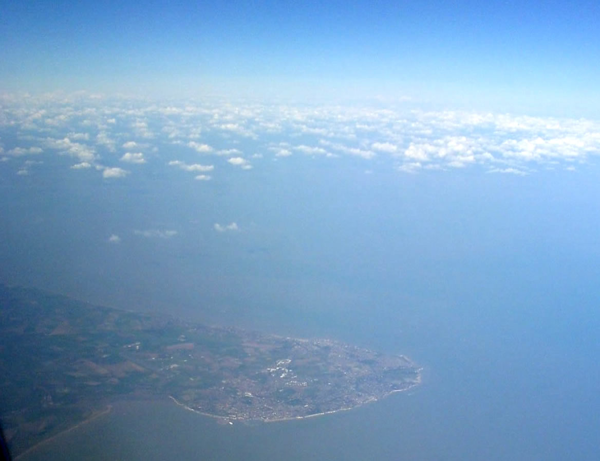
The Isle of Thanet lies at the most easterly point of Kent, England. While in the past it was separated from the mainland by the nearly 2,000 feet (610 m)-wide River Wantsum, it is no longer an island (see below).
Archaeological remains testify to the fact that ancient peoples lived here. Today, it is a tourist destination, but it also has a busy agricultural base. The Port of Ramsgate serves the Continent.
Etymology[]
The name seems to be Celtic in origin, coming from the Brittonic *tanets (Welsh tân) meaning "fire", possibly a reference to a beacon on the island. Ptolemy calls it Tolianis, the Romans Tanatus and Bede referred to it as Tanatos insula. The name 'Tenet' was listed in the Domesday Book of 1086, whereas an 18th century classical dictionary lists Tane'tus, a small island of Albion.[1]
It appears as "Insula de Teynet" and "in Insula de Thaneto" in the Plea Rolls of the Common Pleas, dated 1450, where the cleric Hugh Grobham alias Gromefeld alias Bromfeld is plaintiff in a plea of debt against John Cecely, vicar of St Peters-in-Thanet. [2]
St. Isidore of Seville's etymology is, if doubtful, certainly colorful: "Thanet is an island in the Ocean in the Gallic channel (English channel), separated from Britannia by a narrow estuary, with fruitful fields and rich soil. It is name Thanet (tanatos) from the death of serpents. Although the island itself is unacquainted with serpents, if soil from it is carried away and brought to any other nation, it kills snakes there."[3]
History[]
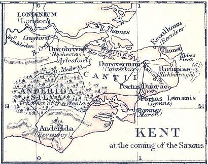
A general map showing late Roman Kent. The Isle of Thanet was then known as Tanatus
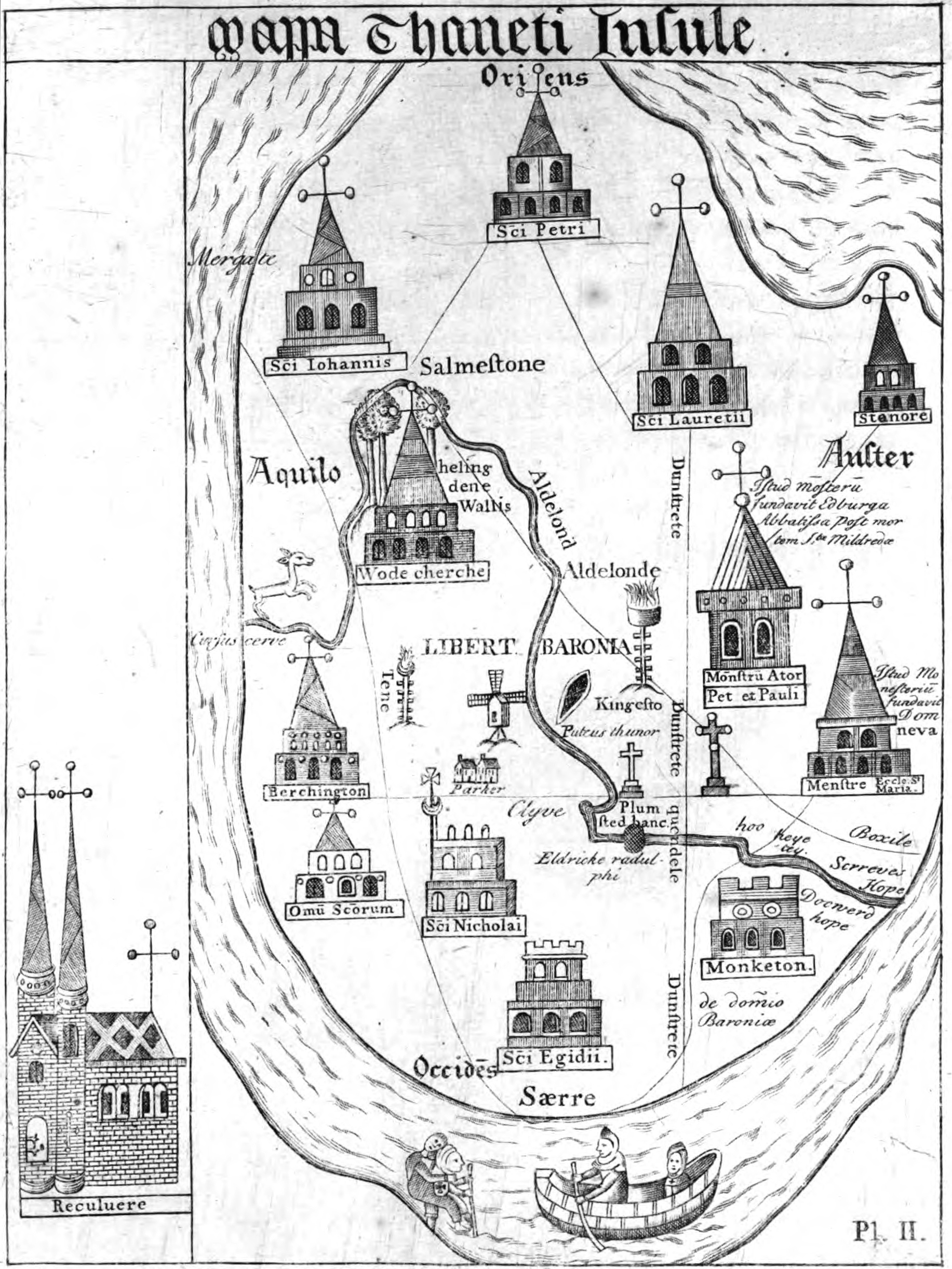
A 15th century map of the Isle of Thanet, with north on the left: Thomas Elmham, Historia Monasterii S Augustini Cantuariensis
Archaeological evidence shows that the area now known as the Isle of Thanet was one of the major areas of Stone Age settlement. A large hoard of Bronze Age implements have been found at Minster-in-Thanet; and several Iron Age settlements have also come to light.[4]
Like their predecessors, the Romans also crossed the sea to invade Britain. Julius Caesar came first, briefly, in both 55 and 54 BC; one hundred years later Claudius sent four legions to Britain, where the Romans were to remain for the next four hundred years. During that time the port of Richborough, on the opposite side of the Wantsum Channel (see Geography below), became one of the chief ports. After the breakup of the Roman Empire and their departure from Britain, other invaders soon followed.
Vortigern, King of the Britons, was under attack from other tribes and called for assistance. Among them were the Jutes Hengest and Horsa; he is said to have rewarded the Isle of Thanet in return for their services. As the following extract from the Historia Britonum (first written sometime shortly after AD 833) testifies:
Then came three keels, driven into exile from Germany. In them were the brothers Horsa and Hengest ... Vortigern welcomed them, and handed over to them the island that in their language is called Thanet, in British Ruoihm.
Throughout this time the Isle remained an island. The Wantsum Channel allowed ships to sail between the mainland and the island in calm waters. Gradually this silted up, and the last ship sailed through the Channel in 1672.[5]
In 597 Augustine of Canterbury is said, by the Venerable Bede, to have landed with 40 men at Ebbsfleet, in the parish of Minster-in-Thanet, before founding Britain's second Christian monastery in Canterbury (the first was founded fifty years earlier by Saint Columba on Eilean na Naoimh, in the Hebrides): a cross marks the spot.[6] In 851 and again in 854, the Vikings wintered on Thanet.[7]
Minster's village website states "It is widely believed, around 670 AD, whether in truth or legend, that the Hind emblem owes its origin to Egbert, King of Kent and Princess Domneva. The King purportedly asked Domneva which piece of land she wished to take as compensation for the murder of her two brothers. Her answer was that she would take no more than her tame deer would run around. This the King granted her with pleasure, and the land became the new Minster."[8] Domneva is a variant name for Domne Eafe.
By 1334–1335 Thanet had the highest population density in Kent according to Edward III's lay subsidy rolls. It acted as a granary for Calais and documents towards the end of that century refer to turreted walls beneath the cliffs needing maintenance. Coastal erosion has long since destroyed these structures.
Governance[]
Margate was incorporated as a municipal borough in 1857 and Ramsgate in 1884. Broadstairs and St Peter's Urban District and Isle of Thanet Rural District covered the rest of the island from 1894. Since 1974, the Isle of Thanet forms the major part of the Thanet local government district of Kent.
Geography[]
The Isle of Thanet first came into being when sea levels rose after the last Ice Age, around 5000 BC. The North Sea encroached on the land which is now the estuary of the River Thames, and southwards to reach the higher land of the North Downs, leaving behind an island composed of Upper Chalk in its wake. Eventually the sea broke through river valleys in the North Downs to the south (Middle Chalk) and finally today's English Channel was opened up.[4] The Upper Chalk is a soft pure-white limestone with abundant flints.[9] The proto-River Stour then formed part of the intervening water, with a new tributary, the River Wantsum, completing it; it became known as the Wantsum Channel.
The Wantsum Channel gradually narrowed as pebble beaches built up at the southern end of the strait, blocking silt coming down down the Stour. In the eighth century it was reported that the Channel was now three furlongs wide (660 yards (600 m)), and a map of 1414 showed a ferry crossing at Sarre. The first bridge over the channel was built there in 1485. Until the mid 18th century there was a ferry between Sandwich and the island; a wooden drawbridge was built, and the ferry was closed.
Today the Isle is an island no longer and the erstwhile channel is now flat marshland criss-crossed by drainage ditches. Meanwhile the exposed chalk cliffs are gradually being worn down by the sea, particularly at the North Foreland. Much else of the coast is a built-up area. The Wantsum area is still liable to flooding: during the North Sea flood of 1953 Thanet was cut off for a few days, but the sea defences have been strengthened since then.
The soil and equable climate of the Isle have always encouraged arable farming.
"... a garden indeed, a county of corn but the labourers' houses all along, beggarly in the extreme. The people dirty, poor-looking, but particularly dirty."—William Cobbett in 1823 when he rode to the Island[10]
Today there are still farms inland, but the coast is nearly all covered in settlements, most of which have come into being in the 19th and 20th centuries.
As the popularity of the seaside resort grew, so did that of the Isle of Thanet. At first the holidaymakers came by boat from London; after the coming of the railways in the mid 1840s, that became the preferred mode of transport. The population grew, as the following population statistics show:
Landmarks[]
The principal landmarks on the Isle are the North Foreland, and all the bays around the coastline, the principal ones of which are Minnis Bay, Palm Bay, Botany Bay, Joss Bay, and Pegwell Bay: the latter being part of the estuary of the River Stour. In 2007, seven of those beaches met stringent quality standards and were awarded a Blue flag: Minnis Bay, Botany Bay (Broadstairs), Margate Main Sands, St Mildreds Bay (Westgate), Stone Bay (Broadstairs), West Bay (Westgate), and Westbrook Bay.[11] In 2008, this had risen to 10 beaches.
Transport[]
The rail connections are via the Chatham Main Line through Margate to Ramsgate, and the Ashford to Ramsgate (via Canterbury West) line. New high speed rail links from London to Thanet began in December 2009, and form part of the UK's first true high-speed commuter service, according to the South Eastern Railway Company.[12] Main road links are the A28 which brings traffic from Canterbury and Ashford; and the A299, north coast route. The Thanet Coastal Path skirts the coast.
There is an airport at Manston,[13] formerly RAF Manston, but since renamed by its commercial operators as Kent International Airport.
Ferry services (predominantly freight and car with passengers) are operated by Transeuropa ferries to the Continent from Port of Ramsgate.[14]
References[]
- ^ Naming of the island through history
- ^ National Archives; CP40/758; http://aalt.law.uh.edu/AALT1/H6/CP40no758/bCP40no758dorses/IMG_0693.htm (entry number 2)
- ^ [The Etymologies of Isidore of Seville, trans. Barney, Stephen A., et al, Cambridge University Press, 2006, pg. 294]
- ^ a b Jessup, Frank W. (1966). Kent History Illustrated. Kent County Council.
- ^ Wantsum Channel
- ^ Notes on Ramsgate:’’Historic Kent‘’
- ^ A. Forte, R. Oram, and F. Pederson. Viking Empires. 1st. ed. Cambridge: Cambridge University Press, 2005 ISBN 0-521-82992-5.
- ^ Rollason, D.W. (1982), The Mildrith Legend: A Study in Early Medieval Hagiography in England, Leicester University Press, pp. 10-1.
- ^ "The Rural Landscape of Kent, SG McRae and CP Burnham, Wye College, 1973.
- ^ Literature and Place: William Cobbett
- ^ BlueFlag.org
- ^ Southeastern 2009 - your journey starts here : Home
- ^ Kent International Airport
- ^ "TransEuropa Ferries". http://www.transeuropaferries.co.uk/. Retrieved 2007-06-29.
| |||||||||||||||||

| This page uses content from the English language Wikipedia. The original content was at Isle of Thanet. The list of authors can be seen in the page history. As with this Familypedia wiki, the content of Wikipedia is available under the Creative Commons License. |