The town incorporated in 1737.[2] The name of the town is partly a blend of Hartford and Windsor, plus the suffix "-ton."[3]
Geography[]
According to the United States Census Bureau, the town has a total area of 31.1 square miles (81 km2), of which, 30.8 square miles (80 km2) of it is land and 0.3 square miles (0.78 km2) of it (1.13%) is water. The southeastern portion of the town contains the Roraback Wildlife Area and several reservoirs.
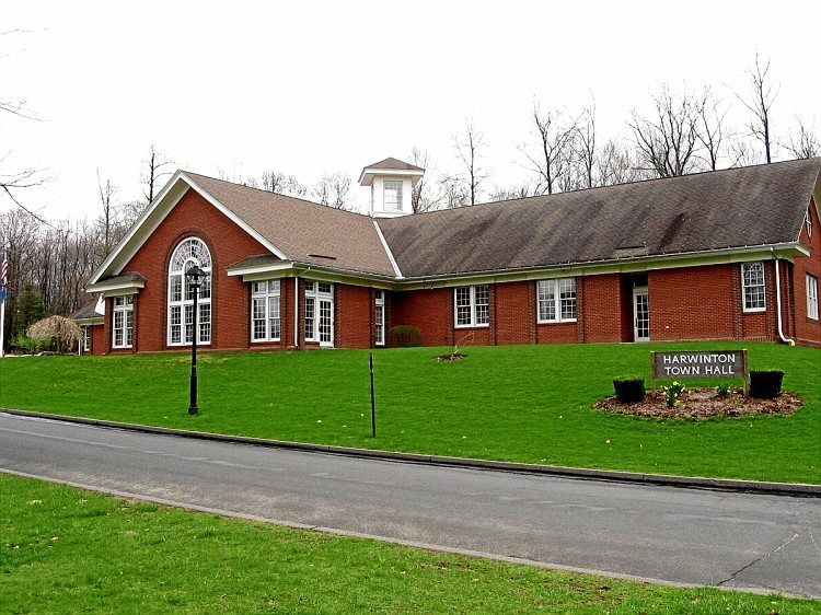
Principal communities[]
Campville
Harwinton Center (part of Northwest Harwinton CDP)
See also: List of Connecticut locations by per capita income
As of the census[6] of 2000, there were 5,283 people, 1,958 households, and 1,546 families residing in the town. The population density was 171.8 people per square mile (66.3/km²). There were 2,022 housing units at an average density of 65.8 per square mile (25.4/km²). The racial makeup of the town was 98.69% White, 0.08% African American, 0.06% Native American, 0.51% Asian, 0.06% Pacific Islander, 0.13% from other races, and 0.47% from two or more races. Hispanic or Latino of any race were 0.89% of the population.
There were 1,958 households out of which 33.7% had children under the age of 18 living with them, 70.6% were married couples living together, 5.2% had a female householder with no husband present, and 21.0% were non-families. 17.2% of all households were made up of individuals and 8.4% had someone living alone who was 65 years of age or older. The average household size was 2.70 and the average family size was 3.05.
In the town, the population was spread out with 25.1% under the age of 18, 5.2% from 18 to 24, 27.4% from 25 to 44, 29.3% from 45 to 64, and 13.0% who were 65 years of age or older. The median age was 41 years. For every 100 females, there were 100.7 males. For every 100 females age 18 and over, there were 98.4 males.
The median income for a household in the town was $66,222, and the median income for a family was $75,912. Males had a median income of $51,597 versus $40,000 for females. The per capita income for the town was $32,137. About 0.8% of families and 2.2% of the population were below the poverty line, including none of those under age 18 and 3.4% of those age 65 or over.
Voter registration and party enrollment as of October 25, 2005[7]
Route 4 connects the town to Torrington in the west and to Hartford in the east. Route 118 connects the town to Litchfield center, with a junction for the Route 8 expressway. Route 222 is a north-south route connecting the town to Thomaston center. Route 72 connects the town to the city of Bristol.
Notable people[]
Harry C. Bentley (1877–1967), founder of Bentley University
Jonathan Brace (1754–1837), judge and U.S. congressman, was born in town.
George S. Catlin (1808–1851), U.S. congressman was born in town.
Collis Potter Huntington (1821–1900), one of four men who formed the Central Pacific Railroad, was born in Harwinton
Elam Luddington (1806–1893), Mormon pioneer to Utah and was the first Mormon missionary to preach in Thailand was born in Harwinton.
Luman Watson (1790–1834), clockmaker, was born in town.
Central Jersey • Greater Danbury • Greater New Haven • Greater Waterbury • Hudson Valley • Litchfield Hills • Long Island • North Jersey • Southwestern Connecticut
MBTA (MA and RI) ·Northeast Corridor (CT, MA, and RI) ·Acela Express (CT, MA, and RI) ·Downeaster (ME, NH, and MA) ·Vermonter (CT, MA, and VT) ·Shore Line East (CT) ·Metro-North Railroad (CT and NY)
Air
Bradley International Airport (CT) ·Portland International Jetport (ME) ·Logan International Airport (MA) ·Manchester-Boston Regional Airport (NH) ·T. F. Green Airport (RI) ·Burlington International Airport (VT)
This page uses content from the English language Wikipedia. The original content was at Harwinton, Connecticut. The list of authors can be seen in the page history. As with this Familypedia wiki, the content of Wikipedia is available under the Creative Commons License.

